
Your Death Valley Visitor Guide: Comprehensive Travel Tips
Sure, Yosemite’s mountains are showy and California’s redwoods are towering, but Death Valley isn’t trying to be your best friend. It’s going to challenge you. The park presents a stark, sharp landscape that rewards visitors who are looking for something more edgy.
If that’s you, then read on because this guide will help you plan your Death Valley visit. I aim to be helpful, so this guide is stuffed with practical tips about the park, suggested things to do, an accommodation guide and packing ideas.

(This article contains affiliate links. This means that if you choose to purchase, I’ll make a small commission.)
You can trust me to give you accurate Death Valley travel planning tips because I actually live in California and visit Death Valley at least every other year. I encourage you to scroll the whole article. But if you have particular questions, use this handy table of contents to skip around.
- Why visit Death Valley
- Info on the Death Valley Visitors Center
- How to get to to Death Valley
- How many days do you need for Death Valley
- Top things to do in Death Valley National Park
- The best time to visit Death Valley
- Where to stay in Death Valley
- Food, gas and cell service
- Guided tours
- What to pack
Why Visit Death Valley
Death Valley is named for the doomed efforts of pioneers who, in 1849, were desperately seeking passage through the southern Sierras. This hot, dry landscape is an unforgiving place for a lost wagon train, but the pioneers persevered. After the establishment of California, Death Valley became a borax mining boom-town in the 1880’s.
In the 1920’s the Pacific Borax Company engaged in a generous act of corporate philanthropy when they lobbied the US government and local citizens to to turn their cash cow into a protected space. The area was designated a National Monument in 1933, and then a National Park in 1994.
Death Valley’s topography includes a vast salt lake bed, which is the lowest spot in the US at -282 feet. In stark contrast, the lake bed is dwarfed by the 11,000 foot Telegraph Peak. There are eroding sandstone cliffs, canyons, volcanic craters and cliffs “painted” with mineral deposits.
The lonely remnants of Death Valley’s mining boom also add historical interest to the park. This forbidding landscape and hard scrabble history has a lot of stories to tell, which is why visiting Death Valley National Park is such a treat.
For more background, check out some of our fun facts about Death Valley .

Death Valley National Park Visitor Center & Fees
Death Valley actually covers 5,200 square miles of the Mohave Desert. But many of the top things to do in Death Valley are located in a centralized area near Furnace Creek, which is also where the Visitor Center is located.
At the Visitor Center you can also check in for the nearby campgrounds, get advice on how to visit the park’s attractions, get hiking suggestions (with maps), and visit the bookstore. They also have museum exhibits on the park’s history and geology. And you can sign your kids up for the Junior Ranger program.
The Furnace Creek Visitor Center is open most days from 8a-5p.
Death Valley Passes
Death Valley has 5 roads that enter the park and none of them are gated. Access into the park is open all of the time. But you do still need a pass to visit. And the only way to get a park map, is to buy the pass.
The entrance fee for Death Valley is $30 per vehicle for a 7-day pass. Motorcycles are $25 and people traveling on foot (who does that in Death Valley?) or bike (ditto!) are $15. An annual pass to Death Valley is $55.
You can also use the $80 America the Beautiful National Parks annual pass , the free Military and Veterans pass or the $80 Senior lifetime pass to access the park.

How to Get to Death Valley
How far is death valley from los angeles.
LA to Death Valley : 271 miles, 4.75-5.25 hours.
The fastest route is via Ridgecrest and the Panamint Valley. If you go that way, we suggest that you stop into Ballarat Ghost town on the way in.
You can take an a bit of extra time and go in via I15 through Baker and Death Valley Junction. That route allows you to detour down to Dante’s View .
You can even combine Death Valley with a road trip to Joshua Tree National Park . This is a routing that we recommend on our list of the top 20 scenic road trips in CA .
How Far is Death Valley from San Francisco?
SF to Death Valley : 502 miles, 7.5-8.5 hours.
The most reliable way is down I5 or Hwy 99 down to Tahachapi and then into the park via Ridgecrest. I prefer Highway 99 to I5 because there’s less truck traffic and you drive past some pretty orchards along the way. Check out our looping route between SF and Death Valley which has some interesting stops around Ridgecrest and the Central Valley.
The scenic way to get from San Francisco to Death Valley is west on Highway 120 through Yosemite/Tioga Pass to Highway 395. This route has amazing scenery. Make time for extra stops, or even better, add on extra days using our Highway 395 road trip itinerary.
This route requires a Yosemite entrance fee and it’s not open in the winter. The closure is usually from November to late-May, but check the Yosemite National park site for status.
How Far is Death Valley from Las Vegas?
Las Vegas to Death Valley : 111-142 miles, ~2 hours.
Las Vegas is actually the closest airport to Death Valley . There are several ways to do the routing. One takes you near Dantes View and the other comes in further north and goes past Rhyolite Ghost Town .
This guide for doing Death Valley as a day trip from Las Vegas , explains the options and offers key stops.
How Long is the Death Valley Road?
People Google this question but it’s a difficult one to answer because there are many roads in the park and none of them are called “Death Valley Road”.
That said, Highway 190 is the major northeast-to-southwest thoroughfare through Death Valley. It runs 187 miles from Olancha (south of Lone Pine) to Death Valley Junction.
Where is the Death Valley Entrance?
There is no single entrance into Death Valley, but there are three main entrances that most people use. The first is to come in from Highway 395 at Lone Pine. The second is to come up the Panamint Valley Road from Ridgecrest. The third enters west into the park from Death Valley Junction.
There are two less popular but scenic routes. There’s Highway 178 which goes north from Shoshone into Badwater Basin. The other takes the narrow high road on Immigrant Canyon Road, which goes over a 5,300 foot pass.
Is Driving in Death Valley Safe?
Yes. If you are worried about road conditions, all of the top sights listed here are accessible from paved roads. Some of the dirt roads are graded and accessible for normal passenger cars but others are only recommended for all 4×4 vehicles with clearance. The Park Service map has very clearly marked guidance on roads.

How Much Time do You Need for Death Valley?
Is one day enough for Death Valley? Not really. It’s the largest national park in the continental US and there is a LOT to do and see. That said, some of the most popular sights are centrally situated. With the help of our Death Valley day trip guide , you can see many of the highlights in one day if you don’t mind scurrying around.
Two days will allow you to visit Death Valley’s top sites with time for some longer hikes. Here’s our two-day itinerary .
And a three day Death Valley vacation will allow you to add in yet more hikes in the park.

Top Things to Do in Death Valley
There are so many cool things do to in Death Valley, it’s hard to figure out how to prioritize. We recommend doing a mix of scenic vistas, hikes and historic sites. That way, you’ll get a great sense of what the park is all about.
Mesquite Dunes at Dawn or Dusk
One of the best ways to get your awe inspired in Death Valley is to get up and out before dawn. The warm light against the orange sand is a beautiful wake-up call and this is a fantastic spot for an early morning photo shoot.
Badwater Basin
Badwater basin is the vast drainage aquifer for Death Valley, covering nearly 200 square miles of daunting salt flats. At -282 feet, it’s the lowest spot in the United States. It’s called “badwater” because a surveyor found that his mule wouldn’t drink the extremely salty water. You can visit anytime of day, but the valley is particularly beautiful at dusk, when the sun is setting over Telescope Peak to the west.
The Golden Canyon Gower Gulch Hike
The Golden Canyon trail in Death Valley is popular…and for good reason. While hiking you enter an ancient portal into Death Valley’s unique geology. You leave the flats of Badwater Basin behind and enter the canyon’s narrow runway, flanked by yellow and red rock formations and intriguing tentacles along Golden Canyon’s side shoots.
Most people just do the Golden Canyon hike but we recommend taking the time to add on the Gower Gulch loop. It will give you views of the Badwater Basin, Zabriskie Point geology and some of the colorful mineral deposits that characterize the area. Here’s our full guide for hiking Golden Canyon and Gower Gulch.
Artists Palette Drive
This scenic drive is located in the Badwater Basin, so you can add it on before or after doing the Golden Canyon hike or Badwater Basin viewpoint. The Artists Palette one-way, nine mile drive will take you through an amazing geologic rainbow. One option is to simply do the drive and get a quick view of the eye candy. But I recommend that you can stop at the multiple pull-outs along the way.
You’ll be rewarded if you get out of the car and hike closer to these multi-hued rock formations. The second pullout has particularly good access for getting into the colorful side canyons.

Zabriskie Point at Dawn
Zabriskie Point at dawn is a must see for your Death Valley trip. The point has generous folds of sandstone in the foreground with the Panamint Mountains as a backdrop. Dawn is pretty enough with the morning sun lighting up the Panamint mountains in pink, but things get really interesting about 20 minutes later when the sun rises a bit more and starts throwing shadows onto the sandstone canyon below. From there, you can head down into the canyon for the 2.7 mile Badlands Loop hike. Zabriskie Point is a short ten minute drive from Furnace Creek.

Ryolite Ghost Town
Technically, Rhyolite is just outside of the park boundary. But since mining was such an important part of Death Valley’s history, it’s worth visiting. Rhyolite’s crumbling infrastructure offers a great lesson on California’s unpredictable mining history. The town went from boom to bust in just 20 short years. On site, you can poke around the building ruins, old rail cars and a cool building make of soda bottles. You should also visit the nearby Goldwell Sculpture garden.
If you like dusty and abandoned spots, check out this guide to California ghost towns . It includes a few others that are near Death Valley.
Dante’s View
Dante’s View is 25 miles southeast of Furnace Creek. At a height of 5,400 feet, you’ll get wide angle panoramic views of the Badwater Basin and the Panamint mountain range.
The other cool thing about Dante’s View is that it’s the same view that Luke, Obi Wan, C3PO and R2D2 had when they were headed into Mos Eisley. And if you are a Star Wars nerd, the Twenty Mule Team Drive, Golden Canyon, Desolation Canyon, Mesquite Dunes and Artist’s Drive were also filming locations.
May the force be with you.

If You Have Extra Time
Ubehebe crater.
The Ubehebe Crater is 58 miles north of Furnace Creek. Death Valley visitors who are in a hurry quite often don’t make the time for it, but I found the crater fascinating. This unique formation is a 600 foot deep inverted volcano. It was formed when gases and magma built up and then exploded all over the surrounding desert floor. The resulting geology has created layers of colorful and textured rock deposits. While there, you can circumnavigate the 1.5 mile rim and/or walk down to the bottom of the crater.

Harmony Borax Works
Borax is a compound used in many detergents and other household products. It’s not as sexy as gold, but during the late 1800’s it was a major part of Death Valley’s mining operations. The Harmony Borax Works offer a quick history lesson on Death Valley’s mining history. It’s located just a few minutes north of Furnace Creek.
20 Mule Team Road
This 2.5 mile one way dirt road takes a drive into the landscape below Zabriskie Point. The short drive takes you through an eroded spare landscape and there is a short .3 mile hike to a nearby overlook.
Sidewinder Canyon Hike
This hike isn’t as popular as Golden Canyon, but it’s quite rewarding for the patient hiker. It’s billed as a 4 mile out and back hike, and the attraction is exploring the four slot canyons that branch off of the main route. They are a revelation and reminiscent of Antelope Canyon in Arizona. Check out our Sidewinder Canyon hiking guide — it has practical tips for how to do the hike with some cool pics that will make you want to go now.
Mosaic Canyon
This 3.5 mile hike takes you through yet another slot canyon with quite a variety of rock textures. If you’re short on time, you can simply wander partway into the canyon and then head out for your next adventure.
Natural Bridge
This 2 mile out and back will take you to a lovely red rock arch. It’s located in Badwater Basin.

The Best Time to Visit Death Valley National Park
The short answer is February/March for pleasant temps and (maybe) wildflowers. Mid-October through December is also very pleasant. The long answer can be found in our when to visit Death Valley article . It includes a temp and precip chart, advice on how to visit in the hotter months and more detail about less busy months.
Whatever you do, try not to go during the summer. It’s often 115′ during July and August. That sort of heat will prevent you from being able to do much of the hiking and sightseeing on this Death Valley itinerary.
If you are visiting Death Valley as part of a larger trip, check out our season-by-season guide for CA to get more itinerary ideas.

Where to Stay on Your Death Valley Trip
There are 12 private and public campgrounds in Death Valley, disbursed across the 5,200 square miles of the National Park. Which campground you choose will be dependent upon whether you want to be in the thick of things or out in the hinterlands. Use our guide to all Death Valley campgrounds and find the right option for you. You can also book a glamping tent in Panamint Springs .
If you prefer a hotel stay, there are three hotels within the park. They range in quality and, frankly, none are a fabulous deal for the money. But if you aren’t camping, it’s worth staying at one of these three places because the nearest lodging outside of the park is 60 miles away. However, book early because during high season, these lodgings fill up fast.
We have a full hotel guide that also gives suggestions for more budget-friendly places to stay outside of the park.
- The Inn at Death Valley is a fancy historic inn, with lovely grounds and a nice restaurant. Check reviews and book with Booking.com .
- The Ranch at Death Valley is a centrally located family-friendly place in Furnace Creek. Check reviews and book with Booking.com .
- The Stovepipe Wells Village Hotel is a perfectly serviceable motel. They don’t have a lot of amenities, but there is a restaurant and small store onsite. Check reviews on Trip Advisor .
Can you rent a cabin or Airbnb in Death Valley?
There are no cabins for rent in the park. And the closest Airbnbs to central Death Valley are in Pahrump, which is an hour from Furnace Creek. There are also a few listings in Shoshone, Beatty, Lone Pine and yet more in Ridgecrest.

Death Valley Travel Tips: Food, Gas & Cell Service
Is there cell service in death valley.
You’ll be tempted with a bar or two, but don’t expect much. And forget about it on the more remote areas of the park or while hiking in slot canyons.
So, cache or print this guide in advance of visiting. Use offline Google maps, Alltrails maps and pick-up paper maps and visitor guides in Furnace Creek (or print them in advance).
Where to Get Gas in Death Valley
There are three places within the park boundary to get gas: Panamint Springs (on the west side), Stovepipe Wells Village (north/central) and Furnace Creek (next to the Visitor’s Center). Keep your tank topped up, because they sometimes run out of gas. In addition, Furnace Creek is the only gas station in the park that sells diesel and premium fuels.
There are also gas stations in the towns along the major gateway roads into the park.
Where to Get Groceries in Death Valley
There is no proper grocery store in Death Valley. You can get snacks, treats and light grocery items like sandwich makings at the Panamint Springs store, Stovepipe Village and the Ranch at Furnace Creek.
Where to Eat in Death Valley
The Inn at Death Valley is the fancy hotel in the park. Their main restaurant has breakfast, lunch and dinner. Their dinner offerings are quite good and reservations are recommended. They also have a poolside cafe with sandwiches, wraps and the like.
The Ranch at Furnace Creek has The Ranch restaurant which offers breakfast and dinner. They also have the Last Kind Words Saloon which has a lovely wood bar and serves drinks, steaks, salads and burgers. The Coffee & Cream is open from 1-7p and has casual food, pizza, sandwiches and ice cream. The 19th Hole has burgers and a full bar (but it closes at 6pm).
Stovepipe Wells Village has the Toll Road which offers a breakfast buffet and a dinner menu. You can also eat in their Badwater Saloon .
I’ve eaten at all of these concession venues and can say that they’re fine but overpriced for the value. You’re a captive audience in Death Valley. So if you are on a budget, bring a cooler and pack as much of your own food as you can.

Death Valley Guided Tours
The National Park sometimes runs guided ranger tours or talks for Golden Canyon, Mesquite Dunes, Badwater and Harmony Borax Works. Check their calendar to see if anything is scheduled for your Death Valley visit.
If you are staying in Las Vegas, you can book onto one of several different Death Valley guided day tours. All of them are approximately 10 hours and will pick-up from Las Vegas hotels and Airbnbs. They are all ~$250 per person for the full day, which includes a guide, national park fee, lunch, snacks and water.
The tours differ by which stops they make and whether or not you can customize your options. Check out these four choices and click on the link to get more info, read reviews and book.
- The Death Valley Day Trip from Las Vegas : This is a basic “best-of” tour. It adds a stop for the Devil’s Golf Course and doesn’t go to Dante’s View.
- Small-Group Death Valley National Park Day Trip from Las Vegas : This tour does stop at Dante’s Peak and Pahrump, but it doesn’t go to the Mesquite Dunes.

What to Pack for Death Valley National Park
Bring an old school map . If you do nothing else, please consider getting an old school road atlas. I love the California Road and Recreation Atlas , which features secondary and tertiary roads, parks and camping spots. It’s perfect for going off the beaten path.
Bring double the water . This is the Mohave Desert after all and the hikes and vista points don’t have water. Bring a water bottle for on the go and stock the car with larger refillable bottles like this wide mouth gallon jug .
Bring a cooler full of food . Services are thin on the ground. Take a good sized cooler (like this Yeti ) that will keep cold in the heat and will hold a decent amount of lunch and snack items.
Pack layers . Just because it doesn’t rain (much) in Death Valley, doesn’t mean that there isn’t weather. On my most recent trip, I went through three layers just on the Golden Canyon hike.
Proper hiking pants . Yoga pants and gym shorts don’t cut it when you are hiking because you don’t want to be dropping your phone and keys all over Death Valley. Proper hiking pants or shorts with zippered pockets are a must. I love the hiking pants from Kuhl and Columbia .
Proper hiking shoes . You don’t necessarily need heavy hiking boots for your Death Valley trip, but you should at least invest in some trail runners or light hikers. Flexible sole gym shoes aren’t good for gripping the rocky, gravely soil of Death Valley. We’ve put 1,000’s of miles on the Hoka Speedgoat trail runners . They have strong foot cushioning and decent grip.
There’s your Death Valley travel guide. We’re hoping that it’s given you all of the practical information that you need for your trip. If you have any questions, be sure to find us on Facebook. Have fun and happy trails!
Explore More California National Parks
- If you are also got an equally thorough guide for visiting Joshua Tree National Park .
- Here’s a guide for visiting Yosemite in the winter , how to road trip it from San Francisco , and what to pack (whatever the season).
- North Coast Redwoods road trip with 9 stops, including Redwoods National Park.
- Our complete list of ALL California national parks (with map). And we have a similar one for all California State Parks too.
- Exploring national park sites in San Francisco’s Presidio .
Share these Death Valley trip details with your friends on Pinterest:

Share with your friends
1 thought on “Your Death Valley Visitor Guide: Comprehensive Travel Tips”
I never considered Death Valley a worthy destination, but you’ve changed my mind. I truly love your writing style- thanks so much for sharing all the great tips!
Leave a Comment Cancel reply
Discover Which Colorado Mountain Town is right for you
Your Utterly Scenic Death Valley Itinerary
- December 3, 2020
- By foxintheforest
Last Updated on January 15, 2024 by foxintheforest
As the largest national park in the Lower 48, Death Valley has a lot to offer. Eerie rock formations and ever-expanding salt flats feel other-worldly. Make the most of your visit with this Death Valley itinerary designed to bring you the most beautiful scenes in Death Valley.
Taking a Death Valley Road Trip – long or short – is definitely a beautiful experience. Don’t let the name fool you – this place has plenty of life. In fact, it’s real name is “Tumpisa” or “land of the red paint rock.”
I’ve been all over the country, and Death Valley truly surprised me. It’s vast, dramatic landscape brings a beauty that’s hard to describe. Even photos don’t really do the place justice.
About this Mega-Epic Death Valley Itinerary
Okay, so as a full-time outdoor writer, I’ve become an expert at making the most of your time outdoors. This stunning Death Valley itinerary features:
- Info on when to visit Death Valley National Park
- How many days to spend exploring the park
- Accessing the park and how to plan a Death Valley road trip
- A comprehensive Death Valley itinerary featuring one day in Death Valley and additional days.
- Camping and places to stay
- Tips for visiting Death Valley
- Additional planning resources
When to Visit Death Valley
One of the great things about Death Valley is the ability to visit the park year-round and still be able to see (most) main attractions.
Remember, Furnace Creek – inside the park – is the HOTTEST place in the country. I’m talking melt-your-skin-off 130-degree temps. SCORCHER.
Therefore it’s best to visit Death Valley between October and April. Fall sees less crowds. Winter is best for camping and hiking. While spring is busy with wildflower viewers.
Summer is possible, but come prepared! Lots of sunscreen, long-sleeve UPF clothing, plenty of water and electrolytes, and a robust vehicle with aircon.
How Many Days Should I Spend in Death Valley?
There are several unique ways to go on a Death Valley road trip, however most Death Valley itineraries are a maximum of 3 days.
If you only have one day in Death Valley, you can easily see many of the big highlights.
Since some of the other must-see attractions are so spread out, two days is a perfect amount of time to spend in Death Valley.
For those that don’t want to feel rushed – or have a particular interest in mining history – three days is perfect.
Pro Tip : It’s $30 to enter Death Valley National Park or free with an America the Beautiful Parks Pass.
Going on a Death Valley Road Trip
Alright, so if you’ve looked on a map, you’ll see that Death Valley is kind of…out there. In fact, it feels like the middle of nowhere. This certainly adds to the mistique of the park.
There are two main ways to go on a Death Valley road trip. Head from the east or west side of the park.
From Las Vegas
Death Valley is one of the best day trips from Las Vegas. If you’re arriving from Las Vegas, the easiest way to access Death Valley is to head east on US 95, then head south State Road 160.
You’ll pass through Pahrump, a small town that’s perfect for mid-priced lodging (and cheap gas). Fill up on gas here before heading out on your Death Valley itinerary.
From Los Angeles
The fastest way to get to Death Valley from LA is to head past Barstow on I-15 and swing northeast around the park. You’ll pass Death Valley Junction – an odd ghost town.
Alternatively, you can access the park from the west side via Panamint Springs. This is your best option if you want to create a Death Valley road trip that includes stops like Alabama Hills, the Sequoia National Forest and other awesome places in California.
Death Valley Itinerary Day 1
First, stop at one of the pay stations near Furnace Creek (or others). It’s $30 for 7 days in the park. Other fee stations include:
- Stovepipe Wells Ranger Station
- Grapevine Ranger Station
- Zabriskie Point
- Hell’s Gate
- Campgrounds in the park

See the Drama of Death Valley at Dante’s View
Your first stop takes you to 5,476 feet above sea level. Dante’s View is hands-down one of the best things to see in Death Valley.
This mega-stunning viewpoint shows you just how vast (and tall) Death Valley really is. The elevation difference between the highest point – Telescope Peak – and the lowest point – Badwater Basin – is over 11,000 feet.
If you can make it here for sunset, ah-mazing! If not, the views are still stellar all day.
Pro tip: Bring a jacket, it’s actually chilly up here!
Distance from Furnace Creek: 24 miles, 40 minutes
Scope Out the Sand Flats at Badwater Basin
After you’ve soaked up the most of the panorama at Dante’s View, you’re going down. Way down.
Badwater Basin is the lowest point in the US at -282 feet below the sea. The salt leeches from below the ground and creates stunning crystal formations. With the salt comes the moisture. The ground is surprisingly wet just below the salt crust. There are even lakes here.
Take your time and explore, but be aware of the heat. This stop is best at the beginning of the day before the crowds show up and the sun becomes too oppressive.
There are toilets here too, so take advantage if you need the facilities.
Pro tip: This place sucks the life out of you quickly. Salt pans dry out your skin and reflect the sun’s rays. Bring sunscreen, wear proper footwear, and don’t wander too far if it’s hot.
Distance from Dante’s View: 41 miles, 1 hour.

Hike the Natural Bridge
This short trail is only 2 miles round-trip and is an easy hike if the temperatures are cooler.
You’ll spot a stunning natural bridge and see just how uniquely strange the rock is here. It’s almost as if it will crumble at any moment, but at the same time, the clay-like soil is very unforgiving.
If you’ve seen the best of the American Southwest, this is a ho-hum hike (scope out Golden Canyon instead). However, if you’ve never seen a natural bridge before, it certainly has a wow-factor!
Pro Tip: If you’re visiting during the warmer months (April through October) hike the Natural Bridge after Dante’s View. Then head to the Devil’s Golf course for a delicious lunch. Afterwards, peep Badwater basin before continuing with the rest of this Death Valley itinerary.
Distance from Badwater Basin: 5 miles, 10 minutes
Pack a Picnic Lunch at the Devil’s Golf Course
For a whacky and weird lunch spot, take the dirt road to the Devil’s Golf Course. Signs on Badwater Road guide the way (you’ll pass it if you’re coming from Dante’s View to Badwater).
Here you’ll be able to see just how much upheavel and movement the floods, salt, and water cause. Sometimes salt formations form that look like golf balls (or eggs) which is where the spot got it’s name.
Plan for a picnic lunch in your vehicle (if it’s hot) or pop the trunk and sit facing this strange landscape. Don’t forget to pack out all of your trash.
Pro tip: The terrain here is unforgiving. It’s easy to trip and fall so take care.
Distance from Natural Bridge Trailhead: 12 miles, 17 minutes
Drive to the Painted Hills of Artist’s Pallet
One of the highlights of one day in Death Valley has to be Artist’s Drive. These gorgeous hills appear to be brushed by an artist with their vibrant greens, purples, and yellows.
The colors come from various minerals and elements in the rock. Half way through the drive you’ll reach Artist’s Pallet. This pull out gets you up close and personal to these stunning hillsides.
You can walk around and explore a little to really admire the view. Also, this is a great spot for a toilet break.
The one-way loop drive through these stunning hills is a must-do on any Death Valley itinerary. Honestly, I thought it was a highlight of the park. Take your time and use the little dirt pullouts to explore this area further (and without crowds).
Pro Tip: The colors are at their brightest when the sun is at its highest. Visit during the middle of the day for the best color.
Distance from Devil’s Golf Course: 10 miles, 20 minutes

Catch a Sunset at Zabriskie Point
By this point, you may be tuckered out (or the sun may be heading to bed). If you’ve got time, check out the “More Options” section for nearby attractions to add to your Death Valley itinerary.
If not, then round out your day with a sunset at Zabriskie Point. Watch as the sun lowers over the horizon and the golden hills come to life with playful shadows. This easy overlook has benches and a few nearby hills to explore.
Distance from Artist’s Drive: 13 miles, 22 minutes
If you’re only spending one day in Death Valley then now is the time to head back. Or, you can opt to stay until the sky grows dark and check out the stars!

Stargazing in Death Valley
Death Valley National Park lies in one of the few Dark Sky Territories left in the US. This means that there is no light polution to obstruct your nightime view.
One of the most amazing parts of any multi-day Death Valley itinerary is stargazing. A few of the most incredible spots to see the stars is:
- Dante’s View
- Harmony Borax Works
- Badwater Basin
- Mesquite Flat Sand Dunes
More Options for One Day in Death Valley
If you’re quick to see the sights, you can scope out these additional nearby attractions in this section of Death Valley National Park:
- Twenty Mule Team Canyon : Short scenic drive with short hiking opportunities. Near Zabriskie Point.
- Golden Canyon: 4.4-mile scenic loop hike (Gower Gulch) great for sunset. Near Artist’s Drive. Could do instead of Natural Bridge.
- Furnace Creek Visitor Center: Learn about the unique history and geology of this magical location. Closed in 2020.
Where to Stay in Death Valley
There are not too many options when it comes to where to stay in Death Valley. In fact, there are only a couple of (expensive) lodging options inside the park.
- Stovepipe Wells Hotel
- The Inn at Furnace Creek
- The Ranch at Furnace Creek
- Panamint Springs Resort
For lodging outside the park, check out the towns of Beatty, Nevada in the north or Pahrump towards the south end of the park. Both towns offer mid-range lodging that’s cheaper than staying inside Death Valley.
Death Valley Camping
If you’re keen to camp in the desert, then reserve a spot (or use a first-come-first-served campground) inside Death Valley National Park. Camping is closed during the summer months. You’ll find 9 campgrounds in the park:
- Furnace Creek: Reservations. Open year-round (summer not recommended).
- Sunset at Furnace Creek : first-come-first-served
- Texas Spring at Furnace Creek : first-come-first-served
- Stovepipe Wells : first-come-first-served
- Mesquite Spring : first-come-first-served
- Emigrant: first-come-first-served. Tent only.
- Wildrose : first-come-first-served
- Thorndike : first-come-first-served. 4WD required.
- Mahogany Flat : first-come-first-served. 4WD required.
Death Valley Road Trip Day 2
Risse and shine! It’s time for day 2 of this Death Valley itinerary. Today you’ll be exploring the northern end of the park. With plenty of beautiful sites and mining history, there’s a lot to see.
Wonder About the Stones at the Racetrack Playa
Start your day early and head toward one of Death Valley’s more remote attractions, Racetrack Playa. It’s a bumpy ride, but worth it to check out this unique place.
The first thing you’ll notice are the rocks that seem to 1) come from nowhere and 2) move. Yup. That’s right. These rocks travel (you can tell from the depression of mud behind them).
Scientists are still stumped by this phenomena. Please don’t move the rocks, or step on their unique trails across the badlands.
Pro Tip: This place is far out of the way. You’ll need a 4×4 vehicle to make this bumpy journey.
Distance from Furnace Creek: 83 miles, 3 hours

Hike the Ubehebe Crater
After you’ve solved the mystery of the traveling rocks, head to the Ubehebe Crater. The drive through the badlands is quite pleseant and there’s plenty to see at this massive crater.
Opt to walk down and back out of the crater (remember you’ll be going uphill in the heat on the way back). Alternatively you can circumnavigate the crater and check out the views nearby. Option 2 is my favorite, since you’ll have the best views.
Pro Tip: This is a great lunch spot too!
Distance from Racetrack Playa: 27 miles, 1 hour and 50 minutes.
Scour the Mesquite Sand Dunes
After a filling lunch, it’s time to see the most beautiful sand dunes in Death Valley. The Mesquite Sand Dunes are one of four dunes in the park, and the easiest to access.
Climb the dunes and sled down (a popular activity) or relax and soak in the views. The Mesquite Sand Dunes deliver some of the most incredible views in the park.
It’s easy to spend a few hours here, so take your time to explore or come back later in the evening.
Distance from Ubehebe Crater: 45 miles, 1 hour.

Additional Activities for Day 2 of this Death Valley Itinerary
If you’re a fast visitor or you’ve got extra days in your Death Valley Itinerary, these northern attracations are woth a look:
- Stovepipe Wells : Old town and mining community
- Harmony Borax Works: Mining operation.
- Grotto Canyon Hike : A technical, scrambly, 2-mile hike that offers a little shade and a lot of challenges
- Telescope Peak Trail: A challenging 14-mile hike that lets you see both the highest (Mt Whitney, 14,505 feet) and lowest (Badwater Basin (-282 feet) in the contiguous US.
- Aguereberry Point : A stunning viewpoint that requires a 4×4 vehicle. The views are better than Dante’s.
Tips for Visiting Death Valley
Before you head out on a Death Valley road trip, keep these tips in mind:
- The park is HUGE! Driving distances are vast and gas is hard to come by. Fuel up before you come in and take your time – the drives are wonderful.
- Bring plenty of water, shade, and salty snacks. There really aren’t any fascilities in the park (unless you want to grossly over-pay) so come prepared.
- Start early and head out in the evenings. If you’re hear during the hot months, definitely avoid the heat of the day, it’s oppressive.
- Cell service is mostly non-existant. Download offline maps with Google Maps before you head out, or pick up a National Geographic map of the area.
Come see one of the most unique places in America with this Death Valley itinerary. You’ll hit the highlights and feel like you’ve really gotten a flavor for the park.
Honestly, this place truly wowed me, and I’ve seen some amazing places. It’s worth it to at least spend one day in Death Valley to see what all the excitement is about.
Additional Death Valley Road Trip Resources
Planning a trip to Death Valley? Here are a few handy resources for nearby attractions:
- What to See in Red Rock Canyon
- The Most Challenging Hikes in California

Meg Atteberry
Meg is a long-time Colorado local and outdoor industry professional. She's spent the last 15 years hiking, climbing, mountaineering, and canyoneering all over Colorado, Utah, Arizona, and Nevada in search of the best views. She's written for Outside Magazine, REI, Backpacker Magazine, and appeared on the Weather Channel.
Let’s connect!

Meg aka Fox is a 30-something who's born to explore. Toddler mom, queer, and neuro-spicy her favorite things to do are climb in the alpine and camp in the desert. Her mission is to get you out on your greatest adventure.
2-FOR-1 GA TICKETS WITH OUTSIDE+
Don’t miss Thundercat, Fleet Foxes, and more at the Outside Festival.
GET TICKETS
BEST WEEK EVER
Try out unlimited access with 7 days of Outside+ for free.
Start Your Free Trial

The Ultimate Death Valley National Park Travel Guide
This central California park is one of the hottest, driest, and lowest places in the country. It's also one of the most beautiful—a place where sculptural canyons, undulating sand dunes, abundant wildlife, and a luminous sky abound.
Heading out the door? Read this article on the Outside app available now on iOS devices for members! >","name":"in-content-cta","type":"link"}}'>Download the app .
Like many people, I assumed a lot about central California’s Death Valley National Park before visiting for the first time in 2015: that it was completely dry, utterly devoid of life, and composed of not much more than a shadeless expanse of sand. Had I known that the park stood in for the dramatic landscape of Tatooine in Star Wars , however, perhaps I would have thought differently.
From my very first hike in the park—to Darwin Falls, a year-round cascade that spills into a surprisingly verdant canyon—I learned that you can’t always judge a national park by its name. Death Valley is very much alive. In addition to the lengthy human history in this part of the Mojave Desert , the area is rich with wildlife, from mountain lions to mule deer, desert bighorn sheep to wandering burros. The park is also home to several species of endangered pupfish that are endemic to its scant water sources.
While the floor of Death Valley itself is relatively flat, it’s hemmed in by the sharp rise of the Amargosa Range to the east and the Panamint Range on the west, which contains the park’s high point: the often snow-dusted Telescope Peak . Far below these lofty ridgelines, the earth creases in endless waves of rock decorated in bold striations and bursts of color thanks to the abundant metals and minerals contained within. The landscape itself is far from barren—more than 1,000 plant species populate Death Valley, from cacti and creosote in its lowest reaches to junipers and pines up high.
If there’s one assumption I did get right so long ago, it’s that Death Valley National Park is hot, vast, and remote. As long as you’re prepared—staying well hydrated, protecting yourself against the elements, and planning for limited gas, food, and sundries—this seemingly alien landscape is a wonder to explore.
What You Need to Know Before Visiting Death Valley

Prepare your rig.
If you plan to cruise the park’s dirt roads, ensure your car is outfitted with off-road tires and that you have spares; flats are especially common on the park’s gnarly 4×4 roads. Gas is available inside the park at Panamint Springs, Stovepipe Wells, and Furnace Creek, but carry extra if you’re venturing beyond the pavement. No matter where you plan to travel within the park, carry plenty of water and maps—cellphones don’t work in most of Death Valley, and GPS devices can prove unreliable.
Research the park’s deep human history.
While it was designated a national monument in 1933 and a national park in 1994, Death Valley has a record of human habitation that stretches back an estimated 10,000 years. While much of the park’s current boundary encompasses the homeland of the Timbisha Shoshone , who have resided here for at least 1,000 years, they were largely displaced during the Gold Rush and subsequent decades. The park’s myriad ghost towns, along with historic sites like the Keane Wonder Mine , Harmony Borax Works , and Wildrose Charcoal Kilns , document this influx of settlers and extractive industry. Perhaps the most intriguing relic is Scotty’s Castle . It’s currently closed due to flood damage, but you can book a ticket when it reopens for a tour of the building’s exquisite interior, complete with the fascinating tale of a grifter named Death Valley Scotty.
Pack your camera—and set your alarm.
Desert light can veer from harsh to otherworldly in an instant. Early birds flock to Zabriskie Point to watch the sun paint the colorful badlands as it rises. The morning spread from Dante’s View is a worthy alternative. The centrally located Mesquite Flat Sand Dunes form a dramatic backdrop at either end of the day. Hike out a bit to lose fellow spectators and their footprints. Finally, make a golden-hour pilgrimage along scenic Artist’s Drive to visit Artist’s Palette , an explosion of color created by the oxidation of various metals and minerals embedded in the rock.
How to Get to Death Valley National Park

Death Valley is located in central California, pressed up against the Nevada border. The nearest major airport is Las Vegas McCarren, two hours from the park’s main visitor center at Furnace Creek . If you’re driving from Las Vegas, you’ll pass through Death Valley Junction, a near-ghost town with a tiny population, before entering the park from the east. Those traveling from Los Angeles, 2.5 hours by car, can also cruise up scenic U.S. Route 395, entering the park from its western entrance at Panamint Springs via CA-190 out of Olancha. Or enter the park via NV-374 from Beatty, Nevada, a small town located two hours northwest of Las Vegas.
When Is the Best Time of Year to Visit Death Valley?

Fall: Starting in late October, when camping season begins and the crowds have yet to arrive, temperatures range from 50 to 70 degrees. Unless it’s your destination, avoid the annual ’49ers Encampment during the second weekend of November.
Winter: The months of November to February brings cooler temps ranging between 40 and 77 degrees, along with potential snowfall at high elevations. Despite Death Valley’s general dryness, precipitation is most likely in winter . Because of the area’s topography, heavy rainfall can prove dangerous. In 2015, flash floods ripped through the park, trapping visitors and damaging infrastructure.
Spring: March to early May boasts the most ideal weather and, in wetter years, vibrant wildflower blooms, which usually peak around late March. It’s also the best time to view Salt Creek pupfish darting around the habitat they are named after. This is the most popular season in the park; while there are plenty of campsites to go around, a weekend arrival means you may have to drive around a bit to find a place to lay your head.
Summer: This season is for masochists—and for those who either stick to the park’s highest reaches or stay put inside their air-conditioned vehicles. The heat index is relentless from May through October; highs rocket into triple digits and can hover there overnight. For this reason, park authorities close several campgrounds and caution against outdoor activities during the day.
Where to Stay in Death Valley

The park has nine campgrounds , four of which are free, with others starting at $14. All of them are first-come, first-served, except for the 136-site Furnace Creek (from $16), which takes reservations between October and April. While Sunset (closed in summer) and Stovepipe Wells are the largest campgrounds, with 270 and 190 spaces, respectively, my favorite is the 92-site Texas Springs, which is centrally located and perched just high enough to offer great views of the surrounding area. Backcountry camping is allowed in previously disturbed areas—the wilderness boundary is 50 feet from the park’s dirt roads. Be sure to park your car right next to the road to minimize impact. If you’re planning a summer stay, be aware that Texas Springs and Stovepipe Wells close due to the oppressive heat and dangerous ground temperatures.
During hotter months, you may want to skip the campgrounds altogether and check into one of four hotels within the park. The most affordable options include the family-owned Panamint Springs Resort (from $55), which has 23 motel rooms, one cottage, and tent cabins; the 83-room Stovepipe Wells Village Hotel (from $144); and the Ranch at Death Valley (from $199), which has 275 rooms along Highway 190 next to the National Park Service visitor center. If you’re looking for something that’s more resort, opt for the recently refurbished Inn at Death Valley (formerly the Furnace Creek Inn, from $359), a lush, Mission-style resort with 66 rooms and 22 casitas that defies the arid surroundings. There’s affordable lodging available outside the park in the town of Beatty and at the historic Amargosa Hotel (from $90) in Death Valley Junction, but choosing to bed down farther inside the park will allow you to avoid a sleepy drive on either end of the day.
What to Do in Death Valley National Park

At 3.4 million acres, most of them designated wilderness, Death Valley is one of the largest national parks. That spaciousness means there’s plenty of room to roam—but it also means you’ll probably spend a lot of time blasting the AC in the car. If you plan to spend several days here, schedule your activities by location.
For the most part, it’s best to avoid hiking Death Valley in the hotter months. If you insist, a good warm-weather option is Telescope Peak , the park’s high point at 11,049 feet. Bed down at the ten-site Mahogany Flat Campground next to the trailhead for an early start on the strenuous 14-mile round-trip hike. Keep an eye out for gnarled stands of ancient bristlecone pines along the way. Within a mile, the vegetation gives way to unobstructed views of the valley. The meadow between Rogers and Bennett Peaks is a good place to camp if you want to break up the hike into two days.
Plenty more options abound if you hit the ground in late fall, winter, or early spring. The one-mile hike to Natural Bridge is family-friendly, with a payoff less than half a mile into the high-walled canyon at a picturesque arch caused by erosion. You’ll find the trailhead 13 miles south of Furnace Creek. Farther north, near Scotty’s Castle, Ubehebe Crater offers a choose-your-own-adventure option with three very different trails: skirt the two-mile rim of the colorful depression that was gouged out of the earth centuries ago by a volcanic explosion; take a one-mile out-and-back that traces the western rim to its smaller adjacent crater, Little Hebe; or descend to its sandy bottom. Just remember: what goes down must climb 600 feet back up.
My personal favorite is the loop that winds through labyrinthine Golden Canyon and Gower Gulch . The trip offers varying routes that range in difficulty and is doable in as few as 4.2 miles, though it’s worth adding more miles to visit Zabriskie Point , the towering Red Cathedral formation, and the sharp folds of Death Valley’s dramatic badlands. Start at the Golden Canyon Trailhead, located two miles south of CA-190 on Badwater Road.
Overnight options abound for backpackers. One of the most iconic excursions is to Panamint City, an impressively intact ghost town that once boomed with prospectors mining its stores of silver ore. The steep, strenuous 14-mile round-trip hike begins along a crumbling roadbed in water-filled Surprise Canyon, about an hour south of Panamint Springs. Bring a map and expect scrambling, overgrown vegetation, and wet feet.
Death Valley boasts nearly 1,000 miles of roadbed. While many are accessible by passenger car, the possibilities expand if you’re rolling in a vehicle blessed with high clearance and four-wheel drive. Most who explore beyond the pavement and maintained dirt roads choose to do so in a jeep; rent one from Farrabee’s Jeep Rentals , located near the Furnace Creek Visitor Center.
One of the most famous—and famously difficult to access—spots in Death Valley is the Racetrack , a dry lake bed dotted with large boulders that move during infrequent freeze-thaw conditions, leaving slug-like trails in the playa crust. It’s a long, rough drive to get here; tradition dictates a stop at mile 20 to hang a kettle at Teakettle Junction. Once you arrive, six miles later, tread very carefully—prints from humans and vehicles are not only unsightly but can scar the Racetrack playa, which is especially delicate when wet.
Farther north, an equally long drive deposits you at the Eureka Dunes , thought to be some of the tallest in North America. To the east, the narrow road in Titus Canyon cuts through 27 miles of the towering Grapevine Mountains, located between the outskirts of Beatty and Scotty’s Castle Road in the park’s center. Keep an eye out for hikers and cyclists, and plan to stop along the way to visit the ghost town of Leadfield and admire bighorn sheep and petroglyphs at Klare Spring.
One of the park’s standout features is also the lowest spot in North America: Badwater Basin , a salt flat located 282 feet below sea level. For an exceptional vista that, on a clear day, includes Mount Whitney , the tallest peak in the continental United States, cruise up to Dante’s View, an overlook perched high above the valley floor.
A short bike path launches from the Furnace Creek Visitor Center and leads to Harmony Borax Works, but if you want a grand adventure riding on pavement, consider bisecting the park east to west or north to south. Beyond that, pack a mountain bike (and fix-it gear, plenty of water, and current paper maps) to explore the park’s extensive network of dirt roads. The only limitations are time, physical ability, weather (winter and early spring are ideal), and water availability (scarce). If you’re not so keen on going it alone, plenty of operators, from REI to local outfits, offer paid tours.
One of my favorite stargazing experiences happened during a late-winter evening at the Harmony Borax Works site, where it seemed the entire galaxy opened up overhead. As it turns out, Death Valley is a star nerd’s dream; with little in the way of light pollution, it’s been certified as a Dark Sky Park by the International Dark Sky Association . Rangers lead frequent night-sky programs, but it’s pretty easy to enjoy the sights on your own—just head anywhere that’s not obscured by canyon walls and look up. For a somewhat dreamlike experience, trek across the Mesquite Sand Dunes at sunset and stick around for the sky to open up. Just pay attention to your route—it’s easy to lose your way in the lunar landscape.
The Best Places to Eat and Drink Around Death Valley

You might want to pack a cooler—it’s slim pickings in this corner of the Mojave. Dining options are clustered around the Furnace Creek, Stovepipe Wells, and Panamint Springs areas, including at the hotels. The latter two offer relatively basic fare and unfussy settings, although the digs at Stovepipe Wells provide a bit more Western flair, especially at the Badwater Saloon . The Last Kind Words Saloon , located in the town square area of the Ranch at Death Valley, cranks that theme up to eleven, with loads of atmosphere and fancier grub, and prices to match. Believe it or not, there’s also a poolside bar in the park, complete with cocktails and cabanas, though it’s limited to guests of the Inn at Death Valley.
It’s worth a visit to Death Valley Junction on either end of your trip to order breakfast or lunch from the slim but well-curated menu at the historic Amargosa Café , open fall through spring.
If You Have Time for a Detour

Speaking of Death Valley Junction, no visit is complete without a tour of the Amargosa Opera House , lovingly restored by a dancer from New York named Marta Becket who discovered the abandoned theater building in the late 1960s while stranded in the tiny outpost with a flat tire. Though Becket died in 2017, the theater continues to present films, concerts, and stage shows in her honor; tours are available year-round.
Another can’t-miss is Rhyolite , a large and well-preserved ghost town located just outside Beatty, Nevada, whose population soared into the five digits before it shuttered in 1916. Among the remaining buildings are three unique bottle houses, made by embedding glass beverage bottles in mortar, built by a prospector named Tom Kelly, who gathered his materials from the dozens of saloons that once dotted the town. It’s not the only sign of artistry in the area—the Goldwell Open Air Museum down the road features a collection of massive sculpture installations that rise from the desert floor.
How to Be Conscious

In 2016, the endangered tiny pupfish at Devils Hole made a big splash in the news when three men were arrested for trespassing in its protected enclosure. One of them decided to go for a drunken swim with the endangered-fish population, which numbers just over 100 in total, and landed himself a prison sentence after a dead fish was discovered in the pool. That’s all to say: don’t be that person.
Also, protect yourself by paying attention to the surroundings. Death Valley is pockmarked with thousands of shafts from abandoned mines, and though the park has been working on it for a decade, it’s only been able to sign and barricade a portion of them. Open shafts abound, so steer clear.
Editor’s Note: We frequently update this National Parks guide, which was originally published on Nov 6, 2019.
- Death Valley
- North America
Advertiser Disclosure
Many of the credit card offers that appear on this site are from credit card companies from which we receive financial compensation. This compensation may impact how and where products appear on this site (including, for example, the order in which they appear). However, the credit card information that we publish has been written and evaluated by experts who know these products inside out. We only recommend products we either use ourselves or endorse. This site does not include all credit card companies or all available credit card offers that are on the market. See our advertising policy here where we list advertisers that we work with, and how we make money. You can also review our credit card rating methodology .
The Ultimate Guide to Death Valley National Park — Best Things To Do, See & Enjoy!

Amar Hussain
Senior Content Contributor
777 Published Articles
Countries Visited: 63 U.S. States Visited: 9

Editor & Content Contributor
151 Published Articles 735 Edited Articles
Countries Visited: 35 U.S. States Visited: 25

Keri Stooksbury
Editor-in-Chief
32 Published Articles 3126 Edited Articles
Countries Visited: 47 U.S. States Visited: 28

Where Is Death Valley National Park?
Nearest airports to death valley national park, driving to death valley national park, taking the train to death valley national park, getting around death valley national park, artists drive, badwater basin, dante’s view, darwin falls, furnace creek visitor center, mesquite flat sand dunes, mosaic canyon, the racetrack, ubehebe crater, wildrose charcoal kilns, best time to visit death valley national park in the winter, best time to visit death valley national park to avoid crowds, best time to visit death valley national park for wildlife, cheapest time to visit death valley national park, annual events in death valley national park, inside the park, beatty, california, lone pine, california, shoshone, california, badwater saloon, the inn at death valley dining room, toll road restaurant, 1. a new park is born, 2. largest park in the lower 48 states, 3. original inhabitants, 4. a miner’s paradise, 5. the history of the name, 6. lights, camera, action, 7. a hidden castle, 8. hottest place on earth, 9. a rare fish, 10. “death valley days” tv series, final thoughts.
We may be compensated when you click on product links, such as credit cards, from one or more of our advertising partners. Terms apply to the offers below. See our Advertising Policy for more about our partners, how we make money, and our rating methodology. Opinions and recommendations are ours alone.
Death Valley National Park stretches across both California and Nevada. This national park is the hottest, driest, and lowest national park in the United States.
It’s also the largest national park in the lower 48 states and contains nearly 1,000 miles of roads that wind through the park and take visitors to the amazing sites and attractions. Each year over 1 million visitors come to explore this massive, mesmerizing park.
Let’s dive into the best things to see and do in this special place.
How To Get to Death Valley National Park
Death Valley National Park spans 2 states: California and Nevada. This park is located about 4.5 hours from Los Angeles and approximately 2.5 hours from Las Vegas . The park stretches over 3,422,024 acres and features plunging canyons, rugged mountains, and rolling sand dunes.
There are 10 airports within 200 miles of Death Valley National Park. However, several are small and only available to privately chartered planes.
Harry Reid International Airport (LAS) , Los Angeles International Airport (LAX) , and San Diego International Airport (SAN) are the 3 closest major airports to Death Valley National Park. Let’s look at these 3 major airports and see what they offer to help you decide which one to utilize.
Harry Reid International Airport (LAS)
Harry Reid International Airport is 111 miles away from Death Valley National Park. This airport is located in Las Vegas.
LAS sees flights from dozens of national and international airlines, including Aeromexico, Allegiant, American, British Airways, Delta, JetBlue, Southwest, United, and more. The extensive mix of airlines provides nonstop flights to many major domestic and international destinations.
Los Angeles International Airport (LAX)
Los Angeles International Airport boasts a seemingly endless list of international and national airlines, including Alaska, American, British Airways, China Airlines, Delta, Southwest, Spirit, United, Volaris, and more. Together, these airlines provide hundreds of flights every day to destinations around the world.
LAX is located 192 miles away from Death Valley National Park . It takes approximately 4.5 hours to drive from the airport to the park.
The airport also offers numerous amenities for travelers, such as dining and shopping opportunities, as well as several shuttles and buses to help travelers get to and from the airport.
San Diego International Airport (SAN)
San Diego International Airport is located 341 miles from Death Valley National Park. It takes a little over 6 hours to complete this journey by car .
SAN has nonstop flights to dozens of destinations around the globe on a long list of domestic and international carriers, including Air Canada, Alaska, British Airways, Frontier, Southwest, Spirit, Sun Country, and more. This airport is a great option as long as you don’t mind spending the extra time in the car to reach Death Valley.

Most travelers who visit Death Valley National Park come from Los Angeles or Las Vegas. There are several ways to get to the park from both of these cities, each providing a one-of-a-kind experience. Let’s look at some of the options.
From Los Angeles
Those traveling from Los Angeles have 2 options for arriving at Death Valley National Park, both of which will take around 4.5 hours . The first option is to take CA-14 north to Cantil, Redrock Ransburg Road to US-395 to CA-178, and then CA-192 to Death Valley.
The other option for those coming from Los Angeles is to take US-10 toward San Bernardino and then follow US-15 until you arrive at Baker. From Baker, you’ll use CA-127 which leads to Death Valley Junction. Finally, take CA-190 to the park’s entrance.
From Las Vegas
There are 4 different routes to Death Valley from Las Vegas that travelers can take. The park calls them the Fastest Route, the Easiest Route, the Ghost Town Route, and the Most Scenic Route.
The so-called Fastest Route follows Interstate 15 South to NV Highway 160 West toward Pahrump, Nevada. From there, follow Bell Vista Road until you reach Death Valley Junction, California. Then, take CA-127 to CA-190 and drive 30 miles to Furnace Creek Center. This route should take about 2 hours.
Amtrak provides train services to Barstow , California, for those who want to experience traveling by rail. Barstow is 142 miles from Death Valley National Park, and you’ll need to rent a car there and then drive about 2.5 hours to the park.
Bottom Line: Driving from Barstow is about the same as driving from the nearest major airport, making this an excellent option for those who prefer ground travel or who want a break from driving long distances.
The only way to get around in Death Valley National Park is by personal vehicle. There are no forms of public transportation to or in the park .
There are several ways to enter the park. Two entrances are paved, and the rest are on dirt roads. The main road running east to west through the park is CA-190. The main roads running north to south are North Highway and Badwater Road.
The National Park Service website has a wide variety of printable and interactive maps for travelers planning their park adventures.
What To See and Do in Death Valley National Park
Death Valley National Park has plenty to experience, see, and do. There’s no shortage of sights and attractions, from hiking trails to fascinating natural wonders. Let’s take a look at the top attractions in this phenomenal park.
The most scenic drive in Death Valley National Park is Artists Drive . This drive is a 9-mile stretch of paved road that winds through the hills of Death Valley. Driving on this popular road is the perfect way to see many stunning sights in the park without walking too much.
The hills are colorful and are formed by volcanic deposits that have built up over the years. This scenic drive is stunning anytime during the day, but if you’re looking for a memorable experience, driving this route during the afternoon light will provide you with the most dramatic bursts of colors .
This is an excellent area for driving, but it’s also a popular route for people on bicycles. It’s essential to be aware of those sharing the road with you and be on the lookout for bicycles and pedestrians throughout your drive.

Badwater Basin is a pool of shallow, salty water over 280 feet below sea level. This is the lowest point in North America . The large salt flats cover nearly 200 square miles of land.
Stories from the past suggest that Badwater Basin received its name when a surveyor’s mule refused to drink the water from the spring-fed pool near the boardwalk you see today.
While not exactly hospitable to many creatures, there are plants and animals that thrive in this environment, including the pickleweed plant and a specific type of snail unique to the area.
This popular attraction at Death Valley National Park is an excellent location for taking photographs. This park area features a boardwalk, making it accessible to wheelchairs and strollers.
If you’re looking for the best view, venturing for a quick and easy walk out to the salt flats is where you will get the best views of the breathtaking area . When you’re in the midst of the salt flats, you’re surrounded by the towering Black Mountains and the Panamint Range.
Dante’s View is one of the most popular sites at Death Valley National Park. This overlook is located off CA-190 and provides sweeping 360-degree views of the southern Death Valley basin.
Dante’s View stands at 1,669 feet tall and is in the Furnace Creek area of the park. Incredible sights that can be seen from this overlook include the Owlshead Mountains, the Funeral Mountains, the Panamint Range, and the Green Water Range.
Death Valley National Park is home to Darwin Falls , which stands 18 feet tall and is surrounded by thriving plant life. Many visitors are surprised to learn that a stunning waterfall can be found in the middle of the desert park .
Darwin Falls is a popular hiking area with a nearly 2-mile trail that takes around 45 minutes to hike from start to finish. Standing in awe of this roaring waterfall will create memories that will last a lifetime.
Furnace Creek Visitor Center is an excellent place to learn about Death Valley National Park, ask park rangers questions, and purchase permits and national park passes.
There are also numerous exhibits and a 20-minute film that teaches about the natural and cultural history of the park. There is an on-site bookstore where you can shop for souvenirs.

Mesquite Flat Sand Dunes are another must-see attraction in Death Valley National Park. Named after the mesquite tree, the area’s dunes are created by the wind which steadily moves the sand and the mountains, which keep the sand from being blown too far.
Many animals make their home in this park area, including kangaroo rats and sidewinder rattlesnakes .
There’s no official trail in this area, so it’s critical to stay on the lookout while exploring . It’s also important to note that if you see a burrow of one of these animals, it’s best to leave it alone so that the animal can continue living undisturbed.
This area is incredible to visit at sunrise and sunset. It’s also an excellent place to stargaze and enjoy the famous night skies at Death Valley.
Mosaic Canyon is a favorite of many visitors to Death Valley National Park. It boasts numerous slot canyons and offers the opportunity to get up close and personal with the incredible geology found in Death Valley.
One of the most remarkable features of this area of the park is the primary rock found in this area of the park. Mosaic Canyon Breccia is a type of natural cement that holds pieces of many other kinds of stones together and gives the appearance of a tile mosaic.
This trail is a great site for climbing — perfect for enthusiasts and adventurers who love a challenge . The hike through Mosaic Canyon starts off easy, but many sections and side trails are rigorous.
Bottom Line: There are tight squeezes, massive boulders, and other types of obstacles that will be encountered along the way. If you’re up for the challenge, this trail won’t disappoint.
The Racetrack is located between the Cottonwood and Last Chance Mountain ranges. This area of the park is a remarkable mixture of beauty and mystery.
This attraction is a “playa,” or a dry lake bed, and is notorious for its sliding rocks. In the past, people believed that the natural phenomenon of sliding rocks was caused by playful spirits and extraterrestrial activity . However, science has proven that a combination of high winds and winter ice causes the stones to move across the playa.
This is an exciting sight to behold that will leave you mesmerized. If you plan to visit this area, it’s imperative to protect the surface of the playa as it is very fragile. It’s vital to only drive in marked areas and to leave the rocks alone . When it has been raining and the playa is wet, it’s critical to stay out of muddy areas and refrain from leaving footprints.
Ubehebe Crater is a massive crater formed by a volcanic eruption. It is thought that the crater was created by an explosion that happened about 2,100 years ago. This crater is 600 feet deep and half a mile across.
Ubehebe Crater is easy to view from the parking area near its rim, but most park visitors enjoy hiking to get a closer look. The rim trail is relatively easy and about 1.5 miles round-trip. This rim route also showcases several smaller craters, including Little Hebe.
Visitors can also walk to the bottom of the main crater. The walk to the bottom of this enormous crater is easy, but the trip back up can be quite strenuous.

A major attraction at Death Valley National Park is the Wildrose Charcoal Kilns . These beehive-shaped historic structures were built and used starting in 1877 by a mining company that produced charcoal and turned Death Valley ore into silver .
These kilns were only used for a few years, which is why they remain in such good condition today. These structures stand 25 feet high and are said to be some of the best examples of historic kilns in the western U.S.
Best Times To Visit Death Valley
A trip to Death Valley National Park will be one to remember for the rest of your life, no matter when you visit. However, there are better times to visit than others if you are hoping to experience specific activities. Below are the best times to plan a Death Valley National Park trip.
February is the best winter month to visit Death Valley National Park. The temperatures are warmer, with lows in the upper 40s and highs in the mid-70s. Not only is the weather ideal during February, but the crowds are much lighter . However, there is a greater chance of rain.
December is the best month to visit if you’re looking for the fewest crowds. Temperatures range from the low 40s to the 70s, making it an ideal time to visit with few crowds and pleasant weather.
There are plenty of activities for adventurers during the winter months, such as snowshoeing to Telescope Peak and being able to explore the dunes without the miserable heat.
If you’re hoping to see the wildlife that makes its home in Death Valley National Park, planning a trip in the fall is best. November is an excellent month to visit the park. The crowds start dissipating, so the chance of spotting wildlife is higher . The weather is also agreeable, making it a great time to hike and camp.
Planning an early summer trip to Death Valley National Park is a great way to be frugal while traveling. Late May or early June is an optimal time to visit Death Valley. The park is less crowded at this time which makes for a less stressful visit.
Hot Tip: Lodging rates and flight pricing is typically less expensive in the early summer months.
Several annual events take place in Death Valley National Park. There’s an event available for every adventurer, from marathons to astronomy events. Let’s take a look at some of the exciting events that take place in this park each year.
Death Valley ’49ers Annual Encampment
Death Valley ’49ers Annual Encampment happens every November. Volunteers host this event at a non-profit organization that aims to spread awareness and appreciation about the Death Valley area. This event features live music, craft fairs, and presentations that pay tribute to the people and history of the region .
Death Valley Dark Sky Festival

Each year in February, visitors can come to the Death Valley Dark Sky Festival to experience an incredible stargazing event.
Death Valley has received the highest ranking of darkness by the International Dark-Sky Association. It is designated as a Gold Tier Dark Sky Park, and guests can visit during this festival to learn about the night sky and the park’s landscapes.
Death Valley National Park partners with Death Valley Natural History Association and other organizations, including NASA’s Goddard Space Flight Center and California Institute of Technology, to provide this incredible astronomical event each year.
Death Valley Trail Marathon
Death Valley Trail Marathon is a half-marathon and marathon that takes place each year in December. The races begin in the town of Beatty and take runners on a gravel course through the scenic wilderness of Death Valley National Park. This event has been taking place for over 30 years and provides a one-of-a-kind, unforgettable experience at Death Valley National Park.
Where To Stay in Death Valley National Park
Lodging won’t be a problem when visiting Death Valley National Park. Options are abundant both in and near the park . Whether you prefer camping, staying in a lodge, or being pampered in a luxury resort, you can find exactly what you’re looking for.
Let’s check out the different accommodations found in and around Death Valley National Park.
Death Valley National Park has a variety of campgrounds and 4 different areas where visitors can lodge during their park visit. These lodging areas include Stovepipe Wells Village, The Oasis at Death Valley, The Ranch at Death Valley, and Panamint Springs Resort . Here’s a look at the lodging options available inside the park.
Camping at Death Valley
There are 4 types of campgrounds available at Death Valley National Park, including developed campgrounds , primitive campgrounds , private campgrounds , and backcountry campgrounds .
There are 7 developed campgrounds throughout the park. Each of these campgrounds is accessible by a paved road . These campgrounds also have water, toilets, and trash services provided.
The primitive campgrounds are accessed by unpaved roads and have no services available for campers. There are 5 such campgrounds available. The National Park Service does not run the private campgrounds within the park.
These campgrounds include Stovepipe Wells RV Park, Panamint Spring Resort, and The Ranch at Death Valley. Camping in one of the private campgrounds requires a reservation in advance.
Hot Tip: Backcountry camping is available in many parts of the park as long as you camp a mile or further from any paved or dirt roads. Free permits are available and required for several areas for backcountry camping.
The Inn at Death Valley

The Inn at Death Valley is a historic inn offering luxury accommodations. It’s located in the Furnace Creek area of the park. Known as the crown jewel of Death Valley, this historic inn has been providing incredible accommodations since 1927 .
The Inn at Death Valley is an AAA-rated 4-Diamond Resort with superior amenities such as brand-new guest rooms and a spring-fed pool, and you can even get massages on site.
Panamint Springs Resort
Panamint Springs Resort is located in the Panamint Springs area of the park. This resort is small and rustic and gives guests a western-style experience.
This resort features 14 historic motel rooms, a cottage, 9 brand-new cabin-style motel rooms, and tent cabins . Camping services are available in this resort area. There are full hook-up sites and sites for tent camping as well. Another draw to the Panamint Springs Resort area is the local restaurant, bar, and gas station in a general store.
The Ranch at Death Valley
The Ranch at Death Valley has been serving visitors since 1933. This hotel has 275 rooms and is well known for its lively atmosphere and for providing exciting activities in Death Valley.
This facility is located next to the visitor center. It has incredible facilities, such as a brand-new restaurant, an ice cream and coffee bar, a general store, and a saloon that feels like it’s been pulled from a western movie.
The Ranch at Death Valley used to be a working ranch but has transformed into a family-friendly lodging option. This ranch offers activities such as horseback riding, carriage rides, Jeep rentals, and an 18-hole golf course . The Ranch at Death Valley is a perfect place to unwind and relax while exploring this incredible national park.
Stovetop Wells Village
Stovepipe Wells Village offers resort-style accommodations and a few sites for RV camping. This area features a 90-year-old historic hotel that is a visitor favorite. This park area provides a tribute to the American West Gold Rush era.
Towns Near Death Valley National Park

There are several towns near Death Valley National Park that are perfect for those who prefer lodging nearby. Three well-known cities that are great places for setting up a base camp include Beatty, Lone Pine, and Shoshone . From historic motels to RV campgrounds, there’s something for every traveler near Death Valley National Park.
The town of Beatty is known as the gateway to Death Valley . This small town is just 20 minutes from the park’s Hell’s Gate entrance. Beatty is a former mining town with many sights and activities on offer, including museums, living historians that reenact life during the 19th century, and more.
Beatty has unique lodging opportunities, including a hotel for extraterrestrial enthusiasts (the Atomic Inn) and several small motels and RV parks. Beatty also has an incredible array of unique restaurants, from classic hometown diners to cafes to Wild West saloons.
Lone Pine is 2 hours from Death Valley National Park and an ideal destination for those who seek adventure. Located between the Inyo and Sierra Nevada mountain ranges, this town is brimming with history and adventure .
There are plenty of lodging options in town, and plenty of dining options, including gourmet restaurants, pizza parlors, Mexican restaurants, saloons, and cafes.
This town is known for its adventure opportunities, such as exploring the surrounding mountains, hiking, climbing, and visiting museums, such as the Museum of Western Film History , and shopping in the historic downtown area.
Shoshone is a desert town an hour away from Death Valley National Park. Historically, this town was a railroad center and a place for local miners to rest and relax. Since then, Shoshone has become a gateway town for those visiting the park.
This town has many lodging opportunities, such as retreats, historic cabins, and RV parks. Shoshone has several dining options, with the Crowbar Café and Saloon being a visitor favorite.
The opera house has a variety of exciting programming to offer visitors throughout the year, and there are many opportunities for outdoor adventures, such as hiking, golfing, and horseback riding.
Where To Eat in Death Valley National Park
There is a great number of dining options in Death Valley National Park. Every lodging area has at least 1 restaurant on offer. From saloons and watering holes to fancy dining rooms, there’s something for every palate at Death Valley National Park. Let’s look at 3 popular places to get a bite to eat.
Badwater Saloon is open daily for lunch and dinner. This restaurant is located in the Stovepipe Wells area. Badwater Saloon serves an outstanding menu of American cuisine , featuring burgers, salads, and sandwiches.
This saloon also offers an impressive selection of wine, specialty cocktails, and Western spirits. This is the perfect place for park guests to enjoy a good meal and company and refuel from their park outings.
The Inn at Death Valley Dining Room is another incredible option in the Oasis resort area of the park. This dining room serves a menu featuring classic dishes with the exciting flavors of cactus, date, pomegranate, and citrus sprinkled throughout many dishes on the menu.
This dining room is open for breakfast and dinner daily and is a more formal establishment. Reservations are required in advance, and the dress code is resort attire.
Toll Road Restaurant provides visitors with a unique culinary experience. This restaurant is one of the finest restaurants in Death Valley National Park.
The restaurant is open daily for breakfast, lunch, and dinner . With generous portions of delicious food and exceptional service, Toll Road Restaurant should be at the top of your list of things to do while visiting Death Valley National Park.
Death Valley National Park Facts

Before Death Valley was established as a national park, it was a national monument. Death Valley was designated a national monument in 1933, and decades later, in 1994, Congress declared it a U.S. national park.
Death Valley National Park is the largest national park found in the lower 48 states. This park is located in California and Nevada and spreads over 3.4 million acres across the desert landscape.
The Timbisha Shoshone Tribe originally inhabited Death Valley. They were hunters and gatherers who believed all their needs could be met by living off the land. They gathered the pinyon pine nuts and mesquite beans found in the area. Because the land was so special to this group, they had many sacred places throughout the park. These areas are still considered sacred today.
Death Valley National Park has been an ideal location for mining for over a century. An abundance of minerals has been found in this area , including silver, gold, tungsten, ore, copper, lead, zinc, borax, and antimony. In 2005, the last mining operation closed its doors.
In the winter of 1849 to 1850, a group of pioneers became lost in the Death Valley area. One group member died during this time, and the others felt the same would happen to them. The men assumed their location would be their grave.
Fortunately, the rest of the lost pioneers were rescued by 2 Good Samaritans. Once they found their way and headed for home, 1 man said, “Goodbye, Death Valley.” The nickname stuck, and so became Death Valley.
Death Valley National Park has been a popular location for dozens of movies and television shows over the years. Some of the most popular movies filmed in the park include “Star Wars: Episode IV – A New Hope” and “Star Wars: Episode VI – Return of the Jedi.”
A castle can be found in Death Valley National Park. Grapevine Canyon is home to a hidden castle called Death Valley Ranch, nicknamed Scotty’s Castle.
This castle was built as a vacation getaway by a man named Albert Mussey Johnson. Walter Scott, a local cowboy and friend of Albert’s, convinced everyone that Johnson built his home with money from secret mines in the area. This dream home can still be visited and toured today. It gives a glimpse into what life was like during the 1920s and 1930s.
Furnace Creek, located in Death Valley National Park, is the hottest place on earth . The highest recorded temperature in this location was documented in July of 1913 when the thermometer hit 134.1 degrees.
Death Valley National Park is home to a rare fish called the Devil’s Hole Pupfish. These fish are iridescent blue and can be seen in Devil’s Hole, which is a geothermal, water-filled cave system in Death Valley. These native fish are at risk of becoming extinct, with the most recent count finding just 175 fish.
“Death Valley Days” was a television series based on and filmed in Death Valley National Park. The episodes would tell stories of key people and events in Death Valley and had some famous hosts, including President Ronald Reagan.
Death Valley National Park is a part of the U.S. you won’t want to miss. Don’t be fooled by its name because Death Valley pulses with life, wonder, mystery, and beauty. Explore Death Valley National Park and discover the adventure, history, and stunning natural beauty that awaits you.
Frequently Asked Questions
Are there fees for visiting death valley national park.
A pass must be purchased upon entering the park. A pass costs $30 per vehicle and provides access to the park for 7 days.
How long should I plan my trip to Death Valley National Park?
This park is massive and has many different areas to explore. Much of the park can be explored in 2 to 3 days, but an ideal trip would be 4 to 7 days. An extended trip provides a less rushed experience and more time to explore various sites.
What is the weather like in Death Valley National Park?
Winter temperatures can get as low as 15 degrees, and summertime highs typically reach up to around 120 degrees. The highest recorded temperature has been 134.1 degrees. It is very dry in the park, so you don’t have to worry about experiencing much rain on your trip to Death Valley.
Can I bring my dog to Death Valley National Park?
The National Park Service does not recommend guests bring their dogs to Death Valley National Park due to the heat and natural dangers. While there are some areas where dogs are permitted, most park areas do not allow dogs.
Was this page helpful?
About Amar Hussain
Amar is an avid traveler and tester of products. He has spent the last 13 years traveling all 7 continents and has put the products to the test on each of them. He has contributed to publications including Forbes, the Huffington Post, and more.
INSIDERS ONLY: UP PULSE ™

Get the latest travel tips, crucial news, flight & hotel deal alerts...
Plus — expert strategies to maximize your points & miles by joining our (free) newsletter.
We respect your privacy . This site is protected by reCAPTCHA. Google's privacy policy and terms of service apply.
Related Posts
![Virtual Tours of the 63 Iconic U.S. National Parks [2024]](https://upgradedpoints.com/wp-content/uploads/2022/11/Arches-National-Park-View.jpg?auto=webp&disable=upscale&width=1200 "death valley travel center")
UP's Bonus Valuation
This bonus value is an estimated valuation calculated by UP after analyzing redemption options, transfer partners, award availability and how much UP would pay to buy these points.
- Work with Me
- Start a Blog
- Yearly Roundups
- 101 in 1001 Goals
- how to start a travel blog
- tips for new bloggers
- write me a guest post!
- Work With Me
A Passion and A Passport
Proving Travel is Possible with a Full-Time 9-5
Sand Dunes, Salt Flats, and Slot Canyons: The Ultimate 2 Day Death Valley Itinerary
last Updated: May 8, 2023 california Death Valley national park
FYI: Affiliate links may be sprinkled throughout the awesome, free content you see below. I’ll receive a small commission when you purchase from my links (at no extra cost to you), which I’ll totally blow on adult things like boba tea and avocado toast. As always, thanks for the support.
Planning a trip to the desert and looking for things to do in Death Valley National Park? You’re in luck, because I’ve put together a massive guide! Full of places to see, where to stay, and a comprehensive Death Valley itinerary. You’ll be on your way in no time!

Death Valley is the hottest, driest, and lowest national park in the USA. It’s also one of the hottest places on Earth (it gets to a blistering 120°F in the summer). And this heat is no joke — it’s called Death Valley for a reason!
Out of all the national parks in California , if you’re looking for a wide variety of landscapes and adventures, definitely choose Death Valley.
The park is a land of extremes and contrasts – there’s salt flats, sand dunes, and even slot canyons to explore. Pastel-covered mountains. Creeks and waterfalls (which are weird to find in the middle of the desert).

And scientific mysteries like rocks sailing across dry beds of mud. It’s weird and wild, and a great place for adventurers — as long as it’s not summer. It is one of the best places for a winter weekend getaway in the states if you’re looking to escape the cold!
My never-ending California bucket list is full of things to do in Death Valley, so I was ecstatic when we finally went and I got to cross a few off!
Before I share my Death Valley itinerary and all the fun things to see/do, I’m sharing some tips below!
Death Valley Travel Tips
Where is death valley national park.
Death Valley National Park is located in south eastern California, bordering the state of Nevada. It’s actually not too far from Las Vegas — only 2 hours away! If we’re getting super specific, it’s a desert valley in Inyo County, east of the Sierra Mountains!
How to get to Death Valley

From Las Vegas
Death Valley is kiiiinda in the middle of nowhere, so plan to do a bit of driving no matter what. Your best bet would be to fly into Las Vegas (landing at McCarran International Airport), and then make the ~2 hour drive to the park.
There’s two main routes to choose from when driving from Las Vegas to Death Valley:
- Pahrump and Death Valley Junction (via NV-160)
- Indian Springs and Amargosa Valley (via US-95)
Our GPS told us to head to Pahrump, go north to Amargosa Valley, then continue to Death Valley Junction. Not entirely sure why, but we made it there! On our route we passed by fields of wacky Joshua Trees, super wild terrain, and even a town known for its UFO sightings. It honestly looked like we were driving through another planet! That’s California for ya!
From Los Angeles
While Las Vegas is definitely the most convenient option, note you can also drive to Death Valley from Los Angeles . It’ll take approximately 4 ½ hours (plus all that inevitable LA traffic), so you may wanna stay for an extra night.
How long to stay in Death Valley
We stayed 2 nights, 2 ½ days and thought it was perfect. We kept our exploring to the main highlights near Furnace Creek, so note if you wanna see more, plan another day or two.

There’s honestly so much to see, just note you’ll need to do some long-ish drives. We didn’t feel like the extra driving, so we stuck to the main areas near Furnace Creek. I’ve heard of people staying a week or longer if they wanna explore further afield — like The Racetrack and/or Ubehebe Crater.
Day Trips to Death Valley
Would I recommend visiting Death Valley as a day trip from Las Vegas? Probably not, as you’ll miss out on so much of the park.
If you can stay at least one night, definitely do! If you absolutely cannot, get a super early start, and plan to drive back to Las Vegas in the dark.
There’s a few tours which take visitors to the park from Vegas, which I highly recommend as they’ll know the best spots and you won’t have to drive back after a long, tiring, and possibly sweaty, day.

A few recommended tours:
- Death Valley Small Group Full-Day Tour from Las Vegas : This tour takes you to all the major Death Valley hotspots, including Dante’s View, Badwater Basin, Zabriskie Point, Devil’s Golf Course and more, all in just one day from Las Vegas! Plus an included picnic lunch in Furnace Creek! It doesn’t get easier than that!
- Death Valley (plus Rhyolite) Full-Day Tour from Las Vegas : Explore the old ghost town of Rhyolite, snag a view of the valley from Hell’s Gate, visit Badwater Basin, Zabriskie’s Point, the Devil’s Golf Course, the Furnace Creek Museum, the Salt Lake, the Sand Dunes and Artists Pallet. Phew — what a day! Breakfast and lunch included!
- From Las Vegas: Death Valley Trekker Tour : Not only does the tour visit the main highlights of Death Valley (Badwater Basin, Zabriskie Point, etc), but also to the quirky Area 51 Alien Center and Rhyolite Ghost Town, all on a luxurious all-terrain vehicle.
Where to stay in Death Valley National Park
Since Death Valley is exceptionally large (3.4 million acres — whoa!), it’s wise to think in advance which parts of the park you wanna visit. And then pick a hotel/campsite nearby! Most visitors stay in Furnace Creek, which is kinda in the middle of all the popular sights — and where we chose to base ourselves (at The Ranch at Death Valley ).

Staying inside Death Valley National Park
Hotels inside the park:
There’s a few hotels located inside the park, but like in Yosemite , they’re pretty pricey. However, given its large size, I highly recommend staying within Death Valley itself if you can swing it.
- The Ranch at Death Valley : Where we stayed! The Ranch is a family-friendly resort with on-site restaurant, outdoor pool, large grounds, and a general store. We loved the extensive remodeling they just did! The rooms are kinda basic, but for the price and location, the hotel can’t be beat.
- The Inn at Death Valley : First-class resort with a swanky pool and beautiful patio for sunset wine and cheese. Best for couples and those looking for a super-chic stay.
- Stovepipe Wells Village Hotel (located in Stovepipe Wells): No-frills lodging with a restaurant, outdoor pool, general store, and property dogs. Much quieter than other areas of the park. Close to the Mesquite Flat Sand Dunes and Mosaic Canyon hike, but further away from the attractions near Furnace Creek.
- Panamint Springs Resort (located in Panamint Springs): Small cabins with great views and excellent service. Far removed from the main hotspots of Death Valley, so be prepared to drive a decent amount everyday. Don’t miss Darwin Falls if you’re staying in Panamint Springs!
Camping within the park:
Luckily, if you don’t mind getting your camping on, there’s quite a few campgrounds located within the National Park (for far less $$$ than any hotel you’ll find). Furnace Creek Campground fills up the fastest (due to its prime location), so book that sooner than later! And it’s also the only campground with RV hookups.
If you’re planning to camp in the winter months, keep in mind it gets super chilly at night. With that being said, due to extreme heat, only a few campgrounds are open in the blistering summer months from May – September.
Campgrounds:
- Furnace Creek Campground (fee)
- Stovepipe Wells Campground (fee)
- Mesquite Spring Campground (fee)
- Wildrose Campground (FREE!)
- Emigrant (FREE!)
- Thorndike (FREE!)
- Mahogany Flat (FREE!)
Staying outside Death Valley National Park
Hotels outside the park: Death Valley is quite remote, so unless you don’t mind driving a fair amount each day, I don’t recommend staying outside the park. However, there’s a few spots to consider:
- Beatty, Nevada (45 minute drive to Furnace Creek Visitor Center)
- Pahrump, Nevada (1 ½ hour drive to Furnace Creek Visitor Center)
- Shoshone, California (1 hour drive to Furnace Creek Visitor Center)
- Lone Pine, California (1 hour, 45 minute drive to Furnace Creek Visitor Center)
When to visit Death Valley
When you visit the park makes all the difference. And I’m not even joking. Visit between late-October and early-April, as other months see scorching hot temperatures that are simply too unbearable.

But whatever you do, SKIP THE SUMMER. Don’t even attempt a visit — you’ll be unbearably miserable. No one likes sweating and feeling sticky literally 24/7. And you won’t even be able to comfortably visit half the interesting things to do in Death Valley.
I don’t usually include monthly averages in blog posts, but it’s kinda hard to put into words just how hot the park is almost year round, so here ya go:
The way longer answer:
FALL/SPRING:
Spring in the most popular time to visit Death Valley National Park, because — wildflowers! If there’s been decent rain in the winter months, there might just be color in the desert (usually peaking late March to early April).
Fall is another great month to visit — with milder temps and clear skies. We visited in late fall (mid-November), and found the temps to be almost perfect. I was anticipating cool-ish weather, like low-60s or so, but it was actually a tad warmer. Definitely dress in layers as mornings are chilly and afternoons are nice and pleasant.
As soon as the sun sets, the temperature drops drastically and almost all of a sudden, so definitely keep a jacket/warm sweater in the car.
Death Valley is one of the best national parks to visit in winter . The average temps range from the mid-60s to the low 70s, making hiking actually enjoyable! Do note that overnight lows frequently drop into the upper 30s, so you’ll need to bring some cold-weather clothing (think, hats, gloves, etc) for stargazing at night. And unlike other parts of the county, there’s lots of clear and sunny days!

One negative of a winter visit is the fact that daylight hours are so much shorter (the sun set around 4:30pm in November when we were there). Make sure to get an early start if you truly want to maximize your time.
→ Read Next: 22 Stunning National Parks to Visit in Winter
Summer starts early in Death Valley, with temps heating up by March, and in the 90s by April. Soon enough, the extreme heat is unbearable to enjoy most activities. It’s hottest in July, with an average high temperature of ~115°F (with records in the 120°s as well)! Talk about sweltering.
With this being said, summer is not a great time to visit the park , as heat exhaustion and dehydration happen all too frequently.
Despite what I mentioned above, if you’re still planning to visit during summer (highly, highly discouraged), plan and pack accordingly. You’ll wanna get your hiking and exploring done in the early morning before the area really heats up. Bring at least a gallon of water per person per day, and don’t overwork yourself. If you’re feeling the effects of heat stroke, take it easy for a while and get outta the sun.
Where to eat in Death Valley
Well, there’s not many options, and the restaurants that are there are definitely on the pricier side. We had granola/protein bars for breakfast (which we brought from home), skipped lunch everyday (fueled up on snacks), and saved our big meal of the day for dinner.
We’re usually big foodies, but there’s no reason for huge meals in Death Valley. Plus, there’s nothing spectacular to write home about. Keep your foodie trips to Japan , Mexico City , and Rome !
With that being said, highly recommend bringing along snacks with you. Either buy them at home or in Vegas — you’ll be glad you have them.
If you do wanna eat in the park like we did for dinner, check out these two spots:
- 19th Hole (a casual bar at The Furnace Creek Golf Course – the burgers were great)
- Last Kind Words Saloon (at The Ranch at Death Valley; the food was good but it was unnecessarily pricey)

Additional Death Valley National Park Tips :
- You’ll wanna fill up on gas before entering the park , and then once again when you leave (Pahrump’s a good option). The limited options in the park are pretty expensive.
- 100% bring snacks with you (either from home or Vegas). The food is pretty pricey in the park, and there’s not many other options nearby.
- Although things look pretty close on the map, they’re much farther than they seem. Definitely plan out your days ahead of time so you’re not zigzagging back and forth.
- I recommend renting an SUV and/or a vehicle with 4WD . We had to drive down some pretty gnarly dirt roads, and we just stuck to the typical tourist spots. I think a typical car would have been ok, but we definitely felt more comfortable being a bit higher up to have more clearance off the ground on those iffy roads.
- The name implies there’s no life here, but there’s actually some desert plants and wildlife in the park . If you’re lucky you may spot some coyotes, bighorn sheep, and even pupfish (when there’s water in the park).
Things to do in Death Valley National Park
We’ve gotten to all the things to add to your Death Valley itinerary — woo! The best part! I’ve broken them down by Otherworldly Landscapes, Viewpoints, and Short Hikes and Walks. Pick a few from each section and plan your few days in the park (unless it’s summer – then stick to mostly viewpoints).

Note if you only have 2 days or so inside the park, all of these things to do in Death Valley won’t really be possible. You’ll want at least 3-4 days to conquer them all. I’ve included a suggested Death Valley itinerary at the end to further help with your planning.
Otherworldly Landscapes in Death Valley
Mesquite Flat Sand Dunes
OMG this was SO. MUCH. FUN. And by far one of my favorite things we did in the park. Sculpted sand dunes as far as the eye can see. Long-curving shadows. And mountains on the horizon. Now this is what I’m talking about. We spent all morning climbing up and running down the dunes!

The dunes are HUGE, and walking on them is a super surreal experience. It’s crazy to think this is California!
Definitely don’t leave the sand dunes off your Death Valley itinerary. I promise you’ll feel like you woke up in the far depths of the Sahara Desert (still on my bucket list).

Get up early and head out just after sunrise – the colors on the sand really shine in the morning! And plus, walking in the sand is way harder than it looks, so it makes for a great morning workout! If you wanna try something fun, bring a sled or piece of cardboard for sand boarding!
You can actually see the 100-foot sand dunes from the parking lot, but you’ll need to trek quite a bit for the good stuff. This is because the dunes closest to the parking lot will be covered in footprints, and you’ll only be able to see those untouched ripples in the sand by walking 20-30 minutes out. BRING WATER – it’s tough walking in the sand.

Good to know — there’s actually other sand dunes in the park as well! I heard Eureka Dunes and Ibex Dunes are even more spectacular than Mesquite Flat, but they’re much more remote and much more difficult to reach. We stuck to Mesquite and were more than satisfied.
And plus, the Mesquite Flat Sand Dunes are the largest dune field in Death Valley, so there’s lots and lots to explore.
- Badwater Basin Salt Flats
Imagine walking out to a bed of geometric-shaped salt flats as far as the eye can see. Yup, that’s Badwater Basin, the lowest point in North America at 282 feet below sea level! It kinda reminded me of the Bonneville Salt Flats which we saw on our cross country road trip from NYC to San Francisco .

Out of all the things to see in Death Valley, don’t miss a visit to Badwater Basin. Like at Mesquite Flat Sand Dunes, the salt flats start right from the parking area, but you’ll need to walk pretty far out to get those views you see online. We saw the polygons starting to form pretty fast when we looked closely, but they’re nothing like they looked in photos.
We walked for what felt like 35 minutes and still didn’t reach it. Next time! (I later did some research and found out you need to walk at least 1-2 miles to reach the salt hexagons). 110% NOT recommended in the heat of summer.

And make sure to look closely at the salt formations in detail — they’re pretty wild! And you betcha I tasted the salt (and yes , it was salty).
Don’t miss the small natural pool next to the boardwalk. It’s definitely a sight to be seen in the middle of the desert (although highly undrinkable due to all the salt).
If you’re lucky to visit after a rainfall, the flats will even look like a huge mirror, which typically only happens in winter.
Ubehebe Crater
Ever see a large volcanic crater 600 feet deep and ½ mile across?! You’ll find that over here at the Ubehebe Crater. And plus, it’s ridiculously fun to say, pronounced U-BE-HE-BE. C’mon, you try saying it out loud. Fun, right?
You can see the giant crater from the parking lot, — or, you can hike to the bottom of Ubehebe Crater or to Little Hebe Crater instead.
Although it’s not entirely known when this impressive crater was formed, scientists have confirmed it could have been as recent as 300 years ago. That’s like, during your great-great-grandmother’s time. And how was it formed anyways? By a steam and gas explosion when hot magma rose up! Science is so cool you guys.
Honestly, it’s quite a far drive out (around an hour and a half each way from the Furnace Creek area), so I don’t recommend it if you’re short on time (like we were). We’ll have to add it to our Death Valley itinerary when we have more time
The Racetrack
Moving rocks in the middle of the desert? WHOA! Another wild and wacky thing to do in Death Valley — anyone sensing a theme here? And no, there’s no actual sports cars here. Just rocks on a barren desert landscape.
The Racetrack is a playa (a dry lakebed with over 1,000 feet of dry mud), known for it’s moving rocks and surface trails. You guys — THE ROCKS MOVE COMPLETELY BY THEMSELVES. Wait, what?! You heard me right. Just another mystery of the desert.
Many theories have been suggested, but a recent research project suggests the rocks move with a rare combination of rain and wind. The heavy rain makes the surface extremely slippery, while strong winds cause the large boulders to skid.
The Racetrack is really far out there (~3.5 HOURS from Furnace Creek, each way), so we chose to skip it this time around. Also, the road to get there is remote and pretty rough, meaning you’ll need good tires and a 4×4 high clearance vehicle. We’ll be sure to add it to our Death Valley itinerary for next visit (maybe, haha).
Viewpoints for your Death Valley Itinerary
Viewpoints are some of the best things to do in Death Valley National Park in the summer, partially because there’s little to no effort required. Plan to spend some time at all of these if you’re visiting when it’s super hot out. But even then, you’ll wanna run right back to your air-conditioned car.
Dante’s View
Out of all the things to do in Death Valley, driving up the windy, curvy roads to Dante’s View is towards the top of our list.
From up here at 5,476 feet, you can see Badwater Basin, Telescope Peak, and even Mos Eisley (in a famous Star Wars scene). The 360° views in every direction are absolutely spectacular. A great spot for panoramic photos, as you can see 100s of miles, and a highlight of our trip for sure!

You’ll need to drive up a curvy, windy road to get here, but I promise the views alone are worth it! And although you can see quite a lot from the parking lot, walk along the path to get even better unobstructed photos.
Many say Dante’s View is best at sunset, but we went in the early morning and were utterly amazed. I don’t think there’s a wrong time of day to head up here.

Because of the super-high elevation, it’s much chillier up here than down in the valley (~20-30° cooler). Be sure to bundle up or steal your partner’s winter clothing (I had to wear my husband’s hat because my head was so cold!).
I recommend heading to Dante’s View either on your way into Death Valley from Las Vegas or on your way out. On the map, it looks like it’s pretty close to Badwater Basin, but it’s actually on a different road (and an hours drive away).
- Zabriskie Point
When you think of Death Valley, what quickly comes to mind? I betcha those colorful badlands and rock formations do! Makes sense – Zabriskie Point is one of the most popular things to do in Death Valley!

And thankfully, it’s super easy to get these views — no hiking required. After a short uphill walk on a paved path, you reach a scenic overlook with unobstructed 360° degrees from the top. Gazing down at the Martian-like moonscape below you will make you feel like you’re on a different planet, easily.
A few hiking trails start here (one that goes all the way to Golden Canyon!), but we just walked around the viewpoint and took (loads of) photos.
Fun Fact — the badlands are made of sediments from Furnace Creek Lake which dried up 5 million years ago – whoa!

We actually visited Zabriskie Point twice — once in the early afternoon, and once or sunset! I will say the colors really come out at sunset, but we loved our visit earlier as well. The viewpoint is really easy to fit into your Death Valley itinerary and I recommend going a few times to see how the lighting changes the landscape.
Devils Golf Course
This area of Death Valley definitely looks the most hellish — there’s jagged spires, large stalagmites, and spiky mounds covering the ground. Be extra careful walking around – the ground is super sharp!

There’s a bunch of pull offs on the road (the entire landscape is considered the Devil’s Golf Course), so pick and choose a favorite or two to check out.
Psst: There was once a lake here, and once the water evaporated (around 2,000 years ago), it left behind a 1,000 layer of salt! It was said that “only the devil could play golf here”, alas the name was born!
- Artists Drive and Artists Palette
Artists Drive is easily one of the most unique things to do in Death Valley, featuring natural pastel colors on the canyons (everything from blue and purple and green). A geologist’s true paradise with it’s multi-colored mineral rocks and canyons!
At about 5 miles in, you’ll reach Artist Palette — the main attraction of Artists Drive! Get out, soak it all in, take photos of the multi-colored canyons, and possibly hike down closer (we stayed at the top).

And where do all the colors come from? Well, time to get all sciency! The colors are produced by oxidation of metals and elements found in the ground. What does that mean exactly? I’m not entirely sure, but colors!
We actually visited twice — once when it was pretty cloudy, and once when the sun was shining directly on the canyons. And I must say, the colors were that much more impressive in the sunshine!
There’s actually two viewpoints along the drive, but the second one is by far the more popular. There’s no true colors at the first stop.
The actual drive is pretty short (a one way loop of ~9 miles) and takes you through canyons and past mountains, but honestly, it wasn’t any more impressive than the hikes we did. Be on the lookout for more colors, though. The road is pretty windy and has some dips, so take it slow and be careful!
Walks and Short Hikes in Death Valley
Out of all the things to do in Death Valley, we really enjoyed the few short hikes we went on! We didn’t tackle anything strenuous, and kept our walks/hikes to around 2-3 miles. The heat in November was warmer than we expected!

Important Safety Information When Hiking in Death Valley:
- Avoid hiking in extreme heat. If you’re visiting in summer, it’s probably not a good idea to go on any hikes at all. Just being brutally honest here.
- Drink lots and lots of water, no matter the temperatures and season. And always be on the lookout for signs of dehydration in yourself and friends/family. Think dizziness, nausea, and headaches. Get out of the sun immediately and drink more water as soon as you feel any dehydration effects!
- Protect yourself and always wear sunglasses, sunscreen, and a wide-brimmed hat.
- Before sitting/reaching, look out for rattlesnakes, scorpions, insects, and other animals. The desert is home to more than you think.
- As always, leave no trace and never feed/touch/chase wildlife.
- Golden Canyon Hike

Imagine towering golden walls (hence the name!), minor rock scrambling (although, honestly, not much), and low overhangs. This was such a fun hike! From the trailhead, there’s a few different hikes you can choose from, ranging from short, easy strolls to strenuous adventures.
We hiked to the Red Cathedral, for a total of ~3 miles roundtrip. It was the perfect amount of time for a moderate mid-afternoon hike in the shade (although would have definitely been way too hot in the blazing summer months).

You can actually hike all the way through the badlands to Zabriskie Point, but that was a bit much for us (~4 miles one way, meaning ~8 miles roundtrip).
- Salt Flats Interpretive Trail
A stream flowing in the middle of the desert more than 200 feet below sea level?! Yup, that’s over here!
The interpretive trail is one of the less popular things to do in Death Valley National Park, but it’s a pretty quick stop! In just 0.5miles, you’ll reach the edge of a salt flat — and it’s super easy (and on an actual boardwalk).
Honestly, if you’re already planning to visit Badwater Basin (which you 1000% should), I’m not sure if the Salt Flats Interpretive Trail will be mind blowing. Which is why we chose to skip it.
But if you’re visiting in the spring, you may just wanna make the stop. The area is home to rare pupfish in the spring-fed Salt Creek, which are most frequently seen from March – May.
- Harmony Borax Works Interpretive Trail
Harmony Borax Works is a historical place in the Furnace Creek area with a short ~0.4 loop trail. The most exciting part — you get to see the old twenty mule team borax wagons. History buffs — be sure to check this place out!

What’s borax you ask? Don’t worry — I wasn’t too sure myself. Borax was that stuff commonly found in detergents, cosmetics, and glazes, and it’s also a known pesticide and flame retardant. (Usage has been a big source of debate, due to possible safety concerns). People use it today mostly for laundry and fighting stains.
And of course a little history lesson: When borax was found in the area in 1881, a plant was opened to process the stuff a few years later. It was way too hot in the summer months, so the work was moved to the Amargosa Borax Plant. Since it was so difficult to get the final product from Death Valley to the marketplace, they used large mule teams and double wagons through the Mojave Desert. This is where that romantic image of the “20-mule team” comes from!
Twenty Mule Team Canyon
Okay, so this isn’t an actual hike in Death Valley, but a beautiful drive along an unpaved road through colorful, eroded badlands. If you’re looking for the best light, drive the ~2.5miles (one way) in early morning or late afternoon.
Star Wars fans unite — scenes from Return of the Jedi were filmed here!
Mosaic Canyon Hike
Out of all the short hikes we did, Mosaic Canyon was definitely one of my favorite things to do in Death Valley. It wasn’t hard per say, but there was a good amount of slick rock to maneuver and higher rocks to climb on. We trekked through narrow canyon slots, polished marbleized rock, and in and around high marble walls.

Mosaic Canyon is known as a “geological art gallery” — full of unique smooth walls, irregularly shaped fragments, colorful swirls and chutes, and alabaster rocks. Tons of geological history here! In my opinion, the prettiest part of the hike was the first ½ mile of the slot canyon – it’s where the canyon is the most narrow and unique (my favorite part).

Do note you need to drive down a ~2 mile dirt/gravel road to get there, so just be aware! Also, NEVER enter the canyon when it’s raining or there’s talk of a storm rolling in. Although it doesn’t happen often, flash floods fill the canyon and block off passages.
Natural Bridge Trail
Looking for an easy hike? Why not walk the 2 miles (out and back) to the natural bridge (makes for some awesome pictures)?! Photos remind me of the sandstone arches in the national parks in Utah ! And it only takes about 15 minutes to walk to the bridge, so if you’re short on time, you don’t even have to do the whole trail.
You’ll also get to see mud drippings on the canyon wall, a dry falls and vertical chute (which used to flow thousands of years ago), and large boulders lodged within. It honestly sounds pretty cool.
I’m kinda bummed we missed this trail (I didn’t do proper research beforehand), but there’s always next time!
Darwin Falls (Panamint Springs)
A year-round 80-foot waterfall in the middle of the desert? You heard that right. This hidden gem can be found in another section of the park, near Panamint Springs.
You can see Lower Falls on the trail after about 20 minutes or so, and Upper Falls if you’re down to do some moderate climbing afterwards. This surreal and special place is a rare oasis with water and even some stream crossings!
Honestly, the road to get there isn’t in the best of conditions, so it’ll probably take a while to get down the 2-mile road. And as always, stay on the trail and watch for vegetation!
Stargazing in Death Valley National Park
If there’s one thing you MUST add to your Death Valley itinerary, it’s stargazing in the middle of the desert.
I thought the night skies in Kauai , Thailand , and San Blas (Panama) were otherworldly, but Death Valley really takes the cake. I mean we saw the milky way with our own naked eyes , and even the bright lights of Jupiter, Saturn, and Mars. To say I was overly-excited is a massive understatement. If only I was better at astrophotography.

Death Valley National Park is actually an International Dark Sky Park! What does this mean exactly? That the night skies are some of the darkest in the entire United States — whoa! When you look up at the skies in Death Valley, you can see the universe the way it looked over 100 years ago (due to very little light pollution).
And plus, it’s one of the best things to do in Death Valley no matter the season — the nights are never quite as hot!
Tips for stargazing in Death Valley
- Download a night-sky app (before you visit Death Valley or using your hotels wifi) so you know what you’re actually looking at! We didn’t do this, but thankfully a couple nearby told us about the planets!
- For the ultimate experience, visit during the new moon. This is when the moon isn’t visible at all, meaning the sky will be darker, resulting in seeing more stars!
- Pick a place with little to no light pollution — this means you’ll have to get away from the hotels, roads, and highways.
- Let your eyes properly adjust to the darkness! It takes roughly 30 minutes for our eyes to see the most stars – just bundle up!
- Consider bringing along some binoculars or even a telescope! I so wished we did that! Just a word to the wise: learn how to use/set up your equipment ahead of time! It’ll be super hard to learn in the pitch black!
- Stay at least two nights. While skies are typically clear, cloudy nights do happen. On our first night we actually couldn’t even see a single star due to immense cloud cover. Thankfully by the next night, it was all cleared up!
Where to go stargazing in Death Valley
- Harmony Borax Works: Most people choose to visit this spot, since it’s super close to the hotels and visitor center in Furnace Creek. This is where we went! Psst: Photographers will love the historic buildings and mule cart for night photography.
- Mesquite Flat Sand Dunes: While you can see oh so much of the night sky here, since it’s located pretty close to the highway, there’s a bit more light pollution from nearby headlights. But if you’re staying in Stovepipe Wells, it’s not far!
- Badwater Basin: Although the sky can be somewhat obstructed from the mountains, checking out the stars from the saltwater flats is definitely an experience!
Recommended Death Valley Itinerary (from Las Vegas)
If you have 2 nights, 2 ½ days like we did, I’d recommend the following Death Valley itinerary:
Day 1 in Death Valley
Drive to Death Valley from Las Vegas (~2 hours). Leave early (latest 8am) to have ample time in the park on Day 1 in order to cross a few highlights off your list of things to do in Death Valley.
Although, we decided we needed an early breakfast from Egg Slut in Las Vegas so didn’t make it to the park until around 11am or so — whoops!
Check out the following on your first day in Death Valley:
- Dante’s View
- Stargazing at Harmony Borax Works
Day 2 of your Death Valley Itinerary
Today’s your only full day in the park, so make sure to wake up early to take FULL advantage. Especially if you’re visiting in winter, since the sun will set early (think 4-4:30ish) and there’ll be significantly less daylight.

Check out the following on your second day of your Death Valley itinerary:
- Mesquite Flat Sand Dunes
- Mosaic Canyon Hike and/or Natural Bridge Trail
- Devils Golf Course
- Sunset at Zabriskie Point
- Stargazing night #2!
Note : You can choose to spend the second night in Death Valley or head back to Vegas. We’re glad we stayed so we could see the stars (it was cloudy our first night).
Day 3 in Death Valley
Depending on what time you need to be back in Vegas, spend the day however you like!
Do whatever you didn’t get to on Days 1-2, or drive out to Ubehebe Crater and/or The Racetrack for the moving rocks. Just know it’ll add significantly more driving time.
I hope this helps you plan out your Death Valley itinerary! Which of these things to do in Death Valley National Park are you most excited about?
Loo king for more California content? Explore my other California guides here!
Did you know that …
When you purchase something through our links, we earn a small fee (but you still pay the same) ! Win-win! If you found this article useful, consider using the links within the article or below. Thanks for your support!
- Book a hotel
- Best place to find tours
- Second favorite place for tours
- Favorite travel insurance
- Book a rental car
- My favorite packing items on Amazon
- Start your very own blog!
Leave a Reply Cancel reply
Your email address will not be published. Required fields are marked *
Save my name, email, and website in this browser for the next time I comment.
You may also love...
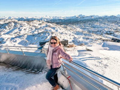
Subscribe To The Newsletter
FOR TRAVEL INSPO and FUN
No spam, only fun!
Favorite Destinations

- About Jessica
- How to Plan a Trip
- Fave Travel Companies
- Shop My Faves
Destinations
- World Travel
- San Francisco
- Northern California
- Southern California
- Central Coast
Ultimate 3-Day Death Valley National Park Itinerary
Sand dunes, craters, slot canyons & wildflowers. Experience the best of Death Valley National Park with this 3-day itinerary.

In this post, guest contributor Paul Martinez shares with us his full 3-day Death Valley Itinerary and helpful tips from his trip so you can experience the best that Death Valley has to offer.
At 134°F, Death Valley holds the record for the hottest air temperature ever recorded, so it’s no wonder why they call it “Death Valley”. Situated east of the Sierra Nevada and in-between the Great Basin and Mojave deserts, this is truly a land of extremes. In fact, Death Valley is one of the most extreme environments on earth with an average rainfall of fewer than three inches, and some years actually receive none!
Despite its record droughts, however, a great diversity of life manages to survive in its valley. Wildflowers can be seen sprouting through the ground in the spring, hidden lush oases provide refuge for wildlife, and kangaroo rats don’t even need to drink water their entire lives!
Here is a complete 3-day Death Valley itinerary and tips on what you need to know for your visit so you can explore the best the park has to offer.
Important Reminder: As it goes in all of the destinations we share, please practice good trail etiquette and remember to Leave No Trace . This means packing out all of your garbage (including toilet paper) and following the established rules. In the desert, this also means learning how to protect cryptobiotic soil and how it has a huge impact on our ecosystems.
Death Valley Itinerary Logistics
Getting to death valley.
Death Valley National Park is only 2 hours from Las Vegas and 5 hours from Los Angeles. It is definitely worth the drive as it is the largest US National Park outside of Alaska. Death Valley also makes for a great week of exploring nearby Sequoia and Kings Canyon National Park , and Yosemite if you are willing to venture a bit further on your road trip.
Death Valley National Park is also less than 2 hours to Lone Pine, CA which is the portal to Mt. Whitney, the highest point in the lower 48 states. Are you up for an unforgettable “lowest to highest” vacation? Go from the lowest point in the lower 48 states, Death Valley’s Badwater Basin, to the highest point, Mt. Whitney.
Best Time To Visit Death Valley
Fall, winter, and spring are the best times to visit Death Valley with milder temperatures. Spring is the most popular time due to the wildflower blooms.
While the Furnace Creek Visitor Center is open year-round, summer can be miserably hot in the park. From May – September, Death Valley is often too hot for most visitors.
Read next: Best National Parks to Visit in Spring
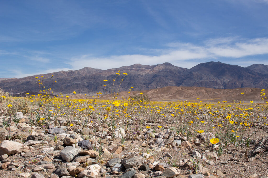
Where To Stay In Death Valley
Death Valley National Park has nine campgrounds, which doesn’t include some of the privately-owned campgrounds that also reside in the park. Furnace Creek Campground is by far the most popular and from October to April reservations can be made online for their 136 available sites. This campground is located directly behind the only visitor center in the park making it a great starting out point for adventuring!
Depending on when you’re visiting, some campgrounds will be closed for the season so make sure to check in advance. All campgrounds in Death Valley are first come, first serve (except for Furnace Creek from October through April).
We didn’t want to worry about finding a campground the day of arrival, so we booked a campsite with privately-owned Panamint Springs Resort prior to the trip. They are located on the western end of Death Valley National Park and offer incredible views of distant sand dunes and the soaring Panamint mountain range… oh and they have a bar and free showers, what’s not love?
#1 campsite finder app
Try the dyrt pro free for 30 days.
Get a FREE 30-Day membership to The Dyrt PRO, one of our favorite apps for finding campsites.
Perks include: • 5,000+ free camping locations • 1,000+ campground discount network • $0 extra booking fees • Get reservations at sold-out campgrounds, and more
Use the code BEARFOOT to get 30 days free!
Other Lodging Options in Death Valley
Not into camping? That’s okay! Death Valley is actually a great National Park for non-campers with 4 accommodation options that don’t involve a tent. Former Bearfoot Theory editor, Kim Vawter, explored Death Valley with her parents and they highly recommend the Furnace Creek Ranch as well as the famous Furnace Creek Inn. Read more about non-camping accommodations in Death Valley here .
Insider Death Valley Tips
Don’t leave home without maps.

We set out from Los Angeles around 8:00 AM and arrived in Death Valley just before noon to set up camp at Panamint Springs Resort. After setting up our tent, we headed towards the Stovepipe Wells Village area to hike through Mosaic Canyon .
Located 1/4 of a mile west of Stovepipe Wells Village, Mosaic Canyon is a two-mile gravel access road leading to the parking area. From there it was just a short walk into the canyon narrows, where the surrounding rock walls are made up of smooth, water-polished marble.
We were both in awe of how incredibly smooth the walls were. Mosaic Canyon is considered a geological wonder, and as part of the National Park System, all of its features are protected by law, so rock collecting is prohibited!

Before dinner, we drove to Mesquite Flat Sand Dunes for a stroll during golden hour. At first glance, it seemed like our plans would have to wait as clouds started to gather right over the dunes. The wind was picking up and sand was blowing everywhere. Nevertheless, we got out of our car and ventured into the sandstorm.
There wasn’t one person in sight, which for being one of the park’s most popular attractions, was astonishing. After a while, the clouds began to clear and the wind started to calm. The mixture between late afternoon light and ripples in the sand was quite the sight to see.

On day 2 of our Death Valley itinerary, we woke up at sunrise to prepare for a full day of exploring, beginning with an easy hike around the rim of Ubehebe Crater , located at the northern end of Death Valley National Park.
It was about an hour’s drive from our campsite to Ubehebe Crater, reminding us of why Death Valley is the fifth-largest national park in the United States and the largest outside of Alaska. The drive led us through colorful canyons, desolate badlands, shifting sand dunes, and sprawling mountains.
Once at Ubehebe, you can enjoy a view of the massive crater right from the parking area, or like us you can hike down or around it. Word to the wise – walking up the steep gravel hill can be difficult!

If you make it to this side of the park, it’s also worth checking out “the racetrack” , which is home to the famous Death Valley moving rocks. These rocks are commonly referred to as one of the most mystifying natural occurrences in the world! Also in this area is Scotty’s Castle but unfortunately, this site is temporarily closed due to flood damage.
Next, we explored the opposite side of the park at Furnace Creek, where many of the popular landmarks are located. Zabriskie Point is one of the Park’s most famous sites and a popular sunrise and sunset viewing location. It’s still spectacular at midday, too! To see a spectacular view of these eroded and colorful badlands, it’s just a short walk uphill from the parking area.

Continuing down the road, definitely stop to visit “The Devil’s Golf Course” which is an immense area of sharply, eroded salt crystal formations as far as the eye can see.
It is said that this area is so jagged that “only the devil could play golf on such rough links.” Just make sure to watch your step, because a slip and fall on these rocks can result in some serious damage.

Once we were done exploring the Devil’s Golf Course, we then headed towards the lowest point in North America, the infamous Badwater Basin . This part of the park sits at 282 feet below sea level, creating a surreal landscape of vast salt flats.
These salt flats cover nearly 200 square miles and are among the largest protected salt flats in the world. It can be extremely hot and dry here, so just make sure that you have plenty of water and sunscreen.

Before heading back to our campsite for the evening, we made sure to take the slightly longer route along Artist’s Drive . This scenic loop takes you through multi-colored volcanic and sedimentary hills. We stopped at Artist’s Palette for an incredible view of hills splattered in pastels, which is said to be remarkable in the late afternoon light.

In the morning, we got up to catch the sunrise and said farewell to our campsite. Our next adventure would take us just down the road, and along a 2 and a 1/2 mile dirt path to the parking area of Darwin Falls .
Prior to our trip, we had no idea that there was a lush oasis hiding in the midst of this unforgiving terrain. This spring-fed waterfall is truly a miracle in the desert, flowing year-round in a narrow gorge. It was a short two-mile roundtrip hike to the falls that involved some rock scrambling and several stream crossings.

Our final stop before driving back towards Los Angeles was Ballarat . This small ghost town lies just outside of Death Valley National Park and is run by its only resident and caretaker: Rock Novak.

The ghost town was a bit eerie when we arrived. There was nobody in sight and as we parked and got out of our car, all you could hear was the faint sound of an alarm going off. We walked around for a while and then out of nowhere appeared Rock. We talked for a couple of minutes and before departing he made sure to invite us to an event they celebrate called Freedom Days, where he emphasized that “anything goes!” We’ll just have to make a trip back to experience Freedom Days.
Read Next: 6 Coolest Nevada Ghost Towns
What to Bring on Your Death Valley Road Trip
Depending on what time of year you visit Death Valley, you’ll need to pack accordingly. Spring, winter, and fall have the coolest day temperatures, but it can get chilly at night so it’s a good idea to pack several different layers for warm days and cool nights.
If you’re car-camping on your Death Valley trip, also keep in mind that there are very few places to get food, fuel, and amenities in Death Valley, so it’s best to pack all of your car camping needs at home.
For information on car camping and hiking gear to bring on your Death Valley road trip be sure to check out these posts:
- What to Wear Hiking
- What To Wear Hiking in the Desert
- Sun Protection for Hikers
- What to Wear Hiking in Fall
- The Best Women’s Hiking Boots
- Car Camping 101: Essential Gear & More
- Road Trip Essentials
Death Valley offers so much from sand dunes to canyons to historic hotels. Any amount of time spent in the park is sure to be full of adventure and discovery! Don’t forget one of Death Valleys’ greatest attractions is its proximity to other National Parks like Sequoia and King’s Canyon as well as other quirky off-the-beaten-path towns.
So pack some snacks, grab your maps, don’t forget sun protection, and get on your way. Our Parks are waiting!
Have you been to Death Valley National Park? What are your favorite Death Valley itinerary stops? Let us know in the comments below!

Paul Martinez is a writer and photographer based out of Los Angeles. He is also the Founder of The Modern Day Explorer, an online publication built for urban and outdoor explorers; sharing guides, stories, and photography from around the United States.You can follow him on Instagram, Twitter, or over on his website, The Modern Day Explorer at TheModernDayExplorer.com.
Leave a Reply Cancel reply
Your email address will not be published. Required fields are marked *
Save my name, email, and website in this browser for the next time I comment.
29 Comments
Great article! Thank you for the guide. Quick question… what type of vehicle did you use for the trip? Did you need a 4×4 or did our stay on mostly roads to get to the spots where you hiked?
Thanks so much! You don’t need a 4×4 vehicle to access our itinerary! Definitely though make sure your brakes are great for dropping down into Death Valley, it can be tough on your brakes for sure!
Great write up! Certainly wasn’t expecting to see a waterfall in the middle of the driest national park in the country.
Cool eh? If you go come back and tell us about it
I will be in DV from May 11th-May 14th. This guide got me all the more stoked! Thanks for posting this!
Glad you enjoyed it, Tim! Have an awesome adventure in the park–hopefully you’ll be able to catch some late season wildflowers!
I would have loved to see Darwin Falls, I never heard about this part of the park, will definitely have to go back for this
Glad it is getting you back to the park, Noel! Have an awesome adventure!
My husband and I are traveling to DV at the end of January . My first time , he went as a youngster w his grandparents . Thanks for your list ! I’m sure it will b a big help!
I’m heading to Death Valley in March and this guide is great!!!
Thanks, Rebecca. Have an awesome trip. March is a great time to visit.
I loved reading this article! It reminded me of my time in Death Valley last summer!! I wished we had one extra day there since I see we missed a couple of great spots! Thank you for sharing!
Great tips for traveling DV. I planned to visit DV this winter, after Chrismas and right before New Year. I was worried about will it be hard to find a campsite in DV. Don’t want to camp at the edge of DV because I planned to see the sunrise at Zabriskie Point. My best option is camp around Furnace Creek area, and Furnace Creek campground seems already booked up. So my question is, What will be the best time to arrive DV to find for an empty campsite, do I need to arrive very early? And which campground has the highest chance to have available campsite? I know is hard to predict the future, but what I need is some info in past few years so I’ll have a better chance to understand what situation I’ll be facing. I also tried to call DV, but the robot answer did not help. :/ Thank You!
Hi Ryan, did you call Recreation.gov? That is who you’ll want to call to discuss campsite information. Have you referred to the listing of all campgrounds and # of sites on the National Park website? https://www.nps.gov/deva/planyourvisit/camping.htm , this is mentioned on their website answering your question regarding how early to arrive, “It is very rare for all campgrounds to fill in Death Valley. Sure, all of the “good sites” may be taken during busy times, but there is typically space at Sunset Campground (no tables, hookups, or firepits) even during the busiest of times.” Have you checked all the private campgrounds that are within the park as well?
Taking a rental car on rental tires out to the Racetrack is a mistake you’ll probably only make once.
Death Valley is an incredibly special, beautiful place.
It will punish the stupid, naive, unprepared, and inexperienced relentlessly and without mercy. Only go off the pavement if you know your tires can handle it. Bring plugs, a compressor, fix a flat, a real spare. Know how to use them confidently if the time comes.
DV has earned its name. Your life may likely depend on your car. Tires will be the weak spot.
Get gas in Nevada. FILL your tank unless you want to pay at least $6 a gallon. Panamint Springs has the most expensive gas. The place is a notorious ripoff and tourist gouge.
Seriously, heed my tire warning. Unless you know you’re ready for offroad, for sure, don’t go there.
Great itinerary! On my first trip to Death Valley I did Mosaic Canyon, Ubehebe Crater, The Racetrack, Artist’s Drive and Zabriskie! On my 2nd trip I repeated a couple of the old faves but decided to explore some other hikes. http://adventuretramp.com/2020/03/03/getting-lost-in-death-valley/
one of the best places to visit in usa
From Dante’s View walk up the ridge to the north for a view of Mt Whitney and Badwater at the same time! About 15,000 feet of relief!
I am planning my next trip there. Such a beautiful place waiting to be explored.
https://survivalinnature.com/
Hi Paul, thank you so much for posting this itinerary! I have been a bit overwhelmed trying to fit all the hot spots into a 3 day trip logistically and this helped tremendously! 2 questions if you would be so kind –
1. It looks like some campsites allow fires and others do not. We will be car camping with off road capabilities, do you know/recommend any of the sites that allow fires?
2. Out of curiosity, how did you guys decide to stay up near Panamint Springs verses the more accessible Furnace Creek area?
Thanks a bunch! – Lauren
Hi Lauren – the NPS website has a list of campgrounds that have fire pits.
Thanks for the article! This looks like an amazing trip full of different scenery! On my bucket list!
If you are in Beatty on the way into the park don’t miss Rhyolite Ghost town. A trip thru Titus Canyon with a high clearance vehicle is worthwhile as it includes an old mining area as well as a drivable slot canyon. Your 3 day list is a good outline of the park. It wets your appetite for more highlights of Death Valley. John Barnes
We are planning on driving a Lexus SUV in DV but not off roading. would it be advisable to drive it to the trailhead to Mosaic Canyon?
Hi Kayshu – although the road to the trailhead is gravel, it’s pretty flat and you do not need an off-road vehicle to access. Enjoy Death Valley!
We were just there 2 weeks ago and loved it! We really enjoyed Golden Canyon and then hiked onward up to the top by the red cathedral rocks. Quite the view. What a place! We spent 2 1/2 days there going to quite a few of the places that you mentioned! Our temps went from 92 on the warmest day – we hiked early and also tried to keep to the shady side of the canyon – and then into the 40’s-50’s after the sun was down. Well worth it!
Hi Brenda, sounds like a great trip! Thanks for sharing.
Hi there! I just want to give an enormous thumbs up for the nice information you’ve gotten here on this post. I might be coming again to your blog for more soon.
- Netherlands
- New Zealand
- Switzerland
- My Travel Essentials
Her Jolie Journey

A Beginner’s Travel Guide to Death Valley National Park
This is easily one of the most underrated US national parks I’ve ever visited! It’s located 2 hours west of Las Vegas and straddles the Nevada and California border. It has everything you could ever want in a park like incredibly unique landscapes, amazing hikes and some cool little hidden gems. We just recently took a road trip here for the first time, and here is the best beginner’s travel guide to Death Valley National Park.
If you’re planning a trip to Las Vegas soon, you don’t want to miss this national park.

How To Get to Death Valley National Park
To get to this beautiful National Park it will require some driving. The biggest cities within close proximity of Death Valley are Las Vegas and Los Angeles. Las Vegas is about 2 hours away and Los Angeles is about 4 hours away.
Driving Directions From Las Vegas (111 miles, 2 hours)
There are two options to get to Death Valley from Las Vegas. You can take 95 N towards Beatty, NV and cut through NV 373. We took this route, because we were staying on the north end of Las Vegas.
The more direct route is taking California Highway 190 through Pahrump, NV.
Driving Directions From Los Angeles (214 miles, 4 hours)
You can take a couple different routes to Death Valley from Los Angeles, and both take you to the Furnace Creek entrance. You can either take California 14 to U.S. 395 and hop over California 190 E. OR you can take Interstate 10 to Interstate 15 N to Baker followed by California 127 that leads you to California 190 E.
Where to Stay in Death Valley
No travel guide to Death Valley would be complete without a round-up of accommodations. The good news is there is no shortage of hotel options! You can stay in Las Vegas and take a day trip to Death Valley or you can find hotel options next door to Death Valley. So this is more of a choose your own adventure type of situation.
It’s no secret there is no shortage of great hotels in Las Vegas. Our trip to Las Vegas was for the purpose of visiting Death Valley National Park, so we saw no need to stay on the Las Vegas strip this time and decided to stick to a reliable Marriott hotel on the north side of Las Vegas.
We stayed at the Fairfield Inn & Suites by Marriott Las Vegas Northwest
This is a newer hotel that was completed in 2021. We found our room to be comfortable and dog-friendly! Breakfast was included which is always a plus.
If you want to stay closer to Death Valley National Park expect to pay more, but this is the best option if you want to maximize your time here. Dog-friendly accommodations are limited.
- The Inn at Death Valley (your nicest option)
Longstreet Inn Casino & RV Resort (dog-friendly!)
Stovepipe Wells Village Hotel (old west themed property)

Best Tips for Visiting Death Valley
When is the best time to visit Death Valley? This park is considered the hottest place on Earth, with a recorded temperature of 134°F in July 1913. So do yourself a favor, and skip this place in the summer. Winter is the ideal time to visit, because you get far less crowds and better weather.
What is the Entrance Fee? The fee to enter Death Valley National Park is $10/vehicle. This can be paid at the visitor center or one of the automated fee machines across the park.
When is Death Valley National Park Open? Death Valley National Park is open all year round, but if you want to check out the visitors center (I highly recommend) you can pop in between 8 am – 5 pm daily.
Cell Service in Death Valley National Park? You can forget all about having service here, so make sure you have what you need like your map and itinerary on hand before entering the park. Pop into the visitors center to get a map and a guide, to help you in the case you can’t find what you need.
Can I get gas in the park? You can find 3 gas stations inside the park: Stovepipe Wells, Furnace Creek and Panamint Springs. They can be unreliable. We tried to fill up at Panamint Springs and they were actually out of gas. I recommend filling up right before you enter the park
Death Valley National Park App
Yes, that’s right! This National Park actually has its own app!! With limited service in the park, this free app provides some of the best Death Valley information by expert rangers themselves. Here are some more exciting features you can expect from this app: what to see, things to do, lodging and camping options, hiking trails, sunrise/sunset locations, audio guided tours and night sky viewing! And this can all be used for offline use.
*We didn’t learn about this app until we entered the park, and unfortunately did not have the service needed to download this app so don’t repeat our mistakes and download this app before you get to Death Valley National Park!

Best Things to Do in Death Valley
Death Valley is considered one of the biggest national parks in the US with 3.2 million acres filled with twisted slot canyons, majestic sand dunes rocky peaks and the most incredible salt flats! Inside this travel guide to Death Valley, learn how explore and enjoy this beautiful national park.
Because this is a big park, make sure to give yourself enough driving time. Get an early start if you are limited on time here. We arrived at sunrise (just before 7 am) in January, and explored as much as we could before the sun set at 5 pm AND still didn’t get a chance to see everything we wanted.
Pick Up A Junior Ranger Program Booklet
If you think you’re took old for this program, think again! The Junior Ranger program is for all ages, and it’s a fun way to learn more about Death Valley National Park. Best part is once you complete the booklet, you get a badge with a logo of Death Valley and they make for an awesome souvenir!
Where to find one? Head to the Furnace Creek Visitor Center and ask a Park Ranger for a booklet. Once it’s complete you can head back to the visitor center and drop it off or mail it in to get your badge.
Don’t Miss The Salt Flats at Badwater Basin
This was our first stop in the park. There are so many beautiful spots in this park that are worth an extra early morning wake up call, and Badwater Basin is one of those spots! There is just something so special about seeing the sun rise over such a beautifully unique landscape.

Considered the lowest point in North America at 282 feet, you can find the most incredible views of salt flats that span for miles at Badwater Basin. Given its unique landscape, it’s easily one of the most popular spots in the park. The parking lot is limited in space, so get here early if you can.

You can find a boardwalk just off the parking lot to view the salt flats, but if you want to find the best views you’ll want to move beyond the boardwalk. It will take you about 30 minutes to get to the more photogenic salt flats or 1.8 miles round trip. And trust me, it’s worth the trek!

Insider Tip: If you really want to catch the magic of Badwater Basin, visit at sunrise or sunset. The views are truly incredible and you get far less crowds.
Devils Golfcourse Is So Underrated
Perhaps one of the more underrated spots in the park and located less than 10 miles from Badwater Basin . We were so surprised we had this place all to ourselves for nearly 30 minutes. Fun fact: this area of the park received its name after a 1934 NPS Death Valley guidebook said, “only the devil could play golf” here given the harsh landscape.

So how was this part of the park formed? This was one home to Lake Manly over 10,000 years ago. Over time the lake dried up and left behind dissolved minerals. What you see today is a result of salty water rising up from underlying mud and as it evaporates you see these salty spires form with a little help from wind and rain.

You can easily miss the sign to Devils Golf Course , and Google Maps did not direct us to the right spot so we had to do a little backtracking. Here is what you need to know: When driving on Badwater Road you want to keep your eyes peeled for Salt Pool Road. This will be on your left hand side if you are heading here from Badwater Basin. The road is unpaved for 1 mile and will lead you to Devils Golf Course.
Artists Palette Is Worth The Hype
Chances are you have seen this rainbow wonderland all over social media, and I can confirm it lives up to the hype! To get to Artists Palette you’ll take a 9 mile scenic loop drive through colorful hills. And keep in mind this drive is one-way, so don’t hesitate if you see a spot you want to stop and check out.

I have to confess i’m often guilty of planning a trip around a cool spot I see on Instagram. Anyone else?? When I saw photos of Artists Palette in Death Valley I just knew I had to see it for myself!

Artists Palette really is quite stunning, and truth is these hills really are filled with the most beautiful pastel colors but photos don’t do it justice. With just a little photo editing this landscape really lives up to its name.
If you’re wondering how to get to the most photogenic spot here, don’t worry because you will see a big sign that points you to the Artists Palette overlook. If you miss it you will have to go all the way back around.
Explore Popular Hikes in Golden Canyon
Golden Canyon is home to the most popular hikes in Death Valley National Park. So what makes this place so special? The landscape here is filled with badlands, towering, twisted rock spires, hidden slot canyons and colorful golden and pink hues.

This is definitely the type of spot where you have so many options to choose your own adventure. You can actually find three separate trails here that overlap with each other. That doesn’t include all the mini trails that branch off from the main trail here. Read on to see what options you have here.
Definitely a fan favorite hike due to the ease at which you can hike this trail. You can simply walk through the mouth of the canyon until you see the canyon end at which you can turn right back around. It’s about 1 mile roundtrip. This is a great option if you are limited on time like we were. You can still catch some amazing views of this area. We even branched off the main trail to make our way to higher ground and catch some great views!
If you want to catch a glimpse of the iconic Red Cathedral continue on the golden canyon trail . Once you reach the end of the canyon, you’ll have to scramble 0.5 miles to see the Red Cathedral. You will spot a trail that takes you up to higher ground to catch even better views. This is a moderately difficult hike and is 3.5 miles round trip.
This is a 4.3 mile round trip hike that provides some incredible views of the Badlands. You will stay on the Golden Canyon trail for 1 mile before reaching mile marker #10. You will follow that marker to the right and this will lead you out of the canyon and reward you with some great views.
If you want get a close up look of the iconic Zabriskie Point, this is the trail for you ! From Red Cathedral you can choose to take the Badlands loop for 1.1 miles and it will lead you to Zabriskie Point.
Visit The Photogenic Zabriskie Point
When I tell you this place is popular, I mean it. We were on our way to Badwater Basin to catch the sun rise, and when we passed the parking lot to Zabriskie Point just before 6:30 am it was PACKED! But it’s popular for a reason. You will find some of the most beautiful golden colored badlands here.

You don’t have to worry about any extensive hiking here. From the parking lot you take a paved trail 0.4 miles up to an overlook that provides stunning views of this landscape. INSIDER TIP: If you do want to do a little off-road hiking, there is a little trail to the right of the overlook you can take that will get you a closer view of Zabriskie Point. Keep in mind the climb back up is a work-out.

The parking lot found here is HUGE, so if you can’t get here at sunrise don’t sweat it because there is plenty of parking.
Discover Rolling Golden Hills at Mesquite Flat Sand Dunes
Most people think Death Valley National Park is just covered in sand, but less than 1% of the park actually has sand dunes! The sand dunes found here truly are iconic though. And Mesquite Flat Sand Dunes is definitely a fan favorite, because this spot is so photogenic and so easy to get to.

You will actually find a 100 foot sand dune here!! And if you’re feeling brave you can bring a sled and try your hand at sledding down this massive dune. We saw a large group of people sledding when we visited in January, and it looked like so much fun! This is the only area of the park that allows sand boarding.

And before you repeat my mistake, I am going to let you in on a little “secret.” You can actually explore FIVE different dune areas here. If you have time available check out these other sand dunes in Death Valley National Park:
Read details above!
This spot flies under the radar, but is filled with the some of the tallest sand dunes in North America! It can be challenging to get here as the road consists of dirt and gravel and can often be closed due to weather conditions in the winter. But rumor has it this spot is worth it if you can get there!
You can find these sand dunes near the salt flats, but it’s highly recommended you have 4WD to reach them because the road can be filled with sharp rocks. If you do make time to visit, there is a really good chance you will have this place all to yourself because it’s one of the least visited areas of the park.
I am starting to get repetitive, but this road is also unpaved and having 4WD will make it easier to get here. These are the only sand dunes in the park that are not found in a valley, but on a slope so they are very easy to spot.
The sand dunes found here are TALLER than the sand dunes found at Mesquite Flat Sand Dunes. And if you need some help finding these, AllTrails has got you covered . Not going to lie, after seeing photos of this spot I am eager to check this place out next time I visit!
Update: Since February 2023, this trail has been temporarily closed due to flooding.
Wildrose Charcoal Kilns- A Death Valley Hidden Gem
It is a mystery to me why more people don’t visit this spot. Tbh, this spot is a bit of a drive and much further than other more popular spots in Death Valley National Park, but it’s SO worth it! Wildrose Charcoal Kilns can be found about an hour south of the Mesquite Sand Dunes on Emigrant Canyon Road, 28 miles from HWY 190.

We visited in January and we were not expecting to walk into a winter wonderland. It made it challenging to get here in our Ford Escape without 4WD and I would not necessarily recommend. We almost got stuck in the snow because of it.
Here are some important tips when visiting the Wildrose Charcoal Kilns:
- The roads do get rough, and it’s recommended you have 4WD. We didn’t, but managed to drive extra slow
- Check the weather before you go, as you can see we ran into bad weather and it was less than ideal to drive in
- The road for the last 2 miles is gravel, but is generally suitable for most cars
Don’t Overlook Twenty Mule Team Canyon
This was our last stop of the day before the sun set, and we almost skipped it but I am glad we ended our trip here. Twenty Mule Team Canyon consists of impressive badlands and some pretty colorful hills although not as colorful as those found at Artists Palette.

This area gets overlooked due its much more popular neighbors like Golden Canyon and Zabriskie Point, but we really enjoyed exploring the landscape here. We got here at sunset and were rewarded with hills covered in deep purple hues and light blue.

The road that leads here is unpaved, but it’s an easy and scenic 4 miles. And chances are you’ll get this place to yourself since many people choose to skip this spot. This also happens to be one of the more dog-friendly areas of Death Valley National Park where you can actually give your dog a proper walk here!
Death Valley National Park Honorable Mentions
We were only able to spend one day here, and crammed as many spots as we could into our itinerary but I am already dying to go back. Here are some additional spots on my list we didn’t have time to visit, but deserve an honorable mention:
- Dante's View
- Mosaic Canyon
- Natural Bridge Trail
- Rhyolite Ghost Town
- Ubehebe Crater
I hope this travel guide to Death Valley helps you make the most of your trip as you explore one of the most underestimated US National Parks in the country!
LIKE IT? PIN IT AND SHARE IT

*Disclaimer: This post contains affiliate links. If you purchase a product through a link below then I receive a small commission at no extra cost to you. I really appreciate your support!
Related posts:
A perfect weekend getaway to joshua tree, shop the look.

You May Also Like
The perfect dog friendly palm springs getaway, 9 insanely cool things to see in palm springs on your first trip, 18 of the best christmas markets in europe you don’t want to miss in 2024, an unforgettable guide to dog friendly death valley (with hidden gems).
TropEco Travel
Custom Travel Planning & Blog
My Guide to Death Valley National Park (in a Tesla)

We were supposed to go to Death Valley for New Years, but opted to stay home because of the California stay at home order. When things finally opened back up again, we jumped at the chance to go. One of my favorite things about Death Valley was its remoteness, you can easily find solitude and truly get lost (in a good way). Here is a rough three day itinerary for your long weekend in Death Valley National Park with details on how to bring an electric vehicle.
Drive to Death Valley
We left San Diego around 9am and arrived to Death Valley around 4pm. We went back and forth on whether or not to bring the Tesla. There are no superchargers in the park or very close to it. The closest superchargers are in Baker, Ridgecrest or Lone Pine. Eventually we read somewhere that one of the hotels in the park, The Ranch at Death Valley, has four free charging stations. They are powered by the hotels solar panels, taking advantage of that strong desert sun. Keep in mind that these are not supercharges and a full charge will take about eight hours. Once we found that out we decided to just go for it and bring the Tesla. We stopped in Baker for a full charge before heading into the park from the southeast end towards Furnace Creek. Once through the entrance of The Ranch at Death Valley, the chargers will be on the corner of Date Grove Road and Greenland Blvd across from the Borax Museum and the post office (see map below). There were never none available, so don’t worry about that.

Get a campsite at Texas Springs or Sunset campground
Texas Springs campground is supposed to be the best campground in the park. The campgrounds aren’t very glamorous here, they are mostly just gravel parking lots, but the bathrooms are nice and clean though. We read that Texas Springs would fill up by 7pm on Friday and overflow would go to Sunset campground. We arrived at 4pm and Texas Springs was already full, much to our disappointment. It worked in our favor though because Sunset campground was much closer to the hotel across the street where our car would be charging overnight.
This came in handy later that night when the wind picked up at midnight, waking us up. It was whipping our tent around and made it almost impossible to sleep. We knew the car would be fully charged by 1am, so at 1am my husband ran across the street to get the car. We quickly broke down the tent and set up our crash pad in the car. This was our first time car camping and we were thrilled to see that our double crash pad fit almost perfectly in the back of our Tesla Model Y. We even discovered that the car has a camping mode and regulates the temperature while you are sleeping. Camping mode used anywhere from 5-10% charge if used through the night.
Sunset at Artist’s Palette

After quickly setting up our tent and paying the campground fee, we booked it to Artist’s Palette for golden hour and sunset. Millions of years ago, repeated volcanic eruptions covered this area with ash and minerals. The colors of Artist’s Palette come from minerals that were chemically altered by heat and water, with the presence of oxygen and other elements. The vibrancy of the colors depends greatly on the lighting. The colors at Artist’s Palette are most vibrant in the hour leading up to sunset or at sunrise.
Sunrise at Zabriskie Point or Dante’s View

We opted for sunrise at Zabriskie Point because we didn’t sleep great the night before (thank you wind) and it was closer to our campground. It was really cool to catch the full moon setting before the sun rose and lit up the mountain range and formations in front of us.
Hike Badwater Basin

The salt flats of Badwater Basin are a must-see when visiting Death Valley for the first time. You must leave the boardwalk and walk straight out to see the polygon salt formations. Go at sunrise or shortly after to beat the crowds and the heat. At 282 feet below sea level, Badwater Basin is the lowest point in North America. One of my favorite things here was the sea level sign wedged into the mountainside (see above right picture). You could really get a feel for how low you really were.
Hike Golden Canyon or Sidewinder Canyon

Golden Canyon is a very popular hike in Death Valley, for this reason we opted for Sidewinder Canyon. It is a ways past Badwater Basin heading south. When we arrived at the parking lot it was a bit confusing as to where the trailhead was, so we just headed up into a canyon. So, we are not even sure if we really hiked Sidewinder Canyon. I would definitely download the trail map on AllTrails if you want to hike this one. On our way out a guy came up and asked us where the trail was, we couldn’t help him much, but at least we know we weren’t the only ones a little confused.

After this we headed back to The Ranch to rest and charge the car. While the car was charging we played cards, read a book, made lunch and had a few adult beverages. After charging our original plan was to backpack to Panamint Dunes and spend a night camping and stargazing on the dunes. But, because of the wind the night before, we decided to stop at the Visitor Center to ask about the wind forecast for the night. It was not good, gusts up to 45mph predicted, so we decided not to backpack. It would have been impossible to set up or break down a tent in strong winds. So instead, we car camped near the trailhead and hiked it early in the morning. Moral of the story, don’t rely on everything going as planned and always have a backup plan.
Mesquite Flat Sand Dunes or Panamint Dunes

Mesquite Flat Sand Dunes are the most popular dunes to visit in Death Valley National Park. They are right off the main road and very easy to get to. Always in search of no crowds, we opted to go to Panamint Dunes instead. To get there you need to drive 5 miles down a dirt road and hike 4 miles to the dunes. For the dirt road leading to the trailhead, it says you need a high-clearance car. After doing some research beforehand and reading stories of people doing it in a regular old sedan, we decided to go for it. It was totally doable in our Model Y, just at a slower pace with the off-road assist setting on. We had some people pass us on the dirt road and I think they were amused to see us off-roading in a Tesla.
We hiked in just after sunrise and much to my delight, we had the dunes all to ourselves! Panamint Dunes may seem small from far away, but once you get there you will be the one feeling small. Climbing the dunes is no easy task, but totally worth it when you reach the top! In the parking lot on our way out we ran into people who had backpacked it the night before. They said it was miserable, so we were pretty glad we didn’t do it.
Drive home
We headed out the west side of the park and charged the car in a small town right outside of Ridgecrest. Overall, I really loved Death Valley and definitely want to go back to explore more. It also felt pretty cool to have done it in an electric vehicle. We had some concerns that the Tesla might hold us back from seeing more of the park, but I’m happy to say that we had no regrets in bringing it and would definitely do it again!
Death Valley is one of the hottest places on Earth. The best time to visit is from fall to spring. Summer will be too hot in the basin, but is okay if you want to hike Telescope Peak. We went at the end of February, the high during the day was 73 and the low at night was 45. Be sure to bring plenty of water and stay hydrated.
If you plan on backpacking, be sure to get a free backcountry permit online or from a visitors center. There are also rules as to where you can car camp, for more information please visit the National Park Service website. Remember when visiting national parks to leave no trace.
If you liked this blog post, be sure to check out My Guide to Sequoia & Kings Canyon National Park ! Don’t forget to book your trip with your favorite travel planner, yours truly.
Share this:
- Click to share on Twitter (Opens in new window)
- Click to share on Facebook (Opens in new window)
You may also like...

A Very Gaudí Day in Barcelona

Pictures that will make you want to visit Belize

Honeymoon in the Maldives
Get smartphone savvy the easy way — join our seven-day email challenge to receive helpful tips each day.
AARP’s Guide to Death Valley National Park
The california oasis is huge, dry, often brutally hot — and absolutely worth a visit.
by Hannah Lott-Schwartz, AARP , December 3, 2021

Getty Images
Hottest place on Earth. Lowest elevation in North America. Driest of all national parks .
Death Valley National Park (DVNP), in southeastern California, is a land of superlatives. Its name alone, gifted by a group of Gold Rush hopefuls who lost one of its party while crossing the valley in the mid-1800s, suggests legendary status — a place to be admired, respected and perhaps even slightly feared.
And perhaps it should be, to a degree. While the title for hottest place on Earth is a matter of some debate, temperatures soar in Death Valley’s aptly named Furnace Creek each summer, resting rather uncomfortably in the 120s, threatening to tip over 130 to set a new world record. In this type of heat, merciful breezes don’t exist; instead, wind hisses at any bit of exposed skin, burning as it passes. It’s a reputation that, coupled with the national park’s name, has kept visitation relatively low in comparison with more popular parks, such as the Grand Teton or Joshua Tree . Yet, with nearly 3.5 million acres to explore, it’s the largest national park outside of Alaska — and a fantastic place to explore, particularly in winter.
Nearly the entirety of Death Valley is designated wilderness, with 1,000 miles of paved and dirt roads connecting towering sand dunes, crusty salt flats and craggy peaks. They create some of the country’s most extreme vertical rises, the faces of which are dotted with remnants of a brief boom-and-bust mining history. This is the ancestral home of the Timbisha Shoshone people, whose village still resides in Furnace Creek, and many of the sites — including Eagle Borax Works, the Panamint Range and Ubehebe Crater — are considered culturally important and/or sacred. Please use discretion and show respect when visiting.
Bighorn sheep camouflage themselves against the badlands along the 120-mile basin, while desert kit foxes, kangaroo rats (who don’t need to drink any water in their entire lifetimes!), bobcats, jackrabbits and coyotes press tracks into the delicate sand.
While summer may bring devastatingly high temperatures, that shouldn’t overshadow other seasons, when warm days give way to cool stargazing under an open sky, unmarred by anything but shooting stars and the largest meteors you’re likely to see anywhere.

Getty Images/AARP
Location: Death Valley, California
Acreage: 3,422,024
Highest peak: Telescope Peak, 11,043 feet
Lowest point: Badwater Basin, 282 feet below sea level
Miles/number of trails: 94 miles, with 21 trails
Main attraction: Badwater Basin, the lowest elevation in North America
Entry fee: $30 per vehicle, valid for one week
Best way to see it: From a reliable 4x4 vehicle that can take you from point to point along U.S. Rou 190.
Best time to go: October through April provide cool enough weather to camp and hike at low elevations in the park. Wildflowers bloom on the valley floor from mid-February through mid-April. After that, flowers remain at higher elevations until June.
COVID-19 Update: Consistent with CDC recommendations, the National Park Service requires people who aren’t fully vaccinated to continue to wear masks indoors and in crowded outdoor spaces. Visitor centers are open. Check for updates at nps.gov/devaor call 760-786-3200.
Getting There
The small airport in Furnace Creek, near the center of the park where the elevation dips toward its lowest point, is open only to private airplanes, so most visitors arriving by air fly into Las Vegas , 106 miles east of the park, and home to the largest nearby commercial airport.
Death Valley is different from other national parks in that there are multiple entrances, none of which have ranger booths; rather, all roads lead to the main thoroughfare, U.S. Route 190, and eventually the Furnace Creek Visitor Center, which serves as the park’s hub. Here, you can pay your park fee, collect informational handouts (newsletter, maps, etc.), speak with rangers, and view a 20-minute video that details the park’s history. About 24 miles northwest on the highway lies the Stovepipe Wells Ranger Station, a modest and irregularly staffed building (with automatic payment machine to collect fees if there’s no one there) adjacent to a general market, bookstore and gas station.
Inside the park, you’ll find restroom facilities all along 190, making pit stops easy at the park’s main attractions. Not so with fuel stops, however: There are only two gas stations within the park, in Furnace Creek and Stovepipe Wells, near the primary western entrance. The main visitor center and hotels offer Wi-Fi, but cell service is spotty at best and cannot be relied upon for communication.
The rule of the road in Death Valley? Be prepared for emergency situations since the starkly beautiful landscape can turn deadly due to soaring temperatures and rough terrain. Plus, there’s no promise even during high season of passersby stumbling upon you to lend a hand should something go wrong. For these reasons, bring extra water and snacks in your backpack and vehicle, check your tires before arrival, know where your spare tire is, and have a backup plan for communication (such as a satellite messenger or personal locator beacon) should you run into a situation in which you need help.
While the main highway is in great condition, the dirt and gravel roads that lead to some of the park’s most winning vistas have claimed countless tires from even the most prepared SUVs. Seriously consider opting for an in-park Jeep 4x4 rental from Farabee Jeeps, in Furnace Creek. The company regularly services its fleet of two- and four-seaters, which have all the rugged road capabilities you need in the park and come with satellite tracking so that should anything go awry — knock on wood — park pros will know your whereabouts. Farabee also offers guided tours, especially popular with visitors traveling by RV, who otherwise cannot access many of the park’s roads due to vehicle length restrictions.
Where to Stay and Eat
You’ll find plenty of places to lay your head at night in DVNP between camping, rustic but comfortable lodging, and even upscale accommodations.
Oasis at Death Valley. Some 80,000 gallons of water flow to the surface daily in Furnace Creek, making this oasis the heart of the park’s action. Here, the two-property Oasis at Death Valley, a privately owned resort collection built in the 1920s by the Pacific Borax Company, later turned into a winter Hollywood getaway, playing host to notables such as Clark Gable and Ronald Reagan. Tucked into a hillside in Furnace Creek, the resort’s 88-room Inn at Death Valley, with a spring-fed pool (naturally heated to 84 1/2 degrees year-round), completed a $100 million renovation at the end of 2018, adding 22 private casitas (each with its own private golf cart for getting to and from the pool) and a spa to the lush grounds. Only the casitas and pool are open in summer.
Ranch at Death Valley. Just down the hill, Oasis's family-friendly sister property is open year-round. It offers 224 rooms and a mission-style town square shaded by towering date palms where visitors throughout the park gather to dine, drink and cool off. You’ll find a seasonal buffet, sit-down restaurant with mostly hearty fare (a standout: the generously portioned kale and goat cheese salad), a saloon with ice cold taps, an ice cream and coffee counter, and general store with everything from “I survived Death Valley” T-shirts to cans of cat food.
Stovepipe Wells Village Hotel. A second, smaller village lies 24 miles northwest in Stovepipe Wells, right next to Mesquite Flat Sand Dunes. The feel at Stovepipe Wells Village Hotel is less ranch-like, more motor lodge, with 83 modest rooms, a pool, seasonal chuckwagon-style dining, and 14 RV hookups. The market across the street has similar provisions as the Furnace Creek general store, but with more Death Valley-branded swag and the park’s cheapest gas.

travellinglight / Alamy Stock Photo
Furnace Creek Campground
First-come, first-serve campgrounds are abundant, but only the centrally located Furnace Creek Campground — just behind the visitor center and with 18 RV hookups and plenty of shady sites — takes reservations (Oct. 15-April 15, $22 per site, $36 per hookup,) available through recreation.gov. Mesquite Spring ($14 per site), Wildrose, Thorndike and Mahogany Flat (all three free) are at higher elevation, which means cooler temperatures that keep them open year-round as a result, but they’re also subject to higher winds and limited road access (a 25-foot length restriction on vehicles or 4x4 capabilities in some cases). These cooler campgrounds often fill up on weekends no matter the season, especially given that overnight temperatures down below in the valley regularly hover in the triple digits in summer.
The massive park welcomes dispersed camping (including car camping and backpacking), with some restrictions. You can set up one mile from any paved road, “day use only” area or developed area, but must avoid off-limit zones designated by the National Parks Service (trails, sand dunes and the valley floor between Ashford Mill and Mesquite Flat) and stay 100 feet from any water source — and, out of respect for the wild, no off-roading.

Dean Fikar/Getty Images
Zabriskie Point
Things to Do
Just as the Earth revolves around the sun, its presence guides activities in DVNP. Sunrise and sunset totally transform the park, turning sandy-hued vistas into brushstrokes of watercolor that shift from soft to fiery as the landscape’s natural minerals shine through. If you’re a photographer, take note: Plan your outposts for these times.
Though the park boasts more than 3 million acres to explore, NPS has done a good job of organizing points of interest, wrangling a handful into sites easily accessible by a typical vehicle, should a 4x4 rental be beyond your adventure budget. Each point can be appreciated by simply driving up or further explored on foot via trail or backcountry wandering.
They include:
Zabriskie Point. At sunrise, herds of onlookers flock to wheelchair-accessible Zabriskie Point, about 5 miles southeast of Furnace Creek, as first light trickles down the mountains that form the horizon, across the valley and finally to the hooked formation that this heavily photographed place is known for. Narrow trails lead down into the wash among the badlands and up along their ridges for sure-footed folks who’d like a different view.
Badwater Basin. Just 85 miles southeast of the highest point in the contiguous United States at Mount Whitney lies the continent’s lowest spot, 282 feet below sea level. Eighteen miles south of Furnace Creek, the paved Badwater Road and accessible boardwalk pours out into Badwater Basin, one corner of some 200 square miles of blueish-white salt flats composed of sodium chloride (also known as table salt), calcite, gypsum and borax that glow at sunset. You’re welcome to walk to the edge of the sturdy, even flats (1 mile, out and back), where polygon shapes form in the crust, creating the characteristic honeycomb veins that snake the surface as though they were Earth’s very wrinkles. To fully appreciate how low you really are, look back to the Black Mountains above the parking lot. High up the cliffs, there’s a sign marking sea level — you’re nearly 300 feet below it.
Artists Drive. Also off Badwater Road, a 9-mile one-way paved detour loop known as Artists Drive hugs the base of the Black Mountains, draping dramatically over orange hills and badlands and detouring into a small parking lot from which you can see Artists Palette, a display of iron oxide and chlorite-rich volcanic deposits that turn the landscape into a Jackson Pollock splash of color, particularly at daybreak and last light.
Dantes View. More than a mile above, Dantes View overlooks Badwater Basin, its vast salt flats morphing into wispy clouds with the bird’s-eye perspective. The easy, paved drive passes through fields that blossom with wildflowers in the spring, carrying you 5,575 feet up to a wide lookout with benches, a couple moderate trails, and wild views all around. By day (especially sunrise or sunset, but really, it’s spectacular at any time), you’ll feel as though you’re on the edge of the world, and by night, avid stargazers look skyward as the Milky Way unravels with exceptional visibility on the new moon, or downward into the basin when full, the moonlight illuminating the salt beds with iridescence.
Salt Creek. Heading west on 190, signs for Salt Creek point you toward one of the last remnants of the valley’s previous life as a massive lake. When it dried up 10,000 years ago, the lake evolved from freshwater to salt, and the ancient pupfish — a tiny, bright blue swimmer found nowhere else in the world — evolved with it, adapting in order to survive in water temperatures that can range from near freezing up to nearly 107 degrees. Visit the half-mile ADA-accessible boardwalk loop November through May, when water flows through the wetlands and encourages the pupfish to spawn come springtime.
Mesquite Flat Sand Dunes. The highway curves around Mesquite Flat Sand Dunes near Stovepipe Wells, with a wide parking lot that offers remarkable views on its own. But plan on arriving before sunrise to walk the dunes after they’ve had time to cool off under the night sky. Most people stay within the first couple valleys, but you’ll be rewarded with solitude by hiking straight out 10 or 15 minutes, passing low juniper shrubs and gnarled mesquite trees (a resource for Timbisha Shoshone for centuries) that blossom in bright yellow flowers and green leaves each spring. There, you’ll be surrounded by soft ripples of sand unmarred by tracks, unless laid by a lizard, sidewinder or kangaroo rat. The tallest dune may not look far, but it’s a solid mile out and can take upward of two hours to get there and back. While birds are scarce in this part of the valley, it’s common to see flyovers from rare military craft in training, including massive triangular B-2 stealth bombers, which (as the name suggests) sneak up on you, so keep an occasional eye toward the sky to catch a glimpse.
Stargazing. The International Dark-Sky Association has designated Death Valley as a Gold Tier night sky, meaning there’s no better location for stargazing. The park’s rangers host nighttime programming in winter and celebrate the cosmos each spring at the annual multiday Dark Sky Festival. But you can enjoy the explosive display any time of year from the rangers’ favorite spots, including Mesquite Flat Sand Dunes, Harmony Borax Works (a historic mining site 1 mile west of Furnace Creek) and Badwater Basin.
Golf. Death Valley may seem an unlikely place for a golf course, but the links at Furnace Creek are notorious. The 18-hole, par 70 course is the lowest elevation game in the world at 214 feet below sea level and rated one of the toughest courses in America by Golf Digest due to the low barometric pressure, which seems to stop the ball in its tracks no matter how good your swing.
Gateway Towns
Because Death Valley has multiple entry points, it has no one definitive gateway town, and certainly no bustling one. But there are a few options for pit stops outside the park, including:
Baker , south of the park on Interstate 15 (where it meets the Mojave National Preserve), is a barely a one-street town but boasts the World’s Tallest Thermometer (or so it has been branded), a few run-down, vacant hotels and diners with vintage signage that make for a good quick photo, and the Mad Greek, a cafe known for its fresh strawberry shakes.
Beatty , across the border in Nevada, was founded in the early 20th century as a mining town, known by weary travelers for hot springs that recently shuttered. A few cute but somewhat random stops remain, such as the Sourdough Saloon and Atomic Inn, but by and large the massive Death Valley Nut & Candy Company is the place to hit for road snacks to suit any sweet tooth.
Lone Pine to the west — the gateway to Mount Whitney, the Alabama Hills and Eastern Sierras — is the best-known among towns near the park. You’ll spot all manner of outdoor enthusiasts here, celebrating recent summits or planning future adventures. Alabama Hills Cafe & Bakery is a favorite for fruit pie should you be peckish. If you don’t have much time but want to explore the scenery more, see it on display at the Museum of Western Film History, which pays tribute to the 400-plus films and countless commercials shot in the area.

AARP Membership -Join AARP for just $12 for your first year when you enroll in automatic renewal
Join today and save 25% off the standard annual rate. Get instant access to discounts, programs, services, and the information you need to benefit every area of your life.
Death Valley Junction. Those flying in to visit the park generally come through Las Vegas, just two hours by car to Furnace Creek. Driving west on Route 160, look for the Amargosa Opera House at Death Valley Junction, about five miles after crossing the Nevada-California state line. The junction itself is on the National Register of Historic Places and offers a modest collection of early-20th-century buildings, the white and bright-blue Amargosa theater and hotel among them. The Amargosa was originally built in the 1920s by a mining company but was taken over in 1967 by the late Marta Becket, a performer whose passion (and elbow grease) gave the opera house new life. While COVID-19 has temporarily paused performances, the hotel is open and accepting reservations.
China Ranch Date Farm. If you’re driving up through Baker, take U.S. Route 127 north to the China Ranch Date Farm, just south of Tecopa. Located in the midst of a desert oasis, the farm is open daily 9 a.m.-5 p.m. Visit for fresh dates (including proprietary varieties) and a richly complex history that includes the area’s Indigenous nations, a 19th-century Chinese miner and early pioneers.
Shoshone. Continuing north on California state Route 127, stop in Shoshone at the Shoshone Museum to learn about those whose ancestral homelands you’re about to explore. At the Charles Brown General Store across the street, stock up on supplies and browse locally made goods.

PHOTO BY: David Becker/Getty Images
On July 11, 2021, the temperature at Furnace Creek Visitor Center hit 133 degrees Fahrenheit.

PHOTO BY: LucynaKoch/Getty Images
A view of the park’s badlands from Zabriskie Point.

PHOTO BY: HaizhanZheng/Getty Images
Death Valley’s remote location makes for fantastic stargazing.

PHOTO BY: Ariadne Van Zandbergen / Alamy Stock Photo
Bighorn sheep are among the wildlife you’ll spot at Death Valley.

PHOTO BY: Jim West / Alamy Stock Photo
Zabriskie Point overlooks an otherworldly landscape, once an ancient lake. (Fun fact: This is where the cover photo for U2’s The Joshua Tree album was shot.)

PHOTO BY: Richard Cummins / Alamy Stock Photo
Follow the boardwalk along the Salt Creek Interpretive Trail, which makes a half-mile loop.
Hannah Lott-Schwartz is a San Diego–based journalist telling stories for National Geographic Traveler, Fortune, TIME , and others.
More on Travel
- Guide to Yellowstone National Park
- 8 national parks at their best in the fall
- 6 fantastic winter getaways in the northeast and midwest
Call: 1.800.675.4318
Search Flights
Enter a valid location
Enter a valid date
Child under 2 must either sit in laps or in seats:
Add Another Flight
Search Hotels
Search Packages
You didn't specify child's age
There are children in rooms without an adult
You have more than 6 people total
Please select a trip duration less than 28 days
There must be at least 1 traveler (age 12+) for each infant in a lap
Search Cars
Search Cruises
Select a valid location
Select a month
Search Things to Do
You are leaving AARP.org and going to the website of our trusted provider. The provider’s terms, conditions and policies apply. Please return to AARP.org to learn more about other benefits.
Your email address is now confirmed.
You'll start receiving the latest news, benefits, events, and programs related to AARP's mission to empower people to choose how they live as they age.
You can also manage your communication preferences by updating your account at anytime. You will be asked to register or log in.
In the next 24 hours, you will receive an email to confirm your subscription to receive emails related to AARP volunteering. Once you confirm that subscription, you will regularly receive communications related to AARP volunteering. In the meantime, please feel free to search for ways to make a difference in your community at www.aarp.org/volunteer
Javascript must be enabled to use this site. Please enable Javascript in your browser and try again.
Tourists flock to see Death Valley in bloom
Gorgeous fields of wildflowers are taking over california with bright yellow daisies even popping up in death valley, the driest and hottest place in america., april 19, 2024, what’s next for russia, what comes next after texas school shooting, what's next for abortion rights in america, the new battle for voting rights, how we can build a clean and renewable future, the fight for kyiv, examining extremism in the military, gun violence: an american epidemic, border crisis: what’s happening at the us-mexico border, remembering george floyd: a year of protest, the source of covid-19: what we know, how did the gamestop stock spike on wall street happen, why are people hesitant to trust a covid-19 vaccine, how climate change and forest management make wildfires harder to contain, disparity in police response: black lives matter protests and capitol riot, 2020 in review: a year unlike any other, examined: how putin keeps power, why don’t the electoral college and popular vote always match up, us crosses 250,000 coronavirus deaths, 2nd impeachment trial: what this could mean for trump, presidential transition of power: examined, how donald trump spent his last days as president, how joe biden's inauguration will be different from previous years, belarus’ ongoing protests: examined, trump challenges the vote and takes legal action, 2020’s dnc and rnc are different than any before, what is happening with the usps, voting in 2020 during covid-19, disinformation in 2020, abc news specials on, impact x nightline: on the brink, impact x nightline: unboxing shein, the lady bird diaries, impact x nightline: it's britney, impact x nightline: natalee holloway -- a killer confesses, impact x nightline: who shot tupac, impact x nightline, power trip: those who seek power and those who chase them, the murders before the marathon, the ivana trump story: the first wife, mormon no more, leave no trace: a hidden history of the boy scouts, keeper of the ashes: the oklahoma girl scout murders, the orphans of covid: america's hidden toll, superstar: patrick swayze, the kardashians -- an abc news special, 24 months that changed the world, have you seen this man.
Death Valley is alive this year. A super bloom is the latest sign.
TECOPA, Calif. — Sometimes the desert holds its secrets close, whispering them only to those who carefully listen. But this year, the hottest and driest place in America might as well be shouting.
In California’s Death Valley region, the last few months have been remarkably loud. And the latest bellow is still ringing out, with the area’s native wildflowers bursting into bloom. The flowers have filled a place best known for its shades of browns and grays with brilliant blasts of yellow and purple and sprinkles of pink and cream.
This roaring display comes just weeks after the resurrection of a long-dead lake , which filled the park’s Badwater Basin and drew visitors from across the country for a once-in-a-lifetime chance to paddle across a body of water rarely revived since prehistoric days.
These fleeting phenomena can both be traced to the unusual and record-setting precipitation that has inundated the state since August, when Hurricane Hilary gave Death Valley its wettest day ever . Subsequent storms dumped even more rain on the desert, eventually dragging it out of a years-long megadrought.
All this water set the stage for one of the best wildflower seasons since 2016, and scientists estimate that tens of thousands of acres are blooming simultaneously. The show has added to the region’s extraordinary year, attracting tourists to the constellation of remote towns along the park’s edge, like Tecopa and Shoshone, where the colors are most vivid. And while the current desert bloom is more subtle than last spring’s statewide flower explosion , for those who revere this place and the plants that thrive here, it is no less super.
“The casual visitor, in a time when there aren’t wildflowers, would think, ‘Oh, this is barren, this is desolate, no wonder they call it Death Valley — I don’t see the life,’” said Naomi Fraga, the director of conservation at the California Botanic Garden, the largest botanical garden dedicated to the state’s native plants. “The thing about a super bloom is it forces you to realize the abundance of life that’s actually here. Because all of a sudden you have all these annuals that are everywhere and it’s amazing. It just feels magical, beautiful.”
For people like Fraga, a desert plant specialist, and her frequent collaborator, Patrick Donnelly, who lives in Shoshone and works as the Great Basin director for the Center for Biological Diversity, good wildflower years are restorative. Operating in one of the world’s most extreme places — where the sobering realities of climate change hang in the air like sand on the wind — takes its toll.
So in years when the rain and the temperature align just right, summoning forth a bounty of blossoms, the pair spends days crisscrossing the Mojave in search of wildflowers to soothe the soul.
“With my job, I have a sense of impending doom 24/7,” Donnelly said, steering his truck over rough dirt roads. “So I’m going to enjoy this. Because I need it. … I love flowers in the desert, it’s the thing that makes me happiest in the world, you get addicted to it. So I’ll just take it and try to drink it all up while I can.”
In that way, these plants do for Fraga and Donnelly exactly what they do for their own ecosystem: When they flower, they spread seeds and replenish a natural underground storage network hidden in the soil. The seeds can survive that way for years, even decades, waiting out harsh conditions in the subterranean seed bank until the next big bloom. Scientists are likewise making the most of this time, because they know rougher years await.
While Fraga and Donnelly feel all blooms are worthwhile, the public in recent years has become fixated on one particular type: the super bloom. But it’s a tricky term.
For one, there’s no scientific definition. Its precise origins are unclear, but it appears to be rooted in National Park Service lore. Old-timers stationed in Death Valley were using the term in the ’90s, according to former park ranger Alan Van Valkenburg, as they swapped stories about the biggest blooms they’d witnessed.
The phrase was hardly seen in media reports before 2016, when Death Valley erupted in color , drawing revelers — and reporters — in droves and sending the words to go viral. A newspaper article 10 years earlier described that spring’s desert bloom as perhaps the best of the century, but did not employ the “super” superlative.
Whatever its source, the term has rankled some botanists, who feel it sensationalizes a sacred ecological process. Others have debated what should qualify as a super bloom. The Park Service, for instance, has not declared a super bloom on the Death Valley floor this year. But just outside the park’s bounds, wide swaths of flowers were stating their own case and Fraga, for one, has learned to live with the terminology.
“I figure if it helps people see the plants, then you’ve got to just go with it,” she said, walking through a field of brilliant yellow desert golds, sometimes known as desert sunflowers.
This spring, if people look in the right places, they’ll see a riot of color: long stretches of the bright desert golds reflect the harsh midday sun along both sides of Highway 127, an old road that runs north toward the park from Baker, Calif.
Elsewhere — perhaps in the shadow of nearby Tecopa Peak, near the historical China Ranch Date Farm or around the Dumont Dunes — purple shocks of sand verbena, tall stalks of desert lilies and bouquets of Mojave prickly poppies, with their jagged leaves and delicate white flowers, form a tapestry of color that stands in stark contrast to the desolate stereotypes many still hold about places like Death Valley.
What makes this year unique, Fraga said, is the size of the plants and the longevity of their blooms, features she attributes to the unusual mix of summer and winter precipitation. Good wildflower years allow botanists like Fraga to collect samples of rare specimens and gather seeds to be used in future restoration efforts.
But these boom years are also rejuvenating the area’s former mining towns. Susan Sorrells, whose great grandfather founded the town of Shoshone in the early 1900s, said the one-two draw of the reborn Lake Manly and the blooms has helped make up for business lost after torrential rains washed out roads and made visiting the region difficult last year. Lately, the town’s family-owned inn has been booked solid.
“The visitation has been great because a lot of folks are just realizing what a little piece of paradise this area is and that it needs to be protected,” Sorrells said.
Sorrells, who grew up in Shoshone and now owns the town, has been cultivating an eco-tourism business, designed to introduce visitors to the land she loves and teach them to be conscious of the flora and fauna that thrive here, even when it’s not obvious at first glance.
“We love that everyone is embracing the beauty that we get to enjoy on a daily basis,” she said. “But we’re also mindful that people must be a part of the solution and not love a special area to death.”
An unsettling sense of whiplash is an occupational hazard that comes with working on the front lines of a changing climate — especially when one’s office is a place as extreme as Death Valley.
It wasn’t long ago that Donnelly and Fraga were walking among acres of dead creosote, one of the world’s hardiest plants, during a megadrought that had pulled them both into a state of despondency. And now here they were, in nearly the same place, verdant and vibrant.
“This is climate chaos,” Donnelly said. “A lake forming in Death Valley after the wettest six months on record, followed by this bizarre bloom that is unlike anything we’ve observed before. If you want the picture of climate change, this is it.”
But this being a lush year, Fraga and Donnelly are feeling buoyed — perhaps it’s the memory of kayaking on Lake Manly, the snowcapped Panamint Mountains looming overhead, or maybe it’s the sweet smell of birdcage evening primrose on a recent hike, wafting through the night air to attract nocturnal pollinators.
“The plants always help me put things into perspective — they have so much capacity to withstand these very, very hard times,” Fraga said, standing near a pale green saltbush plant protruding from a small ridge. “I can’t feel despair because the saltbush is here, living its life in the heat, and if the saltbush can keep going, then I can keep going.”
Or, at the very least, she can collect seeds, literally and spiritually, to prepare for the hard times that will inevitably return.

- Skip to global NPS navigation
- Skip to this park navigation
- Skip to the main content
- Skip to this park information section
- Skip to the footer section
Exiting nps.gov
Alerts in effect.

Paved Entrances
- CA 190 from Death Valley Junction, CA
- SR 374 from Beatty, NV
- CA 178 from Shoshone, CA
- SR 267 from US 95, NV
- CA 190 from Olancha, CA (SR 136 from Lone Pine, CA)
- SR 178 (Panamint Valley Rd) from Trona, CA
Dirt Road Entrances
Many dirt roads enter the park. Popular entrances include: Wildrose Canyon Road, Harry Wade Road, Titus Canyon Road, Death Valley/Big Pine Road, and Saline Valley Road. See the Death Valley Backcountry and Wilderness Access Map for a list of roads and general road conditions. Note that no services exist along these roads for many miles and there is no cell phone service. Help may be many hours away; travel prepared to self-rescue. Visitors entering the park on a dirt road can pay the entry fee in advance on Recreation.gov and display a printed pass on their vehicle dashboard.

NPS/Kurt Moses
Using GPS Navigation
DO NOT DEPEND ONLY ON YOUR VEHICLE GPS NAVIGATION SYSTEM. GPS Navigation to remote locations like Death Valley National Park are notoriously unreliable. Numerous travelers have been directed to the wrong location and dead-end or closed roads by following incorrect GPS information. Travelers should always carry up-to-date road maps to check the accuracy of GPS directions. There is no specific street address for the park or the Furnace Creek Visitor Center.
Map coordinates for Furnace Creek Visitor Center are: N 36°27.70, W 116°52.00 Consider downloading the free National Park Service App prior to your visit and save Death Valley for "Offline Use" to view the locations of popular points of interest in the park.
By Private Plane
- There is a small public airport at Furnace Creek. Fuel is NOT available at the airport. You must provide your own tie downs.
- There is also a rough paved strip at Stovepipe Wells. No fuel is available.
- We recommend airport information manuals for further details.
Check out the park map and download the park newspaper.
Traveling Safely
Many of Death Valley's roads were built in the 1930s. They are narrow and serpentine and cannot be driven at high speed. The most dangerous thing in Death Valley is not the heat - it is the single car rollover.
Cell phones do not work in most areas of Death Valley National Park and wifi is only available for purchase at the Furnace Creek Ranch (Hotel).
Backcountry Travel
Travel on the park's hundreds of miles of backcountry roads requires the correct type of vehicle for the road conditions, tools and replacement parts for your vehicle, and experience driving on rough dirt, gravel and 4-wheel drive roads. Backcountry travel in the summer months (April through mid-October), can be dangerous and requires additional water and supplies and knowledge of how to survive if your vehicle becomes disabled in desert summer conditions!
Last updated: December 26, 2023
Park footer
Contact info, mailing address:.
P.O. Box 579 Death Valley, CA 92328
760 786-3200
Stay Connected
Mysterious lake at Death Valley National Park has outlasted expectations: What to know

The puzzling arrival and surprisingly long life of a new lake in Death Valley National Park has captivated park rangers, visitors and researchers this winter.
The temporary lake arrived with the rainy remnants of Hurricane Hilary last August . It remains thanks to a series of "atmospheric river" storms that kept delivering more rain . Its presence has raised questions about its past − and its future.
For example, could the moisture helping keep the lake alive prompt a rare wildflower “superbloom?" How long might the lake remain? What's the connection to El Niño? And could the lake, which has made surprise appearances in the past, return more often in a warming world?
Lakes have appeared and disappeared in Death Valley for hundreds of thousands of years, leaving behind the park's scenic terraced shorelines that bear testimony to the much wetter past of the driest place in North America. Its newest lake isn't expected to last long enough to leave that kind of geologic evidence, but it’s still “pretty special,” said Elyscia Letterman, an interpretive ranger at the 3.4-million-acre park.
“It’s really beautiful at sunrise and sunset,” Letterman said. “It’s really magical to see the peaks reflected in the lake.”
What isn't so magical is the damage visitors leave in their wake when they park haphazardly, crush the valley's delicate salt crust when they step off trails or, worse, drive off-road, Letterman said. The park is reminding visitors to "be respectful" and stay on existing trails to prevent further damage. No one knows how long the deep impressions left by footprints could remain, she said.
How did the Death Valley lake arrive?
It isn't easy to get water into Death Valley, said Jeffrey Knott, an emeritus professor of geological sciences at California State Fullerton.
Storms that come in from the west have to climb up and over three mountain ranges, and each time they do, more rainfall is lost, leaving little for Death Valley, Knott said. But the chances for rain improve when a rare storm arrives from the south, like Hurricane Hilary .
Hilary's remnants flooded the region with at least 2.2 inches of rain, Letterman said. “When your yearly average is a little under 2 inches, when you get all of that in a single storm, that’s a lot."
That rain made its way to the Amargosa River. The river flows into and ends in the park. On the rare occasions when it rains enough to get the river flowing, the lake reappears in the park's Badwater Basin.
Water also flows into underground water supplies and the bottom of the valley, the park's lowest point.
The lake began to appear almost immediately as Hilary drenched the area, Letterman said. It continued to fill over the next few days. Eventually it grew to about 6 miles long and 3 miles wide, covering a normally dry salt flat.
The lake is unofficially called Lake Manly, the name given to the cluster of lakes that covered the landscape there more than 10,000 years ago.
Visual: See the lake up in Death Valley and how it has grown.
How long will the lake remain in Death Valley?
No one knows how long the lake will last until the sun bakes away the water. It has already lasted longer than the rangers and others expected. The lake that arrived after a big rain in December 1992 lasted about four months.
Groundwater levels remain high in the area because of the high rainfall totals over a large region, said Guo Yu, an assistant research professor at the Nevada-based Desert Research Institute. That can "help keep the water level high for a long period of time.”
If an atmospheric river happened in an otherwise dry year, Yu said the lake level could drop faster.
In recent weeks, the lake has been receding − slowly evaporating, Letterman said. But then the atmospheric river Feb. 4 to Feb. 7 dumped another 1.5 inches of rain over the area. The lake rose again and was nearly a foot deep around Valentine’s Day. It wasn’t as deep as after the hurricane, however.
Is the lake's occasional appearance linked to El Niño?
Perhaps. The lake's arrival has been linked to the El Niño climate pattern several times in the past. A pattern of warmer-than-normal water and weaker trade winds along the equator in the Pacific, El Niño can bring more intense storms and more rainfall to California.
Winter lakes appeared in the park after big rains in 1969, 1992-1993, 2005 and 2015 , all El Niño seasons, according to federal data.
U.S. Geological Survey records dating back to the 1960s show nearly all of the highest water levels in the Amargosa River were recorded during El Niño years.
Could the lake be reappearing more often than in the past?
It’s hard to say, in part because there doesn't appear to be consistent records on how often the lake has occurred in the past, Knott and Letterman said.
Overall, the climate in the Southwest is projected to be warmer and drier in the future. The National Climate Assessment, however, reports that "atmospheric river" events are expected to intensify with the warming climate in the Southwest. Scientists also say the Pacific is producing more intense hurricanes, which hold more water as the oceans and air get warmer and increases the chances that moisture could travel into arid regions of the Southwest.
Will Death Valley have a 'super' wildflower bloom?
There doesn't seem to be one particular way to forecast a superbloom, Letterman said. Recent rain and moisture may help, but a superbloom is "unlikely," judging by a few hints scientists have seen.
When the last superbloom occurred in 2016, early blooms started to appear in January, she said. "There are sprouts around the park, and we are expecting to have flowers, but probably not fields of flowers."
Climate change in Death Valley
One of the hottest places on Earth turns out to be a great place to study ancient lakes and climate change over thousands of years, said Knott, who spent decades researching in the park.
When Knott started research in the park in 1992, it was "no big deal" to go out in April or May, he said. “I could go out and walk around, it was cool enough,” he said. “But in the last 10 years, by April 16, I can’t go out anymore. It’s way too hot.
“Summer has started a month earlier, and it also extends later. It used to be October was pretty easy, but now it’s still hot. It was always the hottest place on earth, but now it’s hotter longer.”
IMAGES
VIDEO
COMMENTS
Whether you are looking to stay in a luxury hotel or a simple tent cabin, Death Valley has a range of options available. Plan a Summer Visit. Tips to plan a safe and enjoyable visit to Death Valley in the summer months. Safety. Tips for staying cool, hantavirus, mines, and more.
Death Valley National Park Visitor Center & Fees. Death Valley actually covers 5,200 square miles of the Mohave Desert. But many of the top things to do in Death Valley are located in a centralized area near Furnace Creek, which is also where the Visitor Center is located. ... Death Valley Travel Tips: Food, Gas & Cell Service Is There Cell ...
In this below-sea-level basin, steady drought and record summer heat make Death Valley a land of extremes. Yet, each extreme has a striking contrast. Towering peaks are frosted with winter snow. Rare rainstorms bring vast fields of wildflowers. Lush oases harbor tiny fish and refuge for wildlife and humans. Despite its morbid name, a great diversity of life thrives in Death Valley.
Dante's View is hands-down one of the best things to see in Death Valley. This mega-stunning viewpoint shows you just how vast (and tall) Death Valley really is. The elevation difference between the highest point - Telescope Peak - and the lowest point - Badwater Basin - is over 11,000 feet.
Hours: The Furnace Creek Visitor Center & Museum is open daily from 8:00 AM to 5:00 PM, and most attractions within the park boundaries are open from sunrise to sunset each day. For more information on accessing Furnace Creek and planning your visit, get in touch with the park directly at (760) 786-3200.
Christy Woodrow January 12, 2024. Our Death Valley National Park travel guide covers how to get there, the best time to visit, must-visit sights, where to stay, what to pack and more! Straddling eastern California and Nevada, Death Valley National Park is an extreme landscape full of sand dunes, salt flats, deep canyons, rock formations, and ...
Death Valley is located in central California, pressed up against the Nevada border. The nearest major airport is Las Vegas McCarren, two hours from the park's main visitor center at Furnace ...
The so-called Fastest Route follows Interstate 15 South to NV Highway 160 West toward Pahrump, Nevada. From there, follow Bell Vista Road until you reach Death Valley Junction, California. Then, take CA-127 to CA-190 and drive 30 miles to Furnace Creek Center. This route should take about 2 hours.
An official form of the United States government. Provided by Touchpoints. P.O. Box 579. Death Valley, CA 92328.
Death Valley Travel Tips. Where is Death Valley National Park? Death Valley National Park is located in south eastern California, bordering the state of Nevada. ... (Badwater Basin, Zabriskie Point, etc), but also to the quirky Area 51 Alien Center and Rhyolite Ghost Town, all on a luxurious all-terrain vehicle.
Experience the best of Death Valley National Park with this 3-day itinerary. In this post, guest contributor Paul Martinez shares with us his full 3-day Death Valley Itinerary and helpful tips from his trip so you can experience the best that Death Valley has to offer. At 134°F, Death Valley holds the record for the hottest air temperature ...
Driving Directions From Los Angeles (214 miles, 4 hours) You can take a couple different routes to Death Valley from Los Angeles, and both take you to the Furnace Creek entrance. You can either take California 14 to U.S. 395 and hop over California 190 E. OR you can take Interstate 10 to Interstate 15 N to Baker followed by California 127 that ...
When to go. Death Valley is one of the hottest places on Earth. The best time to visit is from fall to spring. Summer will be too hot in the basin, but is okay if you want to hike Telescope Peak. We went at the end of February, the high during the day was 73 and the low at night was 45.
Death Valley is huge.I mean, like, Alaska huge - in fact, Death Valley National Park is the 5th largest national park in the United States - and the four larger national parks are in Alaska.It encompasses some 3.4 million acres (5,270 square miles), three-quarters the size of Denali National Park and almost the same size as Glacier Bay National Park.
Hottest place on Earth. Lowest elevation in North America. Driest of all national parks.. Death Valley National Park (DVNP), in southeastern California, is a land of superlatives. Its name alone, gifted by a group of Gold Rush hopefuls who lost one of its party while crossing the valley in the mid-1800s, suggests legendary status — a place to be admired, respected and perhaps even slightly ...
Gorgeous fields of wildflowers are taking over California with bright yellow daisies even popping up in Death Valley, the driest and hottest place in America. April 19, 2024. Examined.
The Park Service, for instance, has not declared a super bloom on the Death Valley floor this year. But just outside the park's bounds, wide swaths of flowers were stating their own case and ...
CA 178 from Shoshone, CA. SR 267 from US 95, NV. West Side: CA 190 from Olancha, CA (SR 136 from Lone Pine, CA) SR 178 (Panamint Valley Rd) from Trona, CA. Dirt Road Entrances. Many dirt roads enter the park. Popular entrances include: Wildrose Canyon Road, Harry Wade Road, Titus Canyon Road, Death Valley/Big Pine Road, and Saline Valley Road.
The puzzling arrival and surprisingly long life of a new lake in Death Valley National Park has captivated park rangers, visitors and researchers this winter.. The temporary lake arrived with the ...