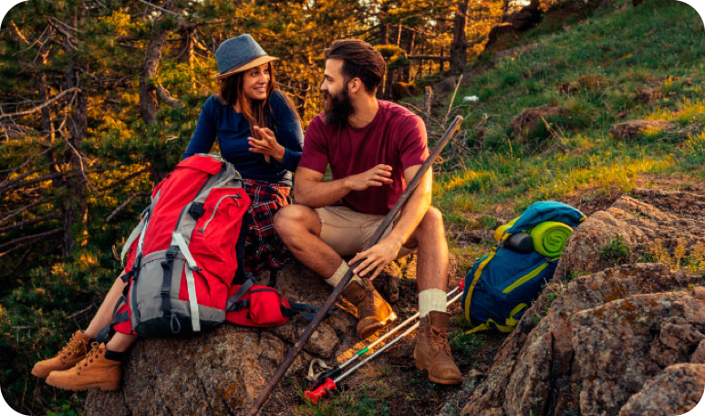
Coulonge River
Canoeing Skill Level: 2 of 4

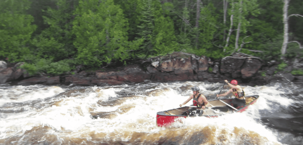
Quebec’s Coulonge River has a great combination of lake and river paddling. It offers a mix of Canadian Shield bedrock and sandy esker meanders. The whitewater boasts ledge-type descents and deep-channel runs. The river is interesting in high and low water levels, with many scenic chutes and falls.
Among the small lakes and creeks high in the Laurentian Highlands – the worn remains of the world’s oldest mountains – our wild river begins. In La Vérendrye Wildlife Reserve, the route passes through a number of large lakes, before narrowing down after Lac Pomponne. We will begin our 200-km paddle at Lac Pomponne – the start of the whitewater stretch. Wildlife abounds, with moose, black bears, foxes, and minks on the shore, while the river supports abundant otters, turtles, and beavers.
Want to Learn More?
Click here to access a detailed trip package with an itinerary and a full list of inclusions and exclusions. To access a recommended packing list, click here .

Dates, Rates & Availability
Prices listed are per person. All trips listed are tentative until confirmed by the Black Feather Office. Click here for our booking, payment and cancellation policies. Please contact us to be put onto a waiting list if your desired trip is full.
What's included
- all meals & snacks from Day 1 lunch to Day 9 lunch
Canoeing Equipment
- 17’ Prospector expedition canoes
- paddles, PFDs, throw bags, paddling helmets
Camping Equipment
- tents – free standing expedition dome tents – 2 per tent
- ‘kitchen’ – tarp, fire box, cooking stoves, utensils, dishes, etc
- containers for food and group equipment
Safety Equipment
- first aid, safety, river rescue, and repair kits
- communications equipment (satellite phone)
Local Transportation
- transportation of guides, group gear, canoes, etc. to and from trip
- van shuttle to the start of the trip
Have a Question?
Our team at the Black Feather Office looks forward to hearing from you!
- Fishing Kayaks
- Paddle Boards
- Life Jackets (PFDs)
- Boat Storage
- Paddling Clothing
- Paddling Accessories
- Cool New Gear
- Submit a Review
- Paddling Near Me
- Paddling Locations Map
- Download the Go Paddling app
- Paddling Trips
- Kayaking Trips
- Canoeing Trips
- Share Your Knowledge
- Add a Paddling Location
- Add Your Trip
- All Articles
- Getting Started
- Boats & Gear
- Techniques & Safety
- Camping & Survival
- Join Newsletter
- Create Account
- Message Boards
- Classifieds
- Photo of the Week
- Free Weekly Newsletter
- Trip Finder
Coulonge River in Quebec
Trip overview.

In the quest of completing the Quebec "Triple Play," the Coulonge River was on the menu for this year. The crew included my son Christopher(15), his friend Austin(14) and his father Jim. Jim wanted a fly-in experience for his son, so this was a perfect opportunity; we therefore opted to fly into Lac Pompone instead of using a road shuttle.
Day 1: July 13, Km205 to Km196 (9Km)
We arrived at Rapid des Joachims at around 12:00. It was a nice sunny day, good flying weather. We decided that Christopher and I would go on the first flight in followed by Jim and Austin. While we were getting ready for the flight, the plane landed and proceeded to unload a family of tourists. As soon as the plane was refueled and our cargo loaded, we took off. In no time we where emerging from the Ottawa River Valley to a full view of vastness of the Canadian forest. The pilot sat the GPS, it indicated an ETA of 34 minutes. The flight was a bit bumpy but there was no doubt in my mind; a ride to Pompone on the dusty and winding roads we would have being much worse. When the GPS indicated an ETA of 1 minute, we could see Lac Pompone straight ahead of us. As we approached, I noticed logging roads and cabins scattered here and there. I recalled Hap's comments about the impact of man on this river and he was right. I became even more apprehensive when I notice a flotilla of canoes on the lake. I was fearful that we might not have a similar wilderness experience as we did on the Noire the previous year. The plane banked sharply to the left, kissed the tree tops and then landed smoothly on the water. As soon as the plane came to a stop, we loaded our packs into the canoe and in no time the plane was taking off again. Christopher and I were at first debating the merit of paddling to the portage located at the end of the lake. But after we judged the distance to the outlet, we instead opted to paddle to a nearby sandy beach and wait for Jim and Austin's arrival. We took advantage of the wait to rearrange our packs and inflate our bow and stern air bags. It was a very nice day with not a cloud in the sky, so a swim was in order.
Before long we heard the rumbling of the Beaver engine as it approached, yet we could not see it. Finally, it emerged from a cove already gliding on the water. We quickly paddled over to the plane and by time we got there Jim and Austin had already unloaded their canoe and the plane was again ready for take-off. It took us all a few minutes to get oriented to exactly where the outlet of Lac Pompone was, but we eventually figured it out and set course for it. A few kilometers of paddling and we were at our first portage of the trip. The portage trail was on the right side, it was somewhat rocky but short. This early on the trip we were all very motivated and we were back on the water in no time. Our goal for the first day was to do this portage, run Rapid #7 (Double Trouble) and then camp at the first camp site river right. Our first rapid for the trip, was definitely worth scouting. We pulled over on the left bank and proceeded to walk over logs that lead us to a big boulder that overlooked the rapid. Some of the rocks Hap had outlined in his book were submerged. This provided a better approach and made the run fairly straight forward, a ledge with a tongue on river left. We hit the tongue and all was well, we both ran it as we had planned and moved on.
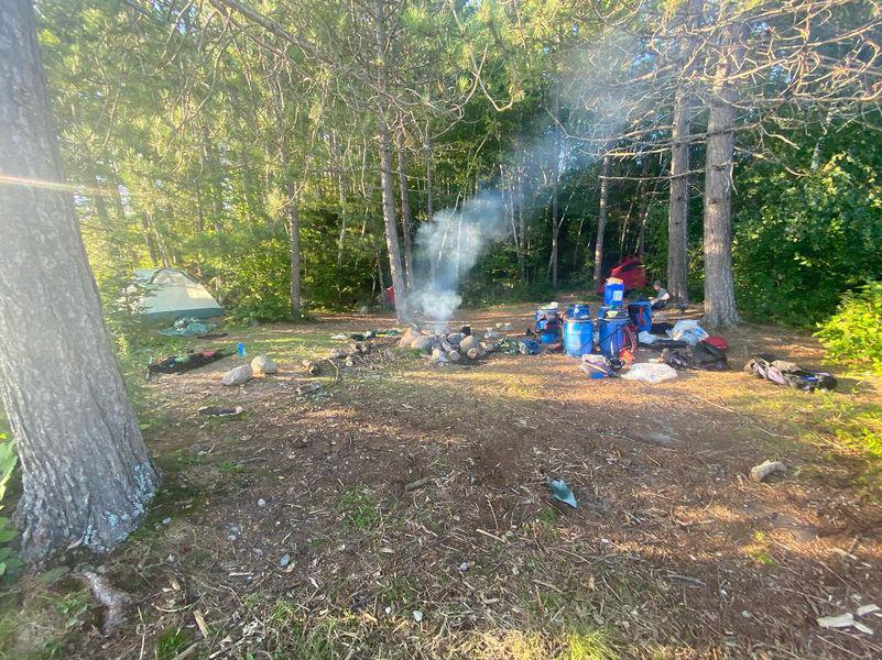
As we paddled toward the camp site we could see the group of canoes I had noticed during the landing negotiating Bride Rapid. We headed toward the campsite marked in Hap's book and soon found it. The campsite was a big disappointment, for whatever reason someone had parked a camping trailer on the site. It appeared to be parked at the location for some time and not used very often. We debated whether or not to take the risk to move on. We had a large group ahead of us and Air Swisha had told us they had flown in a couple in the morning. Well, we tempted chance and decided to go down river. This would mean we would have to run at least one more rapid of some significance today; Bride Rapid CL II # 8. We were hoping that the site at km199, located after rapid #9 would be too small for the large group and would therefore be open for us. We did not scout Bride Rapid, it looked straight forward and we ran it, per Hap, river left to center, a fun long rapid with good wave action. We proceeded down-river and somehow we had lost site of the group ahead of us. We were enjoying the scenery and not paying much attention to where we were going. Eventually we realized that we were supposed to go through an opening river-left at around km 202, but we had missed it. Realizing our mistake, we back paddled, made the correct turn and were now entering a large body of water. We passed km 200, rapid #9 and were now looking for the smaller campsite river-right. Bad luck, the couple that was flown in the morning had set up camp there, we had to move on. From Hap's book, we were all aware of the lack of campsites on the upper section of the river and it was getting late, not to mention that we already had a long day. No one was talking but we were all contemplating the possibility that we might have to bushwhack a site. We had to make a decision soon, at around km 196, where the river makes a sharp 90 degree left turn we noticed a large boulder on river-right. On the right of the boulder formation I noticed an area where canoes may have been taken out. We decided to explore and finally, luck was on our side, a nice campsite was located just up the bank. It was flat and had a fire pit, the previous occupants even left fire wood ready to be used. The site would have room for about three to four tents. We put up camp and quickly started to cook supper. By time we were eating it was dark and we finished cooking with our flash lights. This was the end of a long first day!
Day 2: July 14, Km196 to Km177 (19 Km)
Jim and I were up at around 6:30 and we made coffee and prepared breakfast for the boys. In the mean time we saw the couple that camped on the smaller camp site passing by us, they were wishing us a good day. It was a nice sunny day. We packed and were on the river at around 10:00. Despite a long day yesterday we were happy with our progress, considering we were only on the river for a few hours. Jim had equipped his canoe with a partial homemade spray deck; my canoe was outfitted with a spray deck that I had never used before. This was not the type of river requiring a spray deck, but what the heck; this would be a good opportunity to try it out. Judging the water level from the banks, it looked higher than normal. This was good sign since it would probably cover some rocks and give us smoother runs. A few miles down river we passed the camp site were the larger group we saw yesterday, was camping. The group included about eight kids ranging in ages from 12-14 with two adult leaders. I was impressed by the challenge these two leaders had taken on, taking a group of kids on such journey is not a small task. Just down stream was rapid #10, a long CL II rapid. We stopped and took a look and went for it. I quickly could see the advantage of a spray deck, especially when we hit some of the big waves in the middle of the rapid. We had a blast; it was definitively a fun rapid.

As we proceeded to the end of the rapid we noticed the couple that passed us in the morning, watching us coming down and perhaps wondering if they had to pick up some swimmers. They had opted to line Tall Pine Rapid, probably a wise decision for an open canoe. We were initially planning to camp on Tall Pine Rapid but it was early in the day. In addition we could see the couple was pulling over to it and were already taking their canoe out. We proceeded down river to the CL I rapid # 22 (Stonewall Rapid). After running CL I #26 we decided to look for a campsite. We noticed on river right an area where canoes were pulled out, just a bit after the swifts that followed rapid #26. It had a log retaining wall that probably dated from the logging days. We decided to head to shore and evaluate. Yes, it was a camp site, it was relatively big and had room for many tents and had been used before, judging from the trash that could be found here and there. Some of the previous occupants had built a small jumping platform, something the boys really liked. Another site was visible from this location and it was just down river about 1 kilometer. Jim and I were debating if we should stay here or move on, but seeing the boys having fun jumping from the platform was reason enough to stay. We settled in and while the boys had their fun, Jim and I relaxed in our hammock. After an hour or so the group with kids with their two leaders passed us. We exchanged greetings as they proceeded to the next campsite. We cooked supper and settled in for night.
Day 3: July16, Km 177 to Km 147 (30 km)
Jim and I were up and about at around 6:30 we started the day with our usual cup of coffee. We sat in our mosquito tent pondering the upcoming day. It was overcast and the air was heavy and humid. The boys were still asleep, as any good teenager would be at this time of the day. After our first cup of coffee the weather seemed to turn, drops of rain were hitting the mosquito tent. Almost in unison we jumped out of our shelter, got the boys out of the sacs and immediately broke camp. There was no reason to pack wet tents unless it really had to be. We managed to break camp and cover all the packs with a tarp just in time before the sky opened up. Rain was not our only concern, we could also hear and see thunder and lightning, and it was getting closer and closer. By then, all four of us were huddled in our mosquito tent watching the water just pouring down the sides. At one point a lightning bolt hit within a few hundred meters from us and scarred the hell out of us. Finally, the weather cleared and the thunder storm progressively moved away. We finished packing and launched soon after.
We passed the two guides and their pupils while they were packing on the other campsite. This was the last time we encountered them. From the river looking up it looked like the campsite was Ok (Km 177). By now the sun came out and a northwesterly breeze was keeping us cool. We ran a few CL I rapids and in no time we could hear the roar of the "Cascade du Batardeaux." We stopped to scout, opted for a different route than Hap had suggested. The idea of back ferrying before a drop was not too enticing to us. Instead we opted for a route river-left; along the shore, the water was high enough and most all rocks were submerged. Christopher and I ran first, besides hitting a boulder on the last drop, we had a fairly smooth run. Jim and Austin followed; they corrected the route a bit and had a perfect run. We pulled over on river left for the portage. The large log pile Hap illustrates in his book was gone and this improved the access for the portage. We portaged our packs to the take-in and lifted over the canoes over the first drop and then lined the rest of the way.

Rapid/fall #35 was a surprise for us; we were not expecting such large drops. I guess Hap referring to the drops as "LIFTOVERS" somehow diminished their significance. Make no mistakes; those two consecutive drops were of major significance. We approached the first drop on river- left; it was a rather difficult lift-over. We stayed on river- left and proceeded in a similar fashion over the second drop. In retrospect, I believe we could have lined both drops all the way down on river- right where the drop is more progressive and saved us some grief. Finally, we were done with the portages for the day. Next challenge was a long CL II, rapid # 36, that was not difficult, just plain fun. Our last goal for the day was now to find a decent campsite. We proceeded down river and were now entering the meandering river section; this meant the dreaded sandy beaches. All sites were of the same caliber, on river bends and all sand, since none were to our liking we kept on paddling. Finally we had to make a choice, on Km 146 we took one of the sandy campsites and called it a day.
Day 4: July 17, Km 147 to Chute Gautier (37 Km)
We started the day with the usual routine, except we had fine sand all over. We started our paddle at 9:30 and continued through the long meanders. To our surprise we were still making good time and getting a break from the portages was a welcome change. We stopped at the spring on river-left (Km 127) and enjoyed the nice cold drink of spring water and filled up all our canteens. A bit further down we stopped and checked out the campsite at the fork of the Riviere de la Corneille and the Coulonge. Definitely a very nice camp site with room for probably four to five tents, but it was too early in the day so we opted to proceed to Chute Gautier. The fact that we had not seen anyone on the river since yesterday morning gives us the feeling of isolation. We arrived at Chute Gautier, we ran the upper CL I and portaged from point "A" to "B"; next we ran the canoes down to point "C". We opted not to paddle around point "E", any mistake at that location would mean going over the fall. The campsite marked "NICE" in Haps book is no more. The two upper sites are OK to mediocre, the bottom site has a hunting shack in the back of it and one would practically have to camp on a gravel road. We opted to camp up a ridge of point "C". It was a poor site requiring us to clean out some brush in order to find places for two tents, but at least the view was good. I am still scratching my head, "who was the bone head that authorized the building of a cabin in such a pristine area?" As punishment for the cabin location, we used their outhouse. The fall on the bottom of Chute Gautier is particularly spectacular and worth several pictures.
Day 5: July 18, Chute Gautier to Chute du Diable (20 Km)
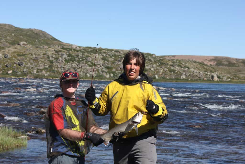
On the river at 9:00, another beautiful but hot day. The wind seamed to have shifted back south west, bringing along the humidity and the heat. We passed a remnant of a bridge at Km 94 and the lumber camp that was located in the area was not visible from the river. The river had good current and the paddle from Chute Gautier to Chute du Diable was done in an easy day. There are at least three sites at Chute du Diable; we felt the one on the bottom overlooking a lake to be the best. Here again, two cabins were erected on river- right. Fortunately, they were somewhat located out of the way and did not interfere too much with the beauty of the fall. The trail leading to the lower campsite was very good. We put up camp and relaxed for the rest of the day while going for a swim and trying our luck at fishing. No fish dinner, instead we had to settle for couscous with chicken. The sky became overcast and weather was deteriorating rapidly. We made the usual preparation for rain and were hoping we would not have to face a thunderstorm to the likes we had a few days ago. Eventually it started to rain and the wind was picking up in strength, we were all nestled in out mosquito tent hoping that the storm would be a short one. All of a sudden an almost tornado-like gust of wind came through, ripping all the anchors out of our shelter tent. Looking down on the lake, we could see water being picked off the surface, almost forming a water spout. To make matters worse, trees were breaking off and falling around us. By then we decided it was too dangerous to stay in the tent. We all felt it was safer to be out of the tent so we could perhaps dodge the falling trees if we had to. Luckily, no trees fell on our tents or on us, but the inclement weather and its strength and damage are something I will never forget. Lightning preceded the wind, but luckily for us it was not very close. When it was all over we crawled into our tents, all wishing for good nights sleep.
Day 6: July 19, Chute du Diable to Rapides Enrages (29 Km)
During the night the bad weather did not flare up again and the morning was the beginning of another beautiful day. We broke camp and were back on the river at 9:00. Before heading down river, we paddled over to the chute and took a few pictures; it was another beautiful waterfall. The damage resulting from last night's wind gust was apparent all along the shore. We could see uprooted trees lying in the water, while many other trees had their tops broken off. Not before long we arrived at a CL II, Little Devil Rapid. We stopped to scout and ran it according to Hap. It was definitively worth taking a look at; it certainly had the potential for trouble. Austin made some memories as well on this rapid, while scouting he stepped off the path and accidentally stirred up a bees nest. He ended up with eight stings. We kept an eye on him for a while and after a half hour or so we felt he would survive the ordeal. We proceeded to Die Hard Rapid, stopped to scout and decided to line it on river-left. We did not like the upper CL III drop and the lower CL II had too many to boulders for our taste. We stopped at a nice lunch spot river-left located on the bottom of the rapid. We continued our journey toward Rapides Enrages until we encountered Leroy, an Indian that lives up a tall bank on river-left. He offered us some cold refreshments; well, after five days of drinking warm river water we were an easy target. We paddled over and walked up the long and steep bank. We visited with Leroy for about an hour or so and enjoyed the cold drinks he pulled out of his propane powered refrigerator. We found him to be quite interesting as he told us his life story. He invited us to camp at his place and even to cook food for us. But we chose to stay on plan and gratefully made an offering to his donation box before we went on our way.

Day 7: July 20, Rapides Enrages to Rapides Guenette (17 Km)
As morning came we still had to finish our portage, as we looked up river and much to our surprise, the kids that camped up river from us were already heading down. They ran Triple Play with no difficulty and, judging from their paddling technique it was obvious they knew what they were doing. We headed one more time up the trail and carried the canoe down to the spring just below the Cascade "C". From there we took advantage of the nearby lagoon to float the canoes down to campsite "E". The lagoon was very shallow and filled with boulders, I knelt in the middle of my empty canoe and soloed it down to the end of the lagoon, bumping and grinding on the rocks all the way. The boys, having a weight advantage over us old guys were able to run the other canoe down in tandem. I assume one could probably line a loaded canoe down the lagoon and somewhat reduce the length of the portage. From that point "E" we jumped in our canoes and paddled down to Triple Play Rapid and pulled over to our campsite. We loaded our packs into the canoes and headed down river to the discovery of a new daily adventure. Before long we arrived at Rapid Galinotte. We proceeded per Hap's notes, a combination of portaging and running. We enjoyed several nice swifts before arriving to rapid No 52 which we ran without scouting. The water level was high enough, making many of the boulders Hap referred to not visible. We all had a great run and hoped for more soon.

Jim and I wanted to spend another night on the river but the boys were getting anxious to go back to the civilized world. Only age teaches one how to appreciate such moments to the fullest. We paid respect to Alex Genette who lost his life on this rapid, while imagining how difficult and dangerous life was for those river men.
Day 8: July 21, Rapides Guenettes to golf course take-out (26 Km)
Our last night on the river went as they all did; without a glitch. We got up at 6:30 and started with our usual cup of coffee while making breakfast. The boys, smelling the end was near were rather motivated to break camp. We had at least four more ledges left to run on this rapid. We lined our canoes over the first ledge, near the campsite, and then pulled them to the shore just below the camp where we proceeded to load. When we were just about ready to leave we saw the group of kids that we had seen the last two days scouting the CL II section we had lined the day before. They decided to run it. The first canoe, which was probably the most experienced paddlers, did a beautiful job avoiding the big holes and made it successfully. The next canoe did not fair so well, it was almost filled to gunwale before they nursed it to the shore. The last two canoes went for a swim. While they got their canoes back into floating condition we jumped into ours and paddled the rest of the rapid. There were three more ledges left to run, Hap classified the drops as CL I. But I felt, depending where one were to runs them, more like CL IIs. The ledges are river wide and are hard to scout. As we paddled away from this beautiful long rapid we took one last good look with some sadness. Before long we approached the last CL II of the trip, rapid #55. We opted not to scout it and ran in the center avoiding most of the troublesome holes, it was a blast.
Following this rapid was a long stretch of almost continuous CL I water that reminded me of the Noire before getting to the Black River Inn. Eventually the river widened and slowed down as civilization became more and more apparent. We did not encounter any more rapids from that point on. We passed under the bridge at Km 21 and were now looking for the take-out at the golf course. The wind had picked up and like always, it came from the wrong direction, head on. The take out was not easy to find and we actually passed by it. We stopped at what appeared to be an obvious boat landing and asked someone for the location. We back paddled about a half km to the point where one can see the golf course. We pulled out and found out that the club house was located up a long hill requiring at least a Km hike. We retrieved our vehicle and loaded up for the trip home.
General comments

Outfitting:
Rx Wenonah Cascade (17.5 ft) equipped with a North Water spray deck and Rx Nova Craft Prospector (17 ft)
We flew-in with Air Swisha
Directions:
Trans-Canada Hwy 17 to Rolphton ONT, cross into Quebec to Rapides des Joachims for fly-in.
"Rivers of the Upper Ottawa Valley" by Hap Wilson (no other maps are needed)
Trip Details
- Trip Duration: Extended Trip
- Sport/Activity: Kayaking, Canoeing
- Skill Level: Advanced
- Water Type: River/Creek (Up to Class II)
Trip Location
Canoe Tripping - The Coulonge River
September 20, 2020

It’ll be a long haul, but there’s still a ways to go before we get onto the river. Once we get there (likely late) on Friday night, we’ll have just a short sleep before a shuttle to the rivertop the following morning.
In the meantime, we’ve got to rent the big things remaining from Esprit before the shuttle:
- Canoes (They come with airbags and thigh straps. Sweet.)
- Remaining barrels needed
- Probably some safety-related stuff (Throwbags, InReach)
- Anything anyone’s missing
These will need to be arranged with Esprit beforehand, because Day 1 & 2 are going to be a crunch. Having everything be turn-key from Friday night to Saturday afternoon would make our lives much, much easier.
All going well, we hop on a river shuttle Saturday morning to get started on our adventure.
Don’t let Google Maps fool you - these are backcountry Quebec dirt roads. The drive is… much longer.
The Guys will be packed in a van with a trailer hitch carrying canoes, so make sure you’re comfy. Once we’ve truly finally reached our destination we’ll be at Lac Pomponne, by the mouth of the Coulonge River.
Step 1: arrive. Step 2: exhale. Step 3: see below.
The Fun Part
For the next 6 days we’ll travel an average of 36km. On our journey there’s gonna be some sweet sets, blessed meals, and lovely evenings at beautiful campsites.
Not much else to say than that - it’ll be what we make it. When we do, The Guys will have made it to the Ottawa River, right back where we started.
What I suppose I could do is describe the sites where we’ll be staying along the way.
- By Lac Pomponne : Our first campsite doesn’t have a name. From what memory serves, it’ll be a beachy landing on the right bank, just after a quick swift. Nice spot.
- Chute Perley : Among a pine grove by a waterfall. Jump off a small ledge and into the current for some fun. Portage on river left.
- Riviere de la Corneille : A more elevated site, situated where the Coulonge collides and consumes the Corneille River. Plenty of space.
- Chute du Diable : Heard before it’s seen - portage on the right side to the base of the large falls. Possibly one of my favourite campsites, the falls are truly a gander. A fisherman’s paradise.
- Rapides Enrages : Set beside a cascade of large water. Portage on river right. Rained while I was there, so my tent confinement disserves my memory of it.
- Chute de L’Ours : The dream campsite. Large, with a beach to hang out on and a series of sets to play in. Take a boat out and surf, or go swim.
It’ll be good nights at these sites with fine sights. Not much more I can do until the spring but plan - you’ll find those below.
Update - We Did it!
In the covid summer, we got it done. Turns out canoe trips are surprisingly easy to organize when international travel isn’t a thing. Big shouts out to Esprit for being total gems!

Take advantage a wide range of activities
An appealing region.
To learn more about the region's attractions, visit:
Mansfield Tourist Information Center
314, route 148, rue principale
819-683-1132
on-site activities
Lake and beach.
pedal boats at your disposal
you can bring your own equipment
relaxation on the river's edge
Hamac at your disposal
A moment of relaxation above the Coulonge River
Cycling and hiking trails
* new * canoe shuttle service.
Canoe rental
(capacity of 3 people per canoe) $110/canoe
- Departure from Aventure Coulonge to the falls (3h approx.)
- Shuttle service: Transport from the falls park to Aventure Coulonge.
For more information and for a reservation request, write to us.
Option with your equipment :
We now offer the shuttle service for the descent of the Coulonge River.
Several possibilities of descents are offered to you:
- Departure from the Lac Bryson outfitter (6 days approx.)
- Departure from the falls in Gauthier (5 days approx.)
- Departure at km 36 (2 days approx.)
- Other departures possible at your request.
** Important, transport must be done with your vehicle. You must have your equipment
3 choices of accommodation available
Rabais sur la location de chalet avec service de navette
Write to us in the book online section for prices and details
* new * vtt
The federated mountain bike trail is accessible from our site.
No rentals available

Collaboration between Coulonge Adventure and Aventure rivière sauvage
Aventure Rivière Sauvage specializes in shuttle and canoe rental services on the Noire and Coulonge Rivers. Coulonge Adventure collaborates with the company to offer packages and canoe excursions.
Discover the attractions
Activities and sports nearby.
Hiking, zip line and via ferrata
100, promenade du-Parc-des-Chutes, Mansfield | 819 683-2770
Rafting and kayaking
Aventure Esprit rafting
3, chemin Esprit, Mansfield | 819 683-3241

Club de Golf Pontefract
Hunting and fishing
Mansfield Fishing Pond
Z.E.C. St-Patrice
Mont Chilly
nearby restaurants
Bryson's bistro du bûcheron
Friendly bistro located in the Spruceholme Inn, a heritage inn that hosts events and conventions.

Donnie's pub

Pizza du coin
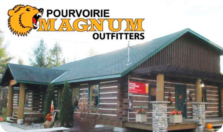
Restaurant Magnum
Coulonge Adventure is a private nature reserve in Mansfield-et-Pontefract, in the Outaouais region, offering mini-cabins and trailer campsite rentals.
Contact information
- 514 967-7949
- [email protected]
© 2024 – Aventure Coulonge – Tous droits réservés – Privacy Policy – Une signature de Zel
- Get Paid to Review Campsites!
Stay in the Loop
Subscribe for exclusive content, giveaways, new products and more!

- Backpacking
- Backcountry Cooking
- Wilderness Medicine
- Destinations
- TRIP REPORTS
Canoeing , Quebec
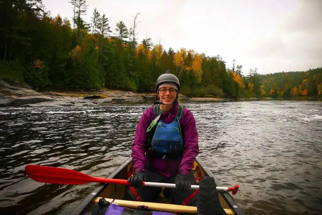
Connection in the cold: an autumn paddle on the coulonge river.

In all my years of canoe tripping, I had never paddled amidst the reds, yellows and oranges of a Precambrian Shield autumn. That changed this October, when I joined a five day canoe trip on the Coulonge River with nine new faces met through the Wilderness Canoe Association .
This post may contain affiliate links. If you make a purchase through one of these links, I may receive a small commission at no extra cost to you. Your support is much appreciated! You can learn more by reading my full disclosure .

In the weeks leading up to the trip, I was met with surprise when I told others about my plans to paddle and camp in the Quebec backcountry. My millennial co-workers, other young professionals recently graduated, sought out European beaches and South American cities for their holidays. Why I would spend my precious vacation days in Canada, outside in the chilly autumn air nonetheless, was unimaginable.
For those who don’t grow up on the pink granite rocks and dark green waters of the Precambrian Shield, it is difficult to understand the magnetic attraction this place can hold. How, after all this time, I have still not grown tired of the spiny pine trees and the smooth curve of shoreline. How I find novelty in such familiar scenery. Familiar, yes, but never repetitive. The colour of the leaves alone is enough to make the whole scene new.
Indigenous groups in the Coulonge River region, the Algonquin and the Mohawk, believe in a deep spiritual connection with the land. In the land one finds home. This is a sharp contrast to Europeans who have long viewed North America as a productive means to an exploitative end. A land to be farmed, extracted, built upon.
My heritage would predispose me to the latter. Yet, as I paddle on the rivers and lakes of the Precambrian Shield, carved by ancient glaciers through some of the oldest rocks in the world, I believe I am closest to understanding an Indigenous frame of mind. Perhaps I will only ever feel a fraction of the connection between people and place the way the Algonquin and Mohawk do. But that fraction is more than enough, and it draws me to return, time and time again.
And now to see it in the autumn, when leaves succumb to dropping temperatures and change their clothes accordingly. When frost lingers in the morning, clinging, sparkling. Beautiful on the stems of leaves; cumbersome on the fly of my tent.
Nonetheless, Quebec must be one of the most beautiful places in Canada in autumn .
Even in my many layers of technical clothing with fancy names – Gore-Tex, merino, Polartec – I feet my bones chill, my chest tighten. I must wrap myself in several layers if I am to sleep through the night. To thrive on a land before the advent of such convenient comforts is beyond my comprehension.
New to canoe camping? Here’s how to get started.

On the third day it rains without pause. The water soaks through my socks and makes its way under my jacket and down my forearms. For hours I question the numbing in my toes. You can’t get frost bite at this temperature, right? How long without feeling until nerve damage sets in? (A tendency toward melodrama is a particular gift of mine.) My medical training would tell me “no, it is not cold enough for frost bite”.
It is, however, cold enough for hypothermia. After lunch we gather in a circle and one canoeist leads us in the Penguin Dance, a series of chants and movements to get all of us warm. It would be quite the scene for a moose passerby. Ten people, ranging in age from 24 to 65, covered in colourful plastic suits, jumping up and down singing about penguins. (Though I guess any modern canoeist activity is quite a perplexing scene for a moose.)
But despite this chilly discomfort, I would do it all again for another glance at orange and red flames propped high on granite cliffs. To see dark green spruce trees peaking out before a yellow aspen backdrop.
After five days spent paddling on the Coulonge River, my connection the shield and forest and river remain unchanged. Back home I procrastinate on Google Maps, casually searching for my next destination. I don’t believe I’ll ever tire of paddling Canadian waters. How can anyone tire of home?
Thank you to all the new paddlers I met on this trip for your wonderful company, invaluable knowledge and delicious food. A special thanks to Jeff, Bob, Barb and Sandro whose photos I have borrowed to illustrate such beauty. The photos you see in this blog post are courtesy of them.

Mikaela | Voyageur Tripper
Mikaela has been canoeing, hiking and camping for over ten years. She previously worked as a canoeing guide in Canada, and spent a season guiding hiking and kayaking tours in the high Arctic. Mikaela is a Wilderness First Responder and Whitewater Rescue Technician.
MY FAVOURITE GEAR

Fleece Sweater

Down Jacket

Hiking Boots

Hiking Shirt

Hiking Pants
2 thoughts on “ Connection in the Cold: An Autumn Paddle on the Coulonge River ”
Stay in touch.
Join our community of outdoor adventurers - you'll find trip inspiration, gear discussions, route recommendations, new friends and more!

Great pics! We are planning to paddle part of the Coulonge River. I was wondering where you put in and took out? You mentioned doing 5 days which is more or less what we would like to do.
Thanks for any info! And keep up the great website, Seb

Hi Sebastian,
I don’t remember where we put in actually! This is one trip where I didn’t take notes (and why there’s no trip report for the river on my site right now). I know we ended at the golf club just upriver to Fort Coulonger. Sorry that isn’t more helpful!
Leave a Reply Cancel reply
Your email address will not be published. Required fields are marked *
Save my name, email, and website in this browser for the next time I comment.
- Facebook Group
Coulonge River - Quebec (FULL)
With a length of 125 km, this spectacular whitewater canoe route is filled with breathtaking views, wildlife and classic class 2 and 3 rapids with portage options. The Coulonge is a remote river located in Western Quebec and flows into the Ottawa River.The river is relatively small and the terrain alternates between Canadian Shield rock and sand. The navigatable rapids are long and the portages are short. (The Ottawa Valley Tourist Association) We will be paddling during 5 days following the current trough swifts and rapids and amazing sand beaches where we will be camping every night
We will be leaving on Sunday October 13th in the morning and driving all day to Walthan Quebec where we will stay at the Black River Inn. October 14th Monday we will have a 3 hours shuttle where we will be dropped off and from there we will paddle south during 5 Days and 1/2 day (14 Thanks Giving,15,16,17,18,19) we will be paddling around 25km per day. We are leaving the river October 19 Saturday and driving south ontario.
-Personal clothing/layering -Rain Gear -Wetsuit or Drysuite -Helmet -Extra paddles -Painters -Throw bag -Rescue Equipment
-Because it is a river tripping boots or runners are the best to wear during the day -3 season tent, -3 season sleeping bag
Black Inn River Chemin de la Rivière Noire, Waltham, Quebec J0X 3H0
I will provide more details
- Nastawgan Archives
- Journal Index
- Contributors' Guidelines
- Outings Insurance
CLUB ACTIVITIES
- Participant Guidlines
- Organizer Resources
- Past Outings
- Sea Kayaking
- Educational Workshops
- Social Events
- Fall Gathering
- Mike Wevrick Lecture
CONNECTIONS
- Social Media
- WCA YouTube
- The Credit River Decision
- The Hoasic Creek Decision
- The Bronte Creek Decision
- Conservation
- River Levels
- Privacy Policy
Calendar of Events
Upcoming events.
- Request new password
2010 - 2022 © Wilderness Canoe Association. All rights reserved. Design by WCA & CERAiT.com

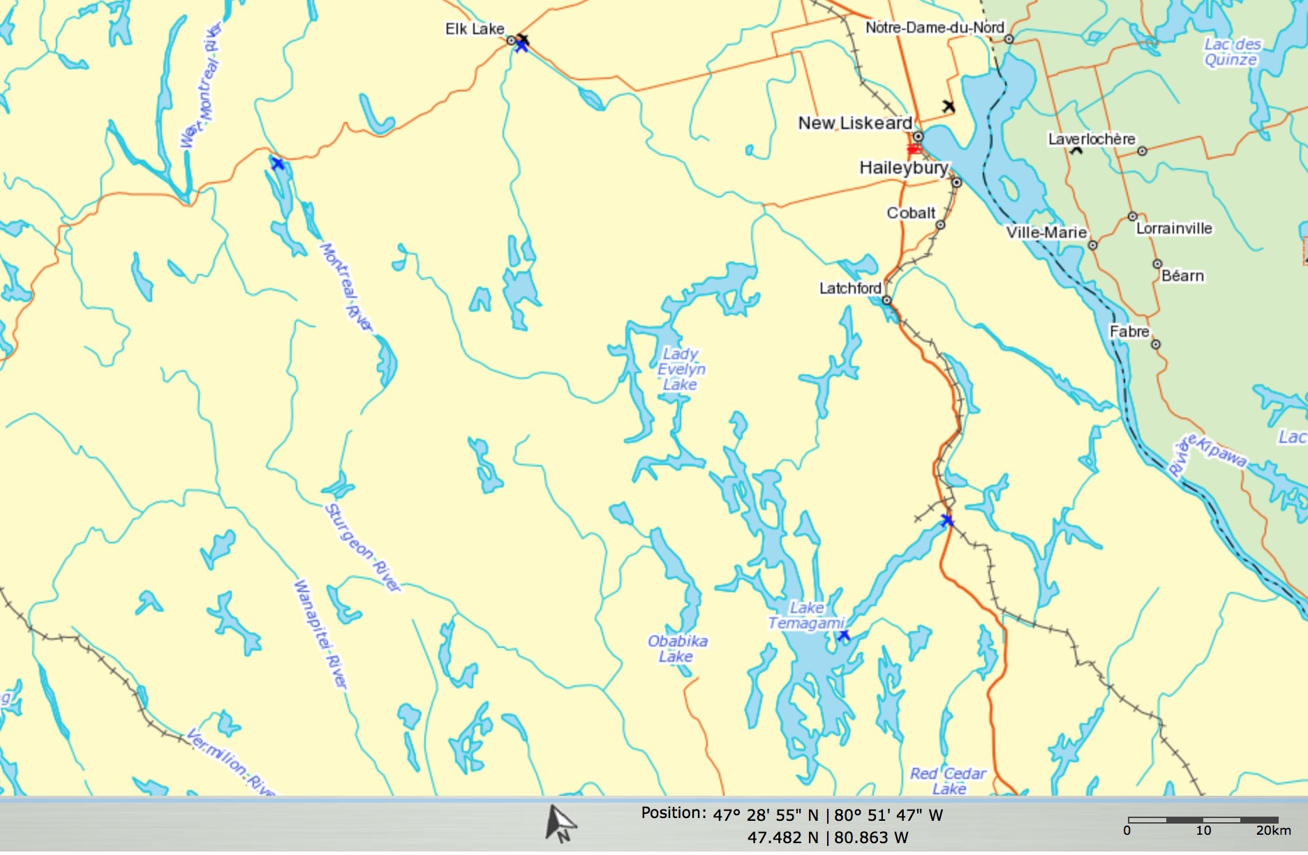
Fort Coulonge: Coulonge River (4 days / 91 km)
If I was forced to pick the best river in the Outaouais/Pontiac region of Quebec I think the Coulonge would be right up there. It has everything. Great white water, good fishing, nice beautiful sandy beaches, falls and it’s remote. Well, not the kind of remote you’ll get from going up north but it certainly feels wild and remote!
Trip Completed: June 2022
Trip Summary
Starting Point: km 106
Ending Point: km 15
Total Distance: 91 km
Duration: 4 days
Difficulty: Intermediate (when we were out there it was high water)
The Coulonge River is on crown land in Quebec. The nearest town is Fort Coulonge.
Traditional Territory: This route takes place on the traditional territory of Anishinabewaki ᐊᓂᔑᓈᐯᐗᑭ - Omàmìwininìwag (Algonquin)
Maps & Resources
Guidebook: Rivers of the Upper Ottawa Valley - Hap Wilson
Map: The maps in Hap’s books are great with amazing details on them. Especially for the breakdown of the rapids. I followed the Cartespleinair map for my trip.
Campsite Reservations: The entire route is on crown land so no campsite reservations are needed.
Permits: The entire route is on crown land so no permits are needed for Canadian residents.
Know Before You Go
Season: The best time to paddle is in July and August.
Cell Reception: None
Water: You will have to purify your water.
Wildlife: Never heard of issues with animals but certainly a place where black bears and moose hang out!
Waste: You must pack out all your garbage. A few campsites have thunderboxes.
Outfitters & Shuttles
Outfitter: Aventure Riviere Sauvage
Shuttle: Aventure Riviere Sauvage has a great shuttle service!
Trip Report
Day 1: km 106 to km 77 (29 km)
We met the outfitter, Aventure Rivière Sauvage, at Chutes Coulonge Park in Fort Coulonge at 8 am. The shuttle upriver took about 2 hours and 35 minutes.
The put-in at km 106 is just below Gauthier Falls and is a very easy put-in on a ...
To continue reading this Trip Report, please login below.
If you aren't a Member yet, please sign up here .
- Good Takeout
- Good Swim Spot
- Thunderbox / Outhouse
- I have read and agree to the Terms of Service
There was a problem reporting this post.
Block Member?
Please confirm you want to block this member.
You will no longer be able to:
- See blocked member's posts
- Mention this member in posts
- Invite this member to groups
- Add this member as a connection
Please note: This action will also remove this member from your connections and send a report to the site admin. Please allow a few minutes for this process to complete.
From now until 4/30/24 purchase an Esprit Gift Card & SAVE 10%! Just enter promo code: SPRING10%

2-DAY COULONGE RIVER TRIP
Quick Details
- Hour Glass Duration: 2 Days
- Users Ages: Ages 7+
- Map Marker Location: Davidson, QC
- Calendar Dates: June-Oct.
Canoe the Coulonge in Davidson, QC
The Coulonge river flows through classic Canadian Shield scenery. From the river’s source in La Vérendrye Park to the confluence with the Ottawa River, it drops nearly 250m as it cascades over a series of thunderous waterfalls and wanders through runable, rock studded rapids.
Nearly 300 million years ago, fault lines scored huge channels deep into the rock as the earth cooled. The Coulonge River follows the path of one of these faults. During our two days (or 3) on the Coulonge, we will explore the section of river from Rapids Enrage to the Les Chutes Coulonge. Featuring ledge style drops with deep channel runs, the whitewater on the Coulonge River provides excellent opportunities for you to learn new skills and gain confidence canoeing class I-II rapids.
Two Day Trip Itinerary
- 7:00 am: Breakfast
- 8:30 am: Pack and depart for river
- 10:00 am – 5:00 pm: Canoeing along the Coulonge River
- 6:00 pm: Dinner at campsite
- 8:00 am: Breakfast
- 10:00 am: Canoeing along the Coulonge River
- 1:00 pm: Take out return to Esprit
- Departure from Esprit
Note: Trip timing may vary depending on water levels
What’s Included
- 2 days of canoeing
- 1 night camping at Esprit’s lodge
- 2 nights camping on the river
- 2 breakfasts
- 2 riverside lunches
- all safety and paddling equipment
- internationally certified guides
- local transportation
- complimentary après canoeing beer, juice or soft drink
- “NEW” Air Medic emergency evacuation insurance
- NEW Covid-19 Kit included in your trip cost! Every guest will receive an Esprit Non Medical Face Mask to be worn during bus transport, locally made hand sanitizer, souvenir pen, and COMPLEMENTARY PHOTOS!
What to Bring
All your mandatory safety equipment is provided for you. Therefore, all you need to bring with you are some personal items to help make your day even more enjoyable.
ADDITIONAL ADD-ONS
Customize your experience with Esprit by adding any of the following options:
RELATED RIVER TRIPS
- Most Popular
- Calendar May-Oct.
- Map Marker Davidson, QC
- Users Ages 7+
- Hour Glass 8 Hours
Ottawa River Rafting Day Trip
Raft both channels of the Ottawa River, Canada’s most famous whitewater river! The best way to experience the Canadian wilderness and enjoying exhilarating high volume rapids.
- Calendar April-Nov.
- Users All Ages
- Hour Glass Multiple Options
Ottawa River Shuttle Services
Our shuttle services at our basecamp in Davidson, Quebec are ideal for accessing the Coulonge and Noire Rivers for your canoeing adventures. Book your shuttle online!
- Users Ages 12+
- Hour Glass 4 Days
4-Day Petawawa River Canoe Trip
Fast, furious, tight and technical, our Petawawa River canoe adventure will develop your whitewater skills on a fun and challenging trip! Book your adventure today.

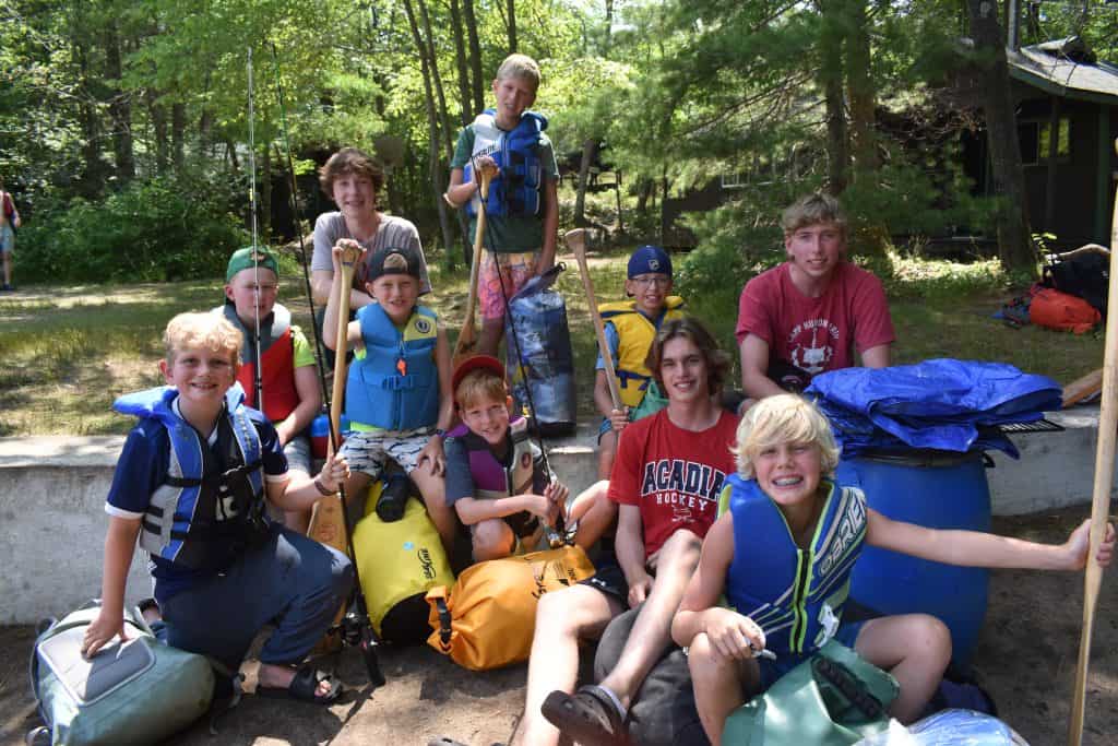
Camp Hurontario
A boys' summer camp in Georgian Bay, Ontario, Canada
Canoe Tripping

Canoe trips for campers 7-11
Camp Hurontario has always been well known for its excellent, progressive canoe tripping program. Our youngest campers will have the opportunity to take Bay trips in the area around the camp for an overnight or several night canoeing and camping adventure. Campers may also enter the nearby Massassauga Wildlands Provincial Park for the small fee of a camping permit per night spent in the park.
Canoe Trips for Campers 11-12
The hartley bay loop.
Campers trip for 5-7 days on the Pickerel River, which is north of Parry Sound off Highway 400. The trip encompasses travel both on the river itself and travel on protected areas of the Bay. The Pickerel River trip travels through beautiful scenic areas dotted with old fishing camps. With several arms of the river to travel, the Pickerel River offers excellent, safe tripping. This trip is reached after a boat trip and van ride from the camp.
The French River
Historically famous as part of the trip route which the Courier de Bois paddled, this trip involves both travel on the French and the interesting Little French River. An excellent trip of five to seven days’ length, this trip offers exciting travel on the river itself with few people in its upper reaches. This trip involves a boat and van ride to and from camp.
Canoe Trips for Campers 12-14
The french/restoule (6 days).
Take a trip back in time and follow this fur-trading route from hundreds of years ago. Starting at Restoule Lake, the trip heads west down the Restoule River, where it empties into the French River. Some of the best campsites in Hurontario’s tripping catalogue are featured on this route, including the incomparable Five Finger Rapids – always a highlight with the campers on this trip. The fishing is also incredible and there are some fun rapids to swim in and camp beside. This trip is an iconic Ontario canoe trip, offering wildlife, good fishing and few people other than trippers. The groups travel by boat, then van, both to arrive at the start and to finish the trip.
The Wanapitei/West Channel (6 days)
Voyaging on this trip is always a big hit, with trippers enjoying a fun two days on the Wanapitei River en route to merging with the West Channel of the French on its way to northern Georgian Bay. An amazing campsite beside a fun set of rapids on the Wanapitei is the first rest stop on this trip that spills onto the fingerboards and one of the best sunset campsites around Whitefish Bay. Dallas Rapids is a fun swim spot, and the islands of the French River Provincial Park are an incredible backdrop for this fantastic canoe trip.
Killarney-Britt Sea Kayak Adventure (8 days)
Beginning in the shadows of the Lacloche Mountains, campers will paddle Hurontario’s fleet of seakayaks through the incredible landscape of Georgian Bay. Highlights include the amazing Fox Islands, cruising the shoreline and exploring the inlets of Philip Edward Island; checking out the incredible Chicken Islands, and paddling through the fingerboards in French River Provincial Park. The campsites are unmatched, as is the scenery. The sunsets over the Bustard Islands offer one-of-a-kind photo ops and fishing will no doubt bring some delicious dinners. The trippers eventually head south along the shoreline of Georgina Bay, past Britt and into Naiscoot Inlet, where this unbelievable trip finishes up.
The Magnetewan River (9 days)
Several years ago, the Government declared the Magnetewan River Basin a wildlife preserve. As a result, it is ideal for canoe trips. The trip on the Mag offers river and lake travel combined. There are several routes with varying degrees of difficulty. The scenery is spectacular, and the fishing is very good. The trippers paddle home through the 30,000 islands and enter the camp bay with beaming faces as they paddle with synchronized vigour to the centre of camp bay! In order to reach the Mag, a boat and van ride from the camp are required.
Canoe Trips for Campers 13-14
The north camp (11 days, approx.).
Over 40 years ago, Hurontario purchased a fishing camp on Lake Windemere in the Chapleau Game Preserve. From this northern outpost, senior campers experience an amazing tripping adventure on lakes filled with wildlife, great fishing and still untouched by the outside world. The campers travel by boat, then van to Chapleau and finally by train to Lake Windemere – a trip that takes a full day and in itself is an adventure! At the North camp, there are many routes from which to choose. The campers and staff discuss their route choices thoroughly before leaving main camp. Senior campers who have taken these trips say this highlights their stay at Camp Hurontario!
We are able to send four trips each month to the North Camp, which is decided by the equipment needs of these trips plus the space available at the North Camp. We will do our best to assure all 14-year-olds a trip out of the North Camp.

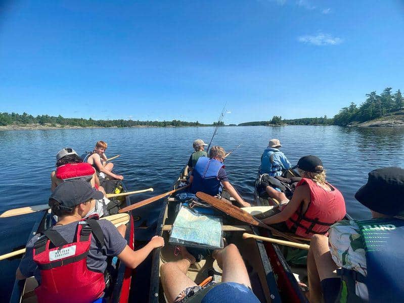
White Water Canoe Trips
For campers who are 15 or 16 years old, Hurontario offers the opportunity to experience the incredible fun of white water tripping. This program involves an excellent training course in the spring and then a choice of five AMAZING river trips, which vary from 10 to 21 days in length. These trips are very popular with senior campers and the numbers are limited. In the spring, senior campers will have the opportunity to choose one of these river trips or our senior northern outpost.
Dumoine River (11 days, approx.)
The Dumoine, remote and deep within the wilds of rural Quebec, is a canoe tripper’s paradise, offering one of the finest stretches of canoeable whitewater in all of North America. Known for its consistent levels for whitewater throughout the summer, the river is predominantly class II with a few class III’s thrown in to keep your attention, and some lakes and calm stretches to relax.
The Dumoine is gentle for the first several days, with quick water and easy rapids and several portages around waterfalls, but then the rapids build, as with our own confidence. In all, our trippers encounter thirty-five rapids and eight portages on the descent to the Ottawa River.
Coulonge River (15 days, approx.)
The Coulonge River flows through the historic Upper Ottawa Valley and into the Ottawa River. Trippers paddle upstream on the Kipawa River and into the headwaters of the Coulonge River before heading downstream for some amazing rapids and incredible campsites, including Rapides Enrages and Chute a l’Ours.
This is an exciting river and lake trip on the Coulonge River from south of Lavaille Park in northern Quebec finishing at historic Fort Coulonge. Starting just north of North Bay and heading to the East, our trippers will pick up the headwaters of the Coulonge on approximately their 5th day and then spend the next 7 days navigating the exciting and beautiful white water of the Coulonge.
To conclude this spectacular trip, campers spend a day with Canada’s number one rafting team, Esprit rafting, on the Ottawa River.
Missinaibi River (19 days, approx.)

The Missinaibi River is an epic journey beginning just north of Lake Superior and finishing up in Moosonee on the shores of James Bay. Covering a distance of almost 800 kilometres, the trippers paddle, portage, and shoot tons of amazing rapids on their journey down this historic fur-trading route. Thunderhouse and Conjuring House Falls are the highlight of the trip, featuring a cliff-side campsite and incredible photo opportunities.
The trip concludes with a journey on the Polar Bear Express from Moosonee to Cochrane where the trippers are picked up and brought back to camp in fine style.
This trip is available to July campers only.
Kesagami River (19 days, approx.)
Paddle to James Bay! Travel along this amazing remote river, which is an untouched gem among Northern Ontario’s wilderness rivers. From north of the town of Cochrane by van, campers set their canoes into the swift waters of this river known for its magnificent scenery and challenging whitewater. The group then paddles some 200 km down the river’s navigable rapids to the shores of James Bay and up the mighty Moose River to Moosonee and Moose Factory, once a Hudson’s Bay Company trading post.
This trip is available to August campers only.
The Hood River – 3 week trip
With its entire length located north of the Arctic Circle, Nunavut’s Hood River offers trippers a unique look at one of Canada’s most remote regions, the Barrenlands. Campers canoe through treeless vistas populated by caribou, muskoxen, grizzly bear, wolves and a huge variety of birds, including the majestic peregrine falcon. Add to this some amazing whitewater, the incomparable Wilberforce Falls, and some of the best fishing the country has to offer, and you’ve got a recipe for the trip of a lifetime.
See more information on this year’s (2024) Hood River trip .

Winter 1 Ridge Dr. Park Toronto, ON M4T 2E4
416-488-2077
Summer Mactier, ON P0C 1H0
705-375-5306

©2024 Camp Hurontario
Privacy Overview

- Anishinaabe Rock Images
- Bicycle Touring
Canoe Tripping
- Easy Travelling
- Hiking/Trekking
- Mountaineering
- Viggo’s Den
Scroll down to see trip reports on any of the areas highligh ted on the map. They are ordered from west to east.

Click on a specific area name to jump directly to the related posts:
Bloodvein ; wabakimi ; steel; missinaibi ; , lady evelyn river ; temagami/chiniguchi ; french river ;, ne georgian bay coast ; coulonge ; ottawa . , ——————————————————, most recent (first half of sept 2023), the savant river from jutten lake to east pashkokogan.
The Savant River is west of Wabakimi Provincial Park in northwest Ontario. It is in a zone designated Caribou Forest , which is a mix of Crown Land, First Nations Lands, and Provincial Parks. It is also an incredible destination for canoe trippers and wilderness enthusiasts.
Table of Contents:
- Accessing Wabakimi Canoe Country
- A Journey Worth Making
- Our West Side of Wabakimi Route Through The Caribou Forest
- Northern Canada Wildfires And Canoe Trip Planning
- Getting To The Put-In From Toronto
- VIA Rail – Washago To Savant Lake VIA Stop
- Our Shuttle Provider: Jonah Belmore
Maps and Information (Rapids, Portages, Campsites, etc.)
- Natural Resources Canada 1:50,000 Topos
- David Crawshay’s Topo Canada iOS App
- ATLOGIS Canada Topo Maps for Android OS
- Toporama Canada Online Map
- Wabakimi Project Maps – Info on Rapids and Portages
- Paddle Planner
- Our Roue GPX and Kml Files – from Max’s Garmin Etrex 20
Day-By-Day Details
- Day 1: Jutten Lake
- Day 2: Halfway Down Savant Lake
- Day 3: Down Savant Lake’s North Arm
- Day 4: Into Jabez Lake
- Day 5: Jabez to Savant Falls
- Day 6: Savant Falls To Velos Lake
- Day 7: Velos Lake to McCrae Lake
- Day 8: McCrae Lake to East Pashkokogan
From East Pashkokogan Lake To the Palisade River and Kenoji Lake
- Route Overview Map and GPX file
- Day 8: From East Pashkokogan Lake To Greenbush Lake
- Day 9: From Greenbush Lake To Metig Lake
- Getting a Wabakimi Park Backcountry Camping Permit
- Day 10: From Metig Lake To Muskiga Lake
- Day 11: From Muskiga Lake To Burntrock Lake
- The Headwaters of the Palisade River system
- History of Wildfires in the Burntrock to Kenoji Area
- Day 12: From Burntrock Lake Down The Palisade River
- Day 13: Down The Palisade Almost To Kenoji
- How The Palisade River Got Its Name
- Looking For the Palisade Pictographs
- Day 14: Bush Plane Pick-Up On Kenoji Lake
- Day 15: A Visit To Armstrong Station’s NORAD Radar Base/The Train Ride Back To Southern Ontario
__________________________________
The bloodvein river system: from top to bottom.

Woodland Caribou Provincial Park / Atitkaki Provincial Park
Canoeing The Bloodvein River System – A Bit of History, Maps, Planning, and Access
Bloodvein Canoe Tripping: Some Images We Paddled Into
———-
Part one: the bloodvein headwaters & woodland caribou park .
Day 1:Trout Bay To Crystal Lake
Day 2: Crystal Lake to the Portage Into Knox Lake
Day 3: Knox Lake To Murdock Lake
Day 4: Murdock Lake To Larus Lake
Anishinaabe Pictograph Sites on the Bloodvein: The Murdock-Larus Site
Day 5: Larus Lake to Barclay Lake
Day 6: Barclay Lake to Artery Lake
Anishinaabe Pictograph Sites of the Bloodvein: The Artery Lake Site
Part Two: The Bloodvein River from Artery to Lake Winnipeg
Day 7: Artery Lake to “Moosebone” Rapids
Day 8: From Moosebone Rapids to X-Rock Rapids
Day 9: From X-Rock to Just Before Goose Rapids
Day 10: From Goose Rapids to The Bloodvein-Gammon Junction
Day 11: From The Bloodvein-Gammon Junction to Kautunigan L .
Day 12: From Kautunigan Lake to Gorge Rapids (W56)
Day 13: From Gorge Rapids to Sharp Rock Rapids (W73)
Day 14: From Sharp Rock Rapids To Namay Falls (W80)
Day 15: From Namay Falls to Lagoon Run” (W86)
Day 16: From Lagoon Run to Below Kasoos… Rapids (W88)
Day 17: From Kasoos Rapids to Bloodvein First Nation to Red Lake, ON
back to the top
The Greater Wabakimi Area:

See the following overview post for some of the scenic highlights of canoe tripping in Wabakimi Country.
A Paddler’s List of Wabakimi’s Top Six

————————————–
1. down wabakimi’s allanwater river to whitewater lake.
On our first visit to Wabakimi, we took the train from Armstrong to Allanwater Bridge and then paddled the route you see on the map below over a ten-day period. Our vehicle was waiting for us at the south end of Little Caribou Lake. After this trip, we were hooked on Wabakimi!

Introduction, Logistics, and Maps
Day-By-Day Trip Report
2. Down the Flindt River to Collins Via the Ogoki, the Palisade, the Grayson, and the Boiling Sand Rivers
Thanks to our first trip, we returned the next summer (2011). This time we had fifteen days. Starting at the CN tracks at Flindt Landing on the southwest side of the park, we paddled the route you see in red on the map below.

Days 1 and 2 – Down The Flindt River From the CN Tracks
Days 3 and 4 – The Flindt and Ogoki Rivers
Days 5 and 6 – The Ogoki, the Palisade, and the Grayson Rivers
Days 7 and 8 – The Grayson River and Whitewater Lake
The Ogoki Lodge and The Beckwith Cabins: “All Things Must Pass”
Days 9 and 10 – McKinley Bay To Smoothrock Lake
Days 11 to 15 – From Smoothrock Lake To Collins Via the Boiling Sand River
The posts below are the original, less-organized and less detailed versions of the posts above. Thanks to the ongoing COVID pandemic I was able to do some more work on them and make them more useful to potential Wabakimi paddlers.
Basic Itinerary and Images
Smoke Over Wabakimi- Canoeing In A Season of Fires
3. From Allanwater Bridge to the Kopka R. via the Brightsand, Kashishibog Rivers
For the third summer in a row we drove back up to Wabakimi, a 1800-km. trip from southern Ontario. This time instead of heading north from the CN tracks we headed south and, after paddling up the Brightsand and Kashishibog Rivers, entered the headwaters of the Kopka River. We followed it all the way down to Bukemiga Lake and the access road to Hwy. 527, where Clem Quenville was waiting to shuttle us up to our vehicle in Armstrong.

Canoe Trip Plans: From Allanwater Bridge to the Kopka
A Tale of Three Rivers: Being An Account of a Trip By Canadian Canoe Up The Brightsand and Kashishibog Rivers and Down the Kopka
4. Down The Misehkow and Albany Rivers…

bush plane insertion and 220 miltes of paddling and portaging
and then back south via Petawa Creek, Hurst Lake, the Witchwood River, the Raymond River, and the Pikitigushi River to the side of the road from Armstrong Stn. where a Mattice lake Outfitter shuttle was waiting. We were back for the fourth summer in a row!
At 17 solid days, this was one of our longer trips and it still remains my brother’s favourite. It really was an epic made more interesting because of the gaps in the information we had on what was coming up. Our posts should help clarify more of what you’ll paddle into.
Overview: Paddling The Perimeter of Wabikimi Provincial Park
Wabakimi Canoe Trip Plans: Misehkow, Albany, Witchwood, Raymond, Pikitigushi Rivers
Canoeing Wabakimi’s Misehkow River
Paddling the Albany River (From the Mouth of the Misehkow to Petawanga Lake)
Up Wabakimi’s Petawa Creek Without A Paddle
Paddling From Auger Lake to Felsia Lake (The Mouth of the Witchwood River)
A Two_Day Paddle Up Wabakimi’s Witchwood River System
Up Wabakimi’s Raymond River to Cliff Lake
- The Pictographs of Wabakimi’s Cliff Lake -Part One: Selwyn Dewdney Takes Us on A Tour
- The Pictographs of Wabakimi’s Cliff Lake – Part Two
Down Wabakimi’s Pikitigushi River From Cliff Lake
5. The Pikitigushi River From Cliff Lake To Windigo Bay
After an absence of a few summers when we did trips down the Bloodvein, the Coulonge, Temagami, and the French River area, we were back for an early September trip. We flew into Cliff Lake, one of our favourite Wabakimi spots, and then paddled the route you see sketched on the map below.
The first part of the adventure ended with a descent of the Pikitigushi to Windigo Bay from the Armstrong Road. We could find no record or information from anyone having done it. It turned out to be a very enjoyable two-day paddle!

From Cliff Lake To Lake Nipigon: Logistics. Maps, and Day 1 – Cliff Lake
From Cliff Lake To Lake Nipigon: Days 2 & 3 – From Cliff Lake to The Bear Camp
From Cliff Lake To Lake Nipigon: Days 3, 4, &5 – From The Bear Camp To Windigo Bay
The second part of the trip had the potential for some real drama since we paddled out into Lake Nipigon. Making use of a string of islands that stretches from Windigo Bay to Gull Bay, we spent three days on the lake before hitting the mainland at Echo Rock near Jackfish Island. We returned to Hwy 599 via the Wabinosh. On the way, we looked for a reported WWII prisoner-of-war camp a local had told us about before the start of the trip.
The NW Corner of Lake Nipigon: Windigo Bay To Echo Rock
Canoeing From Lake Nipigon’s Echo Rock To Waweig Lake
WWII POW Camps In the Armstrong Station Area – The Real Story
6. Wabakimi’s Upper Ogoki River: From Top To Bottom (Almost!)
In July of 2021 we were dropped off by a MLO Beaver in Endogoki Lake, the headwaters lake of the Ogoki River. Our plan was to paddle all the way down to the Waboose Dam at the east end of the Ogoki Reservoir, before following the redirected upper Ogoki’s water down the Little Jackfish. As the first couple of posts below reveal, we experienced some “challenges” during the first few days! They were followed by a week and a half of drama-free paddling down the Ogoki to the Waboose Dam and on to the Little Jackfish.
We now have some new Wabakimi highlights to add to our post on A Paddler’s List of Wabakimi’s Top Six Scenic Spots!

The Ogoki River From Top To Bottom
Bushwhacking The Ogoki Headwaters: Endogoki Lake Days 1 & 2
Bushwhacking The Ogoki Headwaters: Days 3, 4, and 5
A Two-Day Paddle Across the Ogoki’s Whitewater Lake
Down The Ogoki – From Above Ogoki Falls To Whiteclay Lake’s NE Arm
Down The Ogoki – From Whiteclay Lake (NE Arm) To The Ogoki Reservoir (Two Mile Bay)
Canoeing The Ogoki Reservoir: From Eight Flume Falls to “Moose Crossing”
Canoeing The Ogoki Reservoir – From “Moose Crossing” To The Waboose Dam
Paddling The Ogoki Reservoir From Waboose Dam To South Summit Dam
Paddling Down The Little Jackfish River From The Summit Dam To Zigzag Lake
7. The Savant River From Jutten Lake To East Pashkokogan
The steel river system:.

Steel River Provincial Park and surrounding parks
Canoeing Ontario’s Steel River system: Introduction, Maps, and Approaches
Canoeing the Steel River – Day One – The Diablo Portage
Canoeing The Steel River – Day Two – Portaging Into Cairngorm Lake
Canoeing The Steel River – Day Three – From Cairngorm Lake To Steel Lake
Canoeing The Steel River – Day Four – Steel Lake
Canoeing The Steel River – Day Five – Heading South On The Steel River
Canoeing The Steel River – Day Six – Rainbow Falls
Canoeing The Steel River – Day Seven – Meandering Our Way To Santoy Lake
Canoeing The Steel River – Day Eight – Santoy Lake/Our View Of The Steel As a Canoe Trip
Missinaibi:

The Little Missinaibi River From Top To Bottom – Introduction, Maps, Logistics
A Day-By-Day Account of our Nine Days in Missinaibi Country:
Day 1 – From Healey Bay To Ramhill Lake
Day 2 – From Ramhill Lake To Below Sunset Lake/Key Lake
Day 3 – From Below Rawhide Lake To Mukwa Falls (Woods Lake Rd Crossing)
Day 4 – From Mukwa Falls To Little Missinaibi Lake
Day 5 – From Little Missinaibi Lake To Admiral Falls
The Pictographs of Little Missinaibi Lake
Day 6 – From Admiral Falls To Whitefish Falls on Missinaibi Lake
Day 7 – From Whitefish Falls on Missinaibi Lake To Red Granite Point
The Anishinaabe Pictograph Sites of Missinaibi Lake
Day 8 – From Red Granite Point To Crooked Lake Island Site
Day 9 & Day 10 – From Crooked Lake To Missanabie/ From Missanabie Via Train To Healey Bay and On To Southern Ontario
1. Montreal River/ Smoothwater Lake/ Scarecrow Lake/ Sturgeon River/ Wawiagama/ Obabika Lake/ Diamond Lake/ Tupper Lake etc.
Temagami: Paddling From Peak to Peak (Ishpatina Ridge to Maple Mtn.)
2. Lake Temagami/Obabika L. / Chee-skon L. / Bob L./ Diamond L./ Wakimika L./
Early Autumn Canoeing In The Heart Of Temagami
A Return Visit To Temagami’s Diamond Lake Pictograph Site
3. Ferguson Bay/Diamond Lake/ Lady Evelyn Lake/ Hobart Lake/Tupper Lake
Paddling To Temagami’s Maple Mountain

4. The Lady Evelyn From Top To Bottom
Temagami’s Lady Evelyn River From Top To Bottom: Introduction and a Bit of History
The Lady Evelyn River From Top To Bottom: Route Options, Maps, Shuttles, Permits, And More
Day 1 – To the Put-In And Up The Montreal River To Smoothwater Lake
Day 2 – From Smoothwater Lake To An “It’ll Do” CS On Lady Evelyn’s South Branch
Day 3 – From Our “It’ll Do” Campsite To Florence Lake
Day 4 – On Florence Lake
Day 5 – From Florence Lake To Just Below The Forks of the Lady Evelyn
Day 6 – From Just Below The Forks to Macpherson Lake Island CS
Day 7 – From Macpherson Lake To The South Channel’s Bridal Veil Falls
Day 8 – From Bridal Veil Falls To The Bottom of the South Channel
Day 9 – From The South Channel To The West End of Lady Evelyn Lake
Days 10 & 11 – From The West End of Lady Evelyn lake to Mowat Landing
5. Chiniguchi/Sturgeon
NE Ontario’s Chiniguchi/Sturgeon Canoe Route

chiniguchi sturgeon route – one of many variations
6. Random Temagami-Related Posts
Temagami’s Lady Evelyn of the Lake – Who Was She?
Temagami’s Lady Evelyn of the Lake – Who Was She?
Robert Bell’s Lady Dufferin Lake: It’s Not Where You Think It Is!
Robert Bell’s Lady Dufferin Lake: It’s Not Where The Map Says It Is!
French River: From Top To Bottom

Canoeing The French: Intro, Logistics, Planning, and Maps
Day 1 – Lake Nipissing’s West Bay
Day 2 – From Lafleche Point To Canoe Pass
Day 3 – From Canoe Pass To Below The Portage Channel Dam
Day 4 – Down the Five Mile Rapids Section of the Upper French River
Day 5 – From CS419 To Below Recollet Falls
Days 6 and 7 – To Pickerel Bay and Down Fox Creek to Georgian Bay
Days 8 and 9 – Across The French River Delta From East to West
Days 10 and 11 – From Georgian Bay to Hartley Bay Marina
NE Georgian Bay /French River Delta:
An introductory post to the north an east coast of georgian bay-, georgian bay’s north and east coast – paddlers’ eye candy .

A Four-Day Canoe Trip Around Philip Edward Island:

Philip Edward Island canoe trip route
Paddling Around Georgian Bay’s Philip Edward Island – Part One
Paddling Around Georgian Bay’s Philip Edward Island – Part Two
- The Ojibwe Rock Paintings of Killarney’s Collins Inlet
From Killarney’s Chikanishing Creek to Snug Harbour

Kayaking Georgian Bay – From Killarney To Snug Harbour – Intro & Logistics
Days 1 & 2 Chikanishing Creek To Solomons Island to NE of Point Grondine
Days 3 & 4 Point Grondine To The Bustards’ Tanvat Island To S of Byng Inlet
Days 5 & 6 S of Byng Inlet To Hangdog I. Channel To Garland Island (Minks)
Days 7 & 8 Garland Island to Franklin Island To Snug Harbour
The French River Delta and the Bustard Islands:

Logistics, Maps & Day 1 (Hartley Bay To the French River’s “The Elbow”)
Day 2 – From The Elbow to the Bustards
Day 3 – From the Bustards To Eagle Next Point (West boundary of Park)
Day 4 – From Eagle Nest Point to East of the Fingerboard
Day 5 – To Bass Creek And The Park’s East Side
Day 6 – From the Georgian Bay Coast Up To Pickerel Bay (The Elephants)
Day 7 – From Pickerel Bay To Hartley Bay To Recollet Falls To Home
____________________________________________
The coulonge river:.

Canoeing The Algonquin Heartland: From The Coulonge River Headwaters To Ottawa (Select Pix)
Canoeing Quebec’s Coulonge River System – Introduction, Maps, Day-By-Day Reports
Paddling The Coulonge – Day 1: Lac Larouche (Km 271) To Lac Grand (Km 253)
Paddling The Coulonge – Day 2: Headwater Lakes – To Lac Ward (Km 217)
Paddling The Coulonge – Day 3: From Lac Ward To “Tall Pine Rapids” (Km 187)
Paddling The Coulonge – Day 4: From Tall Pine Rapids (Km 183) To Km 157
Paddling The Coulonge – Day 5: Km 156 to The Corneille Confluence (Km 121)
Paddling The Coulonge – Day 6: Km 121 to Km 99 (across from Carmichael Creek)
Paddling The Coulonge – Day 7: Km 99 to “Die Hard” Rapids (Km 81)
Paddling The Coulonge – Day 8: From Die Hard Rapids to Rapides Enragés (Km 60)
Paddling The Coulonge – Day 9: From Rapides Enragés To Chute A L’Ours (Km 43)
Paddling The Coulonge – Day 10: From Chute A L’Ours To Chutes Coulonge (Km 15)
Paddling The Coulonge – Day 11: From Chutes Coulonge (Km 13) To The Ottawa River (km 0)
The Ottawa River:
Fort coulonge to ottawa (the rideau locks).

Canoeing The Ottawa River: Introduction, Maps, Campsites and More
Canoeing The Ottawa – Day 1: The Rocher Fendu’s Middle Channel
Canoeing The Ottawa – Day 2: Rocher Fendu To Portage du Fort
Canoeing The Ottawa – Day 3: Portage du Fort To Baie Du Chat/Arnprior
Canoeing The Ottawa – Day 4: Baie du Chat To Baskins Beach
Canoeing The Ottawa – Day 5: Baskins Beach To Ottawa (Rideau Locks)
Share this:
28 responses to canoe tripping.
Love your blog! I’m planning a 30 day trip and it’s been so helpful reading your posts and hearing about your adventures! Right now I’m planning on either the Albany or Flindt River both would end on Lake Nipigon. I’m curious about your thoughts on both the rivers, and which you have enjoyed more. Or if there are other rivers in the area just as good!
Girlonthetrail – if you are looking for nice views, this trip should provide you with some!
Thirty days – what an epic circular paddle that would be! We spent 17 days to do our version of what you’re thinking of. You plan on doing this solo or with someone in the bow? Where are you coming from – southern Ontario? Manitoba? Is there room in your budget for a bush plane pick-up or drop-off?
So many options with a thirty day window to play with though a solo trip would slow you down somewhat – always having gone tripping with my bro I have no real idea of how that would impact!
If you wanted the Albany to be a part of the trip, you’d access the Albany at Osnaburgh Lake off Highway 599 and then paddle down to Petawanga Lake or even further to the mouth of the Attwood River. We only spent four days on the Albany from the mouth of the Misehkow to Petawanga Lake and had four portages – all around major rapids/falls- to deal with. Just above the Misehkow/Albany junction is a long stretch of whitewater with some challenges. Doing the Albany would expose you to a more majestic river with some very scenic spots. Ken Kokanie and his canoe pal did the route from Osnaburgh Lake to Miminiska Lake and posted a useful 1 50000 map set. My Albany River post has a link to his site.
Your biggest decision would be where to leave the Albany and start heading south. Once on Petawanga you could redo our path south to Lake Nipigon via Petawa Creek and the Witchwood, Raymond, and Pikitigushi River systems. Or you could keep on going down the Albany to the mouth of the Attwood River system and paddle it all the way back up to Hurst Lake before turning south to the Witchwood River system towards Whiteclay Lake and the Raymond River system. We went for the shorter option but it did mean a hard day on Petawa Creek!
You could avoid the top bit of the Albany by doing what we did. We came down to the Albany from the Misehkow after flying in to Rockliff Lake near its headwaters from Mattice Lake near Armstrong Station. It was a nice four-day paddle with a couple of 800 meter portages.
In terms of logistics and keeping costs down, the Flindt River might make a good entry point. It is mostly a series of narrow lakes with the occasional set of rapids. It is just not as big a river as the Albany. You could take the train from Armstrong Station to Flint Landing and set off from there. Once down at Wabakimi Lake and further to Kenoji Lake you could either head Northwest to Burntrock Lake and on to the Misehkow River and then the Albany , a more ambitious route – or you could go down the Ogoki from Kenoji to Whitewater Lake and then on down to the east end of Whiteclay Lake before doing what we did – going up the Raymond and down the Pikitigushi to Lake Nipigon, or close to it. The second option would have you avoid the Albany altogether and would take less time. You’d be doing something few have done recently if you paddled the Pikitigushi right to Lake Nipigon. See the end of the following post for some info on the river as it nears Lake Nipigon –
Down Wabakimi’s Pikitigushi River From Cliff Lake
On thing for sure – you are not going to be seeing a lot of other paddlers! Make sure you have a SPOT Connect or a sat phone and maybe talk with the people at Mattice Lake Outfitters beforehand about emergency bush plane extraction if you run into something unmanageable. They might also be able to arrange a food drop off of half your food load somewhere near the half way point of the trip – unless it is no big deal to take it all with you on Day 1. My bro and I had 75 pounds of food for eighteen days – two pounds per person per day. Something to keep in mind – most of the portaging comes in the second half of the trip and by that time half your food will be gone!
Good luck with your planning. I’m sure all of the above didn’t clarify anything! No one knows better than you your skill level and experience so I’m sure you’ll come up with a route that fits you. Let me know what you decide to do! Send me an email if you have any other questions…
I have read your posts about Wabakimi and appreciate the excellent quality and detail that you provide. A friend and I have been planning a trip to Cliff Lake for the first week of June and we need some help. Can you recommend any maps for the area that will work with Garmin? Right now I have just printed your maps off of your blog. The Wabakimi Project is working on paper maps that might be ready before we leave on May 26. Thank you.
Mike, you lucky guys! Cliff Lake is on our list of places we have to get back to!
Re: the Garmin mapset. I ended up buying the Garmin Topo Canada version 4.0 set for my Oregon 450 because I knew it would work seamlessly with the Garmin Basecamp app on my iMac. You can also just buy parts of the entire map set for slightly less than the CDN $115. it sells for. People have been known to download illegal copies on the net and they often work okay.
The best maps – but without portage and rapids information – are the Federal Govt 1:50000 topo maps. They are available for free download at the government website ( here ) or you can go to http://www.jeffstopos.com for a more user-friendly and visual approach.
The Wabakimi Project maps are a smaller scale so we find the 1:50000 more useful for actual navigation. The Project maps are great for portage, rapids, and campsite locations. The Wabakimi Project crews were in the area in 2014 and worked on some of the portages that we found in pretty rough shape – like the one from Derraugh Lake into Pikitigushi Lake.
You don’t mention how you’re getting there and what your route is. I may be able to help you out with more details or maps. Just send me an email with the details of your route and I’ll see what I have.
We are entering at Caribou with a tow to Linklater and then down the Big R. To Gort. That is an area cleared and marked bt Wab. Pjt. last year. They may have that ready for us by the time we leave which will help…but it may not be ready.
We’ve stared at that area ourselves! Congrats for taking it on – looks to be a bit of work but early season water levels should help. It will make for a great trip report! Needless to say, any useful maps of your route will have to wait until you post yours!
Re: your tow – are you getting towed all the way down Caribou lake to Kellar Bay and then do you portage into Linklater? After you paddle up to Cliff Lake from Gort Lake are you coming back the same way?
Tow into Kellar Bay and dropped at the port. Coming out via Pickitagushi and Boucher’s bear camp. I am a bit apprehensive about the Big R because I saw a report that it is a real bugger in low water. I am counting on spring water levels to facilitate passage. We will have 8 days from entry to exit. Did you look for a potential campsite on Gort?
Now I get it! You save 30 kilometres of paddling by getting towed from the end of the Caribou Lake road all the way up to Kellar Bay. If you wanted to paddle, there is Little Caribou Lake – long and narrow and more like a river – that goes up quite a ways and then there is the shelter of a series of islands as you make your way into Kellar Bay. But a tow is always plush and also way cheaper than a bush plane insertion!
Re: campsites on Gort. There is apparently one on the east side of the river going up into Ratte Lake from Gort Lake. On your return further down there is supposedly one at the end of the portage going into Derraugh Lake from Wash Lake. We ran the easy C1 rapids (YMMV!) and did not see the site. You can camp on the Bad Medicine portage – on the flat part on top – if need be although you will almost be at Cliff Lake by then so finishing the job might be best! After the trip is all done you will definitely remember doing the Bad Medicine portage! It will be worse going up to Cliff Lake.
You should be good with eight days. It will allow you at least a couple on Cliff Lake. You could sample different campsites!
The maps in my post should be all you need for the Cliff Lake to the Boucher Bear Camp stretch of the Pikitigushi. Can’t help you with the Big River section. The fact that a Wabakimi Project crew went through recently and groomed the portage trails should make it less daunting. I hope Phil or Barry can send you at least copies of the particular pages that apply to your route in the next little while.
Enjoy your time with the pictographs!
Thinking of doing the missinabi, bloodvein, or wabakimi trip. Can you let me know how the bugs and portages are for these trips? Thanks in advance.
Johnny, I just got back from a three week trip down the Coulonge River system to Ottawa – so I missed your question by a couple of days!
Bugs is a difficult one to predict. For example, we did not use deet once on our trip this summer. For the past three or four years we have been giving our clothes a permethrin treatment – the lack of bugs may be due to that. We did not find the Bloodvein or Wabakimi to be especially buggy on trips we did in July or August or early September. We think that there is a sweet spot in mid-August when they tend to be least around.
Re: portages. Bloodvein, once on Artery Lake and then on down to Lake Winnipeg is not a big deal. Lots of shelf rapids with easy portagr trails around them, all indicated with flagging tape the summer of 2014 when we went down.
Wabakimi is a bit wilder and less travelled but Phil Cotton’s Wabakimi Project crew has done an incredible job mapping and actually establishing the portage trails. All you need is the map set for the area you’ll be in.
It has been at least twenty years since we did the entire Missinaibi and we haven’t been on the upper stretch down to Mattice in 15 years but the portage trails are well-established and the Hap Wilson guide book is an invaluable source of info on the challenges you will face. Also lots of trip reports out there to give you more recent observations.
Really, you can’t go wrong with any of your trip choices! I hope you had a good time. Let me know how it went!
1st off. Love your site. I, like yourself, enjoy researching trip details. I thought I was pretty good at it. Then I read some of your trips and realized there was a next level. you appear to be approaching Jedi status. Just great. Anyway, I paddled pei south of Killarney this aug. your blog certainly helped on that one. A short w/e trip to north tea lake in Algonquin, and a 5 nighter in pukaskwa on the coastal trail.
Planning on wakakami next fall (I don’t start tripping til middle of aug earliest). Thinking Allenwater to little caribou. U did it in 10 days I believe, so I’m hoping, even solo, to do in 10 as well. Then since I’m up there anyway, perhaps 3-4 nights in quetico as it’s a 20 hr + drive for me. But, after the wabakami trip, will prolly find a spot south of emerald island, set up a base camp, and just day trip.
My question though, is, when u did the wabakami trip I’m looking @, what was your worst portage, and, how bad was it. I’m humming and hawing whether to take my canoe or kayak, and the deal breaker are the portages. Thanks for all your input, and, it is truly appreciated
Brian, you picked some nice spots to paddle this summer! Was Pukaskwa a hike or a kayak trip?
Wabakimi would certainly make for a great destination. The trip you’re wondering about was our first visit in 2010; we returned three more summers after that!
Re: canoe or kayak? My bro and I agree that canoe is the way to go. I’ll admit that neither of us have any experience portaging a kayak solo but there are enough portages – even if none are really long – that we can’t imagine it would be much fun. Better to go with a craft designed for exactly the terrain you’ll be travelling through.
As to whether you can git ‘er dun in ten days – that depends on how relentless you are! My bro and I are definitely lean to the relentless side; we don’t even fish along the way and see oursleves as canoe trippers as opposed to campers. The nice thing about the route is that if you find yourself not covering the distance you hoped to you can shorten it. After going down the Allanwater into Wakbakimi Lake you could, if behind schedule, turn south and enter Lower Wabakimi Lake and head for the exit point on Little Caribou Lake. Or you could go down the Ogoki River and head back at the mouth of Berg River …
BTW – the Allanwater post is one of the first I ever wrote! I reread it this morning and thought – “What a disorganized mess!” Nice to hear you found it useful. I laughed out loud when I saw that comment about approaching Jedi status! You are right about the obsessive level of detail. I’ve taken 35 years of preparing material for my high school students and applied it to our vcanoe trips! My wife has been known to roll her eyes as I tell her there is just a bit more to explain before a post is done!
Best of luck with your plans. We may well return next summer too!
I’ve been thinking something along the lines of this for portaging the kayak. Haha. I should prolly test it out on something easier than a 10 day trip north of thunder Bay I suppose. but I still may lean towards my canoe. I have a bit to figure it out. I do like the kayaks, especially solo, on rougher water.
And I hiked in and out (not entire trail). 6 days, 5 nights. Pretty nice scenery for sure. Weather changed about 3 times a day. A tough trail for sure. McLean’s magazine had it @ 4 for for the toughest trails in Canada (mind you, it was by votes). But it was definitely rugged. But. Being on the southern tip of the boreal forest, and, having never Camped that far north before, it definitely made me want to go back (hence, wabakami).
I do have another question though. Even though I think I know the answer. Why no Algonquin or killarney? My guess was that you guys prefer true wilderness. And the # of people prolly is an additional reason I’m guessing. But. Those are just guesses. O. I do love the shortcut idea if I’m lagging behind schedule. That’s actually pretty huge. And I don’t fish. And again, thanks for your help.
I’ve seen that kayak yoke before – looks like fun! Some models provide better visibility but at the price of having the kayak up too high off your shoulders. Whle kayaks do have their plus points, portaging will never be one of them, especially if you are doing the carry on your own.
In the mid-90’s I did the Pukaslwa coast in a kayak from Hattie Cove to Michipicoten. Awesome trip, incredible scenery…am thinking we may go back and do it in a canoe – but with a spray skirt! Bravo for walking that trail! Next up – the West Coast Trail on Van Island!
haha – you’re right about Killarney and Algonquin. Way too many people and prebooking campsites is just not our style! I was last in Algonquin in the mid-1980’s and Killarney in the fall of ’96. Both are okay if you do them off-season like the week we just spent in the French River delta. Wabakimi gets maybe 1/100th the visitors that those southern Ontario parks do!
You’ll have lots of time to mull things over before it comes time to strap that canoe – or kayak! – to your car top. Good luck!
But the visibility factor is a good point
It is – but a higher center of gravity isn’t!
Thanks for all your help. Will probably be asking more next summer as September draws closer.
Another fact is, my canoe isn’t the lightest. I’d have to weigh them to be sure, but it’s pretty close, and possible the canoe (Ya it’s on my list of very near(ish) future purchases) weighs more.
I’ve also done part of the French. Pretty impressive. The Spanish is also on my radar via train
Hello, I just came across your blog and have briefly looked at many of the epic adventures you have had. What a great journey for a young person, although a bit too adventurous for someone like myself who is a senior. This best I can do is keep to the roads to see the Ontario.
As a “Fire Buff” and someone who is interested in Ontario fire service histories, I was reading your review of your trip to Missanabie. It was interesting to see that a train still operates through the area. We recently stopped into Hawk Junction and the train services has been suspended and the train station abandoned.
Although there wasn’t a lot about the fire department in Missanabie, I did see a few pictures, one of the fire hall and another of a fire truck near some construction trucks. I had tried contacting Ernie a few years ago, but he apparently didn’t want to communicate or share information about the fire service. Since I will probably never make it to Missanabie and with you taking a picture of the fire hall, I am hoping you will give me permission to place it in within my collection.
Best regards and keep safe in your future adventures Rob http://www.robbysroost.ca
PS: As already mentioned I have taken a look at some of your blogs, and as a retired safety professional I really appreciated seeing your willingness to share your experience, and offer safety tips to keep others safe.
Rob, nice to hear that some of our photos of Missanabie caught your eye! We all have our little niches that keep us busy. Ours is pictographs and yours is fire halls! Feel free to use whatever images you want on your website.
That train we took from Missanabie back to Healey Bay might make for a nice little three or four-day adventure for you. It goes from Sudbury to White River and stops at a few places like Chapleau and (if you want, Missanabie) along the way. You could hop on and off and get some neat fire hall photos at both ends and in some in-between spots too! In two days you could do a return trip!
BTW I had to chuckle when I read the line – “What a great journey for a young person, although a bit too adventurous for someone like myself who is a senior.” The fact is – I was 66 when I did that trip last year and my young bro was 63! We think we can keep going into our 70’s. I keep repeating the line “Seventy is the new fifty”!
Keep having fun doing your fire hall research – it is worth preserving the history and images.
Good day. I’m heading up the James Bay road in northern Quebec. Plan to paddle out in james bay and camp in Nunavut (weather pending). Also just going to grab a lake or 2 and explore them as well. Have you done any investigating in this area by chance?
Brian, sounds like an epic plan you have in mind!
How far up that road from Mattagami are you going? There are a few rivers that you’ll be crossing that would take you down to James Bay. I am not familiar with any of them, having only come at James Bay from the Ontario side – down the Moose River a few times and once down the Attawapiskat.

You could drive all the way to the coast at Chisasibi and put in there. I grew up in Noranda some 250 km south of Mattagami – the road did not exist in those days! It must have been built as a part of the Baie James Project in the 1970’s.
http://jamesbayroad.com/jbr/jbrdriving.html
Then it would be 1400 kilometers of paddling on James and Hudson Bay to reach Nunavut! I am not sure what you understand by Nunavut. Is it the territory north of 60º or is it the islands in James Bay?
As for paddling the waters of James Bay and Hudson Bay, I am sure you have considered the complications. If not, do read through this thread at the Canadian Canoe Routes forum. It should convince you that your plan would best be scrapped.
CCR Forum thread – James Bay Paddling
Grabbing a lake or two ? Spend some time at the CCR site and see if any canoe trippers have done a trip in the past that looks like something you could do.
The plan is ile de fort George. And. As for venturing out to James Bay, I should clarify. As the river empties into James Bay, there’s a jut of land sticking out, which, for whatever odd reason, is officially Nunavut. We don’t plan on going very far. If the weather is an issue, we’ll just go on foot as it is landlocked. And. Hopefully not encounter a polar bear. And myccr. Right. I use it all the time. No idea why I didn’t think of it for this one. And do you know any websites that I can download topographic maps by chance. Appreciate your assistance. Brian
Brian, nothing like a bit of detail to clarify things! I had no idea that Nunavut included those rocks and islands along the east shore of the Bay!
Re: maps. The Natural Resources Canada website has the entire collection of 1:50,000 topos here –
http://ftp.geogratis.gc.ca/pub/nrcan_rncan/raster/canmatrix2/50k_tif/
If you have the map sheet i.d. you’ll find it. Fort George, for example, is on the Île Goat Map – 033E15.
http://ftp.geogratis.gc.ca/pub/nrcan_rncan/raster/canmatrix2/50k_tif/033/e/canmatrix2_033e15_tif.zip
This other Govt of Canada website is also worth looking at. It has newer material and you can zoom in –
http://atlas.gc.ca/toporama/en/index.html
Enjoy your ride up and your paddle out – and back!
Ya. My bad. Sorry. And thanks for the info. Appreciate it. And. Perhaps now you can investigate the area. Again, your assistance is appreciated
Hi. I have read many of your trip reports, and find them of superb quality and very interesting reading. I wonder if you could steer me towards your equipment choices and reasoning. Some folks advocate bullet proof royalex boats, and some favor the much lighter (and pricier!) carbon fiber ones. As someone in my mid-60’s and looking to purchase a canoe for some northern river tripping, I am considering a lightweight canoe, but my river experience is mostly in royalex boats. Can you offer some advice and your reasoning? Thanks
Dave, we faced the same question in 2012.
We had a 60-lb. 16′ fiberglass canoe and wanted something lighter. We often paddle on our own in areas which are far from help. We are also both in our 60’s and have our share of crazy river running stories from our 20’s and 30’s. These days we are a bit more deliberate and cautious!
Those factors make the lack of expedition ruggedness of a lighter canoe like our Swift kevlar/carbon easier to justify.
https://www.swiftcanoe.com/dumoine
We went for the 42 lb. model with optional skid plates front and back and loved it. We did not baby it by any stretch. At the end of the second day of use – it was the Kopka trip – we flipped the canoe over and looked at the scratches. It hurt to look at them but it was just cosmetic – and it was proof that we were doing what we like to do. If we just stuck to paddling the lakes in Algonquin Park we wouldn’t get any scratches but we wouldn’t be where we wanted to be either.
Fast forward to 2017. We paddled down a stretch of the Little Missinaibi that few if any paddlers have gone down in the past decade or two. Logjams, sweepers, beaver dams … we were a bit impatient and just hauled our loaded canoe over all obstacles. We ended up cracking the belly of the canoe. Our fault for treating it like a Royalex. Our excuse – it was just too awkward to unload the canoe in the middle of the river as we were making our way down. We dropped off the canoe at the Swift outlet on the way home and told them to do what needed to be done. Their solution – a new full-length belly. I will admit we were shocked when we weighed the refurbished canoe. We now have a 58-pound kevlar canoe but the crack is not an issue!
If I were you, I’d get a lighter canoe. Given that your standard is a 72-lb. Royalex, maybe you don’t need to go to 42 lbs. Maybe 54 lbs. or so will already seem like featherweight! You’ll appreciate the lighter weight. If your Mad River Royalex is at one end of the weight line, then our new in 2012 Swift was at the other.
As for the extra $ that a lighter canoe will cost you, the trick is to divide the extra $1000 to $2000. by the number of years you’ll be paddling it. Let’s say a conservative 10 years. So now you’re only looking at $100. a year for a (much) lighter canoe.
In the past year, my brother and I have occasionally turned to the question of whether we should get another light(er) canoe. My biggest problem will be in explaining to my wife why there are now two canoes in our backyard!
Hi there, I would like to reference your paddle trips by rail for a written submission to this https://www.infrastructure.gc.ca/transi … zJ7-nDC300
I feel this is an opportunity to represents paddlers interests in keeping and restarting passenger rail service to our remote places. Thanks Jeff McColl
Jeff, go right ahead! Hopping off a train with your canoe and a lake or river just below the tracks is always a major thrill – and very Canadian! While we miss that Ontario Northland train, we have used the Sudbury-White River train and the VIA train on the CN tracks from Toronto to Winnipeg. We may get off at Savant Lake next summer for a trip north to the Albany River and east to Fort Hope.
Your comments and questions are always appreciated, as are any suggestions on how to make this post more useful to future travellers. Just drop me a line or two! Cancel reply
This site uses Akismet to reduce spam. Learn how your comment data is processed .
- Already have a WordPress.com account? Log in now.
- Subscribe Subscribed
- Copy shortlink
- Report this content
- View post in Reader
- Manage subscriptions
- Collapse this bar
All-inclusive private tour: Moscow Highlights Overview tour and River Cruise
- All taxes, fees and handling charges
- Hotel pickup. Transport by private air-conditioned coach
- Private sightseeing tour. Sightseeing 2.5-hours cruise
- Professional private guide
- Guaranteed skip-the-line entrance
- Entry/Admission - Hotel Ukraine
- Food and drinks
- Hotel drop-off
- Entrance fees
- You will be picked up from your centrally located Moscow hotel. Your tour finishes at the pier near the hotel "Ukraine". Make your own way to your hotel/hostel. To take a taxi (own expense), please use pier reception or use international companies like Uber or Gett.
- Infants must sit on laps
- Not wheelchair accessible
- Confirmation will be received at time of booking
- Infant rates apply provided they do not occupy a seat
- Children must be accompanied by an adult
- The duration of transfers are approximate, the exact duration will depend on the time of day and traffic conditions
- Confirmation will be received at time of booking, unless booked within 7 days of travel. In this case confirmation will be received within 48 hours, subject to availability
- A moderate amount of walking is involved
- Travelers should have a moderate physical fitness level
- This is a private tour/activity. Only your group will participate
- All sales are final and incur 100% cancellation penalties.
- You'll get picked up See departure details
- 1 Manezh Square Stop: 15 minutes See details
- 2 Aleksandrovskiy Sad Stop: 15 minutes See details
- 3 Red Square Stop: 15 minutes See details
- 4 Saint Basil's Cathedral Stop: 15 minutes See details
- 5 Moscow Kremlin Stop: 5 minutes See details
- 6 Prechistenskaya Embankment Stop: 5 minutes See details
- 7 Cathedral of Christ the Saviour Stop: 15 minutes See details
- 8 Our Lady of Smolensk Novodevichy Convent Stop: 30 minutes See details
- 9 Lomonosov Moscow State University (MGU) Stop: 10 minutes See details
- 10 Victory Park Stop: 15 minutes See details
- jamesrolandj 0 contributions 5.0 of 5 bubbles Inside the Minds and Machines of SpaceX and Blue Origin In his captivating journey into the heart of the space industry, James Roland Jones masterfully blends his rich background in engineering and journalism to bring an enlightening perspective on what propels companies like SpaceX and Blue Origin into the stratosphere of innovation. From his vantage point as both a keen enthusiast and an insightful observer, Jones peels back the layers of technical complexity and corporate vision, allowing his readers to glimpse the sheer magnitude of effort and ingenuity that goes into every rocket launch. His reporting goes beyond mere facts, capturing the spirit and ambition that drive individuals like Elon Musk to redefine humanity’s place in the cosmos. Through his vivid narratives and astute analysis, Jones does not just inform; he inspires, inviting us all to look upward and dream of the stars. Hailing from Hermosa Beach and armed with a dual prowess from UCLA, he is not merely reporting on space exploration; he is storytelling at its most compelling, making the intricacies of rocket engineering not only accessible but utterly fascinating. Read more Written February 14, 2024
- P6945VRwilliamh 0 contributions 5.0 of 5 bubbles Very clean hotel with friendly environment. Clean and friendly environment. Haley who checked us in was very friendly and answered all of our questions. Read more Written July 22, 2023
- teopingping 0 contributions 1.0 of 5 bubbles Bad experience with U Visit Russia This tour operator canceled my booking without going through proper channel making my trip to Murmansk a bad experience. Refund is not done on time. Highly not recommended to use this tour operator. Help service is not helpful as well. Read more Written January 4, 2022
- Sputnikcat13 0 contributions 5.0 of 5 bubbles Good Tour around Volgograd. I can highly recommend this company. My Guide was friendly, professional, punctual, and knowledgeable, The tour took in a wide range of sites connected to the Battle of Stalingrad. Explanations and stories were offered at each site and it's significance was explained in detail. Even if you didn't know about anything about the Battle of Stalingrad you would learn a lot in an interesting and fun way. Read more Written November 13, 2021
- Katrina S 0 contributions 5.0 of 5 bubbles Amazing impression!!! Thank you for all your efforts and deeds to provide us the key to a magnificent, wonderful and a high artistically show. Above any expectation, both musically and visually. The Bolshoi is a world well-known stage for the highest level of music, opera and ballet show and that is why we wanted to catch a glimpse of that legendary place. I lack words to describe the performance (we are well acquainted with the music and we know and even the story, however, the words were meaningless but, anyone can overcome that barrier since the music, and the performance supplied us with pleasure of the highest level). Read more Written August 15, 2021
- P121PSjenniferg 0 contributions 5.0 of 5 bubbles Recommend Can I just thank you for organising this tour. All the arrangements worked out perfectly and our guide, Valeria (I hope I've got her name right) was terrific - full of interesting information, which she passed on in a most engaging way. Please pass on our thanks to her also Kind regards Read more Written July 5, 2021
- johnatang55 0 contributions 5.0 of 5 bubbles Good excursion An amazing place in Moscow! 16-century buildings with a difficult story, a lot to see and to listen about. Guide Natalia was good. Metro ride is also an excursion. Moscow metro is like a museum. Read more Written July 4, 2021
- johnatang55 0 contributions 5.0 of 5 bubbles Main attraction of Moscow Actually too much time to see only Kremlin for me. But we were with the kids, and it was a good way to explore everything at our own pace. Daria is a very experienced guide, knows a lot about Kremlin. Best of all was to skip the lines. Read more Written July 2, 2021
- johnatang55 0 contributions 5.0 of 5 bubbles Russian Versailles This is the best part of Saint-Petersburg! With our great guide Victoria we had a really good time! The speed boat called "meteor" is much better than going to Peterhof by car - no traffic jam and going right from the city center. Good for kids. Read more Written July 2, 2021
- johnatang55 0 contributions 5.0 of 5 bubbles Interesting Yusupov Palace is not as famous as Hermitage but we were shocked by how amazing it is. Victoria is a very knowledgeable nice guide. Highly recommend. Read more Written July 1, 2021
- john m 0 contributions 1.0 of 5 bubbles Appalling service, and very costly. We booked for the Swan Lake ballet on 25 December 2019, with travel date on 24 May 2020, through U Visit Russia. . Due to the Covit19 pandemic we were unable to visit Russia nor attend the ballet. Two tickets were purchased for US$465.50. U Visit Russia was advised of not being able to attend and agreed to pay a full refund but there would be a delay due to the number of cancellations. After some time no refund was forthcoming and U Visit Russia was again contacted by email and we were advised that due to the volume of cancellations the refund would be credited to our credit card within 9 weeks. Nothing and again they were contacted by email but no response was ever received. No refund was ever received. Nothing!! The lesson is to beware of ever dealing with this company. Read more Written February 24, 2021
- WesternGardener 0 contributions 1.0 of 5 bubbles Where are the refunds I booked a private tour for Kamchatka with UVisit Russia for several people (40). Each person paid a deposit (through PayPal) of US$15.30. On June 22, those that first cancelled received a refund. However, I've sent email after email to this company's rep requesting refunds for 18 persons. To date, September 4, 2020, those 18 individuals have not received refunds. Not happy. Read more Written September 4, 2020
- Dmitry F 0 contributions 5.0 of 5 bubbles U Visit Russia company way to go to see Russia Great people working for U visit Russia. I had pleasure to work with Maria Nerkrasova who arranged for our group of 14 Americans to visit Sergiev Posad (u must visit that monastery). She arranged for us tour guide Svetalna in Sergiev Posad - who provided us with excellent information. We visited Matroshka factory where we meet lady who's family been doing matreshka art for over 50 years, we had fabulous lunch with Russian traditional non alcoholic molt drink - kvass at Trapeznaya restaurant. We had awesome driver Ilya who drove our group from Moscow to Sergiev Posad and back with smile and confidence. Our group of 14 visitors from US can't say enough good things about U Visit Russia. Great company, great and caring people to work with like Maria, Anna, and their guides. If you decide to utilize U Visit Russia when you in Moscow ask them to secure Svetlana to be your tour guide, when you in St. Petersburg ask for Victoria to be your tour guide. When I come back to Russia again, i will use U Visit Russia company again 100%. Thanks, D Read more Written February 28, 2020
- Scott M 0 contributions 5.0 of 5 bubbles Fantastic Guide, Great Experience Today’s tour of the Kremlin, Dimond Fund and Armoury was absolutely fantastic. My guide Irina was incredibly knowledgeable full of fun facts, humour and a love of her nation it’s history and treasures. She even went out of her way to make sure that I knew the meaning behind a series of Icons in church’s and historical objects in the armoury. 100% recommend this tour. Even if it’s just to skip the 50 line to hope to get tickets at the Kremlins offices. Read more Written January 5, 2020
- 131natashal 0 contributions 1.0 of 5 bubbles Do NOT purchase from this company!!!!!!! I bought a tour ticket for my daughter on her first visit to Moscow. We were asked to send over her passport information, and they even called us and demanded we send it right away (we were out and wi-fi connection was spotty). We sent it and everything seemed fine. On Thursday we got to the theatre and everyone that worked there told us the tickets were FAKE, they’d never seen anything like these, etc etc. I had to pay the tour fee (2000 rubles) AGAIN to buy ANOTHER TICKET there. Only after the tour had finished did they actually send us the PDF files that they had claimed to send earlier (which they did not). This also happened to TWO OTHER people on the same tour, they received their PDFs from Viator at the end of the tour. Save yourself 4000 rubles and the headache and just buy directly from the Bolshoi Theatre. DO NOT BUY FROM THIS COMPANY!!!!!!!!!!!!!! Read more Written November 28, 2019
All-inclusive private tour: Moscow Highlights Overview tour and River Cruise provided by U Visit Russia
Moscow Boat Tour
- Page active

Description
See all the gems of historical and cultural center of the capital in short time and without traffic jams or tiresome walking.
Depending on the itinerary and duration of the Moscow River boat trip, the tour can be 3 or 5 hours.
Highlights of the tour
- St Basil’s Cathedral;
- Stalin skyscraper on Kotelnicheskaya (Tinkers) embankment;
- The Kremlin;
- “House on the Embankment” Stalin skyscraper;
- Monument to Peter I;
- The Central House of Artists;
- Christ the Savior Cathedral;
- Gorky Park;
- Moscow State University;
- Russian Academy of Sciences;
- Luzhniki stadium;
- Novodevichy Monastery;
- Kiev railway station;
- Europe Square;
- Moscow City Hall;
- Government House;
- Expocentre Exhibition Complex;
- and other famous sights.
You will learn about the different epochs of the city from the foundation in 1147 till Soviet times of 20 th century.
Moscow River
Moskva river has the form of a snake and is the main waterway of Moscow, consisting of a cascade of reservoirs. Within the city, Moskva river is 80 km long, 120 m - 200 m wide and up to 14 m deep. The narrowest part of the river is the Kremlin area in the city center, and the most extensive is around the Luzhniki Stadium in the south.
Bridges in Moscow
Undoubtedly, bridges and embankments are among the most scenic spots and main attractions of Moscow. Plus, they are so romantic.
- Bolshoy Kamenny Bridge – Great Stone Bridge – is the main bridge of Moscow . The first stone bridge was constructed here in the 17th century.
- Patriarshy Bridge is one of the youngest pedestrian bridges, built in 2004. The bridge connects the iconic Christ the Saviour Cathedral with funky Bersenevskaya embankment, extremely popular place among locals for its trendy art galleries, cafes and panoramic views. Patriarshy Bridge used to be a shooting location for ex-Russian President Dmitry Medvedev's New Year speech to the nation.
- Borodinsky Bridge, erected in honor of the 100th anniversary of the glorious victory in the Battle of Borodino (which every Russian kid knows about), a fierce legendary battle during the Russo-French war of 1812.
- Bagration Bridge one of the pedestrian bridges with most picturesque views of the Moskva River with its numerous upper-level observation platforms. The bridge was erected to celebrate the 850th anniversary of Moscow city in 1997.
- Krymsky Bridge used to be in Top 5 Europe’s longest bridges some 100 years ago. The bridge got its name after the ancient Krymsky ford which Crimean Tartars used to invade Moscow in the 16 th century.
Embankments of Moscow
Moscow river boats 37 embankments, the most popular being Kremlevskaya, Sofiyskaya, Pushkinskaya, Vorobyovskaya and Kolomenskaya.
You can get the most spectacular views of the Kremlin from Kremlevskaya and Sofiyskaya embankments.
- Pushkinkaya embankment is the most romantic in Moscow. It meanders along Gorky Park and Neskuchnyi garden and is rich for all kinds of entertainment as well as cozy nooks, including Olivkovy beach, the famous Zeleny theater as well as a pier for river cruisers.
- Vorobyevskaya embankment is part of Sparrow Hills nature reserve. This place opens a beautiful panorama of the river and city from the observation deck and is considered to be the place for taking serious decisions in life.
- Embankment in Kolomenskoye Museum-Reserve has a special charm due to its peculiar geographical relief. The boat trip around Kolomenskoye would be the most peaceful in your life.
- Taras Shevchenko embankment is popular among photographers for its modern Moscow City skyscrapers. Highly recommended for your night boat trip.
- Embankments of Moscow are the pride of the capital. A distinctive feature of each of the promenades is its architecture and beautiful views. In addition, almost all the embankments of Moscow have a rich history and a lot of notable buildings.
Different epochs
Taking a walk along the Moskva River by boat, you will witness the architecture of Moscow from different eras and styles. Archaeological studies indicate that already in the XI century there stood a fortified settlement on Borovitsky hill, which is now called the Kremlin. Little fortress could not accommodate all the residents of the rapidly growing city, and the Grand Duke ordered the construction of a new Kremlin, larger than the former.
Boat trip around Kolomenskoe Park
Moscow river boat trip starts from the pier Klenovy (Maple) Boulevard and provides reat views of Nicholas Perervinsky monastery.
Nicholas Perervinsky monastery was founded at the time of the Battle of Kulikov (1380). The monastery, got its name from the surrounding area – “Pererva”, which can be translated like “tear off” and because of the location – here it abruptly changed its course, turning to Kolomna, standing on the opposite bank.
Nowadays Kolomenskoye is State Art, Historical, Architectural and Natural Landscape Museum-Reserve, which doors are open to everyone who wants to get in touch with the ancient history of Russia.
Take a break from the big city hustle in the shady parks and gardens of the Kolomenskoe Museum-Reserve. Don’t miss a wonderful Church of the Ascension and Tsar Alexey’s Palace in Kolomenskoye!
Monasteries and temples
- Novospassky Monastery
- Founded in the 13th century on the site where now is located the Danilovsky monastery. After a few decades, in 1330, Ivan Kalita moved the monastery onto the Borovitskii hill of the Kremlin. However, in the 15th century, Spassky Monastery again moved, this time to a more spacious place on Krasnoholmskaya waterfront.
- Church of St. Nicholas in Zayaitskom
- Erected in the middle of the XVIII century in baroque style. The building survived after the 1812 fire, but the utensils were destoyed. Parishioners collected donations and restored the temple on their own. In Soviet times, it was closed and re-opened only in 1992.
- Cathedral of Christ the Savior
- The church was originally erected in honor of the victory over Napoleon and was being under construction for long 44 years. Notoriously demolished in 1937 to be a giant swimming pool under open sky. The current building was constructed in 1990s. It is the tallest and one of the largest Orthodox churches in the world.
- The temple was built in 1679-82, during the reign of Tsar Fedor Alekseevich, in late Muscovite Baroque style and can be characterized as bonfire temple. Each gable is a symbol of a heavenly fire.
- Novodevichy Convent
- The most famous concent and monastery in Moscow, presumably founded in 1524. Novodevichy’s status has always been high among other monasteries, it was in this monastery where the women of the royal blood, the wives of Tsars and local rulers of Moscow were kept in prison as nuns.
- St. Andrew’s church (male acts as Compound Patriarch of Moscow)
- St. Andrew’s church stands right on the slopes of the Sparrow Hills, on the way down to the Moskva River, on the territory of the Nature Reserve “Sparrow Hills”. The monastery is small in size but is very cozy. It’s situated in a quiet courtyard surrounded by temples, fruit trees and flowers.
What you get:
- + A friend in Moscow.
- + Private & customized Moscow river cruise.
- + An exciting pastime, not just boring history lessons.
- + An authentic experience of local life.
- + Flexibility: changes can be made at any time to suit individual preferences.
- + Amazing deals for breakfast, lunch, and dinner in the very best cafes & restaurants. Discounts on weekdays (Mon-Fri).
- + A photo session amongst spectacular Moscow scenery that can be treasured for a lifetime.
- + Good value for souvenirs, taxis, and hotels.
- + Expert advice on what to do, where to go, and how to make the most of your time in Moscow.
Write your review
Na Ulitse Yalagina 13B Apartments

Trending Questions
Property policies, frequently asked questions, how much does it cost to stay at na ulitse yalagina 13b apartments, what are the check-in and check-out times at na ulitse yalagina 13b apartments, does na ulitse yalagina 13b apartments provide airport transfer services, what amenities and services does na ulitse yalagina 13b apartments have, does na ulitse yalagina 13b apartments have a swimming pool, does na ulitse yalagina 13b apartments have fitness amenities, does na ulitse yalagina 13b apartments provide wi-fi, does na ulitse yalagina 13b apartments have non-smoking rooms, does na ulitse yalagina 13b apartments have a restaurant, is parking available at na ulitse yalagina 13b apartments, popular hotels, popular attractions, explore more.
COMMENTS
Four Day Trip Itinerary; Day 1 - 7:00 am: Breakfast - 8:30 am: Pack and depart for river - 10:00 am - 5:00 pm: Canoeing along the Coulonge River - 6:00 pm: Dinner at campsite. What to Bring. All your mandatory safety equipment is provided for you. All you need to bring with you are some personal items to help make your trip even more enjoyable.
Coulonge River. Canoeing Skill Level: 2 of 4. Trip Rendezvous: Fort Coulonge, Quebec. Quebec's Coulonge River has a great combination of lake and river paddling. It offers a mix of Canadian Shield bedrock and sandy esker meanders. The whitewater boasts ledge-type descents and deep-channel runs. The river is interesting in high and low water ...
This video helps you plan a 5-6 day wilderness canoe trip down the Coulonge River in western Quebec. The recommended route is from Gauthier Rapids, taking o...
Trip Overview. Note: For river kilometers and rapid numbers refer to Hap Wilson's book "Rivers of the Upper Ottawa Valley." In the quest of completing the Quebec "Triple Play," the Coulonge River was on the menu for this year. The crew included my son Christopher(15), his friend Austin(14) and his father Jim.
The River. The Coulonge is a 217 kilometer long river that feeds into the Ottawa River, where it merges in about an hour northwest of the city of Ottawa. ... Turns out canoe trips are surprisingly easy to organize when international travel isn't a thing. Big shouts out to Esprit for being total gems! Written by the Andrew Litt who lives and ...
Coulonge River Wilderness Canoe Trip Log and Planning Guide. Home. Intro. Road. River. Album. Resources. Sitemap. July 10-17, 1998. 2 boats, 4 paddlers, 8 days, 130 kilometers, 30 sets of rapids, 3 midlife crises, and a big jug of wine. Welcome!
Quebec's Coulonge River has a great combination of lake and river paddling. It offers a mix of Canadian Shield bedrock and sandy esker meanders. The whitewater boasts ledge-type descents and deep-channel runs. The river is interesting in high and low water levels, with many scenic chutes and falls. Among the small lakes and creeks high in the Laurentian Highlands - the worn remains of the ...
Canoe rental. (capacity of 3 people per canoe) $110/canoe. Shuttle service: Transport from the falls park to Aventure Coulonge. For more information and for a reservation request, write to us. Option with your equipment : We now offer the shuttle service for the descent of the Coulonge River. Several possibilities of descents are offered to you:
SUBSCRIBE: http://bit.ly/lifeoflukeThe Coulonge River is a tributary to the Ottawa River known for its great whitewater and when we embarked on this trip in ...
The colour of the leaves alone is enough to make the whole scene new. Indigenous groups in the Coulonge River region, the Algonquin and the Mohawk, believe in a deep spiritual connection with the land. In the land one finds home. This is a sharp contrast to Europeans who have long viewed North America as a productive means to an exploitative end.
Cycling and Canoeing in Davidson, QC. Our Peddle and Paddle program is a fun 1/2 day activity combining a beautiful cycling trip on the PPJ Trans Canada Cycling Trail with a tranquil paddle along the historic Coulonge River. Depart Esprit by bicycle and ride to where the PPJ meets the Coulonge.
Coulonge River - Quebec (FULL) With a length of 125 km, this spectacular whitewater canoe route is filled with breathtaking views, wildlife and classic class 2 and 3 rapids with portage options. The Coulonge is a remote river located in Western Quebec and flows into the Ottawa River.The river is relatively small and the terrain alternates ...
Day 1: km 106 to km 77 (29 km) We met the outfitter, Aventure Rivière Sauvage, at Chutes Coulonge Park in Fort Coulonge at 8 am. The shuttle upriver took about 2 hours and 35 minutes. The put-in at km 106 is just below Gauthier Falls and is a very easy put-in on a cobblestone beach.
Emergency evacuation insurance (Quebec trips only) Esprit and Air Medic ground and air. $5.00/day contact us for group rates. Tweet. Book a fun Esprit Whitewater paddle on the Coulonge River from Davidson, QC. Choose between 2 or 4 full days of canoeing and nature! Book online now.
Coulonge River Canoe Trip. From its headwaters high in the Laurentian Highlands of La Vérendrye Wildlife Reserve, the Coulonge drops a total of 700 feet over nearly 250 km. The upper river passes through a number of large lakes before narrowing down after Lac Pomponne. Beginning at Lac Pomponne, the river runs some 180 km through wild crown ...
Annual Canoe Trip. This year on the Coulonge River in Quebec. Great times with J, Ben, Dave, Marc, Ken, Harold, Pete and me.
Last update: Sept.4, 2022. Table of Contents: First Post: Canoeing The Algonquin Heartland - From The Coulonge River Headwaters To Ottawa The Ottawa - A Canadian Heritage River The Ottawa River - a look at the past 2000 years From Kitchi Sipi to Ottawa - Changing Names Over Time The Ottawa River As a Canoe Trip…
This trip is an iconic Ontario canoe trip, offering wildlife, good fishing and few people other than trippers. The groups travel by boat, then van, both to arrive at the start and to finish the trip. ... This is an exciting river and lake trip on the Coulonge River from south of Lavaille Park in northern Quebec finishing at historic Fort ...
Canoeing Quebec's Coulonge River System - Introduction, Maps, Day-By-Day Reports. Paddling The Coulonge - Day 1: Lac Larouche (Km 271) To Lac Grand (Km 253) ... Johnny, I just got back from a three week trip down the Coulonge River system to Ottawa - so I missed your question by a couple of days!
Moscow River Boat Tours: Great boat and great views - See 478 traveler reviews, 1,194 candid photos, and great deals for Moscow, Russia, at Tripadvisor.
Water Sports in Moscow Boat Rentals in Moscow Dolphin & Whale Watching in Moscow Speed Boats Tours in Moscow Kayaking & Canoeing in Moscow Parasailing ... This tour operator canceled my booking without going through proper channel making my trip to Murmansk a bad experience. ... All-inclusive private tour: Moscow Highlights Overview tour and ...
Moskva river has the form of a snake and is the main waterway of Moscow, consisting of a cascade of reservoirs. Within the city, Moskva river is 80 km long, 120 m - 200 m wide and up to 14 m deep. The narrowest part of the river is the Kremlin area in the city center, and the most extensive is around the Luzhniki Stadium in the south.
Na Ulitse Yalagina 13B Apartments. Region, Elektrostal, ulitsa Yalagina, 13Б, Elektrostal', Moscow region, Russia. LocationIf you want to feel like you're at home no matter where you are, choose this — apartment «Na Ulitse Yalagina 13A Apartments» is located in Elektrostal. This apartment is located in 3 km from the city center.