States Visited Map
How many states have i been to.
Use this free mapping tool to display the states that you have visited, driven or ridden through. Drivers, motorcycle riders, car touring enthusiasts: Create a color state map to show where you have travelled.
States I Have Visited:

While You Are There
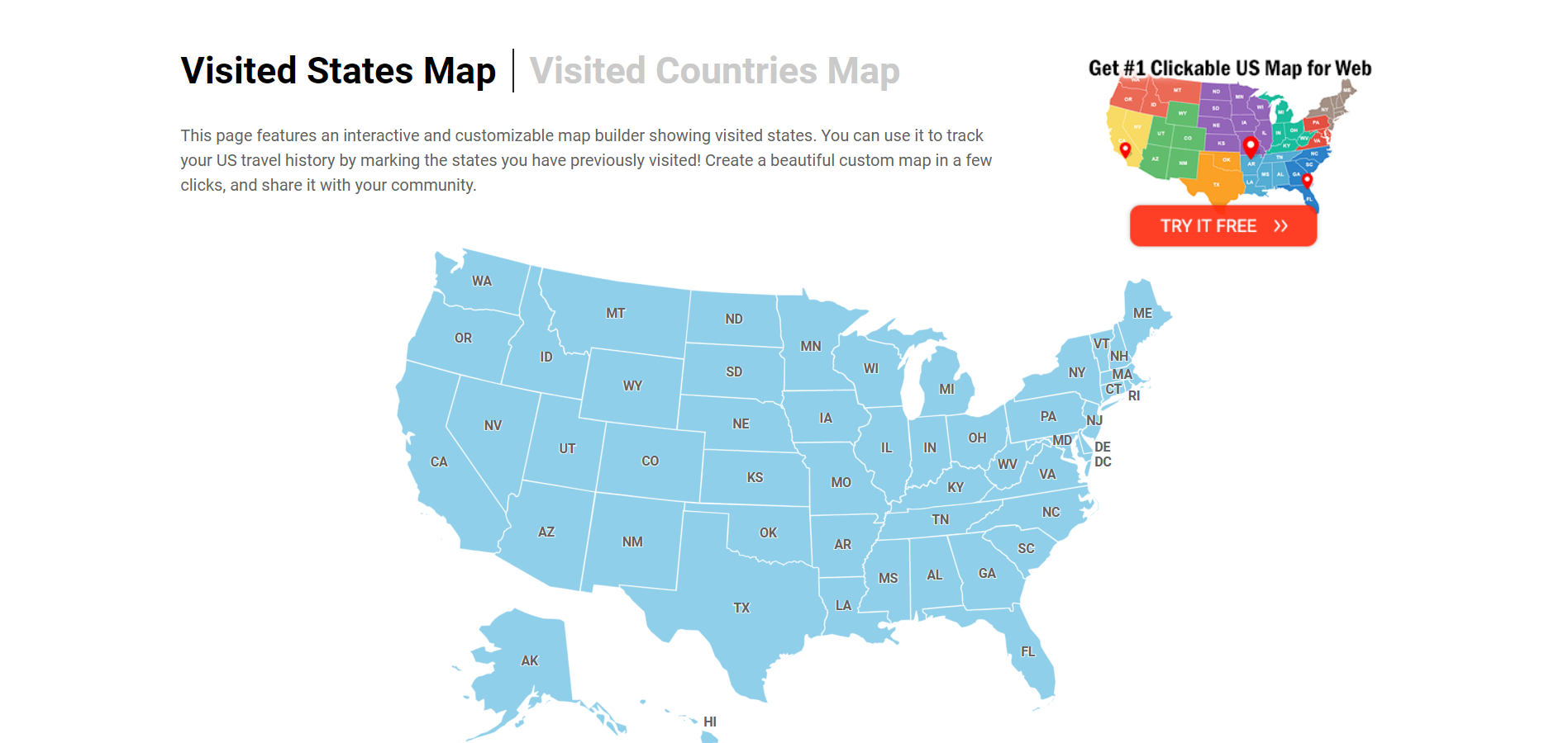
Visited States Map
This page features an interactive and customizable map builder showing visited states. You can use it to track your US travel history by marking the states you have previously visited! Create a beautiful custom map in a few clicks, and share it with your community. Also, check out our Interactive US Map for Websites with advanced customization options!

Select states you visited
- Connecticut
- District of Columbia
- Massachusetts
- Mississippi
- New Hampshire
- North Carolina
- North Dakota
- Pennsylvania
- Rhode Island
- South Carolina
- South Dakota
- West Virginia

Share the URL anywhere you want - or save it so you can come back and add new achievements to your map.
Embedding the map
If you need a US map with advanced features for your website, we offer several options for you. Alongside the standard HTML and JavaScript package, you can also opt for an easy-to-use WordPress plugin.

Frequently Asked Questions
This very simple tool allows you to easily create a map of states you have visited. Simply click on the states on the map, or toggle a checklist item below the map to mark where you have been. You can also customize the colors, turn off labels, and show stats regarding the number of states you have visited.
You can use this tool to track how many US states you have been to. In the "Set Map Parameters" control, check the "Show stats" box. The number of states where you have been will be displayed below the map. When the "Show stats" control is active, the exact number of states you have been to and the percentage of states you have visited are shown below the map.
This page features buttons that allow you to share this map via Facebook, Twitter, and Pinterest. Once you click the button, it will generate an image for the customized map and opens a new tab directing you to the social network you selected. You can also copy the URL and share it on any social network. If you opened map maker from a mobile device, use the share buttons built into your browser.
In the "Set Map Parameters" section, you will see four color options. Click on the associated color square to open the color picker. Once opened, can choose from millions of colors for the states and borders.
This can be done easily, and without the need for registration. Simply copy the unique URL and add it to your bookmarks.
You can quickly reset the map by clicking the "Clear map and reset colors" button. Note, this will reset all the states you have visited, along with reverting your color options and customized settings back to their default.
Visited States + DC Map Generator

Loading, please wait!
U.S. Passport Application Status
Security Alert May 17, 2024
Worldwide caution.
- Travel Advisories |
- Contact Us |
- MyTravelGov |
Find U.S. Embassies & Consulates
Travel.state.gov, congressional liaison, special issuance agency, u.s. passports, international travel, intercountry adoption, international parental child abduction, records and authentications, popular links, travel advisories, mytravelgov, stay connected, legal resources, legal information, info for u.s. law enforcement, replace or certify documents, external link.
You are about to leave travel.state.gov for an external website that is not maintained by the U.S. Department of State.
Links to external websites are provided as a convenience and should not be construed as an endorsement by the U.S. Department of State of the views or products contained therein. If you wish to remain on travel.state.gov, click the "cancel" message.
You are about to visit:
- Accessibility for screenreader
- White House
- Courts and Law
- Monkey Cage
- Fact Checker
- Post Politics Blog
- The Post's View
- Toles Cartoons
- Telnaes Animations
- Local Opinions
- Global Opinions
- Letters to the Editor
- All Opinions Are Local
- Erik Wemple
- The Plum Line
- PostEverything
- PostPartisan
- Volokh Conspiracy
- The Missing Debate
- AllMetSports
- College Football
- College Basketball
- D.C. Sports Bog
- Fancy Stats
- Fantasy Sports
- Public Safety
- Transportation
- Acts of Faith
- Health and Science
- National Security
- Investigations
- Morning Mix
- Post Nation
- The Americas
- Asia and Pacific
- Middle East
- On Leadership
- Personal Finance
- Energy and Environment
- On Small Business
- World Business
- Capital Business
- Innovations
- Arts and Entertainment
- Carolyn Hax
- Home and Garden
- Inspired Life
- On Parenting
- Reliable Source
- The Intersect
- Comic Riffs
- Going Out Guide
- Puzzles and Games
- Theater and Dance
- Restaurants
- Bars & Clubs
- Popular Video
- Entertainment
- Where We Live
- Recently Sold Homes
- Classifieds
- El Tiempo Latino
- Fashion Washington
- WP BrandStudio
- washingtonpost.com
- 1996-2016 The Washington Post
- Terms of Service
- Privacy Policy
- Submissions and Discussion Policy
- RSS Terms of Service
How many states have you been to?
Some domestic and international travelers take on visiting all 50 states as a challenge. There is even an online community, the All Fifty States Club , that celebrates and encourages people on their journey. It has two rules: You must put a foot on the ground in a state and breathe its air. (Some people even have a meal or a beer there!) Click away and see how close you are to joining the club.
[ I was determined to visit all 50 states. I soon discovered I wasn’t alone. ]
How many states have you visited?
Click or tap on the map below to count how many states you’ve been to, or click here to view the full graphic
You’ve visited 0 states and D.C.
Connecticut
District of Columbia
Massachusetts
Mississippi
New Hampshire
North Carolina
North Dakota
Pennsylvania
Rhode Island
South Carolina
South Dakota
West Virginia
More stories
The essential guide to all 59 U.S. national parks
As the National Park Service turns 100, a look at the wonders it works to preserve.

Why you should visit Columbus, Ohio
The country’s 15th largest city, chock full of creativity and innovation thanks to an influx of youthful residents, gives up its secrets

Looking for a geographic thrill? Go where states meet.
The convergence of three state borders, or tri-points, offers a chance for out-of-the-way exploring.
The Most Visited States In The United States
This post may contain affiliate links. As an Amazon Associate, we earn from qualifying purchases.
Every U.S. state has many and various tourist attractions . However, specific U.S. states have become more popular traveler destinations. The following ten states are the most visited in the United States: California, Florida, Nevada, Texas, New York, Virginia, South Carolina, Arizona, Georgia, Hawaii. These U.S. states are some of their particular attractions, and their features are accented below.

1. California
California is the country’s most populated state and is a significant agricultural state, providing about 99% of some crops.
About 50% of the state’s area is government-owned and committed to the conservation of nature. Millions of travelers crowd to California to visit the national monuments, historical places, parks, and beaches. California’s most popular tourist destinations are Disneyland, which is visited by almost 15 million people annually. Other popular attractions in the state are:
- Yosemite National park.
- Death Valley.
- Disneyland.
- The Golden Gate Bridge.
- The Hollywood sign.
Disney World is the most-visited theme park globally, so it isn’t unexpected that Florida would stand so high. There’s so much else to view in Florida, including great beach cities along the Mexican Gulf and Atlantic shores. Florida is scattered with traveler attractions and historical places, recreational facilities, and excellent picturesque spots for travelers to visit.
Nevada is the place to one of the most visiting and entertaining centers globally, Las Vegas. In the city are located gambling and entertainment spots as well as the outstanding clubs in the U.S. Other famous attraction places include Lake Tahoe, Hoover Dam, Valley of Fire State Park.
Texas is the second-largest after Alaska state in the U.S. This state is genuinely distinct in all ways, shapes, and forms. Texas’s landscape varies from sands to stunning shores to mountain areas to dense woods.
5. New York
We are pretty astonished to observe New York come in as the 5th most visited state in the U.S., given how well-known its famous traveler attraction sites are. The most visited attractions of the world’s financial capital are the Empire State Building, Times Square, the National Monument of the Statue of Liberty, the Museum of Modern Art, and the Metropolitan Museum of Art.
6. Virginia
From its gorgeous rolling hills to its vibrant colonial past, Virginia has much to offer everyone passing through. Virginia stretched from the Chesapeake Bay to the Appalachian Mounts. Whether you are a beach person or mount person, Virginia is your best choice.
Famous vacationist attractions include Busch Gardens, Luray Caverns, the Shenandoah National Park, Shenandoah Valley, and different historical monuments, including preserved colonies.
7. South Carolina
South Carolina is a U.S. state of forests, beaches, and beautiful parks and gardens. If you want a pleasant, quiet holiday, think of visiting the Magnolia Plantation and Gardens, Joe Riley Waterfront ParkSkywheel Myrtle Beach, Broadway at the Beach, the Congaree, and Brookgreen Gardens.
Arizona waterfalls are at #8 in our listing of the most visited U.S states. One of the most famous tourist attraction scenes worldwide – Grand Canyon National Park, located in Arizona. Millions of tourists make their route to the state to tour this incredible natural formation. Other astonishing places such as Petrified Forest National Park, Antelope Canyon, Saguaro National Park, Monument Valley, and Petrified Forest bring millions of travelers worldwide.
Visitors to Georgia adore many tourist attractions, including Lookout Mountain, Atlanta Botanical and Rock City Gardens, Carter Presidential Library, National Center for Civil and Human Rights. Moreover, Georgia is perceived as a peach state and is essential for being the prime raiser of pecans, peanuts, and Vidalia onions.
Hawaii is a unique U.S. state located in the tropics. The state is called by many a paradise on Earth because of the picturesque landscapes, lush rainforests, waterfalls, and world-class hotels dispersed throughout the islands. Besides the forests and beaches you can visit, a dormant volcano, and an iconic landmark, Hawaii Volcanoes National Park, Waimea Canyon State, and Na Pali Coast State Park.
The Most Visited U.S. States
The least visited u.s. states.
Now that we know which U.S. states do the most visiting, it is interesting to find out which states did the least traveling. Whether they don’t have any promoted attractions or they favor spending their money on other tasks, or don’t have as much access to huge airports, these are the states who travel the least in America. Coming in at #51 is West Virginia, which is followed on the list by Vermont, Nebraska, New Hampshire, and rounding out the below five is Rhode Island. At #46, we have Kansas, then Arkansas at #44, preceded by Maine, North Dakota, and Connecticut.
Want to learn more about unique landmarks and various tourist attractions in every U.S. state? Then have a look at the following books:
- National Geographic Road Atlas
- Fodor’s Best Road Trips in the USA

How about the most visited states by their size or population? This basically reads as a list of states ordered by how many people live in them.

Not even close Austin
California (Population: 39,613,493) Texas (Population: 29,730,311) Florida (Population: 21,944,577) New York (Population: 19,299,981) Pennsylvania (Population: 12,804,123) Illinois (Population: 12,569,321) Ohio (Population: 11714618
Georgia (Population: 10,830,007) North Carolina (Population: 10,701,022) Michigan (Population: 9,992,427

Isn’t Michigan’s population 10 million?

This is completely incorrect information. This is a list based on population not on how many people travel there every year. Sorry but Maine is in the top ten for destination hot spots for vacationers. To be honest I wish it was closer to 44.
not even close Justin
California (Population: 39,613,493) Texas (Population: 29,730,311) Florida (Population: 21,944,577) New York (Population: 19,299,981) Pennsylvania (Population: 12,804,123) Illinois (Population: 12,569,321) Ohio (Population: 11,714,618) Georgia (Population: 10,830,007) North Carolina (Population: 10,701,022) Michigan (Population: 9,992,427
Lmfao clearly you’ve never been here during flat lander season.

so basically you read the first part about California, just the first paragraph, and called it a day?

Source or methodology please?

thats crazy

man thas crazy. va is small. i live there id know lmaoo

9 mil is small to you? also lots of tourism

Printable States Visited Checklist
Want to keep track of which states you’ve visited and which states are still waiting for you? Check out our printable states visited checklist. Print it out, check off the list and color in the corresponding state on the map to keep you organized, motivate you to explore more of our beautiful country and help plan your next adventures. We keep a copy on a wall which hold many of our travel pictures and maps of places we have visited. It’s a fun way for us to keep track of where we have visited and also helps the kids learn about the geography of the United States.
Keep Track Of Which States You’ve Visited and Which States are Waiting For You. Click either of the following pictures to access our Printable States Visited Checklist.

For more fun options to keep track of your United States travels, check out this Visiting 50 States Journal or State Sticker Map . Both are great ways to keep track of your travel destinations in a fu and organized way.

Hope you enjoy using our Printable States Visited Checklist to plan your United States adventures! Check off the states that you have travelled to and color in the state on the map and keep track of where you have been.
America is an amazing country with so much beauty found throughout our borders. We are hoping to travel to all 50 states with our kids and can’t wait to explore them all. Happy Travels!

Washington DC in Only One Day
You may also like.

Gifts for Road Trips

National Parks Checklist

This is really fun. Thanks for sharing!

Thanks Kerri! I’m glad you like it. Happy travels!
Comments are closed.
Click to add
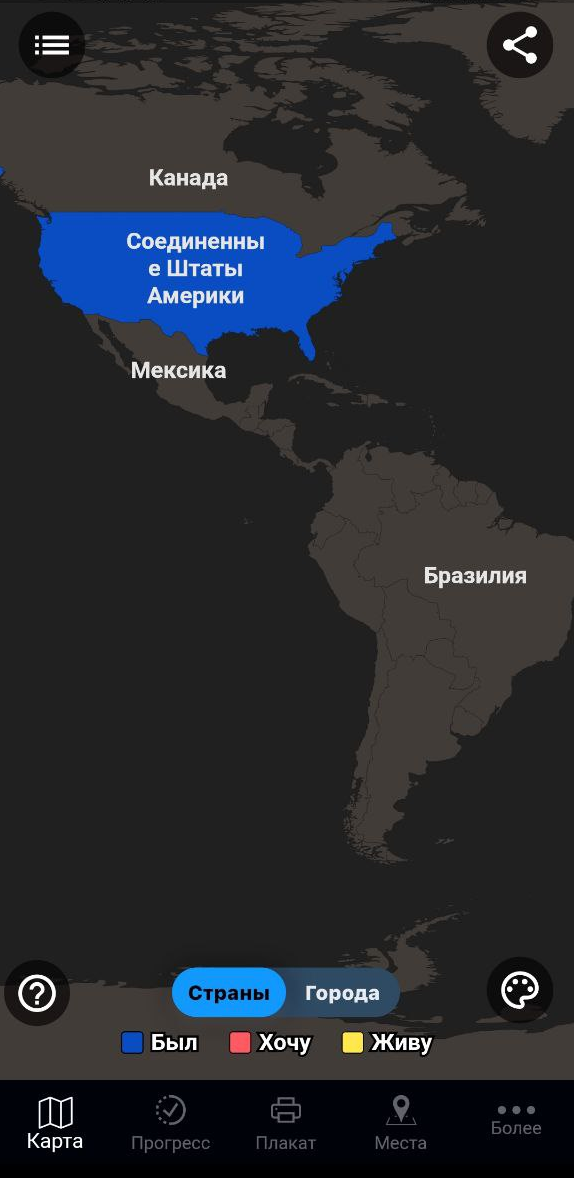
North america, south america, visited ( 0 ) add step clear, map features.
- Equal Earth Equirectangular Mercator Natural Earth Orthographic (globe) Albers USA Projection My home is Yellow (dark) Green (dark) Blue (dark) Gray (dark) Yellow (light) Green (light) Blue (light) Gray (light) Theme Default Custom Facebook - image (1200x630px) Facebook - cover (820x312) Instagram (1200x627px) LinkedIn (1200x627px) Pinterest (1000x1500px) Tumblr (1280x1920px) Twitter - image (1200x675px) Twitter - header (1500x500x) YouTube (1280x720px) Facebook - video (1280x720px) Facebook - reels (1080x1920px) Facebook - stories (1080x1080px) Instagram - video (1080x1080px) Instagram - reels (1080x1920px) Snapchat (1080x1920px) TikTok (1080x1920px) Twitter - landscape (1280x720px) Twitter - portrait (720x1280px) Twitter - square (720x720px) Vimeo (1920x1080px) YouTube - 1080p (1920x1080px) YouTube - 720p (1280x720px) Map size
- Create home step --> Create steps for continents "Water" enabled Grid enabled Place names enabled
Animation settings
Share, download, and embed, download & share.
- Export as video or animated GIF

- Via <iframe> As an HTML code Embeddable link Copy and paste this link directly into WordPress or other CMS.
Apps and services to keep track of visited states in the U.S
In this article, we've compiled the best services and apps to check off U.S. states visited.
Visited states map
Create your visited states map, visited states map, usa tracker, places been - travel tracker, countries been: visited places, visited: track your travels.
Apps and sites are indispensable when traveling. Facilitating navigation, finding places of interest, reviews of hotels and vacation areas - all this is the merit of modern services. But they are useful not only during the trip. For avid travelers, it's important to mark places they've been before, keep statistics and share them with friends.
Traveling to the U.S. often requires the use of separate services. After all, states or unique attractions are not displayed everywhere. To this end, many sites and apps have been created, both for simple note taking and full-fledged note taking, goal setting, etc.
Three of the most popular state counter apps are 'Places Been - Travel Tracker', 'Countries Been: Visited Places', and 'Visited: Track Your Travels'.

Convenient minimalist site to track states visited. No extra functions - only a list of visited states. It is possible to mark states with an interactive map and a table. If you put the cursor on the interactive map - it displays the name of the state.
The map can be scaled, colors and design can be changed. After creating it, you can download the picture, share it in social networks or place the link on your personal site.
- The site is not suitable for real-time tracking, it's just creating a picture as a "recap".
Another site for creating a map of visited states in the United States and then publishing it. Visited states are not just displayed on the map, but also marked with different colors:
- Red - have been through or haven't spent much time;
- Orange - spent at least a night;
- Blue - spent a lot of time;
- Green - spent a lot of time sightseeing or returning several times.
U.S. states not visited are grayed out.
Colors can be customized in the palette section. You can share the map by saving it in PNG format, sharing it on social media, or as a link.
The app is available in the Appstore for iOS.
- The service is not suitable for real-time tracking.
A site with a less aesthetic design than the previous ones. However, it is also capable of creating a map of visited states. You can mark a state by clicking on the interactive map or using the buttons above it. The name of the state is displayed when you hover your cursor over the map.
You can share the created map on social networks or copy it to your website. MapLoco service works not only with the U.S., but also with Europe, Asia and many other places.
A minimalistic to track states and countries visited. It has a nice blue and white palette that can be changed in the settings. Of the features - the abbreviated names of the states are marked directly on the interactive map, which facilitates orientation. When pointing the mouse you will see the full name.
You can also check off places you've visited by using the checkboxes in the list below.
- The finished map is available for downloading or posting on the site.
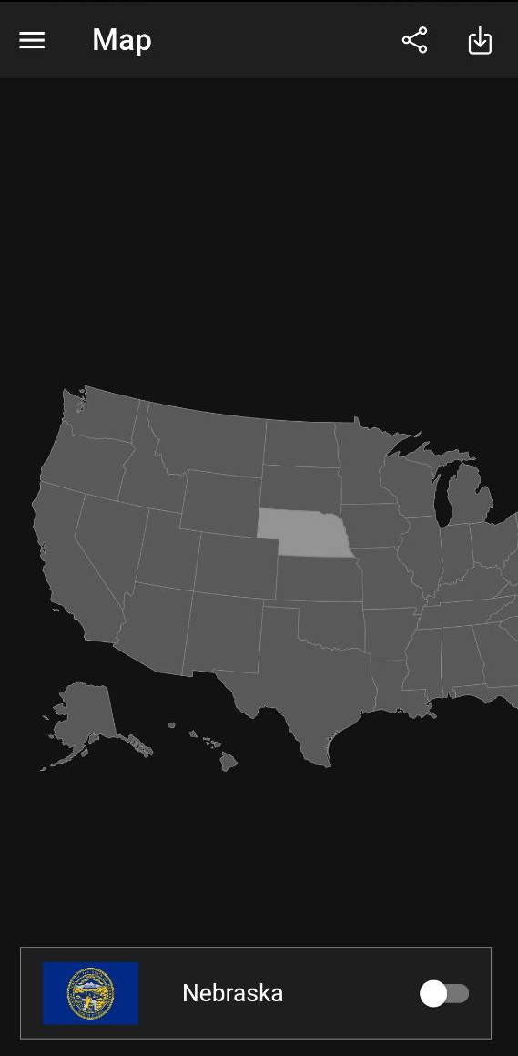
Mobile application to keep track of states visited for Android. After launching it, an interactive map of the USA appears, and when you click on it you can see the name of the state and its flag. The state is marked with a click on the button.
In the upper left menu you can see the "cities" section. The map will show all the cities in the United States. You can see them in more detail in zoom mode. When you click, you will see the name of the city and a caption to which state it belongs. Cities can also be marked as visited.
If it is inconvenient to mark states through the map, you can choose the section "lists" and do it through the table. However, there are no cities in the table - you only interact with them via the map.
The app keeps statistics on how many U.S. territories you've visited and how much of the world you've explored. The app also has an achievement system, such as "visit Alaska."
In the settings, you can choose a light or dark theme.
Android state counter app with more than 100 thousand downloads. Compared to previous services, the functionality here is more extensive.
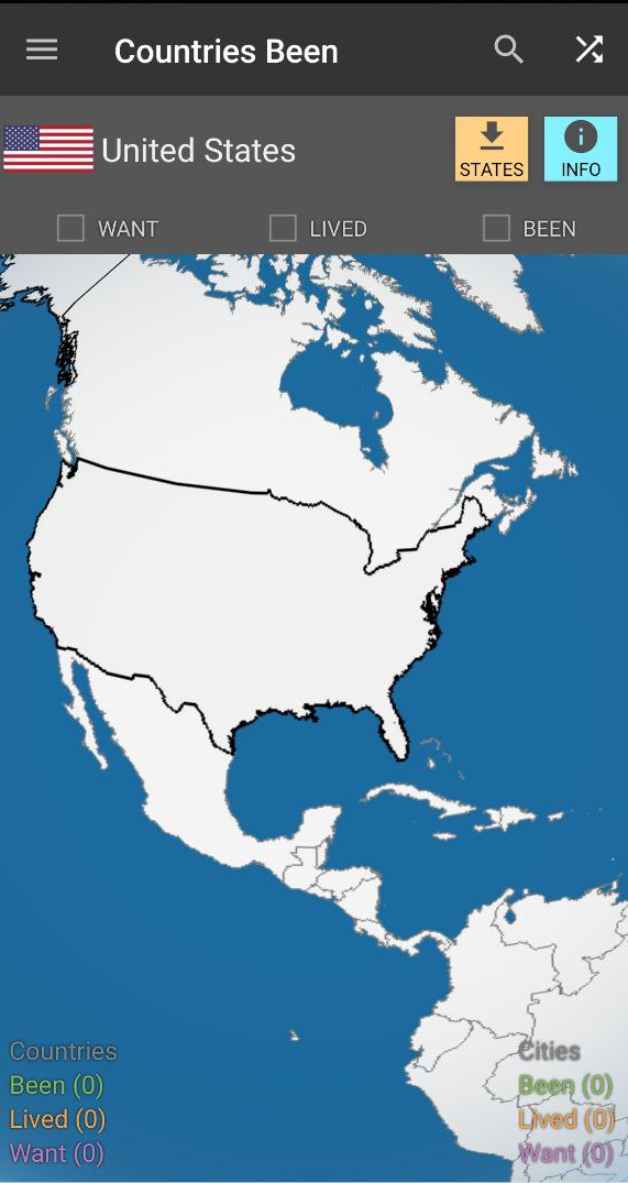
The app is not only suitable for tracking travels in the U.S. states, but also around the world.
When you start it, it opens a map of the world, which displays landmarks, cities, tourist areas, etc.
The city sections have a handy search button. Visit marks are performed in different colors.
On the home page you can select a list of cities, airports, states, UNESCO attractions, etc. to display. The app also maintains statistics for the best attractions based on user reviews.
The first time you launch the state tracker app, you'll be prompted to create an account or sign in through third-party services. It is not necessary to do this, but it is recommended to prevent data loss.
The main page contains a 3D model of the Earth, which you can rotate and zoom in on. The names of countries do not appear when zooming in, but you can read the information using the button in the upper right corner. You can read information about the capital, population, etc.
The app collects statistics on the places you have visited, both countries and cities. You can download additional information about visited countries within the application itself.
If you choose the U.S., it is recommended to download the location of the states separately. The pop-up bar will help you with this.
In order to track visited states, you must register via email and also agree to be sent information. After that you have to choose a country and a city where you live, as well as previously visited countries.
After this you will be redirected to the interactive states traveled map. The countries are displayed in the following colors:
- Yellow - country of residence;
- Red - the country you want to visit;
- Blue - country you have already visited.
The app is not able to track states separately. It only involves visiting countries or cities. However, cities are only available with a paid subscription.
The app also has goals that you can meet when you visit a country from the "want to visit" list. Below are statistics on the most visited places from your country and the percentage of how many countries in the whole world you have visited.

I'm Vladimir, your guide in the expansive world of technology journalism, with a special focus on GPS technologies and mapping. My journey in this field extends over twenty fruitful years, fueled by a profound passion for technology and an insatiable curiosity to explore its frontiers.
USA Travel: I've Been in US 4+
Counties map of united states, sergei shpygar, designed for ipad.
- 4.7 • 754 Ratings
- Offers In-App Purchases
Screenshots
Description.
Create your own travel map marking states & counties of USA where you've been! The app is user friendly and allows you to: - mark visited states & counties - create categories: visited, wish to visit, etc - track world heritage - keep the travel stats - pin pictures and notes for visited places - sync with the iCloud and Dropbox to restore and access the data from new devices - share your own travel map via different social media Send your feedback to e-mail: [email protected]
Version 1.5.3
- We fixed the crash on iPad - Other bugs fixed
Ratings and Reviews
754 Ratings
I love states
I really love states so bad and for Christmas I really want the first five USA flags which is Alabama, Alaska, Arizona, Arkansas, and California. The state and county I live in is mingo, West Virginia. My mom is thinking if I can go to all the states in the United States.
I like the idea of this app, it is a great tool for teaching kids geography. Would nice to be able to select multiple categories for each state, so I can work with each of my grandkids on where there have visited, (by selecting each state with a multiple catagory). Or is there a way to open multiple scenarios?
Developer Response ,
Thank you for feedback! Try to create 2 accounts-file in the Dropbox for this feature
Great app. One suggestion
For when we make county maps, usually of the whole country, can we edit the border thickness of counties and states separately? This would be helpful in seeing the state boundaries easter
In-App Purchases
App privacy.
The developer, Sergei Shpygar , indicated that the app’s privacy practices may include handling of data as described below. For more information, see the developer’s privacy policy .
Data Not Linked to You
The following data may be collected but it is not linked to your identity:
- Diagnostics
Privacy practices may vary, for example, based on the features you use or your age. Learn More
Information
- Traveler Pro $9.99
- World Heritage $0.00
- Map of Hawaii Counties $0.00
- Map of Texas Counties $0.99
- Map of District of Columbia $0.00
- Map of New Jersey Counties $0.99
- Map of Wisconsin Counties $0.99
- Map of Florida Counties $0.99
- Map of Rhode Island Counties $0.00
- Map of American Samoa Counties $0.00
- Developer Website
- App Support
- Privacy Policy

Game Center
Challenge friends and check leaderboards and achievements..

Family Sharing
Some in‑app purchases, including subscriptions, may be shareable with your family group when family sharing is enabled., more by this developer.
Mark O'Travel: Where I've Been
EveryPlace - Where I've been?
Space. Cards for children.
Marine Creatures Cards of Sea
China Travel Map: I Have Been
Sounds of Farm, Wild Animals!
You Might Also Like
Photo Map - Travel Tracker
Places Been - Travel Tracker
Visited: Travel Map With Lists
States Visited
VoyageX | Visited Countries
Pin Traveler: Travel Tracker
Track Wildfires in the U.S.
By Matthew Bloch Josh Williams Rumsey Taylor Tim Wallace John-Michael Murphy and Tiff Fehr Aug. 22, 2022
- Share full article
Daily Summary
Updated July 25
As of Thursday, there are 68 large or notable new fires burning across the Western United States, fueled by hot, dry and windy conditions in many areas.
Several outbreaks in recent weeks have become notably destructive, destroying homes and forcing evacuations.
And as several states experience record-breaking heat, fires have been igniting and spreading quickly, prompting officials to warn about the potential for more to break out in the coming days.
Notable Fires

- 268,000 acres
- +21,000 acres/past day
- 700 people live within five miles

- 135,000 acres
- +1,500 acres/past day
- 100 people live within five miles

- Size unknown
- No change in past day
- 17,000 people live within five miles

Microwave Tower
- +9 acres/past day
- 11,000 people live within five miles

- 15,000 acres
- 1,400 people live within five miles

- 3,000 acres
- +180 acres/past day
- 3,100 people live within five miles

- 50,000 acres
- +8,500 acres/past day

- 17,000 acres
- +4,200 acres/past day
- 500 people live within five miles

Wildfires Burn More Than 620,000 Acres in Oregon and Washington
July 22, 2024
Pacific Northwest Faces Critical Fire Risk as Wildfires Burn
July 21, 2024

Fires in Southern California Burn 30,000 Acres and Force Evacuations
July 15, 2024

California Suffers Its First Death of the 2024 Fire Season
July 11, 2024

Hot Nights Fuel Wildfires in California, Complicating Containment
July 10, 2024

To Protect Giant Sequoias, They Lit a Fire
July 9, 2024

Wildfire in California Prompts Evacuations and Threatens Neverland Ranch
July 8, 2024

Northern California Wildfire Slows, Allowing Most Residents to Return Home
July 4, 2024
Methodology
The map includes active and recent fires reported by the Wildland Fire Interagency Geospatial Services Group. The locations of the fires on the map are approximate, derived from data reported by the NASA FIRMS satellite-based fire detection system, which makes observations several times a day. Areas marked in red indicate where active burning was detected within 24 hours of the most recent fires reflected on the map. The exact boundary of a fire may differ from the extent shown on the map by 500 meters or more.
Air quality data is derived from PurpleAir sensors. Colored squares show levels of particulate matter in the air that average 2.5 microns or smaller in diameter where sensor data is available within a 10-mile radius of each square’s position. Readings have been adjusted to account for the properties of wood smoke. The quality levels are based on the Air Quality Index developed by the U.S. Environmental Protection Agency.
Population counts are rounded estimates. Totals are calculated using 2020 nighttime estimates from the Landscan , a population database generated by Oak Ridge National Laboratory.
By Matthew Bloch , Josh Williams , Rumsey Taylor , Tim Wallace , John-Michael Murphy and Tiff Fehr . Additional production by Jon Huang .
Expand Dashboard
Advertisement
- Entertainment
- Newsletters
WEATHER ALERT
A heat advisory and a rip current statement in effect for 6 regions in the area
After conviction in broward, maryland man faces 2 charges in miami-dade, convicted felon faces charges over carjacking in north miami beach.
Andrea Torres , Digital Journalist
MIAMI – A 66-year-old woman told police a Friday night outing to a 24-hour McDonald’s in Miami-Dade County turned into a nightmare when a man got into her car before she could lock the door.
The man ordered her to drive, but she refused, and jumped out of her white 2018 Jeep Cherokee screaming for help, while the man got in the driver’s seat and sped away from the restaurant’s parking lot.
Recommended Videos
Detectives later identified the man as Remmy Todd, of Denton, Maryland, wanted for a robbery on April 19, 2020, in Broward County. The carjacking was on Nov. 3, in North Miami Beach.
According to Miami-Dade inmate records, Todd was at the Metrowest Detention Center on Monday after spending his 32nd birthday earlier this month at the South Florida Reception Center, a state prison.
According to an arrest warrant, Miami-Dade Detective Juan Casiano reported there was a police chase on the night of the carjacking and Todd abandoned the woman’s white Jeep Cherokee near Northeast 143 Street and 16 Avenue in North Miami and fled.
According to Casiano, police officers arrested Todd on Nov. 4 near Northeast 143 Street and Biscayne Boulevard in North Miami Beach. Correctional officers booked him at Turner Guilford Knight Correctional Center and he was extradited to Broward County on Nov. 8.
After his conviction in Broward court, Todd was sentenced to about a year in prison for the 2020 robbery on Jan. 16.
According to the Florida Department of Corrections, Todd was out of the department’s custody on Jan. 25., and Miami-Dade detained him on March 18. His transfer to TGK was on Friday.
Todd is facing charges of robbery/carjacking and battery on a person age 65 or older.
Copyright 2024 by WPLG Local10.com - All rights reserved.
About the Author
Andrea torres.
The Emmy Award-winning journalist joined the Local 10 News team in 2013. She wrote for the Miami Herald for more than 9 years and won a Green Eyeshade Award.
How Kamala Harris fares against Trump in the 2024 polls
With President Joe Biden exiting the 2024 presidential race, Vice President Kamala Harris now becomes the overwhelming front-runner to be the Democratic Party’s presidential nominee.
Harris’ biggest challenge lies further ahead, though: She has been polling the same as Biden — or just slightly better — against Republican nominee Donald Trump, according to multiple surveys taken before Biden withdrew from the 2024 contest.
And Biden was running behind Trump in many national and battleground-state polls — which precipitated the president’s withdrawal.
In NBC News’ latest national poll , conducted more than a week after Biden’s dismal debate performance but before the assassination attempt on Trump, both the president and Harris trailed Trump by 2-point margins among registered voters, though the actual percentages for each candidate were slightly different. Trump led Biden 45%-43%, while he took 47% to Harris’ 45% in their matchup. Both ballot tests fell within the poll’s margin of error.
Similarly, a post-debate national Fox News poll found Trump ahead by 1 point against both Biden (Trump 49%, Biden 48%) and Harris (Trump 49%, Harris 48%) among registered voters.
But other polls have shown Harris slightly outperforming Biden by 1 or 2 points — though, critically, still trailing Trump at this point in some key matchups.
A national CBS News/YouGov poll of likely voters conducted after the assassination attempt found Trump leading Biden by 5 points among likely voters, 52% to 47%, while it showed Harris trailing by 3 points, 51% to 48%.
And in New York Times/Siena College battleground polls of Pennsylvania and Virginia, Harris performed 2 points better than Biden did among likely voters in these two states.
Importantly, all of these results are within each poll’s margin of error — and so is the difference between Biden’s and Harris’ numbers. Also important: It’s possible these numbers could change after the news of Biden’s exit from the 2024 race. But for the moment, Biden’s numbers and Harris’ numbers look quite similar.
Where Harris runs stronger — and weaker — than Biden
While the recent NBC News poll found Biden and Harris running 2 points behind Trump nationally, the survey found some important differences among demographic groups .
For one thing, Harris slightly outperformed Biden among Black voters, leading Trump among this demographic by 64 points (78% to 14%). That compares with Biden’s 57-point lead among Black voters (69%-12%).

On the other hand, the NBC News poll showed Trump doing slightly better among white voters when matched up with Harris instead of Biden, leading her by 16 points among these voters, compared with his 14-point advantage here against Biden.
Among other demographics — by age, by gender, among Latino voters — there was almost no difference between Biden or Harris.
Indeed, the biggest differences between Biden and Harris in the poll went well beyond demographics.
Among the roughly one-quarter of Republican registered voters in the poll who said they were unsatisfied with Trump as the GOP’s nominee, Trump ran ahead of Biden by 46 points, 63%-17%. But when Trump’s opponent was Harris, more of these dissatisfied GOP voters flocked to Trump. The Republican’s lead with that group grew to 57 points, 73%-16%.
Meanwhile, the voters who preferred a third-party candidate in the poll’s multicandidate ballot test seemed more open to Harris coming in as a fresh face in the 2024 race.
Trump and Biden were virtually tied with these third-party-interested voters in a head-to-head matchup. Trump took 32% and Biden took 31%, with a plurality declining to make a two-way choice, saying they were undecided, would pick another candidate, or something else.
But when Harris was the choice against Trump, more of those respondents made a pick in the two-way ballot test. The vice president went ahead of Trump among these “other” voters, 46% to 39%, suggesting a higher upside with voters currently considering a third-party candidate.
Biden, Harris and Trump have almost equal positive-negative scores
The NBC News poll also showed Biden, Harris and Trump with almost equal positive-negative scores with the electorate.
- Trump: 38% positive, 53% negative (-15 net rating)
- Biden: 36% positive, 53% negative (-17 net rating)
- Harris: 32% positive, 50% negative (-18 net rating)
That said, while Harris had a slightly lower positive score in the poll, 15% of voters said they’re “neutral” about her, compared with just 11% who are neutral on Biden.
That suggests an opportunity for Harris to grow — or fall — with this sliver of voters in the middle.
Mark Murray is a senior political editor at NBC News.
IMAGES
VIDEO
COMMENTS
Copy & Paste this HTML to your website: Make your own interactive visited states map. Just select the states you visited and share the map with your friends.
Drivers, motorcycle riders, car touring enthusiasts: Create a color state map to show where you have travelled. Instructions: Check the states checklist for the states you have visited, select a map size, then click Draw Map to create your own customized map of visited states. Right-click on your customized map to copy the map or save it to ...
Visited states map. Use this tool to create stunning interactive maps of your travels across the United States. Select the states, add animations, configure the way you see fit. Then download as a static image, embeddable code, or even a smooth video or an animated GIF. Once you're done, check out 200+ other maps we have.
Visited States Map. This page features an interactive and customizable map builder showing visited states. You can use it to track your US travel history by marking the states you have previously visited! Create a beautiful custom map in a few clicks, and share it with your community. Also, check out our Interactive US Map for Websites with ...
Visited States + DC Map Generator. Welcome to the Maploco Visited States Generator! This is a fun tool that lets you show your friends all the places you've been. Check the states (and DC) you've been to in the list below. When you're done you can use the buttons to share on Facebook, Pinterest and other sites. Share with your friends!
Create a map of your travels by selecting the US states and Canadian provinces you've visited. Color-code the states if you'd like. Then share your map to social media, send it in Messages or Mail, or generate a high-quality PNG or JPEG image at any size to use however you like. Finished maps can be of the USA, Canada, or both together.
arrow_forward. States Visited App helps you to keep track of States that you have been to. It has different modes to visualize visited places on a map: with states flag or with a fill color. Besides States, you can keep record of visited counties. Perfect for the adventurer, business-traveler and travel-minded person.
What PATNC's announcement means for PAT Affiliates already using Visit Tracker. Read more ...
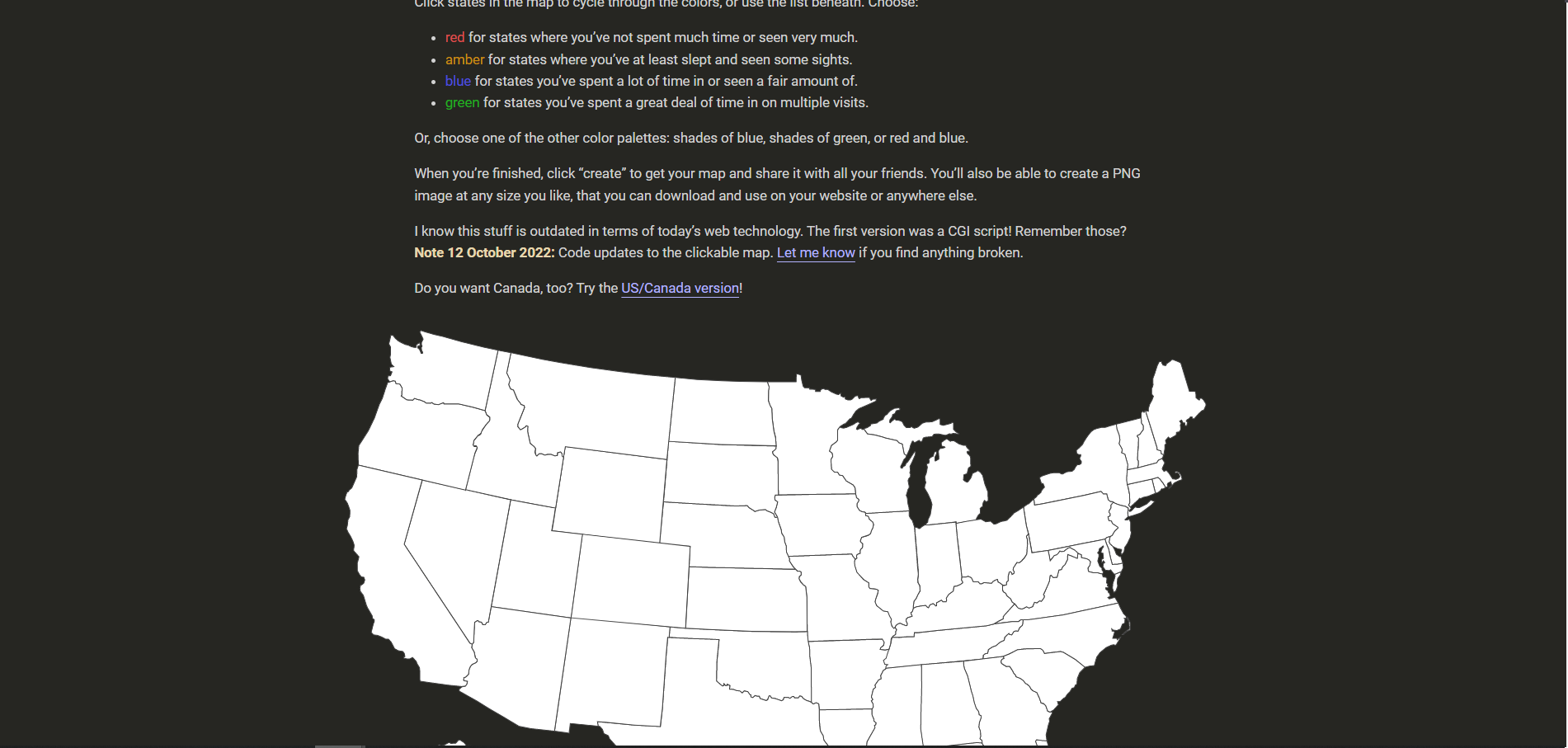
About Visited States Map Create Your Visited States Map. Click states in the map to cycle through the colors, or use the list beneath. Choose: red for states where you've not spent much time or seen very much.; amber for states where you've at least slept and seen some sights.; blue for states you've spent a lot of time in or seen a fair amount of.; green for states you've spent a ...
The US States Visited app lets you keep track of the states you have visited in the US. You can create up to 20 different maps! For each state, you can mark it as visited, rate it, and add a small description. Also, you will see the capital of the state, the estimated state population, and the state flag.
The estimated wait time to receive a nonimmigrant visa interview appointment at a U.S. embassy or consulate and is based on workload and staffing and can vary from week to week. The information provided is an estimate and does not guarantee the availability of an appointment. Wait Time for Interview Waiver.
U.S. DEPARTMENT of STATE — BUREAU of CONSULAR AFFAIRS. U.S. Passport Application Status. ... If you are traveling internationally within 14 days or need a foreign visa within 28 days, go to our Contact Us webpage for information on how to call us.
That also creates a backup of your visit. Provides summary state visit counts and details for each category. Now with zoomable maps! Pinch to zoom in and out. Use wifi or 3g to see standard, satellite and hybrid maps, and more zoom-in detail. (When network is unavailable, you will still see a standard map with state boundaries).
Links to external websites are provided as a convenience and should not be construed as an endorsement by the U.S. Department of State of the views or products contained therein. If you wish to remain on travel.state.gov, click the "cancel" message. You are about to visit:
How many states have you been to? By Matthew Callahan. Feb. 23, 2017. Some domestic and international travelers take on visiting all 50 states as a challenge. There is even an online community ...
Fodor's Best Road Trips in the USA. Every U.S. state has many and various tourist attractions. However, specific U.S. states have become more popular traveler destinations. The following ten states are the most visited in the United States: California, Florida, Nevada, Texas, New York, Virginia, South Carolina, Arizona, Georgia, Hawaii.
For more fun options to keep track of your United States travels, check out this Visiting 50 States Journal or State Sticker Map. Both are great ways to keep track of your travel destinations in a fu and organized way. Hope you enjoy using our Printable States Visited Checklist to plan your United States adventures!
Make your own interactive countries or visited places map. Select, configure, share, download.
USTravelDocs helps you apply for a U.S. visa online. Find out the visa types, requirements, appointments and more.
Join me as I talk about how I created my US State tracker. I plan to visit all 50 states in my lifetime, and this is how I am tracking it! Keep in mind, the ...
Three of the most popular state counter apps are 'Places Been - Travel Tracker', 'Countries Been: Visited Places', and 'Visited: Track Your Travels'. Convenient minimalist site to track states visited. No extra functions - only a list of visited states. It is possible to mark states with an interactive map and a table.
Mark Frauenfelder 2:04 pm Fri Oct 8, 2021. My daughter told me about an iOS app called Visited States Map which lets you keep track of the states you've visited in the United States. You can color ...
Create your own travel map marking states & counties of USA where you've been! The app is user friendly and allows you to: - mark visited states & counties. - create categories: visited, wish to visit, etc. - track world heritage. - keep the travel stats. - pin pictures and notes for visited places. - sync with the iCloud and Dropbox to restore ...
Track Wildfires in the U.S. By Matthew Bloch , Josh Williams , Rumsey Taylor , Tim Wallace , John-Michael Murphy and Tiff Fehr Aug. 22, 2022 Share full article
A 66-year-old woman told police a Friday night outing to a 24-hour McDonald's in Miami-Dade County turned into a nightmare when a man got into her car before she could lock the door.
Kamala Harris has been polling the same as Biden — or just slightly better — against Donald Trump, per polls taken before Biden withdrew from the 2024 contest.