
HIKING in PATAGONIA – The Ultimate Guide to the Best Treks

- Last Updated: February 5, 2024
Everything you need to know about hiking in Patagonia. From trekking in Torres del Paine to El Chalten and everywhere in between, this list of the best hikes in Patagonia will help you plan your big adventure!
Often and widely considered as having the most breathtaking, scenic landscapes in the world, trekking in Patagonia is every hiker’s dream, whether it is for the avid day hiker to the seasoned, experienced multi-day trekker.
Patagonia is a land of dreams, ranging from the raging rivers of the Rio Moscu to the iceberg glacial lakes of Tigre Sur.

The hiking routes take you from lush meadows of wild flowers to snowy-rugged peaks at the base of the world famous Mount Fitz Roy.
Just the thought of hiking in Torres Del Paine National Park sends shivers down my spine. Ever wanted to visit one of the world’s most famous granite peaks? Cerro Torre in Patagonia is your place to do so.
There are literally endless kilometres of hikes to do, but it can be very difficult to choose just one when everything looks like it’s worthy of being on a postcard.
Patagonia truly is one if not the most beautiful places on earth, so where do you begin?
It’s every adventurer’s desire to get a taste of what trekking and hiking in Patagonia is like, so I have established a list of the best day hikes to the some of the world’s most stunning multi-day treks.
READ MORE: Don’t miss our guide on backpacking in Patagonia on a budget.

Table of Contents
Hiking to Mirador Las Torres
Lago grey (grey glacier), the french valley – valle del frances, los cuernos trail, the “o” circuit, short hike to condor lookout, day hike to the base of mount fitz roy – laguna de los tres, day hike to cerro torre, the huemul circuit, laguna esmeralda, glaciar vinciguerra, sierra valdivieso circuit, laguna tigre sur, valle rio moscu, cerro castillo, pumalin park – cascadas waterfalls hike (escondidas), save this pin for later, the best time to go hiking in patagonia.
Early November until late April are generally the best times to go hiking in Patagonia, however this can change from year to year due to varying amounts of snowfall.
Not a fan of the cold? Try and head there in February and March for the warmer months for some great Patagonia trekking.
Also it’s necessary to know that weather in Patagonia is so varied and can change at any time, which can very quickly alter your Patagonia hiking trip. Keep that in mind when planning your adventure.
Hiking according to the seasons in Patagonia has both pros and cons no matter what time of year you decide to go, so if you were going to pick a time, aim for the end of March to mid-April, where weather seems to be slightly cooler but more stable allowing you to enjoy Patagonia in all its glory.
But the best reason for visiting Patagonia at that time of year is to see the entire region in autumn colours! Simply breathtaking.

Hiking In Torres del Paine National Park
When it come to hiking in Patagonia, no trip would be complete without spending at least a few days in Torres del Paine National Park, the crown jewel of Chile.
Whether you’re interested in just heading into the park for a day hike, using one of the accommodations inside the park as a base (we personally recommend EcoCamp ), or carrying all of your camping gear and completing the famous O Circuit, you definitely won’t be disappointed with the trekking here.
- Time Required: 8 to 9 hours
- Distance: 18km
- Difficulty: Hard
- Start / Finish Points: Hotel Las Torres
Widely considered to be the most popular day hike in Torres del Paine, Mirador Las Torres is just one of the magical places you can hike to when in Torres del Paine.
Las Torres translated to English means ‘The Towers’, and mirador means ‘Lookout’ , so you should have an idea of what to expect up there.
The Towers are a series of 3 jagged peaks that literally tower over a turquoise lake below, and chances are you’ve already seen a photo of them at least once in your life.
This particular trek is 18 kilometres of visual delights, despite it being considered as a difficult hike, and the views once you reach the top are just awesome!
Most of the trek is uphill, but don’t let that put you off this classic day hike, as cascading waterfalls, forests beaming with life and boulder fields dominating the higher landscapes and just waiting for you to enjoy.
The last hour is extremely steep, so make sure you save some energy for the final slog.
If you are after a really magical experience spend the night in the park and start hiking up in the dark. If the weather cooperates you’ll be rewarded with Las Torres looking as though they’re on fire with the red sun lighting them up at sunrise.
Las Torres is a hiker’s dream, and if you could only choose one trek in the whole of Patagonia, this would be it! Return via the same way you climbed, starting and finishing at the Hotel Las Torres.
Prefer to hike with a guide? Book your Mirador Las Torres tour here with Get Your Guide.

- Time Required: 3 to 4 hours
- Distance: 11 kilometres
- Difficulty: Easy to moderate
- Start / Finish Points: Mountain Lodge Paine Grande to Refugio Grey
As you might know there are quite a few glaciers in Patagonia (you can even visit some on an amazing glacier cruise in the Chilean fjords ), but this one takes the cake as the best of the best.
Along the famous “W” Trek, towards the western part of the hike, is a long section that follows the Lago Grey lake, which is gradually fed by a huge glacier known as Glaciar Grey.
Here you can expect to see pale blue icebergs floating around in the Lago Grey, as parts of Glaciar Grey collapse into the lake below and it’s a spectacular sight to see!
From Refugio Grey to Mountain Lodge Paine Grande is a 3 to 4 hour hike spanning over 11 kilometres, with little ascent or descent making it a fairly easy day out.
Expect to see vast areas of vegetation, wild flowers and the odd section of track that requires a tricky traverse but nothing too major. Keep an eye out for the majestic Cerro Torre piercing the sky.
Camping is available at Mountain Lodge Paine Grande and Refugio Grey if you want to spend the night there. Otherwise take the ferry to Paine Grande or Refugio Grey and start walking.

Alesha enjoying the view over Grey Glacier.
- Time Required: 3 to 4 hours
- Distance: 12km
- Difficulty: Moderate
- Start / Finish Points: Refugio Los Cuernos
You always have energy in Patagonia, even when you are literally falling asleep, so don’t miss this epic side trip that takes you between the Cerro Paine Grande and the Cuernos del Paine following the flowing river of the Rio Frances.
Why this hike is the one of the most spectacular side trips is because it has frozen waterfalls…how cool is that?!
READ MORE: We’ve just published our best hiking tips after 15 years trekking!
Also pretty dangerous though, so don’t be getting your ice picks out too soon, because there are views much higher up that you can enjoy, such as the 15 minute trek past the Campamento Britanico placing you in an almost cathedral of mountains.
The Mirador right towards the end is complete with a series of tarns beaming the reflections of the surrounding mountains making it that ideal moment to getting that camera of yours out! Camping is available (minus the facilities of toilets etc). Return the same way you came.

- Time Required: 6 hours
- Distance: 22km
- Difficulty: Moderate
- Start / Finish Points: Hotel Las Torres to Refugio Los Cuernos
Based along the front half of the park, home to the W Trek, is a fantastic day hike weaving around a series of steep banks perched along the edges of the Lago Nordenskjold.
Los Cuernos Trail, which means ‘The Horns’ in English and named after the mountains you can see that are shaped like horns, is a beautiful stretch offering views of the Cuernos del Paine, which never cease to amaze, and gorgeous vistas over the lake.
If you still have bounce in your step when you finish the trail, consider a side trips up the Valle del Frances, an additional 12 kilometre stunning section of track.
Plenty of camping is available on the south side of Cuernos Del Paine if you prefer to take more time on this hike (just keep in mind it gets quite windy in these camp spots).

- Time Required: 6-8 days
- Distance: 135km
- Difficulty: Hard
- Start / Finish Points – Hotel Las Torres
Defined as one of the best treks on earth, the Paine Circuit, commonly known to the hiking world as the “O” Circuit due to its shape on a map, is a must do if you have a sense of adventure.
The circuit literally has it all, from pristine forests, meadows of native wild flowers to the grand peaks of Cerro Paine and Cuernos del Paine…and let’s not forget the addition of Las Torres along the eastern side of the trek.
You are best off starting at Hotel Las Torres and heading to Campamento Seron, where views of Cerro Paine (1,508 metres) dominate your surrounds along with rivers flowing off Lago Paine.
Once you connect with the track along the Rio de los Perros, mountains begin to pop-up more frequently along with glaciers, but be sure to pitch your tent at the campsite on Lago Dickinson, as views here are some of the best along the hike.
As you continue to be blown away by Grey Glacier in Torres del Paine (hopefully not by the wind), you find yourself on the trail that begins the “W” trek, which is the shorter, more popular sister of the O Circuit, which begins at Refugio Grey camping area.
Finishing the “O” circuit adds side trips along the French Valley (a must-do hike) and up to Las Torres to watch the sunrise, then heading back down to where you started.
If you want to finish on an alternative route, from Mountain Lodge Paine Grande you can hike along the Rio Grey to the Lago del Toro administration centre.

Trekking In El Chalten
While Torres del Paine is the most popular place to go hiking in Patagonia, the truth is El Chalten is the place that will steal most people’s hearts.
Across the border in Argentina, further north of Perito Moreno and its amazing glacier, is a tiny village called El Chalten that sits in the middle of Los Glaciares National Park.
What makes El Chalten so epic is that not only is entrance to the national park free (yes!!!), all of the hikes start from right in the middle of the village.
So once you’ve finished ticking off the quintessential Torres del Paine treks, head off to tackle some of the best hikes in El Chalten!
- Time Required: 1 hour
- Distance: 2km
- Difficulty : Easy
- Start / Finish Points: El Chaten
Based out of El Chaten is one of the shortest hikes in Patagonia, which mostly consists of a gradual ascent to views from Las Aguilas.
Just because it’s short doesn’t mean it’s not worth doing. The views are quite unexpected, as Viedma Lake appears with a backdrop of stunning, ever-covered mountains of snow.
This is a great hike to do for sunrise in case you don’t feel like camping out in the middle of the park. Return the same way you came.

- Time Required: 8 hours
- Distance: 26km
- Difficulty: Moderate to hard
- Start / Finish Points: Northwest end of El Chalten
This hike will be the one that takes you as close as you can get to the foothill of Mt Fitz Roy, and one of the best hikes in El Chalten.
It’s best off to start early to enjoy the morning alpine glow on the peaks above, but that could be said of most treks in Patagonia.
The trail is pretty mellow to begin with, and there are a few narrow sections through forests which are lovely. Then the hard part comes.
Zig-zagging up and up for the last hour, you will finally reach Laguna de los Tres, with the most epic views of Mt Fitz Roy soaring above you!
Depending how skilled you are in the mountains, there is a climb that proceeds up the peak of Cerro Madsen (1,806 metres) for even better views of Fitz Roy.
Return the same way you came to head back to El Chalten, unless you are deciding to camp at Campamento Poincenot.
Prefer to have a guide? Book your Mount Fitz Roy tour here with Get Your Guide.

- Time Required: 2 days (can be done as a day hike)
- Distance: 19km
- Difficulty: Easy
- Start / Finish Points: El Chalten
A perfect opportunity to get up close and personal with Cerro Torre, reaching into the sky at 3102 metres, can be done as a day hike, but I think it’s pretty cool to take refuge at Campamento de Agostini at the base of Laguna Torre.
This 2-day trek is a culmination of lush meadows, rugged ever-changing glaciers and stunning views of Cerro Torre and its surround snowcapped peaks.
As a side trip, opt for the Mirador Maestri lookout which will add an additional 5 kilometres to your adventure. At Mirador Maestri be prepared for uninterrupted views of Cerro Torre in all its glory!
On return, head back the same way you came with views looking down the Rio Fitz Roy (a glaciated river from Glaciar Torre).
Prefer to have a guide? Book your Cerro Torre tour here with Get Your Guide.

- Days Required: 4 days
- Distance: 63km
- Difficulty: Very difficult
This one is up there as one of the most difficult treks in Patagonia, so be prepared to be fully tested in this stunning lesser-known area of El Chalten.
This Patagonian trek, while demanding in nature, takes you into areas where Cerro Solo can be seen almost standing alone, hence the name ‘solo’.
Mount Huemul is also just as impressive as the contrast between the forest floor, fields of green pastures and rocky spires mix to create stunning views.
The Huemul track puts you to the test with a river crossing almost chest deep as you navigate the Rio Tunel with majestic mountain backdrops.
It only gets harder from here as the Southern Patagonian Ice Field nears, with a climb to Paso del Viento, which is sure to get your blood pumping.
But that’s not all, with a demanding climb to Passo Huemul presenting the clash of Lago Videma (lake) and the walls of the Videma Glaciar.
Views here are gobsmackingly awesome! Take your time to breathe in the fresh air before descending back the way you came.
The Huemul Circuit is considered as a very difficult trek, so its best off to hire a local guide who can help you navigate the rivers and provide insights into one of Patagonia’s most magical areas if you aren’t experienced.
Either way you’ll need a harness and know how to use it, so all hikers on the Huemul Circuit must check in at the information centre before departure to prove they know what they’re doing.

The Best Hikes in Ushuaia
Located at the bottom of Argentina and known as being ‘the end of the world’, Ushuaia is a place that often draws visitors looking to hang out at the bottom of South America. (Click here to read about our experience there.)
It also is a departure point for many people heading off on an expedition to Antarctica.
For those of us that love the outdoors, Ushuaia offers so much more though, and it’s worth spending a few days here to get in some good treks. These are some of the favourite hikes in Ushuaia!
- Distance: 9km
- Start / Finish Points: Refugio Valle Los Lobos
Patagonia isn’t all about multi-day treks, as sometimes the shorter it is the sweeter it tastes. Laguna Esmeralda is an easy 9 kilometre hike to the base of a glacier known as Glaciar Del Albino.
If you prefer to spend extra time taking in the stunning views, a refugios ‘ campsite’ is available near the lake towards the end of the hike allowing you to absorb your surrounds.
At the top, be rewarded with mesmerising views of the Esmeralda Valley down below.
Although this day hike is short, there is an opportunity to put on your crampons and go for a walk along Glaciar del Albino.
The walk on Glaciar del Albino does require advanced hiking skills and that extra bounce in your step, so add up to 4 hours on to your day.
If you’re not fully prepared for it and know what you are doing, don’t go past the 50 metre marker unless your name is Jimmy Chin.
- Days Required: 5 to 6 hours
- Distance: 13km
- Difficulty: Moderate
- Start / Finish Points: Tubera Valle Andorra
This moderately difficult Patagonian trek takes you to a series of glacial lakes with a few steep ascents, making this hike a worthy challenge for avid single day trekkers.
After a series of gradual/steep ascents, Laguna Encatada is finally reached, which is surrounded by lush meadows of grass with reflections of rugged peaks glimmering off its surface.
Hiking to Laguna Encatada provides a unique opportunity to climb the steady peak of Cerro Esfinge, rising to 1275 metres. At the top, the views are breathtaking!
When I think of this hike, I see rugged peaks, flowing hills of dark green grass blowing in the wind with cascading streams of water, and that’s exactly what it is!
The Glaciar Vinciguerra hike sees glaciers precariously wedged between the mountains you are hiking around, as glacial melt trickles past fields of wild flowers.
The water from the glaciers ends up accumulating in glacial lakes where the odd chunk of ice sits bobbing in the freezing waters.
Return the same way you came.
- Time Required: 4 Days
- Distance: 48.5km
- Difficulty: Demanding
- Start / Finish Points: Ruta Nacional 3 or Posada del Peregrine
Deep within the heart of the Fuegian Andes lays one of the more challenging treks in Argentina, but one that you definitely need to consider as a must do hike in Patagonia.
Trekking in the Patagonian Andes wouldn’t be complete with just lush-rugged forests; allow some icy peaks extending from the area’s many glaciers and crystal clear lakes (probably not ideal for swimming) to encompass your surrounds.
This particular trek is a lot quieter than some like the “O” Circuit, as tracks remain barely trodden, so a good sense of direction is always appreciated before attempting this 4 day, 48.5 kilometre trek.
Due to unstable weather conditions in this part of Argentina, it’s always appropriate to take more supplies than you think you will need.
Sierra Valdivieso is a culmination of muddy paths with contrasting streams of blue glimmering glacial water and is something that will acquire your sense of adventure.
This hike in the Fuegian Andes is a classic mix of snow, ice and scree which can be difficult in parts, but once you ascend to the high passes it all makes getting dirty worth it!
Prefer to have a guide? Book your Ushuaia hiking tour with Get Your Guide.

The Best Hikes Along The Carretera Austral
One of the least-visited parts of Patagonia is the long, narrow strip of coastline that makes up the bottom part of Chile.
While most people will make it to Torres del Paine and Puerto Natales , few cross back into the country and continue along the epic highway known as the Carretera Austral.
Public transport is just about non-existent along this long, rugged road, which leaves people to either hitchhike or self-drive between the towns.
When winter comes the place all but shuts down, so that leaves a big part of Chile that not many people see. But that doesn’t mean you shouldn’t check it out!
The Carretera Austral has some insane landscapes and gorgeous mountains and lakes. The coastline is as dramatic as you could imagine, and that all ads up for some amazing hiking!
- Time Required: 4 hours to 2 days (depending on side trips)
- Distance: 8km
- Start / Finish Points: Villa O’Higgins
Patagonia is known for its spectacular glacial landscapes and what better opportunity than to view them by hiking the Laguna Tigre Sur, a moderately difficult hike into some of the most densely populated region of glaciers.
This particular hike is best undertaken with the expertise of a local guide due to it being slightly confusing in regards to finding the correct track to take.
But don’t let that put you off visiting this glaciated area, as Laguna Tigre Sur offers a look into the wilder side of Patagonia, with the odd tricky ridge walk leading you to nearly undiscovered views, glaciers and mountain peaks.
High above the Glaciar Tigre is the Cordon Nevado where chilling winds and extreme temperatures can make things difficult so come prepared for the cold.
There are two side trips to choose from or you can do both with camping spots available. The first side trip leads to the base of the larger Glaciar Tigre Sur where wild flowers thrive in small pockets.
There are a few sections which require the use of your hands to navigate smaller gaps in the larger boulders. At the end of the trail its icebergs galore! Allow 2 hours for this side trip.
The 2 nd side trip continues onto the smaller glacier known as Glaciar Tigre, taking you past large gorges, pristine streams and colourful meadows. Allow 3 hours for this side trip and return the same way you came.
- Time Required: 2 days
- Start / Finish Points: Villa O’Higgins
Similar to what Laguna Tigre Sur provides in terms of glacial views, Valle Rio Moscu is an easy walk generally hiked in 2 days in order to explore a heavily glaciated valley towered by Patagonia’s famous jagged mountain tops.
Hiking at Valle Rio Moscu has a few tricky components such as small stream crossings, best to be taken when the river is low (check with local guides when this is).
The Rio Moscu is a fast-flowing river fed by smaller streams originating from the Cordon de Villa O’Higgins range, while glacial melt from the Ventisquero Rio Moscu contributes an overwhelming amount of water to the raging river.
Ideally it’s best to spend 2 days in the valley as you can explore a spectacular frozen world sitting high in the mountains above.
Camping is available at Refugio Rio Moscu, approximately halfway along the Rio Moscu.

- Days Required: 4 days
- Distance: 62km
- Difficulty: Moderate to demanding
- Start / Finish Points: Las Horquetas Grandes to Villa Cerro Castillo
This 4-day trek will take you through majestic alpine landscapes guaranteed to lead you to plummeting waterfalls, isolated glaciers tucked away into the mountainous backdrops which you will find yourself immersed.
Cerro Castillo is a culmination of everything you think Patagonia is, all jam packed into this one epic Patagonian trek.
It will put you to the test with river crossings in freezing glacial waters, and parts of it needing spot-on navigational skills. Although tracks are well-trodden, they can be impeded by Patagonia’s wild untamed weather.
The whole hike consists of weaving in and out of a valley where mountains range from 1500 metres to a massive 2,675 metres of Cerro Castillo.
Camping is available the whole way along the trek, allowing you to take your time on one of Patagonia’s lesser known hikes which is increasing in popularity.
To gain a different perspective of Cerro Castillo, opt for the side trip into Upper Valle Parada, adding an additional 3 kilometres to your trek, where small lakes such as Laguna Duff remain hidden gems and well worth the extra few hours’ efforts.
The hike finishes at Villa Cerro Castillo, which can be taken by following either the Rio Ibanez or the adjacent path at Morro Rojo peak.
- Days Required: 1 to 2 hours
- Distance: 3.5km
- Start / Finish Points: Caleta Gonzalo
Pumalin Park is one of the world’s most remarkable nature reserves, not just because it is absolutely stunning, but because it would have been wiped off the planet if it wasn’t for a one awesome human being.
Doug Tompkins, the founder of the adventure gear company North Face, bought 400’000 hectares of land that was under threat from logging companies and turned it into a privately-owned by public-accessed park.
He later donated it to the Chilean government under the condition it would continue to be protected. The government agreed, adding more land to it, and today it is South America’s largest national park.
Pumalin Park can be kayaked if you prefer water, as 4 to 10-day kayak trips are available in this stunning part of the world.
However this article is all about hiking in Patagonia, so your best bet is to go for either those shorter hikes taking up to 30 minutes to the more demanding 8-hour plus hikes.
Cascadas is the one to go for as it showcases (as the name suggests) ‘cascading’ waterfalls. You will have to navigate through dense forests and wobbly wooden bridges and ladders before you reach the prize at the end of the trail, being the majestic Cascadas Bajas waterfall.
Camping is available at Rio Gonzalo.

The Ultimate Trekking in Patagonia Packing List
Patagonia is certainly one of the most extreme, potentially harsh climates on earth, therefore it’s necessary to be prepared for all conditions months before you venture to the South American continent.
Hiking gear in Patagonia is quite expensive therefore it’s better to have your gear sorted before you travel to your destination. This packing list for hiking in Patagonia should give you a good idea on what to bring.
- Good quality, lightweight tent. Check out our guide to the best backpacking tents to find one that suits your style and budget.
- Thermal layering including top and pants
- Hiking pants, both long and short, or get convertible pants. These should be waterproof, otherwise get a pair of slip-over waterproof pants as well
- Gore-Tex (waterproof) hiking boots
- Quality backpack for hiking
- Down jacket – these puffy jackets are essential for keeping your torso warm
- Rain and wind jacket – make sure you get a quality jacket that doesn’t leak
- Sleeping bag and silk liner – The warmer the sleeping bag the better
- Cold weather gloves – you will need waterproof gloves aswell as a pair of inner gloves to keep your fingers warm
- Plenty of socks (dry socks are the best)
- A beanie – keeping your head warm is essential
- Hiking poles – if you’re carrying a heavy bag, hiking poles will help you balance. They also provide support for your knees.
- Ability to carry sufficient water (5 litres is ideal)
- Food to last the entire hike. You can pre-order food in some of the refugios in Torres del Paine, but that’s about it. Better to be over-prepared and over-fed then the other way around when hiking.
[box] Have you ever been hiking in Patagonia? Leave a comment below and tell us what your favourite trek was![/box]

Calumn Hockey
Hi, We’re Alesha and Jarryd!

We’ve been traveling the world together since 2008, searching for the planet’s best destinations and adventures.
Love Travel?
Sign up for our free weekly newsletter for the best travel tips, ideas and deals!
We respect your privacy. Unsubscribe at any time.
READ MORE...
Jacis Lodges Review – A Luxury Safari in Madikwe, South Africa
Cape Kudu Hotel Review – Best Place to Stay on Koh Yao Noi
The Ultimate 3 Days in New York City Itinerary (2024 Guide)
Related Posts
Become a professional travel writer with the 2020 world nomads scholarship, 17 awesome things to do in dawson city, yukon, australia in pictures – 30 photos from 3 months of van life, things to do in belize…besides tropical islands, 18 thoughts on “hiking in patagonia – the ultimate guide to the best treks”.
Happy to read your post. I found your blog is very useful and informative. Thank you for sharing with us.
Actually, I am planning to hike in Patagonia in December. I hope I will have good weather. I loved your article; fascinating and helpful.
Patagonia is such a special place. Hope you get good weather. Even if you don’t it is still so beautiful in the rain or snow. Happy travels
Why you keep lying that Patagonia is chilean? Patagonia is ONLY on the Argentinian side (EAST of Los Andes.
Mt. Fitz has been high on our list since we saw Tommy Caldwell and Alex Honnold do the traverse there. I don’t think we’re up to the standards of the traverse but we’d definitely like to do some hiking around there, looks epic!
Great article guys, thanks!
Glad you enjoyed the article. Hope you get to climb Mt Fitz one day. 🙂
Great work guys, will definitely follow you in instagram, could you recommend some good travel companies who can help me with these hiking circuits, will be a solo traveller.
Hi Basu, thank you so much. We did our hikes through Eco Camp and they were brilliant. They have nice accommodation. We did not go with any other agent. 🙂
Thanks for this comprehensive list of treks near El Chalten. Could you tell me how is the biking scene in the town? I am a cyclist and love to ride in new places I visit. I was planning to take my bike on my trip to El Chalten, but not sure if it will be a good idea.
Glad this article could help. We didn’t go biking ourselves in El Chalten so we can not say about the treks. We are sure there is some in the area. If you contact one of the adventure tour companies they may be able to help. All the best and have a great time.
Fantastic blog! For the short hikes ie. <5 hours, are the trails easy to follow or well marked or do we need to know how to navigate? Thank you!
Thank you so much. Yes the paths are easy to follow and there are signage. You do have to have your own wheels to get to some of the hikes as the tourist shuttle doesn’t go near the beginning of them. Have a great time
This was great! Thanks! I know the answer to this, but I’m going to ask it anyways. Since there are camping spots along the way, are there toilets? Should we buy biodegradable TP for the day hikes?
Hi Sam, there are toilets at the campgrounds. Surprisingly all of them are flush toilets. Toilet paper is provided but always bring your own as the toilets run out. When you are hiking and need to use the bush toilet. Please bury your business and pick up your toilet paper. Thanks
Great Post, looking forward to exploring Patagonia.
Thank you so much
Love your blog 🙂 I wish I had more money to travel, cos nothing is better then collecting memories while traveling.
Thank you so much Miljan. Collecting memories is beautiful
Leave a comment Cancel reply
Save my name, email, and website in this browser for the next time I comment.
- USA/Canada 1-888-232-3813
- Walking & Hiking
- Wildlife and Nature
- Multiactivity
- Photo Safari
- Excepcional Journey
- Water Adventures
- Food & Wine
- City Escapes
- Winter Adventures
- EcoCamp Patagonia
- Argentine Patagonia
- Chilean Patagonia
- Atacama Desert
- Santiago and Central Valley
- Easter Island
- Lake District
- Multidestination
- Northwest Argentina
- Uyuni Salt Flats, Bolivia
- For Families
- For Couples
- For Friends
- For Solo Travelers
- Central Valley
- Wildlife & Nature
- News & Awards
- Sustainability
- Outdoor Sports
- Yoga & Wellness

All You Need to Know Before Hiking the W Trek in Patagonia (2023 Upd.)
Posts by tag.
- Patagonia (76)
- Inspire (50)
- Wildlife & Nature (28)
- News & Awards (25)
- Outdoor Sports (21)
- Food & Wine (20)
- Central Valley (16)
- Culture (14)
- Atacama Desert (13)
- Sustainability (8)
- Lake District (5)
- Yoga & Wellness (5)
- Easter Island (3)
- Bolivia (1)
Looking for the most complete information on the W Trek in Patagonia, the most famous multiday hike in Chile? You’ve found the right place!
1. Where is the W Trek located?
2. When is the best time to hike the W Trek?
3. Where to stay on the W Trek?
4. how difficult is the w trek, 5. what should i pack for the w trek.
6. How long does it take to hike the W Trek?
7. What are the highlights of the W Trek?
8. should i do the w trek with a guide, 9. w trek vs o trek : which should i choose, 10. how to book the w trek.
The W Trek in Torres del Paine is undoubtedly one of the best treks in Patagonia. This “W” shaped hiking trail highlights the best of Torres del Paine National Park, including Grey glacier, the French Valley and the Towers’ Base Viewpoint. Here, you will spend up to 8 hours a day hiking in the wild, but with some of the world’s most stunning viewpoints, there is no way you’ll get bored.
And while the surreal beauty of Torres del Paine made it a popular destination amongst hikers (and non-hikers!) Patagonia's finest national park still offers plenty of opportunities to disconnect from civilization and reconnect with wilderness, in landscapes more dramatic than Mordor and Westeros combined.
.jpg?width=2048&name=48449554592_2b21f8035d_k%20(1).jpg "patagonia trek when")
Yet more and more travelers suffer a lack of preparation that can potentially ruin the experience. It is not (so) unusual to see hikers going up the mountain wearing a blue jean, or people with only a T-Shirt to protect themselves in a snowstorm. And because we don’t want anything like it to happen, we designed the most complete article to answer your most common questions, so you have a blast on your W Trek!
Ready for a hike of a lifetime?
The trails of the W Trek are located in Torres del Paine National Park in Chilean Patagonia . The park – an area of 1,814 km2 (700 sq.mi.) - encompasses blue lakes, glaciers, lakes and rivers in the Magallanes Region. It is the southernmost region in Chile, which means the trip to get there is rather long.

Now, how do I get there?
Good question! The trip to get to Torres del Paine is indeed long, but connectivity has improved a lot within the last few years. Most travelers fly from Santiago de Chile to Punta Arenas, a 3-hour flight. From there it’s a 5-hour drive to reach Torres del Paine. There is also the option to fly to Puerto Natales, from which you will only need a 2-hour drive, but this option is mainly available in high season (November to March).
If you come from El Calafate in Argentina, you can cross the border by driving through Cerro Castillo or Paso Dorotea (near Puerto Natales), an overall 4 to 5-hour trip.
2. When is the best time to do the W Trek?
The best time to visit Torres del Paine is incredibly hard to define. The region’s notorious weather can change in the blink of an eye and each season has its advantage and drawbacks. With that in mind, it is useful to understand the meaning of “season” here.
Peak season goes from December to February, with the greatest amount of tourists on the trails. The viewpoints are more crowded which can impact the experience negatively, but it’s also a great time to socialize with longer days (there are up to 17 hours of daylight in summer). It is also more expensive and hotels and refuges tend to be (very) busy.

November and March are still relatively busy and considered high season. As for the low season, it includes the months of September, October, April and May. Most hotels - like EcoCamp - are still open and you will find tranquility on the trails. Off-Season (late May to August) is Winter, with most hotels closed but there is still the option to do a Winter W Trek, if you’re looking for the wildest experience in Patagonia.
As for the weather, there is not one truth but a few trends. Summer is the warmest time of the year with the least precipitations, but has the strongest winds (winds of up to 150km/h / 95mi/h are usual). Autumn ( April /May) is fresh but also incredibly colorful, with less wind and less crowds. Same for the months of September and October (late Winter/early Spring), where you’ll also get more wildlife sighting opportunities.
Check out our article featuring the details on the best time to visit Torres del Paine to be fully informed!
The coziest way to experience the W Trek is to stay in a hotel in the national park, and we can only recommend EcoCamp Patagonia , the world’s first geodesic dome hotel. Here, you’ll spend the night in a dome with a view of the spectacular granite spires that gave the national park its name. You’ll also socialize with fellow travelers in the community domes and minimize your impact on the area as EcoCamp is a sustainable hotel.
.jpg?width=860&name=49305888691_16782575ba_k%20(1).jpg "patagonia trek when")
However, you can’t spend every night in a hotel on the W Trek. Luckily, there are some nice places to stay along the way, namely campsites and refuges . Both options are in the same spots (for every refuge, there is a campsite nearby).
Refuges – locally called “refugios” – are basically mountain huts, but in Torres del Paine they are more like guest houses. They are rustic in a certain way yet they offer plenty of comfort with warm beds and nice communal areas, where you can buy dinner (a good one) and relax near the wood stove. Accommodation is in shared dorms, but there is the possibility to upgrade to private alternatives. There are five refuges/campsites on the W Trek: Grey, Paine Grande, Frances, Cuernos and Central.
Take a look at our post that features everything you need to know about refugios .
The W Trek is not a difficult or technical trek. Hiking the W Trek doesn’t require you to be a pro, but some hiking experience is highly recommended. Compared to lots of other hiking destinations in South America – especially in the Andes mountains – Patagonia is low altitude.

The highest point of the W Trek is the towers’ base viewpoint, at 850m.a.s.l (2788 ft). However, some days are long with lots of walking up, especially the French Valley and the Towers’ Base. Both these hikes require an 8-hour walk (round trip), so you should be used to hiking an entire day. Endurance and stamina matter a lot, even though it is easier than the full Torres del Paine Circuit (“O Trek”), designed for the most adventurous.
Read our post about training for the W Trek for the optimum preparation.
And don’t forget that the weather is a key aspect when it comes to the difficulty level of the W Trek, which is why you need to be prepared with the right gear.
Note: if you hike the W Trek with Cascada Expediciones you will be provided with much of the food and equipment that independent hikers must bring for themselves. If you’re an independent hiker, check out this post .

You should always follow the rule of the 3 layers . The weather is unpredictable so you must be able to remove or add a layer as quickly as the weather changes.
Base Layer: must keep you covered and ensure that perspiration is drawn away from the body.
Mid Layer: must retain the body heat you generate (also called insulating layer). A fleece jacket or medium weight sweater is ideal.
Outer Layer: must protect you from the elements, especially the wind and the rain. A lightweight waterproof layer is always a good idea.
It’s true you should “pack for four seasons”, but consider packing as light as possible. Do not overpack. Hiking poles are highly recommended to protect your knees, and so is sun protection (of at least 30SPF) as the sun can be incredibly powerful here in the south.
Bring a good backpack (between 50 to 80 liters), hopefully a waterproof one. And consider bringing at least one dry bag. Here, the cocktail “wind & rain” can have you soaked within minutes.
If you want to pack like a pro, check out our video below and read our post “What Gear Should You Bring to Patagonia”
6. How long does it take to hike the W Trek?
The full W Trek typically includes 5 days hiking with a total distance of 76km/47mi.
Our 7-Day W Trek includes 2 days of traveling to/from EcoCamp and 5 days hiking. This is the complete W Trek that also features one day of easy hiking and leisurely car journey towards Laguna Azul, on the eastern side of the park. It’s always great to consider an additional day to enjoy the panoramic views of the mountain range which you can’t get on the W Trek!

But the W Trek can also be completed within 3 full days hiking. We offer a shorter 5-Day W Trek that focuses on the highlights of the W (Grey Glacier/French Valley/Towers Base), with a distance of 60km/37mi.
Check out the differences between the 5-Day and the 7-Day W Trek .
EcoCamp Patagonia - Torres del Paine W Trek Comparison Chart
The W Trek takes hikers past some of the best sights in Chilean Patagonia. The most famous highlight is the towers’ base, a 22km/13mi demanding hike through a lush green valley with the most rewarding views of the three granite towers that gave the national park its name. But the other highlights are just as beautiful.

The hike through French Valley offers a stunning view of a hanging glacier that comes straight from Paine Grande, the highest peak in the region (3050m.a.s.l / 10.000ft). A cool spot to witness some tremendous avalanches. There are also some mesmerizing views of the Horns (“Los Cuernos”) on the way, the other impressive spires that made the park so famous.
Grey Glacier is another highlight. This fast retreating glacier is still massive enough to impress every traveler. A full-day hike will take you to a panoramic view of the glacier walls, but the best way to see Grey glacier is by boat, while opting for the navigation (this option is included in our programs). This 3-hour boat trip will take you to the 3 faces of the glacier, which is impossible by foot.
Finally, a stay at EcoCamp Patagonia is also a highlight, for a sustainable rest in a geodesic dome and the opportunity to have fun with fellow travelers in a gorgeous place.
While it is possible to opt for a self-guided W Trek, we highly recommend to book a guided tour. Though the W Trek is not a difficult trek, a guide will improve the experience while showing you some hidden gems of Torres del Paine. Whenever it has to do with geology, wildlife or history, Torres del Paine is a fantastic place to study and a guide will provide you with all this amazing information.
.jpg?width=2048&name=47105939174_b978efbfe1_k%20(1).jpg "patagonia trek when")
Also, a guided W Trek is more comfortable. A tour with Cascada means you’ll have to carry less weight (we’ll help you with some kilos), you won’t have to concern for the logistics, you’ll get some delicious food and you’ll get the security of an experienced guide.
Finally, booking a W Trek with Cascada will have you stay at least 3 nights in a cozy dome at EcoCamp and if you choose to stay in campsites, you won’t have to bother setting up your tent: we’ll do it for you!
You might not be familiar with the other famous trek in the national park, the Torres del Paine circuit – also called “O Trek”. The O Trek is a 360° of the Torres del Paine mountain range, with some epic views of the ice fields and landscapes that stay with you forever (see picture below). It actually includes the hikes of the W Trek.

The main difference between both treks is the duration. The Paine Circuit is a 9-Day program (a 7-day hike) while the W Trek can be completed within 5 days. Also, the O Trek is more challenging than the W Trek.
Total distance is 140km/86mi for the O Trek VS 76km/47mi for the 7-Day W Trek.
The O Trek includes two days with up to 10 hours of demanding hiking whereas the most demanding hikes of the W Trek take no more than 8 hours. And while you will have no option but to stay in campsites on the O Trek, the W Trek offers the possibility to stay in a warm bed every night.
Conclusion: The O Trek is a good choice for the most experienced, adventurous hikers. The W Trek is the perfect alternative if you are not a pro hiker, with less time to spend in the park.
You can book your W Trek in Patagonia with Cascada through our homepage, while opting for the 5-Day or the 7-Day program.
You can also contact us so we can organize the W Trek you’re looking for!

Subscribe to our Newsletter
Related posts.

Team Cascada Insights: Matias hiked the O Circuit in Torres del Paine

Mountaineer Victor Zavala reaches the summit of Paine Grande

Patagonia's glaciers: worth a visit

The Chilean Way
Want to learn more about the beautiful country of Chile? Download our insider’s guide to learn all the best travel tips and tricks.

- TERMS & CONDITIONS
- PRIVACY POLICY
Destination
- Multi Destination
- Salta Argentina
Experiences
- Multi-activity
- Exceptional Journeys
SOCIAL NETWORKS
Updated October 4th, 2022
Dear Traveler,
We are very happy to announce that there are currently no travel restrictions in Chile. Together with the above mentioned, it is mandatory to comply with the following requirements:
- You only have to present the vaccination certificate issued in your country when boarding to Chile. Those who do not have their vaccinations must present a negative result in a PCR test dated less than 48 hours from departure to enter Chile. Those who are under 18 years of age do not have any requirements to enter Chile
- A negative PCR upon arrival is not compulsory any more but diagnostic tests will be carried out randomly at the entry point to Chile. Confirmed cases shall be isolated according to the general health regulations.
- Medical insurance covering any expenses caused by COVID-19 is not compulsory any more
- The use of a face mask is voluntary
In case you have any questions, we will be happy to help you!
The Team at Cascada Expediciones & EcoCamp Patagonia
Hiking The W Trek In Patagonia: A Self-Guided Itinerary [2024]
01 apr 2024 11 nov 2023 | dan.
You can choose your own adventure when it comes to trekking in Chile, but if you like to plan ahead, here’s our tried-and-tested 5 day/4 night, east-to-west, self-guided itinerary for hiking the W Trek Patagonia .
Last updated on 26 March 2024 by Dan
Torres del Paine National Park is a place so epic and otherworldly, its name is often spoken with a kind of hushed reverence. This vast and dramatic stretch of Chilean Patagonia is home to some of the most mind-blowingly beautiful scenery on Earth, and hiking the W trek is one of the greatest ways to immerse in it.
This is Patagonian hiking at its very best, but how you trek the W trail is entirely up to you .
You can go with a guide, or do the W trek self guided (in the warmer months anyway). You can stay in lodges and enjoy a cooked meal and a warm bed. You can carry your own gear and pitch your tent in one of the designated campsites along the way, or carry no gear and book a tent at each site. You can carry all your food, or add a half or full board meal package to your booking, or do a bit of both.
We opted to camp but rather than carry all the gear, we arranged for a pitched tent to be waiting for us each day. We packed food for most of the trek and booked a full board meal package (dinner, breakfast and packed lunch) at one of our overnight camping stays.
The direction you hike and the time you take to do the trek is also your call. As occasional hikers with temperamental knees, we opted for the typical self guided W trek itinerary of 5 days and 4 nights .
Many argue that hiking west to east, and saving the striking granite peaks of Las Torres for the last day is a fitting finale to this incredible hike. We took the opposite view though, starting with the awe-inspiring torres and hiking the W trek east to west so that we could tackle the toughest legs of the trail in the first couple of days, while we still had plenty of energy.
At the end of the day, no matter how you take on the W hike, you’re still trekking one of the most spectacular trails on the planet. And you’ll still get to enjoy the jaw-dropping vista of Las Torres. Twice even, if you’re keen.

Hiking the W Trek Snapshot Location: Torres del Paine National Park, Chile Nearest town: Puerto Natales, Chile Getting to and from the park: Torres del Paine is easily accessible by bus from Puerto Natales. Park entry: Park entry tickets and overnight stays in the park (campsites and lodges) must be arranged before visiting the park. Start and finish: The W Trek traverses a roughly w-shaped route through Torres del Paine National Park between Refugio Las Torres in the east and Refugio Paine Grande in the west. For this itinerary, we start in the east and hike west. Distance: appx. 74 kilometres (46 miles) one-way Time: This itinerary is 5 days and 4 nights Difficulty: Moderately difficult, with some challenging stretches and steep climbs, plus highly changeable weather. We’re occasional hikers but with some preparation and a reasonable level of fitness, we found the W Trek very do-able (even if all our muscles were screaming for days afterwards!).
What’s in this post?
Preparing for hiking the W Trek Patagonia What time of year is best for hiking the W? Where to stay before and after the trek Entry to Torres del Paine National Park Booking Camping and Accommodation on the W Trail Bus tickets to and from Torres del Paine Packing for the W Trek Our Self-guided itinerary for hiking the W Trail Day 1 – Puerto Natales to Chileno via Las Torres Day 2 – Chileno to Francés Day 3 – Francés to Paine Grande via Francés Valley Day 4 – Paine Grande to Grey Day 5 – Grey to Paine Grande (and return to Puerto Natales)
This post contains affiliate links. If you find these links useful and you choose to purchase through these links we may receive a small commission, at no extra cost to you, which helps us to keep this website running. Your support is much appreciated!
Preparing for hiking the W Trek Patagonia
We aim to fully check and refresh this post for each trekking high season (October to April). Things can change without notice though, so we recommend also visiting the links below for information while you’re planning and before you go:
- For the latest updates on requirements for travel to Chile, visit the official Chile tourism website .
- Torres del Paine National Park is managed by the park agency CONAF. Visit the official national park website for park reports, park entry information and more.
- When you check-in at the park for your trek, you’ll receive an information guide with a map showing the park’s trails, services and accommodations. The current brochure can be found here .
What time of year is best for hiking the W?
Patagonian weather will keep you on your toes no matter when you visit Torres del Paine National Park. Be ready for everything. However, there are two distinct periods to be aware of when planning your trip.
High Season – October to April
These are the warmer months in the southern hemisphere, and December to March is the busiest time of year to trek in the park, with visitation peaking over January and February. During this period, you can choose to do a self-guided hike or go with a guide .
If you’re travelling in high season, and particularly if you’re planning to visit during the peak months, be sure to reserve your place in the lodges or campgrounds as far in advance as possible . Torres del Paine is now one of the most popular places to trek in Chile and overnight places book up very quickly.
We hiked the W trail towards the end of March, and while sections were busy, like the path to Las Torres, there were stretches where we wouldn’t see more than a handful of people in hours.
That said, despite making our campsite reservations months prior to our visit, we initially struggled to find availability and had to change our trekking dates to suit what we were able to book.
Low Season – May to September
Many people say winter is even more magical in Torres del Paine.
The park entry fee drops during the low season and you’ll find far fewer people in the park. But temps will also be lower, daylight hours are shorter, rain is frequent and there can be snow and ice. Many of the mountain trails are closed, as are a number of the mountain lodges and services. Trails that are open can also close suddenly due to weather (though that can happen at any time of the year).
Most importantly, to do the W Trek or hike to the base of Las Torres during the low season, you must have a qualified guide . This period typically runs from 1 May to the end of August, but check the official Torres del Paine website for more information if you’re planning to visit over this time.
The bottom line: No matter what time of year you visit Torres del Paine, given the changeability of the weather there, you should check in with park agency CONAF for latest updates and closures.
Where to stay before and after the trek
The nearest major population centre, and the main jump-off point for a Torres del Paine trek is Puerto Natales , a low-key Patagonian town hugging the shores of the picturesque Última Esperanza Sound.
The drawcard of Torres del Paine’s trails has seen Puerto Natales develop a buzzing trekker scene.
We suggest giving yourself a couple of days in Puerto Natales before your trek to get organised, shop, hire any gear you need, and sort out transport to and from Torres del Paine if you haven’t already (see our section on sorting out bus tickets further on).
Just about everyone staying in Puerto Natales is out and about doing the same thing, so having extra time in town means you can stress less if you don’t find what you’re looking for in the first place you visit.
Spending a couple of days here after your trek is also worthwhile – you can rest your weary bones and enjoy this charming little town.

Accommodation in Puerto Natales
Puerto Natales isn’t a big place, but you’ll find everything from budget hostels through to five-star luxury in and around the town.
We stayed at the charming, centrally-located Hotel Aquaterra both before and after our trek. This is a great mid-range option and we really enjoyed our time here. They also stored our luggage for us while we were on the trail.
For more accommodation options like this in Puerto Natales, take a look at Booking.com . Or, if you’re after something more in the budget range, you’ll find various hostel options here .
One place we’ve definitely got our eye on for a future stay is this unique domed apartment . It’s about eight kilometres (five miles) out of town, but with the views this place has, we wouldn’t be moving from the window seats anyway. Perfect for a post-trek, legs-up retreat!
Entry to Torres del Paine National Park
Entry to Torres del Paine National Park is ticketed and there are capacity limits in the mountain lodges and campgrounds. This is for the long-term care and protection of this wild and remote place, and for the safety of visitors to the park. So whether you’re planning to hike the W, trek the O circuit or visit for the day, you will need a ticket to get into the park.
You must now buy your entrance ticket for Torres del Paine National Park at least 24 hours in advance of your visit to the park. You can no longer buy an entry ticket at the park itself. Visit the CONAF website to buy your park entry ticket .
Entry fees vary depending on whether you are Chilean or international, as well as your age, and whether you intend to stay in the park up to, or more than, three days. At last check, international adults 18 and over will pay CLP$31,200 (CLP is Chilean pesos) for up to three days in the park, and CLP$44,500 for more than three days.
Download your ticket to your phone before you head to the park (you won’t have reception there) and carry a printed copy just in case. You should also carry a copy of your passport as you may be asked to show your ID/nationality.
Booking Camping and Accommodation on the W Trail
There are various ways to stay overnight on the W trek in Torres del Paine National Park, but whether you’re planning a lodge stay, hiring camping equipment, or camping with all your own gear, you’ll need advance reservations to do so.
Overnight reservations are mandatory for Torres del Paine and, like park entry tickets, need to be made in advance . You cannot book camping or accommodation once you’re at the park, or camp outside the designated bookable camping zones.
You’ll also need to carry evidence of your overnight reservations as you may be asked to show proof at any time by a park ranger or when passing through checkpoints. We printed our reservation confirmations and carried these with us.
With trekking in Torres del Paine becoming ever more popular, limited accommodation spots and advance booking necessary, sorting out campsites or lodge accommodation is – in our experience – probably the trickiest part of planning a self guided W trek itinerary.
For this reason, we recommend booking your overnight stays as far in advance as possible , preferably as soon as bookings open for the season.
It also pays to be flexible about where you stay, as you may find you need to rework your trekking dates and approach based on what’s available.
Our final W trail hiking itinerary was the direct result of where and when we could get an overnight booking.
How to book your overnight stays in the park
There are a number of mountain lodges (refuges) and campsites in Torres del Paine, and you can only stay overnight in these designated zones.
Broadly speaking, the zones in the east are managed by Las Torres Patagonia (formerly Fantástico Sur) and those in the west are managed by Vertice Travel .
There are also a couple of free campgrounds in the park which are managed by the Chilean park agency CONAF. However, these campgrounds are closed for the 2023-24 season – visit the CONAF website for updates.
You can book direct via the Las Torres Patagonia and Vertice Travel websites, however we know from experience that trying to align availability and book spots for a workable W circuit itinerary across different websites can be complicated and time-consuming. Another reason to plan well ahead.
We’re now aware of a new website called Booking Patagonia , which offers an integrated booking system for travel, tickets and accommodation for Torres del Paine. Tours can also be booked through this site. We haven’t used it yet so we can’t personally vouch for it, but if you do use it, we’d love to know how you go (one of our readers has recently provided some feedback about their experience in the comments at the end of this post).
Bus tickets to and from Torres del Paine National Park
We based ourselves in Puerto Natales, the nearest town to Torres del Paine, before and after our trek and most travellers do the same. From Puerto Natales, it’s an easy bus trip to and from the park.
If you’re travelling by bus, we recommend organising your bus tickets to and from Torres del Paine well in advance . Don’t leave this until the day you head to the park or you may find the buses already full.
If you plan to buy your tickets when you arrive in Puerto Natales, aim to do so as soon as you arrive in town. You can buy bus tickets at the main bus station (Terminal Rodoviario), or through your hotel or hostel. We travelled to Puerto Natales by bus so we bought our tickets to Torres del Paine at the bus station the day we arrived. You can also search bus services and buy tickets online here .
It’s important to note that your bus drop-off/pick-up points at the park may vary depending on your final W trail itinerary, so keep this in mind when booking your bus ticket.
If you follow this itinerary and trek from east to west, you’ll start with the bus from Puerto Natales to Laguna Armaga . After your trek, you will board the bus at Pudeto for the return journey to Puerto Natales (this follows a catamaran ride across Lake Pehoe to Pudeto from Paine Grande). Vice versa if you’re hiking the W from west to east.
To ensure you’re on the trail in good time (and in line with this itinerary), we recommend booking one of the earliest buses out of Puerto Natales on Day 1.
Packing for the W Trek
Any hike, but especially a multi-day hike, can quickly lose its appeal if you’re carrying too much weight in your pack; something we can personally attest to. So we strongly recommend packing light and only carrying the clothes, gear and food you need for the trek.
If you’re travelling longer term and have more stuff with you – which was our situation – leave it in storage at your hotel. Your back will thank you for it.
You can find most of what you need to buy or rent in Puerto Natales for hiking into the surrounding landscapes, from sleeping bags, camping stoves and hiking poles to dried fruit and nuts for your trail mix.
That said, this is a small and relatively remote town and the local prices reflect it. We’re told there’s more choice and better prices at the supermarkets and shops in Punta Arenas, so if you’re coming from or via Punta Arenas, you might consider doing your trek shopping while in that town.
We’ve also read recent reports that it hasn’t been so easy to find dehydrated meals lately in Puerto Natales. If you’re planning your menu around these, you might think about sourcing them elsewhere.
It’s important to know that Chile has stringent rules around what foods you can and can’t bring into the country (fresh foods, fruits, honey, etc are a no-no). Be sure to declare any foodstuffs you do bring in and plan on buying most of what you need for trek meals and snacks once you’re in the country.
We had a tight meal plan for our spin on the W, but with hindsight, we would swap out some of the bulkier food stuffs we packed for lighter, more compact foods. Next visit, we’ll be looking to pack some dehydrated camping meals and light-weight but filling carbs like cous cous and oats.
The night before the trek, organise any food you’re carrying into daily packages of brekkie, lunch and dinner. Pre-bundling your meals saves scrabbling around in your pack for particular items on the trail). Then pack all the gear you’ll be taking with you in waterproof bags inside your backpack.
Cash, pesos or credit card? One question we get asked is whether to carry US dollars or Chilean pesos into the park, and whether the refuges accept credit cards. We carried all three. We paid for some things in pesos, like snacks and the shuttle to the trail head, and other things in USD, like the catamaran from Paine Grande to Pudeto. We also used our credit card at one of the refuges to buy beers. It’s our understanding that all of the refuges accept credit cards.

Our self-guided itinerary for hiking the W Trail
Day 1 – puerto natales to chileno via las torres, total distance: appx. 13.8 km (8.5 miles) total time: appx. 8 hours overnight: camping chileno.
Let’s get trekking! Hopefully you’ve secured your seat on one of the earliest buses out of Puerto Natales this morning (see above regarding buying your bus tickets in advance).
Buses making the run to Torres del Paine National Park generally depart from Terminal Rodoviario in town. Find your bus and load your pack, then kick back until it’s time to go. It’s around two hours to Laguna Amarga, the gateway to Torres del Paine National Park, so settle in, this is a perfect excuse to grab some extra sleep before starting the hike.
When you arrive at the Laguna Amarga Ranger Station, have your pre-purchased park entry ticket ready on your mobile phone or bring a printout. Here, you’ll check in and receive information about visiting the park, and its rules and regulations.
Don’t forget to buy your entrance ticket for Torres del Paine in advance, and at least 24 hours before you head to the park . It’s no longer possible to buy entry tickets on arrival at at the park. Head to the CONAF website for more information .
At Laguna Amarga, hikers split into two groups: those starting their journey here at the eastern end of the park, and those heading to the western starting point at Paine Grande, which involves a further bus trip to Pudeto and a catamaran ride across Lake Pehoé (even if you’re hiking west to east, you’ll get off the bus here to check-in before reboarding the bus for Pudeto).
If, like us, you’re hiking the W from east to west , your next step after check-in is to jump aboard the Hotel Las Torres public shuttle bus from Laguna Amarga to the Welcome Centre and the eastern starting point of the trek. This costs around US$5 per person and is paid in cash as you board (we paid this in pesos).
Alternatively, you can start your hike here from Laguna Amarga. The shuttle will just spare you a dusty 7 kilometre walk along the gravel road.
There’s a toilet at Laguna Amarga, and another at the Welcome Centre. This is a good chance to go before setting off into the mountains.
Trekking tip: We booked our first night’s accommodation at Camping Chileno, which is en route to today’s main destination – the towering granite peaks of Las Torres. We’ll be checking in at Chileno on the way and dropping off our packs ahead of the steep and challenging climb to the Las Torres mirador. If, however, you’ve booked your first night at Hotel Las Torres or Central Refuge and Camping, then we’d suggest dropping off your packs there first, and setting out on today’s hike to Las Torres with a lighter load.

1st Leg: Hotel Las Torres to Chileno ( appx. 5 km / 3.1 miles, around 2 hours)
We’re officially underway on the W trail around 10.30am and from the word go, the views are eye-popping. After a flat kilometre or so, the path starts to climb: get used to it, it’s pretty much uphill from here.
The hike is moderately steep in some spots, until about a kilometre (0.6 miles) or so from Camping Chileno, where the trail flattens out a little before descending into the campground.
Despite feeling like our hearts might explode for much of this first stretch, we cover the distance in around two muscle-busting hours, with frequent stops to take in the views, rehydrate, and give our racing pulses a break.

Drinking water There’s no need to lug extra water with you on the Torres del Paine circuit. You’ll pass pristine mountain streams regularly throughout your journey. Bring a water bottle, fill up at nature’s tap and enjoy some of the purest water you’ll ever drink. Just remember to top up well away from the camps and upstream of the trails.
We haul our packs into Chileno around 12.30pm . This campground is operated by Las Torres Patagonia (formerly Fantástico Sur), and is the closest camp you can stay at to the famous Las Torres hike and mirador (the CONAF-managed campground near the base of the Las Torres climb has been closed for some time).
The riverside setting at Chileno is truly stunning and the sheer peaks of the three granite towers – our ultimate goal today – rise tantalisingly above the forested mountains ahead.
The campground itself is a nice set-up of tiered camping platforms among the trees. There are shared bathrooms with hot showers, and a restaurant and bar with big windows, plus an outdoor terrace for soaking up the epic views.
Our tent is ready for us when we arrive at Chileno, so we check in, drop our bags in our tent, grab a smaller pack with snacks, water bottles and cameras, eat the lunch we prepared last night, and set out for Las Torres around 1.30pm . Timings here may vary depending on your check-in.
2nd Leg: Chileno to Las Torres (appx. 4.4 km / 2.7 miles, around 2 hours)
This is without doubt today’s toughest leg, so there’s a huge bonus in not having to tote your full pack up the mountain.
From Chileno, you’ll hike for around 3 kilometres (1.9 miles) or so along a meandering path through pretty woodland, across rushing rivers, and through a wonderfully moody stretch of fallen forest that we dub the ‘tree cemetery’. It’s a lovely, moderate walk, and we have no sense of what’s ahead when we reach the sign that tells us ’45 minutes to Mirador Las Torres’.
My notes from this point in our trek simply state: ‘hiking hell starteth here’. A touch dramatic maybe, but as irregular hikers, this was probably the hardest section of the entire W for us. Maybe you’ll breeze through it, just be ready for it.
Shortly after the sign, the climb to Las Torres begins in earnest. It’s a gritty, rocky terrain of steep, gravelly inclines and large boulders. The panoramas as you climb are absolutely breathtaking, but so is the hike itself. There are moments while we’re in the throes of it, looking up and spotting the tiny trekkers far above, that this stretch feels like it will never end.
It does end though, about an hour later, and the scene that awaits as we round a final boulder and face the towering granite pillars of Las Torres makes every single breath-wrenching step worth it.

It’s buzzing at the top: hikers drape the rocks surrounding the glacier lake; a bushy-tailed Patagonian fox weaves its way between the boulders; there’s even a guy getting his hair cut at the water’s edge (one hairdresser’s quirky approach to memorialising his travels while promoting his business).
We spend some time taking pics before settling onto a boulder of our own to simply take in this awe-inspiring scene. Aim to spend around an hour at Las Torres .

3rd Leg: Las Torres to Chileno (appx. 4.4 km /2.7 miles, around 2 hours)
The journey back down from Las Torres is in some respects even more challenging than the climb up. The constant down is tough on knees and the gravel makes the going slippery. We’re beyond grateful for our hiking poles, though we both still manage to pull off some memorable butt slides.
Trekking tip: Hiking poles made all the difference for us when we were trekking in Patagonia. We carried one each, which was ideal as it left us both with a hand free to grab branches and rocks, haul each other up and down, and catch our fall when we slipped. Which was often.
It takes us around two hours to get back to Chileno; we have time to shower, buy a couple of well-earned beers and watch the sunset burn the tips of Las Torres molten gold.
It was cloudy the entire time we were up at the base of the towers, so watching them all beautifully backlit now is a bit of a kicker, but if there’s one thing you’ll learn quickly hiking the W Patagonia, it’s that the weather doesn’t give a rats what you think.

Preparing for Patagonian weather If there’s one constant about the weather in Patagonia, it’s that there’s nothing constant about it. We were particularly lucky on our five days in Torres del Paine, but you should be ready for four seasons in a day. Layer up, have a rain jacket handy, and wear quick-dry clothes. Skip a rain cover for your bag though. While we never experienced the legendary winds that tear through the park from time to time, we heard plenty of stories of pack covers being whipped off suddenly and disappearing into the wilds. Expect to get rained on, and pack your gear in bag liners or waterproof bags inside your backpack instead.
Cooking stoves are not allowed to be used in the Chileno zone, so we opted for the full board food package here, which includes dinner tonight, breakfast tomorrow and a packed lunch to take with us.
Later in the evening, we join a host of other hikers in the restaurant for a surprisingly tasty and filling three-course meal full of protein and carbs.
We’re absolutely wrecked by the end of dinner, and we’re tucked up in our sleeping bags by 9.30pm.
Sunrise at Las Torres When we originally planned our itinerary for hiking the W, we had every intention of doing a second trek to Las Torres for sunrise on Day 2. In late March, this would have entailed getting back on the track up the mountain by 5.30am . As we climbed into our sleeping bags that first night though, we decided to pull the pin: we were just too tired, and we were also a little wary of making the tricky climb in the poor dawn light.* It was a tough call at the time, and it didn’t help when we poked our heads out of our tent the next morning to see the torres erupting with golden light above the silhouetted foreground. As we watched though, the clouds rolled in and soon enough the peaks were shrouded in mist. There’s no accounting for Patagonian weather, or how your body may feel after a long day of hiking. The best you can do is plan, and be flexible on the day. *PS. For safety reasons, hiking in the dark isn’t actually allowed in Torres del Paine. Trail sections have opening and closing times, check the park brochure for more info.
Day 2 – Chileno to Francés
Total distance: appx. 18 km / 11.2 miles total time: appx. 6 hours 45 minutes overnight: camping francés.
Sunrise is around 8am when we do the W trek in late March, and as we haven’t made the dawn hike to Las Torres, we enjoy a more leisurely start to the morning on Day 2.
If you do decide to do the dawn hike up to Las Torres for sunrise, factor in around five hours this morning and adjust the following timings for today’s next legs accordingly.
As breakfast is part of our full board package at Camping Chileno, we pack up our gear and head to the dining room at 8.30am for a hearty kickstart to the day.
1st Leg: Chileno to Los Cuernos (appx. 15 km / 9.3 miles, around 4.5 hours)
We’re on the trail by 9.15am , heading back towards Hotel Las Torres. We won’t be going all the way to the hotel though as there’s a shortcut off to the right around half-an-hour after leaving Chileno. The shortcut is signposted and takes you along a mostly downward sloping path surrounded by undulating hills and lake views.

We reach the end of the shortcut and rejoin the main W route around 11am . At some point after this though, we suddenly find ourselves in what can only be described as the Patagonian Swamps of Mordor and we start to wonder whether we’ve veered off on to a secondary trail by mistake.
We can still glimpse the Nordernskjöld Lake off to left, and we know the official trail travels alongside it. To this day, we’re unsure if we did actually go off piste (though the number of bootprints in the mud suggests not).
Eventually, we seem to be back on track according to the map, just a little muddier for the experience (and even more grateful for our depth guage hiking poles).

The next stretch travels up and down through very pretty lakeside country, with the occasional steep section, before passing down into the valley at Los Cuernos. We arrive at the Los Cuernos shelter and camping area around 1.45pm .
You could stop at any point along the stretch to Los Cuernos for a lunch break; we stop just past the shelter and find a nice rock with a view. We opted for the full board meal package with Camping Chileno so we’ve been provided with a packed lunch today as part of this.
We chill for around 45 minutes and then set off around 2.30pm for Camping Francés , where we’ll be staying tonight.

2nd Leg: Los Cuernos to Francés (appx. 3 km / 1.9 miles, around 1.5 hours)
The trail to the Francés campground is up and down and rubbly, with some steep sections, and a pretty pebbly beach crossing. Today’s walk has been positively sedate compared to yesterday’s heart-starter climbs, but never fear, a leg-burning rise awaits just before the descent into the camp.
We arrive at Camping Francés around 4.00pm . The campground here is run by Las Torres Patagonia (formerly Fantástico Sur).
The tent platforms are clustered between the trees and there’s a good shower and toilet block a short walk from the campsite. There’s also a small shop with basic amenities.
By 5.15pm we’re checked in and set up on our platform. We’ve arranged for a tent at Camping Frances but we’re cooking our own food tonight.
Sunset is close to 8pm in late March, and having made it through our second day on the W trail, we’re zipped up in our sleeping bags soon after.

Day 3: Francés to Paine Grande via Francés Valley
Total distance: appx. 20.3 km / 12.6 miles t otal time: appx. 9 hours overnight: camping paine grande.
Despite our fatigue, neither of us sleeps particularly well on our second night and we’re both groggy when the alarm goes off at 7am.
Our restlessness is partly due to the strange soundtrack that has accompanied us throughout the night: sharp cracking sounds like distant shot gun blasts and deep, thunderous rumbles. It’s not until we set out on the trail through the Francés Valley today though, that the source of the unnerving noises becomes obvious.
On this itinerary, today is the longest day hiking the W, and based on our experience, we recommend getting on the trail by 8am at the latest to maximise your time in the Frances Valley. We departed later when we trekked, so we’ve adjusted the timings below to suit an earlier start.
1st Leg: Francés to Italiano Ranger Station (appx. 2 km / 1.2 miles, around 30 minutes)
The first leg this morning is a rejuvenating, 30-minute leg-stretcher to Italiano Ranger Station. Aim to pack up and set out from camp by 8am.
There’s a ranger at the Italiano Ranger Station when we arrive. He points to some racks opposite the office building; this is where we opt to leave our backpacks ahead of the challenging hike into Francés Valley.
We sort our valuables and lunch into a smaller daypack, lock up the big packs, and get going again. Look to be back on the trail by 8.45am .
2nd Leg: Italiano Ranger Station to Británico Lookout (appx. 5.4 km / 3.4 miles, around 3 hours)
The first kilometre (0.6 miles) out of Italiano is a flat trail through pleasant forest, after which the track starts to climb steeply through a rocky, rubbly stretch.
The scenery is seriously beautiful, serving up views of the ironically named Paine Grande Hill – 3,050 metres above sea level – and the Francés glacier that clings to it. This is the source of the crackshots and grumbles we’ve been hearing as the hanging ice shifts, melts and avalanches down the mountain.
Soon enough, you’ll reach the Francés mirador, a lookout offering spectacular panoramas over the ‘hill’ and its glacier; this is the perfect spot for a short break and a snack, as the next stretch is tough.

From here, the trail to Británico Lookout is a challenging, rubble-strewn boulder dash with lots of climbing.
A flat, rocky clearance scattered with the parched white trunks of dead trees and overshadowed by the jaw-dropping Cuernos massif, marks the final stretch before a steep, 10-minute climb to the mirador itself.

Summitting the boulders of the Británico Lookout around three hours after setting out , we cast our eyes over what will become our favourite panorama of this epic journey: the vast and spectacular Francés Valley. Find a rock to perch on and settle in for lunch with this glorious scene at your feet.

We’ve come a long way, but there’s still a huge day of hiking the W ahead. To our eternal regret, we were only able to linger here for half an hour as we left camp too late on this morning. That’s why we recommend getting on the trail no later than 8am today – trust us, you’ll want as much time at Britanico as possible and by arriving around 11.45am, you’ll have close to an hour here.
We’ve promised ourselves that next time, we’ll spend an extra day or two in this valley so we can take in this view at our leisure. For us, this remains one of the most magnificent vistas we’ve come across in all our world travels.
Trekking tip: Get on the trail by 8am at latest this morning so you can hang out for at least an hour at Britanico, or better yet, stay an extra day in the Francés Valley.
3rd Leg: Británico Lookout to Italiano Ranger Station (appx. 5.4 km / 3.4 miles, around 2 hours)
Aim to set off back down the trail to Italiano around 12.45pm . We find this a knee-buckling downward journey and our legs are screaming by the time we reach our packs back at the Italiano Ranger Station just over two hours later.
Once we’ve retrieved our packs (now four-deep in a giant bag pile), re-sorted them, and stopped for a quick breather, we set out for the Paine Grande refuge and camping area, starting with a bridge crossing out of Italiano. It’s around 3pm by this stage .

4th Leg: Italiano Ranger Station to Paine Grande (appx. 7.5 km / 4.6 miles, around 2.5 hours)
The final stretch of the W trail today is a journey of around 7.5 kilometres (4.6 miles) and it’s mostly flat with some sloping ups and downs.
Travelling out of the valley and along the raised walkway as you head towards Sköttsberg Lake, remember to turn around and take in the mountain scene back the other way: it is immense.

After some more steady rises, we make our final descent into Paine Grande Refuge and Camping around 5.30pm . By this stage, we’re seriously sore and tired and very ready for a beer from the lodge bar, which is the first thing we do once we’ve checked in and dropped our packs at our tent.
The campground at Paine Grande, which is managed by Vertice Travel, is large and separated into sections for campers carrying their own gear, and those like us who have booked a tent. A wooden walkway links the campgrounds with the lodge, the campers’ kitchen and bathrooms.

As Paine Grande is the western starting point for hiking the W and a transit point for O circuit trekkers, as well as for day trippers and short stay visitors, this is the largest and busiest lodge and campground in the park.
There’s a good-sized kitchen building, which is heaving with trekkers when we make our way in there to cook dinner around 7pm.
The camp shower and toilet facilities here are basic. We recommend getting your ablutions out of the way while everyone else is cooking dinner and before the post-meal rush. Paine Grande also has dorms, a restaurant and bar, and a mini-market.
We’re tucked up in our tent just as a light rain begins to fall around 8.30pm.
Day 4 – Paine Grande to Grey
Total distance: appx. 11 km / 6.8 miles total time: appx. 3 hours 45 minutes overnight: camping grey.
Today is our shortest day so far on the W trail, so we decide to set out a little later as we’re definitely starting to feel the past three days’ hiking, and a strange kind of exhilarated fatigue.
We’re up at 8am with plans to be on the trail by 9am. However the banshee-like screeches of a fox followed by the thrilling appearance of a large, tawny-coloured puma on the hill behind the camp has us – and everyone else – lingering for a while in hushed awe, until the sleek big cat disappears around a bend into the next valley. Which happens to be the same valley we’re about to trek into.
After checking in at the ranger station for advice on what to do if we see the puma again, we set off through the narrow, pretty dell at around 10am . We’re both relieved (and maybe a touch disappointed) to find no further sign of our feline friend.
The big cats of Patagonia Don’t let the thought of pumas roaming the forests of Torres del Paine put you off trekking there. The fact is, these magnificent creatures are extremely shy and actively avoid humans. Seeing a puma is incredibly rare. Spotting one near camp as we did is apparently almost unheard of. However, it’s important to be across what to do and how to act if you do encounter a puma; you’ll find advice on this in the guide that you receive when you register for your Torres del Paine trek.
The valley walk is flat at first but soon begins to climb, and continues to serve up steady inclines followed by some steep descents into the Grey refuge and camping area.
The scenery on this leg is still epic, but maybe a touch more serene than the high drama mountainscapes of the last couple of days. Grey Lake is flat and still on the day we hike the trail, and dotted with blueish lumps of ice from the vast Grey Glacier at its head.
About halfway along the trail, a rocky lookout reveals the first glimpses of this immense glacier, a sea of ice six kilometres (3.7 miles) wide and 30 metres (98 feet) high in places.

We arrive at the Grey Camping area around 1.45pm , a journey of 3 hours and 45 minutes, with plenty of photo and snack stops along the way.
Grey Refuge and Camping is also operated by Vertice Travel. The lodge has a lovely bar and lounge area in addition to its dorms, and the campground out front is overlooked by the stunning peaks of the Cordon Olguín. By the time we arrive, the clouds have cleared and the mountains burn golden as the sun drops.

If you’ve got the energy, check in (or leave your pack with the office if check-in hasn’t opened yet), and then head back out to hike past the western tip of the W trail and on to the first leg of the O circuit towards Paso Ranger Station. This will bring you much closer to the glacier, but bear in mind, it’s a five hour, one-way hike to Paso itself.
Trekking tip: Leaving Paine Grande at 10am worked well for us, but if you do want to hike a stretch of the trail from Grey towards Paso and back to Grey today, consider starting out from Paine Grande earlier in the morning so you have more time to do this.
We opt to stop and enjoy our lunch with mountain views, then roll out our mats and nap in the sun until check-in opens.
After getting our tent sorted, we hike to a rocky outcrop on the lake just 15 minutes from camp. The views from here towards the glacier’s terminus are gorgeous and we spend time here just soaking up the scene.

On our return to camp, we head to the lodge for a drink at the bar before making dinner on one of the picnic benches outside the buzzing campers’ cooking area.
In addition to the bar, there’s a restaurant at Grey, and a small shop selling grocery basics. There’s an equally small toilet and shower block for campers (the showers only have certain hours of operation but the water is hot).
We’re in bed by 9pm and prepped for a very early departure in the morning.
Day 5 – Grey to Paine Grande (and return to Puerto Natales)
Total distance: appx. 11 km / 6.8 miles total time: 3 hours 15 minutes.
It’s our last day on the W hike! We’re on the trail early so we can get back to Paine Grande in time for the late morning catamaran across Lake Pehoe to Pudeto, where we’ll pick up the bus back to Puerto Natales.
It shouldn’t take more than four hours to get back to Paine Grande from the Grey campground, but we’re feeling pretty exhausted by this stage and John has nurtured some nasty blisters, so we’re up and on the trail before sunrise .
It’s freezing when we set out at dawn but as the day lightens, we’re treated to a stunning peach-tinted sky reflecting off the lake, and we stop often to snap pics.

Despite John’s sore feet, we make good time on the return journey and while we’re climbing for much of the first half, it feels easier than the trek up from Paine Grande yesterday. Maybe it’s because we’re on the home run, even though the thought makes us sad.
Our journey back to Paine Grande takes us 3 hours and 15 minutes , 30 minutes less than yesterday’s hike in the opposite direction.
We haven’t eaten breakfast and we’re starving by the time we arrive. We were planning to grab something to eat at the restaurant at Paine Grande, but we discover it’s closed between breakfast and lunch.
We make do with our leftover trail mix instead, which is a bigger deal than you might think: we packed way too much of the bitty hiker’s snack and after five days we have a serious love/hate relationship with it.
Fortunately, there’s now a mini market at Paine Grande, which is apparently open from 7am. But if you’re setting out really early like us, perhaps have something you can eat on the go for this final morning.
Tickets and times for the ferry between Paine Grande and Pudeto Ferry departure times from Paine Grande and Pudeto change throughout the year so be sure to check the schedule when you’re planning your w trek itinerary, and adjust your final day hiking start time to ensure you arrive back at Paine Grande at least 30 minutes before the ferry departs. You don’t need to reserve a place on the boat, just hop aboard and buy your ticket with cash (at last check, it’s US$30 for internationals). The journey to Pudeto takes around 30 minutes.
We board the late morning catamaran for our return to the eastern side of the park. The boat trip across Lake Pehoé offers spectacular views of the entire mountainscape we’ve spent the last five days traversing. It’s an epic perspective of the W panorama and a mesmerising finale to our W trek itinerary.
If the weather is nice, we totally recommend taking a seat outside on the catamaran so you can properly admire the breathtaking scenery.

Disembarking the ferry at Pudeto, we grab a coffee from the lakeside café (open from October throughout the trekking season), take a seat in the sun, and enjoy our last moments in Torres del Paine while we wait for our bus.
Pudeto ferry and bus connections In addition to checking ferry times for the catamaran between Paine Grande and Pudeto when you’re organising your trek, it’s also worth checking the bus connections to and from Pudeto, so you can work out the best approach for your final day on the trail.
From Pudeto, the bus makes its way back to the Laguna Amarga Ranger Station to collect hikers finishing their trek at the eastern end of the park. From there, we settle in for the return two hour bus journey to Puerto Natales .
Tonight, back in Puerto Natales, after a good hot shower and a lamentation on the ridiculous amount of trail mix we’ve got left over, we head out for a celebratory drink.
Our legs might be seizing, our knees protesting and we’re beyond exhausted, but we’re buzzing with the sheer thrill of having completed this epic trek. We’re already talking about when we might come back and hike the W trail again, or better yet, take on the longer O circuit.
However we do it, trekking in Torres del Paine is one nature experience we’re keeping firmly on our bucket list.

Got any questions? Have you trekked in Torres del Paine recently? We’d love to hear from you, drop us a message below.
For more exciting experiences and things to do in this incomparable part of the world, head to our Chile page or our South America section.
49 thoughts on “Hiking The W Trek In Patagonia: A Self-Guided Itinerary [2024]”
Great website! We’re hoping to do this February/March 2025, and are wondering how best to spend our time on either side of this hike. Did you travel to El Calafate and El Chalten while you were in the area? Or do you recommend other areas down there? Any advice greatly appreciated!
Hi Lisa, thanks for your message! Fantastic to hear you’re planning a trip to Patagonia! Besides the W Trek, there are various activities you can do in and around Puerto Natales and Torres del Paine, like boat trips on Grey Lake to Grey Glacier or horseback riding.
We most definitely did travel to El Calafate and El Chalten after our trek and absolutely recommend, especially if you’re keen to get out on some further hikes. We bussed from Puerto Natales to El Calafate and the next day did a day trip to the Perito Moreno Glacier, which is an absolute must. From El Calafate, we travelled by bus to El Chalten (the panoramas on the bus ride in are wow – try and get the front seats!) and spent a good couple of days exploring this gorgeous area and just hanging out. There are a range of hikes you can do out of El Chalten – the day hikes to Laguna de Los Tres and Cerro Torre are epic.
If you head south from Puerto Natales to Punta Arenas, you can do day trips to see King penguins, Magellan penguins, whales and dolphins, so that’s another option.
Have a wonderful time and happy trip planning! Cheers, Danielle
Thank you for sharing your Patagonia insights! I found it very thorough and incredibly helpful. I we are planning our trip for October 2024. I have a question. How did you book your meal plan? Thanks! Kim
Hi Kim, thanks for your feedback, we’re glad you’ve found our post helpful! When you go through the booking process for each accommodation (including camping) along the trail, you’ll have the opportunity to add meals as part of those bookings. Links to the accommodation providers are in the post. Good luck with your planning and happy trekking in October! Cheers, Danielle & John
Hi thank you so much for this detailed blog. It appears that one would have to stay at Frances camp if going east to west in order to shave hiking time on day 3. Is there a bus company through which we have to pre-book a bus ticket from Pudeto ferry to Las Amargo? Or is it a shuttle service? Do you have any idea if booking a guided tour via Las Torres means that they carry your heavy rucksacks?? Is the last day at Grey really worth it ? Or would you rather end the trek on day 4? Thank you!
Hi SK, thanks for your message. Until the CONAF Italiano camp reopens, Frances camp is the closest camp to the Frances Valley so yes, it is the best bet timing-wise for getting in and out of the Frances Valley and on to Paine Grande on Day 3 if travelling from east to west. You could also stay at Los Cuernos, but that would add around 1.5 hours to Day 3.
The buses running from Puerto Natales to Torres del Paine drop off and pick-up from Laguna Amarga and Pudeto. When you buy your bus ticket to Torres del Paine, you’ll note where you’ll be getting off and on again (it will depend on your itinerary, but for us, travelling from east to west, we got off at Laguna Amarga and boarded at Pudeto on our return. Check out the section in our post on bus tickets to and from the park for more info. There’s a shuttle that runs between the Laguna Amarga ranger station and Hotel Las Torres for a fee.
We would suggest contacting the tour company you’re interested in for advice about whether porter services are available on their guided tours. We left most of our luggage in one of our backpacks at our hotel in Puerto Natales and carried only what we needed for the trek to keep the weight down.
We personally feel that every leg of the W is absolutely worth it – the scenery is superb throughout. Five days gave us just the right amount of time to enjoy the whole trail without pushing too hard. To do the trek in four days, you’d likely need to compromise on either the full hike into Frances Valley or the Grey leg in order to reach camps before dark, and we wouldn’t want to skip either. But that’s us. If four days was all we had to trek, we would possibly leave Grey but we’d have to make sure we did a boat tour out to the glacier instead! 🙂
All the best with your planning! Cheers, Danielle & John
This is seriously one of the best breakdowns I’ve read. Patagonia is one of three “Someday” treks I have on my list to head off on once my son is a little bigger and can carry more of his own gear. We’re building up now with longer and longer trips around Central/Eastern Europe
Love this site!
Thanks for your message Brian, we really appreciate your feedback. So cool that you and your son are already hiking together, and what an awesome bucket list adventure to look forward to with him! Happy trekking and thanks again! Danielle & John
Do you have a map with the accommodations you booked or where you rented out tents/gears? Planning on doing this solo in June!
Hi Erika, thanks for your message! There’s a trail map available at the official Torres del Paine website: https://parquetorresdelpaine.cl/mapa-2023-2024/ – it shows all the accommodations/campsites along the trail. You can also find links in our post to the accommodation providers we booked our campsites and camping gear through.
As you’re considering a June trip, we’d also encourage you to check out the official Torres del Paine website for information about winter hiking regulations – https://parquetorresdelpaine.cl/permisos-especiales/ . Many of the accommodations and trails close over winter and while you can visit the park, we understand it’s mandatory to have a guide for the W Trek and the trek to the base of Las Torres between 1 May and 30 August (though the timeframes can change depending on weather). All the best with your planning! ~ Danielle
Hello Dan, What a great find this was. Thank you so much for writing it. I’m looking to mimic your trek with some modifications. I will very likely have a car rental when I arrive into Punta Arenas. My plan is to drive myself and 2 others into the park and leave the vehicle parked at the welcome center or hotel (unsure if this is allowed). At the end you mention that you ferry to Pudeto- then catch a bus that swings by Laguna Amarga into Puerto Natales. Is there a bus that goes directly back to the welcome center or hotel from Pudeto so we can get back in my rental? It looks like the Laguna Amarga ranger station is about 8.5 km from the welcome center. Or is it best to just shuttle from Puerto Natales for the whole thing and leave the rental somewhere in town?
Hi Bruce, thanks so much for your message and feedback! Very good question re. parking – based on our limited research into this, our understanding is that you can leave your car at Hotel Las Torres while you trek if you’re a guest there, otherwise, cars can be parked at the nearby Welcome Centre. We’ve also seen reference online to a small car parking area at Pudeto, so in theory you could arrange bus tickets from Pudeto to Laguna Amarga, and from there get the hotel shuttle to Hotel Las Torres/the Welcome Centre. I would suggest posting your question on Tripadvisor and hopefully someone has done something similar recently and can provide latest info. It might also be worth contacting Hotel Las Torres and asking their advice; no doubt they get questions like this frequently. All the very best for your trip planning and the trek itself – it’s an unforgettable experience! Cheers, Danielle & John
Thank you so much for the great information. I’m a long term planner and we’re looking to book for our family of four, Christmas 2024. I found this blog really really helpful in hiking cost effectively. Thanks Again!
Hi Melissa, thank you so much for your message, we’re really happy you’ve found our post helpful in your planning. Also very excited for you and your family – what a fantastic Christmas experience! We hope you have a really wonderful time hiking the W, it’s just such an incredible place! All the best and happy hiking! Danielle & John
Thanks for the article, I find it very useful. I have just booked the circuit trail for this April. About that: I looked into using Booking Patagonia for the reservations, and it works really well. Though, there is a downside: they charge an extra $90. You’ll notice this at the very and of the booking process, which I found quite frustrating. For me that was a reason to book directly at Vertice and Las Torres Patagonia, which works fine.
Hi Valentijn, thanks so much for this update, that’s really helpful to know! Thanks also for your feedback on our post, we’re pleased you’ve found it useful. All the best for your upcoming trip in April, have a sensational time and happy hiking! Cheers, Danielle & John
Thanks for the great write up. The details are useful and your descriptions are inspiring. I’m leaving for Chile in a couple days and your post just added to my excitement.
Hey Mike, thanks so much for your feedback, we hope you have a really fantastic trip. Chile is an incredible country, one of our faves!
Cheers, Danielle & John
Thank you for that informativ Blog! I have a question: are there any possibilities to heat up some water in the Refugiés without a stove?
All the best Sophie
Hi Sophie, thanks for your message!
As we had a cooking stove (and booked meals at Chileno where stoves can’t be used), we can’t personally say for sure whether hot water is currently available at all of the stops on the route. That said, we did find a trekker’s report online from late 2023 noting that they were able to access hot water (not boiling) through the coffee/tea dispensers at each of the refugios they stayed at, which they used for their dehydrated meals. Would suggest seeing if there are other trip reports from this season, or posting on a forum for latest updates. Or perhaps hire a stove in Puerto Natales and buy a gas canister just to be on the safe side! We’d love to know what you find out!
Have a magic time trekking the W!
Cheers, Dan & John
Hi guys. Thanks for all the detailed info. Just wondering if you could give an estimate of how much it cost for the W trek. I am being quoted $1180 per person for 4 nights and five days starting 12th February with this included:
• camping accommodation with all the equipment • all the meals • transportation from/to natales-park • park entrance • catamaran • welcome kit
Not sure if this price is really high or if it would work out as that much if I book everything myself separately anyway.
Many thanks
Thanks for your message and feedback – we’re really excited for your trek in Torres del Paine.
We were travelling long-term when we did the W Trek so we went out of our way to keep costs down by booking the campsites directly, carrying some of our own camping gear and bringing most of our own food. Travelling as a pair also helped as the single supplements can add quite a bit. We’d also note that, like everything, prices have hiked post-Covid.
We’ve included some costings in our post but not many as we’re conscious things can change quickly (plus there are so many potential cost combos for accommodation/food, it’s tricky to provide a general estimate). As the bulk of your costs will be in the camping, gear and food components, you might consider checking out the latest price lists for camping and food package options on the Vertice and Las Torres Patagonia websites; that would give you a sense of costs in the context of your quote. Given how quickly accomm/campsites book up for the season and the challenge of trying to coordinate an itinerary across multiple websites, having a third party making the arrangements, while costing more, would take the hassle out of that.
All the best with your planning and we hope you have a sensational time trekking!
Cheers Danielle & John
Your hikes sounded amazing. We are going in Feb and I wasn’t sure what to expect. Sounds like I should do some training! Do you recommend stiff hiking boots to navigate the big rocks or are light hikers enough support?
Thanks for sharing, Karen. Canada
Hi Karen, many thanks for your feedback! To be honest, if you’re a regular walker/hiker, you may find the W Trek a breeze – we met plenty of people who barely cracked a sweat, lol. As irregular hikers, we found some of the steeper sections a little more ‘breath-taking’ but still very do-able. We both wore regular lightweight hiking shoes and they were fine (apart from John developing blisters towards the end), but we also saw people in solid boots. I guess it depends on your preference. We did find having a hiking pole each was useful on some of the more uneven terrain like the rocky climb to Las Torres. We’d love to hear about your trek when you get back – have a fantastic time! Danielle
Going in February, cant wait. Did you know how anyone who did the kayak at Grey and talked about there experience?
Hi Efren, that’s so exciting! We don’t personally know anyone who has kayaked at Grey but we wish we’d had time for it – what an amazing experience! The lake is beautiful and the glacier is epic! If you do kayak, we’d love to hear about it! Have a fantastic time, Cheers, Danielle & John
Awesome Post!
I’m looking at doing this the same direction as you guys did around the same time in 2025.
You mentioned availibilty determined your campgrounds; that being said would you change any of your stays if you could in retrospect? Maybe saw some better campgrounds/lodges along the way that you wish you could have booked had there been availibilty?
Hi Chris, thanks for your message and good question! We were on a long travel stint when we did the W Trek so we opted for camping to keep our costs down, plus the campsites we ended up with proved to be very well located for a five-day itinerary. That said, all of the lodges and refuges looked quite nice so if we were to do it again (and we hope to!), we would consider adding some lodge/refuge stays, following the same itinerary. Location-wise, the Cuernos and French refuges would be good alternatives to camping (though these are beds in dorms, which is less appealing to us). We would definitely consider the Cuernos Cabins (2-3 people per cabin), especially if we were planning a longer stay in the French Valley! We’d also consider staying at the lodge at Grey next time as, of all the campgrounds, this was probably our least favourite (plus we were very ready for a bed by that stage!). Overall, the quality of the campgrounds/refuges throughout the park is very good and we were really happy with our camping experience and itinerary. Best of luck with your planning and we’d love to know how you go! Happy travels!
Wonderful description. We are going in Jan 2024! Looking forward to it.
Hi Kishore Joshi, thank you so much for your feedback, we hope you’ve found it helpful! Wishing you a fantastic W Trek, it really is the most incredible place! Happy travels!
Hi! How much cash would we need, knowing that the bus and entrance are paid for and also full board meal plan at the refugios is booked? So for snacks, water or other costs etc? Do they accept USD or should we have it exchanged? Thanks!
PS, did you also really use ‘poop bags’ for your used toilet paper along the way? 😅
Thanks for your message. We carried both USD and Chilean pesos with us just in case, and we were able to use credit cards at the refuges. We paid for the shuttle from Laguna Amarga and the catamaran from Paine Grande in pesos, though we have read that the catamaran operators may take USD in high season. It’s handy to have pesos for smaller purchases like snacks. We carried a refillable bottle and filled up in streams and at the refugios, so we didn’t purchase water.
We have packed degradable doggy bags for carrying out toilet paper on past hikes! 🙂 On the W Trek though, we carried a loo roll and some trusty Ziploc bags, but we mostly just made strategic use of the campground facilities!
Happy trekking!
Hi John and Dan Thanks for such good info. Is it safe doing it self guided ? Thanks
Hey Iris, thanks so much for your message, we hope you found the post helpful. We found going self-guided very easy – the trails are well trodden and during the peak season, there are plenty of other people hiking too (guides are mandatory in winter). Plus all trekkers have to stay in the designated camping and accomm areas so there are others around and you can stay in dorms if you’re not keen on camping. Conditions can vary dramatically though and it is the great outdoors, so having appropriate gear is essential and hiking with friends is good idea though we hear lots of people do it solo. Everyone we met en route were friendly, encouraging and helpful too. We absolutely loved the hiking the W and hope you get to experience it too! Happy travels! Dan & John
This is really helpful thank you so much. Did you have much hiking experience before you took this on? Would you recommend any training prior to going? What size backpack would you recommend taking?
Thank you so much
Hi Jo, thanks for your kind words, we’re glad you found the post useful! We’re casual hikers and while we’d done a bit of hiking before the W, it was certainly one of the ‘biggest’ hikes we’d done. We definitely tried to up our walking/hiking game before the W in preparation and glad we did as we personally found some of the steeper, sustained-climbing parts of the trek relatively tough – we just took our time and had lots of breaks; necessary anyway to take in the gorgeous views! I carried a 30L daypack and John carried a 50L backpack – between us we carried everything we needed for the five day hike, but I would note that we didn’t have to carry tents, sleeping bags or mats as we hired these. We hope you have the chance to hike the W trek, it remains at the very top of our hiking list! Happy travels!
Thank you all for this awesome breakdown and information! We followed it exactly to book our accommodations and plan to do the trek end of March. Thanks again!
Hi Kristen, thanks so much for your feedback! We’re stoked you found our post helpful and we’re very excited for your upcoming trip. Torres del Paine is sooooo spectacular, wishing you a fantastic trek – let us know how you go! ~ Danielle & John
Thanks Dan for the great details and info.
Hi Kristen. I am doing the trek around of march with a friend. We are travelling from Perth, Australia. Would be great to collaborate in planning.
Thanks Bikash
Hello! This page is fantastic, thank you so much. We are looking at November and can be flexible in terms of dates. Did you book your accommodation first? Are there any other considerations i.e. tickets or entry to the park? Or should we just arrange accommodation and go from there? Do you mind sharing how much you paid approximately for your camping accommodation? No worries if not. Thanks 🙂 Amie
Hi Amie, many thanks! We booked our accommodation first and a couple of months in advance. Site availability ended up driving our approach to the trek – so it’s good that you have flexibility! Would definitely get in as early as possible to book. Tickets for the park itself are arranged at the park entry office, but you will need to have the accomm bookings in place (and evidence of them) when you get to that point. So it’s important to book the accommodation and bus tickets to the park in advance. Bus tix you can buy when you get to Puerto Natales, but try and do that as soon as you arrive rather than on the day you intend to travel to the park. Prices for camping and cabins may have changed since we trekked, but if you head to the accomm links in our post, you’ll be able to find out the current prices as it’s all bookable online. Hope that helps and have a fantastic trek! Cheers, Dan & John
Thank you for the detailed information. We are trekking this exact route this March 2020!
Hi Jackie, thanks for your message, we’re really happy you’ve found it helpful for planning. Hope you have a sensational trek!
Thank you so much for the detailed guide! This is really helpful 🙂
Hi Katherine, thanks for getting in touch! We’re really pleased you found the guide useful – happy hiking!
How did you book the campsite ? I unable to locate the source to book just the campsite
Hey Rajesh, thanks for the message.
The Camping areas are run by three different operators in the park, and you can find links to all three operators in our post.
All three operators’ websites have information about their camp sites, and how to book.
Hope this helps.
John & Dan
Exactly what I’m looking for, thanks! Chileno and Los Torres always been there on my bucket list, now I know where and how to start.
Awesome, thanks Rika, we’re really pleased you’ve found it helpful. It is the most spectacular walk – even if you just did the one leg to Las Torres, you’d have photography opps galore! Happy travels!
Leave a comment Cancel reply
Save my name, email, and website in this browser for the next time I comment.
Ultimate W Trek Patagonia Map Guide: Tips, Routes, Distances and Essentials for Hikers

Travel Resources
- Accommodation at the best prices.
- Book activities and excursions in Spanish.
- Find cheap flights.
- Rent your Car for Patagonia
- -5% eSIM discount with unlimited data and no roaming charges
- Store your luggage for US$ 5.90 per day
- Travel and cancellation insurance with -5% discount
- I will organize your trip
Are you ready to embark on an unforgettable hiking journey in one of the most stunning landscapes on Earth? Patagonia’s Torres del Paine National Park in Chile is home to the iconic W Trek, a five-day adventure that takes you through the heart of this breathtaking region. In this ultimate guide, we’ll cover everything you need to know about the W Trek Patagonia map, from the detailed day-by-day itinerary to essential tips on weather, accommodations, food, safety, and more. Get ready to experience the adventure of a lifetime!
Key Takeaways
- Explore Patagonia’s wild beauty on the iconic W Trek with this comprehensive map overview
- Challenge yourself by grasping distances between key points and enjoy an unforgettable journey
- Prepare for your adventure with essential tips, trail distances, itinerary breakdowns & packing essentials!
W Trek Patagonia: A Comprehensive Map Overview

The W Trek in Patagonia is a thrilling multi-day hiking route that takes you through the mesmerizing Torres del Paine National Park, one of the most remarkable hiking destinations in South America. This 80 km (50 mi) trail offers an exhilarating blend of spectacular scenery, challenging terrains, and unforgettable experiences.
This section offers a thorough trek map overview of the W Trek, covering key points of interest and trail distances, assisting in your adventure planning.
Key Points of Interest
The W Trek is famous for its iconic granite towers, the awe-inspiring French Valley, and the majestic Grey Glacier. These breathtaking landmarks will leave an indelible impression on you as you traverse the challenging yet rewarding trails through the national park.
One of the most exhilarating highlights of the W Trek is the French Valley, where you’ll have the opportunity to marvel at both majestic mountains and tranquil lakes. Another must-see is Grey Glacier, an imposing wall of ice that will leave you speechless as you take in its sheer scale and beauty. And let’s not forget Paine Grande, the grandest peak in the park, standing tall and proud as a testament to the incredible power of nature.
Trail Distances

Familiarizing yourself with the trail distances between key points is critical in planning your daily routes along the W Trek. The first day of the W Trek, for example, covers an impressive 22 km (13.6 mi) from Hotel Las Torres to Refugio Los Cuernos.
Throughout the trek, you’ll encounter invigorating hikes like the one up to the towers on the final day, boasting an elevation gain of 900 meters (2,956 ft). Along the way, you’ll also have the opportunity to witness the breathtaking Glacier Grey.
Grasping the trail distances paves the way for better preparedness in tackling the W Trek, optimizing your unforgettable journey through Patagonia’s wild and untamed beauty.
W Trek Itinerary: Day by Day Breakdown

The best way to experience the awe-inspiring landscape of the Torres del Paine W Trek is by taking your time and enjoying it over 4 nights and 5 days. This section provides a detailed day-by-day itinerary for hiking the W Trek in Patagonia, inclusive of recommended stops and accommodations you’ll encounter on your journey.
Whether you’re a seasoned trekker or a first-time hiker, this itinerary will help you make the most of your adventure in one of the world’s most extraordinary landscapes.
Day 1: Hotel Las Torres to Refugio Los Cuernos

Your first day on the W Trek includes:
- Journey from Hotel Las Torres to Refugio Los Cuernos
- Distance of 22 km (13.6 mi)
- Takes around 6 hours
- Follow the Ascencio River to enter the Ascencio Valley
- Pass by the lookout point for the Towers at 900 meters
- Refugio Los Cuernos is aptly named after “The horns,” a pair of stunning granite peaks in the area.
To kick off your adventure, you’ll take the Bus Sur bus from Puerto Natales to Pudeto at 3 pm the day before, arriving in time for the last ferry of the day at 6 pm. The bus fee is CLP 12,000 (US$14), and the ferry fee is CLP 20,000 (US$25). Alternatively, you can opt for a thrilling walk from Laguna Amarga entrance to Hotel Las Torres, and the bus fee from Laguna Amarga to Hotel Las Torres is CLP 5,000 (US$6).
Day 2: Refugio Los Cuernos to Paine Grande

Day 2 of your W Trek adventure takes you from Refugio Los Cuernos to Paine Grande. This portion of the trek covers an impressive distance of 20 km (12.4 mi) and takes around 7 hours to complete. Along the way, you’ll be able to take in the majestic view of the Grey Glacier from several different vantage points.
On this day, you’ll also have the opportunity to explore the French Valley, one of the most breathtaking highlights of the W Trek. This lush, verdant valley offers stunning views of the surrounding mountains and lakes, making it a perfect spot to rest and soak in the beauty of Patagonia.
Day 3: Paine Grande to Grey Campsite

On the third day of the W Trek, you’ll cover the hike from Paine Grande to Grey Campsite. This segment of the trek is a thrilling 19 km (11.8 mi) journey that takes around 8 hours to complete. You’ll start your day at Paine Grande, then head to the Italiano campsite, followed by the Mirador Frances.
If the weather is good, you’ll have the chance to take a detour to Mirador Britanico, where you’ll be able to admire a stunning ring of toothy granite peaks, including the park’s second most famous landmark, the three-horned Cuernos del Paine. Afterward, you’ll finish off the day in the beautiful Francés Valley and campsite.
Day 4: Grey Campsite to Paine Grande
On the fourth day of the W Trek, you’ll hike from Grey Campsite back to Paine Grande. This leg of the journey covers 11 km (6.8 mi) and takes around 3-4 hours to complete. Along the way, you can enjoy the magnificent views of the Grey Glacier and its surrounding landscapes. Once you arrive at the Paine Grande campsite, you can rest and prepare for the next day’s adventure.
As you make your way back to Paine Grande, take the time to appreciate the stunning vistas of Los Cuernos and the majestic mountains that surround you. This day offers a more relaxed pace, allowing you to fully immerse yourself in the breathtaking beauty of Torres del Paine National Park.
Day 5: Paine Grande to Hotel Las Torres
The final day of the W Trek covers the hike from Paine Grande back to Hotel Las Torres. This leg of the journey includes a thrilling afternoon of kayaking, ice hiking, or a short hike to the hanging bridges. As you reflect on your incredible adventure through the wild and untamed beauty of Patagonia, take a moment to appreciate the unforgettable memories you’ve made along the way.
After completing your epic journey, you’ll return to Puerto Natales via bus and ferry. The bus fee from Laguna Amarga or Pudeto to Puerto Natales is US$14 (CLP 20,000/US$23 from Hotel Grey). With your W Trek adventure complete, you’ll head home with a heart full of memories and a newfound appreciation for the remarkable landscapes of Patagonia.
Essential Tips for Hiking the W Trek in Patagonia

Being well-prepared and well-informed is paramount for the best possible experience on the W Trek. This section shares essential tips for tackling the W Trek, covering aspects like:
- Accommodations
Whether you’re a seasoned trekker or a first-time hiker, these tips will help you make the most of your adventure in one of the world’s most extraordinary landscapes.
Weather and Clothing

Patagonia’s unpredictable weather is one of the factors that make the W Trek such an exhilarating adventure. The best time to do the W Trek is from November to early March, when the average temperatures range from 10°C (50°F) to 18°C (64°F). Although it usually rains and snows throughout the hiking season, March and April are the peak months for precipitation, so it’s advisable to bring waterproof gear.
Selecting clothing and footwear for the W Trek requires consideration of factors like the terrain type, weather conditions, and the trek’s length. Be sure to pack a moisture-wicking base layer, a fleece layer for insulation and warmth, and a waterproof jacket and pants to protect against rain and wind. This layering system will help you adjust your clothing quickly and efficiently as the weather changes on the trek.
Accommodation Booking

Accommodations along the W Trek include paid campsites with basic mountain hotels (refugios) and one free campsite. Booking your accommodations in advance is advised, as spaces may fill up quickly, especially during peak season. Websites like Patagonline can help you check availability and book accommodations directly.
When booking accommodations, be sure to consider factors like location, price, and available facilities. For example, Refugio Los Cuernos offers a stunning location nestled between granite peaks, while Paine Grande and Grey campsites provide breathtaking views of Los Cuernos and the Grey Glacier, respectively. By researching and booking your accommodations ahead of time, you’ll ensure a seamless and enjoyable W Trek experience.
Food and Water

Attending to food and water supplies during the W Trek is a significant aspect of your adventure. Most camping sites and refugios have shops and restaurants where you can stock up on supplies and enjoy a hot meal. However, cooking your own food can be a great way to save money and add an extra element of excitement to your trek.
To ensure you stay well-hydrated, remember to bring a reusable water bottle and a water filter or purification tablets. Drinking water can be found all around the park and is of excellent quality. By planning your meals and water supply, you’ll have the energy and stamina needed to conquer the challenging terrain and make the most of your W Trek adventure.
Safety and First Aid
Safety takes top priority when embarking on the W Trek. Here are some essential safety tips to keep in mind:
- Stay reachable and inform people back home about your plans.
- Carry a charged phone with emergency numbers.
- Consider carrying a satellite phone, a hiking guide, or a paper map for added peace of mind and navigation assistance.
It’s also a good idea to carry a small first aid kit, including items such as band-aids, pain relievers, and any personal medications you may need. By taking these safety precautions and being prepared for minor injuries or ailments, you’ll ensure a successful and enjoyable W Trek experience.
Alternative Hiking Routes in Torres del Paine National Park
If you’re looking for alternative hiking options in Torres del Paine National Park, you’re in luck! In addition to the famous W Trek, there are several other exciting trails for you to explore. This section introduces:
- The more challenging and longer O Circuit
- A variety of day hikes
- Shorter treks, perfect for those with time constraints or seeking a less strenuous park experience.
The O Circuit

The O Circuit is an incredible full loop around the Cordillera del Paine, covering a distance of approximately 136 kilometers (85 miles) and taking around 6-10 days to complete. This challenging trek includes the popular ‘W’ route and the more remote backside, offering a unique and rewarding experience for adventurous hikers.
While the W Trek is great for those looking for a shorter and somewhat easier trek, the O Circuit is perfect for those seeking a more rugged and remote experience. The O Circuit takes you through a diverse range of landscapes, including dense forests, vast plains, and towering peaks, offering a true immersion into the wild and untamed beauty of Patagonia.
Day Hikes and Shorter Treks

For those with limited time or seeking a less strenuous experience, Torres del Paine National Park offers a variety of day hikes and shorter treks, including the popular trek Torres del Paine. Some of the most popular day hikes in the park are:
- Mirador Las Torres
- Mirador Cuernos/Salto Grande
- Laguna Azul
- Salto Grande Waterfall
These trails provide stunning views of the park’s most famous landmarks and can be completed in just a few hours.
Whether you’re looking for a leisurely stroll to take in the breathtaking scenery or a more challenging day hike to push your limits, Torres del Paine has something for everyone. With its diverse range of trails and breathtaking landscapes, the park is a hiker’s paradise just waiting to be explored.
Day Trek: Mirador Las Torres
Mirador Las Torres is one of the most popular day hikes in Torres del Paine National Park, and it’s easy to see why. This trail takes you to the base of the park’s iconic granite towers – the Torres del Paine – providing a close-up view that’s truly awe-inspiring.

The trek is a challenging one, covering a distance of about 19 km (12 miles) round trip with a significant elevation gain. However, the effort is well worth it. As you ascend, you’ll pass through lush beech forests and across rushing rivers before finally reaching the turquoise lagoon at the base of the towers. The sight of the sun rising or setting on the towers is a spectacle not to be missed, making this trek a must-do for any visitor to the park.
Getting to Torres del Paine: Transportation Options

Reaching Torres del Paine National Park is easier than you might think, with several transportation options available. This section offers information on bus services and car rentals, assisting in your journey planning to the park.
Whether you prefer the convenience of public transport or the flexibility of driving, there’s an option to suit every traveler’s needs.
Bus Services
There are several bus services available for reaching Torres del Paine from nearby cities like Puerto Natales. We highly recommend either Bus-Sur or Buses Fernandez for your travel to Torres del Paine. The bus ride from Puerto Natales to Torres del Paine costs only $25 USD (return), and you can book your tickets online through websites such as:
When planning your bus journey, keep in mind that there are specific departure times from Punta Arenas to Puerto Natales, such as:
By planning your bus journey in advance, you’ll ensure a smooth and hassle-free trip to Torres del Paine National Park.
Buses Inside Torres del Paine National Park
Once inside Torres del Paine National Park, there are shuttle buses available to transport you between key points along the W Trek. These buses run at regular intervals throughout the day, providing a convenient way to navigate the park and rest your legs between hikes. Be sure to check the timetable and plan your hikes accordingly to make the most of this service. The bus service within the park is an excellent way to save energy for the trail and allows you to cover more ground in a shorter time, enhancing your overall experience of this stunning landscape.

Car Rentals

For those who prefer a more flexible and independent travel option, renting a car is a great choice. To rent a car in Patagonia, you must have a valid driver’s license from your country and be at least 21 years old. The general costs of renting a car in Patagonia can vary, but on average, you can expect to pay around $76 per day for a small car rental.
Top-rated car rental companies in Patagonia include:
- Discover Cars
By renting a car, you’ll have the freedom to explore Torres del Paine National Park at your own pace and take breaks along the way to fully appreciate the breathtaking scenery.
Packing Essentials for the W Trek
Packing the right gear is crucial for a successful and enjoyable W Trek experience. This section provides a comprehensive packing list for hikers embarking on the W Trek, encompassing clothing, camping gear, and electronics.
By ensuring you have all the essentials, you’ll be well-prepared to tackle the challenging terrain and make the most of your adventure in the wild and untamed beauty of Patagonia.
Clothing and Footwear
Choosing clothing and footwear for the W Trek requires consideration of terrain type, weather conditions, and the trek’s length. Here are some recommendations:
- Pack a moisture-wicking base layer
- Bring a fleece layer for insulation and warmth
- Don’t forget a waterproof jacket and pants to protect against rain and wind
This layering system will help you adjust your clothing quickly and efficiently as the weather changes on the trek.
The ideal footwear choices for the W Trek in Patagonia are waterproof all-leather boots with deep treads. Additionally, gaiters can be a great way to keep your feet dry and prevent water from slipping in over the top of the boots. By investing in the right clothing and footwear, you’ll ensure your comfort and safety on the W Trek, allowing you to fully enjoy the incredible landscape and adventure that awaits.
Camping Gear
Camping gear is essential for your W Trek adventure. Invest in:
- A good tent, such as the Big Agnes Battle Mountain 2 or the ALPS Mountaineering Highlands Tent
- A lightweight and compact sleeping bag suitable for cold temperatures
- A roll mat for sleeping
- A mess kit for cooking
Additionally, don’t forget to pack:
- Base layers
- Trekking pants
- Hiking socks
- A waterproof backpack cover
By packing the right camping gear, you’ll be well-prepared to tackle the challenging terrain and make the most of your W Trek adventure in the stunning landscapes of Patagonia.
Electronics and Navigation
Electronics and navigation tools can be invaluable during your W Trek adventure. A GPS device, such as the Garmin inReach Mini or handheld devices from Outdoor Gear Lab and Switchback Travel, can help you stay on track and navigate your way through the park. Additionally, smartphone GPS apps like Gaia GPS and AllTrails can also be useful for navigating your way on the trail.
Remember to bring a charged phone with emergency phone numbers, a satellite phone if available, and a head torch for early morning or late-night hikes. By packing the right electronics and navigation tools, you’ll ensure a safe and enjoyable W Trek experience, allowing you to fully explore the breathtaking landscapes of Torres del Paine National Park.
In conclusion, the W Trek in Patagonia’s Torres del Paine National Park offers an unforgettable adventure through some of the most breathtaking landscapes on Earth. By following our comprehensive guide, you’ll be well-prepared to tackle the challenging terrain, plan your accommodations and meals, and make the most of your time in this extraordinary region. So lace up your hiking boots, pack your bags, and get ready to embark on the adventure of a lifetime!
Frequently Asked Questions
How long is the w trail in patagonia.
The W Trek in Patagonia is a moderately difficult hike covering 46 miles (76km) and typically takes 4-5 days to complete. It includes mainly gentle terrain with some challenging climbs of up to 800m. Be sure to come prepared for varying weather conditions.
Where do you sleep on the W trek in Patagonia?
On the W Trek in Patagonia, you can sleep in shared dormitories or upgrade to a private alternative. There are five refuges/campsites available along the route: Grey, Paine Grande, Frances, Cuernos and Central – check out our post for all the details!
What is the hardest trek in Patagonia?
The El Chaltén Trek in Patagonia is one of the most difficult treks to undertake, featuring demanding nature and views of Cerro Solo. So be prepared for a full test and take advantage of stunning scenery in this lesser-known area!
What is the best time of year to hike the W Trek?
The best time of year to hike the W Trek is from November to early March, when temperatures are mild and the weather is more stable for optimal trekking conditions.
How long does it take to complete the W Trek?
You can conquer the W Trek in 4-5 days, depending on how fast you go and what route you take.
PAINE TREKK
Book Travel Consultation
Book a 30-minute consultation with a travel expert to optimize your planned trip. I will assist you in organizing your trekk in Torres del Paine, ensuring an unforgettable adventure.
Book a 30-minute consultation with a travel expert to optimize your planned trip. I will assist you in organizing your trek in Torres del Paine, ensuring an unforgettable adventure.
Save on your trip
- Book excursions in English.
- Search for cheap flights.
- Book your Car for Patagonia
- Buy travel and cancellation insurance for COVID
- Book transfers from the airport.
- Book buses within Argentina
- The best books and travel guides.
Book your tours
Search for your hotel, related posts.

Where is Torres del Paine
Torres del Paine National Park is located in southern Chile, five hours north of Punta Arenas,

Torres del Paine how to get there
Torres del Paine National Park is remote, a characteristic that adds to its intrigue but also

Where is Puerto Natales
In the south of Chile, Puerto Natales is one of the must-see places for those who

Where is Punta Arenas
Punta Arenas is located at the southern tip of South America, just north of the Strait

About the author
I am Matias, born in Patagonia, and a lover of my land.
For more than 20 years I help foreign travellers to organise their trip to Patagonia.
I also manage this exotic accommodation on the Atlantic coast.
- Torres del Paine
Latest posts
- Best Tango Show in Buenos
- Best Patagonia Travel Books
- Hop On Hop Off Buenos Aires
How much does a trip to Patagonia cost?
Top 15 must-see argentina locations for your 2024 trip, argentina vacation guide: explore top destinations and tours, top-rated patagonia tour companies for 2024/2025 adventures, is there a train from buenos aires to patagonia, can you fly from buenos aires to patagonia, explore the majestic ice: your ultimate perito moreno glacier tour guide, destinations.
- Book your excursions
- Search for cheap flights
Terms & Conditions / Privacy Policy

Ultimate Guide to Hiking the W Trek in Patagonia
Situated in the southern realms of South America , Patagonia is one of the world’s last untouched wildernesses. Chilean Patagonia is a land of towering peaks, crystal-clear rivers, blue-hazed glaciers and treeless steppe, it offers vistas like nowhere else on Earth.

Often at the top of hiker’s bucket list, the region’s most celebrated trekking route, the W Trek, takes a ‘W-shaped’ path through Chile’s Torres del Paine National Park in Patagonia. There’s perhaps no better way to explore the region’s dramatic landscapes than on foot, so we’ve created a comprehensive guide with everything you need to know about hiking Patagonia’s famed W Trek.
Travel Guide to Hiking the W Trek in Patagonia
Hiking the w trek basics.

While scenic, hiking the W Trek is no gentle stroll in the park. Demanding in places, it requires a good level of basic fitness to cover its 50-mile length successfully. This is not least because altitude is a significant factor on the route, topping out at more than 3,500 feet above sea level. After all, the W Trek lies deep within the southern reaches of the mighty Andes mountain range. Located within Chile’s Torres del Paine National Park , the W trek can usually be hiked in four or five days.
There are a number of options available for those looking to hike the W trek. Some choose to pre-plan the lodging, purchase a pass and do it on their own. While this is certainly an option, the lodges fill up months in advance. Another option for those that don’t want to hike the W trek alone or are booking closer to your hike date and the lodges are full, is to book a guided hike.
Guided hikes can be private or you can book a small group hike to go with a guide and some other people.
Accommodation on the W Trek

Most of this multi-day hike will require overnight camping in tents or at a designated lodge, with hostels and hotels accessible at the start and end of the trek. Camping is only permitted with designated refuges, or refugios at Torres del Paine National Park. Keep in mind that these often get booked up a year in advance so make sure to plan ahead to get the best spots at your favorite refugio.
Lodging at the refugios are either tent camping or a shared room inside the lodge. Tents provided at the refuge are meant for the colder weather, rain and wind so they are warmer than tents you may be used to. Still, if you require the comfort of your own bed inside a warm, cozy lodge then make sure to book even further out because those rooms book up the fastest.
The upside of this arrangement is that you’ll have access to shared bathroom facilities, which generally include hot showers ideal for soothing sore muscles after a day’s walk. Refuges also have heating and electric lighting, and a communal dining room for eating meals sheltered from the elements. Most contain a small shop selling basic items.
Many of the refugios even have wifi so you can catch up on communication with loved ones. Keep in mind that the cost is much higher because it is satellite internet. You will not have cell service while hiking the W trek so make sure your loved ones are aware.
HOT TIP : If you find that individual reservations are booked up in all of the refugios, there may still be availability through a guided tour . You can join a guided hiking tour that is organized by the companies that own the shelters and this comes with a guide for your hike as well as lodging at the shelters along the way. It will be slightly more expensive than hiking and booking everything solo and you will be restricted to one company of shelters versus being able to pick and choose but the upside is your dates will be more likely to be available when planning closer to your travel date.
When to Tackle the W Trek

Hiking the W Trek is open right throughout the year, but if you’re planning on heading along it independent of guides and tour groups you’re limited to the period between October and April. This coincides with the southern hemisphere’s summer months and is also great to combine with a visit to the beautiful Atacama desert .
Independent hiking is complicated by the fact that places at refugios need to be reserved ahead of time, and can be fully booked months in advance. This is particularly true for the high season, which lasts from December to February. The route is also at its busiest during these months, which some trekkers find takes away from the overall experience of solitude and isolation Patagonia is renowned for.
Getting Started : Where to Fly Into and How to Get There
The standard gateway to the W Trek is the town of Puerto Natales , Chile. It lies more than 1800 miles south of the Chilean capital, Santiago. Limited flights connect the airport at Puerto Natales with Santiago, and it’s often easier to fly to either Punta Arenas further south in Chile, or even to El Calafate, just across the border in Argentina.
From either of these latter airports, you’ll then have to head to Puerto Natales by road. Long distance buses cover the distance from Punta Arenas in around three hours, or around 7 hours from El Calafate including border formalities. There is also an opportunity to rent a car and drive yourself .
If coming from Argentinian Patagonia, you should arrange your visa for Chile ahead of time. However, most European, North American and Australian passport holders require nothing more than six months validity on their passport for tourist visits of less than 60 or 90 days (dependent on nationality).
Puerto Natales – The Gateway to Torres del Paine National Park

Puerto Natales has a good cluster of hostels and hotels that are well used to welcoming those starting or finishing hiking the W Trek. Perhaps even more helpfully, this once small fishing village has a number of stores where hikers can rent any equipment they may need. Most stay open until 8 or 9 pm, allowing you to organize any kit requirements even if you arrive later in the day.
It’s also possible to securely store gear you won’t need during the trek. Ideally, your backpack won’t weigh more than around 30 lbs.
Storage can be arranged with your guiding service if you hire a guide, with your hostel/hotel depending on where you are staying or you can rent storage at the bus station. Ask your hotel or hostel if it is possible to store some of your items while you do the W trek. If they don’t have storage available, you can store your items at the bus station. Be aware of the opening hours if you choose this option as you will only be able to drop off or pick up your items during specific hours.
Getting to the W Trek from Puerto Natales, Chile
It’s possible to walk the W Trek in either west to east or east to west directions. That said, the vast majority of trekkers start the trail at the end closest to the entry gates into Torres del Paine National Park, which means they tackle the route from west to east. In turn, starting the trek in this direction means you’re not thrown into the deep end on day one.
Several trustworthy companies run buses that drop off and pick-up hikers from the park entrances. The trip takes between two and four hours depending on which entrance is used. They all have departures in the morning from Puerto Natales, usually around 7 am. If you’re struggling to get a seat, less popular services also operate in the early afternoon, leaving Puerto Natales around 2.30 pm.
You should buy your ticket ahead of time at the company offices inside Terminal Rodoviario , where the buses depart from. You’ll find the terminus on Avenida Espana. Round trip tickets (around $20) permit a ride on any of that company’s returning buses.
Buses generally have stops at Laguna Amarga, Pudeto, and Administrativa. The stop at Laguna Amarga is primarily used by those heading along the W Trek from east to west as it connects with the minibus to Las Torres base camp.
If you’re following the majority of trekkers in starting the W Trek at its western end, you’re better off buying a ticket to either Pudeto or Administrativa. From Pudeto, a catamaran crosses Lake Pehoé in around half an hour. Its destination is Paine Grande. As it lies midway along the W Trek route, arriving via Pudeto means repeating your day one walk on day two.
A way of avoiding this is to head instead to Administrativa and then catch the three-hour ferry that travels the length of Lago (Lake) Grey towards the stunning Grey Glacier where there is a campsite.
Fees for entering the park are the equivalent of roughly $30, and can be paid in Chilean pesos, US dollars or euros. If you pay in dollars or euros try and have the exact amount and don’t rely on there being change available. There are numerous currency exchanges in Puerto Natales. Tickets last as long as you stay within the park, or for five consecutive days of entry.
W Trek Itinerary

For those crossing Lake Grey, day one of hiking the W Trek will be mostly taken up by arrival at Grey Campsite, situated between the lake and montane forest. However, there’s still a chance to give your hiking boots a little action, with a trail leading to a viewpoint of Grey Glacier. Approximately one mile in either direction, it has an ascent and descent of around 1,200 feet in total.
If you get lucky with the weather you will have incredible views of the glacier and the glacial lake with icebergs swimming in it. The day we went was cloudy, windy and rainy making it very difficult to complete the hike. While you can’t predict the weather, be aware that the glacier creates a micro climate so just because it is sunny in other parts of the park does not mean that it will be the same nice weather near the glacier. Pack a hat and a warm jacket as it can get very cold, windy and wet.

Day two is usually the first full day of hiking the W Trek, with the path following the eastern shore of Grey Lake for the first third of the day’s route before moving inland.
The path is relatively gentle, and the scenery simply extraordinary from early on. The campsite of choice is called Refugio Italiano, which sits at the southern end of French Valley. In all, hikers usually take around eight hours to reach this point, covering around 13 miles and a further 1,000 feet in altitude.

Day three is normally dedicated to hiking French Valley which is the favorite part of hiking the W trek for many.
Following streams and rivers much of the way north, the valley offers spectacular views of glaciers towards the lookout at Britanicos Camp, although it’s uphill all the way. After taking in the majestic scene, you then complete the central part of the ‘W’ by returning to your previous night’s camp, having covered around ten miles and another 1,000 feet in altitude.
The day’s trek usually lasts around seven hours. Just like with the previous treks, the glaciers here can create microclimates which means that the weather could be unpredictable. Parts of this trek can be especially windy so hold on to your hats!

Day four of the W Trek sees hikers take on the second ‘V’ of the W-shaped route, along the Sendero Paso Los Cuernos trail. Much of the day’s path follows the shores of Lago Nordenskjöld, which are typified by alpine grasslands crisscrossed by small streams. You’ll more than likely end the day at Chileno Camp, after seven hours and 12 miles of walking.
Day five is normally the last day of hiking the W Trek, although it’s possible to cover shorter distances each day thanks to a chain of intermediate campsites along the way.
For most though, day five means the journey to the base of Los Torres mountains, which rise to a height of 9,500 feet. Heading towards their granite towers you’ll follow the sound of the River Asencio. The trek ends with a scramble over loose moraine, so be sure to save some energy.
In all, you’ll cover around nine miles in six hours, allowing plenty of time to meet the bus back to Puerto Natales.
What to Pack when Hiking the W Trek

Camping equipment can be rented at refugios, but this will add to your costs. If you’re completing the W Trek as part of a tour , tents and meals will be prepared for you. Even so, you’ll still need some specialty equipment to finish hiking the W Trek. In addition to cold weather gear, you should take waterproof clothing, as well as a battery-operated head torch for nights in camp and early morning starts.
Weather can really vary in the summer so you will need both warm clothing on the cold days and nights and light clothing for hotter days.
Below is a brief checklist of the must have things to pack along with you so you are prepared for the elements when hiking the W trek.
While there are many tours and ways to visit Torres del Paine National park , The W Trek in Torres del Paine National Park is an ultimate bucket list experience for anyone visiting Patagonia in Chile. Taking in incredible mountain, lake and glacier views there’s really nothing else like it. Follow the recommendations in our guide to hiking the W Trek in Patagonia, and you’ll be well on your way to being able to tick off this bucket list.
Looking for more epic bucket list destinations in South America? Check out our content for Ecuador for some incredible places to explore.

Bucket List Places Contributors
Roatán travel guide: best things to do, where to stay, eat, drink, galapagos luxury cruise review: aboard quasar evolution 8 days/7 nights, you may also like, kenya safari travel guide: the best parks to..., san juan islands travel guide and ultimate 10-day..., a guide to thailand’s remarkable temples, 10 day alaska road trip itinerary: ultimate alaska..., atacama desert travel guide: things to do, where..., most beautiful places in ethiopia: ultimate travel guide, 10 most beautiful places in laos to visit, diving in galapagos: one of the best places..., galapagos luxury cruise review: aboard quasar evolution 8..., roatán travel guide: best things to do, where....
This website uses cookies to improve your experience. We'll assume you're ok with this, but you can opt-out if you wish. Accept Read More
19 Things to Know Before Hiking the W Trek in Patagonia’s Torres del Paine in 2024
So you’re interested in hiking the W Trek in Patagonia – one of South America’s most famous trails. The W Trek zigzags through the heart of Chile’s iconic Torres del Paine National Park , a land where the summits form stunning granite monolith towers and the lakes glisten a breathtaking turquoise blue. The trek is named after the W-shape it forms on a map, running along the base of the iconic mountains before doubling back into the Valle Francés (“French Valley”) at the very heart of the reserve.
This detailed guide will run through all the ins and outs of hiking the W Trek. It will cover the best time of year for hikers to visit this wild part of Chilean Patagonia, some challenges you can expect to encounter, top trip highlights, what gear you will need, how long you may spend in the wilderness, and much more. Happy exploring!
My experience hiking the W Trek
I’ve trekked extensively throughout the Andes, from the dizzying heights of Machu Picchu to the impressive glaciers of Argentine Patagonia, and have learned powerful life lessons from my adventures . However, I still remember the W Trek as one of the most amazing mountain adventures I have taken. There’s a reason why it’s the most famous hiking trail in Patagonia. T he scenery you’ll enjoy along the way is second to none – imagine jagged mountains that resemble massive shards of ice, milky mountain lakes, and the rolling Patagonian Steppe in the distance.

A personal highlight of the W Trek was the approach to Grey Glacier, which feels like one of the most untouched parts of Torres del Paine. The path to Grey Glacier along Grey Lake is stunningly beautiful and poses a nice challenge as you trek amongst chiseled sculpturesque mountains. Adding to the physical beauty of it all, the hiking route is fantastically well-organized with designated camp / hut sites that boast gorgeous views of the national park, the trekking season is long, and wonderful local guides are available. I highly recommend you experience hiking the W Trek for yourself .
What’s in this guide to the W Trek?
- An introduction to Chilean Patagonia
- Where is the W Trek?
- The history of the W Trek and the Torres del Paine National Park
- Highlights of the W Trek
- How long is the W Trek? How many days are needed?
- Elevation and terrain on the W Trek
- Is the W Trek difficult?
- Preparation for the W Trek
- When is the best time of year to go?
- What do I need to pack for the W Trek in Patagonia?
- Accommodations: Where to stay on the W Trek
- W Trek permits
- Getting to the start of the W Trek
- Sample W Trek itinerary
- The 5-Day W Trek Circuit
- W Trek Express
- Alternative routes to the W Trek (O Circuit vs Q Circuit)
- Where to go after the W Trek
- Visas for Chile
1. An introduction to Chilean Patagonia
Chilean Patagonia is one side of the greater region of Patagonia. Altogether, it encompasses a whopping 400,000 square miles (that’s over a million square kilometers!) of land at the southern end of South America. It’s a diverse place, rolling from seemingly endless steppes inhabited by unusual Welsh-speaking farming communities to the jagged tops of mountains like the Fitz Roy and the Torres del Paine.
Ever since the first Spanish conquistadors started coming here in the 1500s, Patagonia has been seen as a land of myth and majesty. Open and vast like nowhere in Europe, it wowed explorers with calving glaciers and penguin-spotted islands, mirror-like alpine lakes, and whale-filled oceans. Today, the awe-inspiring nature of the region is still very much intact and trekking here is seen as a bit of a rite of passage a la the Himalaya.
Chilean Patagonia begins roughly 500 miles (805 kilometers) south of Santiago, the capital, and then arcs around the whole of the edge of the continent before finishing at the icy channels of the Tierra del Fuego archipelago. It’s all pretty wonderful, but most agree that the zenith is the Torres del Paine National Park, which is where you’ll be doing the W Trek.
2. Where is the W Trek?
The W Trek leads you to the most famous part of Chilean Patagonia: The Torres del Paine. They’re a trio of incredible granite tower peaks that look like daggers shooting straight out of the earth. At their closest point, the three towers are just 12 miles (19 kilometers) from the Argentina border. The nearest main town is Puerto Natales, Chile. More generally speaking, the W Trek takes you down to the ice-capped, snow-dusted ends of the continent, less than 400 miles (645 kilometers) from Cape Horn . It’s truly a wild part of the planet you must see!
3. The history of the W Trek and the Torres del Paine National Park
Arguably the most famous corner of Chilean Patagonia, the serrated tops of the mighty Torres del Paine massif became the centrepiece of their own national park back in 1959. But you have to go back almost 80 years more to discover the moment when the region first entered the limelight.
Yep, Scottish travel-writing pioneer Lady Florence Dixie blazed a trail here during her South American travels in the late 1880s. Her prose recalls “three tall peaks of a reddish hue” stood before plains of ripe berry bushes and grazing guanacos.
Her descriptions piqued the interest of others. Finnish geologist Otto Nordenskjöld took a break from his polar explorations to visit the region in the 1900s. Then came the missionary-mountaineer Alberto María de Agostini en route to his epic crossing of the Southern Patagonian Ice Field.
It wasn’t until the end of the 1950s that the region was designated an official national park by the Chilean government. It was originally known as Grey Lake National Tourism Park but was subsequently given its modern name in the 1970s, the same decade it was dubbed a prestigious UNESCO World Biosphere Reserve.
It was also the 1970s that saw the formation of the famous trails. That was spearheaded by a team of local rangers in conjunction with British explorer John Garner (who now has a pass named after him in the range). They laid the foundations of the now-iconic circular route that encompasses the whole massif, including the W Trek section itself.
4. Highlights of the W Trek

If you’re looking to be wowed by the sheer majesty of hiking in Chilean Patagonia, then yes, the W Trek is most certainly worth it. This relatively low-altitude trek takes you through areas of the national park that are widely considered to be the most incredible places in Patagonia. In a region that’s beset by ice fields and soaring peaks, that’s really saying something!
The W Trek requires a commitment of about 4-5 days of hiking, on average. What’s great is that there is something special to see on every single day of the journey. Views abound from start to finish and there’s always another W Trek highlight to look forward to. The most impressive parts of the trek are:
- The French Valley & Cerro Paine Grande – See the spectacular summits of Cerro Paine Grande, the tallest peak of the Cordillera Paine mountain range in Torres del Paine National Park, up close as you trek into the French Valley. The French Valley is a hidden cleft in the Andes that’s topped by a hanging glacier and dashed with gnarled beech forests.

- The Base of the Towers – you will either finish or begin the trek at this stunning location with a turquoise lake set before the iconic Torres del Paine granite spires themselves. The lookout point encompasses three sheer mountains before a milky alpine lake. This is the scene that is the infamous image of the W Trek.

- Mirador Britanico – There are numerous lookout points within the French Valley, but we’d say the Mirador Britanico trumps the lot. Stand on this slab of rock to survey an amphitheater of cathedral-like mountains that descend into forests of Antarctic beech trees filled with finches and woodpeckers.

- Los Cuernos – A set of twisted mountains dominating the northern view for much of the hike. A colossal cirque of peaks all tangled together, the Los Cuernos form the very heart of the Torres del Paine massif. Look up to spy out summits named things like The Blade, The Sword, and the Shark’s Fin.

- Grey Glacier – This colossal ice field with calving sheets of frozen water could be one of the most awe-inspiring things you encounter on the W Trek. It is the largest glacier in the Torres del Paine National Park. Just one of the many tongues of frozen water that cascade down from the great Southern Patagonia Ice Field, Grey Glacier is either the grand finale or the starting point of the W Trek. It’s everything you imagine of a South American ice cap, sporting 98-foot high (30-meter) walls that rise suddenly from the turquoise waters of Lake Grey.

- Pehoé Lake – This many-armed body of water rolls out to the south of the W Trek path. You’ll see it on multiple days, but there’s one epic photo spot that frames the twisted Los Cuernos mountains above a mirror-like dash of water.

- The wildlife in Torres del Paine – Of course, you cannot forget the park’s incredible fauna! You will undoubtedly encounter a diverse range of wildlife on the W Trek. One of the most common mammals you will spot will be the ubiquitous guanacos, which are related to llamas and vicuñas. You may also see Magellanic woodpeckers, Patagonian gray foxes, Andean condors, or even caracaras (a unique-looking bird of prey). Even more elusive are the pumas and the endangered and rare Chilean Huemul, or South Andean deer.

5. How long is the W Trek? How many days are needed?
The distance of the W Trek is approximately 55 miles (88.5 kilometers) long. One of the great things about this hiking route is just how versatile it can be. It’s easy to chop, change, and add to the W Trek itinerary so you’ll find everything from 4-day treks to 7-day ultimate treks on the menu.
There are many different distances reported by various sources for the W Trek. The below is what I have personally tracked via GPS while hiking the East to West route for 5 days.
Day 1 – Central Sector to Central Sector (Base Torres Hike)
- 13.5 miles / 22 kilometers
Day 2 – Central Sector to Francés Sector
- 11.5 miles / 18.5 kilometers
Day 3 – Francés Sector to Paine Grande (including Mirador Britannica Lookout)
- 15 miles / 24 kilometers
Day 4 – Paine Grande to Grey Mountain Refuge
- 7.5 miles / 12 kilometers
Day 5 – Grey Mountain Refuge to Paine Grande / Lake Pehoé
If you plan to do the W Trek in 4 days then your Day 4 (Paine Grande to Grey to Paine Grande) will be 15 miles (24 kilometers) in length.
You can do the trail in different directions. There are ways to skip one leg of the journey and add on extra excursions. So long as you follow the basic idea of a W-shaped route through the Torres del Paine park and include a trek into the stunning French Valley along the way, you can rest assured that you’ll see the Patagonian national park’s highlight attractions.
6. Elevation and terrain on the W Trek
The pinnacle of the W Trek reaches 2,788 feet (850 meters) above sea level. Now, that might sound positively low for veterans of Everest Base Camp, Mount Kilimanjaro, or the Inca Trail – and it is. However, where this trek gets tricky is in elevation gain and loss and the daily distances. Some sections of the W Trek see hikers clock up altitudes of over 2,000 feet (610 meters) in just a few hours, only to lose it all again that afternoon as they head to the rest site for the night. You’re likely to notice this most after the hike to the base of Las Torres, which is followed a few days later by the ascent into the French Valley.

The good news is that there’s zero technical climbing on the W Trek. The trek is on a mix of well-maintained paths, packed mud, loose gravel, and stones. There are some parts where you may need to navigate wet rocks, low streams, and cable bridges, but there’s nothing overly challenging on the route itself in terms of terrain.
7. Is the W Trek difficult?
The W Trek multi-day hike isn’t a cinch, but it’s also not on the same level of difficulty as other world-famous hikes such as Mount Kilimanjaro or Everest Base Camp . So how hard is the W Trek in Patagonia’s Torres del Paine? Well, there’s no technical expertise needed and you don’t have to acclimatize. The trail is well-marked and maintained for a majority of the route. I’d say one of the the biggest challenges is the unpredictable weather, which can change from snow to heavy rain to blazing sun in just a matter of hours. In addition, Torres del Paine is known for its extreme winds which can reach speeds of up to 100 mph (161 kph).

The W Trek also packs a lot of walking into single days. For comparison, you are asked to hike between 6-8 miles (9.7-12.9 kilometers) per day on average on an Inca Trail tour. However, on the W Trek, you can expect to hike between 7.5 miles (12 kilometers) and 15 miles (24 kilometers) per day depending on how your adventure is structured. I highly recommend a training plan that builds in long distances (over 10 miles / 16 kilometers per day) and consecutive day hikes.
8. Preparation for the W Trek
We’ve already mentioned how the W Trek isn’t up there with Kilimanjaro and other high-altitude expeditions. Most trekkers of decent fitness level should be able to complete it with a solid training schedule beforehand. That said, the days are long on this one – some pack in up to 10 hours of hiking across tough terrain that can get tougher when the weather changes.
For that reason, we’d say a good program of regular exercise starting around 12 weeks prior to the start of your hike is always a good idea. Begin with local walks of 2-3 hours and short runs of just a few miles each. By six weeks out, you should be able to up your runs to three miles and complete a hike of 7-9 continuous hours. With three weeks to go, try to double your number of runs and do weekly hikes of at least 7-9 hours each. I also recommend that you begin doing consecutive day hikes at this time and ensure you are wearing a pack with the same weight you will bring with you on the trek. Resistance training can also work wonders for muscle fatigue and recovery, something that’s often an issue with such long days on the W Trek.
9. When is the best time of year to do the W Trek?
The seasons can be very unpredictable this far south in Patagonia. As a general rule, summer (November to March) is better for trekking, making it the peak season for hiking the W Trek in Torres del Paine. That’s because it’s warmer, with midsummer temperatures typically between 43-63°F (6-17°C), and there’s less rain (average of just 4 millimeters each month).
However, it’s not totally clear cut that the summer season is the best time to hike the W Trek. It all depends on your preference and the type of experience you’re looking for. There are way more people hiking the trail so the W Trek lookout points are busier and the mountain huts more expensive. Additionally, high summer winds can spoil a hike in Patagonia so you’ll have to be ready to change plans if the gusts get up to over 80 mph (130 kph) or so.

Autumn (April is a good alternative to the main summer trekking season. The upsides include fewer hikers and beautiful colors on the Patagonian Steppe – think pale yellows, deep oranges, and muted browns rolling out from the base of the mountains. However, there is usually more rainfall and the temperatures at night get low. Keep in mind that the main W Trek route closes on April 30th each year.
Spring (September to November) is another popular time to hike the W Trek but this season can bring the risk of snowfall. This means you’ll need to pack extra thermals. The W Trek route typically opens in mid-September each year. However, a few of the huts are closed until October 1. So, if you want to do the Trek in September you will need to do an amended version.
Winter (May to August) a majority of the huts and campsites along the standard W Trek route are mainly closed due weather conditions and snowfall. However, it is possible to do three of the four segments of the W Trek as out and back hikes by staying in two of the refugios that are open during the Winter months. Also, please note that there are fixed group dates for these excursions and the treks are guided by a professional mountain guide which is required by the National Park for safety reasons.
We offer trips all year long on the W Trek. Click HERE to learn more.
10. What do I need to pack for the W Trek in Patagonia?
What you pack for your W Trek trip will depend on when you decide to visit Torres del Paine to hike the trail, but try packing as light as possible. Travelers in the high season (summer and autumn) won’t need as much thermal gear as those visiting in the low season (spring and winter), when there’s a bigger risk of snow and sub-zero temperatures. That said, every hiker on the W Trek should have a good thermal under-layer, a fleece, and waterproof outer layers for the upper and lower parts of your body . The weather can be pretty wild and unpredictable, even in the height of summer, so it’s a good idea to bring multiple layers to wear .
When it comes to trekking equipment, there are some must-haves: sturdy walking boots, a good set of trekking poles, a high-volume and lightweight water bottle and/or reservoir, sunscreen, and a reliable waterproof trekking backpack . Depending on how you choose to do the trek, you may also need camping equipment and a sleeping bag. Note: when booking with us, sleeping bags will be ready for you in both the mountain hut and/or tent at each sector. And depending on the trip package that you book, you may receive a ‘welcome kit’ containing a sleeping bag liner, microfiber towel, water bottle, and map.
Also, drinking water is not treated at huts/campsites along the trail. Many hikers feel comfortable drinking the water along the route (including from rivers or streams). But, if you prefer additional protection and peace of mind, you can certainly bring your own portable water filter (e.g. Katadyn BeFree, LifeStraw, Grayl, Sawyer Squeeze, etc.). Some of these systems only weigh a few ounces!

Some hikers will go for a porter service on their W Trek trip to help carry baggage and equipment. That’s an optional extra with most providers. A porter on the W Trek will typically carry 33 pounds (15 kilograms) of your clothing and gear. Keep in mind that if you do decide to get a porter, you won’t need one on the Base Towers hike as this day is an out and back trek. In addition, if you are doing the 4-day trek from East to West you also won’t need a porter for the last day as you can pay a small fee to leave your baggage at Paine Grande while you trek to Grey.
My team at The Explorer’s Passage makes it easy for trekkers who plan their travels with us. Because the requirements for the W Trek change with the seasons and the sort of trek you go for, we can provide our guests with a full packing list so they’re fully prepared – just ask us !
11. Accommodations: where to stay on the W Trek
There are a number of options when it comes to accommodations on the W Trek. Depending on the sector you are staying in, the options include standard camping, premium camping, cabanas, refugios / mountain huts, and hotels. I’m going to describe each of these options in greater detail below:
Standard Campsites
For the most part, the campsites on the W Trek are of very high quality, at least for true backcountry camps. They’re well equipped with all the things that trekkers might need, and even have extras that you could only dream of in the far-flung basecamps of other major trails. Take the site at Paine Grande, for instance: it has hot showers during designated times each day, bathrooms, access to the restaurant and bar at Refugio Paine Grande, and even pay-as-you-go Wi-Fi. At the various campsites, some of the tents are set up on the ground and others are set up on wooden platforms.

Premium Camping
A few of the campsites on the W Trek circuit have a newer concept known as premium camping, which consists of a raised tent approximately 6 feet (1.8 meters) off the ground and has a ladder for access. The tents in premium camping are larger and sturdier than in standard camping, and there is no need for mattress pads as the entire base floor of the tent consists of a ~3-inch (7.6-millimeter) comfortable pad. Currently, premium camping is currently available at Chileno and Francés Sectors but there are plans to bring this concept to more sectors (such as Central Sector) on the W Trek in the coming years.

Cabanas (cabins)
At Cuernos Sector there is a wonderful accommodation option known as cabanas (cabins). They are mini villas that dot the landscape around the main refugio building and are private accommodations that can fit 1-3 people. There are bathrooms and showers that are shared by all guests who are staying in the cabanas.
Most of our guests doing the East to West W Trek hike directly from Central Sector to Francés Sector on Day 2 of their hike, which is ~11.5 miles (18.5 kilometers). Chileno is located ~9.5 miles (15.3 kilometers) from Central Sector and is 2 miles (3.2 kilometers) short of Francés Sector. So, if you would like private indoor accommodations, then you can sleep in a cabana (cabin) at Cuernos for the evening. Just note that if you do choose to sleep at Cuernos on Day 2 of your trek then it will tack on ~2 miles (3.2 kilometers) to your trip on Day 3 of your hike.
Refugios / Mountain Huts
Refugio is the local name for a refuge or shelter that’s essentially a mountain hut or lodge that offers dorm-style (bunk beds) accommodations along the W Trek. Refugios are rustic but comfy, and typically have warm communal areas with dining halls where you can meet and mingle with other trekkers. The bathrooms and showers at the refugios are communal.
Some of the refugios have bar areas, like Central and Paine Grande sectors. Many of the refugios have small shops where you can purchase an assortment of goods such as water, soda, energy bars, eggs, noodles, toothpaste, toothbrush, and clothing. All of the main refugios on the W Circuit have Wi-Fi for an additional fee as well. Depending on which sector you are in, the number of people per room will differ. The room size on the W Circuit ranges from 4-8 people.
Hotels
On the standard W Trek route there is only one hotel option, Hotel Las Torres, which is located in the Central Sector. Hotel Las Torres is a very nice 4-star hotel located approximately 100 yards (nearly a meter) from the refugio and camping area at Central sector.
If you are doing the East to West Route, then you will most likely be spending two nights in the Central Sector as your first day of hiking is an out and back trek. We have many guests who stay at Hotel Las Torres for the first two nights of their journey, then do either camping or huts for the remainder of the trip.
Please note that EcoCamp is located in the Central Sector. While not a traditional hotel, EcoCamp consists of luxury domes of different sizes and amenities. We have many guests that stay in EcoCamp for a few nights as part of their W Trek journey.

If you would prefer to stay in a hotel every night while in Torres del Paine, there are six wonderful hotels that offer all-inclusive programs for their guests. Please note: If you stay in one of these hotels you won’t be able to do the full W Trek. However, you will be able to do some of the W Trek segment hikes as guided day trips with vehicle / boat support to the trail heads. At the all-inclusive hotels in Torres del Paine, you get to choose between a range of guided hikes and adventure activities, many of which are included as part of your package.
Below is a list of the main all-inclusive hotel properties in Torres del Paine:
Hotel Las Torres 4-Star Hotel Located in the Central Sector, 100 yards (~1 meter) from the Central refugio and camping
Hotel Lago Grey 4-Star Hotel Located in between the south shore of Grey Lake and Lake Pehoé
Explora Lodge 5-Star Hotel Located near the southern shores of Lake Pehoé
EcoCamp Patagonia 5-Star Domes Located on a hilltop overlooking the Central Sector
Tierra Patagonia Hotel & Spa 5-Star Hotel Located in on the Eastern shore of Lake Sarmiento de Gamboa
Awasi Patagonia 5+ Star Hotel with 14 private villas Located East of the Central Sector in a private reserve
The W Trek is punctuated with a host of rest areas and the conventional plan of the hike makes use of seven of these Sectors along the way. Let’s take a closer look at each rest site:
- Central Sector – The Central Sector is the base of operations on the eastern side of the W Trek. It’s often used as the starting point or ending point of the entire W Trek journey and is one of the most developed sites in Torres del Paine.
Accommodations at Central Sector include camping, two mountain huts/refugios (Central Refugio & Torre), EcoCamp Dome, and Hotel Las Torres. In the camping area, there is standard camping, which has hot showers, bathrooms, and designated picnic tables. It is expected that premium camping will be added in the near future in the Central Sector. The refugio in the Central Sector has a large common area that has a very fun and social atmosphere so you can meet people from all across the globe. It has 6-person hut rooms, communal bathrooms and showers, and a restaurant and bar area.
Hotel Las Torres is situated 100 yards (~1 meter) from the camping and refugio in the direction of the Las Torres Base Hike. The EcoCamp domes are situated on a hilltop overlooking the entire Central Sector.
- Chileno – Chileno is wedged into the narrow valley that runs north to the base of Las Torres themselves. It-s a pit stop before or after seeing arguably the greatest vista on the W Trek and the location is one to match – scenes of snow-capped peaks and cascading pine woods dominate on both sides. The site is much like the Central Sector, with standard camping and a refugio. The refugio has 6-person hut rooms. Chileno has premium camping as well. There are communal bathrooms, showers, and a small restaurant. It’s a quality lodge with a fantastic outdoor area by a roaring river.
- Los Cuernos – You’ll be greeted with sweeping 180-degree views of glimmering Lake Nordenskjöld when you enter Cuernos sector. It is set on a soft slope right under the twisted tops of Los Cuernos massif itself. In true Patagonia style, it’s well appointed with standard camping, a refugio, and a series of 20 private cabanas (cabins) that are situated in the beautiful terrain throughout the sector. The refugio has 6-person hut rooms. Cuernos has an onsite bar, restaurant, and a snack kiosk, as well as communal bathrooms and showers, and Wi-Fi.
- Francés – Remember when we said that the French Valley was one of our top highlights on the whole W Trek? Well…the Francés Sector is the gateway to it all. Just 2 miles (3.2 kilometers) to the west of Los Cuernos, it’s an alternative midway option for hikers wanting to enter that secret Shangri-La of the Andes. The site has standard camping, premium camping, and 8-person dome huts. It’s also just as comfy as the other sites listed here, complete with hot showers, bathrooms, a restaurant, shop, and wifi.
- Italiano – This campground on the main course of the W Trek is a free-to-camp alternative at the base of the French Valley. Because it’s free, don’t expect the same amenities and frills as in the sites on the W Circuit. The basics are all taken care of: Running water, toilets, and a cooking shelter. We rarely have guests stay at this site as it is very basic, but our trekkers primarily use it as a location to drop their bags off for the up-and-back excursion into the French Valley.
- Paine Grande – There’s a pretty slick lodge at the Paine Grande sector on the edge of Lake Pehoé that some trekkers use as the first point of call on the W Trek if doing the West to East Route. The site has a large standard camping site with space for over 200 campers and 4- or 6-person hut rooms. There are communal bathrooms, showers, a shop with an extensive assortment of items, and a large restaurant area. Don’t miss the onsite Paine Grande Bar here – it’s a chance for a pre- or post-trek drink overlooking the serrated Paine Grande Massif.
- Grey – Grey sector marks the western end of the W Trek and, as such, is an important starting point, not to mention connecting point for those looking to join with the larger O Trek. The lodge here is one of the best on the trail. It’s got 60 beds in 4- and 6-person rooms, and a cozy restaurant and bar area to enjoy after dark. The campground has room for 120 people in standard camping and offers a covered cooking space and shared toilets. There’s paid Wi-Fi if you need it as well.
One important item to note is that if your group size is below the minimum room s ize in the refugios, then other travelers will fill the empty spots on the rooms. Guests are not permitted to purchase the extra room spaces to create a private room.
Since the sectors are run by three different companies and itineraries often require a separate reservation, booking accommodations for the W Trek can be a chore. It doesn’t have to be, though! The Explorer’s Passage makes visiting Torres del Paine easy. Book your trip to Patagonia with us and let us take the stress out of planning so you can focus on hiking the W Trek. Also, with us, all meals are included from the start of the hike to the finish.
12. W Trek permits
In planning this journey, you may ask yourself “Do I need a permit for the W Trek?” Although you’ll need an entrance ticket to enter Torres del Paine National Park, there’s no official permit system for the W Trek as there is for the classic Inca Trail route to Machu Picchu. There are, however, capacity limitations on the number of trekkers that are permitted to stay in the park’s campsites, huts, cabanas (cabins), and hotels. That acts as a sort of de facto limit on the number of people who can do the trek, governed mainly by who was quick enough to book their accommodations.
My advice? Start planning early to avoid disappointment. The huts, campsites, and cabanas (cabins) go on sale in May and June each year for the upcoming trekking season which typically goes from September 8 to April 30. Spaces in Central, Chileno, Cuernos, and Francés Sectors are typically released in early to mid May. Spaces for Paine Grande and Grey sectors are typically released in early to mid June. I typically recommend that our guests try to get their bookings in before the first release dates to ensure they get their desired spots.
If you would like help with this process, you can plan to travel with us and our experienced team will take care of all the important details for you, including campsite, hut, cabana (cabin), and hotel bookings, meals, National Park permits, transfers, gear rentals, and much more.
13. Getting to the start of the W Trek
Most people start the W Trek hike with an organized bus transfer from the city of Puerto Natales to Torres del Paine National Park.

Your journey to the trailhead of the W Trek will depend on which direction you will be hiking it: either from East-to-West, or vice versa. At The Explorer’s Passage, we recommend East-to-West, primarily because you get the hardest day of hiking (to and from Las Torres Lookout Point) out of the way on the first full day, when your legs are still fresh. However, some prefer to save the view of these granite towers as a reward for the final day, so they start the journey in the West and head East. As with all adventures, there are pros and cons to each option!
- To hike the W Trek from East to West, you will get off the bus at the National Park office at Laguna Amarga, then take a connecting bus to the Welcome Center at Central Sector.
- To hike the W Trek from West to East, you can get off at the Pudeto stop and catch the catamaran across Lake Pehoé to the refugio at Paine Grande. There are boat departures throughout the day, but be sure to check the schedule before you depart because they can change at short notice.
All of the above trips can be done from Punta Arenas , but expect transfer times to the trailhead to be in the region of five to six hours, instead of a 2-3 hour bus ride from Puerto Natales.

14. Sample W Trek 4-Day Hike itinerary
As noted in the prior section, at The Explorer’s Passage we recommend hiking the W Trek from East to West. Below you will find a sample itinerary for this option (visit our W Trek trip page to download a full detailed itinerary):
- Day 1: Puerto Natales to Torres del Paine National Park – After breakfast at your hotel in Puerto Natales, you will have the morning to explore the town a bit more. Later, you will travel by bus to Torres del Paine National Park. Enjoy dinner in the Central Sector as the excitement builds for the days ahead, where you will have the rare privilege of exploring one of the planet’s most striking national parks!
- Day 2: First Day of W Trek (Las Torres Lookout) – Today, you will start early and begin your hike of the W Trek – one of South America’s most famous trails. Today’s destination is the iconic Las Torres Lookout Point! During the first stretch, you will walk through the pampa, cross the Ascencio River, and then hike up to Los Vientos Mountain Pass, where you will enjoy amazing views of the valley and lakes. You will continue your journey to the Chileno Mountain Refuge, and then go deep into a lenga beech forest up to La Morrena, where the hardest part of the day’s hike begins. From there, you will follow a rock trail to the spectacular Las Torres Base Lookout Point. Later, you will return to the Central Sector to have dinner and rest.
- Day 3: Second Day of W Trek (Nordenskjöld Lake & Francés Sector) – Today is your 2nd full day of hiking the W Trek. You will walk along the shores of Nordenskjöld Lake, below the peaks of Almirante Nieto and the striking Cuernos del Paine. During the hike, you will enjoy magnificent views of Los Cuernos, hanging glaciers, lakes, and the abundant vegetation and wildlife. You will have dinner and sleep in the Francés Sector.
- Day 4: Third Day of W Trek (French Valley) – This day features one of the most memorable portions of the W Trek: the Valle Francés. You will start early with a light hike to the Italiano Campsite. From there, you will progress through the woods up the Francés River Valley. You will continue to the Francés Lookout Point, where you will enjoy one of the most breathtaking views of the trek: the view of the valley framed by the Paine Grande, Catedral, Hoja, Máscara, Espada, Aleta de Tiburón, and Cuerno del Norte mountains. The landscape will undoubtedly leave you speechless! Later, you will begin the descent to the Paine Grande Sector for the evening.
- Note: we can arrange optional add-on excursions in the Grey Glacier area if you are interested: kayaking (~3 hour activity) and/or ice hiking (~5 hour activity). These activities will require an additional day to your itinerary, as you would need to sleep in Grey Sector for the evening.
If you prefer to hike the W Trek from West to East, culminating with an up-close encounter with the iconic towers themselves, here is a sample itinerary:
- Day 1: Puerto Natales to Torres del Paine National Park – You wake up early in Puerto Natales for an early transfer to Torres del Paine National Park and then take a boat boat navigation across Lake Pehoe to the Paine Grande Sector. From there, you begin hiking North to Grey Sector. This is your first chance to catch a glimpse of the famous Torres massif, with a broadside of the twisted tops of the Cerro Paine Grande. Once you reach Grey Sector, you break for lunch and turnaround to hike back to Paine Grande Sector. The W Trek hike starts by skirting the milky waters of Grey Lake going southwards. This is right beneath the Cerro Paine Grande and the Paine Horns, which are some of the most famous mountain summits in South America. I’d recommend taking some time to visit the Mirador Glaciar Grey on both the walk to Grey Sector and again back to Paine Grande. This location has some of the best views of the entire W Trek. If you have time for 5 days of hiking in Torres del Paine, you can lengthen your itinerary and stay in Grey Sector (huts or camping) for one evening. This would also give you the ability to either participate in either or both the kayaking or ice trek activities.
- Day 2: Second Day of W Trek (Paine Grande to French Valley) – For many, this day is the highlight of the whole W Trek. The path bends eastwards and north from your second campsite, taking you deep into the heart of the Torres del Paine National Park. The first step is the trek along the south side of the massif to the Italiano campsite. You can leave your main bags there for the expedition into the French Valley. Then, take the north spur into that famous cleft in the Andes, which soon becomes a lush land of twisted pine trees and meadows beneath the hanging French Glacier. If the group is walking well, the aim will be the jaw-dropping Mirador Británico at the end of the valley, all before a return to the Frances Sector hut and campsite complex.
- Day 3: Third Day of W Trek (Nordenskjöld Lake and Francés Sector) – You’re now back to skirting the southern edge of the Torres del Paine. Head east from Frances Sector and join the path that circles Nordenskjöld Lake (Lago Nordenskjöld). It will take much of the day to link up to your next W Trek overnight spot (the Central Sector), but there are some fantastic lookouts along the way. They’ll put the high peaks of the Torres just behind and the rolling tundra of Chilean Patagonia in front, not to mention the placid waters of numerous alpine waters in the foreground.
- Day 4: Fourth Day of W Trek (Las Torres Lookout) – After an early morning start, you will begin a tough uphill ascent through the craggy easternmost valley of the Torres massif. It’s steep but opens the way to the Mirador Las Torres, which is surely one of the most unforgettable viewpoints on the planet! There, you’ll see the three jagged peaks that give this region its name and reputation, jutting straight up from pearly blue waters. You should finish with photos around mid-morning, because you’ll be descending back down to the Central Sector and then to Laguna Amarga (National Park Station) to board a bus back south to Puerto Natales.
These sample itineraries are just a start and the opportunities are endless. Regardless of whether you’re traveling solo or in a group of any size, our expert Adventure Consultants will craft extraordinary itineraries for your private travel needs. See how to get the ball rolling on your private travel dreams here .
15. The 5-Day W Trek Circuit
The W Trek circuit is often completed in four full days of trekking. However, approximately 50% of our travelers elect to do it in five days and spend a night at the Grey Mountain Refuge by Grey Glacier, staying in either camping or in huts.
With this 5-day hike option, the typical fourth day of the standard 4-Day route’s 15-mile (24-kilometer) hike is essentially split in half and shared between Days 4 and 5: from Paine Grande Sector to Grey Sector on the fourth day and then back to Paine Grande Sector the next day to catch the catamaran across Lake Pehoé.
Trekkers who select the 5-day option and spend a night in Grey Sector also have the opportunity to take an ice trekking excursion on Grey Glacier (with crampons and ice axes) or go kayaking in Grey Lake, with amazing views of the massive glacier. Both of these adventure activities are offered multiple times per day, and are a great way to complement a trek in Torres del Paine. In addition, if you stay at Grey Sector for one evening then you have an opportunity to explore the famous “Three Bridges” which are massive suspension bridges that begin approximately 1 mile north of Grey Sector.
16. W Trek Express
Most experts agree that the W Trek is the single most incredible trek in the whole of Patagonia, both on the Argentinian and Chilean sides of the border. However, not all travelers have the time to complete the entire adventure, which is why a more condensed version of the W Trek is offered.
Cue the W Trek Express route. This cuts down your travel time by one day but still ensures you get to see all the legendary parts. Your travel from Puerto Natales to Torres del Paine will take place in the morning on the same day that you begin trekking. It runs East to West, starting with the dramatic outlook over the Torres del Paine on an up-and-back route. Day two skirts the top end of Nordenskjöld Lake beneath the amazing Los Cuernos peaks. Day three is another there-and-back hike into the heart of the French Valley before a final day that whisks you across Lake Pehoé to be collected.
The whole Express W Trek can be self-guided or guided and done with hut accommodation or camping.
17. Alternative routes to the W Trek (O Circuit and Q Circuit)

The W Trek may be the most popular trail in Torres del Paine but it certainly isn’t the only walking route that will let you experience this awesome corner of Chilean Patagonia. Usually open from November to April, there are also two route extensions that take you counterclockwise on the trail but promise to whisk you even higher into the clouds as you explore the mountains and glaciers. They are:
- The O Circuit (8-10 days) – Also known as the Paine Circuit, the O trek is the full circuit around the Cordillera del Paine mountains within the national park and includes the W route. It’s definitely a tougher and longer route, but its lesser traveled 74 miles (119 kilometers) of pure Patagonian wilderness will take you to the heights of the John Gardner Pass at about 4,000 feet (1,219 meters) above sea level. The O Circuit trail highlights you’ll see include the reflective Lago Paine, a mesmerizingly turquoise lake, and the mountains from the northern section of the park.
- The Q Circuit (9-11 days) – The Q Circuit is the longer version of the O Circuit. The Q route includes one extra day of trekking past Lake Pehoé. This one’s for the most dedicated of trekkers who have the most time (and money) to spare.
If you have more time to spare and are up for an extended trek, definitely try out one of the treks above.
18. Where to go after the W Trek
You’ve got a few options for onward travel once you’ve finished the W Trek. The most obvious and popular place that hikers return to is Puerto Natales. Many trek packages even include a drop-off back in that town, which has become a bit of a buzzy outdoors hub in recent years, touting craft beer emporiums and wine tasting establishments. Puerto Natales also happens to be the best base for launching boat trips through the stunning fjords of Chilean Patagonia, including to the far-flung Tierra del Fuego for penguin watching and the Serrano Glacier a little closer by.
You might also want to use this opportunity to cross over into Argentinian Patagonia. The W Trek takes you very close to the border and there are regular buses that make the trip up to El Calafate (6 hours) or you could do a private transfer to El Chaltén (6 hours) from Puerto Natales. Both locations are top options for continuing your adventures through the Andes, opening up hikes under the Fitz Roy (arguably the most famous mountain in Argentina) and visits to the Perito Moreno Glacier (a UNESCO site that showcases huge chunks of ice peeling off a glacier tongue).

19. Visas for Chile
There’s a long list of 90 countries that get visa-free access to Chile, including virtually all of the European Union, the United Kingdom, and the United States. That means administrative work at the border or prior to departure shouldn’t be too much of an issue if you’ve got your heart set on the W Trek. Notable exceptions include Australian citizens, who are no longer charged a hefty reciprocity fee when they enter but do need to go through the process of pre-applying for a single- or multiple-entry visa. All travelers should have at least six months’ validity left on their passport before traveling.
So there you have it, a comprehensive guide to 19 things you should know before hiking the W Trek in Chilean Patagonia! I hope this post has provided you with the necessary information to help you begin planning a truly memorable adventure tour to Chile. If you feel inspired, here are the other best places to visit in Chile .

This guide has covered a lot, but you may have more questions on hiking the W Trek in Torres del Paine. If so, my experienced team here at The Explorer’s Passage would love to hear from you so please contact us and let’s chat .
We have been running trips and treks to Chile for 10 years. We pride ourselves on delivering extraordinary tours based on travelers’ needs and are humbled by our guests’ testimonials . In fact, our dedication has earned us a 5-star rating on Tripadvisor , and awards by Travel+Leisure Magazine and Newsweek. Check us out and discover why so many travelers worldwide choose us . My team and I would love for you to join us on the W Trek or any of our other adventures !
I hope to go exploring with you soon!
Jeff Bonaldi Founder & CEO The Explorer’s Passage
About Jeff Bonaldi
Jeff Bonaldi is the Founder and CEO of The Explorer’s Passage, a premier adventure travel company. His mission is to provide travelers with the opportunity to transform their lives and the planet through the power of adventure.
Learn more about Jeff’s story and his company HERE .
Share This Amazing Location!
Related posts.

Expert Guide to Solo Travel & Top Destinations in 2024

Everest Base Camp Trek – 13 Things to Know for Your Trip in 2024

14 Best Places to Visit in Iceland in 2024

14 Things to Know Before You Climb Mount Kilimanjaro in 2024

The Ultimate Guide to Inca Trail Permits for 2024

The Classic Inca Trail Route: A Day by Day Guide
- Privacy Policy
- Puerto Rico
- Travel Guides
Hiking the W Trek in Patagonia Self-Guided: The Complete Details

When you think of Patagonia, it’s hard not to imagine the picture of its most famous pristine peaks. Many avid hikers and outdoor enthusiasts dream of one day visiting Chile and Argentina to explore the Patagonia region. One of the most famous hikes in Patagonia is the W Trek.
This is the smaller version of the O-trek, but even though it’s shorter, it still offers the adventure of a lifetime. These hikes are located in the Torres del Paine National Park in Chile.
My dream finally came true in December 2024 when I visited Patagonia for the first time. There were beautiful landscapes everywhere, and I couldn’t stop staring at them.
In this guide, I’ll go over everything you need to know (and there’s a lot) about hiking the W Trek in Patagonia self-guided.

Table of Contents
What is the W Trek in Patagonia and Why You Should Hike it
What makes this hike unique is how well the trails are maintained, the excellent refugios, the people, and, of course, the views.
When traveling throughout Patagonia, it’s funny and cool to notice the same people repeatedly. Most people stick to a very similar itinerary.
There are options for individuals who want to camp and have gear, don’t have gear, or want to go all out and sleep in beds.
Where is the W Trek in Patagonia?
The W Trek is a four- to five-day hike in Torres del Paine National Park. Patagonia is located in Chile and Argentina , offering something different.
Most people who plan to visit Torres del Paine National Park stay in Puerto Natales . This town is easily accessible by bus if you’re coming from Calafate, where the famous Minitrekking on Perito Moreno Glacier is done.
We stopped by here shortly on our way south, where we decided to see Penguins in Punta Arenas before returning for the trek!

How to Get to Torres del Paines National Park
Getting to Torres del Paines National Park is relatively easy. We were one group of the many individuals who got to this park to do the W Trek alone, self-guided.
What does this mean? It means there’s a lot of bus options. I liked using Busbud to find bus times while traveling in Chile and Argentina.
This website didn’t have all the buses possible for every town, but it gave me a good idea of the times.
Bus From Puerto Natales to Torres del Paine National Park
Depending on your path, either East to West or West to East, will determine which bus ticket you need to buy.
No matter what, you’ll stop and get off the bus at Laguna Amarga . This is the Entrance to the park and you’ll have to show your entrance ticket. More on that later.
After finding the bus ticket on Busbud, I always visit the bus company’s website. In this case, it’s Bus Sur .
If you’re starting from West to East like us, you’ll first need a bus ticket from Puerto Natales to Puedeto . When we got to the entrance, we showed our tickets, grabbed our bags, and switched buses.
Our bus driver took a break before taking us another 25 minutes up the road to the Pudeto dock. Keep asking the drivers as everyone seemed confused about what was happening.
If you’re going from East to West, the first ticket you’ll need is one to Laguna Amarga . To find these tickets, go to Bus Sur’s website and type in the destination of Torres del Paine.
In the description will be either Laguna Amarga or Pudeto. You’ll need one of each, but you will determine which you need first and last, depending on where you start.
A side note : YOU MUST PRINT OR SCREENSHOT YOUR TICKETS
Wi-fi is scarce or non-existent inside the park.
Bus Schedule
This might be confusing at first but it’ll all become clear soon. I suggest starting a notes page on your phone with your itinerary and all the needed documents in there.
Below is the bus schedule for Torres del Paine National Park in Patagonia.
Puerto Natales to Laguna Amarga & Pudeto
Current Prices (one-way): ~12,000 Chilean Pesos
Laguna Amarga to Puerto Natales
Pudeto to puerto natales.
I get it if you don’t want to take a bus and would rather drive yourself! I suggest renting a car outside of Puerto Natales as the prices will be more expensive there.
I’m unsure about driving inside the park and to which miradors are possible, but there’s a parking lot behind the Welcome Center. This is next to Refugio Torre Norte.

Things to Know When Planning the W Trek in Patagonia
The W Trek in Patagonia is a long hike and Torres del Paine doesn’t make the information easy to find.
Below will be a plethora of extra details you need to complete the self-guided hike of the W Trek!
Overview: My Itinerary (West to East)
- Take the bus from Puerto Natales to the Park Entrance (Laguna Amarga)
- Switch buses to go to Puedeto
- Take the ferry to Paine Grande ($25,000)
- Hike to Grey (11km) and hike back to Paine Grande (11km)
- Hike from Paine Grande to Mirador Britanico (13km)
- From Mirador Britanico, hike to Cuernos (10km)
- Hike from Cuernos to Chileno
- Wake up early hike from Chileno to Mirador Torres del Paine
- After spending time at the mirador, hike down to Torres Central and the Welcome Center
- Purchase a ticket back to the park entrance ($5,000)
- Take the bus back to Puerto Natales

Things to Bring
Patagonia is known for its huge mood swings of weather, and I wouldn’t change that for the world. It’s what makes this area unique. But it’s a good idea to come prepared.
During the peak season, between December and February, there will be warm, cold, and rainy weather. Here are some things I suggest bringing.
- Hiking Boots
- Grayl Water Filter
- Insect Rep ellent
- Patagonia Down Sweater
Do I have to Purchase a Camping Spot in Torres Del Paine?
Unfortunately, you can’t simply show up in Torres del Paine and expect to camp for free if you have your own gear. I’ve heard many stories of other travelers not doing their research and showing up with no purchased camping spot.
A few companies own these camping spots on the W Trek in Patagonia.
- For tents/camping spots/beds at Paine Grande, you must book a spot through Vertice Travel .
- If you’re looking to stay the night at Cuernos, Torres Central/Norte, or Chileno, you must book through Las Torres .
How Far in Advance to Book?
Hiking in Torres del Paine National Park is one of Chile’s most popular activities. This might seem obvious to some but what isn’t so obvious is how early you must book your reservation.
From experience, my girlfriend and I tried booking in early October for late November. There were spots, but many were limited, and not everything was available in three straight days.
We ended up booking our reservations for the park for the middle of December. I’d suggest booking your reservations for Torres del Paine at least two months in advance, if not further.
You don’t need to purchase the ferry ticket in advance as this can only be bought in person with cash.

Entrance Fee
Unlike when doing hikes like Laguna de los Tres in El Chalten , there is an entrance fee for Torres del Paine National Park.
You can purchase the entrance tickets here . They are currently $12,000 for a 3-day or more pass.
You must download the QR code before getting on the bus, as there will be no signal once you get to the park.
How Many Days Does it Take to Hike the W Trek in Patagonia?
The days it takes to hike the W Trek in Patagonia will depend on your fitness level and if you want to take your time.
We did this trek in 3 nights and 4 days. This is the shortest time I’d ever suggest, even if you’re a fantastic hiker.
My suggestion would be to do 4 nights and 5 days. This will give you ample time to relax at the beautiful refugios and take it all in without feeling rushed.

Camping vs. Refugios
The amazing thing about this trek is that you have multiple options for your sleeping arrangements, depending on your budget.
We rented a tent and slept in the Refugio. On night one, we rented a tent with a mat, and it was honestly more comfortable than I thought it’d be!
For night two, we slept in a dorm room at the Refugio. This wasn’t too bad, but the price was almost triple that of renting a tent the previous night.
We were exhausted and wanted a good night’s sleep. We got that.
For the third night, we slept in another tent but it was large and elevated. I loved these! These were at Chileno Refuge next to Mirador Torres.
The main pros & cons for renting a tent or sleeping in the Refugio are money and if you can’t sleep well in a tent.
I’ll go over the prices of everything next.

How Much Does the W Trek Cost?
Hiking the W Trek in Torres del Paine is expensive. Especially when compared to other places in Patagonia like Bariloche and El Chalten .
But there’s ways to make this experience cheaper like bringing our own food and camping gear.
Overview (per person) : Our Costs
- This price includes mats & sleeping pads for both nights we camped.
- This price is mainly from buying dinner on nights 2 & 3. We packed our food for every breakfast and lunch.
- Tickets (Bus + Ferry + Entrance) : 61,000 Chilean Pesos or $62 USD
- Total Cost Per Person : $537 USD
Food Costs :
- Breakfast = $25
- Lunch/Box Lunch = $25
- Dinner = $40
- Full Board = $80
- Breakfast = $28
- Box Lunch = $30
- Lunch = $50
- Dinner = $50
- Full Board (Breakfast/Box Lunch/Dinner) = $100
- Half Board (Breakfast & Dinner) = $70
- Same price as Cuernos because they are the same company.
Campsite/Refugio
- Campsite (with own equipment) = $13
- Simple Bed = $65
- Bed w/ Bedding = $100
- Premium Campsite w/ Everything = $190 single/$220 double
- Single Bed = $144
- Premium Tent = $200 single/$288 double

Which Direction is the Best for the W Trek?
This is one of the most asked questions about the W Trek in Patagonia. For me, it was quite simple.
I wanted to end this amazing adventure at the best view in the park, Mirador Torres.
Going from East to West might make more sense if you want to explore Lago Grey and do activities such as kayaking and ice trekking.
I personally loved going from West to East, and I’ll tell everyone to do this same route every time.
W Trek Patagonia Map

Credit goes to the Torres del Paine Website . There’s a lot of maps out there if you want something better.
How to Make Campsite/Refugio Bookings in Torres del Paine
I mentioned this earlier, but there are two separate websites you must book your accommodation through before arriving.
If you plan on taking the same route we did and going from West to East, you’ll stay at Paine Grande, Cuernos, and finally, Chileno.
Below are the websites to book each night’s stay.
- Paine Gr a nde
W Trek vs O-Trek in Patagonia
You will hear many people humbly bragging about completing the O-trek, and as they should. It’s definitely difficult, even compared to the W Trek!
The O-trek is much longer and less commercialized in the upper sections. You create a strong bond with everyone who completes it with you.
We did the W Trek because we were short on time and didn’t have our own gear. This meant the trip would be more expensive than we could budget.

Is the W Trek Difficult?
Some might not agree, but the W Trek is difficult. You should only attempt it if you’re in decent hiking shape.
If you’re flying into Santiago first before completing this, there’s a hike called Cerro Manquehue . It’s one of the best views in all of Santiago!
W Trek in Patagonia Hiking Details
- Distance: This hike is a 45.5-mile point-to-point.
- Duration: On average, it will take people 4 days to go up and back down. This depends on your fitness level and which route you take.
- Difficulty: I’d rank this hike as hard because of the amount of time it takes and the elevation gain.
- Incline : The elevation for this hike is around 9,917 feet or 3022 meters.
- Hiking Guide: A guide is not needed for this hike and is easily accessible by the public
Best Places to Stay in Puerto Natales
- Yogan House : This is the hostel we stayed at but it felt more like a really nice B&B. The rooms were amazing and it was by far the best breakfast I’ve ever had in South America.
- Vinnhaus : If you’re looking for a stunning, centrally located hotel, this is it. There’s nothing bad I can say about this place. It honestly should cost more.
- Hostal Boutique Factoria Patagonia : Looking for a cabin like experience in Puerto Natales? Then look no further than this spectacular Boutique hotel!

My Experience Hiking the W Trek in Patagonia
Hiking the W Trek was unlike anything I’ve ever experienced. I met new people and made new friends, all while taking in some of the most beautiful scenery in the world. It was priceless.
The first day was honestly one of the longest, if not the longest. We started by waking up at 6 a.m. and getting a ride to the bus station.
We took the earliest bus because we knew the day would be long. It was quite relaxing, actually, and most of the people on the bus slept.
Things started getting confusing when we arrived at the entrance two hours later. We were told to switch buses but different people kept telling us different buses.
Eventually, we found the right bus, and we were headed another 30 minutes to Pudeto.
We arrived at the dock, bought a cafe late, and waited for the ferry to arrive. You’ll pay the ferry in cash (25,000 CLP).
Once we arrived at Paine Grande, we unpacked, ate lunch and headed to see Lago Grey! We should have stayed the night here and then hiked in the morning because it was already late and we’ve been moving for quite some time now.
You can stop in different spots; you don’t have to go the entire way.
When we finally returned to Paine Grande, we cooked our dinner and immediately went to sleep.

The next day was another long one. All of these days were going to be quite long but the first two were the longest.
We woke up, ate breakfast and hit the trail. Our first goal was to reach Mirador Britanico and then end at Cuernos.
The hike up to this mirador is steep and adds on a lot of mileage. I don’t think going all the way to the top is worth it. Instead, you can go halfway where the views are better and go back down. It’s stunning.
There’s a refugio here, and you can leave your bags at the bottom to hike up since you’ll be coming back down.
From here, we headed to Cuernos, where we then enjoyed a nice salmon meal and a couple of beers and relaxed.
Along this trail to Cuernos, you’ll go along a beach with black and white pebbles. It was raining and the feeling was surreal.

This was the shorter day and I was excited for that. We woke up, ate breakfast, and once again got on the trail early.
The trail was relatively flat for the early section until you met back up with the trail to Chileno from Torres Central.
This part became very steep but once we reached the top, you could see the refugio. We arrived early enough to have a couple beers, take a nap, shower, all before dinner.
After dinner, we washed up and went to bed early because the next day was going to be the best of them all.

Day 4: The Final Day
This was it. This is what we’ve been waiting for. We woke up around 6am, ate a quick breakfast, and got on the trail.
We were actually late to the party as a lot of people who stay at Chileno end up going there for sunrise. I think there was more people there for sunrise then when we arrived around 9am.
The trail was easy at first but became steep and sometimes hard to follow. But once you make it, you’ll know.
I couldn’t stop staring at her. Torres was something from a storytale, and I didn’t want to leave.
We spent around an hour here taking photos and eating snacks before we headed down. As we started to descend, large groups were going up.
After resting at Chileno, we headed back towards Torres Central and the Welcome Center. We bought a shuttle ticket back to the entrance and that was it.
Just like that, it was over.

Final Thoughts
I’ll be back. I told myself I needed to complete the O-trek, and I will. This hike wasn’t only about reaching Torres but everything in between, from making new friends to exploring a totally different part of the world. Patagonia is magical, and everyone should be able to explore this area one day.
Previous post

Minitrekking on Perito Moreno Glacier Review: Complete Guide

How Many Days in El Chalten: My Complete Itinerary
Related posts.

Cerro Manquehue Hike: The Best Viewpoint in Santiago, Chile
Leave a reply cancel reply.
Save my name, email, and website in this browser for the next time I comment.

Recent Posts

The Subway Cave Hike in Sedona: Everything You Need to Know

The Schnebly Hill Windows Hike in Sedona: The Complete Guide


Dedicated to bringing you captivating stories, bucket list destinations, and off the beaten track experiences from near and far.
welcome to the blog
Inspiration
Middle east, latin america, north america, comprehensive guide to hiking the w-trek in patagonia, destination guides.
There are some views that are so iconic that they’re instantly recognizable – the Mona Lisa or Starry Nights of the natural world. They’re places that, even though you’ve seen hundreds of photos, feel surreal as you’re standing there, gazing, happily letting time slip away as you soak in their remarkable spirit.
The Base of the Towers in Chilean Patagonia is one of those spots. I’ve browsed through dozens, maybe hundreds of photos, hoping that I’d get the chance to see it myself. When that chance came last February, I grabbed it – even though I only had a couple of days to plan for a whirlwind trip. Luckily I had my friend Carrie from Venture Patagonia to plan the entire thing!
I would be joining my friend Andrea along the W-Trek through Torres Del Paine National Park, one of the most famous trails in a land famous for its natural beauty.
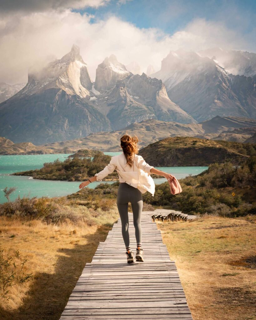
What is the W-Trek?
The mileage and elevation gain of the W-Trek is no joke – almost 50 miles and 9,000 feet of climbing through Torres Del Paine National Park. But that walking can be spread out between three and seven days, making it a manageable trip for those new to trekking. We decided to take four days but needed another day of travel to reach the hike’s launch point at Glacier Grey.
The W-Trek is normally walked east to west, starting at Refugio Las Torres and ending at Refugio Paine Grande. It runs up three valleys, creating the W shape that gives it its name. Instead of traveling east to west, we actually started on the west and at Glacier Grey.
There were two reasons for this: First, Andrea was actually backpacking the entire “O-Circuit” which, unlike the W-Trek, can only be completed in one direction. Second, we wanted to end our trek at its most famous viewpoint – the Base of the Towers.
The W-Trek in five days
Day one: lago grey.
Torres Del Paine is a huge national park, covering about 700 square miles, and the larger Patagonia region encompasses 400,000 square miles. Not unlike its largest American cousins, just traveling through the park can take some time.
To reach our launch point, we took The Grey III Ferry across Lago Grey, a lake at the base of the Grey Glacier. We stayed at the campground at Glacier Grey but had time for some fun before calling it a night. There are two great options that can both be completed in a few hours.
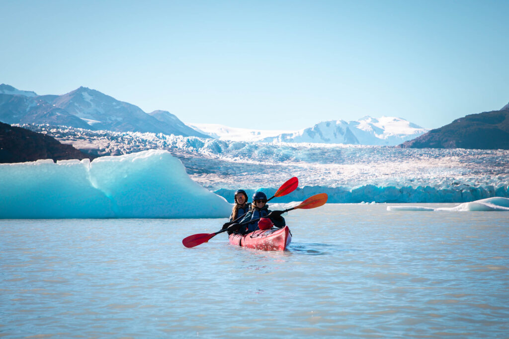
Activity One: Kayak Lago Grey
That first afternoon, after meeting up with Andrea, we kayaked Lago Grey , soaking in views of the glacier cascading into the lagoon, with more ice dotting the surrounding peaks. Talk about a cold lake – it was literally chilled by icebergs that had broken off the glacier!
Our 2.5 hour beginner-friendly expedition service outfitted us with kayaking gear, including a neoprene suit, additional drysuit and booties, and other safety gear. At the time (2022), kayaking Lago Grey cost: $66.000 CLP per person.
Andrea and I shared a double kayak, slowly weaving through icebergs as the sun glinted off the water. It was the sort of unexpected joy that can be hard to capture on a meticulously planned backpacking trip!
Activity Two: Suspension Bridge Hike
A great second option is to hike to a pair of suspension bridges that span the lagoon and glaciers, offering stunning views of the massive, shifting ice. The 2.3 mile hike gains about 950 feet of elevation, making it manageable for the day before embarking on a major trek.
Day 2. Glacial exploration and Paine Grande: 11 km/6.8 miles
It’s hard to comprehend the scope of glaciers in Torres Del Paine. That’s what makes a hike on a glacier so incredible; there’s really no other way to feel so dwarfed by these amazing structures.
Before hitting the trail on our second day, Venture Patagonia arranged for us to go on a five-hour walk across the Grey Glacier. Our guide did a wonderful job of pointing out pools of stunning blue melt water, navigating safely around crevasses, and finding great photo spots. We were outfitted with crampons, an ice axe, and helmets.
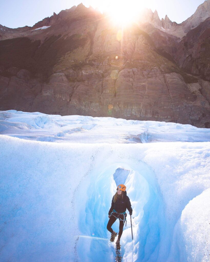
After the glacier walk, it was time to actually begin our path on the W-trek. Our first leg was the easiest, an 11km/6.8 mile walk. We set up our tent at Paine Grande and indulged in some luxuries like wifi, a shower, and a why-is-this-so-good ramen noodle dinner.
Day 3: Paine Grande to Los Cuernos: 25 km/15.8 miles
The realities of trekking set in quickly on day three. Sometimes, you just need to cover some miles. And sometimes, those days are hot – hot enough to make you wonder if hiking an extra section is worth it.
I’ve run into this question in a lot of different conditions. Making the safe choice matters most, but I’m almost always happy when I push forward… and we were thrilled that we pushed on to Mirador Britanico. After all, if you don’t do the French Valley to Mirador Britanico, did you even really hike the “W”?
This series of lookouts covers the middle swoop of the W, where the French Valley slices from Lake Nordenskjold into jagged highlands. We weren’t sure exactly what views would greet us as we hiked through the forested valley.
But the scenery was spectacular. Hanging glaciers lined sweeping rock walls, and sharp peaks gave us a taste of the famous towers to come. It’s amazing to think about how the same glaciers we walked across a few days ago helped to shape these gigantic peaks.
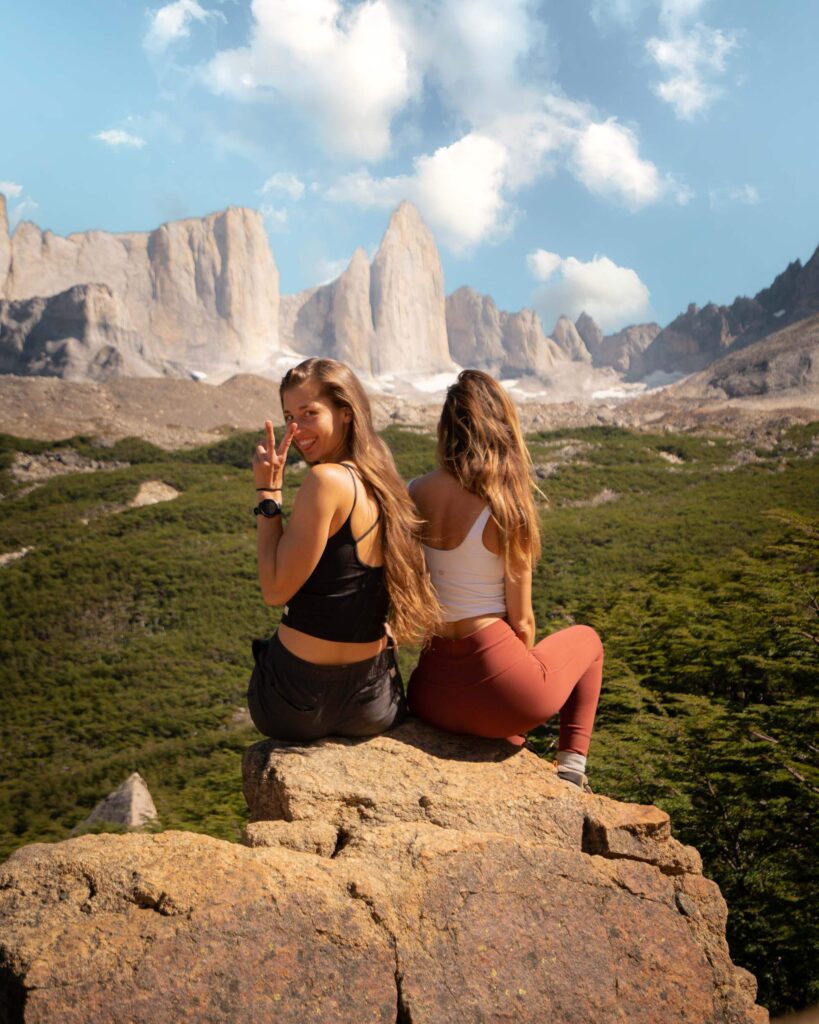
These were the sort of views that end up on Instagram feeds – the greatest hits of a hike. And that’s great! They’re hits for a reason!
But for me, the hot, wooded trek there, the decisions we made along the way, and even the extensive travel to just get to our trailhead all help build into a crescendo that peaks at these kinds of beautiful spots. Without the journey there, they don’t have the same power.
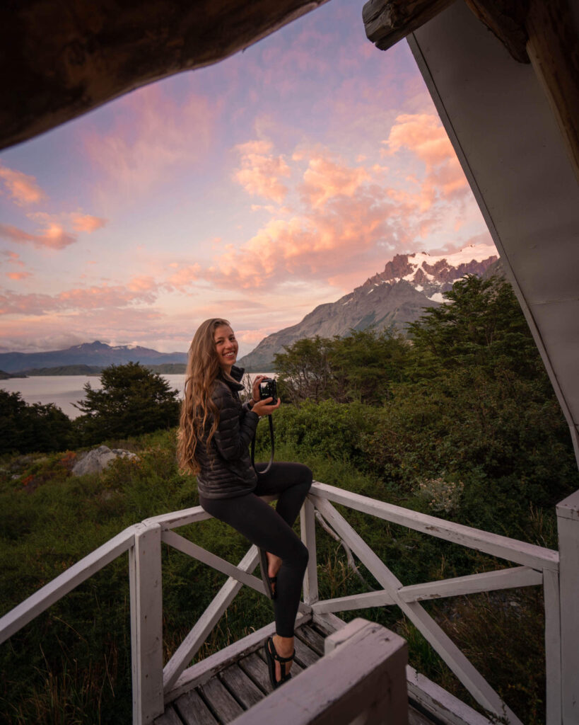
We stayed at Refugio Los Cuernos, which is named after “the horns,” a pair of massive granite peaks in the area. If you’re looking for a shorter day, Frances also has lodging options.
At Refugio Los Cuernos we opted to upgrade to our own private hut. Such a fun luxury! It was at this point that we also started enjoying breakfast and dinners at the refugios.
Day 4: Los Cuernos to Chileno: 12.8 km/8 miles
In some ways, this felt like a wrong way day. We hiked away from some of the most spectacular views at Los Cueros, traveling back along the middle swoop of the W, downhill past the towering granite and hanging glaciers.
At multiple points, Andrea and I mentioned how cool it would be to hike the W-Trek in the opposite direction – into the views. But we were soon back on the right track, continuing on the westward route that would eventually lead us to Los Torres.
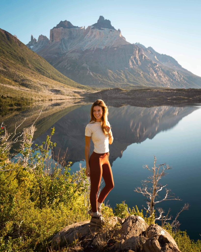
We climbed into the Ascension Valley gaining about 500 feet in a little more than a mile, reaching our camp at Refugio Chileno. Tomorrow would be our big day at the Base of the Towers… or at least we hoped so.
Day 5: Sunrise at Los Torres: 14 km/8.7 miles
This wasn’t a necessary sunrise hike. It’s only about 3 miles from Refugio Chileno to Los Mirador del Torres – The Base of the Towers – and we had enough time for a leisurely morning. Our beautiful weather was also running out.
A ranger at our refugio warned that ripping winds and rain were likely this morning. Those iconic towers would probably be swathed in clouds. But I’d seen too many photos of the stunning alpenglow that stains the towers bright pink at sunrise to give up that easily.
In hindsight, maybe it’s fitting that we decided to go anyway. It was a trip that I joined at the last second, that depended on so many little things going right. We put our faith in this one last thing breaking our way.
There’s no better way to soak in a beautiful view than in the early, changing light, as it shifts from a pale, even haze to a soft glow with hues of orange and pink.
We hiked up about 1,600 feet from Refugio Chileno, taking on the second major climb of the route. When we arrived at the base of the towers, it was still dark. We waited to see if we would get a weather window as the sun rose.
Did. We. Ever.
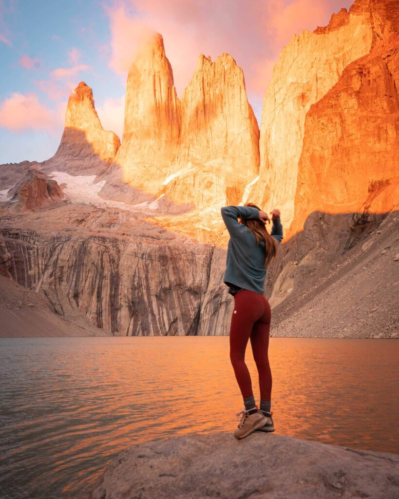
Orange light bathed the towers and washed into the lake below. It was a fitting way to cap a trip that I had already spent so much time thinking about.
Ironically, I botched the camera settings for my own photos. Maybe it was the 4 a.m. wake-up call. Maybe it was cold fingers. I’d like to think that I was just lost in a surreal moment.
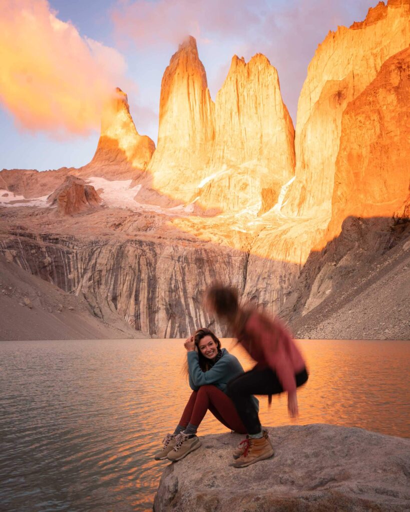
After the light show was over up at The Towers, we headed back down to Refugio Chileno to eat some lunch and pick up all the gear we had left behind for our quick assent that morning. Once we had packed up it was time for the final push. We ended our W-Trek at Hotel Las Torres with celebratory pisco sours.
We spent our final night with a surprise stay at EcoCamp Patagonia , a domed refugio that sits at the western edge of the trail. There’s nothing like a hot shower at the end of a trek, and a picturesque rainbow gave us one last shot of Patagonia beauty.
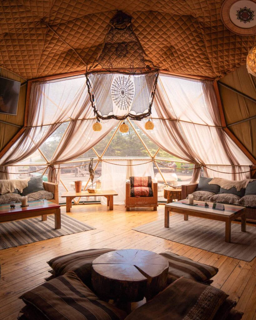
Final Thoughts About My Experience On The W-Trek
The towers are among the most spectacular scenery that I’ve seen. It’s truly a privilege to be able to explore natural beauty far beyond my backyard, with logistics taken care of by Venture Patagonia to ease our path.
It’s also a fundamentally different experience than taking friends to places I’ve long visited in Washington, where I’m the one who can teach them about what we pass by on the trail.
Travel can be a pain (Paine? Too much?). There’s cost, planning, time off work, logistical hurdles, and simply the anxiety of putting yourself in an unfamiliar place.
But it can be so rewarding, and not just for the spectacular views that show up in an Instagram post. I got to spend time with my friend Andrea, an amazing writer and photographer in her own right. I met wonderful people from Venture Patagonia, who graciously shared their wisdom about Torres Del Paine.
And, as it gets increasingly difficult to take time off for outdoor adventures, I got to spend five days on the trail filled with appreciation for natural beauty and personal reflection.
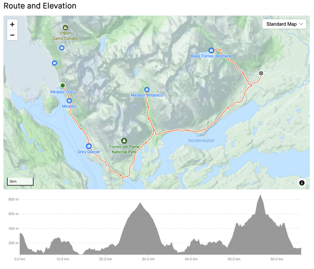
Camping vs. Refugios
It’s important to understand how lodging and backpacking operate in Torres Del Paine. There’s no dispersed camping like in some National Forests in the U.S. You can’t pitch a tent wherever you please.
Instead, camping occurs only at designated campgrounds. These are operated by different companies, have different costs, and are booked through different services.
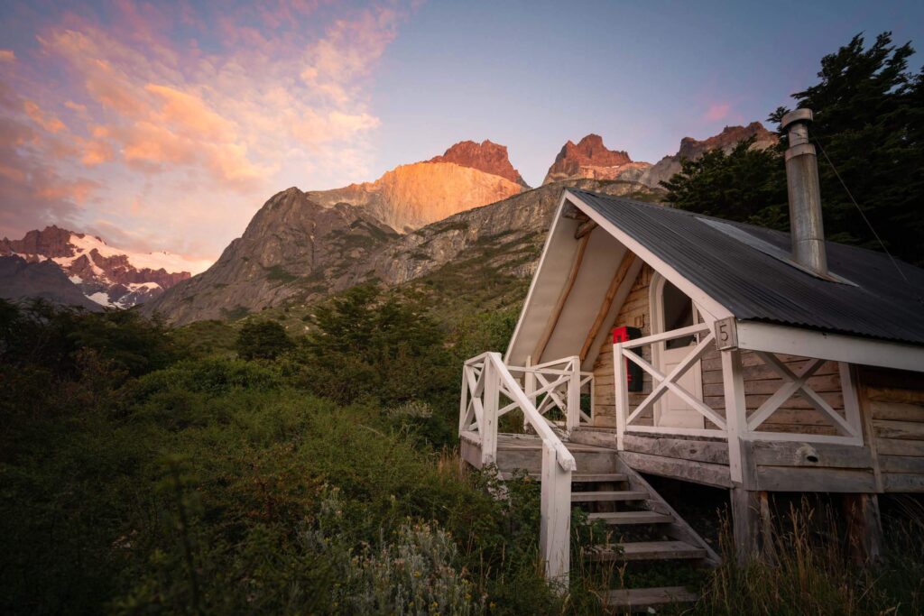
CONCAF (Chile’s version of the NPS) runs the Paso and Italiano campgrounds. Both are currently closed but might reopen for the 23-24 season. When open, they are free to stay at but need to be booked in advance at this Spanish-language website.
Fantastico Sur runs the Chileno, Frances, Los Cuernos, Seron, and Los Torres campgrounds. Each costs $21 USD for two people per night with an extra $11 USD per person. Book here.
Vertice Patagonia runs the Dickson, Los Perros, Glacier Grey, and Paine Grande campgrounds. Each campsite costs $9 USD per person. Book here.
We were lucky enough to get to experience a bit of everything. Our first two nights we camped in a 2-person tent I brought from home. Our third night we had a private hut at Los Cuernos, and our last night was spent in a dorm-style refugio room at Chileno.
There’s one huge advantage of spending every night at a refugio – you can carry way less stuff! There are also luxuries like wifi, showers, soft beds, and the comfort of enclosed sleeping quarters.
The flip side? Refugios are significantly more expensive than campgrounds. They aren’t available at all campgrounds in the park, including Italiano about halfway through the W-trek. Plus, you might end up in a dorm with a noisy sleeper.
Whether staying in a tent or refugios, you’ll share amenities like stores, restaurants, and bars. Some are great; others are a mixed bag. Most stores aren’t well stocked, campground bars can be a little noisy, and lodging whether by tent or refugio can seem a little cozy for those used to backpacking in solitude.
There’s also a middle ground. Many campsites rent tents, sleeping bags, and sleeping pads, helping you save on pack weight but avoid spending on a refugio. You can also bring some gear and rent some.
Does this seem like a lot to navigate? If so, you may want to work with a guide service like Venture Patagonia as we did !
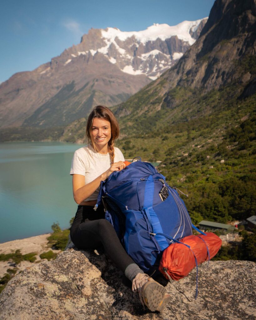
Full Board vs. Self Supported – The Best Way to Eat on the W-trek
The availability of restaurants and stores at campgrounds along the W-trek opens up a variety of possibilities for staying fueled. You can select options ranging from full board, with meals prepared for you to get through the entire day, to self-supported, which is more like a solo backpacking trip where you carry all your food.
Most campgrounds have a restaurant that can provide dinner and breakfast on site, plus lunch to go. They can accommodate vegetarian and gluten-intolerant diets. You can order full board whether you stay in refugios or campsites.
If you prefer to prepare your own food, options are much like backpacking that many of us are used to in the U.S. You carry what you can eat and what you need to cook with. This includes dried meals, snacks like bars and gels, and larger cooked meals if you like a larger spread and can carry a bit more.
Campgrounds also have stores that focus on calorie-heavy staples like pasta, beans, candy, soda, chips, and ramen. They also have hygiene products, and if you like to unwind, beer and wine.
You can also pick and choose from available options. Do you want to eat breakfast and dinner on full-board but prefer your own snacks for lunch? That works. Do you want to prepare your own meals but enjoy an evening beer? That works. At our first campsite, we feasted on ramen noodles. You do you!
The Value of a Guide
A self supported hike along the W-Trek is not only possible, it’s an amazing experience! There are few things as rewarding as a successful solo backpacking trip. BUT given the extensive time and travel cost required to even get to Patagonia, you might consider going on a guided trip. Especially if you don’t have any previous trekking experience.
Reasons to Do a Guided Trek:
You don’t just hike the route, you learn about it. Guides are a wealth of information about the history, plants and animals, and hidden gems along the route. Hiking is so much more than trodding a path; guides help you immerse yourself in a place.
Lodging is a breeze. Guide companies take care of the sleeping arrangements, letting guests relax and enjoy the hike. A guide can also help secure any additional permits and fees you need.
No giant packs! I know I mentioned this already, but it’s a real treat to be able to embark on a multi-day hike without hoisting on a full pack.
Guides support local jobs. Outdoor recreation can be a critical resource for local economies, and services like guiding help local residents steward amazing natural places while providing for their families. Venture Patagonia’s owners Carrie and Kevin, live in Patagonia where Kevin grew up in a 5th-generation ranching family.
Self Supported W-Trek
If you are an experienced backpacker, self-supported can be a great option. The trail is in good shape and easy to follow, especially if you use a mapping application. You frequently see other hikers, who are usually happy to help with questions.
In many ways, the biggest challenge is booking campgrounds and refugios, arranging transportation into Torres Del Paine, and navigating the wider scope of international travel.
Self-Guided – An In-Between option!
You can also select a mix of services – which is what Andrea and I did. We felt confident that we could hike self-supported, but didn’t want to deal with the logistics of booking campgrounds, ordering meals, planning activities along the route, or arranging transportation before and after the trek.
That’s where Venture Patagonia came in! Many services let you customize the level of support you need.
When to Visit Torres Del Paine
Torres Del Paine is best visited during the Southern Hemisphere’s summer months of December-February, though spring (September-November) and fall (March-May) also have their charms.
Winter (June-August) is more challenging and usually requires a guide but can be an amazing experience. Even during the summer months, be prepared for all types of weather!
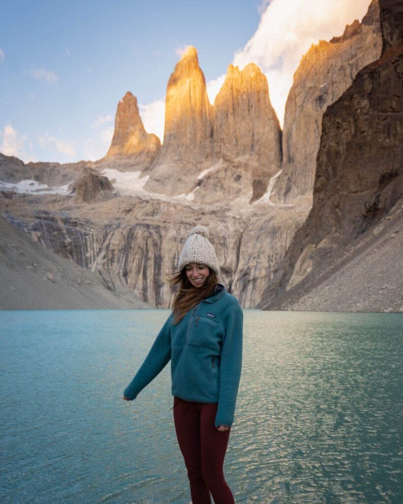
What to Pack for The W-Trek in Torres Del Paine
Packing layers is a crucial aspect of preparing for any trekking trip as it helps you stay comfortable and safe in changing weather conditions. The weather can be unpredictable in Torres del Paine, and temperatures can vary significantly at different elevations and times of day.
Packing appropriate layers for the W-Trek allows you to adjust your clothing to match the changing conditions, keeping you warm, dry, and protected. I have an entire blog post dedicated to the gear you will need for the W-Trek , but here’s a packing list to help you get started:
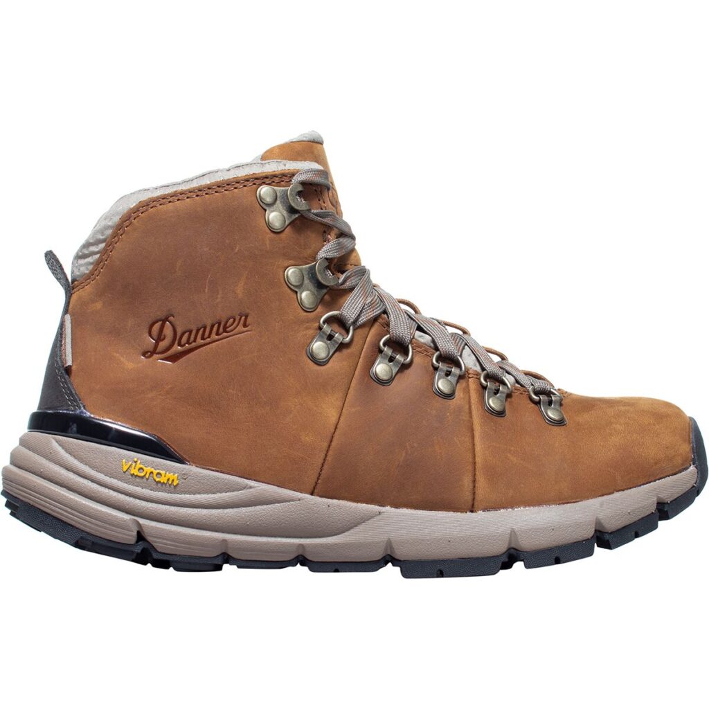
- Hiking boots : Choose sturdy, waterproof hiking boots that provide ankle support.
- Waterproof and breathable rain jacket : The weather in Torres del Paine can be unpredictable, so a waterproof and breathable rain jacket is essential.
- Insulated jacket : Nights can get chilly, so bring a warm, insulated jacket.
- Quick-dry hiking pants : Opt for lightweight and quick-dry hiking pants that are comfortable for long hikes.
- Moisture-wicking base layers : Bring moisture-wicking base layers, including shirts and underwear, to stay dry and comfortable during the trek.
- Hiking socks : Pack several pairs of moisture-wicking hiking socks to keep your feet dry and prevent blisters.
- Sun hat : A wide-brimmed sun hat will protect you from the sun during the trek.
- Gloves and beanie : Bring gloves and a beanie for warmth, especially if you plan to hike during the colder months.
Camping gear (For Self Supported Trips):
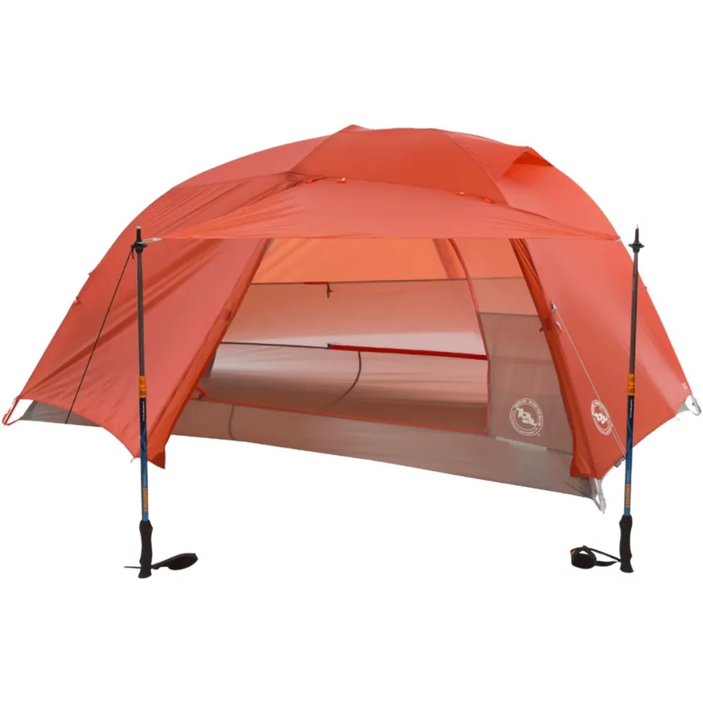
- Tent : If you plan to camp along the trail, bring a lightweight and waterproof tent.
- Sleeping bag : Choose a sleeping bag suitable for the weather conditions, preferably rated for cold temperatures.
- Sleeping pad : A sleeping pad provides insulation and comfort while camping.
- Cooking equipment : If you plan to cook your meals, bring a lightweight camping stove, cooking utensils, and a fuel canister (wait until you get to Patagonia to purchase).
Food and water:
- High-energy snacks : Bring lightweight, high-energy snacks like nuts, trail mix, and energy bars to keep you fueled during the hike.
- Water bottles or hydration bladder : Carry enough water bottles or a hydration bladder to stay hydrated along the trail, as water sources may be limited.
Other essentials:
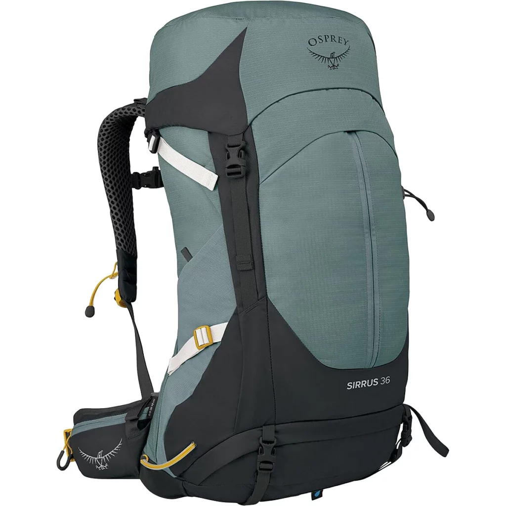
- Backpack : A sturdy and comfortable backpack with a hip belt is necessary to carry all your gear during the trek.
- Trekking poles (optional): Trekking poles provide stability and reduce strain on your knees during steep ascents and descents.
- Headlamp : A headlamp is essential for navigating in the dark, especially if you plan to camp.
- Sunscreen and sunglasses : Protect your skin and eyes from the sun’s harsh rays with sunscreen and sunglasses.
- Insect repellent : Torres del Paine has mosquitoes and other insects, so bring insect repellent to protect yourself.
- First aid kit : Carry a basic first aid kit with essentials like bandages, blister pads, and any necessary medications.
Remember to check the weather forecast and trail conditions before your trip, and pack accordingly. It’s also advisable to pack light and only bring what you absolutely need to keep your backpack manageable during the trek. Happy hiking!
Just a quick heads up! Some of the links on this blog may be affiliate links, which means that if you click on them and make a purchase, I may earn a commission. Don’t worry, though – it won’t cost you anything extra, and it’s a way for me to keep this blog up and running. Thanks for your support!
Leave No Trace
Don’t be that tourist! It can be tough to remember that areas of Patagonia are a fragile wilderness when your campground has a bar. But continue to keep a clean camp and embrace zero-impact principles when on the trail and in the backcountry to ensure that future generations have the chance to enjoy this amazing place!
Other Treks You Might Enjoy
Complete Packing List For The W-Trek In Patagonia
Tips For Hiking The Tour Du Mont Blanc
Complete Guide To Backpacking The Mineral King Loop
Thru-Hike The Enchantments In One Day
4-Day Ausangate & Rainbow Mountain Trek
Like this post? Pin it for later and share it with others!
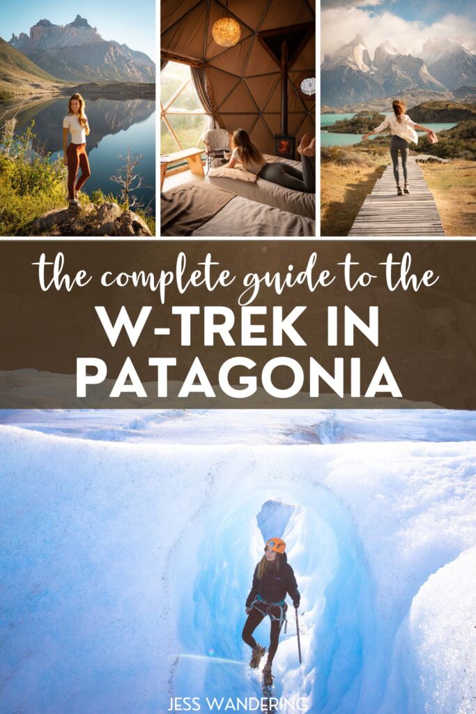
Complete Packing List For The W-Trek In Torres Del Paine »
« a complete guide to the baunei coast: sardinia’s east coast paradise.

keep reading
Leave a reply cancel reply.
Your email address will not be published. Required fields are marked *
Save my name, email, and website in this browser for the next time I comment.
WoW! Always inspiring and so hard to choose which views are my favorite when all are fantastic. I love living my life vicariously through your treks!
Thanks so much for the kind feedback John! the W-Trek was definitely one of my favorite adventures. Thanks for taking the time to stop by the blog and leave a comment – always very appreciated.
Amazing W-trik. I go through your blog post and it’s Wounderfull and very attractive. For a short time I feel like I was with you on your five day trip. Enjoy your day
Hi Jess, thanks a lot for the very detailed itinerary. Wondering what did you do on the final day after the trek before returning to Puerto Natales ? Did you have some private transportation to get you back while stopping at view points along the way ?
Yes! That’s exactly what we did. After the trek we spent the night at EcoCamp Patagonia, then the next day Venture Patagonia picked us up and drove us on a scenic tour through the park back to Puerto Natales.
Reader Favs

Travel Writing
The stories behind your favorite instagram posts of 2020.
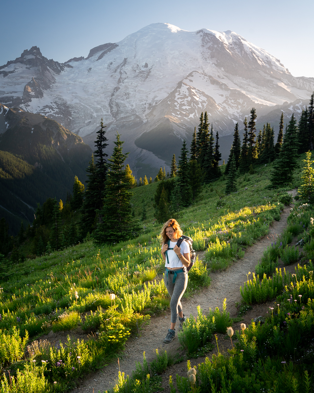
10 Best Hikes in Washington (A Local’s Must Do Washington Hikes)
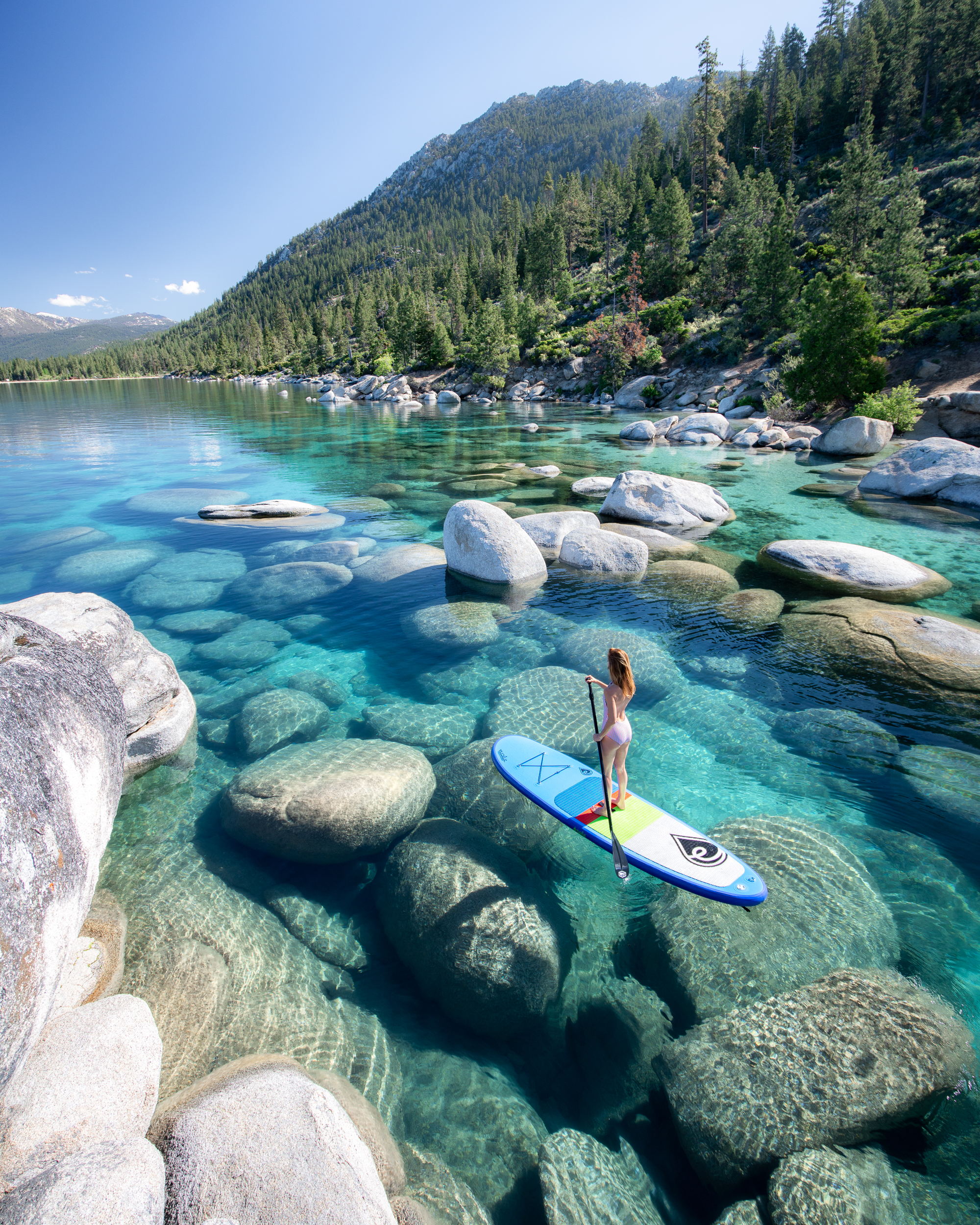
72 Perfect Hours In Lake Tahoe: Best Things to Do
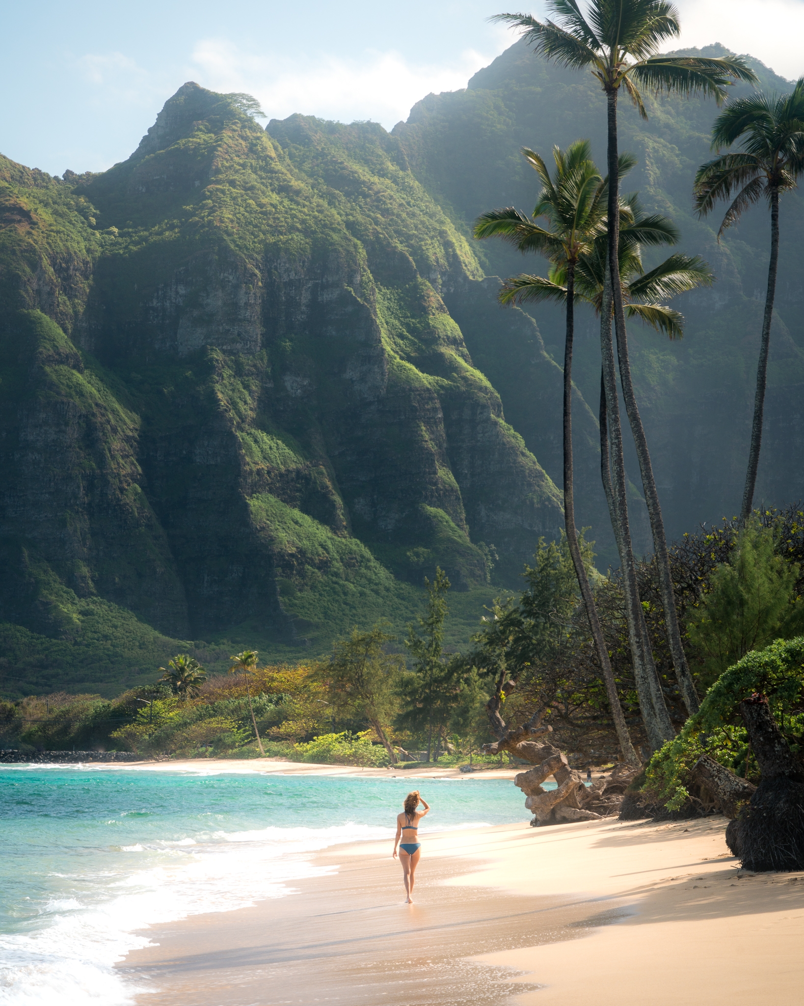
How I Afford To Travel All The Time

Hi, I’m Jess, an outdoor enthusiast based in Seattle. I grew up exploring the Pacific Northwest, and early on was infected with the travel bug. I tried to suppress my wanderlust in pursuit of a traditional career path, but after a short stint as a lawyer, I left the confines of my office to get back in touch with my roots. Now, I wander the world taking photos, making memories, and sharing my love for travel with others!
Meet the Writer

Before you go, make sure to subscribe so that you don’t miss out on new blog posts, upcoming events, and other fun travel resources!
Wander with Me
@jess.wandering
Back to Top
Design by Oregon Lane
Privacy Policy
©2021 Jess Wandering
Terms and Conditions

24 Things to Know Before You Trek in Patagonia
07/13/2021 by Kristin Addis 66 Comments
For a few years running now, I’ve explored Patagonia slowly, switching between Chile and Argentina and making hiking my main activity.
It was mind-blowing. I’ve never seen so many glaciers, waterfalls, and rainbows all in one place. It’s rugged and tough landscape that tested my limits but was so easy to fall in love with at the same time.
I did several treks, some were just one day and others spanned several days or even more than a week. With the right gear and knowledge, Patagonia can be enjoyable despite the elements and without many mishaps.
Here’s what I learned about trekking and camping in Patagonia:
Table of Contents
How to Prepare for Trekking in Patagonia
1. you seriously do need hiking boots.
I’ve trekked in Nepal , China , and all over the States in running shoes and thought they were great. The biggest difference is in Patagonia the trail is often super muddy, very rocky, or totally wet. Sometimes there isn’t really even a trail and you have to go by GPS.
There were SO many times when I was really glad to have waterproof shoes that I could just trek through the mud with and not care. They were one of the most important things to bring along. Here are the ones I recommend .

2. … and thick socks
The easiest way to avoid blisters is to reduce friction. That meant wearing thick socks and tying my boots very snugly when I trekked. When I did develop blisters, it really helped to keep my shoes tight and my socks thick to keep them from getting bigger or worse, tearing.
3. Bring Compeed
Compeed is so much better than Band Aids! These blister bandages are the best I’ve found, and they stay on for several days as well. You can get them at your local pharmacy, or a similar product at REI . Bring them with you as they may not be possible to replace everywhere in Patagonia (I actually never found them when I looked for them there).
4. Bring the right clothing with you
You can experience all kinds of different weather within the span of a few hours in Patagonia. I trekked through tons of rain, very heavy winds, and even snow over the two months that I was there. It can feel quite extreme at first, but in time you do get used to it and it even becomes part of the enjoyment of Patagonia.
However, it’s only fun if you have warm, waterproof clothing. Here’s my packing list for Patagonia to help !

5. Get a tent suited for Patagonian weather
A normal tent isn’t going to be a good choice in Patagonia, where winds can reach upwards of 100km/hour. That is some serious wind and the shape of the tent, plus strength of the tent poles, both matter a lot so that nothing breaks while you’re midway through a trek.
I used an MSR tent that was resilient and super light to carry at the same time. The shape is designed for wind and the rain jacket kept us dry, except for one occasion when the rain was so heavy that everyone woke up wet (it does happen).

6. For the love of God, do NOT buy your camping gear in Argentina
In the past I’ve bought a bunch of my camping equipment in the local country before the trek. It saved me a lot of money and the trouble of carrying the equipment around. This is not true at all in Argentina. Seriously do not buy any of your gear there!
I saw a North Face bag on sale for $300 that would have been $50 back home. Absolutely everything was overpriced in every single store I checked. This is likely even more exuberant now that the country’s economy has plummeted. Just bring it from home, seriously.

7. But honestly, Chile isn’t that much better
There were a few things that I had to buy in Chile, like my sleeping bag and hiking poles. The price was closer to what I would pay back home, but I think I could have saved more by ordering stuff on REI and just bringing it with me.
8. Get lightweight cooking gear
Trekking with pots and pans is not a possibility for me. It’s just way too much weight and when you have to carry a week’s worth of food on your back, it’s already heavy so why make it worse?
I found this foldable pot that doubles as a pasta strainer and thought it was great. It’s super light and the quality is good. I used it for cooking everything I ate.
9. Hiking sticks are here to help you
Some people think hiking poles make them look dorky. I don’t care. I like the idea of protecting my knees and redistributing the weight. Plus, hiking poles saved me from face-planting into rocks more than once when wind gusts caught me by surprise.
It’s also good to have poles that aren’t super heavy, and as they get lighter, the cost usually goes up. Here’s a post to help you pick which trekking poles are best.

10. Avoid those dumb sporks
When you’re looking at stuff to buy for your trek, you’ll see these half-fork, half-spoon with a knife at the end of one of the fork blades. It looks like a great idea. You can slice your food then pick it up with the fork to eat it!
False – it’s really hard not to cut your face on the knife part. Why was it designed that way, and how did I fall for it?
11. Life will be so much better with powder, not cans
It’s hard to resist easy things like canned tuna (btw, not for me, ew) and sauces. You have to pack those cans up and back out, though. That’s a lot of extra weight for not much gain.
My milk was powdered, as was all of the sauce and soup that I used for cooking. Some people even bring entire meals made out of powder that you just add water to. When water is as easy to get as it is in Patagonia, why not get things that are light until you add water?

12. Rain-proof your stuff
Rain covers tend to blow off or just be incredibly annoying when the wind catches them, making tons of noise right in your ear.
I didn’t bring a rain cover. I lined my bag with a bin liner and put my clothes, food, and electronics all in their own plastic bags as well. The backpack could get wet – no problem, and the stuff inside stayed dry.
13. Get a hat that won’t blow away easily
Go for a hat that keeps your head warm, your face covered from the sun, and your ears warm in the wind. This hat ticks all the boxes.
I kind of felt like a dweeb wearing it but then again, my face was protected and my ears were covered. Two birds, one stone, really.

14. It’s pretty nice to have a lightweight, warm sleeping bag
It gets seriously cold when you’re sleeping next to a glacier. I got snowed on as well in Torres del Paine, so having a warm sleeping bag that was also super lightweight was a life-saver. This is a non-negotiable item, along with a good tent, in order to enjoy the camping part of trekking in Patagonia. You’ll want it to be at least comfort level of 0-degrees Celsius .
15. It’s worth it to get a thick sleeping mat
I spent around $20 on a mat that was lightweight but also pretty useless on bad ground. I encountered a lot of roots and rock and think things would have been a lot better if I’d brought a thicker mattress. They do weigh more but only slightly and that’s something I would probably have been willing to carry.
I would probably use something like this in the future.
16. Most water on the trails is clean, but when it’s not, sterilize it with this
Most of the water is glacier water in Patagonia and it’s some of the cleanest on earth. However, especially in Torres del Paine, some campgrounds have had trouble with the increase in tourism and due to some campers doing things like washing in the streams or worse, some of the water has been making people sick.
I bring a steripen along on long treks. I never want to worry about the water or be without it, so I just sterilize it with a Steripen .
PLEASE: It’s up to everyone who hikes in Patagonia to work together to keep the water safe. Too often I saw idiots jumping into the glacial lakes, swimming in streams, or washing their bowls directly in the water. This water trickles down and effectively makes campers drink your bathing or dirty dish water. That’s not cool. Take water into a clean bowl and walk at least 100 paces away before washing, same goes for using the bush toilet. Please think twice before getting that swimming selfie – it’s incredibly selfish.
17. You can eat the Calafate berries
They have thorns and are not to be confused with the little red berries also growing on the ground, but Calfate berries, as long as you know what they look like , are nice snacks to have along the trails, especially on the Huemul Circuit .

18. Here’s a useful camping food list:
Powder, carbs, nuts, oatmeal, chocolate, and fruits. Those are always in my trekking pack because they weigh the least and give me the most energy.
A day’s packing list:
- one portion oatmeal with milk powder and chocolate powder to taste
- 100 grams of dried fruit and dried nuts
- 1 small chocolate bar
- one portion pasta and powdered sauce plus slices of salami and/or cheese for dinner
For lunch, I pretty much always ate nuts and dried fruit. That way I could just keep going without having to stop. Dinners always had a treat in them of salami or a cheesy sauce (yes, a rare moment when I was willing to eat cheese) just to keep it nice and interesting. I also experimented with cous cous and powdered potatoes and think they’re both great options for hot dinners as well.

Since I was going to Patagonia with my friend Steve who has been there before and already knew that powder was the way to go, I was able to lighten my food load significantly by not bringing cans or liquid sauces. I’m so glad that we didn’t make the mistake of bringing all that weight!
Also, Steve has a pretty helpful guide specifically for Torres del Paine hiking here , with park entrance prices and campground info, that I’d suggest in conjunction with this post!
19. You’ll need this kind of cooking grill
It’s forbidden to have open fire in just about every national park in Patagonia, at least that I’m aware of.
A little camping stove that you attach to gas cans, available in the sporting goods stores in Patagonia, is best for trekking.
20. Bring a headlamp!
Because using your phone as a flashlight is going to get annoying really quickly. I like this waterproof one .

21. …and a portable charger
So that you can recharge your phone and cameras. This is the one that I use. (click here for more info on my camera gear ).
22. Don’t forget mosquito repellant
Yep, they do exist sometimes in Patagonia.
23. …and sunscreen!
Make sure to always lather up when trekking in Patagonia, or anywhere for that matter. A sunburn when trekking is the worst! I like Sun Bum best.

24. Get ready for the best trip ever
Patagonia is seriously awesome to trek through. The landscape keeps getting more and more dramatic as you go through, providing constant surprises and little challenges. It’s one of the most rugged and lovely places I’ve traveled through, and if you’re planning to do the same, get ready for one of the best trips, ever, period.
About Kristin Addis
Kristin Addis is the founder and CEO of Be My Travel Muse, a resource for female travelers all around the world since 2012. She's traveled solo to over 65 countries and has brought over 150 women on her all-female adventure tours from Botswana to the Alaskan tundra.
Leave a Reply Cancel reply
Your email address will not be published. Required fields are marked *
Save my name, email, and website in this browser for the next time I comment.
subscribe to our newsletter
This site uses Akismet to reduce spam. Learn how your comment data is processed .
07/13/2016 at 6:56 pm
I’ve been waiting for this..great post! I’m heading to Patagonia around Christmas (after I backpack Central America and the rest of South America) so wouldn’t buy a lot of things at home. Hopefully I can find some cheap gear in Peru or somewhere. Awesome tips, thanks again!
Kristin says
07/14/2016 at 1:49 am
And if you can’t in Peru, opt for buying in Chile rather than Argentina. Have fun!
Patricia says
07/15/2016 at 2:41 am
Hi Kristin, thank you so much for your post, it’s gonna be very useful on our trip to Patagonia in January. We are very excited, can’t wait for this!!!!
07/15/2016 at 7:24 am
Yay glad to have been helpful! You’re going to love it
John @ Pretravels says
07/15/2016 at 2:58 am
Great images and fantastic tips! If you’re not used with this type of terrains you might end up with the wrong gear and nothing spoils hike more than this.
07/15/2016 at 5:32 am
This is precious – perfect timing, it will help me in my preparations immensely. Thank you for this post and wonderful photos 🙂
07/16/2016 at 12:00 am
For me Patagonia seems so far away … But who knows, maybe someday! 🙂
Mishelle says
07/16/2016 at 9:38 am
Great post! I have this destination on my bucket list. Hope I go there one time.
Nicole says
08/03/2016 at 4:21 pm
I am so happy that I friend of mine ran across this article!!! I am gearing up for a 5 week trek the middle of Oct. and although I have read literally everything, it’s nice to have a first hand account!!! How easy is it to find the powered foods/dehydrated things in towns? This is hands down my biggest concern! I am an avid hiker and love to do ziplock cooking but I for the life of me can not find any info on actual food purchases while I am there!!! Thank you so much!!!
08/03/2016 at 4:28 pm
You won’t easily find those whole dehydrated meals that some people bring. I don’t find that they taste all that great and I prefer just having real food like pasta with a powdered sauce. I had no problems getting powdered milk, dried fruit, powdered chocolate milk (essential), and soups. I went into more detail on my trekking food in this article: https://www.bemytravelmuse.com/torres-del-paine-circuit/
Crystal says
09/30/2016 at 12:55 pm
I’ve heard from a few people that it’s best to rent gear outside of TDP rather than buying at home – honestly not sure I’ll use it again (outside hiking boots). Do you know anyone who has used rented gear – tents, sleeping bag, mats, stove – and if they found it adequate for the conditions?
Marijke says
10/11/2016 at 5:58 am
Hi Kristin, Thanks for the useful post. I’ll be backpacking through South-America from March until June and Patagonia is definitely on my list! What was your itineray in & how did you travelled to Patagonia? thanks! Marijke
10/13/2016 at 11:54 am
This should help: https://www.bemytravelmuse.com/patagonia-itinerary/
You can also check out these two guides with interactive maps. I started in the north and moved south, switching regularly between Chile and Argentina https://www.bemytravelmuse.com/argentina-guide/ and https://www.bemytravelmuse.com/chile-guide/
Georgia Tucker says
11/01/2016 at 9:54 am
Hi, this is really helpful. Roughly how much did you spend? How much were camp sites per night for a 2 man tent roughly?
11/01/2016 at 2:25 pm
Budget anywhere from $5-$20, as it can really vary depending on the campsite’s location and popularity
Genevieve says
01/08/2017 at 10:02 pm
Hi Kristin this is really beautiful!! How did you guys keep up with the good path when Steve say there was no trail? And how did you get the gps on the phone if there is no good SIM card? Thank you! this looks incredible! Genevieve
01/09/2017 at 12:15 pm
We downloaded maps.me for offline maps and plotted the points ahead of time. That’s how we figured out the trail 🙂
kimberly says
01/10/2017 at 6:50 am
hello Kristin, thank you so much for this info.. I see in one pic you are wearing a tank top.. what time of year was this.. I’m going back and forth on clothing for some pieces.. we will be going from santiago , hiking through panes del torres , end of february into early march for 2 weeks. Ive got a couple questions … did you get rocks in your shoes.. did you need small gators, did you wear darn tough socks? and were they to the calve but not over? which boots did you go with, were they gortex? did you need shake and warms, did you bring extra hike shoe what did you wear in the refugio? we won’t be camping some males have a different vision of what to bring.. i need a womens perspective.. what type of sport bra did you feel worked what type of long johns did you wear.. and what did you wear on your feet in the refugio if you stayed in any..
01/10/2017 at 9:08 am
Hey Kimberly – I was there February to late March. I suggest layers (more here about what to pack: https://www.bemytravelmuse.com/womens-patagonia-packing-list/ ) – No but I had boots on that were well-sealed and waterproof so that kept them out. They’re made for trekking in those conditions – Sorry, what are small gators? ¯\_(ツ)_/¯ – Yes wear thick socks and mine were mid-calf – Boots are linked in the packing list – It’s not cold enough to need hand warmers – No just brought one pair – You can wear what you wear hiking in the refugio. It’ll be cold! – you can bring flip flops for the refugio and wear them with socks. Give your feet a break from the hiking boots. Sports bra-wise just wear what you’d wear to the gym!
04/25/2018 at 6:57 am
Gators are actually gaiters and are best described as: “Adjustable elastic band for convenient and firm bundling, front opening Velcro design for easier putting on and taking off, firm hook fasten to shoelace and durable strap to keep the gaiters from coming loose FUNCTION: To protect your boots and trousers from rain, water and mud. Pair there gaiters with hiking boots or ski boots to keep rocks, dirt and snow from getting into your footwear OCCASION :This gaiters good for skiing, backpacking, hiking, camping, fishing, and other outdoor adventures” So essentially when wearing boots these are fabric covers that further protect any water, dirt or snow to get into your boots. They look a little like shin protection when you play hockey or other similar sports.
Aria Srinivasan says
01/15/2017 at 1:10 pm
I’m only going for a week to Patagonia.. would you still recommend the hiking boots?
01/15/2017 at 4:15 pm
If you want to hike, they’d be incredibly helpful. It’s super rocky and often wet terrain.
Taylor says
02/07/2017 at 7:38 am
Where can I find your “dorky” hat; I’ve been searching everywhere! It seems so practical!
02/08/2017 at 11:03 pm
I can’t find it either! I bought it in a rural area of China years ago.
Connie says
02/13/2017 at 5:17 am
Hi! Sorry to ask something trip-specific, but I’m having trouble finding this anywhere. I’m going to do the W trek next week and was originally planning on checking my backpack with the tent.
But I’m paranoid about it getting lost with 3 transfers, so I figure if I bring everything except the stakes, I can take everything as a carry-on. But are there places to purchase decent stakes in Puerto Natales upon arrival? I see there are a lot of places to rent equipment, but I wasn’t sure if I would be able to only purchase stakes.
Thanks in advance!
02/13/2017 at 7:22 am
Hey Connie, to be honest I have no idea. I’d email erratic rock and ask what they suggest!
03/07/2017 at 2:38 am
Hiya, we booked our tickets to arrive in Chile in January, thinking this would give us plenty of time to book campsites for Torres Del Paine but they all seem to be booked up already?! A year ahead? Does this mean we can’t visit the park..? Any advice so welcome, this is quite shocking… 🙁
Joanna says
04/04/2017 at 4:37 pm
I love your blog!! I was wondering about the photos you take..how do you take the photos of yourself since you’re a solo traveler?
04/05/2017 at 12:22 am
Selfies! I’ve written about how here: https://www.bemytravelmuse.com/how-to-take-travel-selfies/
vikram says
04/05/2017 at 4:14 am
rofl at the comment on snickers ! but these are pretty awesome tips. How much Spanish would i need to know though ? also i love climbing, so any recommendations on decent bouldering not too far off the hiking trails ? any pointers would be like manna from the heavens .. all the best for your future adventures
04/05/2017 at 4:52 am
My Spanish is no bueno. I only know what I picked up growing up in California, which is restaurant Spanish. It would really help to know some as you won’t encounter a lot of locals in Patagonia who speak English, but I survived.
I did some bouldering in Bariloche in the north of Patagonia: https://www.bemytravelmuse.com/things-to-do-in-bariloche/
Jyotsna says
08/20/2017 at 9:58 pm
Amazing post! The hat you mentioned which serves as a beanie as well as a sun protector looks great, where did you get that from? Searched all over but could not find it.
08/21/2017 at 12:52 am
China like soooo long ago but putting a beanie over a baseball cap works similarly well
Teresa says
09/07/2017 at 10:34 am
I’ve just started planning a trip to Patagonia for around a month, what are your thoughts on doing a month long trekking trip solo as a female? Some say go for it and some say its a big no no. I’m aware common sense goes a long way if you’re travelling solo but is it something you’d recommend on a trekking tip in Patagonia? Love the blog by the way – so much seriously helpful info!
09/07/2017 at 2:08 pm
I think you’ll meet lots of people. You’ll meet people in town who will want to go with you, you’ll meet people on the trail, and you’ll meet locals too. I love solo traveling so that’s my feelings towards it!
09/19/2017 at 4:30 pm
Looks so exciting! I am planning a trip for March 2018. I love your “dorky hat,” the white one that is a headband with a visor. What brand is it? I want one!!!!
09/20/2017 at 3:53 am
So many people have asked and I wish I could find one online! I bought it in a tiny town in China. However now I put a thin neckwarmer over my rainbow had and it works similarly well 🙂
09/28/2017 at 6:13 pm
Thank you so much for posting! I’m hoping to plan my trip to Patagonia for a departure in the next 6 months – I’m very active and an avid hiker, but will be likely going solo. Do you have a guide you’d recommend? Thank you,
09/29/2017 at 5:19 am
I didn’t use any guides, but for most of these hikes you can find people to hike with in town, or even along the trail.
P. Sanchez says
11/07/2017 at 5:19 am
I recently came across your article on trekking in Patagonia. I enjoyed reading your guide and found it quite helpful, up to where you condemned people and called them idiots for wanting to swim in the lakes/rivers. Discarding dirty/soapy water into a river is one thing (I’m a marine biologist/coastal ecologist so I understand and respect nature), but jumping in for a swim? No, I would not jump into a 2 metre wide stream for a swim at a campsite where people will be collecting water further down, but no amount of dirty stares and silent (or even verbal) judgement will stop me from having a swim in a lake/larger river. Maybe you should consider editing that part out of your guide. It’s definitely on my mind to take a swim there, and the only thing that would stop me is if CONAF or a carabinero told me its forbidden to do so (haven’t found anything of the sort). If someone is a germophobe, then that’s on them to decide if they want to drink the water with or without disinfecting it, but don’t ruin other peoples experience just because you don’t agree with their idea of fun.
There’s a saying that goes “dilution is the solution to pollution”, and I can guarantee you dirtier things have been in your mouth (with or without you being aware of it) than a mouthful of water collected from a lake where someone has bathed in.
11/07/2017 at 6:13 am
Thanks for weighing in. The water in Patagonia is the cleanest on earth. That glacial water is 10k years old and when you jump in right at the source, it makes everyone also at that lake need to drink that water too. I just didn’t think it was cool to wash off 8-days of sweat into water people are drinking. It was also freezing cold and a hypothermia risk, so I wasn’t tempted.
If everyone takes the attitude that it’s going to get diluted, then nobody can drink the water without filtering it first. It already happened in Torres del Paine at one of the more popular trails, and it’s the water coming right down very close to the source. Sad.
It’s just about respecting what we have so that everyone can enjoy it. When we all take the attitude of one little thing that I do will not affect the rest, or it’ll just get diluted, it adds up, and this is why we can’t have nice things.
It’s important to let people know, who may not have realized, the importance of treating the water as sacred and clean. This post has potentially informed people who might not have known what is OK and what isn’t when camping. My writing addresses keeping all of the water clean and respecting it everywhere without splitting hairs about where is OK and where isn’t, and also it’s my site, so I’ll write what I want 🙂
04/25/2018 at 7:12 am
“Dilution is a solution to pollution” is an illusion, this is a mistaken notion on all counts, please don’t use that :). A drinkable water body can be tainted by pollution hundreds of miles away. If it is a pristine area, the only considerate thing to do is leave it that way. There are SO many places in the world where you can dive in and have a blast, under waterfalls, in deep blue pools etc. There are SO few places that are pristine. As a scientist who works in the environmental field, I think it is awesome that Kristin provides these guides that challenge yourself when traveling while using common sense, preparation, and consideration of the places you visit. Preparation is the key. You never know what you might encounter so at least be prepared for the expected so you have that down to concentrate on anything else and enjoy yourself to the fullest. Being a good guest in the countries your visit is paramount in so many ways. I think it is great that Kristin mentions safety including sunscreen, repellent (if there’s water, there’s mosquitoes), proper footwear/gear and so on. I trust her more than most and when traveling will bring these guides with me to make sure I enjoy myself, am safe, and respect the places I go. Before her I wouldn’t visit many places in the world out of fear of exploiting them. She taught me you can enjoy the world and if you visit a place, you give back (to the locals) as much as you take. Thanks BTW for this post, it is very thorough with great advice and every link works even 2 years later.
11/08/2017 at 11:24 pm
Ok a few things I agree with. I personally wouldn’t wash my 8-days clothes directly in the water, but I wouldn’t lose my shit if I saw someone else doing it (unless they were adding products to it). As for 10k year old water and hypothermia… I think we’re picturing different lakes. The water at Torres del Paine doesn’t seem like it has good drainage (at least in front of Los Cuernos) so I can see how contaminants might build up there with bad flow (especially with the increasing number of visitors). As for the hyporthermia, so long as you have dry clothes to warm you up once you get out (and it isn’t too windy) it isn’t really that dangerous. Just don’t stay in too long…
Sure, the mentality of “it’s only me, it wont make a difference” is usually wrong and common among people that justify littering, since it adds up, but in the scenario I’m picturing, the lakes/rivers will have good water flow and and oil/skin/fecal matter that comes off your body will just wash away and be broken down. Lotion, insect repellant etc. wont, so yes, one should rinse before jumping in. We CAN have nice things if we are smart about it. It isn’t necessarily about splitting hairs, but being informed and unbiased. Let people know that if they absolutely must jump in, to take these precautions (rinse before as you would before jumping into a swimming pool, do not stay in too long, do not jump in if the stream is small and people nearby e.g. at camping grounds use it for drinking water). That being said, I appreciate tourists respecting the land, and it goes without saying; if I see a sign saying “no swimming” I will listen to it. Especially if it is by CONAF.
11/09/2017 at 2:10 am
Where are you supposed to rinse off the lotion and insect repellant? There aren’t showers nearby, or signs, or a bunch of rangers. Except for the really popular hikes, these are not like the national parks in North America. This is usually raw, unadulterated nature 🙂
I think once you get there you might understand where I’m coming from. I’m done arguing about this now 🙂
11/29/2017 at 5:22 pm
You just got me super excited planning my trip to Patagonia! So many useful info on here!!!
Thanks for sharing!
Melissa says
12/05/2017 at 8:19 pm
Hey Kristin! Thanks for the tips. I was curious if I need hiking pants for the trip (hiking the W in December) but saw that you wore tights which I prefer. How thick should they be – any suggestions where I could get some hard wearing ones? Thanks!
12/06/2017 at 12:57 am
I like LuLulemon. I always wear leggings when I hike. I just like them better! If you’re cold wear two – just make sure they’re roomy or you’ll constantly have to be pulling them up. I’ve had that happen before, it’s annoying!
Jennifer Duke says
12/07/2017 at 11:22 am
Thanks for the tips. I’m going on a Patagonia tour and there are some hikes planned. I sincerely thought my regular tennis shoes would cut it. Glad I read this first. Also, even though I’m not camping, I might pack some of those suggested food items to keep with me so I don’t separate from my group. Great article!
12/07/2017 at 2:09 pm
I would get boots! And yes snacks are always good to have along 🙂
01/05/2018 at 4:53 am
Thanks for this great post! What would you recommend for a coat/jacket and gloves? Going in March to the Chile side for a few days, but not camping.
01/05/2018 at 8:11 pm
I’ve got a packing list here, should help 🙂 https://www.bemytravelmuse.com/womens-patagonia-packing-list/
Sabrina says
06/02/2018 at 12:57 am
Where did you get that hat? Seems warm and functional and at the same time looks nice!
06/02/2018 at 1:46 am
China in a tiny little town. I have tried in vain to find it online since you’re about the 40th person to ask on here but haven’t been successful 🙁
Brianna says
08/14/2018 at 2:51 pm
Band-Aid Hydro Seal Blister are amazing!!! They don’t sell Compeed in the US anymore 🙁
08/16/2018 at 9:24 pm
Bummer! Not even on amazon?
Rob Pinckard says
03/11/2019 at 8:48 am
Great article. I’ve found that your comment about boots is spot-on; heavy packs need heavy boots. Running shoes or even mocassins are incredibly comfortable at camp, at the end of the day, and on a long trip, I’ll make room for them in my pack. But on an extended back country route of rocks and mud, water and ice? High quality, well designed boots are like a sports car in an urban environment. I’m older school than you, but wouldn’t backpack without moleskin for blisters…especially if the boots you’re wearing have less than several trips of wear on them. Carry a small pair of scissors to custom fit the bandage to the site, and the moleskin will remain in place for several days. I’ve found nothing, over the years, that works nearly as well.
03/13/2019 at 11:48 am
I love compeed personally but my goal Is just not to get blisters!
08/21/2018 at 3:43 am
Hi Kristen.
Great post, super helpful!
I’m in the start of planning my trip for the O. Firstly booking the campsites but do I need to pre book a permit to gain entry to the park? So if I was starting say on the 10th and finishing on the 18th would I pre book this permit for this amount of time? Just a little concerned with fitting the camp sites within selected dates and then wondering if I need the permit to cover the trip?
08/21/2018 at 9:43 pm
You will need a permit for the park but I think you can apply for that in person.
Pauline says
01/09/2019 at 4:51 pm
Hi Kristin! I’m very grateful for your guide as I’ve never done any multi day hike, especially not in the kind of harsh weather that can be encountered in Patagonia! With what kind of backpack did you travel (especially for the treks at e.g. Torres del Paine)? Is a 50L enough or will I need to upgrade to a bigger one? Thank you in advance! Pauline
01/09/2019 at 5:04 pm
I had a 75L and used every inch of it for the O. You could make a 50 work for more like a 5-day or shorter, though!
02/15/2019 at 5:54 am
Thanks for the nice detailed guide. I have a couple of questions, because I am planing in the beginning of 2020 to travel around the world with just a carry on. Since Patagonia is my 1st stop, is there an outfit that I can rent the camping gear? Also do you book your accommodation in advance? Thanks
02/16/2019 at 2:55 pm
Yes you can rent and for Torres del Paine yes book ahead, the other hikes don’t have campsites in the same sense. I just showed up personally.
02/04/2024 at 6:18 pm
Thanks for the article. I’m 60 and will be hiking with my 29 year old son in 9 months (Nov 2024). I’m in good health and have reasonable endurance and good balance. He is in exceptional physical condition. How strenuous and challenging is trekking in Patagonia? I’m starting to up my exercise for strength, endurance, and balance but I certainly don’t want to be surprised! Thanks, Mary
Kristin Addis says
02/10/2024 at 3:38 am
really depends on the trail you choose! But it can be steep and weather unpredictable.
12 unmissable hikes in Patagonia: wonder at the pristine wilderness
Nov 16, 2021 • 10 min read

From short walks to multi-day treks, there are many inspiring hikes to choose from in Patagonia © Olga Danylenko / Shutterstock
The name “Patagonia” typically conjures up visions of endless pampas (grasslands) and southern cowboys, but there is so much more to the region than that. Covering a massive chunk of southern Chile and Argentina , this unique 402,734 sq mile region is a patchwork of diverse terrains and microclimates that challenges and surprises hikers of all abilities.
Criss-crossed by glacial rivers and streams, alternately covered in scrubland and ancient woodland, and dotted with myriad ice-melt lakes ranging from pale blue to navy, Patagonia bristles with mountain ranges (particularly on the Chilean side) and glitters with glaciers. Whether you’re looking to rough it on multi-day treks through pristine wilderness, hike from hut to hut in epic national parks , exert yourself on varied day treks before returning to the comfort of your boutique guesthouse, or just stretch your legs beneath the shade of Chile’s and Argentina’s oldest trees while road-tripping along Chile’s Carretera Austral , Patagonia has a great deal to offer.
Trekking in Patagonia and Tierra Del Fuego (included in this list of hikes) is largely confined to the peak and shoulder seasons of November to late March. If hiking off the beaten track, make sure someone knows your proposed route, take a tent sturdy enough to withstand the famous Patagonian wind – La Escoba de Dios (God’s Broom) – and all the supplies you’ll need . During any hike, all-weather gear is a must (since you may experience four seasons in one day!). Accommodations must be booked many weeks in advance for the December to February high season.
Here are 12 of the region's very best hikes.

The "W", Torres del Paine National Park (Chile)
Best overnight hike
46 miles (74km) one way, 3–5 days, moderate
The shorter of the two multi-day treks that Chile’s iconic Torres del Paine National Park is known for, this trail is shaped like the letter "W" (hence the name). You take a boat across Lake Pehoé, hike through woodland along the banks of Lake Grey to the icy monolith of Glacier Grey before retracing your steps. You then pass along the shores of glacial Lake Nordenskjold, and climb steeply up the French Valley for an up-close look at Los Cuernos – the park’s bell-shaped mountain range. A final stint through scrubland, across hills and up the Ascencio river valley brings you to the trident peaks of Las Torres. You can either camp en route at designated campsites, go from refugio (bunk hut) to refugio , or even glamp along the way. Due to Torres del Paine’s immense popularity, all accommodations and camping spots have to be pre-booked months in advance. The "W" is best hiked west to east if you’re camping, so that you’ll have used up most supplies before tackling the steep ascent to the granite towers.
Laguna de Los Tres, Parque Nacional Los Glaciares (Argentina)
Most scenic and most challenging
15.5 miles (25km) round trip, 8–10 hours, moderate
Only accessible on less windy days, this is the most scenic and challenging of all the day hikes around southern Argentina’s compact trekking capital of El Chaltén . The well-marked trail ascends through ñire (small southern beech) woodlands from the north end of El Chaltén’s main street, past the turquoise Laguna Capri, and across boggy terrain to Camapamento Poincenot, popular with climbers. A steep, exposed trail zigzags up the mountain side to the glacial lagoon, where you get excellent bonus views of Cerro Fitz Roy (11171ft/3405m) – the mountain resembling a jagged tooth. Dip your feet in the water and see how quickly they lose all feeling!
Lagunas Altas Trail, Parque Nacional Patagonia (Chile)
Easiest to access
14.2 miles (23km) loop, 8 hours, moderate
The most easily accessible trail in Parque Nacional Patagonia , due to its location near the entrance to the park this invigorating leg-stretcher is stupendously scenic. Climbing a forested ridge from the Westwind Campsite near the visitors center, the trail passes several tiny glacial meltwater lakes as you cross open terrain. You’ll find that your jaw drops open more than once during the hike at the all-encompassing views of the northern Patagonian ice field, Chacabuco Valley and the Jeinimeni Mountains en route.

The "Circuit", Torres del Paine National Park (Chile)
Best long-distance trek
68 miles (110km) loop, 6–10 days, moderate
If you have more time to spare, hike the loop-shaped Circuit, the longest trek in Torres del Paine, trekked in a clockwise direction. Incorporating the "W", this spectacular loop gives you unique views of the backs of Los Cuernos and Las Torres – the park’s two mountain ranges – from remote back country. The terrain is never boring, as you climb partially-forested hills en route from the Serón campsite to the Dickson campsite and refugio , enjoying views of Lake Paine and Lake Dickson along the way, and taking boardwalks across boggy sections. This first half of the hike is where you’re most likely to come face to face with one of the park’s many mountain lions.
From Refugio Dickson, you enter dense southern forest with its thickets of giant wild rhubarb and ferns, with glimpses of waterfalls through the trees. The highest and most challenging part of the trek is the weather-dependent crossing of the John Gardner Pass (4002ft/1220m) between the Los Perros Campsite and Refugio Grey. Once you reach the top, the Glacier Grey icefield opens up below you like a vast, frozen river. As with the "W", you can either camp all the way, or go from refugio to refugio .
Los Alerces Trail, Parque Nacional Pumalín Douglas R. Tompkins (Chile)
Best easy hike
0.5 mile (700m) loop, 30 minutes, easy
Alerce trees are the giants of Patagonia. Growing up to 148ft (45m) in height and living for up to 3000 years, and used for making southern Chile’s unique shingled roof tiles, they were cut down almost to extinction by colonists in the late 19th and early 20th centuries and now have protected status. Off the Carretera Austral, some 7.7 miles (12.5km) south of the Caleta Gonzalo car ferry landing, this wonderful interpretive trail passes through a particularly impressive grove of these millennia-old skyscrapers of the forest.

Laguna Torre, Parque Nacional Los Glaciares (Argentina)
Best hike with icebergs and glaciers
13.6 miles (22km) roundtrip, 6–8 hours, moderate
Another excellent day hike from El Chaltén, this trail takes you from the south of town through the Fitz Roy river valley. Passing a small hydroelectric station, you climb through lenga and ñire woods to reach the Mirador Laguna Torre, with views of glaciers beneath the Adela mountain range, Cerro Torre, Mt Fitz Roy and the granite "needles" popular with rock climbers. Crossing an alluvial plain bisected by the glacial Fitz Roy river, you pass the partially sheltered De Agostini campsite before skirting the iceberg-filled Laguna Torre to reach Mirador Maestri, overlooking the Grande glacier.
Laguna de Los Témpanos, Parque Nacional Queulat (Chile)
Best hike in Parque Nacional Queulat
1.2 miles (2km) return, 1 hour, easy
If you do just one hike in Parque Nacional Queulat , off Chile’s Carretera Austral in northern Patagonia, make it this one. From the main car park, after crossing the hanging bridge high above the raging Ventisquero river, you may have to brave the perpetual rain. Expect to beslapped in the face with moisture-laden ferns as you make your way through dense forest and damp undergrowth along this straightforward trail to a splendid glacial lagoon – but it’s well worth it. From the banks of the lagoon, you get uninterrupted views of the Ventisquero Colgante – a hanging glacier across the lagoon, filled with car-sized chunks of calved ice. The frequently inclement weather, and the park’s remoteness, means you’re likely to have it all to yourself.
Volcan Chaitén Crater Trail, Parque Nacional Pumalín Douglas R. Tompkins (Chile)
Best all-encompassing view
2.7 miles (4.4km) round trip, 3 hours, moderate
In 2008, the eponymous volcano in northern Patagonia staged a surprise eruption and buried half the town of Chaitén under mud and ash. This relatively steep five-hour round-trip trek starts near Puente Los Gigos, off the Carretera Austral, north of the now-rebuilt town. Following the eruption path of the volcano, the trail gets progressively more barren the higher you get. Your reward at the top is the all-encompassing view of the still-smoking crater and the surrounding forest.
Dientes de Navarino Circuit, Navarino Island (Chile)
Best demanding trek
33.2 mile (53.5km) loop, 4–5 days, difficult
On Chile’s southernmost permanently inhabited territory (across the Beagle Channel from Tierra del Fuego), this demanding trail loops around the jagged pinnacles of the Dientes de Navarino mountain range. Requiring camping wild and excellent navigation skills, it’s best done in a clockwise direction with at least one other companion. The trail cuts across bare stony plateaux, skirts glacial lakes, traverses boggy lowlands, and crosses exposed mountain passes, with highlights including expansive views of the Beagle Channel from Cerro Bandera and Paso Virginia (near the beginning and end of the trek, respectively). Watch your footing on the steep, rapid descent from the latter pass.
Lago del Desierto – Chile trail (Argentina/Chile)
Best hike that crosses an international border
12.4 miles (20km) one way, 6–8 hours, moderate
In recent years, this cross-border trail connecting tiny El Chaltén in southern Argentina to Chile’s equally tiny Villa O’Higgins has gained in popularity with adventurous hikers (and cyclists). Best done from Argentina to Chile (as that avoids a relentless uphill slog), it involves taking a boat across the pristine Lago del Desierto, some 23 miles (37km) north of El Chaltén, getting stamped out at the Argentine border post, then trekking through hilly, dense woodland until you reach the sign welcoming you to Chile, where the narrow trail becomes a broad, forest-fringed gravel road. It then winds its way down to Lago O’Higgins, to the tiny border post of Candelario Mancilla. From here, you have to catch another ferry across Lake O’Higgins/San Martin. During high season, when ferries across both lakes are more frequent, you can time the hike so that it’s doable in a day; otherwise you may have to camp at one or both border posts.
Avilés Trail, Parque Nacional Patagonia (Chile)
Best hike for camping wild
29 miles (47km) one way, 3–4 days, difficult
Connecting the eponymous forest lake in the Reserva Nacional Lago Jeinimeni (accessed from Chile Chico) with the Casa Piedra campsite in the scenic Avilés Valley in Parque Nacional Patagonia further south, this is a serious off-the-beaten-track endeavor that requires organizing transfers to and from the trailheads in advance and ample wilderness trekking experience. While the terrain is only moderately demanding, the trail through the valley is rudimentary and minimally marked, there are multiple river crossings and you have to camp wild, bringing all your supplies with you.
Cabo Froward (Chile)
Most remote
45.3 miles (73km) round trip, 4 days, difficult
The goal of this adventurous hike is to reach Cape Froward – the southernmost mainland point on the continent of South America. Starting at the trailhead some 56 miles (90km) south of Punta Arenas , the trail mostly hugs the coast, meandering along wind-battered cliffs, traversing boggy undergrowth, and passing the San Isidro lighthouse. Unless you’re an experienced wayfarer, it’s best to join a guided hike with Erratic Rock from Puerto Natales , as the trek involves fording narrow, deep rivers at low tide and camping wild. The trail isn’t well-marked in places.
You might also like: Chile's best hikes and treks through extraordinary landscapes The best hikes in Argentina: from ice fields to rainforest trails I went on a solo trip to Patagonia (and I loved it)
This article was first published Apr 1, 2014 and updated Nov 16, 2021.
Explore related stories

Jan 8, 2024 • 11 min read
From Andean treks to whale watching off Patagonia, here are the top things to do in Argentina.

Feb 8, 2023 • 4 min read

Feb 7, 2023 • 5 min read

Dec 6, 2022 • 10 min read

Nov 28, 2022 • 6 min read

Oct 5, 2022 • 6 min read

Jul 29, 2022 • 15 min read

Dec 13, 2021 • 11 min read

Dec 3, 2021 • 10 min read

Oct 28, 2021 • 6 min read
- Search Please fill out this field.
- Manage Your Subscription
- Give a Gift Subscription
- Newsletters
- Sweepstakes
- Nature Travel
Everything You Need to Know to Trek Patagonia's Torres del Paine
Considering how beautiful this corner of the world is, planning a backpacking adventure here is worth the effort.
:max_bytes(150000):strip_icc():format(webp)/Cassidy-Randall-2000-be9d24d06d274f75a1bb91d34e256a10.jpg "patagonia trek when")
As I crested the rise of John Gardner Pass, my breath was taken away — and not just from Patagonia's famous fierce wind. Below me lay the miles-long expanse of Grey Glacier spread out like an icy sea. Its big toe trailed icebergs into Grey Lake, its head disappeared up the valley in a wash of light, and a rainbow graced its far side. I was, quite literally, struck with wonder.
It was day three of an eight-day trek on the O Circuit in Torres del Paine , the Chilean national park famous for its iconic skyline. It's also quickly becoming known for its multi-day O Circuit (and the shorter front side of the circuit called the W Trek) as a way for more adventurous tourists to see the park.
The W Trek may get all the glory for being the shorter version of the full circuit and thus easier to plan and access — but with campsites set in storybook-beautiful locations, cozy refugios where you can buy a bottle of wine and a three-course meal, and a double dose of drool-worthy scenery, hiking the full O Circuit is far and away worth the extra effort to plan.
To make your trip planning easy, here's everything you need to know. The biggest tip: Start planning now for a trip from December to March to ensure you get the reservations you want. Alternatively, aim for the quieter shoulder months of November or April, when the weather is still good and the park is relatively empty.
How to Book Camping and Lodging Reservations Online
At first glance, it may be intimidating for the average traveler to plan a trek around the circuit. In response to the increasing popularity of the area, the park now requires advance reservations for all campsites and refugios, the backcountry lodges along the trail, and limits the number of people in each. Two separate companies, Vertice and Las Torres Patagonia , as well as CONAF (the Chilean version of a national park service), run the various campsites, and each has its own booking system.
You can also go through a service like Booking Patagonia or Torres Hike to book campsites. These third-party booking platforms will charge you a small fee to make your reservations for you, but you won't have to navigate three different websites (and deal with translating them from Spanish with assistance from Google).
How to Get There
Fly into Punta Arenas and take a bus to Puerto Natales, the gateway to Torres del Paine. There's a tiny airport in Puerto Natales that's worth the extra cost to fly into if your flights line up. This charming port village has several small hotels to choose from.
Potential Itinerary for an O Circuit Trek
The O Circuit is completed counterclockwise, beginning at the Laguna Amarga entrance on the east side of the park. From Puerto Natales, you can take a bus to Laguna Amarga, and once you've paid your entrance fee, take another bus to the Central sector, where there's a campsite , refugio , and nearby Hotel Las Torres .
Estimates of how long the trail is range from 68 to 85 miles. In any case, it takes the average hiker eight days.
Day 1: Central/Hotel Las Torres to Seron
Distance: About eight miles
While this is probably the least scenic stretch of the circuit, the easy walking is a great way to ease into this multi-day trek, especially if you're getting a later start due to traveling from Puerto Natales. The Seron campsite is surrounded by the rolling hills and wildflower fields that border the Paine River. There's a small restaurant, Wi-Fi, and bathrooms with hot showers.
Book Seron campsites through Las Torres .
Day 2: Seron to Dickson
Distance: About 11 miles
Hike up a small pass where you get the first glimpse of the glacial lakes and impressive peaks Patagonia is known for. Even the back side of the famous towers make an appearance from behind the jagged ridgeline at one point.
Refugio Dickson is one of the smallest refugios on the circuit. It and the campsite are stunningly situated on Dickson Lake, which is bounded by a spired glacier at the far end of the water that lights up pink with the sunrise.
Book Dickson accommodations through Vertice .
Day 3: Dickson to Los Perros
Distance: About seven miles
If it's cold, windy, or rainy, it's a good idea to spend a mellow morning at Dickson before setting out for Los Perros ("The Dogs"). The Perros Glacier is unique and worth spending some time taking in from the lookout around the corner from the moraine if the weather's good. The campsite is well-protected in the trees, with a large cooking shelter and a small store for snacks and beer.
Book Los Perros accommodations through Vertice .
Day 4: Los Perros to Paso and Grey
Distance: About five miles to Paso, plus another four miles to Grey
This section of trail takes hikers over John Gardner Pass, ducking in and out of the trees before leaving the trees behind altogether for the dramatic alpine. Cresting the pass offers the first view of Glacier Grey, one of the most amazing sights on the entire circuit.
The downhill section of this stretch is a leg-burner, descending into the forest to the campsite at Paso. This site is lackluster, but a good option for those who might need to break up a long day. Otherwise, it's worth pushing on to Grey for ridgetop walking with views of icebergs and a series of long swing bridges over gorges. Refugio Grey and the campsite have gorgeous views of the snow-covered ridgeline.
This is the last stop on the back side of the circuit. There's an option to take a boat across Grey Lake to Hotel Lago Grey, near the southern park entrance, making Grey a good starting or stopping point.
Book Paso accommodations through CONAF for Paso and Vertice for Grey.
Day 5: Grey to Paine Grande
This is the start of the W Trek, as well as the first stretch of the circuit accessible to day hikers, so be prepared for a busier trail. Most of the path winds along a ridge above Grey Lake with intermittent views back to the glacier.
Paine Refugio is the biggest on the circuit, boasting a full cafeteria, bar, and warming rooms with wood-fired stoves. Its picture windows look out at the massif of the Cuernos (Horns) del Paine, making it the perfect place to post up for a well-deserved hot drink. The campsite is a vast grassy field with the same killer view. There's also a boat option here across Pehoe Lake to exit the circuit, or for hikers to start the W Trek.
Book Paine Grande accommodations through Vertice .
Day 6: Paine Grande to Camp Italiano, Plus Britanico Lookout
Distance: About five miles to Camp Italiano, plus another three miles one way to the Britanico lookout
It's a quick and easy hike to Camp Italiano. From here, drop heavy packs and then day-hike up the French Valley for some of the most incredible scenery of the entire trek along the base of the Cuernos, the French Glacier, the Shark Fin, and other dramatic alpine features.
There's no refugio at Camp Italiano, which is a basic site nestled into the trees. The French campsite a half hour further down the trail is also a good option, or hike another three miles to Los Cuernos.
Book Camp Italiano accommodations through CONAF , or book a French campsite or refugio through Las Torres. Accommodations at Los Cuernos are also booked through the Las Torres website and include cabins , a refugio , and campsites .
Day 7: Camp Italiano to Chileno
Distance: About 10 miles
This mellow-but-long section runs along the base of the massif, making for some incredible views above. The Central campsite and refugio are nestled against a hillside with a view of the massif. The Chileno campsite and refugio are further up the trail, allowing for a shorter hike the next day to the base of the Torres — called Mirador ("lookout") Las Torres. However, Chileno is passed through by everyone hiking around the base of the Torres, so it may not be the quietest option.
Book Central or Chileno accommodations through Las Torres.
Day 8: Chileno to the Base of the Torres and Welcome Center
Distance: About 13 miles
This is the jewel in the crown of the park: the famous towers that Torres del Paine is named for, rising from a deep blue glacial lake. That also makes it the most popular section of the trek, so be prepared for streams of people or wake up early to catch the view with a bit of solitude — although local guides will tell you that the towers usually emerge from the clouds in the early to late afternoon.
Treat Yourself
For the tail end of your trip, consider treating yourself to a night or two at EcoCamp Patagonia . This sustainable hotel composed of geodesic domes is located in the heart of Torres del Paine right off the circuit, making it feel like you're still in the heart of the wild — especially in its serene courtyard where you can relax and watch the sunset over the Torres. With yoga, massage, three-course meals, and a lively bar, EcoCamp is a glorious way to end your hike. EcoCamp also offers guided day trips to most of the popular sections along the W Trek, so this is a great option if you want to experience the hikes in Torres del Paine but don't want to backpack.
Consider a Tour Company
If you want to trek in Torres del Paine but would rather not juggle reservations and planning, consider booking through Cascada Expediciones . Many tour companies are popping up as the O Circuit and the W Trek gain in popularity, but not all are created equal in terms of delivery and professionalism. Cascada has been on the scene since 1991 and helps tourists book multi-day and day hikes in Torres del Paine, as well as other adventures around Patagonia, complete with reputable guides.
Related Articles

The Ultimate Guide to Hiking the W Trek in Patagonia: Full Itinerary, How to Self Book, Cost Breakdown & More!
March 28, 2023.
Hiking the W Trek in Torres Del Paine National Park is an incredible experience that will reward you with endless views and memories that will last a lifetime. You will see jagged mountain peaks, aqua blue lakes, waterfalls, glaciers and more as you take the journey. If you’re lucky, you’ll also see giant condor birds and make new friends as you stay at the inns along the way.
I found the W Trek to be incredibly rewarding and definitely worth the effort, planning and costs. The trek is also perfect for those who are newer to backpacking but are experienced day hikers. Trekking during the day with inns to stay overnight is the perfect combination!
This blog includes a W Trek itinerary and covers everything you need to know to book the W Trek self guided, pack for the W Trek and be prepared. This is based on my experience visiting over New Year’s in December 2022 and January 2023.
Table of Contents
Overview of the w trek, when to hike the w trek, hiking the w trek self guided vs with a guide, how to book the lodging for the w trek, booking an entry ticket to torres del paine national park, booking transportation between puerto natales and torres del paine national park, w trek planning checklist (for self booking), tips and important things to know before hiking the w trek, day one of the w trek, day two of the w trek, day three of the w trek, day four of the w trek, how should you end the w trek, ways to save money on the w trek, what to pack for the w trek, other ways to see torres del paine national park, faqs about the w trek, final thoughts.
- Located in Torres Del Paine National Park, Chile
- 50 miles/80 km
- Typically done in 4 Nights, 5 Days
- The highest elevation is at the Base of Towers, 2,788 feet above sea level
The W Trek refers to a multi-day hike that is shaped like the letter W. This area is unique because there are several inns along the trek where you can spend the night. You can choose between hostel-style lodging, have them provide you a tent at the campgrounds or bring your own tent. Each inn serves food, has restrooms and showers and even offers wifi for an additional fee.
The W Trek is about 50 miles and is typically done in 5 days and 4 nights. There are very few technically challenging sections of the trail, but there are long days with steep climbs. If you have experience hiking 10+ miles in a day in mountainous areas and feel that you can do that for a few days in a row, then you will be set up for success.
Because of the amenities offered, this is a great trip to do if you’re new to backpacking or if you just prefer to stay in a bed instead of a tent. If you stay in the refugios and purchase their full room and board package, you will not have to carry all of your food, water and sleeping equipment. The lighter you can pack for the trek, the more comfortable you’ll be.
While the hike itself is not overly difficult, dealing with the unpredictable weather is the toughest part. I experienced really high winds during my trek. Bad wind is common and it’s not uncommon to experience heavy rain, fog or even snow. You’ll want to make sure you’re prepared with the good layers and keep your expectations low in case it’s too foggy to see some of the best views along the trail.

For a shorter version of this blog, check out my top 30 tips for hiking the W trek!
You will most likely hike the W Trek in the summertime for the Southern Hemisphere (winter in the Northern Hemisphere). The W Trek is typically open to hiking self-guided from October to the end of April, and you’ll likely have the best weather from November to March. I hiked the trek over New Years (December and January), which was really special!
If you would like to hike in the park during the winter months, you can do so with a guide.
There are several companies that offer guides if you’re not comfortable hiking the W Trek on your own. This can be a great option for some!
However, I think a guide is unnecessary, as the trail is well marked and easy to follow. It all depends on your comfort level, abilities and budget.
If you are looking for a guide, some companies that offer services include Swoop Patagonia, Tangol Tours, Chile Nativo and many more.
How to Self Book the W Trek
Many people assume you have to go through a third party company to book the W Trek. A third party would certainly be a little bit easier, but if you prefer to do it all yourself, I’m going to tell you exactly how!
Two separate companies own the various lodges in Torres Del Paine National Park: Vertice Travel and Las Torres Patagonia (previously called Fantastico Sur).
For this itinerary, you will book with Las Torres Patagonia for the first two nights at Los Cuernos and El Chileno, and Vertice Travel for the second two nights at Paine Grande and Refugio Grey.
You can book directly with each company on their websites.

To book El Chileno and Los Cuernos, start on the Las Torres website . Choose to book the ‘shelters’ and then make reservations at the Central Refuge and the Chilean Refuge. Upon booking, you can select to add on full room and board (breakfast, packed lunch and dinner) or any combination of only dinners, only breakfast, etc.
To book Paine Grande and Refuio Gray, start on the Vertice Travel website. Under accommodations, make reservations at ‘Refuge & Camping Paine Grande’ and ‘Shelter & Camping Gray.’ When you book, you will select that you’re doing the W Circuit and be able to book both lodges at once, along with the full room and board.
If you have any dietary restrictions, be sure to request that when booking. If you don’t see the option, send an email to their customer service to confirm. I am a vegetarian and all of the inns were very accommodating!
I booked my trip for December/January in May and June. In 2022, the reservations for Las Torres went on sale well before the reservations for Vertice Travel. So, I booked half of the trek and then waited until the Vertice released their openings. Keep an eye on their social media platforms and/or send an email to their customer service to stay up to date.
After your lodging and transportation is squared away, it is very important to book an entry ticket into the national park. I did this a week or two ahead of time.
To buy your ticket, go to aspticket.cl and select ‘buy or reserve.’ You will then select the correct park, which is listed as ‘Parque Nacional Torres del Paine (Venta)’ in Spanish. From there, you will input your entry and exit dates in and out of the park.
You will then need to fill out a variety of information, such as your birthdate and passport number, where you are staying each night of the trek, if you are traveling with a guide and more.
When you complete the form, you will pay the fee ($49 USD per person at this writing) and receive an email with a QR code. Make sure you have this QR code saved offline (and/or printed) for when you arrive at the park! The rangers will scan it upon arrival and there is not reliable cell reception.
The cheapest and easiest way to get between Puerto Natales and Torres Del Paine National Park is by bus! There are a few different bus companies that run multiple daily trips between the city and the park.
I booked my tickets a week or two in advance with Bus-Sur, and I used busbud.com for easy booking. For the beginning of the trek, I recommend leaving Puerto Natales as early as you can (mine left at 6:45AM).
Keep in mind that you will be starting and ending at different places inside the national park.
For the beginning of the W Trek, book a ticket from Puerto Natales (Rodoviario) to Terminal Laguna Amarga . For the ending of the W Trek, book a ticket from Pudeto (Catamaran Paine Grande) to Puerto Natales (Rodoviario). I recommend an afternoon or evening time for the end of the trek, my bus left Pudeto at 2PM.
The bus rides will take about two hours and there are some great views along the way. Be sure to print out your bus tickets ahead of time and arrive a little early.
If you’re booking everything yourself, here is a quick checklist to make sure you have everything you need before setting out!
- Los Cuernos
- Paine Grande
- Refugio Grey
- National Park Entrance Ticket
- A morning ride from Puerto Natales to Laguna Amarga to start the trek
- An afternoon or evening ride from Pudeto to Puerto Natales to end the trek
- (Optional) A glacier trek or glacier kayaking from Refugio Grey (book with Bigfoot Patagonia)
- (Optional) The catamaran ride on Grey Lake

- Expect all kinds of weather, especially high winds. Wind is very common in the area and can be really intense. Also know that it’s possible fog will sock in some of the most epic views. Keep your expectations low just in case.
- You can drop off your heaviest gear at parts of the trail! Bring a day pack and drop your packs at El Chileno and Camp Italiano before ascending up the most difficult parts of the trail.
- The towers will be crowded but the rest of the trails won't be. But overall, the W trek is not the best for solitude and you will often see other people around. It’s a good social hike because you can meet people every night at the inns.
- The elevation of this region is relatively low (2,788 feet is the highest point on the W Trek), so you shouldn’t have an issue adjusting to the altitude.
- Each inn on the trek has drinking water, food and alcohol for sale, plus wifi for purchase and more. You will not exactly be roughing it on this journey! That being said, you should bring a water filter just in case you’re sensitive to the water or want to make sure you can fill up at streams on the way.
- Download the map of the trail on All Trails to follow along with your progress throughout the trail.
For a full list of tips for hiking the W Trek, check out my top 30 W Trek tips !
W Trek Itinerary: East to West
I hiked the W Trek from East to West. You can also hike it in the opposite direction, but hiking it east to west tends to be more common. I liked hiking it from east to west because I got the most difficult portions out of the way early. It was also fun to end the trek with a gorgeous catamaran ride across Lake Pehoe!
Below is my full itinerary for hiking the W Circuit! I hiked 50 miles over 4 nights and 5 days total.
- Take the bus from Puerto Natales, hike to the Base of the Towers, stay at El Chileno
- 9.9 miles, 3,000 feet of elevation gain
The best way to get to Torres Del Paine National Park is by taking a bus from Puerto Natales. The bus ride will take about 2 hours to reach the main entrance of the park (Laguna Amarga), which is where you’ll be exiting the bus for this itinerary.
When you arrive, you will need to exit the bus and have a ranger scan your entry ticket. You should have your ticket saved offline ahead of time and ready to show from your phone.
There was a bit of a language barrier for us here, as none of the instructions were given in English. How it worked was that everyone got off to get their ticket scanned here, whether you were getting off here or not. After they scanned our tickets, we went back to the bus to collect our backpacks.
From there, you will take a smaller shuttle bus to get to the start of the W Trek. This bus costs an extra fee of 4000 Chilean pesos per person in cash. It was a quick, 10 minute bus ride to reach the Torres Del Paine Welcome Center, where you will officially begin your trek! The welcome center has packed lunches, hiking poles and other items if you have forgotten something.
I calculated the day one milage to be 9.9 miles with just over 3000 feet of elevation gain. In terms of steepness, it was definitely the hardest day of the trek for me.

As you begin the trail, you’ll start with a short and flat walk back to Hotel Las Torres Patagonia. This is where most people stay to do a day hike up the Towers, and some people stay here for the first night of the W trek. It’s an option, but I definitely recommend staying in El Chileno instead if possible!
The trail is flat at first but you will quickly begin to gain elevation. A little under 2 miles from Hotel Las Torres, you’ll come to the first fork in the trail. Stay to the right as you continue up into the Windy Pass.
This portion of the trail gets a bit steep and there is a chance you’ll experience high winds. Luckily, there are some amazing views whenever you stop to take a break. Two miles from the hotel, you’ll reach a high point and then need to descend to reach El Chileno. El Chileno is located right next to the river and the perfect place to stop for lunch.
You can use the cubbies inside of El Chileno to drop off your heaviest gear before continuing up to the Towers. Depending on the time of day, I don’t recommend spending too long on a break at El Chileno. At some point in the afternoon, the park rangers will stop letting anyone hike up to the Towers, so be sure to stay on schedule.

Since you will be staying at El Chileno tonight, go ahead and check in when you pass through. Your room will probably not be ready, but you can let them know you're there and be assigned a time for dinner.
The hike to the Towers gets quite steep for the last 0.7 miles. There is a bit of rock scrambling and a lot of dusty areas if conditions are dry. Be sure to watch your step and take your time. This is also a popular day hike so you’ll likely encounter crowds and need to spend a lot of time stepping aside for other hikers.
But the crowds and steep scrambling are worth it. At the top, you’ll be rewarded with an incredible view face to face with Lago Torres and the three Towers. The towers; Torres d'Agostini, Torres Central and Torres Monzino, are the most iconic sight in Torres Del Paine National Park, and certainly could be considered among the best views in the world. On a clear day, the towers stand tall as a backdrop to the bright turquoise lake below.

After enjoying the towers, make your way down to El Chileno for your first dinner of the trek. While El Chileno had my least favorite food of the W trek inns, I loved the atmosphere. Before or after dinner, you can hang out outside where there are picnic tables overlooking the river. Dinner at El Chileno is served at long tables and offers a great chance to get to know fellow hikers.
The rooms inside El Chileno were pretty basic. My room slept 6 people over 3 bunk beds (but there were only 4 of us for this night). There were shared bathrooms divided by gender down the hall. Overall, El Chileno is nothing fancy but I had no complaints.
- Hike from El Chileno to Los Cuernos
- 8.2 miles, 1,174 feet of elevation gain
On day two of the W trek, you’ll hike from El Chileno to Los Cuernos. In this itinerary, this day is tied for the easiest. The day will begin uphill as you hike out of the valley where El Chileno sits, but then it will be mostly downhill the rest of the day.
This trail includes many fantastic views of Nordenskjöld Lake. The lake is a brilliant aqua green color and there are some beautiful viewpoints.

This is the day where I saw a large hoard of condor birds flying up above and sitting on nearby cliffs. Condor birds are the largest flying birds in the world and they’re fascinating to watch!
Los Cuernos is owned by the same company as El Chileno and has a similar vibe. I actually was here on New Year’s Eve, so we were served a special meal. They also threw a NYE party for the staff (that we were invited to as well). I’m not sure what it’s like on other nights, but the atmosphere was lively and celebratory. This meant it was loud and hard to sleep, so you may want to bring along ear plugs.
Los Cuernos also offers private cabins that sleep 2 people, so try to book one of these if you prefer things a bit quieter.
- Hike from Los Cuernos to Paine Grande and into the French Valley on the way
- 16.4 miles, 3,102 feet of elevation gain
Day three is the longest day of the W Trek. You will hike up into the French Valley, the center of the ‘W,’ to reach Mirador Britannica. Then you will continue onto the third inn of the trip, Paine Grande.
If you do the entire trail, it will be about 16.4 miles and 3,102 feet of elevation gain. I turned back early due to high winds and fog on this day, so I only went about 13 miles.
The trail starts out relatively flat and easy until you reach Camp Italiano. If you have a very windy day like I did, watch out for the beach areas. The beaches are very exposed and the wind almost knocked us over at one point.

When you reach Camp Italiano, there are some outdoor shelves where you can drop off your heaviest gear. There was also a whiteboard here that had information on what time the viewpoints would close for the day and a warning about the high winds.
The hike up into the French Valley is steep at times, but felt more gradual than the hike to the Towers. You will go in and out of forest areas and viewpoints. Even if you just go part of the way, there are some fantastic views where you can admire the surrounding mountains and look for waterfalls, avalanches and glaciers in the distance.
There are four main viewpoints along the way. When I reached the second one, Mirador Valle de Frances, the wind was extremely strong, so many people turned around here. We went a little bit further, but decided to turn around before making it to the third.

After returning to Camp Italiano to pick up your gear, it will be about 5 more miles to reach your inn for the night. It’s mostly downhill and relatively easy. However, the wind was very intense for me and made the miles feel quite long.
There was one suspension bridge crossing that felt particularly daunting, as the wind was shaking the bridge all over the place while we crossed over a river canyon.
You will also pass an area of wildfire damage. Unfortunately, there have been multiple cases of fires started from the mistake of tourists in the park, so please make sure to follow the rules. Open fires are strictly prohibited and camp stoves are only allowed to be used in designated areas.
After this long day, it’s a great feeling to reach Paine Grande. This inn feels nicer than the first two inns, as it’s newer and larger. However, what you gain in newness means that there is less of the great community feeling you get from the smaller inns.
The rooms here are equipped with two bunk beds and more comfortable bedding than Los Cuernos and El Chileno. They also have real lockers if you want to lock up any valuables. Dinner is served buffet style and there is a bar upstairs as well.
- Hike from Paine Grande to Refugio Grey. Optionally, hike up to the suspension bridges and a view of Grey Glacier.
- 6.9 miles, 1,319 feet of elevation gain
- Second hike is 5 miles with 1,014 feet of elevation gain
On day four, you’ll hike to the final inn of the trip, Refugio Grey. You also have the option to hike an additional few miles to see some suspension bridges and close up views of the Grey Glacier, which I highly recommend doing.
The first trail between the two inns is 6.9 miles with 1,319 feet of elevation gain. While it isn’t difficult, this was the windiest area of my trek. The wind made it difficult to move forward at times and definitely slowed us down.

However, the trail has some fantastic views of Grey Lake and about halfway through you’ll start to see the Grey Glacier in the distance. The trail has multiple ups and downs, so you’ll have a nice variety.
At one point about 2 miles from the inn, there is a short portion of the trail where you’ll have to climb down a rock scramble that can be slick. It’s very doable if you have some hiking experience, but I found this to be one of the most technical portions of the entire W Trek.

When you reach the Refugio Grey, there are a few excursions and additional trails you can choose from if you’re up to it. First, you have the option to kayak next to the glacier or go on a guided glacier trek. These activities cost extra and you should reserve them in advance if possible. We reserved the kayaking excursion, but unfortunately it was too windy for us to go out. It had been too windy to kayak for a couple weeks, so keep in mind that this cancellation is very common.
Additionally, you can take a hike up to see some incredible suspension bridges and a view of the Gray Glacier. This trail is about 5 miles with a little over 1,000 feet of elevation gain. It is part of the O Circuit, so you’ll likely see hikers on the O coming the other way.

There are three suspension bridges you can hike to, but I only went to the first two.
The second bridge is especially magnificent. It is quite long and dangles 100’s of feet in the air over a large valley. On one side, you get a fantastic view of the glacier. On the opposite side, you can see a tall waterfall coming down from the mountains. I don’t recommend this if you’re afraid of heights, but it’s a really neat experience if heights don’t bother you.
If you aren’t up for the longer trail, there is also a viewpoint very close to the Grey Inn (a half mile) where you can get a nice view of the glacier.
After an additional hike, an excursion or some rest, enjoy your final dinner of the W Trek. I thought that Refugio Gray had some of the best food for dinner on the trip!
Day Five of the W Trek
- Hike from Refugio Grey to Paine Grande, take the catamaran across Pehoe Lake, take a bus back to Puerto Natales.
- 6.9 miles, 1,208 feet of elevation gain
On your final day on the W Circuit, hike back to Paine Grande to catch the Grande Catamaran. This is the same trail that you did on day four in the opposite direction, but you’ll have about 100 less feet of elevation gain. When you reach Paine Grande, line up to take the catamaran to Peduto.
There are actually catamarans from both Refugio Grey and Paine Grande, and they go different places. I was confused about this, so I’m going to explain the difference and the pros and cons of each.

For the least amount of hiking, you can end your trek from Refugio Gray and take the catamaran across Lago Grey. This journey will take about an hour and costs $75 one way. It will take you to Hotel Lago Grey.
Pros of the Lago Grey Catamaran
- Less hiking! You get to leave from your final lodge via a beautiful boat ride.
Cons of the Lago Grey Catamaran
- It’s about 3 times the cost of the Lake Pehoe Catamaran.
- We were told that this boat is much more susceptible to delays and cancellations due to wind.
- It will bring you to the Lago Grey Hotel, which has fewer transportation options to get you back to Puerto Natales. You may need to stay at the hotel and arrange private transportation.
- This boat is not first come first serve like the Lake Pehoe Catamaran. You should make a reservation before your trek because it is likely to sell out.
For the reasons listed above, most hikers return from the trek via the Lake Pehoe Catamaran. The boat ride takes about 25 minutes and runs a few times a day. Check for the most up to date schedule at Paine Grande.

You cannot make a reservation for the Lake Pehoe boat. You’ll need to wait in line by the dock and board first come, first served. You also need to make sure you have cash - the boat requires $30 USD or $25 Chilean pesos per person, each way. During peak season, they take cash in US dollars or Euros as an alternative to Chilean Pesos.
The boat is quite large so you shouldn’t worry if there is a long line to board. Also note that even though there is a schedule, the boats do not always run on time.
The boat also has stunning views! If it’s a clear day, you’ll get a new perspective of the park and see incredible mountain peaks as you ride through turquoise colored water.
When you reach Pudeto, take a bus ride back to Puerto Natales to end your time in Torres Del Paine National park. There is a small cafe to wait in before your bus ride. You should make sure that you have reserved a bus ticket ahead of time.
I took the second ferry of the day back from Paine Grande (it was scheduled for 11 but ended up being closer to 12) and then waited about 2 hours in the cafe for my 2 PM bus ride. The cafe sold lunch items, coffee, beer and more. There is also a one mile waterfall trail you can enjoy if you have the energy!
When you reach Puerto Natales, celebrate your hard work with a delicious meal, a pisco sour and a nice hotel stay. I loved eating at Cafe Artimana, Cafe Kaiken and La Guanaca Pizza.
How Much Does it Cost to Hike the W Trek?
In December/January 2022/2023, we paid $872 per person to hike the W Trek. This included 4 nights of lodging, full room and board, the bus tickets to and from the park, the ferry at the end and the entry ticket into the national park. We had to pay about $37 extra for a special New Year’s Eve Dinner, so you can subtract that if you’re not going over Christmas or New Years!
Here is the cost breakdown:
Night 1: El Chileno - $125 per person for the bed with sheets, $88 per person for the food
Night 2: Los Cuernos - $125 per person for the bed with sheets, $124 per person for the food (This was New Years Eve so the food cost extra - they did something special!)
Night 3: Paine Grande - $92 per person for the bed with sheets, $61 per person for the food
Night 4: Gray - $92 per person for the bed with sheets, $61 per person for the food
Ferry to return from Paine Grande and end the trek: $30 per person (cash only)
Bus Tickets on Bus Sur between Puerto Natales and the national park: $10 per person each way. There is also a shuttle between the entry to the park to the actual start of the trek that cost $5 per person (chilean pesos only)
Entry ticket into Torres Del Paine National Park: $49 per person
You also have the option to pay extra for wifi, alcohol or extra food at all of the inns. They all take credit cards.
Prices are subject to change, these were the prices for the 2022 - 2023 season.
This does not include flights into Puerto Natales to start and end your trip. This can vary a lot based on where you’re flying from! Note that it is very likely to need to connect through Santiago first.
There are definitely ways to cut out some of the costs!
- You can camp instead of staying inside the inns. The inns all offer options to rent out tents so you don’t have to carry your own. Or you will pay the least if you carry your own.
- You can bring your own food instead of paying for full room and board. I would recommend bringing your own breakfast and lunch items and only paying for dinner if this is something you’re considering. I did not love the breakfast service because on some days, I wanted to leave earlier than breakfast was being offered.

- A backpack that will fit your needs for carrying your things for 5 days and 4 nights. I carried a 40L backpack and thought it was the perfect size.
- A small day pack to carry the essentials for the times you can leave your bigger pack behind.
- A water bladder or water bottle.
- A water filter (We only filled up on water from the inns, which have drinkable water. But it’s good to have a water filter just in case. It depends on your comfort level and sensitivity.)
- Snacks! I did not need any extra food than what was provided from the full room and board, but it’s always good to have some options if there are items in the packed lunches that you don’t like.
- Hiking essentials including a first aid kit , knife, emergency shelter, headlamp and sun protection.
- Your passport, printed out tickets and confirmations, cash and credit card.
- Rain gear. Rain is common on the trek, make sure you have a good rain coat and a rain cover for your backpack.
- Layers. It might get cold, so I recommend bringing a warm hat and gloves.
- Sturdy hiking boots .
- Hiking socks and the clothing you’ll need for 5 days and 4 nights. Avoid cotton and bring items that are moisture wicking.
- Small towel for showering .
- Toiletries such as soap, moisturizer, toothbrush and whatever else you need.
- A second, lightweight pair of shoes to wear around the inns.
- A phone charger and portable battery.
- A buff to help protect against the dust on windy days.
- Insect repellent . I did not encounter mosquitoes, but I’ve heard during certain times of year they can be bad.
- A kula cloth to use instead of toilet paper.
- Trekking poles .
- Ear plugs if noise would bother you in the inns.
For a more detailed packing list for the W Trek, check out my W Trek packing guide !

There are certainly many other things to do in Torres Del Paine National Park besides the W Trek!
If you’re up for a more challenging adventure, consider the O-Trek, which is approximately 68 miles and takes 6-10 days.
If hiking for 5 or more days isn’t your thing (or you have less time) but you want to see some of the park, consider some day hikes.
Day Hike Options Include:
- Mirador Las Torres, the most iconic view in the park, is often done as a day hike. Stay at the Hotel Las Torres and the trail will be about 12.5 miles.
- Take the catamaran from Hotel Grey and hike up to the suspension bridges for a view of Glacier Gray. The hike from Refugio Grey is about 5 miles.
- Hike to the Salto Grande from Pudeto, the trail is 0.9 miles.
- Hike to the Rio Pingo waterfall from Hotel Grey, the trail is 5.3 miles.
There are many more day hike options, these are just a few! You can also go horseback riding, fly fishing or biking or a variety of other activities.

How difficult is the W Trek?
The trail itself is not difficult on the W Trek. It is well marked and there are just a couple areas of rock scrambling. However, the difficult part is hiking a long distance every day and carrying heavy packs. You should be used to hiking 10+ miles on a day hike and carrying a heavy bag.
Can you hike the W Trek solo?
While I did not hike the W Trek solo, I would be very comfortable doing so. I thought that the trail was well marked and felt very safe. With the shared dorms and communal dinners, it’s really easy to meet other hikers and make friends along the way.
Would you recommend the W Trek or doing day hikes?
My experience on the W Trek was one I will never forget and I think it is very much worth doing! If you have the time, I highly recommend doing the entire W trek instead of just day hikes.
Is the water safe to drink in Torres Del Paine National Park?
The water tends to be safe to drink from the water sources at the inns. Some hikers also drink water directly from streams, but I’ve heard mixed reviews and that is not something I would recommend. I recommend bringing a water filter just in case, but it all depends on your comfort level and sensitivity.
Are there mosquitoes on the W Trek?
I did not encounter mosquitoes on the W trek, but I’ve heard that others have during certain months when it is rainy and warm. Bring insect repellent just in case.
What is the hardest part of the W Trek?
I thought the hike to the Base of the Towers was the hardest part of the trek. It’s a long day with a steep climb.
What kind of wildlife will you see on the W Trek?
I saw very little wildlife on the trek, but I did see several condor birds! There are gauchos (llamas) in Torres Del Paine National Park, but it’s rare to see them on this trail. You will likely see them along the roads driving in and out of the parks instead.
Other animals that live in the park but are rare to see are pumas, huemul deer and foxes. There are no bears in Torres Del Paine, so there is no need to carry bear spray.
If you have dreamed about a trip to Patagonia, I hope this guide will help you make it a reality! The W trek and a visit to Torres Del Paine National Park a bucket list experience that you’ll remember for years to come.
If you’re flying all the way to Patagonia, I recommend more adventures than just the W Trek. After the trek, I drove into Argentina to continue my trip. Check out my 2 week Patagonia itinerary and my guide to renting a car in Patagonia to continue planning!
For more Patagonia guides, check out these blogs:
- The Ultimate 2 Week Itinerary for a Patagonia Road Trip
- A Guide to Renting a Car and Driving in Patagonia
- 30 Tips for Hiking the W Trek
- A Detailed Packing List for the W Trek
Thanks for Reading!
Save to Pinterest!

The Best Things To Do in the White Mountains, NH in the Fall
Where to Stay in Yellowstone (Comparing 3 Lodges in the Park)
Let's stay in touch!
Join the Lost with Lydia email list to get monthly travel guides and tips!
You also may like

30 Tips for Hiking the W Trek in Patagonia (Self-Guided)

A Detailed W Trek Packing List: The Ultimate Patagonia Hike
Everything You Need to Know About Hiking the Torres del Paine O Circuit
By Author Steph Dyson
Posted on Last updated: 6th October 2023
While the W trek may be what brings the hordes to the park, the O Circuit is Torres del Paine National Park’s undisputed gem.
Untouched landscapes of Magellanic forests, a rich array of wildlife, and more glaciers per day than is probably your fair ratio, this trek goes above and beyond what the W can offer – and you get to finish with the torres themselves anyway.
What’s more, it’s a far quieter route. Since 2017, the O Circuit has only allowed a daily visitor number of 70, which might seem a lot, but in practice means you are unlikely to bump into too many others until you reach camp at night.
As a result, there’s more opportunity for catching a glimpse of the native Patagonian fauna, including guanaco and even pumas, and more time for taking photos free of other hikers. Magic.
I’ve visited the national park on a number of occasions and had the fortune to hike both the W and the Circuit.
Therefore, this guide to the O Circuit in Torres del Paine National Park aims to show you how you arrive prepared for this trek, with everything from booking campgrounds, to sorting food and planning your equipment list included.

Trust me: you’re about to embark on what will soon rank as one of your favorite hikes in Patagonia.
Click to navigate this article:
What is the O Circuit?
The O trek, O Circuit or Full Circuit all refer to the 136-kilometer (85-mile) hike that is the second most popular trail in Torres del Paine National Park in Patagonia*.
The trail begins at the Laguna Amarga entrance to Torres del Paine National Park and completes a full loop of the park, passing anti-clockwise around the back of the Cuernos del Paine, and then up and over the John Gardener Pass and alongside Glacier Grey and the Southern Patagonia Ice Field.

You then join the better-known W trail to end your trek at the striking granite torres (towers) that give the name to the park.
* find out more about the shorter and more popular Patagonia hike, the W or read about the best day hikes in Torres del Paine or this complete guide to Torres del Paine National Park (for hikers and day trippers alike ).
Planning Your Trip to Patagonia?
Save time, stress & money with a customized travel itinerary planned for you by a Patagonia expert
What previous clients have said:
“Steph’s itinerary exceeded all expectations. She provided off-the-beaten-path hikes, great restaurants and accommodations, and very helpful local contacts. Due to the weather we had to deviate from our original plan, however Steph quickly responded to our email during the trip with further recommendations. Her service took all the guesswork out of planning our vacation and led to the most fun and unforgettable trip we have ever had!”
But is the O Circuit really accessible for those without much hiking experience and what’s the ideal number of days to aim for?
Do I need to be really fit and an experienced walker to hike the O Circuit in Torres del Paine?

The O trek is a challenging hike; you’re covering 136 kilometers (85 miles) across just nine days, and you’re also gaining significant elevation on two of those days. You’ll also likely be carrying camping equipment and food on your back, which can wind up being very weighty.
However – and I go into this further in my article about the 14 essential things to know before embarking on the O – ultimately anyone can hike the O Circuit.
Sure, it helps if you’ve broken your boots in, have a decent rucksack that fits and won’t cause you discomfort, and know how to cook up a meal with only a stove and a few pots, but realistically, the only barrier to the O Circuit is your own self-belief.
It remains the longest hike I’ve ever done and while I come from a family of walkers (my dad does four-month long-distance hikes around Europe every other year), it was a challenge, but one that could be overcome with preparation.

Scroll to the FAQ section of this article for more information about how to prepare for this trek.
What is the distance of the O Circuit?
The O Circuit in Torres del Paine is a 136-kilometer (85-mile) hike*. Depending on your fitness levels and your familiarity with carrying a heavy rucksack, it is possible to hike it in anything from six days to eleven. In general, it takes people nine days to hike the O Circuit.
When we did it, we hiked it in nine days, which is what I’ll use to illustrate the trek in this post. I’ll also indicate where and how you could shorten or extend the number of days.
While you are not obliged to stay at every refugio (refuge) or campground in the park (and instead can turn two of the days on the O Circuit into one if you’re a fast, fit hiker), you are required to hike the O Circuit anti-clockwise.
*Differences in distant lengths abound across the internet for this trek! The distances quoted in this article were recorded during our hike of the O Circuit and include the hike from Laguna Amarga to Serón (rather than from Hotel las Torres to Serón where most people start) as well as the hike back from Hotel Las Torres to Laguna Amarga at the end of the trek (and which many people instead opt to take the minibus transfer).
Which months can I hike the O Circuit?
The official opening date of the O Circuit entirely depends on when CONAF decide to open the trail. This normally happens in November, with the hiking season continuing until the end of March and sometimes into April, with November and March being the b e s t times for visiting the national park and Patagonia as a whole .
During the low season (1 st of April until 31 st of October), the O Circuit is closed.
Torres del Paine Circuit map

The cost of hiking the O Circuit in Torres del Paine National Park
Unfortunately, trekking in Torres del Paine National Park isn’t cheap. This is because you have to pay for every campground that you stay at, in addition to a fairly high national park entrance fee.

The cheapest way to hike the O Circuit is to bring all of your own food and camping equipment into the national park with you, leaving you to only pay fees for your bus transport, admission into the national park and campgrounds.
If you to backpack the Torres del Paine O Circuit, you can expect to pay $167,000 CLP ($186 USD)*:
- Return bus from Puerto Natales to Torres del Paine National Park: $22 USD
- Adult entrance fee into the park for three+ days: $49 USD
- Serón Campsite: $25 USD
- Dickson Campsite: $10 USD
- Los Perros Campsite: $10 USD
- Grey Campsite: $10 USD
- Paine Grande Campsite: $12 USD
- Francés or Los Cuernos Campsites: $25 USD
- El Chileno or Las Torres Campsites: $25 USD
We also spent only $17,000 CLP ($27 USD) per person for food for the entire trek)
*all figures are per person, based on two people sharing a tent and trekking the O Circuit in nine days
If you don’t want to have to bring camping equipment and instead want a tent, sleeping bag and sleeping mat set up for you at each campground, you can expect to pay $462,000 CLP ($515 USD)*:
- Adult entrance fee into the park: $49 USD
- Serón Campsite: $70 USD
- Dickson Campsite: $58 USD
- Los Perros Campsite: $58 USD
- Grey Campsite: $58 USD
- Paine Grande Campsite: $60 USD
- Francés or Los Cuernos Campsites: $70 USD
- El Chileno or Las Torres Campsites: $70 USD
If you want to backpack the O Circuit and not carry any food, you can expect to pay an additional $454,000 CLP ($508 USD)* on top of the above prices:
- Serón Campsite: $88 USD
- Dickson Campsite: $61 USD
- Los Perros Campsite: $61 USD
- Grey Campsite: $61 USD
- Paine Grande Campsite: $61 USD
- Francés or Los Cuernos Campsites: $88 USD
- El Chileno or Las Torres Campsites: $88 USD
* all prices are full-board, including breakfast, a packed lunch and dinner
Making camping reservations for the Circuit in Torres del Paine
You can only stay in the official refugios (basic dorm-style accommodation) and campgrounds in the park; wild camping is not permitted and you could well receive a hefty fine for attempting it.

Booking camping pitches or refugio is necessary for hiking the Circuit in Torres del Paine National Park; in fact, you may not be allowed entry into the national park if you cannot show your reservations.
The campground and refuges tend to book up at least four to six months in advance in high season (December through March) and a couple of months in advance for October, November and April.
If you cannot get reservations, it’s sometimes possible to visit the offices in Puerto Natales of Vertice Patagonia and Las Torres (formerly known as Fantastico Sur), who operate the refugios and campgrounds in the park and see if they have space to accommodate you due to a last-minute cancellation.
While you are not obliged to stay at every refugio or campground in the park (and instead can turn two of the days on the O Circuit into one if you’re a fast, fit hiker), you are required to hike the O Circuit anti-clockwise. Therefore, you need to ensure that you make reservations in this direction – you’ll face problems otherwise!
I’ve gone into a surreal level of detail in another post about reservations for Torres del Paine (scroll down for the section about the O Circuit) that should answer all of your questions and give you a sense of prices and facilities available at each of the different overnight stops.
The website Torres Hike shows you the availability of accommodation and allows you to book it directly through them , rather than having to go via the Vertice Patagonia and Las Torres websites. All you need to do is plug in your dates and it’ll show you which campgrounds and refugios are available – saving you LOTS of time.
Equipment for hiking the O Circuit in Torres del Paine
While you can actually stay at refugios every night along the O Circuit (see below), most people instead choose to camp and self-cater – either for monetary reasons or just for the fun of it. This, therefore, adds a considerable degree of weight to your rucksack.
However, every hiker is only as fit and athletic as their rucksack is light and refined.

Regardless of how strong you might be, carrying a four-kilogram tent is going to slow you down dramatically. Ditto overpacking clothing that you never wear and lugging heavy gas bottles and saucepans.
Camping and trekking equipment
My dad does some pretty extreme long-distance hiking across Europe and so he knows a thing or two about packing ultralight. I’ve learned from him that to streamline your pack and your speed, I would highly recommend:
I’ve learned from him that to streamline your pack and your speed, I would highly recommend:
- A comfortable 60-liter rucksack. I found 60 liters was perfectly big enough for hiking the full O Circuit – any bigger and you can start to overpack to fill the space; I highly recommend Berghaus, which has a fully adjustable back system and is available on Amazon or check out the highly-regarded Osprey rucksacks for women on REI | Osprey | Amazon and for men on REI | Osprey | Amazon .
- A lightweight backpacking tent. This is likely the heaviest part of your camping equipment and so needs to not weigh you down; I recommend the Big Agnes Copper Spur HVUL 2 Tent (1.4kg/3lb 1oz), which you can find on REI | Backcountry | Amazon . If you’re after a cheaper option and are in the UK, the Wild Country Zephyros 2 is a great alternative. For those on a budget in the US or Canada, check out the North Face Stormbreak 2 ( REI | Backcountry | Amazon ) or the North Face Stormbreak 3 ( REI ).
- A warm, lightweight sleeping bag. It can get cold on the O Circuit, so you want something that will still provide the warmth you need but won’t be too bulky or provide unnecessary additional weight; I recommend the Rab Ascent 700 Women’s . If you’re in the States or Canada, for women, the Marmot Trestles 30 ( REI | Backcountry | Amazon ); for men, the cheaper Marmot Eco Elite 30 ( REI | Backcountry ).
- A lightweight sleeping pad. A decent sleeping pad is the difference between a comfortable sleep and one spent feeling every single one of the stones underneath the tent; Therm-a-Rest ProLite is good ( REI | Backcountry ) or find a more inexpensive sleeping pad on REI | Backcountry | Amazon .
- A camping stove and fuel. You want something lightweight but powerful that won’t use up too much fuel (because you have to carry it or buy it for elevated prices at the campgrounds!); the MSR Pocket Rocket is a great option, and can be found on REI | Backcountry | Amazon .
- Camping pots. Again, lightweight and non-stick are your mantras here; Head into your local camping store or buy the MSR pots ( REI | Backcountry | Amazon ).
- Collapsible bowl. Being able to fold it down saves space and also makes it a slightly less awkward shape to fit in your rucksack. Several companies are now offering these. You can find them on REI | Backcountry | Amazon
- Camping mug. Go for a durable and lightweight plastic or metal one; Pop into your local supermarket or camping store for a cheap one or buy one on REI | Backcountry | Amazon
- Spork or similar. You don’t want to bring much cutlery but you do want something that doesn’t snap in your rucksack; Opt for titanium for more durability such as these ones on REI | Backcountry | Amazon

Essentials you might not think about:
- Toilet paper. All of the toilets along the W part of the trek have paper, but many of those on the O Circuit don’t. Don’t get caught out!
- A rain cover for your pack. It rains all the time in Torres del Paine National Park and, if your rucksack doesn’t already come with its own rain cover, I suggest buying one. Just make sure it fits securely, as you don’t want it blowing away. This one by Osprey ( REI | Osprey | Amazon ) should fit your rucksack without letting water in at the top where the bag straps are.
- A dry sack to be used as a rucksack liner. In case of heavy rain, you also want to make sure that water doesn’t break through into your bag and get all of your clothes wet, which can still happen, even with a rain cover. I suggest a 35- or 40-liter dry bag that can be used as an internal liner for your bag for all items that need to remain dry and closed up inside your rucksack. Check them out on REI | Backcountry | Amazon
- A book or cards. Some of the days are actually quite short in terms of hiking, so a book or pack of cards is great for periods of downtime.
- A charger for your phone or camera. You can actually find electricity in many of the campgrounds (see the full list of facilities available in this guide to camping in Torres del Paine ), so you’ll want to bring a charger to make use of them and to keep your electronics alive for all the photographs you’ll take!
For clothing, I would also recommend:
- Hiking boots. You want some that are comfortable and that you’ve broken in (i.e. you’ve worn them on a number of occasions before to loosen up the fabric) so that they don’t give you blisters!; Check out the Salomon hiking boots for women on REI | Backcountry | Amazon or the men’s version on REI | Backcountry | Amazon
- Base layer hiking socks (x3 pairs). I wear a thin pair of socks underneath a thicker pair of socks as I’ve found this helps me avoid getting blisters. You may just want the thicker pair, but it’s worth trialing with both on a hike to see which is most comfortable; Get socks on REI | Darn Tough | Amazon
- Outer layer hiking sock (x2 pairs). As above; Get them on REI | Darn Tough | Amazon
- Gore-Tex waterproof jacket. This is essential for keeping you warm and dry – rain is a very common occurrence in the park, even in summer!; I love the Patagonia Storm10 Jacket as it’s an ultralight, easy-to-pack but fully waterproof jacket ( Patagonia ); the North Face Alta Vista Jacket ( Amazon | REI ) is significantly cheaper but offers good weather protection. For him: check out the men’s version of the Patagonia Storm10 Jacket on REI | Backcountry | Patagonia ; the North Face Alta Vista ( Amazon| REI ) is a good shout. I’ve also heard great things about Arc’teryx ( REI | Amazon ) too
- Waterproof and windproof pants. I bought these last-minute in Puerto Natales and was so thankful I had them to protect me not just from the rain but also from the fierce wind; These zip-off rain pants are great for women: available at REI | Amazon ; these rain pants are great for men: available at REI | Amazon .
- Trekking poles. These were essential for the John Gardner Pass, particularly on the way down which was steep and exceedingly muddy. You don’t need to spend loads on them but you do want some that pack down small and light and that are sturdy; Check them out from Black Diamond on REI| Backcountry | Amazon .
- Sandals. We had fairly unusual weather and had to ford a couple of streams that had swollen because of rainfall (something that is very rare but could happen). We found Teva sandals to be the best for this and were also good for evenings when you could wear them with socks and give your feet a break from your hiking boots; Get them for her on REI | Backcountry | Amazon and for him: REI | Backcountry | Amazon – and they’re great for covering long distances in cities comfortably, too!
- Basic short-sleeved or strappy top (x2) for hiking
- Long-sleeved top (x2) for hiking and layering
- Fleece jumper (x2). These are great for the evenings or morning when it’s cold; Check them out for women: REI | Backcountry | Amazon ; for men: on REI | Backcountry | Amazon
- Insulated down jacket. Again, these are great for the cold weather in the mornings and evenings and tend to pack down very small and not weigh much; I love my new Jack Wolfskin down jacket ( Amazon ), as it’s extremely warm and lightweight; REI has great options for men and a helpful guide to choosing one .
- Hiking trousers, zip off at the knee (x2) or shorts. Comfortable trousers that don’t chafe anywhere are essential, while zip-offs allow you to adapt to the weather; Find them for women on REI| Backcountry | Amazon . For men, check these out on REI | Backcountry | Amazon .
- Thermal underwear. I found this was necessary at night time because it can get cold, particularly at the Los Perros and Paso campgrounds; for women: top ( Under Armour | Amazon ) and bottoms ( Under Armour | Amazon ); for men: top ( REI | Under Armour | Amazon ) and bottoms ( Under Armour | Amazon )
- Leggings (x1). I use these for either walking or as warm pajama alternatives. Available from REI | Amazon
- Warm hat, gloves, and scarf or a Buff. Again, you want to stay warm in the evenings when the temperature drops and a buff is good wind protection for your neck and face when you’re hiking; Get a buff from REI | Amazon
For further details and advice, check out this article dedicated to helping you decide what is essential to pack for Torres del Paine (i.e. lightweight gear is your friend). And this one about packing for a trip to Patagonia is pretty damn useful too.
Food for the O Circuit
Long-distance hiking requires you to strike the right balance between food that’s lightweight enough that you can physically carry it and meals that provide enough nourishment for you to wake up in the morning.
It’s a delicate balancing act, but one that’s certainly not impossible. Our rule was to pack out our meals with plenty of carbs while including ingredients and condiments that would provide the flavor and make it more than edible.

Additionally, we wanted meals that cooked quickly so that we weren’t gnawing our arms off at the end of a long day of hiking and ones that didn’t use up all of our fuel for the camping stove too quickly.
Staple dishes that are both lightweight and easy to cook include:
- Quick-cook porridge made using powdered milk and with added sultanas for flavor and additional energy
- “Sandwiches” made from two biscuits with a wedge of cheese between them
- Dried soup in a cup for a quick energy fix
- Bacon and courgette rice – both flavorsome and packed with carbohydrates!
- Chorizo and tomato pasta – also tasty and really quick to cook
If you don’t have time to organize food when you get to Puerto Natales or you’d prefer to do less cooking, Mountain House have a great selection of pre-prepared trekking food available on REI and Amazon , which just needs you to add water. Bear in mind they are fiendishly expensive and home-cooked food is always tastier – but they’re a good option in a pinch!
For a complete list of the food we carried (on a budget of only $17,000 CLP ($27 USD) per person for the entire trek), check out this article on your Torres del Paine menu .
It also lists where you can find additional food and drinks (i.e. beer) at the various campsites and lodges around the park.
If you’re already traveling around Patagonia, where can you get camping equipment for Torres del Paine?
If you are traveling to Patagonia just to hike the O Circuit or are planning on doing a number of different hikes while you’re there (there are some great national parks along the Carretera Austral , for example), I would recommend bringing your own camping and trekking equipment.
Prices for buying this type of gear in Chile are elevated and you’ll likely pay significantly more than you would buying the same items at home.
However, if you are traveling long-term across South America or don’t want to have to carry all of your camping equipment during the rest of your trip, you have three different options available to you:
Buy equipment in Punta Arenas or Puerto Natales
There are a number of hiking and camping equipment shops in these two towns. Punta Arenas is a tax-free zone so prices here are cheaper than you will find in Puerto Natales, although Calle Manuel Bulnes in the latter has some gear shops.
I actually found a pair of waterproof trousers for only $15,000 CLP ($21 USD) in one of the shops there, which is a lot cheaper than I thought they would be.
If you’re looking to buy equipment for camping and hiking in Torres del Paine National Park, you should be able to find everything that you need in these shops, but you will pay an elevated price for good-quality gear.
Estimated additional cost: $360,000 CLP+ ($400 USD+) per person
Rent equipment from Puerto Natales
Your second option is to rent all of your camping and cooking equipment from either Rental Natales (you can book online but they are very expensive), Yaghan House (O’Higgins 584; contact them here to reserve; they also have a 12pm daily talk about the park) or Lili Patagonico’s (Arturo Prat 479; you can book online here ). The latter two have cheap, good-quality rental gear.
Remember to check the equipment thoroughly before committing as it does get a lot of wear and tear on the trail and you want something without holes and with zips that close to keep you warm and dry!
Estimated additional cost: $29,500 CLP ($33 USD) per person per day based on two people sharing a tent
Rent equipment at each campsite in Torres del Paine National Park
Your final option is by the far the most expensive. Each of the main camping grounds in Torres del Paine rents out tents, sleeping bags, and sleeping mats at a premium.

For example, in Grey , you can hire a two-man tent for $29,000 CLP ($32 USD), a sleeping bag for $21,000 CLP ($23 USD), and a sleeping mat for $8,000 CLP ($9 USD), bringing up your overnight cost (including cost of the camping site) to $53,000 CLP ($58 USD) per person per night (based on two sharing).
Bear in mind, this doesn’t include the cost of hiring cooking equipment (which you can’t do at the campsites), so you will also need to pay for meals at each – an additional cost of between $55,000 CLP ($61 USD) and $80,000 CLP ($88 USD).
Estimated additional cost: $462,000 CLP ($515 USD) per person for equipment plus $454,000 CLP ($508 USD) per person for meals for eight days hiking the O Circuit (based on two people sharing a tent).
How to get from Puerto Natales to Torres del Paine National Park
There is plenty of public transport to get you from Puerto Natales to Torres del Paine National Park.
Four companies travel from Puerto Natales to Torres del Paine each morning and all cost around $20,000 CLP ($22 USD) for a return ticket. The return ticket must be used to return with the same company, but can be used on any day or time of bus.
You must buy tickets either online or from the companies’ offices, which are inside the Terminal Rodoviario (Av. España 1455) in Puerto Natales.
If there are a few of you, consider negotiating a group price. We did this and it got us a few thousand pesos off per ticket. It’s advisable to book your bus ticket at least a few days in advance when visiting the park in high season (December through March).
The main bus companies are:
- JB Buses Patagonia (tel. 61/2410 242)
- Transport Maria José (tel. 61/2410 951)
- Buses Juan Ojeda (tel. 9/8943 7808)
- Buses Gómez (tel. 61/2415700)
- Bus Sur (tel. 61/2410 784) – you can book these online and in advance
Between September and April, the buses you want leave at 7am and 7.15am or 7:30am from the bus terminal in Puerto Natales. The buses arrive at Laguna Amarga, where you get off the bus, show your entrance fee (you need to book it here in advance and download the QR code: there is no internet at Laguna Amarga), and start the trek, at 9am and 9.15am/9.30am.
Try and pick an earlier bus; queues can be long for later departures and for those when multiple buses are leaving (and arriving at Laguna Amarga) at the same time.

For the return journey from Laguna Amarga, they pick up at 3pm and 7.45pm each day (pre-pandemic they picked up at 11.30am, 1.30pm/2pm/2.30pm, 6.30pm, and 7.45pm each day but I’m not sure if those times are still correct). The exact times depend on the specific bus company; Bus Sur has the most frequent departures.
From Laguna Amarga, you need to:
- Take a minibus shuttle service to the Welcome Centre (Centro de Bienvenida) from where it’s a nine-kilometer (5.6-mile) hike to reach the Serón campground. These buses leave directly from Laguna Amarga at 9am, 3pm, 5pm and 8pm daily (and will wait while people are showing their ticket to enter the park). From here, there are signposts directing you to the O Circuit.
I used to suggest a direct hike from Laguna Amarga to the Serón campsite, a 14.3-kilometer (8.9-mile) route, however this is now closed to hikers. You must begin hiking from the Welcome Centre (Centro de Bienvenida) instead.
Where do you buy your Torres del Paine national park entrance ticket?
The entrance ticket to Torres del Paine National Park costs $35 USD for an adult and $17 USD for children aged 12 to 17 to stay up to three days in the park. If you plan on staying for over three days in the national park, it will cost you $49 USD for both adults and children.
You must book your entrance ticket before you enter the park using this website . You need to download the QR code in Puerto Natales while you have internet (there is no signal in the park) and may need to show a copy of your passport to prove you do not live in Chile.
Hiking the O Circuit in Nine Days
The following day-by-day route description indicates how you can hike the O Circuit in nine days. There are ways that you can adapt the itinerary, either by reducing the number of days or lengthening them. I indicate where the best places to do this are.
Remember, you are only able to camp in the official campgrounds across the national park, which explains why some of the hiking days are very short – but unless you want to combine two days into one, there’s very little you can do to get around this.

The data and hiking times were compiled from my last trip around the O Circuit. For context, our party consisted of my brother and me (both in our early 30s and reasonably fit) and two mid-60-year-olds (again, reasonably fit). We carried food for all but one day as well as lightweight camping equipment.
Total Distance of the O Circuit: 1362 km (82 mi)
Day One: Laguna Amarga to Serón
Distance hiked: 13 km/8 mi
Hiking duration: Five hours and 30 minutes (including around an hour’s worth of stops).
Average pace: 3.9kph/2.5 mph.
7:00am/7:15am Take the bus from Puerto Natales bus terminal. The early bus you take, the less likely you are to queue behind other hikers to buy tickets when you reach the national park.
9am Arrive at the Laguna Amarga Rangers’ Station and show your pre-purchased ticket ( here ) to the park rangers. This can take up to an hour, depending on the queues.

Today is an easy introduction to Torres del Paine National Park. From the ranger’s station at Laguna Amarga, take a minibus shuttle service to the Welcome Centre (Centro de Bienvenida). These buses leave directly from Laguna Amarga at 9am, 3pm, 5pm and 8pm daily (and will wait while people are showing their ticket to enter the park). From here, there are signposts directing you to the O Circuit.
Alternatively, hike to the Welcome Centre (10 kilometers (6.2 miles)) along the road.
When I visited, I took the now-prohibited trail alongside the Río Paine – a tumbling mass of water – for the vast majority of the day. The trail from the Welcome Centre instead hikes through a forest and joins this river around eight kilometers (five miles) into the hike. From there, you follow the river a further five kilometres (three miles) to reach the Serón campground

4pm Arrive at the Serón campsite. Find a pitch with a little wind protection (there aren’t very many like this!), enjoy a hot shower if you need it (!), and make use of their covered shelter for cooking dinner.
Day Two: Serón to Dickson
Distance hiked: 18.61 km/11.5 mi
Hiking duration: Six hours 15 mins (including one hour’s worth of stops)
Average pace: 3.63 kph/2.25 mph
Elevation change: Up 534 m, down 495 m
8am Rise early for breakfast and a decent morning start to the day’s hiking.

9am Leave camp and begin your trek towards Dickson. The first part of the day is flat as you follow the route of the Río Paine up to Lago Paine. You’ll climb up a number of steep headlands for great mountain views, before continuing along the side of Río Paine towards one of its sources: Lago Dickson.
The views of Lago Dickson and the campground nested on a grassy flat beside are magnificent.
4pm Arrive at Dickson campground and pitch up. There’s a geodesic dome where you’re required to cook all food and various picnic tables dotted around the site for eating. Don’t forget to head to the edge of the river through the woods on the northern side of the campsite to see the hanging glaciers perched vertiginously above Lago Dickson.
Hiking the O Circuit in fewer days: You can combine the trail from Laguna Amarga to Serón and from Serón to Dickson into one long day of hiking. This comes in at 31.6 km (19.6 miles) in total.
Day Three: Dickson to Los Perros
Distance hiked: 12.65 km/7.9 mi
Hiking duration: Five hours 30 mins (one hour 15 minutes of stops)
Average pace: 3 kph/2 mph
Elevation change: Up 575 m, down 208 m
8:30am Wake up and have breakfast

9:30am Leave the camp. The path climbs up into the forest in the south behind the campground, with the trail emerging out of the woods for spectacular views back across the lake in the north and towards John Gardner Pass in the west.
From now on, you can see glaciers in the mountain cliffs ahead, and you’ll pass just before the camp alongside the beautiful Laguna Los Perros, with its namesake glacier hanging above the water.

3:30pm Arrive at Los Perros and find a sheltered spot in and among the trees to pitch up. There’s a hut for cooking and eating at the center of the site, which provides good protection from the weather.
Day Four: Los Perros to Grey
Distance hiked: 18 km/11 mi
Hiking duration: 9 hours (two hours of stopping)
Average pace : 2.3 kph/1.43 mph
Elevation change: Up 690m, down 1516m
6:00am Wake up and have a good breakfast – you’re going to need it for today’s climb!
7:00am Leave camp by 7am at the latest. The weather is better and the wind lower in the early morning, so the quicker you make it over Paso John Gardner the better your chances of sensational views across the Southern Patagonian Icefield.

The trail climbs up through scree and boulders, passing hanging glaciers on each side of the narrowing valley.
It’ll take you around three hours to summit the 1,180-metre (3,871-foot) John Gardner Pass John Gardner, from where, on a clear day, you can expect truly astonishing views across the Southern Patagonian Icefield and Glacier Grey. The latter measures around six kilometers wide at this point and is truly incredible.

The wind can be fierce, so take things carefully as you begin the climb down, which descends via a series of switchbacks and is generally a bit of a muddy and rocky bog.
The path passes alongside Glacier Grey, which you can see through the trees at regular intervals.
1pm Pass Paso, a former CONAF-run but now closed campsite. Continue to Grey, enjoying the different viewpoints of Glacier Grey. The path goes up and down gently for a while, often with fantastic views of the glacier, before passing into a series of different gullies, some of which you must climb out again with the aid of a metal ladder drilled into the rock.

After around 3.6 kilometers (2.3 miles), you reach the first of two wooden bridges perched across two steep river gullies, which can be a trial for anyone with vertigo. Around two kilometers (1.2 miles) after the second, a small pathway leads off the main trail and back to the right; this is Mirador Grey and is the closest viewpoint that you can get of the glacier face on.
5pm Arrive at Grey and stay overnight.

Day Five: Grey to Paine Grande
Distance hiked: 11 km/6.8 mi
Hiking duration : Four hours (one hour of stopping)
Average pace : 2.8 kph/1.75 mph
Elevation change: Up 614 m, down 316 m
8am: Today is a relaxed day, so you can either get up early and go kayaking or ice trekking on the glacier or spend a bit more time in bed.
10am: Take the trail heading south. You’ve now officially joined the W! From here, it’s a further 11 kilometers (seven miles) to reach Paine Grande, with a couple of further viewpoints of the glacier thrown in for good measure. The trail is mostly downhill.

3pm: Arrive at Paine Grande. Pitch up as close to the side of the hill as possible to avoid the wind. There’s a huge shelter with plenty of space for cooking and loads of benches for you to sit and eat. You’ll also find a number of power sockets here.
There are hot showers (four per gender) which open at in the early evening (timings are written on the doors to the toilet block). The queue for the women’s starts early.
Hiking the O Circuit in fewer days: I know of people hiking from Los Perros all the way to Paine Grande. Again, this would be a very long day of hiking and would come in at 26.6 km (16.2 miles) in total.
Day Six: Paine Grande to Francés
Distance hiked: 13 km/8 mi (+ 9 km/5.6 mi for the extension to Mirador Británico), 4 hours hiking
Hiking duration : Five hours 15 mins (one hour 15 mins of stopping) + three hours for extension to Mirador Británico
Average pace : 3.25 kph/2 mph
Elevation change: Up 555 m, down 495 m*
8am: Wake up and eat breakfast. Today will either be long or painfully short – all depending on the weather. Both times I’ve walked Torres del Paine W hike I’ve experienced dreadful weather in the Francés Valley.
9am: Hike to the ranger station and campsite, Campamento Italiano (around two hours), where you leave your rucksack with the ranger. You’ll pick it up on your way back down from the Francés Valley.

This part of the hike marks the central section of the W and it’s all uphill. After an hour’s steep gradient up a rocky, slippery trail to Mirador Francés, look for Glaciar Francés as it clings to the mountainside in the west.
If you’re feeling energetic, and the weather’s playing fair, you can continue climbing to Mirador Británico (an additional 3.5 km each way; around three hours’ return), where you’ll view a ring of toothy granite peaks, including the park’s second most famous landmark, the three-horned Cuernos del Paine.
It’s one of the park’s most stunning viewpoints—when the sky is clear. You may even see an endangered Southern Andean huemul (a type of deer) around here.

Luckily, the hike back is downhill to return to Italiano, where you pick up your rucksack and hike the 30 minutes to reach Francés.
13:00pm-16:00pm Arrive at Francés**, pitch up (some skill will be required to do this on the wooden platforms. Make sure you bring some string or extra guy ropes to help you), and enjoy the views across the lake. Check-in doesn’t start until 2.30pm and hot showers aren’t available until 5pm, so take your time on the hike if the weather is rubbish and it looks like you won’t be making it up to Mirador Británico!
* because of the weather, we didn’t hike up to the Mirador Británico, so this elevation change doesn’t reflect the 500-meter (1,640-feet) elevation gain to reach the mirador.
*if there is no availability at Francés when you go to make your refugio or campsite reservations , you can instead book to stay at Los Cuernos, which is a further 3.5 kilometers (one hour) from Francés.
Day Seven: Francés to El Chileno
Distance hiked: 17 km/10.5 mi
Hiking duration : Six hours (two hours of stopping)
Average pace : 3.7 kph/2 mph
Elevation change: Up 740m, down 360m
8:00am Get up, have breakfast, and pack up your tent.
9:00am Leave the campsite and begin the trek to El Chileno, situated about two hours from the bottom of the towers.

This trek meanders alongside the lake, gaining and losing altitude as it goes, until you reach the start of the valley where it becomes all uphill. The views are incredible but if it’s sunny, it will be hot!

16:00pm Arrive at El Chileno* and pitch your tent. Get everything organized for the morning as you’ll be leaving early. Check with the staff what time sunrise will be the next morning.
*Campamento Torres, the campground just below the towers, is no longer open to the public. It’s not as easy to get to the towers for dawn as the distance is now around four kilometers , rather than one kilometer ; however, it is still possible to do it.
If you can’t get a pitch at Chileno, it is possible to hike from Torres Central/Norte ($15,000 CLP ($21 USD) camping pitch per person). Although you’re not officially supposed to hike from here up to the towers, you can: leave four hours ahead of sunrise. It’s an additional one-hour 45 minutes if starting from Torres Central/Norte to reach the towers.
Day Eight: El Chileno to the Torres and then back to Laguna Amarga
Distance hiked: El Chileno to the Torres 3.8 km/2.3 mi; the Torres to Laguna Amarga 17 km/10.5 mi
Hiking duration : Four hours 50 minutes (45 minutes stoppage)
Average pace : 4.5kph/2.8mph up to the towers; 8.33kph/5mph from the Torres to Laguna Amarga
Elevation change: Up 450m, down 450m to and from the towers; Up 150m, down 630m from El Chileno to Laguna Amarga
4:30am Wake up and take a small bag (including warm clothes and a snack) to see the torres at dawn. Don’t forget your torch as the route is over rocks and can be treacherous.

4:45am Start hiking up to the torres . For us at the very start of March, dawn was at about 7:15am.
8:00am Leave the torres and return to the campsite. Pack up, have breakfast start the long walk down.
12.30pm When you get to Las Torres Hotel car park, there is a shop selling ice creams – have one, you deserve it!

To get the shuttle minibus ($4,000 CLP ($6 USD)) to take you to Laguna Amarga, you need to hike one kilometer down the road towards Torres Central/Norte to reach the Centro de Bienvenida .
Departures leave the Welcome Centre at 8am, 2pm, 4pm and 7pm daily, and take about 30 mins.
If you can face the walk, it’s about another one and a half hours to two hours to the Laguna Amarga Ranger Station where buses are waiting to pick you up.
14:30pm Take the bus from Laguna Amarga back to Puerto Natales.
17:00pm Arrive in Puerto Natales bus station and go and enjoy a pint at Cerveza Baguales on the Plaza de Armas to celebrate!
You’ll most likely need a place to stay for a night or two post-hike, and our guide to the best hotels in Puerto Natales caters to a range of budgets and travel styles.
*If you can’t get a pitch at El Chileno, it is possible to hike from Torres Central/Norte ($15,000 CLP ($21 USD) camping pitch per person). Although you’re not officially supposed to hike from here up to the towers, you can: leave four hours ahead of sunrise.
Make sure you bring a headtorch for climbing in the dark (it will get lighter as you reach the more difficult stretch of hiking just below the towers), plus warm clothing (even including a sleeping bag) to use at the top and keep you cozy as you enjoy the sunrise.
FAQs and further helpful information about the O Circuit
Can you hike the torres del paine circuit with a tour.
Yes, of course. As with the W hike, I don’t think it’s necessary to pay for a tour, particularly as the trails are well-marked and you can book everything online anyway.

If you would rather avoid the hassle of organizing campgrounds, meals, and transport into the park, you can instead take a tour. These cost upwards of $2,495 USD per person.
Luckily, Chile Nativo in Puerto Natales offer readers a 5% discount on any trek (the Circuit or otherwise) if you include the referral code “Worldly Adventurer” when booking with them!
Otherwise, hiking the O Circuit without a guide is very simple, as the path is well-marked and the terrain, while challenging, is easy enough to traverse.
How can I prepare physically for trekking the O Circuit?
When I hiked the O Circuit, I wasn’t the fittest. However, I have a lot of experience of hiking and I don’t think that your legs ever really lose the muscles that allow you to get up and down hills without too much problem.
Therefore, my biggest recommendation for hiking the O Circuit is to ensure that you’ve done a number of hikes in the months and weeks leading up to the trek. These can range from shorter, eight-kilometer (five-mile) wanders to multi-day treks.

The two most important things to consider during your preparatory hikes are:
- To get used to carrying a rucksack with a heavy load . Our packs weighed in at around 35 pounds (16 kilograms) at the beginning of the trek – although, luckily, they got lighter as we hiked because we ate the food (often the heaviest part of your pack!). Carrying a heavy backpack can hurt your shoulders and it’s essential to know that your rucksack fits properly at the shoulders and the waist so that you carry that weight equally across your back. If you’re not sure how to ensure that your backpack fits properly, check out this article from REI or head into a local outdoor store for advice.
- To do some hill climbing. There are three big climbs on the O Circuit: the gain of around 2,260 feet (690 meters) to summit the 3,871-foot (1,180-metre) Paso John Gardner (the highest point on the trek), the elevation gain of 1,640-foot (500-meter) to hike up to Mirador Británico at 2,300 feet (700 meters) and the 2,300-feet (700-meter) elevation gain to reach the base of the torres at 2,952-feet (900 meters) above sea level on the final day. For all three, you’ll want to know psychologically that you can do it because you’ve hiked up a mountain before – a belief system that I’ve learned is often more important than being physically prepared!
Ultimately, you want to know that you’ll be comfortable getting up each morning, shouldering your pack, and being ready to hike for nine or eleven days solid.
Do you need a map for the Circuit?
Yes, it’s always a sensible idea to have a map indicating your route. These are provided upon entry to the national park (after you pay your admission fee). Unfortunately, they’re not waterproof, so consider bringing a plastic map case or just keeping them out of the rain.

Be aware that, while it helps to know where you’re going, the hiking trails are so well-marked that a map isn’t really necessary for the vast majority of the hike.
I would also recommend downloading maps.me , an app that can be used offline and that shows you the hiking trails in the national park and with which you can use GPS to know exactly where you are.
Top tip: When using maps.me, you MUST zoom into Patagonia on the app and then download the necessary map while you still have an internet connection – maps are only available for regions and countries that you have specifically done this for in advance.
Can you stay in refugios instead of camping for the O Circuit, as you can for the W?
While camping is the most popular way of staying in the park during the O Circuit, if you’re concerned about your ability to carry a heavy pack or just don’t enjoy camping, it is possible to hike the full O Circuit and stay almost every night in a comfortable (if basic!) refugio .

Bear in mind that these consist of very basic accommodation in six-bed dormitory rooms, which can be shared by both male and female hikers. It’s cheaper if you bring your own sleeping bag and you will have access to hot showers and toilets (in some cases a separate set to those used by the campers).
You can self-cater if you choose to stay in the refugios , but a lot of people choose to go all in and get meals provided at (almost!) every place.
Your only issue is that day one, Campamento Serón and day three, Campamento Los Perros, only have accommodation in tents.
Y ou can expect to pay $1,031,800 CLP ($1,151 USD)*:
- Serón Campsite: $125 USD dorm bed in refugio + $88 USD full board
- Dickson Campsite: $40 USD dorm bed in refugio (excluding sleeping bag) + $61 USD) full board
- Los Perros Campsite: $58 USD fully-equipped tent + $61 USD full board
- Grey Campsite: $40 USD dorm bed in refugio (excluding sleeping bag) + $61 USD full board
- Paine Grande Campsite: $59 USD dorm bed in refugio (excluding sleeping bag) + $61 USD full board
- Francés or Los Cuernos Campsites: $125 USD refugio + $88 USD full board
- El Chileno or Las Torres Campsites: $125 USD refugio + $88 USD full board
*all figures are per person and trekking the O Circuit in nine days
If you plan on staying in the refugios, you can get away with a 40-litre pack and even smaller if you decide to go fully catered, as all you will need to pack clothing for the duration of the hike.
- You still want a 40-litre backpack that provides decent back support and has a hip strap to support the way that the bag sits on your back. I would highly recommend the Osprey Tempest 40-litre rucksack for women ( REI | Osprey | Amazon ) and the Osprey Talon 44-litre rucksack for men ( REI | Osprey | Amazon )
Can you hike the Torres del Paine Circuit clockwise?
It’s no longer possible to hike the O Circuit counter-clockwise, and although one way that you can amend the route is by entering the O Circuit at Paine Grande (take the Hip Sur catamaran across the lake; information and itineraries here ), hike east to Frances/Los Cuernos, Torres Central/Chileno and then to Seron and continue along the O, finishing where you started at Paine Grande.

From Paine Grande, you can then leave the park along a trail that takes you to Administración, the ranger station in the southwest of the park. This trail has outstanding views back towards Los Cuernos and will add an extra day to your route, with you hiking what is known as the Q Circuit (again for the shape that it makes on the map).
Note: you can only hike this trail south from Paine Grande, not north from Administración.
Friday 26th of January 2024
Do you need to bring a water filter or is there potable water at the campsites? Thanks!
Steph Dyson
Friday 9th of February 2024
There is potable water at the campsites. Steph
Saturday 26th of August 2023
Thanks for all your information!! I'm looking to book for Jan 2024, but I can't figure out if it's too early? How far in advance can you book, do you know?
Wednesday 20th of September 2023
Hi Kara, you need to book asap. January is peak travel month and you might struggle to find availability now. Steph
Pavan Pakala
Tuesday 4th of July 2023
Can I buy park fees ahead of time or can I pay before starting the hike at the entrance? We are doing the O circuit in mid-december and got all the campsites booked. I am seeing conflicting information that we can buy ahead of time. Appreciate the clarification. Thx pav
Wednesday 5th of July 2023
Yes you need to. Buy them here: https://aspticket.cl/ As with everything, it's incredibly glitchy though. Steph
Monday 26th of June 2023
Hey Steph, Thanks for everything you to provide awesome info. Approximately, how many refugios and/or camp permits is given per day on the O circuit? I am curious what the numbers are for our planning purposes since we may have large group to travel in mid December. Thx!
Hi Pavan, 70 hikers are permitted each day. Steph
Sunday 25th of June 2023
Hey Steph, Thanks for all the wonderful info. We are also planning the O circuit either in mid December or late February.
I know there are couple of aggregator websites that allows to book all campsites from one place. Would appreciate any thoughts on the differences between the following sites. https://torreshike.com/en/ https://www.bookingpatagonia.travel/#/ Thanks!
Thanks for the kind words Pavan! I've never used Booking Patagonia but finds Torres Hike is brilliant (although they've had a few problems these past few days because Vertice is rubbish and keeps messing up their system). Steph

Passing Thru Travel
15 Best Places in Patagonia To Visit in 2024
Posted: February 24, 2024 | Last updated: February 24, 2024

Patagonia, a region shared by Argentina and Chile, is a land of awe-inspiring natural beauty. Known for its rugged landscapes, towering mountains, and pristine glaciers, Patagonia is a haven for adventurers and nature lovers alike. This guide takes you through the most breathtaking destinations in Patagonia, each offering a unique experience of this wild and untamed region. Patagonia’s diverse landscapes promise an unforgettable journey from the iconic Torres del Paine to the remote Tierra del Fuego.

1. Torres del Paine National Park, Chile
Torres del Paine National Park, a highlight of Chilean Patagonia, is renowned for its dramatic peaks, bright blue icebergs, and vast pampas. The park’s network of trails, including the famous W Trek and the O Circuit, offers some of the world’s best trekking experiences. Hikers are treated to stunning views of the park’s namesake towers, the Paine Massif, and the Grey Glacier. The diverse ecosystems within the park, from steppe to subpolar forests, are home to an array of wildlife, including guanacos and condors.
Insider’s Tip: Book refugios or campsites well in advance if you plan to trek.
When To Travel: The best time to visit is during the Southern Hemisphere’s summer, from November to early March.
How To Get There: Fly to Punta Arenas in Chile and then take a bus or a rented car to the park.

2. Perito Moreno Glacier, Argentina
The Perito Moreno Glacier, part of Argentina’s Los Glaciares National Park, is one of the most accessible and dynamic glaciers on the planet. Visitors can witness the awe-inspiring sight of ice calving from the glacier into Lake Argentino. The park offers various viewing platforms and boat tours for different perspectives of this natural wonder. Unlike many other glaciers worldwide, Perito Moreno is one of the few still growing, making it a particularly fascinating site for glaciology enthusiasts.
Insider’s Tip: Take a guided glacier walk on the ice for a memorable experience.
When To Travel: Visit between October and April for milder weather.
How To Get There: Fly to El Calafate in Argentina, and then it’s a short drive to the glacier.

3. Fitz Roy Mountain, Argentina
Fitz Roy Mountain, near the small town of El Chaltén, is a paradise for experienced hikers and climbers. The mountain’s iconic jagged peaks present one of the world’s most challenging and rewarding climbs. For those seeking less strenuous activities, numerous trails like Laguna de los Tres offer breathtaking views of Fitz Roy and the surrounding Patagonian landscape. The town of El Chaltén itself is a charming base for exploring the region, with cozy accommodations and local eateries.
Insider’s Tip: Start your hike early in the morning to avoid crowds and enjoy the best views.
When To Travel: Trekking season runs from November to April.
How To Get There: Fly to El Calafate and then take a bus to El Chaltén.

4. Tierra del Fuego, Argentina and Chile
Tierra del Fuego, an archipelago off the southern tip of South America, is a land of stark contrasts and extreme beauty. Ushuaia, the world’s southernmost city, is the gateway to this remote region. Here, visitors can explore the Tierra del Fuego National Park, take boat trips along the Beagle Channel, or embark on expeditions to Antarctica. The region’s unique flora and fauna, including Magellanic penguins and Andean foxes, make it a fascinating destination for wildlife enthusiasts.
Insider’s Tip: Visit the End of the World Museum in Ushuaia to glimpse the area’s history.
When To Travel: The best time is during the Southern Hemisphere’s summer, from December to March.
How To Get There: Fly to Ushuaia from major cities in Argentina or Chile.

5. Marble Caves, Chile
The Marble Caves on Lake General Carrera are a breathtaking natural formation. Millennia of waves washing against calcium carbonate have sculpted these caves into stunning formations. The caves’ walls, with their swirling patterns of blue and grey, are a photographer’s dream, especially when reflected in the lake’s azure waters. Accessible only by boat, the caves offer a serene and otherworldly experience.
Insider’s Tip: Take a boat or kayak tour for the best views of the caves.
When To Travel: Visit between September and February for the best weather.
How To Get There: Fly to Balmaceda, then drive to Puerto Río Tranquilo, where tours to the caves are available.

6. Valdés Peninsula, Argentina
Image Credit: Shutterstock / Natalia Di Marco The Valdés Peninsula is a UNESCO World Heritage Site celebrated for its unique marine wildlife and rugged coastline. It’s one of the best places in the world to see Southern Right Whales, which come close to shore between June and December. The peninsula also hosts large colonies of sea lions, elephant seals, and various bird species. Its steppe-like interior and dramatic coastline offer stunning landscapes and excellent wildlife viewing opportunities.
Insider’s Tip: Take a whale-watching tour between June and December to see Southern Right Whales.
When To Travel: Wildlife viewing is best from September to March.
How To Get There: Fly to Puerto Madryn or Trelew, then drive to the peninsula.

7. Cerro Castillo, Chile
Cerro Castillo, less crowded than Torres del Paine, offers equally stunning scenery for those willing to venture off the beaten path. The trek around Cerro Castillo takes you through diverse landscapes, including forests, alpine meadows, and high mountain passes, with the castle-like peaks of Cerro Castillo as a constant backdrop. The trek is challenging but rewards hikers with incredible views of glaciers, turquoise lakes, and the Patagonian wilderness.
Insider’s Tip: Pack for all weather conditions, as the weather can change rapidly.
When To Travel: The trekking season is from November to April.
How To Get There: Fly to Balmaceda and then drive or take a bus to Villa Cerro Castillo.

8. Cape Horn, Chile
At the southernmost tip of the South American continent, Cape Horn is a legendary location known for its challenging sailing conditions and rich maritime history. Cruises to this remote area offer a unique opportunity to experience the wild beauty of the southern seas and the sense of adventure that comes with reaching the “end of the world.” The area is also significant for its unique flora and fauna adapted to harsh conditions.
Insider’s Tip: Choose a cruise that includes lectures on the region’s history and wildlife.
When To Travel: Cruises run during the Southern Hemisphere’s summer, from December to March.
How To Get There: Cruises to Cape Horn typically depart from Ushuaia.

9. Los Alerces National Park, Argentina
Los Alerces National Park, a UNESCO World Heritage Site in Argentina, is known for its ancient Alerces trees, some of which are over 3,000 years old. The park’s lakes, rivers, and forests offer a serene setting for hiking, kayaking, and fishing. The park is a testament to Argentina’s commitment to conservation, with well-maintained trails and minimal-impact tourism practices. The park’s diverse ecosystems are home to various wildlife, including deer, pumas, and several bird species.
Insider’s Tip: Explore the Arrayanes Forest for a magical walk among unique cinnamon-colored trees.
When To Travel: Visit from October to April for the best weather.
How To Get There: Fly to Esquel and then drive to the park.

10. Pumalín Park, Chile
Pumalín Park, one of the largest private parks in the world, is a testament to conservation efforts in Chilean Patagonia. Created by conservationist Douglas Tompkins, the park spans over 400,000 hectares of temperate rainforests, fjords, and waterfalls. Visitors can hike through pristine forests, kayak along untouched fjords, and witness the park’s commitment to environmental preservation firsthand. The park’s infrastructure, including trails and campgrounds, is designed to minimize human impact on the environment.
Insider’s Tip: Visit the park’s environmental information centers to learn about its conservation efforts.
When To Travel: The best time to visit is from December to March.
How To Get There: Fly to Puerto Montt, then drive or take a ferry to the park.

11. El Chaltén, Argentina
El Chaltén, often called Argentina’s trekking capital, is the gateway to some of Patagonia’s most iconic trails. The town offers a range of trekking options, from easy day hikes to challenging multi-day expeditions. The surrounding landscapes of glaciers, lakes, and mountains provide a stunning backdrop for outdoor activities. In addition to trekking, visitors can enjoy rock climbing, horseback riding, and fishing.
Insider’s Tip: Visit the Los Condores viewpoint for a stunning panoramic view of the town and surrounding peaks.
When To Travel: Trekking season is from October to April.

12. Laguna San Rafael National Park, Chile
Laguna San Rafael National Park is home to the San Rafael Glacier, one of the largest and most actively calving glaciers in the Chilean Patagonia. The park offers boat tours that provide close-up views of the glacier and the icebergs in the lagoon. The park’s remote location and stunning ice landscapes make it a must-visit for adventure seekers and nature enthusiasts. Visitors can also explore the surrounding rainforests and spot wildlife such as sea lions and dolphins.
Insider’s Tip: Take a boat tour that includes visiting the hot springs at Quitralco Fjord.
When To Travel: The best time for boat tours is from October to April.
How To Get There: Access is mainly by boat or plane from Coyhaique or Puerto Chacabuco.

13. King Penguin Colony, Tierra del Fuego, Chile
The King Penguin Colony on the Chilean side of Tierra del Fuego offers a unique opportunity to observe these majestic birds. Located at Parque Pingüino Rey, the colony is one of the few places outside Antarctica where you can see king penguins in their natural habitat. The park provides a respectful and sustainable way to observe the penguins, with designated viewing areas to minimize disturbance.
Insider’s Tip: Respect the penguins’ space and observe them from a distance to avoid disturbing them.
When To Travel: Penguins can be seen year-round, but the best time is during the breeding season, from September to March.
How To Get There: Fly to Punta Arenas, take a ferry and drive to the park.

14. Bariloche, Argentina
San Carlos de Bariloche, known simply as Bariloche, offers a unique combination of stunning natural landscapes and a lively city atmosphere. Bariloche is located in Argentina’s Lake District, a hub for outdoor activities like hiking, kayaking, and mountain biking. The city’s Swiss-style architecture and renowned chocolate shops add to its charm, making it a popular destination year-round. In winter, Bariloche transforms into a ski resort, while the summer months are perfect for exploring the surrounding lakes and mountains.
Insider’s Tip: Take the cable car to Cerro Campanario for one of the best views in the region.
When To Travel: Visit from December to March for outdoor activities and pleasant weather.
How To Get There: Fly to Bariloche Airport, with regular flights from Buenos Aires.

15. Aysén Region, Chile
The Aysén Region in Chilean Patagonia is a secluded paradise for adventurers. Less crowded and largely untouched, it offers a wilderness experience that includes the Northern Patagonian Ice Field and numerous fjords. The Carretera Austral, a scenic route through the region, leads to remote beauty spots ideal for hiking, kayaking, and fishing. Aysén’s rugged terrain and pristine landscapes are perfect for those seeking an immersive nature experience away from tourist trails.
Insider’s Tip: Plan a road trip along the Carretera Austral for a unique way to explore the region’s diverse landscapes.
When To Travel: The best time to visit is during the Southern Hemisphere’s summer, from December to March.
How To Get There: Fly to Balmaceda Airport and rent a car for the best exploration experience.

The Bottom Line
Patagonia is a land of endless natural wonders, offering experiences that range from witnessing colossal glaciers to trekking through pristine forests. Each destination in this vast region presents an opportunity to connect with nature and witness the raw beauty of one of the world’s most spectacular landscapes. As you plan your journey through Patagonia, remember that the true essence of this place lies in its wild and untamed spirit, inviting you to explore and discover its many treasures.
More Articles Like This…
Barcelona: Discover the Top 10 Beach Clubs
2024 Global City Travel Guide – Your Passport to the World’s Top Destination Cities
Exploring Khao Yai 2024 – A Hidden Gem of Thailand
The post 15 Best Places in Patagonia To Visit in 2024 republished on Passing Thru with permission from The Green Voyage .
Featured Image Credit: Shutterstock / Olga Danylenko.
For transparency, this content was partly developed with AI assistance and carefully curated by an experienced editor to be informative and ensure accuracy.
More for You
The dog breed that has attacked the most people, based on data. Plus, see the rest of the top 20.
2 sisters sued their insurer after it offered $5,000 to fix their wrecked home after a storm. They won $18 million.
The Best Big Bang Theory Blooper of Every Season
Lost Planet Theia Is Hidden Inside the Earth, New Study Says
There’s another chance to view the stunning northern lights show Sunday night – but not for everyone
GOP senators see warning signs for Trump after embarrassing week
Leaving These 13 Things by the Front Door Could Keep You Safe
Meghan Markle Wears White Sleeveless Column Dress During Invictus Games Tour
Top 20 Unbelievable Pink Performances
Here's The Average American's Net Worth at Every Age. How Does Yours Compare?
Where To Find the Most Famous Restaurants in All 50 States
How Many Fighter Jets Does The United States Have?
Don't Crush Your Metal Cans When You Recycle Them. Here's Why
“Downton Abbey” 3rd Movie Officially Announced — with Paul Giamatti Reprising His Role from Series
Fox News Host Confronts GOP Senator on Going After Judge Merchan's Family
Found The Near-Perfect Home, But Hate The Split-Level Floor Plan? Here's How To Modify
10 Cars That Don't Loose Much Value After 1 Year Of Ownership
Top 20 Best Kelly Clarkson Show Moments
8 reasons why you should always sit in an aisle seat on planes
20 Best Sandwiches in America You Need to Try At Least Once
- Best Hikes In The World
- Appalachian Trail
- European Hikes
- Nepal Hikes
- Patagonia Hikes
- See All Hikes
- Mount Kenya
- Mount Kilimanjaro
- Mount Toubkal
- See All Mountains
- South Africa
- New Zealand
- Switzerland
- United Kingdom
- Packing Lists
Fitz Roy Trek Guide: Everything You Need to Know

Argentina , Hikes , Patagonia , South & Central America

One of the most well-known mountains in South America is Mount Fitz Roy. This mountain is an emblem of Patagonia and I was thrilled to check hiking Fitz Roy off my bucket list. It should be on everyone’s list for backpacking Patagonia .
At 3,375 m, the jagged peaks create one of the most dramatic landscapes on earth. Every year, the famous Fitz Roy draws huge crowds of trekkers to its slopes.
Even though its a bit of a climb, the trail is manageable enough for novices. It is still attractive for seasoned trekkers. In this guide you will find everything you need to know about hiking Fitz Roy.
Fitz Roy Trek - Know Before You Go
Where is mount fitz roy.
Also known as Cerro Chalten, Mount Fitz Roy is located on the border between Argentina and Chile. It is near the village of con the Southern Patagonian Ice Field. El Chaltén is a tiny village on the edge of Los Glaciares National Park.

View of El Chalten From The Fitz Roy Trail
Regional Map
The Fitz Roy trek is situated in the Los Glaciares National Park near the southern tip of South America. The park itself is located 112 km north of Puerto Natales and 312 km north of Punta Arenas.

Map courtesy of Elchalten.com
How To Get To El Chaltén
The closest airport to El Chaltén is El Calafate. There are several direct flights each day from Buenos Airies to El Calafate. Aerolineas Argentina offers reasonable rates on this route starting from $350 return.
If you are making a stop in El Calafate, it is worth visiting the famous Perito Moreno Glacier.

Perito Moreno Glacier, a day trip from El Calafate
From El Calafate, the cheapest way to get to El Chaltén is by bus. The ride is about 2.5 hours and costs around $35- $45. If you have the budget for it, you can rent a car and drive yourself to El Chalten.

This is the cool welcome sign you see on arrival in El Chalten. Picture by Liam Quinn .
Accommodation in El Chaltén
El Chaltén is a charming little village but can get busy over Patagonia’s peak trekking season (November-March). At this time, you will find it difficult to get a hostel room.
There are plenty of campsites which cost $10-$20 dollars per night. I rolled into town without any pre-bookings and managed to find a spot to pitch my tent.
Fair warning, campsites in El Chalten are fairly packed. If you are looking for something more peaceful, I recommend staying at one of the sites on the road to Laguna Del Desierto. This will only really work if you have your own vehicle as these sites are a few kilometers from town.
Food And Restaurants In El Chaltén
There are a few grocery stores in El Chaltén where you will be able to buy snacks and supplies. I found Supermercado El Chalten had the widest range, good fresh produce, and the best prices.
Grocery prices in El Chaltén are high compared to the rest of Argentina. If you are on a tight budget, it would be better to stock up at the supermarket in El Calafate.
El Chalten is a tourist mecca and you will find plenty of restaurants to choose from.
There are also some great bars and craft breweries to enjoy a cold beer after a long day of trekking. La Cervaceria was my favorite for their selection of craft beers and is also a good spot to meet fellow travellers.
Mount Fitz Roy Hike
When you hear about the Fitz Roy trek, people are usually talking about the trail that takes you to the Fitz Roy viewpoint. You hike to the base of the mountain where you get an epic view.

Fitz Roy Viewpoint as the trail ends
Here we go into more detail about your options for trekking Fitz Roy.
Have People Climbed Fitz Roy To The Top?
The mountain was first climbed by French alpinists Lionel Terray and Guido Magnone in 1952. It remains to this day, one of the most difficult ascents on the planet.
Only exceptionally skilled mountaineers climb the peaks to the top. This is not really an option for everyday tourists.
How Long Is The Fitz Roy Hike?
You have two options for hiking Fitz Roy. You can either do the trail as a leisurely 3-4 day trek or as a full day hike.
The trek is considered an easy multi-day hike and only a basic level of fitness is required. The trails are well-defined and there are ranger stations dotted along the path. All this means that the Fitz Roy is an ideal option for inexperienced trekkers.
Fitz Roy Hike Elevation
The total elevation gain on the Fitz Roy hike is 864m or 2835ft. There is no altitude sickness risks as the elevation of the trek stays fairly regular throughout.
Hiking Fitz Roy- Your Options
Fitz roy day hike.
It is completely possible to hike Fitz Roy in a single day. This and other Patagonian treks can be done unguided.
The trail from El Chalten to the lookout point and back is 21km/ 13 miles (10.5km/ 6.5 miles each way).
I’d suggest leaving between 6 and 7 am to avoid the crowds and get back before the hottest part of the day.
The trail begins at the edge of town, at the end of San Martin Street. There’s a big parking lot with a sign that says ‘Sendero el Fitz Roy’. From here you wind your way upslope. You get some good views of the town from the top.
The trail passes by Laguna Capri which is also a campsite. This is a good spot for a snack or a swim. That’s if you can brave the cold water!

Laguna Capri
After Laguna Capri, the trail flattens out and it is an easy walk. After a few more kilometers, you will reach a forest and the Poincenot campground.
Shortly after passing the campsite, you get to the base of the final slope. You will know you are at this final ascent because there are signs warning that you need to be in good physical condition to complete this climb.
The final ascent is only 800m or so but it is no joke . You will be trekking almost straight up on a gravel path. There is also very little shade along this stretch which makes it even more challenging. When the Fitz Roy trail is busy, a queue forms all the way up and down.
Hang in there!

Almost at the top of a very gravelly ascent
Once you reach the top, you will know the effort was worth it. As you come over the top of the slope, sparkling blue Laguna De Los Tres.
There is a trail that continues to the left of Los Tres, upslope to a hidden laguna which is the main lookout point. Not everybody, including myself at the time knows about the continued pathway. It’s well worth it if you can summon the extra energy.
After spending some time at the top, you return to El Chalten the same way.
Hiking Fitz Roy (3-4 Day Option)
The Fitz Roy trek is generally around 30km in length and takes 1-3 days to complete depending on how much walking you wish to do each day.
If you book a 3-4 day Fitz Roy Trek tour or choose to do an extended version yourself, this is what each day will look like:
Day 1: Spend the night in El Chalten
You will likely spend the first night in a hostel or campground in El Chalten. Buy any last-minute supplies and get a good night's sleep before your trek.
Day 2: El Chalten - Laguno de Los Tres
Today is the beginning of your hike as you trek to Laguna Los Tres all the while getting stunning views of Mount Fitz Roy.
The trail begins by winding its way to Laguna Capri where you pass the lake’s northern corner.
From there you follow the path uphill to Blanco River, passing Poicenot – the mountaineering camp. From the camp, it’s a short, steep trail up to one of the park’s most famous locations, Laguna de Los Tres.

Its a rewarding feeling reaching Laguna de Los Tres
The famed turquoise-blue lagoon sits idyllically below the granite spires of Fitz Roy and makes for a photographer's dream! You have lunch here then head back down the trail to Poicenot where you camp overnight.
Day 3: Cerro Fitzroy, Laguna de los Tres
Day three is not too long so feel free to set off a bit later. Begin by hiking along the Fitzroy trail up to Rio Blanco.
Here is the climbers’ base camp where mountaineers begin their epic climb.
From this vantage point, you’ll be as close to Mount Fitz Roy as you can get without climbing it. You’ll be able to stare straight up at the towering spires that rise over 1500 meters above the surrounding glaciers.
After having lunch at the base camp you then descend back down to Poincenot Camp where you stay overnight once again.
Day 4: Cerro Torre to El Chaltén
Take a nice breakfast before exploring the trail around Laguna Capri as you head to Lagoons Madre within the stunning Hija Valley.

Laguna Madre
After having a long lunch, take the trail down to the Fitzroy River Valley where join the Cerro Torre Trail.
Once on the trail, you trek to Laguna Torre which sits below the famous Cerro Torre group. This looks like something out of a postcard!
Finally, head back to El Chaltén where your trek ends.
Recommended Route Map

The best map we have found for the Fitz Roy Trek is the Monte Fitz Roy & Cerro Torre: Trekking-Mountaineering and Lago Del Desierto: Trekking – Travel Map .
The map provides a compressive satellite relief, contour lines, shelters, timed trails, camping and inns.
How to Prepare for Fitz Roy Trek
When is the best time to trek fitz roy.
The Fitz Roy Trek can be hiked all year round, however, certain seasons offer different things depending on what you are after. Below we have summarised each.
Whilst the landscape is one of rugged beauty, the weather is just as rugged with high winds and frequent storms. Make sure you bring the necessary gear to deal with this.
Fitz Roy In Spring – September to November
This is a great time of year to visit the park if you want warm, clear weather but without the crowds. Although not quite as warm as the summer months, the skies are often clear and you’ll get stunning views across the park. This is also the best season to see flowering flora in the region and witness the breeding season of wildlife.

A Breeding pair of Ashy Headed Geese on the Fitz Roy Trail
Fitz Roy In Summer – December to March
This is the high season. Although the trails are at their capacity now, the weather is also at its warmest and you’ll enjoy mostly clear days on your trek. If you’re the active type, then summer is also the period when you can horse ride, kayak, and mountain bike in the area.
Fitz Roy In Fall – March to June
Our favorite season. The landscape comes alive with color and the trails start to empty out as days become colder. The wind is often ferocious, but the beautiful views are worth it!
Fitz Roy In Winter – June to August
Although the majority of refugios are closed during this period, this season has the benefit of being the quietest. There will be very few other visitors and you’ll have many of the trails to yourself. This is the coldest period be prepared for very chilly nights and high winds.
How much does the Fitz Roy hike cost?
The cost of a Fitz Roy Trek varies depending on when you book flights, when you trek (out of season tends to be a little cheaper), and whether to trek with a local or western trekking agency or independently.
You should budget for the following key expenses:
- Visa, Vaccinations, Insurance etc:~$300-$500
- Equipment (buying and hiring):~$500-$800 – camping gear can be rented at the park entrance for $200.
- Return flights to El Calafate: ~$350-500
- Tour Agency: ~$500 for a cheap local agency to ~$2,000 for a pricey Western trekking agency. You could do an independent trek for less than $200 as many of the campsites are free. You will need to book early though. This price includes food, park entrance, and camping. Food can be purchased from refugios throughout the park, however, it is very expensive.
- Tips: ~$10-20
- Misc (additional food, unplanned travel/hotels etc): $50
Total cost for a Fitz roy trek (including all of the above): $2,000 – $4,000
Are permits required for the Fitz Roy Trek?
No, permits are not required to enter Los Glaciares National Park.

The sign to Los Glaciares National Park as you enter El Chalten
How difficult is Fitz Roy Hike?
The Fitz Roy Trek is not considered to be a difficult trek. The trail length is relatively short and the elevation remains fairly steady.
The trek is the ideal starting point for inexperienced trekkers and only a basic level of fitness is required to complete it. Saying that there is the occasional steep section and if you do the multi-day Fitz Roy trek then each day you will be walking for a good 3-4 hours.
Is altitude sickness a risk on the Fitz Roy Trek?
There is almost no risk of altitude sickness on the Fitz Roy Trek. The trail doesn't comes close to the altitude needed to bring on altitude sickness.
See our detailed article on altitude sickness for more details.
What gear do I need for the Fitz Roy Trek? (Fitz Roy packing list)
Trekking the Fitzroy trail requires a certain amount of essential pieces of trekking clothing and equipment. The Fitzroy Trek is often completed as a multi-day trek that travels through a number of landscapes.
Many pieces of equipment can be rented in El Chalten, but we recommend bringing the most important pieces of gear with you, this includes:
- Hiking shoes. I love a good/ multi-functional set of trail runners. Salomon Speedcross are always a solid bet. I'd suggest going up half a size for wider feet.
- Its worth investing in a good small backpack for day hikes. 20L capacity like this from This Osprey one are perfect for fitting snacks, a waterbottle and an extra jacket. If you are carrying around more equipment, you may want a 40/50l backpack .
- A Sleeping bag that withstands at least -9 degrees Celcius. The TETON Sports Leef is a good buy. Alternatively, rent a bag but bring your own Sleeping Bag Liner
- Trekking poles- A basic, affordable pair like these are more than good enough.
- A waterproof hiking tent (If you plan on camping). At 2.5kg, This one from Forceatt isn't too heavy to carry
To help you plan and prepare for your trek we have written a detailed hiking gear list .
What kind of insurance do I need for the Fitz Roy trek?
Trekking insurance is always a must. Although unlikely, accidents do happen and can cost a lot of money. You should consider the cost of rescue from remote destinations. It is also a great idea to take out travel insurance for other related risks of travel such as loss of baggage, stolen gear, delays, and damaged equipment. See World Nomads for a quote.
Recommended Guidebook

The one guide book that stands above all others is Los Glaciares National Park Travel & Trekking Guide: Fitz Roy, Cerro Torre, Patagonian Ice Cap, Patagonia, Calafate, Chalten by Colin Henderson.
Other guide books available include Fodor’s Chile: with Easter Island & Patagonia (Travel Guide), and Backpacking in Chile: Travel Guide & Trekking Guide for Independent Travelers .
More guides to hiking Patagonia and hiking in South America .
- Patagonia W trek
- Torres del Paine O trek
- Best season to hike in Patagonia
- Hikes in Chile
- Hikes in Argentina
About the author
Alison Macallister
With a degree in Nature Conservation and experience working with wildlife including the Big 5, Alison used to work as a guide for a 5-star safari reserve in South Africa. Today she is a full time traveller and editor for Mountain IQ. She has travelled and hiked extensively in South America, including many solo hikes in Patagonia, the Cusco region of Peru, Ecuador and Chile.
Leave a Reply
Your email address will not be published. Required fields are marked
I did the Fitz Roy day hike as described above in March 2006. I went alone, and didn't see a single other person the entire hike, which was a little daunting when you consider that as you leave El Chalten there were signs warning of pumas/mountain lions and what to do if one approaches you. That said, i didn't encounter any. I took 4 litres of drinking water, and had used 3/4 of it by the time i reached the campsite Campamento Poincenot, but luckily the water upstream was potable (there was a sign indicating as such). There was no evidence of any campers staying when i passed through, it was totally empty. As mentioned in the article, the final ascent to the glacial lake was tough going, but it was just as bad coming down. My legs were a little shaky by this time, since i hadn't really prepared for this hike in advance, and by the time i got back to El Chalten i was worn out ! In retrospect i was probably unprepared. i didn't have a map or compass, no serious wet weather gear, or even a first aid kit. I was wearing shorts, t-shirt with a fleece in case it cooled down. I was lucky with the weather, it was bright and sunny with odd small shower over other parts of the valley but they didn't get me wet. Tbh, at the time I didn't even know i was following a 'named' route – i just set off from the town and just tried to keep going in the right general direction to reach the glacial lake. It was definitely a lot further than i had been anticipating. All in all, though, it was a great trek and if i ever find myself down there again, i'd repeat the hike. Doubt i'd have it all to myself again though !
Thanks for sharing that Rob, what an amazing experience to have that area to yourself! I was there last year and I think those days are over…still. a stunning trek.
We work with local guides to offer great value adventures at unbeatable prices
IMAGES
COMMENTS
Patagonia isn't all about multi-day treks, as sometimes the shorter it is the sweeter it tastes. Laguna Esmeralda is an easy 9 kilometre hike to the base of a glacier known as Glaciar Del Albino. If you prefer to spend extra time taking in the stunning views, a refugios ' campsite' is available near the lake towards the end of the hike ...
The full W Trek typically includes 5 days hiking with a total distance of 76km/47mi. Our 7-Day W Trek includes 2 days of traveling to/from EcoCamp and 5 days hiking. This is the complete W Trek that also features one day of easy hiking and leisurely car journey towards Laguna Azul, on the eastern side of the park.
Booking Camping and Accommodation on the W Trail. Bus tickets to and from Torres del Paine. Packing for the W Trek. Our Self-guided itinerary for hiking the W Trail. Day 1 - Puerto Natales to Chileno via Las Torres. Day 2 - Chileno to Francés. Day 3 - Francés to Paine Grande via Francés Valley. Day 4 - Paine Grande to Grey.
The most popular trek in Patagonia, the Torres Del Paine W Trek is fast becoming one of the most well-respected short hikes in the world due to the trail's stunning scenery. Guanaco in Torres Del Paine. Located in the amazing Torres del Paine National Park which was made a World Biosphere Reserve by UNESCO in 1978.
The W Trek in Patagonia is a moderately difficult hike covering 46 miles (76km) and typically takes 4-5 days to complete. It includes mainly gentle terrain with some challenging climbs of up to 800m. Be sure to come prepared for varying weather conditions.
1 Travel Guide to Hiking the W Trek in Patagonia. 1.1 Hiking the W Trek Basics. 1.2 Accommodation on the W Trek. 1.3 When to Tackle the W Trek. 2 Getting Started: Where to Fly Into and How to Get There. 2.1 Puerto Natales - The Gateway to Torres del Paine National Park.
19 Things to Know Before Hiking the W Trek in Patagonia's Torres del Paine in 2024. So you're interested in hiking the W Trek in Patagonia - one of South America's most famous trails. The W Trek zigzags through the heart of Chile's iconic Torres del Paine National Park, a land where the summits form stunning granite monolith towers ...
Hiking the W Trek in Torres del Paine is expensive. Especially when compared to other places in Patagonia like Bariloche and El Chalten. But there's ways to make this experience cheaper like bringing our own food and camping gear. Overview (per person): Our Costs. Accommodation + Gear (3 nights): $345 USD.
The W-Trek in five days Day One: Lago Grey. Torres Del Paine is a huge national park, covering about 700 square miles, and the larger Patagonia region encompasses 400,000 square miles.
The three most popular trekking routes in Patagonia are the Torres Del Paine Full Circuit Trek, the Torres W Trek, and the Fitz Roy Trek. All three treks offer something very different in terms of landscapes and difficulty. Below is a brief description of each route.
36. There is a Tipping Culture in Chile. If you are hiking the W Trek with a group, it is expected (but not required of course) to tip your guides and porters. For the 4 day trek I completed, the recommended tips were 40USD/35000clp for the 2 guides, and 20 USD/18000clp for the porter.
In this guide, I break down hiking conditions in Patagonia month by month. I've included insight based on my own adventures in this region. Best Time to Trek in Patagonia: Factors & Seasons. When Is The Best Time To Visit Patagonia For The Weather? For ideal weather conditions, the best time to hike Patagonia is between November and March.
Ascent: 2956 ft of elevation gain. Time: 7 - 9 hours. The first day of this 4 day W trek itinerary in Patagonia will cover a lot of ground. You'll kick off the day bright and early departing from Puerto Natales. A 2-hour drive delivers you to the Laguna Amarga entrance gate of Torres del Paine National Park.
5. Get a tent suited for Patagonian weather. A normal tent isn't going to be a good choice in Patagonia, where winds can reach upwards of 100km/hour. That is some serious wind and the shape of the tent, plus strength of the tent poles, both matter a lot so that nothing breaks while you're midway through a trek.
Volcan Chaitén Crater Trail, Parque Nacional Pumalín Douglas R. Tompkins (Chile) Best all-encompassing view. 2.7 miles (4.4km) round trip, 3 hours, moderate. In 2008, the eponymous volcano in northern Patagonia staged a surprise eruption and buried half the town of Chaitén under mud and ash. This relatively steep five-hour round-trip trek ...
You can also turn this hike into the epic Patagonia National Park Trek (97 km, 5-6 days), which crosses Sector Valle Chacabuco and connects with the Paso Los Condores and the Ruta de Huemul to enter into Sector Tamango, the third part of the national park. Information about the latter here. 6. Lagunas Altas, Sector Valle Chacabuco, Patagonia ...
The W Trek in Torres del Paine, Patagonia, Chile. Torres del Paine, where the W Trek takes place, is one of the most famous national parks in South America.It was established as a national park in 1959 and is approx. 1814 square kilometres (181,400 hectares).
Hiking the W in Chilean Patagonia's Torres del Paine National Park is one of the absolute highlights of a visit to Patagonia - I should know, I've done it twice! Back in March 2016, I walked the Torres del Paine W trek as part of a tour around Patagonia and was so struck by the park that I returned in March 2017 to hike the Full O Circuit.
Day 2: Seron to Dickson. Distance: About 11 miles. Hike up a small pass where you get the first glimpse of the glacial lakes and impressive peaks Patagonia is known for. Even the back side of the ...
After the trek, I drove into Argentina to continue my trip. Check out my 2 week Patagonia itinerary and my guide to renting a car in Patagonia to continue planning! For more Patagonia guides, check out these blogs: The Ultimate 2 Week Itinerary for a Patagonia Road Trip; A Guide to Renting a Car and Driving in Patagonia; 30 Tips for Hiking the ...
In addition we have provided a .GPX file for the Trek. Season - October 1 through April 20 (summer in Patagonia). Park is essentially closed April to September. Duration - 5 to 6 easy to moderate days (fitter/faster hikers could do this in 4 days) Distance - 60 miles (97 km) including one 16.4 mile (43 km) gravel road section.
Glacier Grey and the Southern Patagonian Icefield are just some of the stunning glaciers spotted while hiking the O Circuit in Torres del Paine National Park, Patagonia. The O trek is a challenging hike; you're covering 136 kilometers (85 miles) across just nine days, and you're also gaining significant elevation on two of those days.
Trekking in Patagonia during midwinter, from June to August, is often discouraged. The region faces extreme weather, with heavy snow and fierce winds, posing risks for trekkers.
1. Torres del Paine National Park, Chile. Torres del Paine National Park, a highlight of Chilean Patagonia, is renowned for its dramatic peaks, bright blue icebergs, and vast pampas. The park's ...
One of the most well-known mountains in South America is Mount Fitz Roy. This mountain is an emblem of Patagonia and I was thrilled to check hiking Fitz Roy off my bucket list. It should be on everyone's list for backpacking Patagonia. At 3,375 m, the jagged peaks create one of the most dramatic landscapes on earth.