

Rotwand (medium, 12 km, 800 m altitude)
Despite a hiking time of around 6 hours and an ascent of 800 meters, the hike to the Rotwand (1884 m) is accessible even for occasional hikers. The view from the highest peak of the Bavarian Mangfall Mountains is magnificent and the hiking trail is easy to walk. Just before the summit, the Rotwand House awaits with food and cool drinks.
Details & Directions
[the_ad id=”7225″]
Rotwand Ascent
The hike here in the bavarian part of the Mangfall mountain range starts on the southern shore of Spitzingsee. Pass by the barrier adjacent to the Alten Wurzhütte and head south towards Albert-Link-Hütte .
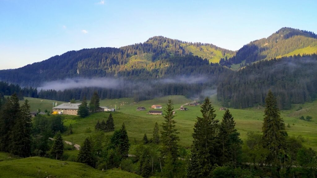
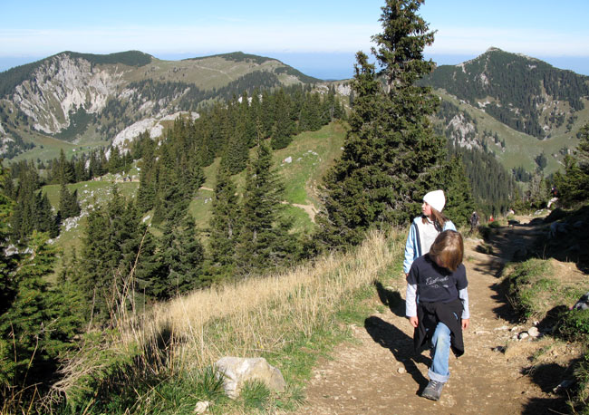
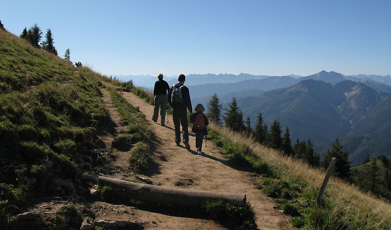
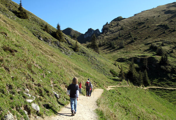
Shortly after the barrier, the hiking trail branches off to the left and into the forest up to the Rotwand. After a clearing you’ll reach a fork in the road at a mountain rescue hut. Follow the signs here towards Rotwand. The steadily rising gravel path leads to just before the summit.
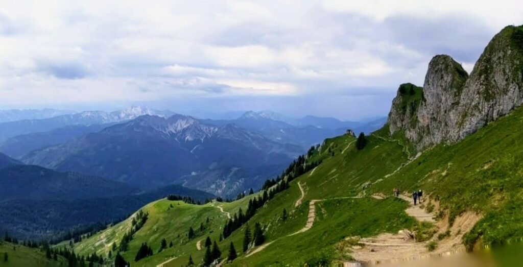
Reaching the top of the “steps” you’ll run in to the only climbing section of the route – sure-footedness here is a must.
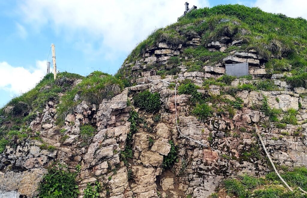
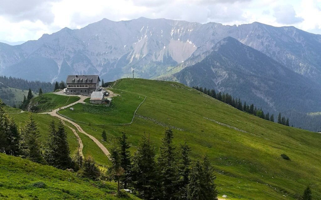
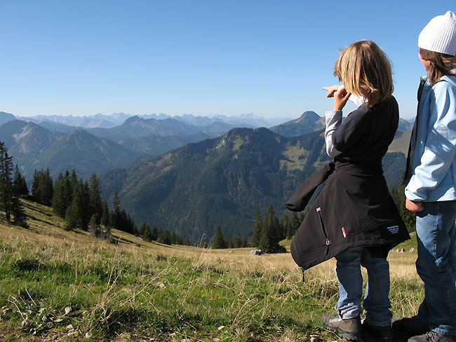
The Rotwand is the highest peak in the Spitzingsee region. Almost all the well-known peaks in the region, including the Wendelstein, Aiplspitz or the Brecherspitz, can be admired from the summit. In good weather, the view even extends to the striking peaks of Roßstein and Buchstein at Tegernsee with the Tegernseer Hütte, to the Zugspitze as well as the glaciers of the Central Alps to the south.
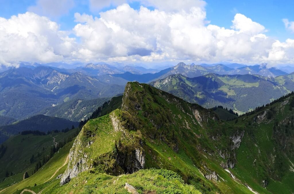
The Rotwand House
We recommend planning extra time for a break at the more than 100-year-old refuge of the German Alpine Association Rotwand House. The view across to the Bavarian Alps from the large sun terrace is too good to miss and the food’s not bad either
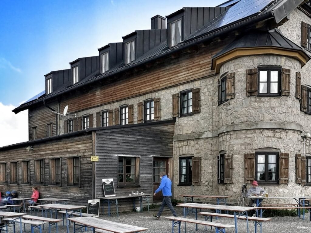
You can expect to find various seasonal, regional and Bavarian dishes on the menu. With a Knödel and a beer on board, the final stretch to the summit of the Rotwand should take around half an hour.
Descent from the Rotwand
The descent follows the same path as the ascent. Arriving back at Spitzingsee it’s worth considering a final walk along the Spitzingsee Loop Trail .
Alternative Route
The ascent described here is the most popular and easiest route for most hikers. There are however several alternative hiking trails that leading to the Rotwand here above Spitzingsee. Our personal favourite in the longer tour via the Pfanngraben. This route is quieter and and scenically particularly worth seeing. From the summit of the Rotwand is is possible to extend the hike up the nearby Hochmiesing.
Can I climb the Rotwand in winter?
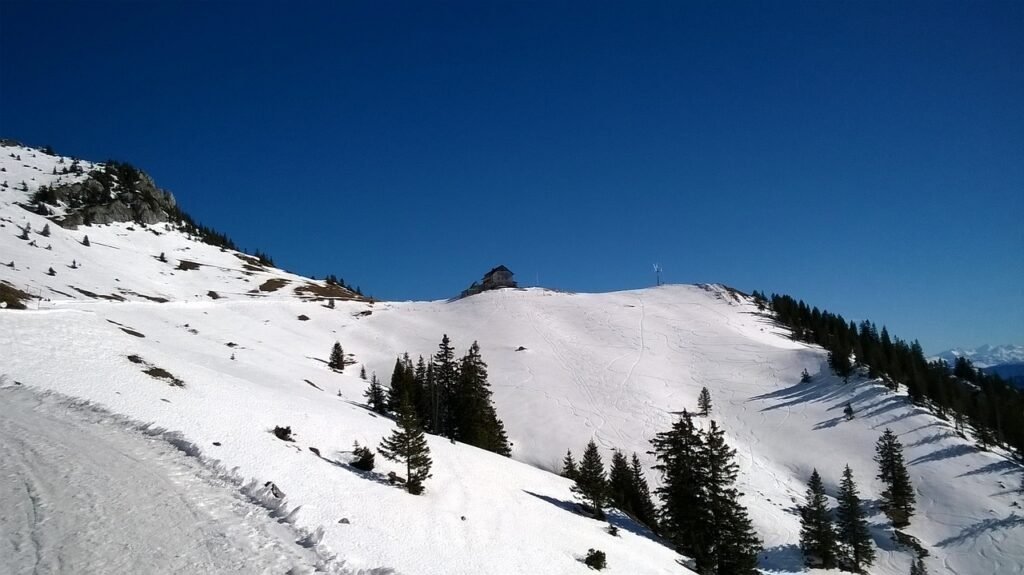
The Rotwand is a fantastic choice for a winter hike near Munich. The path is usually prepared throughout the winter and is popular both for snowshoeing and sledging.
Those arriving by car will find ample parking along the shores of Spitzingsee . For those travelling by train: Take the Bayerische Regiobahn (BRB) from Munich to Schliersee and change to the RVO bus towards Spitzingsee, getting off at the Spitzingsee Kirche station.
The hike up the Rotwand is one of the most popular hiking tours south of Munich for good reason. The trail is manageable even for occasional hikers, the Rotwand House offers welcome refreshments before the final ascent to the summit and the summit itself offers one of the most beautiful views of the Bavarian Pre-Alp mountains.
Weitere Artikel

From Spitzingsee to Bodenschneidhaus (easy, 9 km, 210 m elevation)

Aiplspitz & Jägerkamp (medium, 10km, 760m)

Cable Car & Hike: Obere Maxlraineralm, Schönfeldhütte & Taubensteinhaus (easy, 5km, 350 m altitude)

- Tourensuche
- Tourenverhältnisse
- Neue Touren
- Beliebteste Touren
- Hüttensuche
- Beliebteste Hütten
- Übersichtskarte
- Übersicht & neue Panoramen
- Deutschland
- Österreich
- Rumänien
- Bergpartner
- Klettersteige
- Leichte 3000er
- Wandern mit Kindern
- Schneeschuhtouren
- Winterwandern
- Alpinlexikon
- Alpenblumen
- Lawinenwarndienst

Rotwand (1884 m)
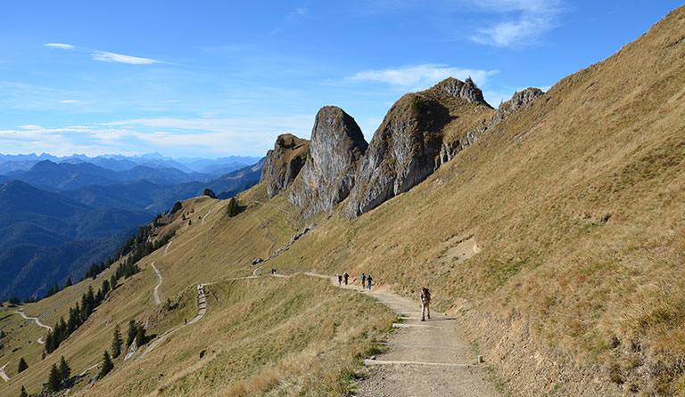
Spitzingsee (1085 m) - Rotwandhaus (1737 m) - Rotwand (1884 m)
Geo-koordinaten des ausgangspunkts:.
47.661979, 11.888168 ( in Google Maps öffnen )
Passende Artikel bei Amazon.de:
- Kompasskarte 8 - Tegernsee, Schliersee, Wendelstein
- Rother Wanderführer - Tegernseer und Schlierseer Berge

- Über den Taubenstein (2 ½ Stunden): Ein sehr schöner aussichtsreicher Höhenweg, der bei Seilbahnbetrieb allerdings auch gut besucht ist. Vom Rotwandhaus folgen wir dem beschilderten Pfad zum Taubenstein und zur Taubensteinbahn. Dieser leitet uns in nordöstlicher und später östlicher Richtung zum Kirchsteinsattel (1788 m) hinauf. Von dort wandern wir bergab und queren an der Westflanke des Lempersbergs vorbei. Nach einem Abstieg über steinige Wege erreichen wir den Fuß des Taubensteins. Durch eine seilgesicherte Rinne mit speckingen Felsen erreicht man in einem Abstecher von fünf Minuten den aussichtsreichen Taubenstein-Gipfel (1693 m). Für den weiteren Abstieg steigen wir in nördlicher Richtung hinunter zur Bergstation der Taubensteinbahn. Von hier kann man direkt zur Oberen Maxlraineralm hinunter wandern und trifft später wieder auf den Aufstiegsweg. Alternativ spaziert man von der Taubensteinbahn ein Stück nordwärts zum Taubensteinsattel (1592 m). Vom Sattel erreicht man nach rechts in 5 Minuten das schön gelegene Taubensteinhaus (1567 m). Für den Abstieg wendet man sich am Taubensteinsattel nach links und steigt über die ehemalige Piste des Oberen Lochgrabens (Wegweiser „Spitzingsee Ort“) zu einer Querstraße hinunter. Hier biegt man linkshaltend in den breiten Querweg ein und folgt diesem immer geradeaus zur Schwarzenkopfhütte und von dieser weiter über den Berggasthof Igler zurück zum Aufstiegsweg.
- Durch den Pfanngraben (3 ½ Stunden): Eine ruhige Variante, die bis zum Spitzingsee der Drei-Seen-Tour folgt. Vom Rotwandhaus steigt man in östlicher Richtung in die Kümpflscharte, der Einsattelung zwischen Rotwand und Auerspitz , hinunter. Dort wendet man sich nach rechts und wandert südwärts über die Kümpflalm in den Pfanngraben hinunter. Durch den Pfanngraben geht es in westlicher Richtung zur Waitzinger Alm. Über das Blecksteinhaus und die Albert-Link-Hütte wird zu guter Letzt zurück der Spitzingsee erreicht.
- Über den Miesingsattel und die Kleintiefentalalm (3 ½ Stunden): Wie bei der Variante durch den Pfanngraben steigt man vom Rotwandhaus in östlicher Richtung zur Kümpflscharte hinunter. Am Sattel wendet man sich nach links, quert an der Ostflanke der Rotwand vorbei und erreicht in einem Gegenanstieg den Miesingsattel (1704 m). Wir lassen den Hochmiesing rechts liegen und steigen zur Kleintiefentalalm (1555 m) hinunter und zum Taubensteinhaus (1567 m) hinauf. Vom Taubensteinhaus erreichen wir innerhalb von 5 Minuten in westlicher Richtung Taubensteinsattel (1592 m). Von dort geht es über die ehemalige Piste des Oberen Lochgrabens (Wegweiser „Spitzingsee Ort“) hinunter zu einem Querweg. Nun biegen wir scharf links ab und folgen dem breiten Querweg immer geradeaus zur Schwarzenkopfhütte und von dieser weiter über den Berggasthof Igler zurück zum Aufstiegsweg.
Einkehr- & Übernachtungsmöglichkeit:
Rotwandhaus (1737 m), DAV-Sektion Turner-Alpenkränzchen, Tel. +49 (0)8026/7683. Ganzjährig geöffnet. Betriebsurlaub vom 1. bis zum 25. Dezember und von der 2. Aprilwoche bis Anfang Mai.

Spitzingsee - Wandern & Bergtouren
Touren in der Umgebung:

Folge hoehenrausch.de:
Unsere partner:.

Navigation:
über uns:.
- Route Finder
- Route Planner
- Travel Guide
- Places to visit
- Eat & drink
- Accommodation
- Ski resorts
- Current Conditions
- Avalanche Report
- Collections
- Travel Stories
- Publications
Rotwand (1884m) and Aiplspitz (1759m). Long tour from the Taubenstein mountain station

Author’s recommendation
The round can be extended or shortened as desired.
Extensions: Hochmiesing, ascent from Spitzingsattel to Taubenstein
Shortening: From the Taubensteinhaus directly back to the mountain station

Track types
Safety information, tips and hints.
Spitzingsee cable cars
Rotwandhaus
Taubensteinhaus
Destination
Turn-by-turn directions.
From the mountain station, an initially quite new path leads south towards Rotwandhaus. If you like, take the Taubenstein as the first summit of the day. The trail continues below the Lämpersberg and crosses over to a striking saddle with a rocky head (1802 m). From here you can already enjoy a comprehensive view of the Central Alps. The Rotwandhaus is also clearly visible.
If you want to skip the Rotwand, descend directly down the wide path to the Rotwandhaus . Aspirants to the summit cross below the rock faces in a westerly direction until the narrow path meets the path that leads up from the Rotwandhaus. The summit is reached in a few minutes. A large metal plate with an engraved panorama helps you to identify the summit. Descend to the Rotwandhaus, where you can either take your first break or turn left 50 metres before the Rotandhaus in the direction of Soinsee/Geitau.
The Kümpflschate is quickly reached. Turn left and continue downhill towards Soinsee. However, we keep sharp left and cross the Nebelwände on a somewhat narrower path and finally reach the saddle between Hochmiesing and Rotwand. You can also get here directly from the summit of the Rotwand via a steep path. From the saddle, you can also take the Hochmiesing with you if necessary (+180m).
Continue downhill to Kleintiefental-Alm, where you come to a forest road. Continue briefly downhill until an inconspicuous path branches off to the left, which leads over to the Taubensteinhaus with little loss of altitude. We recommend taking a long break there. Then head east around the hut and use a faint track to descend into the basin below the Rauhkopf. This section ends at the Krottenthaler-Alm in the basin below the Aiplspitz.
Behind the alpine pasture, briefly follow a wide path until a barely visible track heads northwards through damp meadows towards the summit of the Aiplspitz. We reach the forest and meet a clear path that first leads through the forest and then up a large meadow to the saddle between Aiplspitz and Kleinmiesing. From the saddle, head left up to the summit of the Aiplspitz.
Now with a bit of scrambling, secured in places with a rope on the ridge and at the end around the cool north side of the Tanzeck to a large meadow. Here you can take a final rest in the sun before descending directly south to the saddle below the Rauhkopf. A final ascent leads to the summit of the Rauhkopf and further down to the mountain station of the Taubenstein cable car.
Public transport
Public-transport-friendly
From Munich, take the A8 motorway to the Weyarn exit. Continue via Miesbach (from here on the B307), Schliersee, Fischhausen-Neuhaus. After Fischhausen-Neuhaus, turn right towards Spitzingsee. Cross the Spitzingsattel to the car park at the Taubensteinbahn.
From Rosenheim via the A8 motorway to the Bad-Aibling exit. Continue via Bad-Feilnbach, Hundham, Fischbachau and Aurach. In Aurach, at the end of the road turn left onto the B307 towards Schliersee. Before Fischhausen-Neuhaus, turn right towards Spitzingsee and continue as above.
Coordinates
Author’s map recommendations, book recommendations for this region:, recommended maps for this region:.
Localization
Similar routes nearby
- On the Rotwand
- Family tour: Around the Spitzingsee - 2nd stage: Taubensteinhaus (1567 m) - Rotwandhaus (1737 m)
- Three Lakes Tour Day 2
- Family tour: Around the Spitzingsee - 3rd stage: Rotwandhaus (1737 m) - Spitzingsattel (1130 m)
- Swisstrack Tour Spitzingsee - Rotwandhaus (barrier-free)
Questions and answers
Would you like to ask the author a question?
Help others by being the first to add a review

Photos from others
Weather at the route's trailhead.
- Show images Hide images
- 11 Waypoints
Excursions and leisure tips for the region

- Trip Reports
- Areas & Ranges
- Huts & Campgrounds
- Logistical Centers
- Fact Sheets
- Custom Objects
- Plans & Partners

- Additional Parents
- Images (23)
- Climber's Log Entries (7)
- Comments (3)
- Additions & Corrections
- Getting There

- Accommodation
- Weather Conditions
- Route Overview
- Maps & Books
- External Links
View Rotwand Image Gallery - 23 Images
- Nearby Mountains & Rocks
- Interactive Map
- Mountains & Rocks in Germany
Children refers to the set of objects that logically fall under a given object. For example, the Aconcagua mountain page is a child of the 'Aconcagua Group' and the 'Seven Summits.' The Aconcagua mountain itself has many routes, photos, and trip reports as children.
- Rotwand Reibn - a ski loop
Parents refers to a larger category under which an object falls. For example, theAconcagua mountain page has the 'Aconcagua Group' and the 'Seven Summits' asparents and is a parent itself to many routes, photos, and Trip Reports.
- Krottenkopf
- Hinteres Sonnenwendjoch
- Hoher Fricken
- Hochmiesing
- Blauberge - Halserspitze
- Wendelstein
- Risserkogel
- Plankenstein
- Taubenstein
- Brecherspitz
- Schildenstein
- Kampen Ridge
- Seekarkreuz
You need to login in order to vote!
Don't have an account.
- Rating available
- Suggested routes for you
- People who climb the same things as you
- Comments Available
- Create Albums
Careless Indian Traveler
Everything you need to know to hike Rotwand
March 11, 2021
One of the best things about living in Munich is the Bavarian Alps looming around the corner. The number of weekend getaways filled with hiking adventures, gorge walks and mountain lake dips that you can embark on irrespective of your level of fitness are truly endless. All you need is a few hours off your schedule for the world of adventure to come knocking on your doorstep! I n this blogpost, I spill everything you need to know to hike up Rotwand, a beautiful mountain dominating the Mangfall Ranges of the Bavarian Alps to kickstart that adventure life…

Why Rotwand?
- Public Transportation
- Car/Motorbike
- Hike to Rotwand
- The best time to visit Rotwand
Ready, Set, Go!

Rotwand is the highest peak in the Spitzingsee region and one of the easiest summits that I have ever conquered! In fact, the summit is open to hiking all through the year. Therefore, if you fancy a hike through the autumn foliage, or amidst icicles and thick white snow or even through blooming flowers and buzzing bees, this hike is the perfect bet!
Moreover, since the hike is considered as an ’easy’ mountain hike, it requires absolutely no extra equipment and can be done by people of all fitness levels. All you need is a bit of grit and lots and lots of water!
Getting to Rotwand
This hike is best done as a day trip from Munich. Therefore, this section will feature directions from Munich. If you are reading this blog from elsewhere in the world, feel free to add this hike to your Bavarian Itinerary to experience one of the best (and the easiest) views in the Bavarian Alps!

Step 1: Getting to the Starting Point of the Hike
With public transportation from munich.
Once in Munich, getting to the starting point of the hike is quite easy. The Bayerische Oberland Bahn (BOB) runs every hour from Munich to Bayrischzell. Although it runs till Bayrischzell, you need to get off at Fischhausen-Neuhaus and continue further with bus number 9562 to Spitzingsee Kirche. The entire journey takes around 90 minutes. The connection time between the train and the bus at Fischhausen-Neuhaus is around 3 – 4 minutes. While this sounds tight, it is helpful to know that the bus almost always waits for the train to arrive! More information regarding the train and bus schedules can be found here (The departure and arrival stations must be mentioned as ‘München Hbf’ and ‘Spitzingsee Kirche, Schliersee’).
Another thing to keep in mind is that although the train initially starts with three bogeys from Munich Central Station, each bogey splits at some point and heads to a different destination. In order to reach the starting point of the hike, it is important that you are in the coach that goes to Bayerischzell. In case you are in the wrong coach, before the train splits at Holzkirchen, you will be given a few minutes to get into the right coach. This can be quite stressful, so it is always better to be in the right coach and relax before your arduous climb!
By Car/ Motorbike
If you would rather drive to the starting point of the hike, put this GPS co-ordinates in your navigation device and you are good to go! The co-ordinates correspond to a paid parking lot close to the starting point of the hike. The drive time from Munich to this location is just over an hour.
Step 2: Hike to Rotwand
Trailhead : Link
Tiny yellow boards located along hiking paths usually give information regarding the difficulty of the hike. Alpine hikes in Germany and Austria are classified into three categories,
- Blue (or Easy): flat or slightly inclined terrain, no exposed sections
- Red (or Medium): mountain hiking with some steep, rocky, partially exposed sections and a considerable elevation gain
- Black (or Difficult): challenging terrain with plenty of steep rocky slopes and mostly exposed alpine terrain
I highly recommend reading my beginner’s guide to alpine hiking before attempting this hike!
Being quite a popular mountain, there are several hiking routes to Rotwand and all of them are easy (i.e., marked blue in the signboard’) till ‘Rotwandhaus’. The last twenty minutes of the hike is however a little hard and involves a few steep sections!
The ascent takes between two to three hours with an altitude difference of 800 metres. Depending on your fitness level, the entire hike (i.e., the ascent and the descent) takes anywhere between five to seven hours!

Optional Alternate Route: If you would rather traverse less ‘altitude’, it is probably a good idea to take the cable car to Taubenstein mountain station (Bergstation) and follow the signs to ‘Rotwand/Rotwandhaus’ (or Panoramaweg Rotwand) from there. This hike takes three to four hours. If you decide to do this hike instead, the public transportation instructions remain the same except the stop at which you have to alight. In this case, disembark at the bus stop, Spitzing Taubensteinbahn, Schliersee instead of at Spitzingsee Kirche, Schliersee and walk to the cable car station. More information regarding the cable car can be found here .
If you are a first-time hiker or are just looking for some useful tips and tricks regarding hiking equipment, feel free to glance through this blogpost for an insightful overview!
The Best Time to Visit Rotwand
Although spring and summer are the chosen seasons to hike in Germany, this mountain is an all-weather mountain. While summer hikes in this area can be topped with a swim in Spitzingsee surrounded by endless green rolling hills, a winter hike feels like a trip to Narnia! I hiked during winter without ice cleats and it was totally okay! The path is maintained all year around so hiking in winter is quite a pleasant experience.

The general costs you can encounter as a day trip from Munich is listed in this section. However, the budget would heavily depend on the kind of traveling you would like to do! All the costs listed are per person (unless otherwise mentioned) and assumes a ‘budget’ travel style.
Transportation
If you are traveling from Munich with a group of friends, I would highly recommend purchasing the Bayern ticket! Bayern Ticket is a day ticket that lets you travel all around Bavaria in regional trains. This Ticket costs 26 EUR for one person and 8 EUR for every additional person (upto 5 people). i.e.,
- If you are traveling alone, you would pay 26 EUR
- If you are traveling with a friend, you would pay 26 + 8 = 34 EUR (for 2 people, 17 EUR per person)
The easier, alternate route involves taking the cable car up and down. The price for a round trip in Taubenstein Bahn is 20 EUR. More details can be found here .
It is a hiking tradition in Germany to end your hike with a beer at one of the mountain huts! While hiking Rotwand, the hut in question is the Rotwandhaus . Like other mountain huts, a meal with a drink of choice would cost you between 10 to 20 EUR.

Moreover, it is always a good idea to carry some snacks to munch on during the hike. If you need some insight regarding the kind of snacks to buy, the ‘smart snacks’ section of this blogpost should give you a fair idea!
Thus, to sum up, my day trip to Rotwand from Munich cost around 30 EUR !
The Mangfall Ranges is a one of the most beautiful areas in the Bavarian Alps. Rotwand, being the highest peak in this area, is defintely worth every cramp and sweat you will encounter. A quiet, quick getaway to enjoy the stunning view should definitely be on your list!
Before you embark on your hiking adventure, I highly recommend skimming through my mountain hiking guide for an unparalleled overview on alpine hiking . Moreover, this blog pos t also lists all the equipment required to conquer an alpine hike.
If you are looking for another hiking experience, I cannot recommend the following hikes enough:
- Schrecksee – The highest mountain lake in the German Alps
- Archenkanzel – Hidden viewpoint over lake Königssee
- Rubihorn – A complete Allgäu Experience with postcard views
- Seealpsee – An easy beginner appropriate hike in Switzerland
- Olpererhütte – Austria’s best kept secret view
- Kramerspitz – The perfect day hike from Munich
Have any questions about traveling to Rotwand or hiking in general? Leave them in the comments below!
Pin for later,

Copyright © 2024 Careless Indian Traveler · Theme by 17th Avenue

- South Tyrol
- Val Gardena
- Hochpustertal
- Meran and Environs
- Südtirol Bolzano
- Altopiano del Paganella
- Altopiano di Folgaria - Lavarone - Luserna
- Altopiano di Pinè - Valle di Cembra
- Garda Trentino
- Giudicarie Centrali - Valle del Chiese
- Madonna di Campiglio - Pinzolo - Val Rendena
- Rovereto - Vallagarina - Altopiano di Brentonico
- San Martino di Castrozza - Primiero - Vanoi
- Terme di Comano - Dolomiti di Brenta
- Trento - Monte Bondone - Valle dell'Adige
- Val di Fassa
- Val di Fiemme
- Val di Sole - Pejo e Rabbi
- Valsugana - Lagorai - Tesino
- Route Planner
- All destinations
- Accommodation

From the Paolina hut, follow trail 552 almost flatly in a northerly direction until the fork to the Vaiolon Pass. Continue to the right along trail 551, which winds its way over steep gravel paths to the foot of the Rotwand wall and then through a scree gully (short, secured section) to the Vaiolon Pass (2560 m). From the hut you can enjoy a beautiful view of the Vaiolon peaks, the Tscheinerspitze and the Mugoni peak. After unpacking the via ferrata equipment, you follow the north ridge of the Rotwand along an easy, secured path, which is mostly equipped with steel ropes. Via this not particularly steep route, which offers a magnificent panorama during the ascent, you finally reach the summit of the Rotwand (2806 m). Beautiful Dolomite peak with a view of the Fassa Dolomites, but also of the Pala and Lagorai groups, the eastern Dolomites, the Cima d'Asta and the high plateau of Welschnofen. On the horizon you can see the western part of South Tyrol and the main Alpine ridge with its
Localization


Questions and answers
Would you like to ask the author a question?
Help others by being the first to add a review

Photos from others
- Terms and conditions
- Map information
- Privacy policy
- Legal Disclosure
- Pro and Pro+
- Customer information
- Cancellation policy
- Terms of payment
Wandern im Winter
Skitourenkurs
Unterwegs am Nockberge-Trail
Hochwanner - Bike & Hike
Klettersteig-Spezial
Unfall am Berg
Bergtour - rotwand.
Rotwand (1884 m)
Bergtour | bayerische voralpen | spitzingsee 800 hm | insg. 04:45 std. | schwierigkeit (1 von 6).
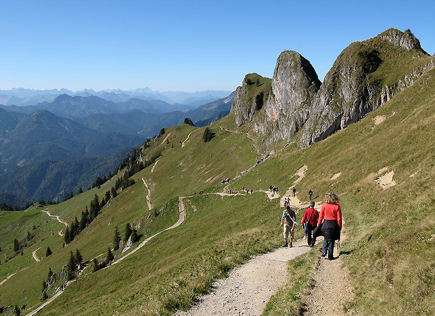
Einer der bekanntesten und beliebtesten Münchner Hausberge. Viel besucht, aber auch wirklich sehr schön! Alle echten Münchner Kindl müssen hier einmal oben gewesen sein, das gehört sich einfach so! Auch die Aussicht von der Rotwand ist berühmt und das zurecht! Die Anstiegsmöglichkeiten sind vielfältig - es gibt auch eine lockere Variante mit Seilbahnunterstützung - und allesamt technisch nicht schwer, allerdings teilweise etwas lang und daher für Ungeübte etwas anstrengend. Weil es mehrere Routen gibt, kann man auch eine schöne Rundtour machen. Mit dem Rotwandhaus findet man kurz unterm Gipfel eine sehr schöne Einkehrmöglichkeit.
Für diese Tour derzeit leider nicht verfügbar.
Um diese Funktion zu nutzen, loggen Sie sich bitte ein.
Tour mit Freunden teilen
Tourensteckbrief Rotwand
A8 München – Salzburg bis Ausfahrt Weyarn, weiter auf der B 307 über Miesbach, am Schliersee vorbei und weiter Richtung Bayrischzell, jedoch kurz hinter Neuhaus schon rechts ab zum Spitzingsee. (Route A+B) Man fährt durch den Tunnel und parkt links der Straße am sehr großen, gebührenpflichtigen Parkplatz oberhalb der Kirche. (5 Euro / Tag - Stand 2020). Wer (C) mit der Seilbahn ein Stück auffahren will, parkt bereits vor dem Tunnel, an der Talstation der Taubensteinbahn (5 Euro / Tag - Stand 2020). Navi-Adresse : D-83727 Schliersee, Spitzingstraße 4
A+B: Wurzhütte am Spitzingsee (großer, gebührenpflichtiger Parkplatz oberhalb der Kirche). Oder (C) Taubenstein Talstation (auch hier gebührenpflichtige Parkmöglichkeiten).
( A .) Die Bergstraße hinter der Wurzhütte hinein und gleich nach 30 Metern bei der Weggabelung halb-links hinauf (Wegweiser Rotwand). Kurz hinter der Bergwachthütte beginnt dann der ausgeschilderte Forstweg zur Rotwand. Eine großzügige Kehre kürzt man über einen ausgeschilderten Steig ab. Dann geht es weiter auf dem Forstweg, an der Wiederaufforstung vorbei, eine weitere Kehre und schon ist man bei der Wildfeldalm. Jetzt quert man unter der Rotwand hindurch zur Hütte, oder steigt links abzweigend steil hinauf zum Gipfel.(Dies ist die Route für Mountainbiker. Sie endet aber am Rotwandhaus). ( B .) Man bleibt noch einige Meter auf der in (A) beschriebenen Bergstraße (biegt also nicht hinter dem Bergwachthaus ab) und geht weiter bis zum Wirtshaus Untere Maxlrainer-Alm. Hier biegt man rechts ab, verfolgt den Forstweg bis zur Skipiste und steigt dann an deren linken Rand über einen Waldsteig bis zur oberen Maxlrainer Alm und weiter über die Piste bis zur Taubenstein Bergstation. Hier beginnt der sehr schöne Steig, vorbei am Taubenstein (Besteigung 15 Minuten plus) hinüber zum Rotwandhaus. Er ist erst eine Kammwanderung, dann quert man unter dem Lämpersberg und der Rotwand durch. Gipfelaspiranten zweigen ein ganzes Stück vor der Hütte links ab und steigen steil an zum Kreuz. ( C .) Man benutzt die Seilbahn zur Taubenstein Bergstation, dann weiter wie unter (B) beschrieben.
Alle hier beschriebenen Möglichkeiten eignen sich auch für den Abstieg, so dass man eigentlich immer eine schöne Rundtour machen kann.
Es gibt eine ruhige, aber etwas mühsamere Variante auf die Rotwand. Sie führt durch den sogenannten Pfanngraben. Siehe Rotwand - Pfanngraben .
Auf den hier vorgestellten Wegen ist die Rotwand durchwegs als einfache Bergwanderung einzustufen. Einzig die letzten Meter über eine Felsstufe sind etwas anspruchsvoller und erfordern ein wenig Geschick. Während die Tour mit Seilbahnhilfe auch konditionell recht leicht ist, sind beim Normalweg ohne Seilbahn immerhin 800 Hm zu bewältigen. Ansonsten: Klassischer und viel begangener Münchner Hausberg. Doch nichts kommt von ungefähr: die Aussicht ist fantastisch (Großvenediger, Großglockner, die Kitzbüheler und Hintertuxer sind zu sehen) und das Rotwandhaus gemütlich. Besonders schön: Möglichkeit (B).
Aufstieg: 2,5 bis 3 Stunden; Abstieg: 2 Stunden; Möglichkeit (A): 1,5 Stunden.
Höhendiffernz: 800 Höhenmeter
Ende Mai bis zum Wintereinbruch. Wobei die Tour bei entsprechender Schneelage auch als Winterwanderung gemacht wird. Rodelmöglichkeit ab Rotwandhaus.
Rotwandhaus des DAV, 114 Plätze, Telefon: +49/(0)8026/7683 oder +43/(0)664/1645290. Beinahe ganzjährig geöffnet, in den Übergangszeiten jedoch meist nur am Wochenende bewirtschaftet. Siehe auch hier .
Karte vom Bayerischen Landesvermessungsamt „Tegernsee / Schliersee und Umgebung“, 1:25.000. Und AV-Karte BY15, Mangfallgebirge Mitte, Spitzingsee-Rotwand, 1:25.000. Beide erhältlich in unserem Karten-Shop .
Bernhard Ziegler
Bilder zur Tour
Tourentipp-globo-vision.
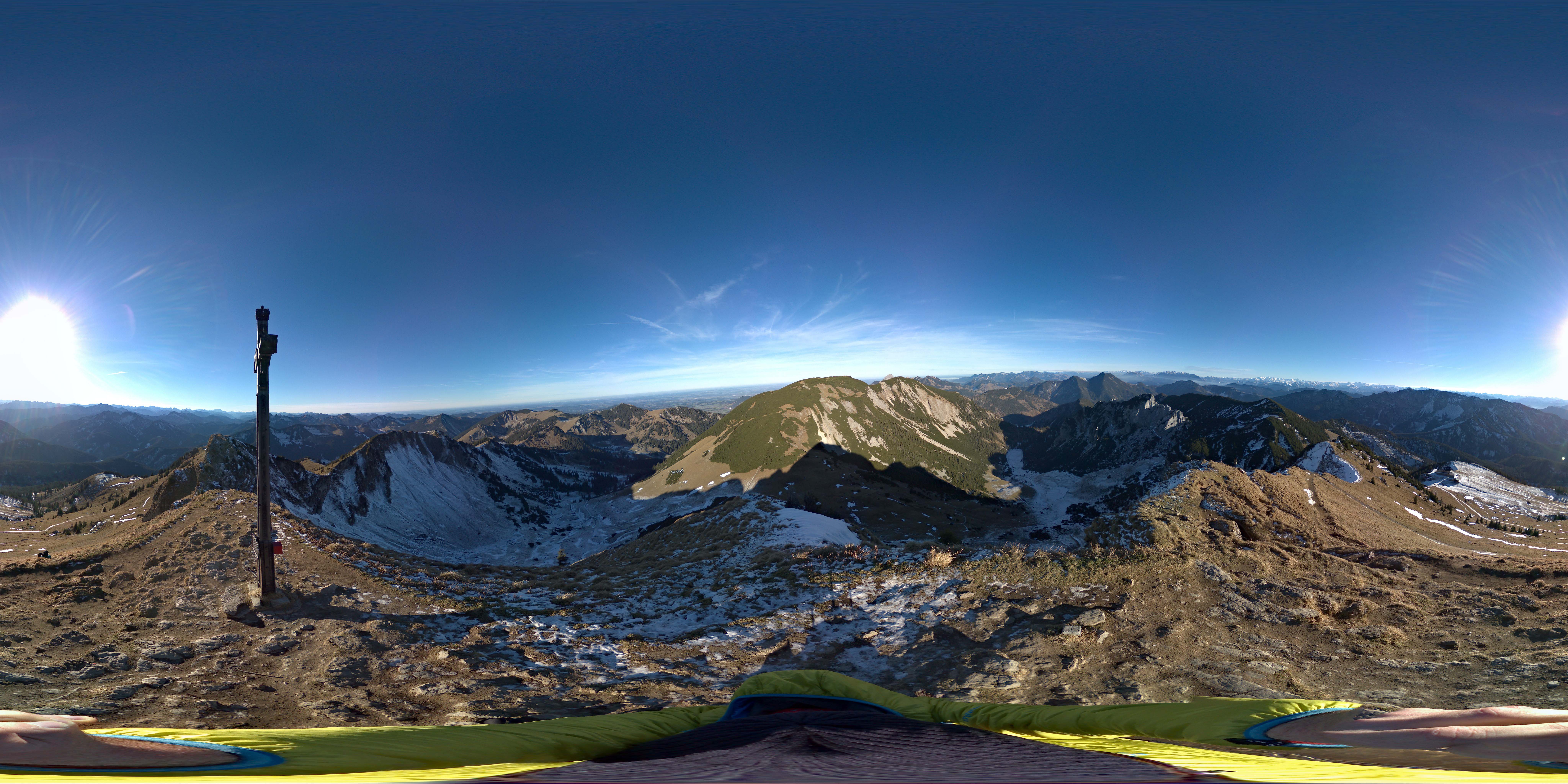
Panorama-Fotografie mit sensationeller 360x360-Grad-Technologie. Aufgrund der Bildgröße kann es zu etwas längeren Ladezeiten der Panorama-Pictures kommen.
Zwischen Taubenstein und Lämpersberg. Links hinten: die Rotwand.
Zwischen Taubenstein und Lämpersberg eröffnet sich bereits ein herrlicher Blick.
Auf dem Weg vom Taubenstein zum Lämpersberg mit Blick auf Aiplspitz (re.), Benzingspitze und Jägerkamp (li.) im Hintergrund.
Die flache Querung beim Lämpersberg mit tollem Ausblick.
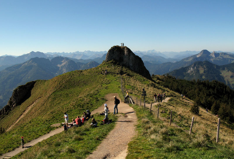
Auf dem flachen Weg vom Lämpersberg herüber. Links der Mitte schaut schon die Rotwand heraus.
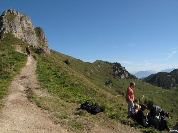
Zwischen Lämpersberg und Rotwand führt der Weg über diese Schulter mit Minigipfel.
Hier beginnt die Querung durch die Südflanke unterm Rotwandkamm.
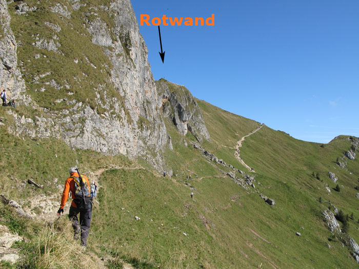
Am Beginn der Querung durch die Südflanke unterm Rotwandkamm. (Der Weg ist viel einfacher als es hier auf dem Bild erscheint.)
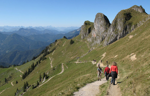
Die riesigen markanten Grathöcker. Direkt darunter: die Querung Richtung Taubenstein. Weiter unten: der Weg über die Wildfeldalm.
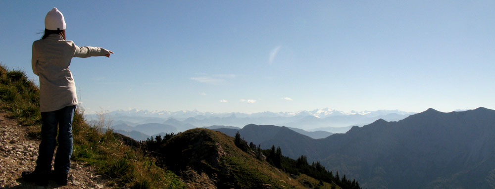
Schon beim Gipfelanstieg über den Südhang eröffnet sich ein fantastischer Blick auf beispielsweise die Kitzbüheler Alpen und die Hohen Tauern.
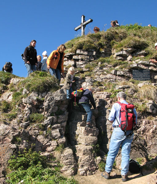
Eine zwei Meter hohe Felsstufe bildet das Finale dieser leichten Tour.
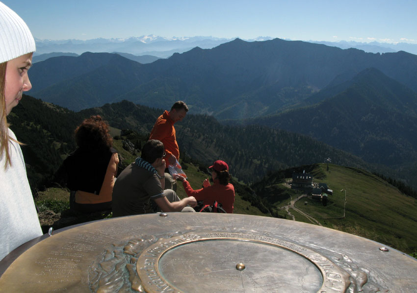
Am Gipfel mit Panoramascheibe und einer wirklich gigantischen Aussicht. Unten: das Rotwandhaus.
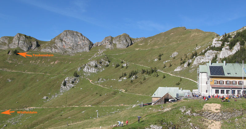
Rotwandhaus und Rotwandgipfel. Oben: die Querung vom Taubenstein herüber - unten: der Weg über die Wildfeldalm.
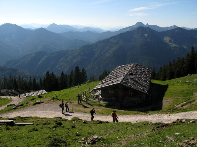
Auf der Variante über die Wildfeldalm.
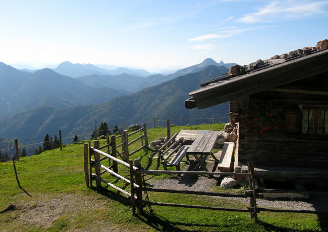
Die Wildfeldalm.
Karten und Routenskizze
Auf dem Kartenausschnitt können Sie die Lage der Tour und die Anfahrt nachvollziehen. Soweit ein GPS-Track hinterlegt ist, dient die Karte auch als Routenskizze.

Download GPS Daten
Wettervorhersage.

Top - Bergtouren aus der Region Bayerische Voralpen
Hier finden Sie die schönsten Touren aus dieser Gegend. Die Region Bayerische Voralpen ist bekannt für ihre Vielfalt, für ihren landschaftlichen Reiz und hohen Erholungswert. In unserem Tourenarchiv finden Sie dazu Gebietsinformationen und weitere lohende Routenvorschläge mit Bildern und GPS-Daten.
Kommentar zur Tour

- Route planner
Thorsten planned this outdoor adventure with komoot!
Discover your own fun with the #1 outdoor app., rotwand klettersteig.
- Select Starting Point
- Open in Planner
- Download GPX file
Tour Overview
Tour profile, weather forecast.
July 11, 2020
- Create a Copy of This Tour
- Report Tour
You Might Also Like
Collection by DOLOMITES Val Gardena / Gröden
Mountain Biking Collection by DOLOMITES Val Gardena / Gröden
Hiking Collection by DOLOMITES Val Gardena / Gröden

- Artist Statement
- Speaker Training
- Performances
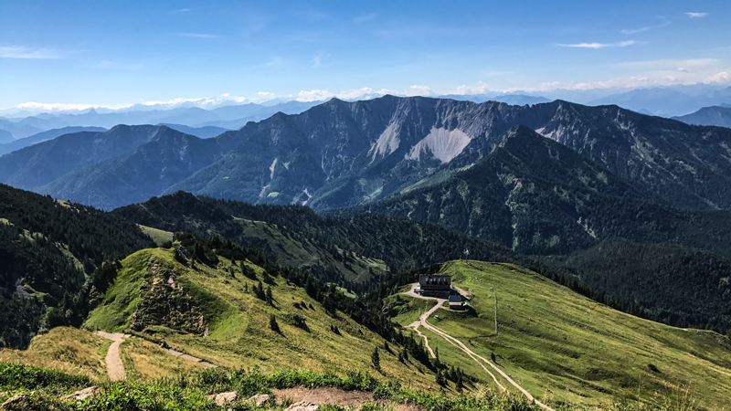
Creative Walks – The Rotwand Tour.
The Rotwand tour is one of my favourite creative walks routes. It’s a relatively easy hike that takes you through a pine forest, past a couple of Alpine cabins and you even get to see a few waterfalls. You’ll be greeted by cowbells and cattle about thirty minutes from the summit too. As with any mountain path, the weather dictates the experience and memory of the route. I’ve walked up Rotwand in the early morning summer sun, and it felt like something out of Jurassic Park. But I’ve also scampered up it in the pouring rain and fog. With the wind howling in the trees, it felt like an Autumnal “Shining” (with the Rotwandhaus appearing in the mist, a Bavarian Stanely Hotel ). The walking experience dictates the ideas, which is what makes creative walks such a unique working adventure. The visuality of the mountain, the scene it sets, the associations it forms in your mind all help to kick start the process of harvesting memories and combining them with facts, strategies and ideas.

By loading the video, you agree to Vimeo's privacy policy. Learn more
Always unblock Vimeo
Creative Walks on the Rotwand – Fun and easy on the legs.
At 1.884 metres above sea level, the summit is reached quickly. It’s an easy walk, even for an office potato. We’ll park safely at the church car park and have a quick look at the Spitzingsee before moving on up into the first part of the walk. It’s a tarmac road used by the forestry. After thirty minutes we’ll pass a little cabin and then turn right into the forest and make our way slowly and steadily up the gravel road to the summit. Every so often the Mangfall Mountains will appear through the trees, and we’ll reach the first of three tiny waterfalls after half an hour. We should have a whole bunch of rough thoughts, memories and ideas scribbled onto Artefact Cards by now. We’ll spread them out onto a large boulder and sort them into sets of “good, bad and ugly”.
Creative Walks – Solvitur Ambulando!
We’ll walk through the electric cattle gate and hear the ring of the cowbells. This is Alpine country. We’ll pass the cabins and rest on a rock to sort our ideas, discarding the weaker ones and working on what we think will solve your problem. Onwards. Solvitur Ambulando !
The gravel road rises, and then the Rotwandhaus appears, it’s space age wind mill whizzing manically. Your heart will skip at the thought of a cold drink and maybe some food but I’ll point upwards, left of the house, to the cross on the summit and we’ll push on. A quiet will fall over us, and we’ll concentrate on sorting our thoughts and putting one foot in front of the other.
At the summit you’ll spend five minutes alone, just taking it in: listening to the wind, the birds and the cowbells and looking at the endless sea of mountains that spread out in front of you.
The Rotwandhaus is open all year round and serves a wicked lentil stew. We’ll sit in deckchairs and spread our notes, ideas and plans on the grass in front of us and chose the idea we want to work on during our descent. And when, two hours later, we’re back down by the lake I’ll leave you for alone for a while to look at the water and ponder the answer, the idea we found up on the mountain, and you’ll realise that this was probably the best days work that you have ever had.
Get in touch now if would you like to find out more or book your own creative walk.
- Datenschutzerklärung
- Preplanned tours
- Daytrips out of Moscow
- Themed tours
- Customized tours
- St. Petersburg

Moscow Metro 2019
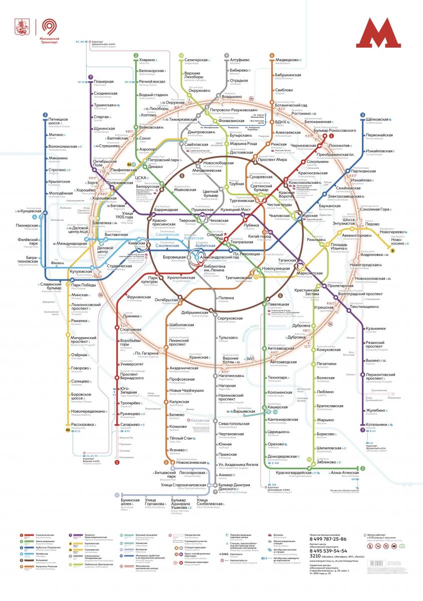
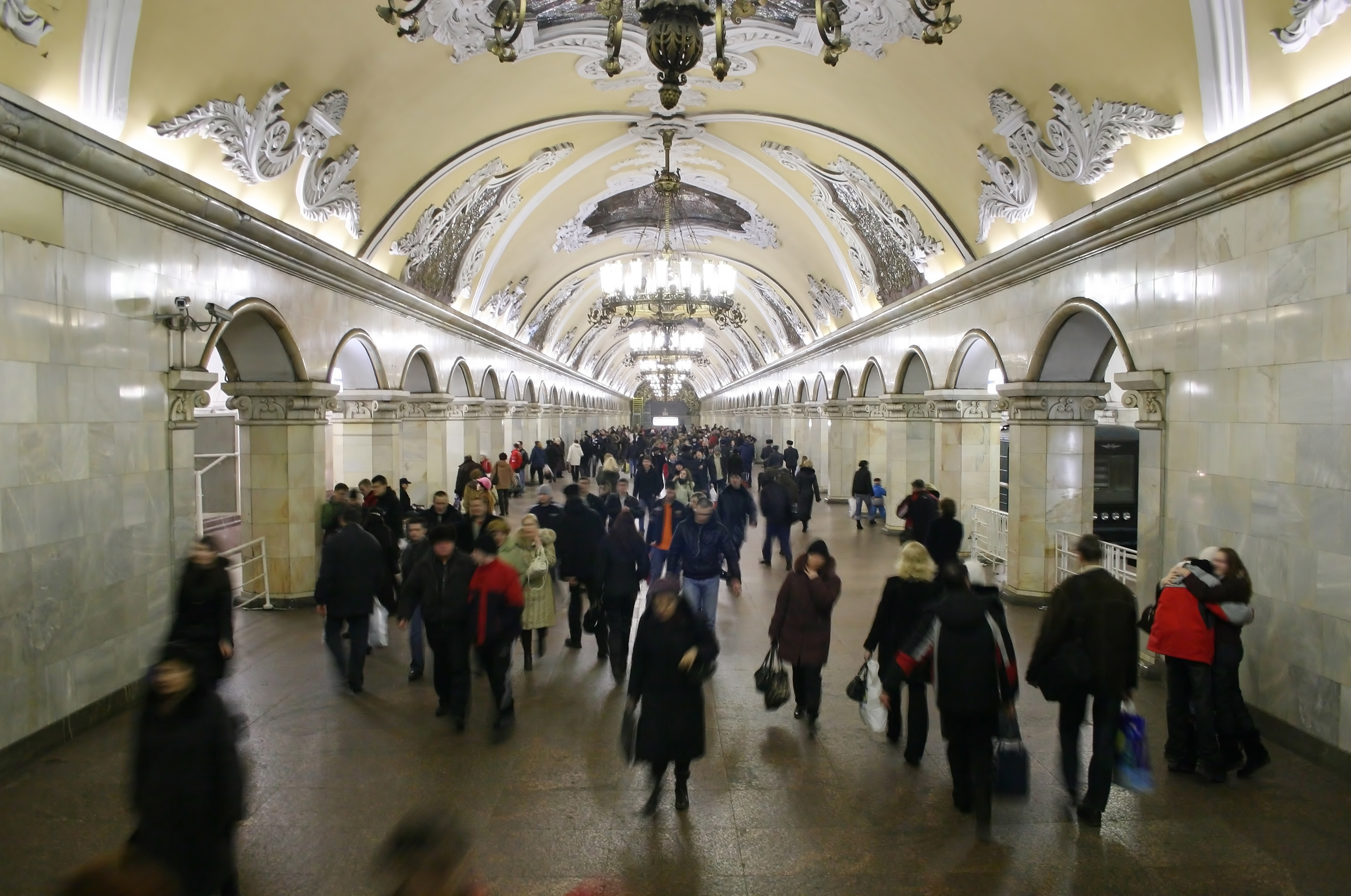
Will it be easy to find my way in the Moscow Metro? It is a question many visitors ask themselves before hitting the streets of the Russian capital. As metro is the main means of transport in Moscow – fast, reliable and safe – having some skills in using it will help make your visit more successful and smooth. On top of this, it is the most beautiful metro in the world !
. There are over 220 stations and 15 lines in the Moscow Metro. It is open from 6 am to 1 am. Trains come very frequently: during the rush hour you won't wait for more than 90 seconds! Distances between stations are quite long – 1,5 to 2 or even 3 kilometers. Metro runs inside the city borders only. To get to the airport you will need to take an onground train - Aeroexpress.
RATES AND TICKETS
Paper ticket A fee is fixed and does not depend on how far you go. There are tickets for a number of trips: 1, 2 or 60 trips; or for a number of days: 1, 3 days or a month. Your trips are recorded on a paper ticket. Ifyou buy a ticket for several trips you can share it with your traveling partner passing it from one to the other at the turnstile.
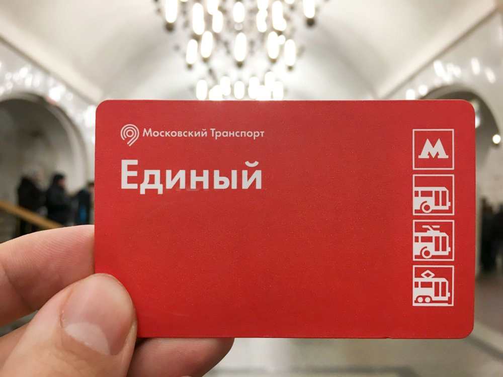
On every station there is cashier and machines (you can switch it to English). Cards and cash are accepted. 1 trip - 55 RUB 2 trips - 110 RUB
Tickets for 60 trips and day passes are available only at the cashier's.
60 rides - 1900 RUB
1 day - 230 RUB 3 days - 438 RUB 30 days - 2170 RUB.
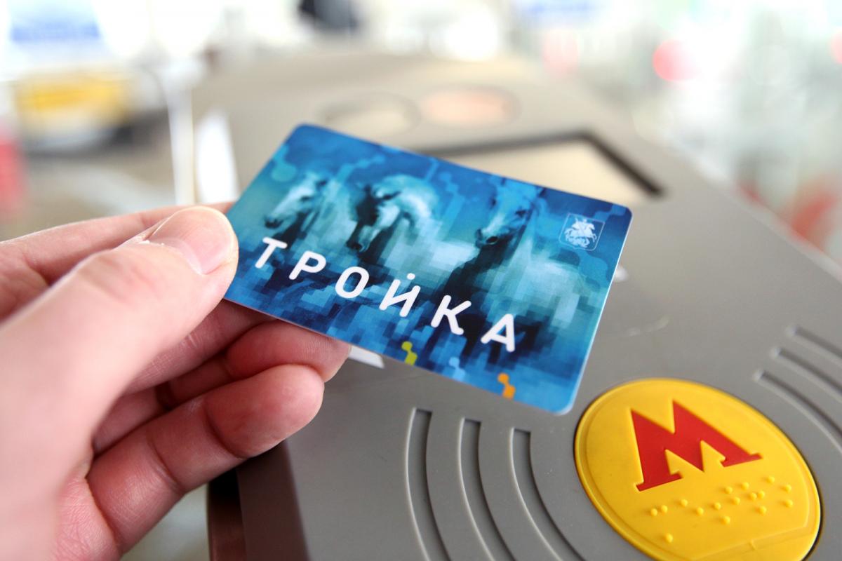
The cheapest way to travel is buying Troyka card . It is a plastic card you can top up for any amount at the machine or at the ticket office. With it every trip costs 38 RUB in the metro and 21 RUB in a bus. You can get the card in any ticket office. Be prepared to leave a deposit of 50 RUB. You can get it back returning the card to the cashier.
SamsungPay, ApplePay and PayPass cards.
One turnstile at every station accept PayPass and payments with phones. It has a sticker with the logos and located next to the security's cabin.
GETTING ORIENTED
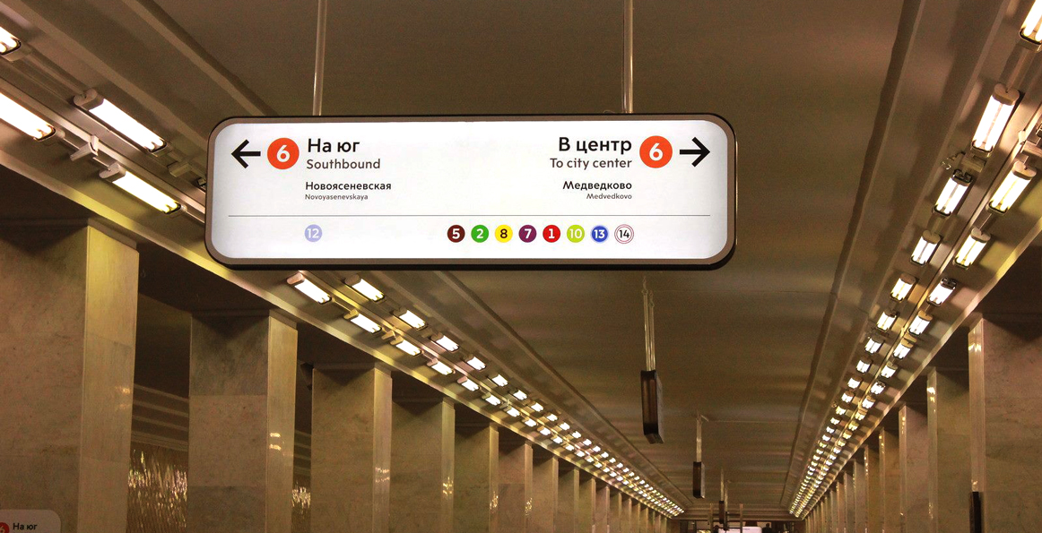
At the platfrom you will see one of these signs.
It indicates the line you are at now (line 6), shows the direction train run and the final stations. Numbers below there are of those lines you can change from this line.
In trains, stations are announced in Russian and English. In newer trains there are also visual indication of there you are on the line.
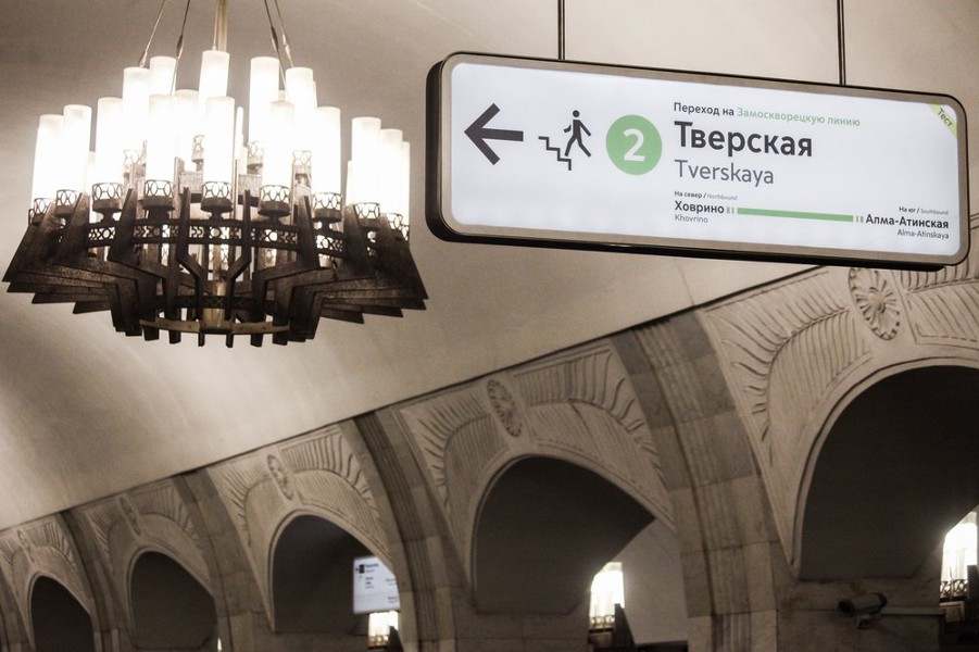
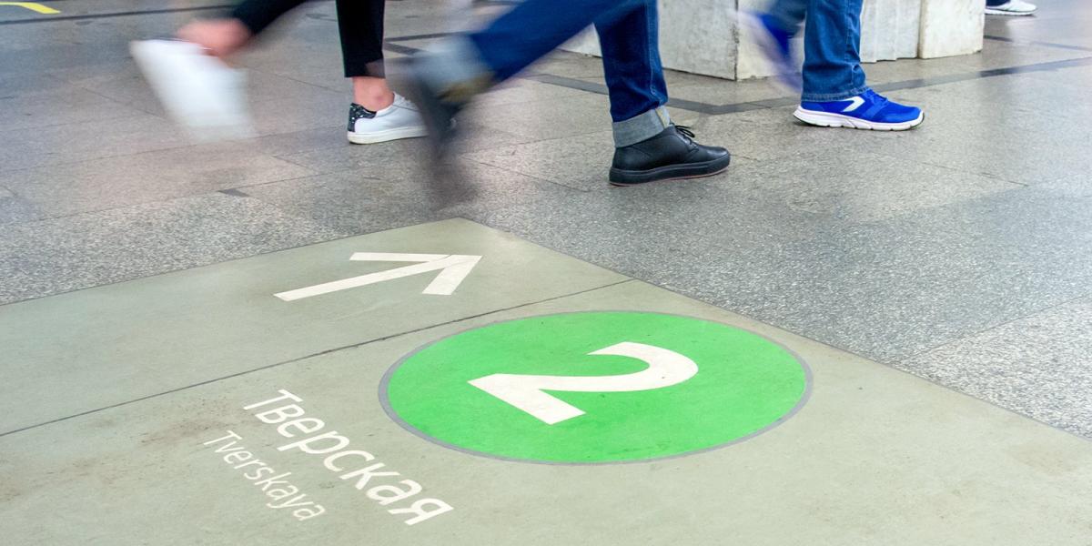
To change lines look for these signs. This one shows the way to line 2.
There are also signs on the platfrom. They will help you to havigate yourself. (To the lines 3 and 5 in this case).
Guided Walking Tour of the Moscow Metro
Description, good to know.
- Pricing details
Departure place
You would like, admiring the frescoes in kurskaya and komsomolskaya metro stations, marvelling at the architecture of the moscow metro, listening to your guide's commentary, essential information *, duration 1 hour 50 minutes, starting time 2:00 pm.
Set off to discover the most breathtaking stops on Moscow’s beautiful metro system on this walking tour.
Some of the stops on the Moscow metro are real masterpieces. Head underground and admire the Moscow metro with your guide.
During your guided tour, you will get to admire the Ploshchad Revolyutsii , designed by the architect Dushkin. There are no fewer than 72 sculptures in this station!
You will then explore Kurskaya station, built in 1938. The design, mosaics and slogans will immerse you in the era of Stalin. You will also see the frescoes depicting Russian victories in Komsomolskaya station.
Then, continue to one of Moscow’s must-see metro stations, Novoslobodskaya , which resembles an underground palace: marble, stained glass windows...
Join your guide to explore the most lavish and important metro stops in Moscow!
- Availability: every day (excluding exceptional dates)
- Duration: 1 hr. 50 mins approx.
- Departure point: The Kremlin
- Languages: English
- Please wear comfortable shoes
- Metro tickets are included for the metro stations visited during the activity
- A valid student card will be requested from participants who have booked the reduced student tariff
- A minimum of 2 participants is required to book this activity
Price includes
- Metro tickets
- The services of an English-speaking tour guide
- The guided tour of the Moscow metro
Price doesn’t include
- Access to stations not included in the tour
- Hotel pick-up/drop-off
- Tips (optional)
- All other extras
Customers also look
Moscow Metro Tour
- Page active

Description
Moscow metro private tours.
- 2-hour tour $87: 10 Must-See Moscow Metro stations with hotel pick-up and drop-off
- 3-hour tour $137: 20 Must-See Moscow Metro stations with Russian lunch in beautifully-decorated Metro Diner + hotel pick-up and drop off.
- Metro pass is included in the price of both tours.
Highlight of Metro Tour
- Visit 10 must-see stations of Moscow metro on 2-hr tour and 20 Metro stations on 3-hr tour, including grand Komsomolskaya station with its distinctive Baroque décor, aristocratic Mayakovskaya station with Soviet mosaics, legendary Revolution Square station with 72 bronze sculptures and more!
- Explore Museum of Moscow Metro and learn a ton of technical and historical facts;
- Listen to the secrets about the Metro-2, a secret line supposedly used by the government and KGB;
- Experience a selection of most striking features of Moscow Metro hidden from most tourists and even locals;
- Discover the underground treasure of Russian Soviet past – from mosaics to bronzes, paintings, marble arches, stained glass and even paleontological elements;
- Learn fun stories and myths about Coffee Ring, Zodiac signs of Moscow Metro and more;
- Admire Soviet-era architecture of pre- and post- World War II perious;
- Enjoy panoramic views of Sparrow Hills from Luzhniki Metro Bridge – MetroMost, the only station of Moscow Metro located over water and the highest station above ground level;
- If lucky, catch a unique «Aquarelle Train» – a wheeled picture gallery, brightly painted with images of peony, chrysanthemums, daisies, sunflowers and each car unit is unique;
- Become an expert at navigating the legendary Moscow Metro system;
- Have fun time with a very friendly local;
- + Atmospheric Metro lunch in Moscow’s the only Metro Diner (included in a 3-hr tour)
Hotel Pick-up
Metro stations:.
Komsomolskaya
Novoslobodskaya
Prospekt Mira
Belorusskaya
Mayakovskaya
Novokuznetskaya
Revolution Square
Sparrow Hills
+ for 3-hour tour
Victory Park
Slavic Boulevard
Vystavochnaya
Dostoevskaya
Elektrozavodskaya
Partizanskaya
Museum of Moscow Metro
- Drop-off at your hotel, Novodevichy Convent, Sparrow Hills or any place you wish
- + Russian lunch in Metro Diner with artistic metro-style interior for 3-hour tour
Fun facts from our Moscow Metro Tours:
From the very first days of its existence, the Moscow Metro was the object of civil defense, used as a bomb shelter, and designed as a defense for a possible attack on the Soviet Union.
At a depth of 50 to 120 meters lies the second, the coded system of Metro-2 of Moscow subway, which is equipped with everything you need, from food storage to the nuclear button.
According to some sources, the total length of Metro-2 reaches over 150 kilometers.
The Museum was opened on Sportivnaya metro station on November 6, 1967. It features the most interesting models of trains and stations.
Coffee Ring
The first scheme of Moscow Metro looked like a bunch of separate lines. Listen to a myth about Joseph Stalin and the main brown line of Moscow Metro.
Zodiac Metro
According to some astrologers, each of the 12 stops of the Moscow Ring Line corresponds to a particular sign of the zodiac and divides the city into astrological sector.
Astrologers believe that being in a particular zadiac sector of Moscow for a long time, you attract certain energy and events into your life.
Paleontological finds
Red marble walls of some of the Metro stations hide in themselves petrified inhabitants of ancient seas. Try and find some!
- Every day each car in Moscow metro passes more than 600 km, which is the distance from Moscow to St. Petersburg.
- Moscow subway system is the 5th in the intensity of use (after the subways of Beijing, Tokyo, Seoul and Shanghai).
- The interval in the movement of trains in rush hour is 90 seconds .
What you get:
- + A friend in Moscow.
- + Private & customized Moscow tour.
- + An exciting pastime, not just boring history lessons.
- + An authentic experience of local life.
- + Flexibility during the walking tour: changes can be made at any time to suit individual preferences.
- + Amazing deals for breakfast, lunch, and dinner in the very best cafes & restaurants. Discounts on weekdays (Mon-Fri).
- + A photo session amongst spectacular Moscow scenery that can be treasured for a lifetime.
- + Good value for souvenirs, taxis, and hotels.
- + Expert advice on what to do, where to go, and how to make the most of your time in Moscow.
Write your review

IMAGES
VIDEO
COMMENTS
Rotwand (medium, 12 km, 800 m altitude) Despite a hiking time of around 6 hours and an ascent of 800 meters, the hike to the Rotwand (1884 m) is accessible even for occasional hikers. The view from the highest peak of the Bavarian Mangfall Mountains is magnificent and the hiking trail is easy to walk. Just before the summit, the Rotwand House ...
Rotwand am Spitzingsee im Mangfallgebirge. Wanderung von Spitzing über die Wildfeldalm und das Rotwandhaus, auch als Winterwanderung geeignet. ... Gesamtbewertung der Tour „ Rotwand": Im Durchschnitt 4 von 5 (5 Bewertungen) Letzter Eintrag (von Christian und Marianne): 24.06.20 Schöner Tag für eine Wanderung zur Rotwand. Mediteraner ...
9.1 km. 3:50 h. 425 m. 425 m. 2,340 m. 1,922 m. At an altitude of over 2,000m, we hike past the impressive Rotwand on our tour. Fantastic views and imposing rocks accompany us on the way. Thanks to the cable car that takes us from Vigo di Fassa to almost 2,000m, the metres in altitude that we subsequently climb on our hike are manageable.
Rotwand Rundwanderung (leicht, 5:30h, 950hm) Die Rotwand (1884m) ist einer der bekanntesten Gipfel der Münchner Voralpen. Doch nur Wenige nehmen bei dem Auf- oder Abstieg den Weg über den Pfanngraben, der zunächst malerisch neben der Valepp und dann an einem schönen Gebirgsbach bis zum Rotwandhaus kurz unterhalb des Gipfels führt.
Routes Germany Bavarian Prealps Rotwand (1884m) and Aiplspitz (1759m). Long tour from the Taubenstein mountain station. ... Rotwand (1884m) and Aiplspitz (1759m). Long tour from the Taubenstein mountain station. Hiking Route · Bavarian Prealps closed. Responsible for this content DAV Sektion München ...
Rotwand is one of the most popular summits of the Bavarian Prealps, being located some 45min south of Munich and accessible by two easy routes from the Spitzingsee resort. It is the highest mountain of the Schliersee Region though it beats neighbouring Hochmiesing by 1m only. Like most of the Prealps summits access runs across grassy slopes until you reach the summit block where several metres ...
Rotwand is the highest peak in the Spitzingsee region and one of the easiest summits that I have ever conquered! In fact, the summit is open to hiking all through the year. Therefore, if you fancy a hike through the autumn foliage, or amidst icicles and thick white snow or even through blooming flowers and buzzing bees, this hike is the perfect ...
Beautiful circular tour in one of the most magnificent Dolomite regions of the Val di Fassa. Relatively short and not too difficult climb that leads to one of the main peaks of the Rosengarten group. ... Rotwand. Mountain tour · Val di Fassa Responsible for this content Tappeiner Verlag. moderate. Distance 5.7 km Duration ...
Rotwand (Bavaria) / 47.65083°N 11.93528°E / 47.65083; 11.93528. The Rotwand ("Red Wall") is a 1,884 m high peak in the Mangfall Mountains in Bavaria, the highest summit in the Spitzingsee region and one of the most popular of Munich 's local mountains ( Hausberge ). The summit may be reached in an easy hike from the lake of ...
Rotwand is an expert Hiking Tour: 5.49 km and takes 01:54 h. View this route or plan your own! bkindler planned an outdoor adventure with komoot! Distance: 5.49 km | Duration: 01:54 h ... Expert Hiking Tour. Good fitness required. Sure-footedness, sturdy shoes and alpine experience required. The starting point of the Tour is right next to a ...
Auch die Aussicht von der Rotwand ist berühmt und das zurecht! Die Anstiegsmöglichkeiten sind vielfältig - es gibt auch eine lockere Variante mit Seilbahnunterstützung - und allesamt technisch nicht schwer, allerdings teilweise etwas lang und daher für Ungeübte etwas anstrengend. ... Hier finden Sie die schönsten Touren aus dieser Gegend ...
14.09.2021 - 00:00. AW: Rotwand Klettersteig. Am 21.8.: Tourenbeginn um 04:15 Uhr bei 12°C mit Aufstieg zur Kölner Hütte und Durchstieg über den Santnerpass ins obere Gardeccia-Tal. Lange, aussichtsreiche Runde in der südlichen Rosengartengruppe. Gehört zur unschwierigen „Parade-Tour" in den Dolomiten.
Thorsten planned a mountaineering Tour. March 4, 2019. Download GPX file. Rotwand Klettersteig is an expert mountaineering route: 8.28 km and takes 04:24 h. View this route or plan your own!
The Rotwand tour is one of my favourite creative walks routes. It's a relatively easy hike that takes you through a pine forest, past a couple of Alpine cabins and you even get to see a few waterfalls. You'll be greeted by cowbells and cattle about thirty minutes from the summit too. As with any mountain path, the weather dictates the ...
EMTB TOUR Um die Rotwand - Von Stauden, Elendgraben, Pfanngraben, Spitzingsee zurück.Viel Spaß beim Schauen. Auch auf Instagram: https://www.instagram.com/An...
Moscow Metro. The Moscow Metro Tour is included in most guided tours' itineraries. Opened in 1935, under Stalin's regime, the metro was not only meant to solve transport problems, but also was hailed as "a people's palace". Every station you will see during your Moscow metro tour looks like a palace room. There are bright paintings ...
Customized tours; St. Petersburg; SMS: +7 (906) 077-08-68 [email protected]. Moscow Metro 2019. Will it be easy to find my way in the Moscow Metro? It is a question many visitors ask themselves before hitting the streets of the Russian capital. As metro is the main means of transport in Moscow - fast, reliable and safe - having some ...
Set off to discover the most breathtaking stops on Moscow's beautiful metro system on this walking tour. Some of the stops on the Moscow metro are real masterpieces. Head underground and admire the Moscow metro with your guide. During your guided tour, you will get to admire the Ploshchad Revolyutsii, designed by the architect Dushkin. There ...
Moscow Metro private tours. 2-hour tour $87: 10 Must-See Moscow Metro stations with hotel pick-up and drop-off. 3-hour tour $137: 20 Must-See Moscow Metro stations with Russian lunch in beautifully-decorated Metro Diner + hotel pick-up and drop off. Metro pass is included in the price of both tours.