
The Aosta Valley : in Val Ferret, one step away from heaven
At the foot of Mont Blanc , north of the Courmayeur basin, lies Val Ferret , which together with Val Vény forms the geographical limit of the massif on the Italian side.
High-altitude excitement
As you enjoy a walk along the Val Ferret, on the left you can admire some of the highest and most majestic peaks in the Alps: the Dent du Géant, the Grandes Jorasses, the Aiguille de Triolet and Mont Dolent, while on the right, the slopes of Mont de La Saxe are decidedly gentler.
In summer season in Courmayeur, mountain enthusiasts can enjoy a wide choice of itineraries, with everything from walks, suitable for everyone, to mountain biking and horse riding, through to mountaineering routes , including an tempting trail at the Dent du Géant . Its unmistakable profile attracts anyone visiting this area to admire the spectacular scenery offered by the towering mountains. A series of fixed ropes facilitates the ascent to the Dent du Géant. However, this is an alpine route for experts and it is advisable to be accompanied by an alpine guide to ensure a safe ascent. You can reach the Torino hut with the first run of the Skyway cable car, and if you are not sure whether you will be able to climb back down the same day, you can stay overnight.
A trekker's paradise
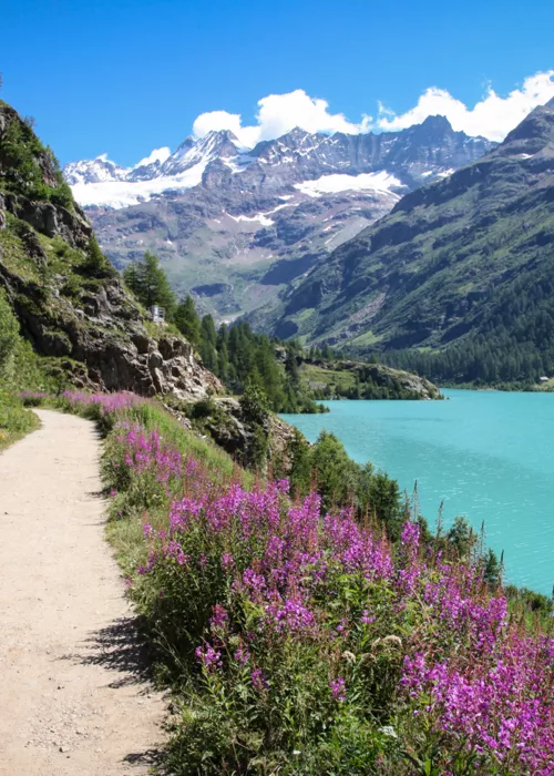
Val Ferret is also the ideal destination for anyone who loves trekking : an easy and well-signposted trail crosses the entire valley from Entrèves to the Col du Petit Ferret. After crossing Entrèves, you will leave your car and take the dirt track, passing the Dora di Val Ferret and, shortly afterwards, entering the forest. Once you have made your way through the forest, you will be rewarded with spectacular views of Val Ferret, Val Vény and Mont Blanc. This 15-kilometre route can be divided into stages, thanks to the three shelters found along the way: the first is Bertone Refuge , the second is Bonatti Refuge , which offers splendid views of the Dent du Géant, and the last is Elena Refuge , after Arnouva.
Cross-country skiing and snow biking in winter
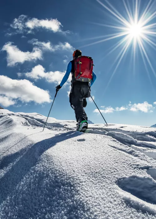
Val Ferret is an unmissable winter holiday destination. If you love snow-covered landscapes and activities in the snow, you are sure to be spoiled for choice, with opportunities to try out cross-country skiing , fat biking, snow biking or simply stroll along the beaten snow path reserved for pedestrians. In addition to Nordic skiing in Val Ferret, in Courmayeur you have two slopes perfect for downhill skiing or snowboard adventures, that of Chécrouit and that of Val Veny, and two ski schools, the ideal solution if you are a beginner.
The richness of Val Ferret, from fauna to flora
Val Ferret is also a Special Protection Area , located on a migration route and established with the aim of protecting birdlife. The protected area starts from the village of La Palud and extends to Col Ferret: 81 bird species have been identified, including some increasingly rare ones, such as the golden eagle, bearded vulture, red-crowned owl, ptarmigan, chough, black grouse, black woodpecker and red-backed shrike.
It is also home to the highest ibex colony in Europe, and you are very likely to spot chamois, roe deer, deer, hares and marmots: there is even a small group of albinos. The flora is equally spectacular. Adding to all the flowers and plants you will find along the trails of Val Ferret or Val Veny, be sure to visit the Saussurea Alpine Botanical Garden , among the highest in Europe, which can be reached by the Skyway cable car (first station at Pavillon du Mont Fréty). Set up in 1984 by the Donzelli-Gilberti Foundation to protect the Mont Blanc flora, it also hosts species from the Eastern Alps, Asia and North America.
Via Val Veny, 11013 Courmayeur AO, Italia

Related articles
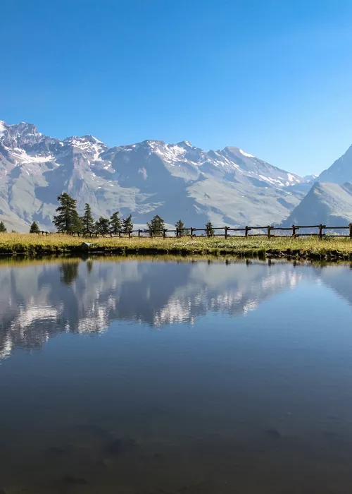
Aosta Valley: stress-free outdoor experiences among the highest peaks of the Alps
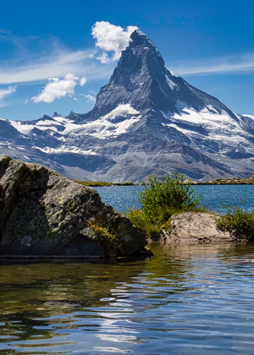
Landscapes of Aosta Valley

Aosta Valley: medieval fortresses and ancient traditions on Europe's highest peaks
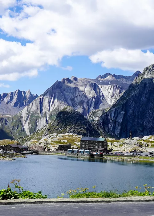
Aosta Valley: gateway to the Via Francigena in Italy
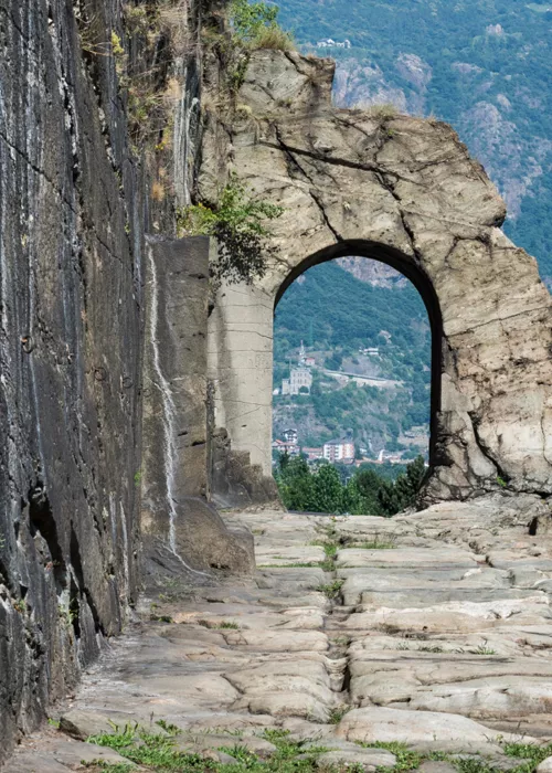
Aosta Valley CAI Trail: Donnas

The Skyway Monte Bianco cableway at Courmayeur: feeling on top of the world
What to do in Cervinia on winter weekends
Cycling and e-biking routes: in the Aosta Valley you'll be spoilt for choice
Aosta Valley by bike: get your adrenaline rush at Pila Bikeland
Aosta Valley: brief guide for an exclusive holiday
The Chanousia Botanical Garden, for a thrilling experience
Aosta Valley: snow, taste and well-being
Valle d'Aosta living is sustainable living

Aosta Valley and its legendary grappa
Mountain flavors: the typical products of the Aosta Valley

The Great St Bernard Pass: following the footsteps of pilgrims
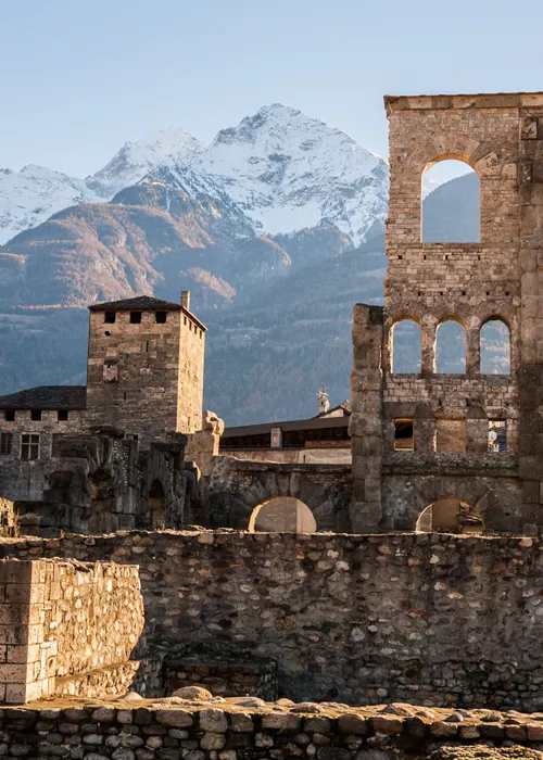
Discover Aosta: pristine landscapes and historic villages, churches and castles
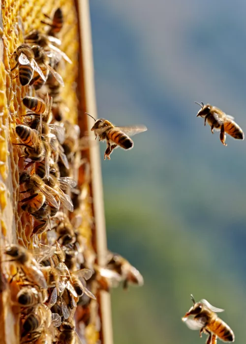
Valle d'Aosta, flavours at high altitude
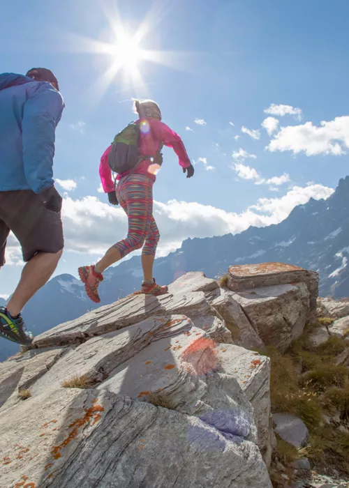
Wellness break in the Aosta Valley, where nature is therapeutic
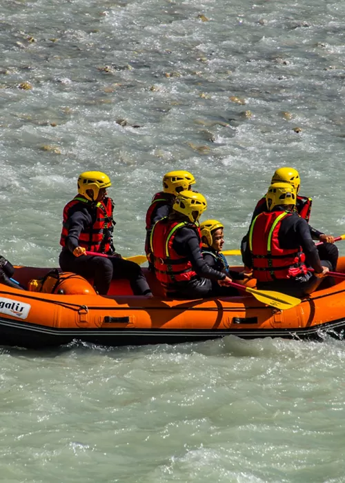
Rafting in Valle d'Aosta: thrills and adrenaline along the Dora Baltea
Continue living like an Italian
Subscribe to the Newsletter so as not to miss places, events and experiences for experiencing the best side of Italy: the authentic one.
Keep up to date
Would you like to learn about the most authentic experiences to be had in Italy, stay up to date on the most interesting events, discover our special offers and receive lots of insider hints and tips?
Save your favorite places
Create an account or log in to save your wishlist
Do you already have an account? Sign in

- Trip Finder
- Newsletter Signup
- Request a Call
- Crete Sea to Summit
- Best of the Swiss Alps
- Exploring The Jungfrau
- Italian Dolomites
- Best of the French Alps
- St Moritz to Italy
- Exploring Croatia
- Italian Lakes Discovery
- Best of Slovenia and the Julian Alps
- Tour of the Giants
- Italian Dolomites Alta Via 1
- Chamonix-Zermatt Haute Route
- Deluxe Haute Route
- Deluxe Tour du Mont Blanc
- Via Alpina - Swiss Alpine Route
- Deluxe Bernese Oberland Traverse
- Eiger to the Matterhorn
- England Coast to Coast
- Scenic Alps by Rail
- Cheese, Chocolate, & the Alps
- Self-Guided - Scenic Alps by Rail
- Self-Guided- Glacier Express
- Christmas in Switzerland
- Scenic Alps by Rail - Christmas Edition
- Self-Guided Haute Route
- Self-Guided Tour du Mont Blanc
- Self-Guided Jungfrau
- Self-Guided Via Alpina
- Self-Guided Bernese Oberland Traverse
- Self-Guided Eiger to the Matterhorn
- Self-Guided Swiss Alps
- Self-Guided Austria Zillertal Alps
- Private Guided and Custom Trips
- Appenzell -Alpstein Range
- Zermatt and the Matterhorn
- Leukerbad -Thermal Hot Springs
- Principality of Liechtenstein
- Saas-Fee - Pearl of the Alps
- Tour Calendar
- Where We Stay
- How We Travel
- FAQ – Alpenwild Experience
- FAQ - Tour du Mont Blanc
- FAQ - Haute Route
- FAQ - Alps Hiking Tours
- FAQ- Scenic Alps by Rail Tour
- A Self-Guided Tour FAQ
- Self-Guided FAQ - Haute Route
- Self-Guided FAQ - Tour du Mont Blanc
- Self-Guided FAQ - Rail Tours
- Travel Agents + Alpenwild
- Why You'll Love The Alps
- Packing List – Alps Trekking Tours
- Packing List – Alps Hiking Tours
- Packing List – Alps Walking and Sightseeing Tours
- Packing List - Winter Tours- Christmas in Switzerland
- Weather In The Alps
- Haute Route Essentials
- Tour du Mont Blanc Essentials
- Is a Self-Guided Trip for me?
- Car Travel in Switzerland
- Maps & Books
- Book Your Trip
- Make a Payment
- Why Choose Alpenwild
- The Alpenwild Story
- Guides and Trip Leaders
Highlights of the Tour Du Mont Blanc: Val Ferret

Whilst every place along the Tour du Mont Blanc is visually stunning, the Val Ferret really does take some beating! Val Ferret is a valley in Italy which runs from Courmayeur to a tiny hamlet called Arnuva. Whilst it’s possible to walk this stage of the Tour du Mont Blanc along the valley bottom, the balcony trail is far more interesting.
On Alpenwild’s Tour du Mont Blanc , we do this hike on the fifth day, after three days of hiking and a well-deserved rest day in Courmayeur. We hike straight from our hotel in Courmayeur to the trail head (stopping via the bakery for fresh bread for our pic nic lunch of course!)

One of the best parts of the Val Ferret balcony trail is that most of the ascent is gained in the first couple of hours, leaving a more leisurely afternoon to enjoy the views. After two hours of hiking up a forest trail, the trees clear and the Bertone Refuge comes into sight. Here you can reward your efforts with a cappuccino on the sun deck.
With most of the hard work done, the afternoon is spent meandering along an undulating trail which affords spectacular views of the Italian side of Mont Blanc and the Grand Jorrasses. On this day of the Tour du Mont Blanc you are walking on the opposite side of the Mont Blanc Massif to Chamonix. Looking back towards Courmayeur, it’s possible to see the Col de la Seigne which divides France and Italy. And looking ahead, the Grand Col Ferret rises up, forming the natural border between Italy and Switzerland.

After a few more hours of hiking you will reach a junction. From here you can descend to the valley floor or continue along the balcony trail. If the weather is good, I like to stay high as the views are better and the trail goes past the cosy Bonatti refuge. I always stop here for another coffee (when in Italy!)

From the Bonatti refuge it’s just a couple more hours hiking to reach the tiny Arnuva hamlet at the end of Val Ferret. On Alpenwild tours we stay in Arnuva overnight in a beautiful rustic family owned hotel. The hotel only has 10 rooms and is nestled into the hill side to keep it safe from avalanches in winter. On a summers day it’s lovely to spend the afternoon sunbathing on the grassy terrace, gazing up at the glacial peaks. With so little light pollution in the valley, it’s worth staying up late as on a clear night, it’s possible to see the milky way.

From Val Ferret, the next stage of the Tour du Mont Blanc is to climb over the Grand Col Ferret and wave goodbye to Italy and hello to Switzerland. More on that in a future post!
Are you planning to hike the Tour du Mont Blanc?
If you’re planning to hike the Tour du Mont Blanc this summer and looking for a luxury guided trip – why not check out Alpenwild’s Tour du Mont Blanc ?
You may also enjoy some of the other articles I’ve written on the Tour du Mont Blanc:
- Packing list for the Tour du Mont Blanc
- Is a guided Tour du Mont Blanc or self guided Tour du Mont Blanc for you?
- Are you fit enough to hike the Tour du Mont Blanc?
- Wildlife on the Tour du Mont Blanc
- The best time of year to hike the Tour du Mont Blanc
If you have any questions about the Tour du Mont Blanc, leave a comment below and I’ll be happy to answer.
- Recent Posts

- Haute Route Q&A - May 31, 2019
- Saint Luc: Highlights of the Haute Route - May 23, 2019
- Are hiking poles worth the purchase? - May 18, 2019
Interested in reading more content like this? Click subscribe to receive an email when a new post is published.
2 Replies to “Highlights of the Tour Du Mont Blanc: Val Ferret”
Leave a reply.
Your email address will not be published. Required fields are marked *
XHTML: You can use these tags: <a href="" title=""> <abbr title=""> <acronym title=""> <b> <blockquote cite=""> <cite> <code> <del datetime=""> <em> <i> <q cite=""> <s> <strike> <strong>
Save my name, email, and website in this browser for the next time I comment.
Blog Categories
- Wildlife and Nature
- Sightseeing and Exploring
- The Via Alpina Hiking Trail Archives
- Snowshoeing
- October 2023
- August 2023
- January 2023
- November 2022
- January 2022
- November 2021
- October 2021
- September 2021
- February 2021
- January 2021
- December 2020
- November 2020
- October 2020
- September 2020
- August 2020
- February 2020
- January 2020
- December 2019
- November 2019
- October 2019
- September 2019
- August 2019
- February 2019
- January 2019
- December 2018
- November 2018
- October 2018
- September 2018
- August 2018
- February 2018
- January 2018
Sign Up for Our Email Newsletter
Stay up to date on the latest Alpenwild news. You're free to opt out at any time.
See our Privacy Policy.

- Bicycles and Mountain Bikes
- Summer skiing
- Mountaineering
- Winter sports
- Other sports
- Guided hikes and tours
- Pré-Saint-Didier Thermal Spa
- Saint-Vincent spa
- Roman Architecture
- Food events
- Where to eat
- Gran Paradiso national park
- Mont Avic natural park
- Nature Reserves
- Botanical Gardens
- Natura 2000
- Walking trails
- Motorcycle routes
- Cultural itineraries
- Food & wine tours
- Spiritual itineraries
- Cable cars to the 4,000’ers
- Casino de la Vallée
- Observatory
- Glider flight
- Air balloon flight
- Paragliding
- Helicopter flight
- Giants of the Alps
- Tourist areas
- Accommodation
- Online booking
- Weather report
- Downhill snow report
- Crosscountry snow report
- Information
- Getting around
- Coming by car
- Coming by train
- Coming by coach
- Arriving by plane
- Airport transfers
Out & about
Tourist areas

- Introduction
- Gran Paradiso
- Great Saint Bernard
- Aosta and surroundings
- Lower valley and Mont Avic

This splendid valley runs from the foot of Mont Blanc on towards Col Ferret, the pass that leads over into Switzerland. Along the left side of the valley are some of the loftiest, most magnificent peaks in the Alps: the Dente del Gigante , the Grandes Jorasses , the Aiguille de Triolet and Mont Dolent , while the slopes of Mont de La Saxe on the right are considerably less forbidding. The views here are spectacular all year round.
In the summer, mountain lovers will find a huge choice of routes available to them, from walks up to the mountain huts to high-altitude trekking trips and challenging mountaineering routes. The valley also boasts a nine-hole golf course and mountain bike trails, as well as offering the opportunity to try activities such as angling or even just to enjoy the view from the valley bottom as you relax outside the local bars and restaurants.
In winter, the Val Ferret offers cross-country skiing fans 20 km of slopes with great snow right up towards the end of spring.
- Page 1 of 1
- 10 25 50 100 Results per page
- Order by date place Type
Cyclotour: Courmayeur – Val Ferret
Courmayeur lies at the foot of the enormous Mont Blanc massif and is the oldest Alpine resort in Val d’Aosta. Ever since the 19th century it has been regarded as the capital o…
Arp Nouva - Rifugio Elena - Col du Grand-Ferret
Once you reach Arp-Nouva by bus, cross the bridge over the stream and continue along the dirt road until you come to a path, which goes off to the right and is signposted TMB. After severa…
Balcony on Mont Blanc
The majority of the trail follows the balcony on the slopes of the Mont-de-la-Saxe , at around an altitude of 2000 m so it is an ideal route for panorami…
Lavachey - Rifugio Bonatti - Col Entre-Deux-Sauts
From Courmayeur, continue along the paved road and go into Val Ferret . When you get to Lavache y, continue for a further 1 km and, just before crossing th…
Mont-de-la-Saxe
Leave the car in Planpincieux, in the municipality of Courmayeur, then continue along the paved road walking alongside the Grandes Jorasses campsite. When you reach a chapel,cross the Dora of th…
Rifugio Bonatti - Col Malatrà
The departure point for this trail is the Bonatti refuge. You can get to the refuge by taking Altavia 2 from Courmayeur, or go up route 28, which starts on the right side of the Val Ferre…
Villair - Bertone Refuge - Bonatti Refuge
From Courmayeur, take the road that leads to the village of Villair Superiore, at the entrance to Val Sapin. From here, the road continues to climb then becomes a dirt road and crosses the Tsap…
Grandes Jorasses
Day one From Planpincieux, near the bars and restaurants, head towards the centre of the village following signs for the Boccalatte Refuge. After passing close to a smal…
Mont Dolent
First day From Arnouva, walk along the dirt road that rises from the valley to the hairpin where, on the left, a path climbs to the summit of the Tête de Ferret. Th…
MOTOTOUR 16 - Morgex – Val Veny and Val Ferret (Round Trip)
VAL FERRET AND VAL VENY, WHITE SPECTACLE Just a few Km after Courmayeur you encounter Entrèves, characteristic village. If you think the landscape has been amazin…

- . Bicycles and Mountain Bikes
- . Summer skiing
- . Mountaineering
- . Winter sports
- . Other sports
- . Guided hikes and tours
- . Having fun
- . Pré-Saint-Didier Thermal Spa
- . Saint-Vincent spa
- . Roman Architecture
- . Tradition
- . Food and wine
- . Food events
- . Where to eat
- . Gran Paradiso national park
- . Mont Avic natural park
- . Nature Reserves
- . Botanical Gardens
- . Natura 2000
- . Itineraries
- . Walking trails
- . Snowshoes
- . Motorcycle routes
- . Cultural itineraries
- . Food & wine tours
- . Spiritual itineraries
- . Experiences
- . Cable cars to the 4,000’ers
- . Casino de la Vallée
- . Observatory
- . Glider flight
- . Air balloon flight
- . Paragliding
- . Helicopter flight
- . Out & about
- . Giants of the Alps
- . Tourist areas
- . Multimedia
- . Where to stay
- . Accommodation
- . Apartments
- . Online booking
- . Plan your trip
- . Weather report
- . Downhill snow report
- . Crosscountry snow report
- . Information
- . Getting around
- . How to get there
- . Coming by car
- . Coming by train
- . Coming by coach
- . Arriving by plane
- . Airport transfers

Department of Tourism, Sport and Commerce
© 2000-2024 Regione Autonoma Valle d'Aosta
- Tour Planner
Highlight – Escursionismo ( Segmento )
Consigliato da 40 escursionisti
Posizione: Orsières , Entremont , Valais , Svizzera
Splendida Val Ferret, semplicemente un ambiente mozzafiato.
29 gennaio 2021
In un'escursione attraverso la Val Ferret si misurano i diversi livelli di altitudine, i tipi di paesaggio e la fruizione del paesaggio culturale alpino, da Issert (ca. 1.000 metri) a Ferret (ca. 1.700 metri), dai prati di bassa quota a i ghiaioni dei ghiacciai. Gli ultimi masi e le numerose case di villeggiatura sono sparse in un ambiente inizialmente idilliaco, che diventa sempre più selvaggio man mano che si sale più in alto.
8 settembre 2017
7 agosto 2023
Vuoi condividere la tua esperienza? Effettua l'accesso e aggiungi il tuo suggerimento!
- Naviga a questo punto
- Suggerisci una modifica
Informazioni
- Distanza 9,96 km
- Salita 700 m
- Discesa 220 m
Altri luoghi che potresti scoprire
Orny-Gletscher
Gîte de la Léchère
Les Arlaches
Berghütte La Peule
Gran Col Ferret Trail
Bivouac du Dolent
Champex-Lac Viewpoint
Relais d'Arpette
Vista sulla Val Ferret e il massiccio del Monte Bianco
Thirdeyemom
Traveling the world and doing good, a taste of the tour de mont blanc: a hike in val ferret, courmayeur.
Our first hike along our taste of the Tour de Mont Blanc (TMB) was in the Val Ferret, one of two breathtaking valleys that cut through Courmayeur, Italy on the southeastern side of Mont Blanc. Known as one of the most stunning hikes in the area, especially if blessed with good weather, hiking in Val Ferret would set the tone of what would be a stunning eight full days of hiking around the TMB and leave me longing to go back.
We rose early to one of many mouth-watering, gorgeous mornings in the Alps. The sky was cloudless and eggshell blue and the view of the towering, snow-capped jagged Graian Alps pierced through the sky like lightning. We enjoyed a lovely breakfast of fresh Italian parma ham, local cheese, homemade bread, and sweets before lacing up our hiking boots and heading out.

View right outside my hotel window in Courmayeur, Italy
Although we had rented a car for the week, our hotel recommended taking the bus to the start of our hike since parking is difficult on busy weekends in the summer. With our backpacks ready to go and a picnic lunch of fresh Italian baguette, local cotta ham, tomatoes, and Piave cheese, we set off. We caught the bus at the city hall (Municipio) stop located a few short blocks from our hotel in the direction of Val Ferret.
As we left Courmayeur, it was obvious that the rest of the fully packed bus was also heading to the Val Ferret for a hike. The thirty-minute ride was filled with fellow trekkers from all around the world, sharing stories of their routes and experience on the TMB. It was fun to chat and compare notes, and I especially was excited to meet fellow women older than me partaking in the tour self-guided. Everyone was filled with smiles and laughter. Obviously, their souls were happy and fulfilled from the fresh mountain air and stunning views afforded along the TMB. It made me even more excited to start our day and do our first hike.
The bus drove through a winding valley road and we got off at the stop marked Rifugio Bonatti where we would access the trail.
The air was fresh and pure, and as soon as I was off the bus and on the trail, I felt alive with excitement and anticipation for our day. I was in my element, and all I could think of was the famous John Muir quote: “The mountains are calling and I must go”.

Heading off into Val Ferret

Sensational views like this are common on a lovely day in Val Ferret
The first part of the hike brings you up to the Rifugio Bonatti, a relatively steep 30 minutes up through beautiful forest and wildflowers with jaw-dropping views of the surrounding Alps. Although we had only just begun our hike for the day, the setting at Rifugio Bonatti was too darn beautiful to not stop and take it all in. We ordered a cappuccino and hot chocolate to enjoy on the patio before setting off on our journey hiking back to Courmayeur.

The Rifugio Bonatti (2025 m) is located on a pastoral hillside on the south side of Val Ferret facing the impressive Grandes Jorasses. The Rifugio is named in honor of great Italian mountaineer Walter Bonatti and is one of the nicest huts on the TMB. We took a brief look inside and it definitely is lovely.
After setting off, we headed for about two hours in the direction of Rifugio Beretone passing through high open meadows, covered in wildflowers and with extraordinary panoramic views that make this one of the most stunning hikes of all along the TMB.
I was impressed by how well-marked the trailheads are, making it quite easy to do the TMB self-guided. Every trailhead had not only distance but approximate time with multiple choices.

The Val Ferret is one of two valleys that slice through Courmayeur. The TMB goes through both the Val Ferret and the Val Veny and each valley is quite unique. As you hike from Rifugio Bonatti to Rifugio Beretone along the TMB, you pass along the glorious north flank of the Mont de la Saxe and what makes this hike so astounding is that the two sides of the valley are completely different.
The northern side is rugged with steep, with high rocky peaks dripping with glaciers while the southern side is beautifully verdant and lush. It is quite surreal walking through this large open meadow cut through these diverse valleys along the flank of Mont Saxe. Part of the joy of this hike is taking the time to stop and pinch yourself that it is not all but a dream.
We hiked to the sound of cicadas and the song of cuckoo birds and enjoyed the many Buongiorno ‘s along the way.

Following the path

There are lots of tiny villages and hamlets like this one below in case you want to take a break and spend the night.

Glaciers are everywhere too.

We reached the Rifugio Beretone two hours later and it was buzzing with activity. Since it is only about an hour and a half hike from Courmayeur, many Italians hike up for lunch on the weekend.

After you pass the rifugio, the rest of the hike continues down a very rocky and steep trail. It is rather hard on the knees and toes! I am glad we did the hike this way as opposed to the other way as it would be hard to start with such a steep incline.
Just as we were beginning to wonder when the hike would be done, we entered a small hamlet on the outskirts of Courmayeur and were back in civilization. In not too long, we were back in town enjoying a well-deserved gelatto and already dreaming about the next day’s hike into Val Veny.
Rifugio Giorgio Bertone (at 1985 m) is a popular day hike from Courmayeur, especially on weekends, where the locals climb up the steep 1.5 hour trail and dine in the heart of the Alps. www.rifugiobertone.it
Rifugio Bonatti (2025 m) – located on a pastoral hillside on south side of Val Ferret faceing the impressive Grandes Jorasses. Named in honour of great Italian mountaineer Walter Bonatti and one of the nicest huts on the TMB. www.rifugiobonatti.it
To reach the hike, take the bus from the Municipio stop in Courmayeur and get off at the Rifugio Bonatti. Hike is approximately 12 km and takes roughly four hours with a few stops along the way.
Like it? Why not PIN for later!

I would love it if you shared!
14 comments.
How beautiful
Thanks! I sure love the Alps!
RUT!….
But of course! 🙂
- Pingback: A Taste of the Tour de Mont Blanc: A Hike in Val Ferret, Courmayeur — Thirdeyemom | O LADO ESCURO DA LUA
breathtaking pics. when is the best month to visit Mont Blanc?
Thank you! The best months are June, July and August. 🙂
Another fabulous hike Nicole. I hope I get to see this part of the world one day. Alison
Me too Alison! You would love it! Besides the hiking, the views in the town are incredible so you can just enjoy a breathtaking meal outside in Courmayeur or Chamonix with the Alps right there. It really is special.
You would love it Alison! 🙂
An incredible experience, Nicole! Your terrific photos tell the story of this spectacular area. Thanks for taking me there. 🙂
Thank you Jane. I really have a special place in my heart for Europe. Always have, always will. I love the beauty of all these mountain towns and villages. They make me so happy.
Nicole what a stunning hike and I especially love the idea of being able to stop for refreshments and snacks and take in all of the beauty. Wonderful to see such a range of ages.
Thanks Sue! This is a trek you must do! I know you’d love it! We also saw some brave souls mountain biking on the TMB! I think it would be better though to hike it. Then you can capture all its beauty. I was so inspired by the wide range of ages on the trek. There were tons of people in their 60s and 70s which inspired me deeply! (Not to mention my Dad). 🙂
Leave a Reply Cancel reply
This site uses Akismet to reduce spam. Learn how your comment data is processed .
Discover more from Thirdeyemom
Subscribe now to keep reading and get access to the full archive.
Type your email…
Continue reading

ALTIMETRIA QUOTE E DISTANZA
dislivello totale salita: mt 1.430 quota massima: mt 2.080 quota minima: mt 1.262 km totali: 34,7
SENSO DI MARCIA
girare in senso orario
TEMPO DI PEDALATA
di puro movimento 4 ore e 30 minuti
SINTESI VALUTAZIONI
panorami: 10/10 difficoltà salita: 8/10 difficoltà discesa: 10/10 impegno fisico: 8/10
NOTE GENERALI (ES. NON PEDALABILITA’, DIFFICOLTA’ PARTICOLARI, NOTE VARIE, ECC.)
pendenze: massima salita 14,6%, massima discesa 30,8% tratto a mano: circa 40 minuti nel complesso dell’itinerario. In particolare, una ventina di minuti a spinta/spalla sono richiesti per salire dei quota sul sentiero della Val Ferret (Sentiero della Grande Balconata della Val Ferret), complessivamente si parla di circa 150/180 metri di dislivello non ciclabile, escludendo i brevi tratti in cui è possibile pedalare; in seguito, percorrendo il sentiero della Balconata, si incontrano diversi brevissimi passaggi a spinta sopratutto più frequenti dopo il rifugio Bonatti: complessivamente occorre mettere in preventivo una decina di minuti; infine occorre confrontarsi con l’ostico e ripido sentiero di discesa dopo il Rifugio Bertone, dove i tempi non in sella sono naturalmente commisurati alle proprie capacità di discesa ed al mezzo tecnico a disposizione: anche in questo casi è bene mettere in preventivo una decina di minuti complessivi per i molteplici passaggi sopratutto nella prima parte di discesa salita: prevalentemente su asfalto con massima pendenza del 9-10% sino a Planpincieux, poi eccetto il breve tratto a tornanti, ci si confronta con asfalto dalla modesta pendenza fino a Arpnouva; lo sterrato per il Rifugio Elena è in ottime condizioni con pendenze massime attorno al 12-14%; il grado di difficoltà piuttosto elevato attribuito all’itinerario è legato alla percorrenza dei tratti in salita sul sentiero che percorre in quota la Val Ferret, spesso piuttosto intensi ancorchè brevi e comunque su stretta traccia di sentiero discesa: molto difficile causa pietre e passaggi con stretti tornanti – vedasi quanto indicato in scheda % sterrato: 71% ricordarsi : // note: evitarne la percorrenza nei periodi estivi di più alta frequentazione turistica

Avvertenza: l’utilizzo della traccia è ad esclusivo proprio rischio e lo scarico è reso disponibile per finalità di mera informazione e statistica. Chi decide dunque di affrontare il percorso si assume tutte le responsabilità per rischi e pericoli a cui si può andare in corso, considerando altresì che la percorribilità e lo stato delle strade e dei sentieri muta nel corso del tempo e che non sussiste alcun obbligo di Itinerari-mtb.it a mantenere aggiornate le informazioni essendo un mero sito illustrativo degli itinerari storicamente percorsi dai componenti del Team. Itinerari-mtb.it declina pertanto ogni responsabilità per conseguenze legate all’uso della traccia o delle informazioni legate alle presente scheda di itinerario
2 risposte a Tour dei tre Rifugi della Val Ferret
Grazie della descrizione, traccia GPS e foto. Ci siamo stati il 15 agosto. Posti incredibili e spettacolari – frequentato ovviamente anche da escursionisti ma non ci hanno disturbati, con un po’ di toleranza c’è posto per tutti. Mi permetto solo di dire che noi “bikers di livello medio” abbiamo spinto la bici anche per lunghi tratti dove nella descrizione si leggeva “diventa quasi interamente ciclabile”. La discesa dal rif. Elena per sentiero non la farei più inquanto per noi a tratti non ciclabile – tornerei per la stradina per risparmiare un po’ di energia per quello che segue. Quanto alla discesa dal rif. Bertone (fino a trovare la sterrata a 1500) devo dire che l’abbiamo trovata assai difficile (direi un buon S3 se non S4 in alcuni punti) e siamo riusciti a pedalare ben poco – questa impressione è stata confermata anche da bikers più esperti di noi e tecnicamente più bravi. Ciò non toglie niente al giudizio complessivo “BELLISSIMO” nel complesso – al patto di accettare anche molti tratti da fare a piedi diventando così un percorso “ciclo/escursionistico” Grazie ancora
Bellissimo giro con panorama impressionante… nella seconda parte più cicloescursionitico che di mtb pura, il tratto di spinta complessivo dura più di una ora e 5h30 di movimento totale (almeno per me mediamente allenato). Come indicato se fatto in giornate estive come oggi oltre a fermarsi per spingere la bici bisogna fermarsi per fare passare gli escursionisti sempre nella seconda parte. Tutti e tre i rifugi offrono da bere e da mangiare. Discesa per amanti del genere è top fino ai 1500mt
Lascia un commento Annulla risposta
Il tuo indirizzo email non sarà pubblicato. I campi obbligatori sono contrassegnati *
Attivare box di controllo per OK a tenuta e utilizzo dati personali di cui informativa Privacy nel sito. *
- Panoramica privacy
- Cookie strettamente necessari
- Cookie di terze parti
- Cookie Policy
Questo sito Web utilizza i cookie in modo da poterti offrire la migliore esperienza-utente possibile. Le informazioni sui cookie sono memorizzate nel tuo browser e servono a riconoscerti quando torni sul nostro sito Web ed aiutare il nostro team a capire quali sezioni del sito Web ritieni più interessanti e utili.
I cookie strettamente necessari dovrebbero essere sempre attivati per poter salvare le tue preferenze per le impostazioni dei cookie.
Se disabiliti questo cookie, non saremo in grado di salvare le tue preferenze. Ciò significa che ogni volta che visiti questo sito web dovrai abilitare o disabilitare nuovamente i cookie.
Questo sito utilizza Google Analytics per raccogliere informazioni anonime come il numero di visitatori del sito e le pagine più popolari.
Devi prima attivare i cookie cosiddetti "strettamente necessari" così da poter salvare successivamente le tue preferenze!
Più informazioni riguardanti la nostra Cookie Policy
Tour Sci Alpinistico ad Anello della Val Ferret
Escursione su richiesta.
Questa escursione è su richiesta, se sei interessato indicaci quando vorresti effettuarla ed inviaci i tuoi riferimenti. Ti contatteremo subito per darti la disponibilità di una guida e per ulteriori informazioni.

Questo spettacolare tour ad anello di scialpinismo è una meravigliosa ed incredibilmente panoramica escursione che si sviluppa in un ambiente fatato. Tocca i colli di Bandarrey, Fourchon, Saint Rhemy e Malatrà.
Un bellissimo itinerario che sconfina in territorio svizzero e che accompagna gli escursionisti attraverso ampi ed evocativi pendii regalando panorami stupendi, salite stimolanti ed emozionanti e divertentissime sciate su neve fantastica. Un itinerario lungo e impegnativo ma incredibilmente remunerativo che si sviluppa prevalentemente su ampi pendii.
- Difficoltà media
Presenza punti di ristoro nelle vicinanze
- Numero massimo partecipanti
Adatta solo agli adulti
Informazioni sull'escursione di sci alpinismo in Val Ferret
Il tour sci alpinistico ad anello della Val Ferret parte dalle località di Arnouva o Lavachey, nella parte italiana della Val Ferret; si sale in direzione del Rifugio Elena. Superato il rifugio, si prosegue lungo il fondo del vallone fino a raggiungere il Colle di Bandarrey (2696 metri) a cui si arriva superando un breve risalto molto ripido.
Inizia, poi, la discesa in territorio svizzero, ma prima di effettuarla è possibile salire all'Aiguille des Angroniettes che è proprio sopra il colle. Entrando in Svizzera si scende fino ad una quota di circa 2150 metri per, poi, risalire -attraverso un canale- verso il Col Fourchon (2695 metri).
Dal colle si rientra in Italia con una bellissima discesa di 300 metri di dislivello. Velocemente, poi, si sale al Colle di St. Rhemy o al vicino Col d'Arc (2'560 metri) da cui si scende nella Comba di Merdeux fino ad incrociare la bella strada poderale. Se le condizioni della neve lo consentono, è possibile scendere fino al torrente e risalire aggiungendo all'anello ulteriori 300 metri di dislivello in discesa ed in salita.
L'ultimo tratto con le pelli di foca si affronta per salire al Col Malatrà lungo un ripido pendio. Dal colle si scende dolcemente verso il Rifugio Bonatti per raggiungere la strada che riporta gli escursionisti al punto di partenza.
L'escursione sci alpinistica ad anello della Val Ferret parte da una quota di 1642 o 1769 metri e raggiunge una quota massima di 2934 metri coprendo un dislivello totale di 2600 metri. È classificata come BS e l'esposizione prevalente durante la discesa è variabile.
Prezzo tour sci alpinistico ad anello della Val Ferret
€ 445 - fino a 2 persone
€ 495 - fino a 3 persone
€ 550 - fino a 4 persone
Dove incontrerai la tua guida alpina in Val Ferret
- Punto di ritrovo Il giorno dell'escursione fatti trovare: Ristorante Chalet Dolent 3 Località Lavachey in Val Ferret 11013 Courmayeur, AO dove incontrerai la tua guida alpina.
- Orario di ritrovo da definire
- Coordinate geografiche 45°50'59.6"N 7°01'17.4"E
- Trasferimento Non ci sono trasferimenti dal luogo di ritrovo al luogo dell'escursione
Cosa portare

Cosa è importante sapere
Ricorda di portare l’attrezzatura minima indispensabile per effettuare l'attività. Nel caso tu sia sprovvisto dell’attrezzatura segnalacelo, provvederemo noi a procurartela, se disponibile o a noleggio.
La prenotazione di questa esperienza è individuale, con guida alpina dedicata, può essere effettuata per un numero di partecipanti che non eccede il numero massimo consentito.
Il prezzo indicato è riferito all'escursione con guida alpina dedicata ed all’eventuale trasferimento con mezzo privato della guida. Si intende per prenotazioni fino al numero massimo di partecipanti previsto.
La guida alpina può annullare o interrompere l'escursione o modificarne l’itinerario qualora non siano garantite le condizioni minime di sicurezza. Visualizza le condizioni e i termini previsti
Per questa esperienza sono previsti termini di cancellazione e modifica moderati. Visualizza le condizioni e i termini previsti
Come prenotare la tua guida alpina
Per effettuare la prenotazione dell'escursione sci alpinistica ad anello della Val Ferret con guida alpina, devi inviare una richiesta che deve indicare i tuoi riferimenti, il numero di partecipanti e la data/periodo in cui vuoi effettuare l'escursione sci alpinistica. Il nostro team ti risponderà subito con la disponibilità della guida, eventuale data di scadenza opzione per la prenotazione, modalità di pagamento, caratteristiche ed organizzazione dell’attività. Una volta confermata la prenotazione ti invieremo la ricevuta e il voucher di presentazione con i dettagli relativi al servizio, il nome della guida alpina, o della scuola d’alpinismo, e i riferimenti di contatto.
Ti potrebbe anche piacere...
Sci Alpinismo in Val Ferret al Col Malatrà
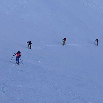
Sci Alpinismo in Valle d'Aosta alla Tête Entre Deux Sauts
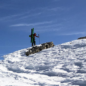
Sci Alpinismo all'Aiguille des Angroniettes in Val Ferret
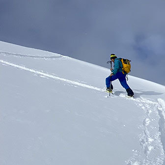
Sci Alpinismo alla Testa Bernarda
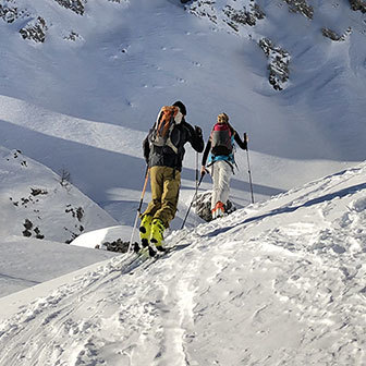
Sci Alpinismo al Mont de la Saxe
Sci Alpinismo al Mont Dolent
Sci Alpinismo al Mont Grapillon
Sci Alpinismo al Mont Chetif
Sci Alpinismo al Monte Bianco dal Rifugio Des Cosmiques
Tour Sci Alpinistico al Monte Bianco dal Rifugio dei Grand Mulets
Sci Alpinismo al Monte Bianco dal Piton des Italiens
Sci Freeride al Ghiacciaio del Toula
Vallée Blanche, Sci Freeride al Monte Bianco
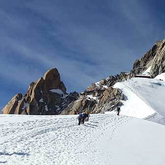
Traversata Vallée Blanche nel Ghiacciaio del Monte Bianco
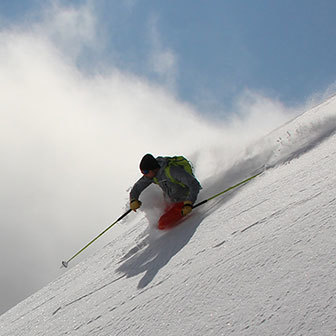
Marbrèe, Sci Freeride al Monte Bianco
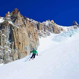
Sci Freeride Canalone Aiguille des Glaciers
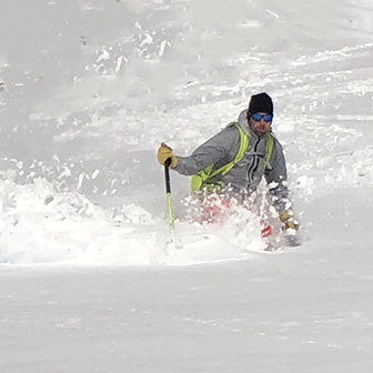
Sci Freeride da Punta Helbronner
Via Normale Italiana al Monte Bianco
Salita al Monte Bianco, Via Normale Gouter
Sci Freeride a Chamonix, Freeride al Glacier Rond
Sci Freeride nei Boschi del Pavillon al Mont Frety
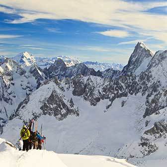
Sci Alpinismo all'Aiguille du Midi e Glacier du Géant
Prenota la tua guida.
Affidati alle nostre guide alpine per vivere un'esperienza indimenticabile. Scegli un posto e un’attività, al resto pensiamo noi!
- Trip Finder
- View Catalog
- Subscribe to Newsletter
- Contact/Request Info
- Client Portal
- SUBSCRIBE TO NEWSLETTER
- About Ryder Walker
- About Our Inns
- Meet Our Team
- Guest Reviews
- Special Offers
- Awards & Stories
- Conditions & Policies
- Guided Hiking Tour Schedule
- Easy Going-Moderate Treks
- Moderate-Challenging Treks
- Challenging Treks
- The Dolomites
- Swiss Engadine
- Berner Oberland
- Tour du Mont Blanc
- Switzerland
- Private Hikes
- Self-Guided Tour Schedule
- Easy Going Treks
- Liechtenstein
- Berner Oberland Mini Trek
- Chamonix To Champex Mini Trek
- The Heart of Austria Mini Trek
- Italian Dolomites Mini Trek
- Swiss Engadine Mini Trek
- Telluride Mini Trek
Italy | Highlights of Italy: Courmayeur, Cogne, Champoluc
A showcase of three of our favorite regions in italy.
REQUEST MORE INFO | TRIP ITINERARY & MAP | FAQs
Trip Highlights :
Experience true italian authenticity in three italian regions surrounded by elegant scenery., after a full day of exploring, rest in superior 4-star hotels known for their hospitality and ambiance., dine on haute cuisine in elegant surroundings to regional, farm-to-table specialties in cozy surroundings..
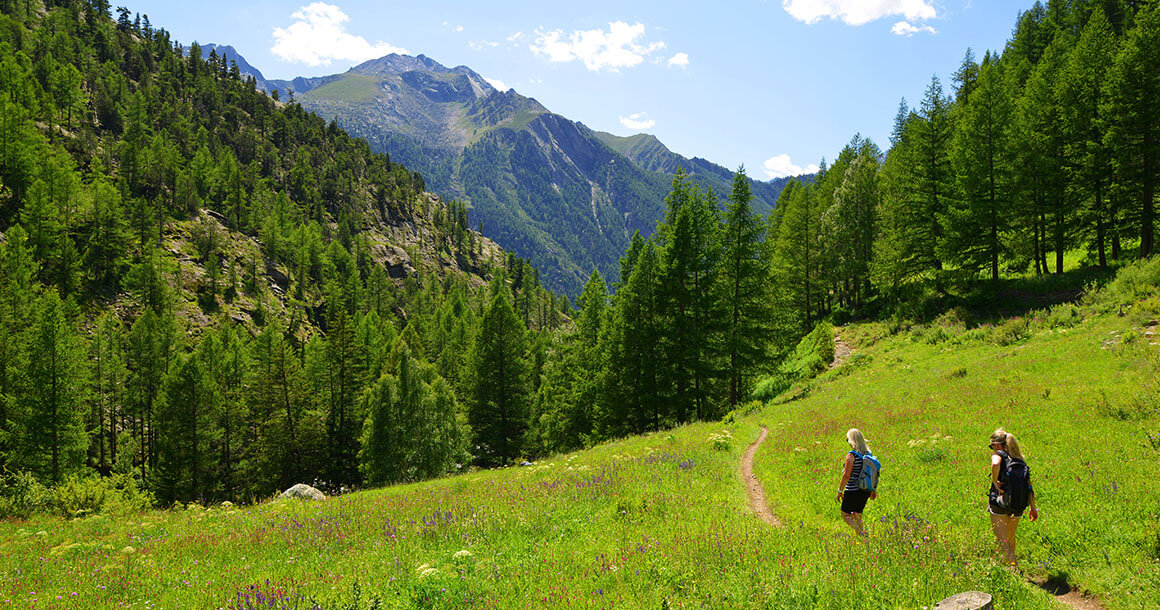
The Highlights of Italy Trek was designed to showcase three of our favorite villages in the Val d’Aosta region of Italy , as well as provide exceptional hiking with a broad range of physical challenge. For those who prefer to unpack and stay unpacked for a few days at a time, this trek is for you.
We begin our trek in the beautiful, historic alpine resort town of Courmayeur, ideally perched at the headwaters of the Dora Baltea river which carves its way through the Val d’Aosta and ultimately down to the Mediterranean. Courmayeur is located in Northwest Italy, bordering France and Switzerland, and sits directly beneath the imposing south face of Mont Blanc, arguably the most impressive aspect of this peak .
Our next trekking adventure takes us to Cogne, one of the most beautiful villages in the Aosta Valley, located in the heart of the Gran Paradiso National Park – Italy’s oldest national park . There are 130 waterfalls inside the park and it is home to the Paradisia botanical garden with more than 1000 mountain-dwelling species including Ibex, wild goat, marmots, and royal eagles. Cogne is surrounded by four valleys and proudly showcases the vast Meadows of Sant’Orso, recognized as a “Wonder of Italy.”
Our final destination is the charming village of Champoluc, where summer visitors experience countless hiking trails around the Monte Rosa massif while enjoying magical views of the surrounding glaciers and peaks. During the 12th century, the Walser people emigrated from the lower reaches of the Swiss Valais to settle the high mountains that surrounded them and traces of their existence are still evident in the upper Val d’Ayas where Champoluc sits.
Throughout the tour we have chosen to stay in superior 4-star hotels known for their hospitality and ambiance. Similarly, food ranges from haute cuisine in elegant surroundings to regional, farm-to-table specialties in cozy, authentic surroundings .
Learn more about the Northern Italian Alps-Valle d'Aosta destination
Trip Itinerary
Day 1 - arrive in courmayeur.
Independently transfer to Courmayeur. Overnight in a well-appointed four-star hotel not far from the pedestrian zone.
Day 2 - Checrouit/Masion Ville to La Visaille
Setting out with Courmayeur’s main tram to Plan Checrouit, we ascend to a magnificent ridge directly opposite some of the most spectacular scenery in all of the Alps. We spend the morning fascinated by the South Face of Mont Blanc (its most impressive side). After a well-timed espresso stop, we descend into the Val Veny, a verdant glacier scoured valley below the French border. Wander gentle WW1 roads to La Visaille for our quick shuttle home. A panoramic start to say the least!
Distance: 6 miles. Elevation gain/loss: 1200/2000 ft.
Day 3 - Sentiero Balcone della Val Ferret
The balcony path above the Val Ferret is the perfect complement to yesterday’s outing in Val Veny. In fact, it is a near mirror image. Still staring up at the South Face of Mont Blanc we now get a full view of its most famous facet – The Brenva. As the legendary Tom Patey once put it, “Any fool can monkey around on rock overhangs, but it takes craft and cunning to beat the Brenva”! Sure enough this Himalayan-scale wall of ice was the setting for many of mountaineering’s most significant developments over the course of generations.
Distance: 7 miles. Elevation gain/loss: 1800/2100 ft.
Day 4 - Transfer to Cogne
Cogne is approximately a 1-hour drive, first down the main valley and then climbing up to the edge of the Grand Paradiso National Park. The park was established by King Victor Emmanuel in the early 19th century to protect its legendary Ibex herd (from poachers – he wanted to hunt them himself!). The Ibex are Italy’s most majestic wild animal and are now ever present after having been culled to a herd of only 60 at the time of the park’s initiation. We have the option to enjoy a lovely circumnavigation on floor of the beautiful Valnontey or a quick ascent to a nearby sub summit for those in need of more challenging terrain.
Day 5 - Lago di Loie Loop Hike
One of the most celebrated hikes in the Cogne area, excellent views and ever-changing terrain all culminating in the wonderful cascading waterfall “Cascade de Lillaz”. The Lago di Loie is a crystal clear emerald green lake set against the backdrop of Mont Blanc now receding into the distance. Begin in the tiny hamlet of Lillaz just up valley from Cogne. Marmots and Ibex abound in this lovely amphitheater. Continue on to the upper ridge to complete a circumnavigation of the valley or enjoy shorter options back to your start point.
Distance: 8 miles. Elevation gain/loss: 2100/3100 ft.
Day 6 - Rifugio Vittorio Sella
This out and back trail goes into the National Park and features the possibility of wildlife viewing, as well as views of the Grand Paradiso mountain. Start wandering along the floor of the Valnontey beside the river or enjoy a jump start by vehicle to the hamlet of Valnontey. An excellent, very broad path, takes us into the Lauson Valley below the Petit and Grand Lauson. The gentle trail is a wonderful feat of engineering. Enjoy a fabulous hut lunch at the Rifugio Vittorio Sella – you may even have Ibex trying to steal your food!
Distance: 6 to 10 miles. Elevation gain/loss: 3300 ft.
Day 7 - Cogne to Champoluc
Begin with a scenic 1.5 hour transfer to Champoluc. Spend the a afternoon hiking above the village. There are several hike options to choose from, including an easy-going loop hike to the Cappella Sarteur. Harder options such as the Mezzalama hut are also available. Champoluc has risen from its humble history to become a startlingly beautiful and elegant Aostan mountain village below the magnificent flanks of the Breithorn and Lyskamm.
Day 8 - Alpi di Verra and Lago Blu
Today we experience an excellent loop out of the village of St. Jacques, the highest in the valley. A remarkably charismatic hamlet, St. Jacques is not to be missed! We spend the day under the broad flanks of the Breithorn (the peak that towers above Zermatt, Switzerland on the opposite side of the ridge). The Lago Blu is a charming byproduct of glacial advances of the early 19th century when the ice was exceptionally active. It now even boasts gentle white sand beaches.
Distance: 8 miles. Elevation gain/loss: 2700 ft.
Day 9 - Crest/Col Pinter
After a quick transfer with the Crest cable car, we spend our last day on an epic climb to the Col Pinter. An absolute highlight will be the views all the way back to Monte Bianco! The Lago Pinter is a wonderful lunch spot near the pass to Gressoney. With the addition of a new cable car stage to Ostafa, this outing can be as strenuous or gentle as you wish.
Distance: 9 miles. Elevation gain/loss: 3300 ft.
Day 10 - Depart
Trip rating.
Trip Ratings Explained
Guided Tour
June 19-28, 2024
2024 Pricing $5,150 per person double Single(+$620)
*Minimum of 4 people to run this trek.
Private Guided Tour
Mid June – Mid September
2024 Pricing $6,160 per person double Single(+$620)
Please contact us to schedule a private guided tour.
Trip Profile
9 nights / 10 days
Accommodations
9 nights in superior, four-star hotels.
Breakfast + Dinner
Breakfast and dinner are included daily.
Luggage Transfer
Luggage transfers (1 per person, 50 lbs or less)
Transportation
All transportation during the tour beginning in Courmayeur and ending in Champoluc.
A one-time group transfer from Champoluc to the train station in Ivera is included upon departure.
Geneva Airport – Courmayeur: 2 hours by Alpybus, a shared van service.
Milan Malpensa Airport – Courmayeur: approximately 5 hours by bus.
Highlights of Italy: Courmayeur, Cogne, Champoluc | Italy
- Name * First Last
Similar Trips
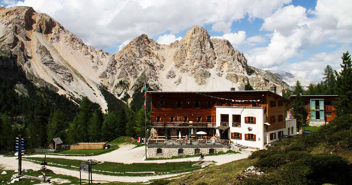
Via Ladinia: Heart of the Italian Dolomites
From the Durmitor Mountain Range to the Bay of Kotor
Sicily: Aeolian Islands
The Dalmatian Coast
As Seen In:

Itinerari Mountain Bike
Giro ad anello nella Val Ferret che tocca i Rifugi Elena, Bonatti e Bertone in single trail costantemente di fronte al Massiccio del Monte Bianco. Rif. Elena quota 2.066 m, aperto da metà giugno a metà settembre. Rif. Bonatti quota 2.025 m, aperto da metà maggio ad inizio ottobre. Rif. Bertone quota 2.000 m, aperto da inizio giugno a fine settembre. Eviterei il giro in mtb nel mese di luglio ed agosto e forse anche nei weekend fino a metà settembre. Il sentiero di collegamento tra i rifugi è condiviso con gli escursionisti a cui normalmente si dà la precedenza. Il percorso si suddivide in cinque tronconi: salita al Rif. Elena completamente ciclabile; discesa ad Arpnouva con alcuni passaggi tecnici all’ inizio e a fine tratto; salita da Arpnouva con un primo tratto poco ciclabile; traverso fino a Rif. Bonatti e poi sopra Rif. Bertone ciclabile; discesa a Planpincieux ciclabile. L’ anello inizia da una delle frazioni di Courmayeur, Planpincieux, 1.590 m. e ci si immette sulla strada di fondovalle seguendola fino a Lavachey (1.640 m) e poi si giunge alla frazione di Arpnouva (1.790 m) nei pressi della quale poco dopo ha termine l’asfalto ed ha inizio il tratto di salita più impegnativo per pendenze e fondo (sterrato) in direzione del Rifugio Elena (2.066 m) raggiungibile in circa mezz’ora di facile pedalata. Dal rifugio, dove si ha una notevole panoramica sull’intera Val Ferret e sul ghiacciaio di Pré de Bard, parte un ottimo ed evidente sentiero che ridiscende a fondovalle e risulta per la gran parte del tempo percorribile in sella senza particolari difficoltà, ad eccezione di qualche ripido passaggio più agevole nel versante prativo nell’ultima parte e qualche curva stretta su fondo sdrucciolevole nella prima parte. Si ripercorre poi in comune con l’itinerario di andata alcune centinaia di metri su strada per deviare, nei pressi del ponte di legno, sul sentiero TMB (Tour del Monte Bianco) in prossimità di alcune case della frazione di Arpnouva e comincia poi a salire di quota sul versante del Mont de Belle Combe: i primi 100 metri di quota di fatto sono ciclabili per rari e brevi momenti causa traccia troppo ripida tra cespugli e pini; successivamente due traversi con minori pendenze permettono di guadagnare rapidamente metri sino ad arrivare, sempre in alternanza con tratti a spinta, all’alpeggio di Arpnouva di mezzo (2005 m). Qui il sentiero diviene più regolare e pedalabile – con continui saliscendi in ambiente privo di vegetazione – fino al Rifugio Bonatti (2.025) dove è presente una meravigliosa balconata naturale sul massiccio del Monte Bianco ed in particolare sulle Grandes Jorasses, qualcuno intravede il Rif. Boccalatte. Dal Rifugio Bonatti, seguendo sempre il TMB, si perde leggermente quota e si prosegue in single trail in direzione del Rifugio Bertone; nel giro di poco più di un’ ora di pedalata si giunge presso una panoramica sommità (2.040 m). Per la discesa a valle o si opta per il sentiero TMB per Courmayeur o per la più facile discesa a ritroso fino a Leuchey per ricongiungersi con la strada della Val Ferret e ritorno al parcheggio. L’escursionista editore n.1 – Monte Bianco – Courmayeur – Carta dei sentieri (1:25.000)
Come arrivare al punto di partenza
Se l'itinerario è incompleto o presenta dei problemi segnalacelo attraverso il nostro modulo di contatto: Modulo di contatto .
Non ci sono ancora commenti..
- MTB-MAG.com
- Inserisci un itinerario Attenzione, nuovo portale!
- Lista delle regioni
- Tutti gli itinerari
- Itinerari più belli
- Gli user più attivi
Cerca negli itinerari
Vuoi rimanere informato?
Per poter usare la | Itinerari (inserire itinerari, scaricare le tracce GPS), devi loggarti .
MTB-MAG.com | Itinerari 2004-2024 | Maps © Thunderforest , Data © OpenStreetMap contributors
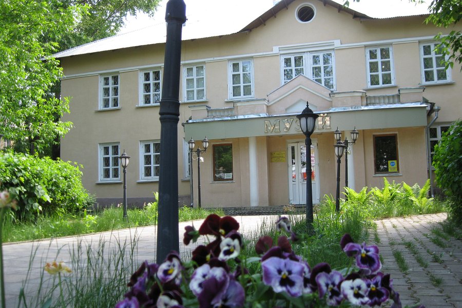
Electrostal History and Art Museum
Most Recent: Reviews ordered by most recent publish date in descending order.
Detailed Reviews: Reviews ordered by recency and descriptiveness of user-identified themes such as wait time, length of visit, general tips, and location information.
Electrostal History and Art Museum - All You Need to Know BEFORE You Go (2024)
- (0.19 mi) Elektrostal Hotel
- (1.21 mi) Yakor Hotel
- (1.27 mi) Mini Hotel Banifatsiy
- (1.18 mi) Elemash
- (1.36 mi) Hotel Djaz
- (0.07 mi) Prima Bolshogo
- (0.13 mi) Makecoffee
- (0.25 mi) Amsterdam Moments
- (0.25 mi) Pechka
- (0.26 mi) Mazhor
ELECTROSTAL HISTORY AND ART MUSEUM: All You Need to Know BEFORE You Go (with Photos)
- (0.19 mi) Elektrostal Hotel
- (1.21 mi) Yakor Hotel
- (1.27 mi) Mini Hotel Banifatsiy
- (1.18 mi) Elemash
- (1.36 mi) Hotel Djaz
- (0.07 mi) Prima Bolshogo
- (0.13 mi) Makecoffee
- (0.25 mi) Amsterdam Moments
- (0.25 mi) Pechka
- (0.26 mi) Mazhor

- Trekking and hiking
- Mountain bike
- Rock climbing
- Summer mountaineering
- Alpine pool
- Yoga in the mountains
- Kayak and rafting
- Paragliding
- Sport fishing
- Summer fun parks
- Ski and snowboard
- Freeride and ski touring
- Cross country skiing
- Snowshoeing
- Winter mountaineering
- Snow and fat bike
- Winter fun parks
- Courmayeur Sport Center
- Ice skating
- Indoor climbing
- Outdoor and indoor tennis
- Gym and fitness
- Restaurants
- Mountain huts and refuges
- Bar and café
- Club and après ski
- Local products
- Courmayeur by night
- Terme Pré Saint Didier
- Tour of villages
- Alpine festivals
- Alpine museum
- Folk groups
- Marching bands
- Bibliography
- Tour du Mont Blanc
- Skyway Monte Bianco
- Vallée Blanche
- Events calendar
- Bed & Breakfast
- Apartments and guesthouses
- Webcam and weather forecasts
- Slopes and lifts
- Useful numbers
- How to get here
- Once you’re here
- E-bike sharing
- Ski and mountaineering schools
- Entertainment
- Spa & wellness
Located along the route of the Tour du Mont Blanc , the Col du Grand-Ferret connects the Val Ferret of Aosta Vallley with the Swiss one and offers beautiful views. Priceless view of the Pré-de-Bar glacier, the Ferret valley, the Col de la Seigne , and the border between Italy and Switzerland, you can also see the border with France at the bottom of the Val Veny.
E - Trekking
Recommended period
Arnouva (1.770 Mt)
Altitude difference
Itinerary description
From the bus stop in Arnouva, which allows you to reach a point of the route prohibited for vehicle transit, you pass past the Chalet Val Ferret (1,784 meters) crossing a bridge, and continue to a clearing that allows you to go down to the shore of the Dora Ferret up to a magnificent waterfall. From the esplanade, you can choose whether to take the path that on the right climbs along the side of the mountain or continue along the unpaved road: the journey times are almost identical, but you must pay attention to late snowfields. The path reaches a group of huts in ruins and passes a stream, before facing the last climb to Rifugio Elena (2,062 meters). Built against the side of the mountain to be protected from avalanches, the refuge offers a magnificent view of the Pré de Bar glacier and the east face of the Grandes Jorasses. In the period of early summer, the refuge is surrounded by numerous beautiful flowers of various types. Behind the hut, the trail turns right to cross the ridge and reaches the Pré-de-Bar Damon pasture. Past the ruins, the path climbs before turning left towards the Col du Grand Ferret (2,537 mt). An orientation board helps to identify the most interesting points of the panorama.
Useful tips for hikers
– According to the regional law it is forbidden to set up tents and camp below 2500m. – Help us protect the mountains! Remember to leave the paths as you found them: collect your waste, you can throw them and differentiate once you return to the valley. – In the mountains, you need appropriate clothing: bring with you sunscreen, a windbreaker, and hiking shoes. – Keep a trail map in your backpack in case you lose your phone line. – Always consult the weather conditions before organizing your trip. – There are no refreshment points or fountains along some of these routes. Remember to always bring the right amount of water with you. – To ensure safety for the youngest hikers, it is advisable to walk along the paths on the side of the mountain. – Given the presence on the trail of other hikers, but also marmots, squirrels, and other components of the local fauna, it is recommended to keep dogs on a leash.
How to Arrive

2018 Primetime Emmy & James Beard Award Winner
R&K Insider
Join our newsletter to get exclusives on where our correspondents travel, what they eat, where they stay. Free to sign up.
A History of Moscow in 13 Dishes
Featured city guides.

IMAGES
VIDEO
COMMENTS
Tour della Val Ferret. Partendo dal centro di Courmayeur Località Planpincieux, alle porte della Val Ferret, questo percorso conduce fino quasi al confine svizzero, godendo ininterrottamente della maestosa vista della catena del Monte Bianco dalle Grandes Jorasses al Mont Dolent. La Val Ferret, soleggiata e dal clima mite durante il periodo ...
Caffe della Posta. 506. 0.2 mi ... The Val Ferret valley offers some excellent hikes during summer and the one we did was about a 7 hour hike from the end of the Val Ferret valley where the bus from Coumayeur terminates. It forms part of the tour Mont Blanc hiking path and starts with a fairly solid uphill slog for an hour and a half and then ...
Val Ferret tour. Starting from the center of Courmayeur Locality Planpincieux, at the gates of the Val Ferret, this route leads almost to the Swiss border, enjoying uninterruptedly the majestic view of the Mont Blanc chain from the Grandes Jorasses to Mont Dolent. The Val Ferret, sunny and mild in the summer, is also suitable for families with ...
The Aosta Valley: in Val Ferret, one step away from heaven. At the foot of Mont Blanc, north of the Courmayeur basin, lies Val Ferret, which together with Val Vény forms the geographical limit of the massif on the Italian side.. High-altitude excitement. As you enjoy a walk along the Val Ferret, on the left you can admire some of the highest and most majestic peaks in the Alps: the Dent du ...
Chalet Val Ferret sits nestled at the end of Val Ferret. An afternoon sunbathing on the grass outside and a hearty home cooked italian meal is the perfect end to a days hiking! Photo by Jennifer Stretton. From Val Ferret, the next stage of the Tour du Mont Blanc is to climb over the Grand Col Ferret and wave goodbye to Italy and hello to ...
Autumn. This splendid valley runs from the foot of Mont Blanc on towards Col Ferret, the pass that leads over into Switzerland. Along the left side of the valley are some of the loftiest, most magnificent peaks in the Alps: the Dente del Gigante, the Grandes Jorasses, the Aiguille de Triolet and Mont Dolent, while the slopes of Mont de La Saxe ...
Val Ferret is the realm of cross-country skiing, snowshoeing, fat biking, and snow biking in winter. In summer, it is a paradise for hiking, biking, golf, and fishing. Good food lovers can visit it at any time of the year. ... Tour du Mont Blanc. Golf. A place above ordinary . CONTACTS +39 0165 841612 . [email protected] ...
La Val Ferret sul Tour du Mont Blanc (TMB) è un angolo di paradiso alpino che incanta gli escursionisti con la sua bellezza maestosa e i paesaggi tranquilli. 🏞️🏔️ Situata sul versante italiano del TMB, la Val Ferret offre viste panoramiche su vette imponenti, prati lussureggianti e borghi incantevoli. Mentre attraversi la valle, l'iconico massiccio del Monte Bianco domina l ...
Rifugio Giorgio Bertone (at 1985 m) is a popular day hike from Courmayeur, especially on weekends, where the locals climb up the steep 1.5 hour trail and dine in the heart of the Alps. www.rifugiobertone.it. Rifugio Bonatti (2025 m) - located on a pastoral hillside on south side of Val Ferret faceing the impressive Grandes Jorasses.
Traccia gps Tour dei tre Rifugi della Val Ferret 656 downloads 350.74 KB. Download GPX. Condividi: WhatsApp; E-mail; 2 risposte a Tour dei tre Rifugi della Val Ferret. Ruth dice: 19 Agosto 2019 a 14:25. Grazie della descrizione, traccia GPS e foto. Ci siamo stati il 15 agosto. Posti incredibili e spettacolari - frequentato ovviamente anche da ...
Il tour sci alpinistico ad anello della Val Ferret parte dalle località di Arnouva o Lavachey, nella parte italiana della Val Ferret; si sale in direzione del Rifugio Elena. Superato il rifugio, si prosegue lungo il fondo del vallone fino a raggiungere il Colle di Bandarrey (2696 metri) a cui si arriva superando un breve risalto molto ripido.
Day 3 - Sentiero Balcone della Val Ferret. The balcony path above the Val Ferret is the perfect complement to yesterday's outing in Val Veny. In fact, it is a near mirror image. Still staring up at the South Face of Mont Blanc we now get a full view of its most famous facet - The Brenva. ... All transportation during the tour beginning in ...
Giro ad anello nella Val Ferret che tocca i Rifugi Elena, Bonatti e Bertone in single trail costantemente di fronte al Massiccio del Monte Bianco. Rif. Elena quota 2.066 m, aperto da metà giugno a metà settembre. Rif. Bonatti quota 2.025 m, aperto da metà maggio ad inizio ottobre. Rif. Bertone quota 2.000 m, aperto da inizio giugno a fine ...
In the sweet Val Ferret, you can enjoy a walk and a visit to Bertone and Elena refuges, to taste an excellent polenta surrounded by the Mont Blanc chain. If you like to walk in enchanted places, trekking in the historic center of Courmayeur and in the surrounding villages is the right thing for you. ... Tour della Val Sapin . Tour du Mont Blanc ...
Art MuseumsHistory Museums. Write a review. Full view. All photos (22) Suggest edits to improve what we show. Improve this listing. The area. Nikolaeva ul., d. 30A, Elektrostal 144003 Russia. Reach out directly.
Guided tour of the New Tretyakov Gallery (20 th century) on Krymsky Val. This tour is to the branch of the Tretyakov Gallery that has collections of twentieth-century art, starting with avant-garde and ending with perestroika.The new Tretyakov, as it is commonly named, is on the bank of the Moscow River, and the Muzeon was set up in the adjacent park.
Art MuseumsHistory Museums. Write a review. All photos (22) Suggest edits to improve what we show. Improve this listing. Revenue impacts the experiences featured on this page, learn more. The area. Nikolaeva ul., d. 30A, Elektrostal 144003 Russia. Reach out directly.
Located along the route of the Tour du Mont Blanc, the Col du Grand-Ferret connects the Val Ferret of Aosta Vallley with the Swiss one and offers beautiful views. Priceless view of the Pré-de-Bar glacier, the Ferret valley, the Col de la Seigne, and the border between Italy and Switzerland, you can also see the border with France at the bottom of the Val Veny.
This tour of Moscow's center takes you from one of Moscow's oldest streets to its newest park through both real and fictional history, hitting the Kremlin, some illustrious shopping centers, architectural curiosities, and some of the city's finest snacks. Start on the Arbat, Moscow's mile-long pedestrianized shopping and eating artery ...