Adventures in Destinations Unknown


Driving Oregon’s McKenzie-Santiam Scenic Byway
Last modified on April 2nd, 2021 at 10:15
In Oregon’s Cascade Mountains, two geologically fascinating ecosystems collide. On the west side of the Cascades, lush Douglas fir and red cedar forests conceal waterfalls and glimmering lakes. On the drier east side, ponderosa pines prevail and cloudless skies abound.
Oregon’s two halves clash in everything from climate to politics to scenery. The area of their convergence reveals a place that is at once hot and cold, wet and dry, living and dead. Charred forests give birth to new life. Frigid streams contain pockets of boiling water. Lava fields adjoin snow fields, providing visual reminders of the forces of fire and ice that have shaped the land.
When brought together, these contrasting elements create an outdoor-lover’s paradise of postcard-worthy backdrops and geologic wonder.
Table of Contents
THE MCKENZIE PASS-SANTIAM PASS SCENIC BYWAY
The McKenzie-Santiam Scenic Byway is primarily made up of two roads: the narrow winding Old McKenzie Highway, and Oregon’s Route 126.
Both roads connect Sisters with the Willamette Valley. Both lead to some of Oregon’s most beautiful and underrated gems.
While they are often traveled independently of one another, the two roads combine to create an unforgettable route that showcases the diverse geology of Oregon’s central Cascades.

If approached from the east, the McKenzie Pass-Santiam Pass Loop begins and ends in the western-themed town of Sisters. Alternatively, you can start the loop near McKenzie Bridge.
Along its course, the byway journeys through verdant forest and provides peek-a-boo views of snowcapped volcanoes.
Broken Top Mountain, Mount Washington and The Three Sisters tower above the area, while waterfalls and rivers lie hidden beneath its carpet of evergreen trees.
THE MCKENZIE RIVER HIGHWAY: OR-126
The OR126 contains no shortage of places to see. The highway crosses much of the state and connects the central Oregon coast with Sisters.
As it leaves the oceanside city of Florence, the ribbon of pavement traverses a shallow coastal mountain range and enters the fertile Willamette Valley. After passing the Eugene-Springfield metro area, it follows the McKenzie River through the Willamette National Forest—where it reveals plunging waterfalls, turquoise pools, and secluded hot springs.

Parts of Highway 126 suffered severe damage during the Holiday Farm Fire of 2020. East of Eugene, between Vida and McKenzie Bridge, the road passes through wildfire-scorched landscapes that reveal heartbreaking destruction.
If you’re intending to approach the McKenzie-Santiam Loop from the west, check updated information before planning a trip to the area. Debris and landslides still present significant hazards. And the scars from the devastating wildfire season are visible reminders of the area’s long path toward recovery.
BELKNAP AND COUGAR HOT SPRINGS
Central Oregon’s abundant volcanic activity has resulted in a smattering of thermal springs. The McKenzie Highway is home to two of the most beloved hot springs in Oregon: Belknap and Cougar (also known as Terwilliger).
Belknap is a developed mini-resort with hotel rooms and a concrete pool. For non-guests, soaking costs $8 per hour and is permitted between 9am and 6pm on weekdays.
Nearby Cougar consists of clothing-optional pools that cascade down the river like a necklace chain. A natural spring, it contains six soaking areas that are spaced apart by rock walls and surrounded by verdant forest. They range in temperature from 85 to 112 degrees.
Due to wildfire damage in 2020, the Cougar Hot Springs are temporarily off-limits.
THE TAMOLITCH POOL
The Tamolitch Pool lies along the ambling McKenzie River Trail. Known alternatively as the ‘Blue Pool’ for its striking color, it is one of the most beautiful bodies of water in Oregon.
Some 16,000 years ago, lava flow from Belknap Crater buried a 3 mile stretch of the McKenzie River. Thus, while the Blue Pool seems to spring out of nowhere, it is actually the continuation of a river that momentarily sinks below ground. When the river resurfaces, it seeps through porous lava, creating a pristine turquoise swimming hole. The porous rock acts as a natural filter, removing contaminants and resulting in a shade of blue that is almost difficult to believe.
The Tamolich Pool’s jewel-like water alternates between shades of turquoise, sapphire and emerald. When light touches its surface, the blue pool is almost iridescent.

The 3.7 mile out-and-back trail to the Blue Pool is a popular day trip from both Eugene and Bend . Its popularity has risen dramatically in recent years.
When I was growing up, I’d never even heard of the Blue Pool.
Now, its photos are plastered all over social media and its scintillating waters draw tourists from all corners of the state and beyond.
SAHALIE AND KOOSAH FALLS LOOP
The Sahalie and Koosah Falls Loop is one of the most popular hikes along Oregon’s McKenzie River. Reminiscent in some ways to the lauded Trail of Ten Falls near Salem, it is a multi-cascade trek that boasts unforgettable waterfalls and a lush forested setting.
The two waterfalls lie along a 26 mile river trail that also includes the Tamolitch Pool. Portions of the river trail are popular among hikers and mountain bikers.
Most visitors, however, choose to explore the two cascades as part of a 2.6 mile loop from the Sahalie Falls parking lot.
SAHALIE FALLS
Sahalie Falls is a raging cataract that pounds the river into rainbow prisms. Its impressive rush of white water pours 100 ft over a naturally-formed lava dam.
All around, mossy vegetation carpets the area in shades of emerald.

At times of high water, a secondary stream drops into the lava bowl to the right of the main cascade—adding character to an already picturesque scene.
KOOSAH FALLS
Though slightly smaller and less popular than its neighbor, Koosah Falls is no less impressive. The cascade pummels over lava rock and empties forcefully into the sapphire waters of the McKenzie River.

While 64 ft Koosah Falls contains its own parking area and is easily accessible from the highway, most choose to visit the attraction as part of the Sahalie Falls Loop.
HOODOO SKI AREA
Hoodoo is a local ski resort that caters to families from the Willamette Valley and Central Oregon . It is home to five lifts that provide access to 800 acres of skiable terrain.
During winter months, it becomes one of the top outdoor playgrounds in the Oregon Cascades.
MOUNT WASHINGTON VIEWPOINT
After crossing over Santiam Pass, the landscape along Oregon’s Highway 126 transforms. The Ponderosa-clad Deschutes National Forest replaces the moss-covered fir trees of Oregon’s western half. On either side of the road, snow-capped mountains peek out over the fire-charred forest.
Between Hoodoo and Sisters, roadside pullouts offer views of steep-sided Mount Washington and the iconic Three Sisters.

Mount Washington rises above lava-strewn plains. Though it is one of the most impressive attractions in Oregon’s Cascades, the craggy peak is often overlooked.
The McKenzie-Santiam Highway provides some of the state’s best views of the sheer mountain and its surroundings.
OLD MCKENZIE PASS SCENIC BYWAY: OR-242
The Old McKenzie Highway is one of Oregon’s most scenic drives. The seasonal highway (accessible from July through September) cuts between two of Central Oregon’s top wilderness areas and connects the towns of Sisters and McKenzie Bridge.
Along the way, it provides access to countless historic, recreational, and scenic attractions—including lunar landscapes, waterfalls, and old growth forests.

The Old McKenzie Highway follows the path of an 1860s wagon route. It highlights jaw-dropping vistas of Mount Washington and a 65-square-mile lava flow.
Beyond the sprawling lava flow, it snakes through emerald forest and passes by stunning waterfalls.
DEE WRIGHT OBSERVATORY
The Dee Wright Observatory is located in the Oregon Cascades, atop a barren blanket of lava in the Willamette National Forest. It overlooks a 65-square-mile sea of black lava rock.
The Dee Wright Observatory dates back to the 1930s, when the Civilian Conservation Corps constructed the structure to showcase the area’s spectacular topography. The rocky shelter features a number of viewing windows, some of which have been specifically aligned to capture views of prominent peaks.

As with the nearby Newberry Crater National Monument , the volcanic lunar landscape near the Dee Wright Observatory caught the attention of NASA astronauts planning a mission to the moon. Scientists believed that the moon’s mysterious pockmarked surface was a result of volcanic activity.
So in order to prepare for what they might encounter in space, they performed extensive fieldwork and equipment testing in the area.
It isn’t difficult to see why the Oregon lava lands represented their closest approximation to the moon’s surface.
PROXY FALLS
The Proxy Falls Trail passes through lava fields that have been reclaimed by forest. It features two lovely waterfalls that spill over mosses and ferns.
Though the Old McKenzie Highway remains closed to vehicle traffic for much of the year, Proxy Falls is accessible year-round. When Dan and I visited in winter, we parked at the snow gate on the road’s western end.
From the gate, we hiked up the highway for two miles, before veering off toward the waterfall.
I’ve read that the Proxy Falls trail can get crowded in summer.
During our winter visit, however, we found ourselves standing before the 254 ft waterfall in complete solitude.
UPPER PROXY FALLS
At 129 ft, Upper Proxy Falls is the smaller of two beautiful waterfalls that lie along the Old McKenzie Highway. Its vertical stream trickles over a carpet of dense green moss and ferns.

Though the cascade itself is beautiful, its most particular characteristic is the fact that its water seems to vanish upon reaching the ground.
Instead of flowing onward, the waterfall’s ribbon of water plunges into porous subsoil and sinks below lava rock.
Proxy Falls pours 226 ft into a gaping canyon in the Willamette National Forest.
The cascade’s wispy tentacles spread out over the rock like a dense spider web. I found it quite reminiscent to Spray Falls in Washington’s Mount Rainier National Park .

With its graceful form, mossy surroundings, and fairy tale aesthetic, Proxy Falls is one of the most beautiful cascades in the Pacific Northwest .
Having the attraction completely to ourselves made our experience all the more magical.
WHERE TO STAY ALONG THE MCKENZIE-SANTIAM HIGHWAY
Sisters is a picturesque western town that acts as the gateway to some of Central Oregon’s best recreation. It boasts wonderful places to stay—including the FivePine Lodge , the Best Western Ponderosa Lodge , and the GrandStay Hotel and Suites .
Outside of Sisters, accommodation is mostly relegated to camping. There are numerous primitive and established campsites scattered along the loop.
WHEN TO VISIT THE MCKENZIE-SANTIAM HIGHWAY
Driving the full McKenzie Pass-Santiam Pass Loop is only possible between July and September, when warm sunny temperatures dominate the weather forecast. Much like the Cascade Lakes Highway , the OR-242 remains closed to vehicle traffic during Oregon’s snowy season.
That being said, many of the area’s attractions are still accessible year-round. Highway 126 is fantastic in winter, when the waterfalls plunge in full force and crowds are few and far between.

If you’re willing to put in a little extra effort, Proxy Falls makes for a fantastic (albeit longer than normal) winter day hike.
And after a day of exploring Oregon’s waterfalls in the cold and rain, the area’s thermal hot springs are all the more rewarding.
Oregon’s highest mountains create wildly contrasting landscapes. Along the McKenzie Highway’s scenic loop, the juxtaposition of fire and ice reveals a land that has been carved by the elements and sculpted by forces of nature. Glaciated peaks rise up from stark black lava fields. Charred trees—once ravaged by wildfires—give birth to fledgling vegetation. Ice-cold waterways lie adjacent to steamy thermal pools.
And amidst its wildly contrasting landscapes, the drive showcases nature’s capacity for beauty, as well as its wanton tendency toward destruction.
__________________________________________
Did You Enjoy this Guide to the McKenzie Pass-Santiam Pass Scenic Loop in Oregon? Pin It!


Low elevation snow causing travel difficulties

Low elevation snow is causing travel difficulties in parts of Oregon. Oregon Highway 126 was closed for several hours Monday morning due to a crash west of Noti, but has now re-opened. Traffic cameras showed snow-covered pavement in the area. Snow is also impacting travel on several mountain passes along I-5 in southwest Oregon.
On Monday morning, snow was falling in parts of Eugene and Corvallis, but was not impacting travel in those cities. The National Weather Service is not predicting significant snowfall on the valley floor, but says snow could mix with rain several times through the week in lower elevations.
The Eugene Public Works Department is closely monitoring the forecast and is prepared to clear roads of snow and ice, according to a press release from the City of Eugene.
Drivers are urged to use caution and to view latest road conditions by visiting ODOT’s website, tripcheck.com .
The weather is causing some cancellations and early closures. The list includes: Blachly, Fern Ridge, Mapleton, and Crow-Applegate Loraine schools are all on a two-hour delays Tuesday.
Alsea School District is dismissing two hours early on Monday, with all after-school and evening activities canceled. Florence Senior Meals site will be closed on Monday.

Snow disrupts highway between Eugene and Florence on Hwy 126W
by News Staff

UPDATE: The highway closed again around 2:45 p.m. Monday due to a crash.
NOTI, Ore. - Chains were required over Cougar Pass Summit on Highway 126W between Noti and Walton - until a crash closed the highway.
"Winter conditions are causing delays at several locations between Mapleton and Noti," the Oregon Department of Transportation said. "Travelers should take alternate routes and delay travel until conditions improve. Be prepared, give yourself extra time, and drive for conditions."
WERE YOU THERE? Share your videos and photos
Oregon State Police stopped traffic at Poodle Creek Road near milepost 41 on the east side of the closure area.
Photojournalist Loren Ruark captured the scene:
Eastbound traffic could be seen coming through via one lane.
By 11:30 a.m., ODOT TripCheck showed the highway back open to traffic with delays.
Lance Farson from Westates Flagman was on scene helping respond to the situation Monday morning.
"As far as I know, there's a power pole down because of an accident," he said. How long it takes to repair depends on how many line crews the utility sends, Farson said. In his experience, it can take upwards of 5 hours.
He urged travelers to slow down if they encounter snow.
"I would say drive under 45 and use your 4-wheel drive if you have it," he said. When I came through on Poodle Creek from a different work zone, I saw 4 accidents. They were just slide offs, the fire department was there helping people."
At the time, Hwy 126W wasn't open.
"I wouldn't come this way. It looks like it's closed," Farson said.
GOT SNOW? Share your videos and photos
Earlier on Monday morning, the Oregon DOT said traction tires are allowed on vehicles under 10,000 GVW and not towing.
"Vehicles towing must use chains," ODOT said.
That changed as vehicles became involved in crashes: As of 8:50 a.m., all lanes were closed 2 miles west of Noti due to a crash.
There are also reports of disabled vehicles creating hazards and delays east and west of the pass.
Farther north, Highway 36 closed outside Junction City.
DEVELOPING STORY | Watch your live local news for updates | Real-time traffic

OR-126 Traffic in Oregon
Oregon State Highway 126 Live Traffic, Construction and Accident Report
Current OR-126 Oregon Traffic Conditions

DOT Accident and Construction Reports
Road construction is occurring. prepare to slow. watch for workers. ramps affected..
TYPE: Construction Serious
Slow traffic on OR-126 / SW Highway 126 from Wiley Rd (OR-126) to SE Veterans Way (OR-126)
A crash has occurred. prepare to slow or move over for worker safety..
TYPE: Accident Serious
Road construction is occurring causing minimal delay to traffic. Use caution and watch for
TYPE: Construction Moderate
OR-126 OR News Reports
Westbound lanes of ronald reagan highway reopened after crash near i-75.
- Springfield
- Apr 05, 2024 3:30pm

A crash with injuries and a vehicle fire has been reported on westbound State Route 126 in Springfield Township. Multiple emergency crews are responding to the scene. The extent of injuries has not ... Read More
OR-126 Live Chat
- Open Chatroom
Weather on OR-126 Oregon
53° f (clear).
- 5 Days Weather Forecast
- Reported from Walton, OR
OR-126 Traffic by City
- OR-126 Sisters Traffic
- OR-126 Noti Traffic
- OR-126 Springfield Traffic
- OR-126 Walton Traffic
- OR-126 Redmond Traffic
- OR-126 South Powell Butte Traffic
- OR-126 Powell Butte Traffic
- OR-126 Eugene Traffic
- OR-126 Prineville Traffic
- OR-126 Florence Traffic
- OR-126 Veneta Traffic
- OR-126 Q Street Traffic
- OR-126 Mapleton Traffic
- OR-126 North Powell Butte Traffic
Other Oregon Roads
- I-5 Oregon Traffic
- I-84 Oregon Traffic
- US-97 Oregon Traffic
- US-101 Oregon Traffic
- US-26 Oregon Traffic
- US-20 Oregon Traffic
- US-26 W Oregon Traffic
- US-30 Oregon Traffic
- US-26 E Oregon Traffic
- US-197 Oregon Traffic
- US-97 N Oregon Traffic
- US-97 S Oregon Traffic
- I-82 Oregon Traffic
- US-30 E Oregon Traffic
- I-105 Oregon Traffic
- I-205 Oregon Traffic
- US-101 N Oregon Traffic
- I-5outhbound Oregon Traffic
- I-205 Multi-Use Path Oregon Traffic
- I-405 Oregon Traffic
- OR OR-126 DUI Related Accidents
- OR OR-126 Fatal Accidents
- OR OR-126 Car Accidents
- OR OR-126 Motorcycle Accidents
- OR OR-126 Truck Accidents

Route 126 West

Connect with: Interstate 5 Interstate 105 Route 99 and Historic U.S. 99 Delta Highway - Eugene
Page Updated 11-17-2010.

Expect Delays: Highway 126 W intermittent closures for storm cleanup on February 26
by News Staff

LANE COUNTY, Ore. — According to the Oregon Department of Transportation (ODOT), Highway 126 W will be experiencing intermittent 1- hour closures on February 26th.
OR 126W milepost 19 at the westbound entrance to the Knowles Creek Tunnel will close for 1-hour durations on Monday, and there could be a total of three 1-hour closures between 7:30 a.m. and 4:30 p.m.
The closures will allow crews to remove hazardous tree and debris from above the tunnel, which was caused from the most recent ice storm.
ODOT tells us they expect the work to be completed by the end of Monday, and are advising motorists to be prepared for delays, or use an alternate route.
Additionally, up to 20 minute delays are to be expected between milepost 11 and 41 due to the ongoing cleanup efforts along this section of the highway. The delays between these mileposts are expected to extend well into the spring.
For more information, visit Tripcheck.com .

Oregon State Highway 126 Live Traffic, Construction and Accident Report
Current OR-126 Bend Oregon Road Conditions
Dot accident and construction reports, construction @ wilson ave -- impact: high.

TYPE: Construction Minor -
Construction @ HUNNELL RD -- Impact: Closure

TYPE: Construction Moderate -
Construction @ BUTLER MARKET RD -- Impact: Closure

Report an Accident
- Post more details
Weather on OR-126 Bend
42° f (clouds).
- 5 Days Weather Forecast
OR-126 Conditions by City
- OR-126 Springfield Conditions
- OR-126 Sisters Conditions
- OR-126 Eugene Conditions
- OR-126 Walton Conditions
- OR-126 Mapleton Conditions
- OR-126 Veneta Conditions
- OR-126 Redmond Conditions
- OR-126 Powell Butte Conditions
- OR-126 Noti Conditions
Other Oregon Roads
- I-5 Oregon Conditions
- I-84 Oregon Conditions
- US-97 Oregon Conditions
- US-101 Oregon Conditions
- US-26 Oregon Conditions
- US-30 Oregon Conditions
- US-20 Oregon Conditions
- US-97 S Oregon Conditions
- US-26 W Oregon Conditions
- US-26 E Oregon Conditions
- I-82 Oregon Conditions
- US-197 Oregon Conditions
- I-105 Oregon Conditions
- I-405 Oregon Conditions
- I-205 Oregon Conditions
- US-30 E Oregon Conditions
- I-5outhbound Oregon Conditions
- I-5 TRUCK Oregon Conditions
- US-97 N Oregon Conditions
- US-730 Oregon Conditions
- Central Oregon
- Oregon-Northwest
- Crime Stoppers
- KTVZ.COM Polls
- Special Reports
- NewsChannel 21 Investigates
- Ask the Mayor
- Interactive Radar
- Local Forecast
- Snow Report
- Road Conditions – Weather Webcams
- Prep Scoreboard
- Livestream Newscasts
- Livestream Special Coverage
- Local Videos
- Photo Galleries
- 21 Cares For Kids
- Community Billboard
- Community Links
- One Class At a Time
- Pay it Forward
- House & Home
- Entertainment
- Events Calendar
- Pump Patrol
- Mother’s Day Giveaway 2024
- Junior Forecaster
- Pet Pics Sweepstakes
- Sunrise Birthdays
- Submit Tips, Pics and Video
- KTVZ Careers
- Central Oregon Careers
- Email Newsletters
- Advertise with NPG of Oregon
- Careers and Internships
- Closed Captioning
- Download Our Apps
- EEO Public Filing
- FCC Public File
- NewsChannel 21 Team
- On-Air Status
- Receiving KTVZ
- TV Listings
Highway 126 reopens after spot fires from Lookout Fire prompt closure; welcome rain expected in area

(Update: Thursday morning update; Highway 126 reopened Wednesday evening)
Fire behavior limited amid cooler temperatures
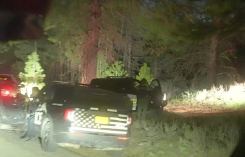
McKENZIE BRIDGE, Ore. (KTVZ) – Three small spot fires from the Lookout Fire were discovered Wednesday morning east of Highway 126 and four miles north of Belknap Springs, prompting ODOT to close the highway between U.S. Highway 20 on the north and state Highway 242 to the south for several hours.
The fires were located about four miles north of the Hwys. 126-242 (McKenzie Pass Highway) junction, the largest initially reported at 1.5 acres. ODOT closed the 20-mile stretch “to aid firefighters as they take full suppression actions,” fire officials said.
ODOT indicated the road reopened by about 7 p.m. and while drivers faced "no to minimum delay," they also were urged to use caution in the area.
A 14-mile stretch of the McKenzie Pass Highway to the east has been closed for almost two weeks due to the nearby wildfire. Get traffic updates on KTVZ.COM's TripCheck page .
Here's Thursday morning's update on the Lookout, Horse Creek and Pothole fires:
Lookout Fire, Bedrock Fire, 2023 Horse Creek Fire
News - 08/31/2023.
Alert: Highway 126 between Highways 242 and 20 reopened on Wednesday evening at 6:30 pm.
August 31, 2023 Morning Update
Lookout, Horse Creek, Pothole Fires Total Personnel: 940 Resources: 61 engines l 15 crews l 12 bulldozers l 35 water tenders l 11 masticators l 16 helicopters Horse Creek: Size: 763 acres l Start Date: August 24, 2023 l Cause: Lightning l Containment: 10%
Fire behavior was limited yesterday. Fire crews and equipment completed a fireline around the perimeter of the fire and used a drone to identify hot spots and map the perimeter of the fire last night. This will help guide crews today as they widen and secure the line. Masticators are working to reduce fuels along the Horse Creek Road to create a fuel break and more secure control line.
Lookout: Size : 24,575 acres l Start Date: August 5, 2023 l Cause: Lightning l Containment: 17%
Three small spot fires were detected east of Highway 126 about four miles north of Belknap Springs, the largest was about two acres. Aviation resources dropped water and retardant on the fires immediately after detection. This aided on-the-ground resources to surround the fires with containment line. Crews will continue to secure and mop-up these spot fires today.
Along the northern, western, and eastern flanks of the fire, fuel breaks continue to be prepared by tree fallers, fire crews, and heavy equipment along forest system roads to be used as primary and alternate control lines.
On the southeast flank, near Belknap Springs, smoke may become more visible in the McKenzie River corridor as the fire slowly backs downhill toward completed containment lines near Highway 126. On the southern edge, crews are removing unneeded firehose, pumps, etc. where containment lines are confidently secure.
To provide a safer working environment for firefighters, teams of expert tree fallers are working out in front of crews to remove fire weakened trees. Please Note: In the northwest corner of the Lookout Fire, west of the Trail Bridge Reservoir, there is a mapping error, the fire has not expanded quite as much to the north. This error will be adjusted in tomorrow’s maps.
Pothole: Size: 109 acres l Start Date: August 25, 2023 l Cause: Lightning l Containment: 0%
No measurable growth on this fire during the past couple of days has provided firefighters opportunities to build direct fireline around most of this fire. Today they will work to connect control lines around the entire perimeter.
Bedrock: Total Personnel: 631 Size: 31,590 acres l Start Date: July 22, 2023 l Cause: under investigation l Containment: 80% Resources: 24 engines l 11 crews l 6 bulldozers l 27 water tenders l 8 masticators l 11 helicopters
There has been no measurable growth on the Bedrock Fire for several days. Pockets of unburned fuels within the established control lines will continue to produce visible smoke. Fire crews are now focused on hauling out equipment, fire hose, and pumps and repairing damage to the land and forest roads (grading, installing water bars, and re-contouring dozer lines). Sprinklers and other fire suppression equipment are being removed from the community of Big Fall Creek as the danger of active fire has substantially diminished.
All Fires
Firefighters and law enforcement officers maintain a presence in evacuated areas. Trained firefighters are flying Unmanned Aerial Systems (UAS) or drones through the smoke to provide infrared heat imaging to locate hotspots near control lines and provide more accurate mapping of the fire perimeter. Drones also support firing operations in areas that are hard to access, which reduces risk to firefighters.
Widespread light to moderate rain is predicted beginning today through Friday, with a total accumulation of precipitation for Thursday and Friday between 0.5”-1”. For today, west/southwest light winds are expected with some gusty conditions on ridgetops and where river and creek drainages align.
Evacuation Centers: An evacuation center is in place at Westridge Middle School in Oakridge for evacuees and small pets from the Bedrock and Lookout Fires. A large animal shelter is established at the Lane County Fairgrounds in Eugene. An up-to-date and searchable evacuation map is available through Lane county’s website.
Lane County Evacuations: https://www.lanecountyor.gov/cms/one.aspx?pageId=19729054 Linn County Evacuations: https://www.linnsheriff.org/
Road Closures:
Highway 242, McKenzie Highway, is closed between milepost 61-76, 14 miles west of Sisters, Oregon to just east of the junction with Highway 126. Highway 126 is currently open. Please monitor Trip Check for any updates at: https://tripcheck.com/
Forest Closures: Willamette National Forest closure orders remain in place around all four fire areas. These closures help provide firefighters with safer driving conditions and decrease the potential for search and rescue operations that could interrupt firefighting activities. Closures can be found at: https://www.fs.usda.gov/detail/willamette/alerts-notices/?cid=fseprd552029
Restrictions: Fire Restrictions are in place on the Willamette National Forest: https://www.fs.usda.gov/willamette . Temporary Flight Restrictions remain in place over the Bedrock and Lookout fire areas.
Smoke Outlook : https://outlooks.wildlandfiresmoke.net/outlook/4c92bc1a The Fire and Smoke Map (fire.airnow.gov) is another source for air quality information.
Lookout Information Line: 541-215-6735 (8am-8pm) Email: [email protected] Facebook: https://www.facebook.com/LookoutFire2023 Inciweb: https://inciweb.nwcg.gov/incident-information/orwif-lookout-fire
Bedrock Fire Information: 541-414-6272 (8am-8pm) Email: [email protected] Facebook: https://www.facebook.com/BedrockFire2023/ InciWeb Bedrock: https://inciweb.wildfire.gov/incident-information/orwif-bedrock-fire
Jump to comments ↓

KTVZ news sources
Related articles.
‘It’s worse than you could possibly imagine’: Oregon GOP lawmakers, candidates share thoughts on border visit

Nix closes career with 5 TD passes, No. 8 Oregon rolls over Liberty 45-6 in Fiesta Bowl

Cathy Marshall
‘Not the normal thing to see out there’: Bend hit-and-run leads to traffic stop, China Hat chase, DUII suspect’s arrest
KTVZ NewsChannel 21 is committed to providing a forum for civil and constructive conversation.
Please keep your comments respectful and relevant. You can review our Community Guidelines by clicking here
If you would like to share a story idea, please submit it here .
IMAGES
VIDEO
COMMENTS
The TripCheck website provides roadside camera images and detailed information about Oregon road traffic congestion, incidents, weather conditions, services and commercial vehicle restrictions and registration.
Closure I-5, 8 miles South of Albany MP 226 Highway closed due to police activity. Use alternate route. Updated 4/28/2024 7:07:00 PM
Clackamas County - US26 at ZigZag - Hoodland US26 at Arlie Mitchell Rd. US26 at Blue Box Pass Summit US26 at Brightwood US26 at Frog Lake US26 at Government Camp US26 at Government Camp Maint US26 at Govt Camp Lp Rd US26 at Hwy35 US26 at ORE216 Jct US26 at Run Away Truck Ramp US26 at Ski Bowl West US26 at Trillium Lake US26 at USFS Rd 35 US26 ...
Commercial Vehicle Information Informational only Details I-105/OR126 EB & WB MP 3.50 to MP 4.00 (Eugene) Effective March 27, 2024, this section of I-105/OR126 EB & WB will be restricted to 14 feet 00 inches in width Sunday through Thursday nights between the hours of 7 PM & 5:30 AM.
ORE126 at Cushman ORE126 at McKenzie ORE126 at McKenzie ORE126 at Territorial Hwy ORE126 at Walterville ORE126 at Walton (Cougar/Badger Pass) ORE126 at Walton (Cougar/Badger ... and help us understand what features are most important to you and what we could improve about TripCheck services. Thank you! Take Survey Close. Road Camera. Roadcam ...
The McKenzie Highway (OR 242) section of the scenic byway begins at the junction with Oregon 126 near McKenzie Bridge and ends at the junction with U.S. Highway 20 and Oregon 126 at the city of Sisters. The highway travels between two federal wilderness areas, and countless historic, recreational, and scenic features and sites.
US30 (Historic Columbia River Hwy) MP 11.93 (Latourell Creek Bridge - east of Corbett) Effective June 18, 2020, US30 (Historic Columbia River Hwy) crossing Latourell Creek Bridge at MP 11.93 is restricted to the following weights: 27 tons for SU5 (5 axle single-unit truck); 28 tons for SU6 & SU7 vehicles (6 and 7 axle single-unit trucks).
I-205 at 10th West Linn I-205 at 92nd I-205 at 99E I-205 at Airport Way I-205 at Blankenship Road I-205 at Division SB I-205 at Foster I-205 at Gladstone I-205 at Government Island I-205 at I-5 Ramps I-205 at Johnson Creek I-205 at Killingsworth I-205 at Lawnfield Rd.
Rustle up a picnic lunch at a local bakery or supermarket, fill your tank, and head west on Oregon Route 242 past llama ranches and into the Deschutes National Forest. B. McKenzie Pass The Byway follows the path of an 1860s wagon route, emerging from the forest at Windy Point to a jaw-dropping vista of Mount Washington and a 65-square-mile lava ...
THE MCKENZIE RIVER HIGHWAY: OR-126. The OR126 contains no shortage of places to see. The highway crosses much of the state and connects the central Oregon coast with Sisters. As it leaves the oceanside city of Florence, the ribbon of pavement traverses a shallow coastal mountain range and enters the fertile Willamette Valley.
A major east-west state route, Oregon 126 travels from U.S. 101/Oregon Coast Highway in Florence east to U.S. 26 in Prineville after passing through Eugene, Springfield, Santiam Pass, Sisters, and Redmond. In Eugene, the state highway follows West 11th Avenue into west Eugene from Florence and the Oregon coast line. Oregon 126 turns north onto ...
OR-126 Oregon Road Conditions Statewide. 126 Eugene, OR Traffic. OR-126 Eugene, OR in the News. OR-126 Eugene, OR Accident Reports. OR-126 Eugene, OR Weather Conditions. Write a Report. 126 Springfield Conditions. 126 Walton Conditions. 126 Veneta Conditions.
An ODOT traffic camera shows wintry conditions on Hwy 126 west of Veneta. Low elevation snow is causing travel difficulties in parts of Oregon. Oregon Highway 126 was closed for several hours Monday morning due to a crash west of Noti, but has now re-opened. Traffic cameras showed snow-covered pavement in the area.
Highway OR-126 Traffic & Road Conditions in Oregon Oregon DOT Traffic Cameras. OR126 - Highland Ave at SW 5th St ... TripCheck Oregon Incidents (5) 8:59:00 AM - No to Minimum Delay OCHOCO. ORE126, Redmond . View on Google Maps. ... Road Construction - Estimated delay under 20 minutes HISTORIC COLUMBIA RIVER. HWY100, 5 miles West of Ainsworth ...
UPDATE: The highway closed again around 2:45 p. m. Monday due to a crash. --- NOTI, Ore. - Chains were required over Cougar Pass Summit on Highway 126W between Noti and Walton - until a crash closed the highway. "Winter conditions are causing delays at several locations between Mapleton and Noti," the Oregon Department of Transportation said. "Travelers should take alternate routes and delay ...
OR-126: The McKenzie River Highway. This stretch of the route showcases the beautiful peacock-blue waters of the Upper McKenzie, as the river tumbles south over waterfalls and through lava flows and here parallels the West Cascades Scenic Byway.The McKenzie River National Recreation Trail also follows the river's route for more than 26 miles/41.8 kilometers, with several well-marked access ...
Slow traffic on OR-126 / SW Highway 126 from Wiley Rd (OR-126) to SE Veterans Way (OR-126) TYPE: Construction Serious. Road construction is occurring causing minimal delay to traffic. Use caution and watch for. TYPE: Construction Moderate.
Meeting the freeway ahead is the Delta Highway, a north-south freeway joining Interstate 105 & OR 126 with the Belt Line Highway, an east-west freeway. 04/01/05 : Westbound at the Exit 1 trumpet interchange with Delta Highway on Interstate 105 & OR 126. Delta Highway serves the Valley River Center mall nearby on the two mile drive to the Belt ...
Oregon Road and Traffic Cams - Western Oregon including Eugene. Road Cam: ORE126 at Cushman. ~ Western Oregon Region Map ~. I-5 at Cottage Grove. I-5 at Cottage Grove. I-5 at Cottage Grove - 2 miles south. I-5 at Cottage Grove - 2 miles south. I-5 at Del Rio Rd.
West of I-5 between Springfield and Eugene, the highway that becomes OR 126 rolls past the Oregon Duck football home of Autzen Stadium, with the Willamette River flanking it to the south. It dodges past Skinner's Butte and the Rose Garden, and through strip malls and fast food joints on the west side of Eugene. ...
LANE COUNTY, Ore. — According to the Oregon Department of Transportation (ODOT), Highway 126 W will be experiencing intermittent 1- hour closures on February 26th. OR 126W milepost 19 at the ...
Parrell Rd Road is closed from Murphy Rd to Brosterhous Rd. TYPE: Miscellaneous Moderate -. Bend, OR Traffic. OR-126 Bend, OR in the News. OR-126 Bend, OR Accident Reports. OR-126 Bend, OR Weather Conditions. Write a Report. Springfield Conditions. Eugene Conditions.
ODOT TripCheck TripCheck map Wednesday shows Hwy. 126 closure due to spot fires crossing to the east. ... Alert: Highway 126 between Highways 242 and 20 reopened on Wednesday evening at 6:30 pm.