How accurate is Google Maps Journey time?
By: luke stewart tag(s): geolocation published: feb 01, 2021.

I have been doing quite a bit of work with businesses and government organisations on how to use Google Maps in real time and in particular the predictive Journey times and Estimated time of Arrival (ETA) functionality available through the Google Maps APIs .
One question that always comes up is how accurate the journey times are. So, I decided to put Google Maps to the test to find out just how reliable it is.


Testing the accuracy of Google Maps journey times
Google does not provide much documentation on the actual accuracy of their journey times, so it often comes down to the potential user to test this for themselves. Having used Google Maps for my own in-car navigation for a few years, I believe the predicted journey times are indeed very accurate. I would quite often let the person at the other end of my journey know my ETA and — bingo — arrive at that exact time. However, I had not validated the accuracy of the journey times. This is exactly what I have been doing over the last couple of months.
Over the past two months, I have noted the predicted journey time at the start of any car trip and measured this against the actual time. Having completed the analysis, I can confirm that, as expected, the Google Maps journey times are very accurate. Below is a summary of my findings.
Google Maps journey time analysis and findings
To undertake the analysis, I would enter my route into Google Maps, note down the predicted journey and arrival times and compare these to the actual times. I tried my best to stick to good driving behaviour, speed limit etc. to make sure the results were as representative as possible.
I conducted 56 individual trips with an average distance of 18 miles and journey time of 32 minutes. The trips were mainly from my house in Hampshire to locations in the South of England. I spent an average amount of each journey on motorways, A and B roads, with the odd country lane thrown in for good measure. I also recorded the traffic conditions based on the Google Maps navigation app and if the whole route equaled green, orange or red traffic. The majority of my trips were in green or orange, but I did have some with red traffic for comparison.
Considering the number of journeys I undertook and their average time and distance, I think an average of 1.8 min out of predicted journey time is a very good result. This gives me a lot of confidence about the accuracy of Google Maps journey times. It also gives me a lot of confidence that the technology we are offering to our customers is the best and most accurate there is.
One thing to note is that the journey time accuracy went down based on the amount of traffic on the route and the distance travelled. This is expected as those two variables make predicting journey times much harder. However the accuracy does not fall by a significant amount and my confidence in Google’s journey accuracy stays high even when undertaking long trips in traffic.
One further thing to note is I excluded from the results any trip that had an unpredictable incident such as a car crash, although there was only one such incident over my trips.
How does Google Maps work out journey times?
Google calculates journey time by measuring the distances between your two chosen points, and applying any speed limits that are in place on the route to provide a perceived average speed for the journey. This is then used to compute the forecast arrival time at the destination.
Crucially, however, Google Maps also layers over additional live, real-time data to ensure that these trip times are as accurate as possible. Data is sent anonymously to Google from Apple of Android smartphones that have Google Maps open, or from any Android device that shares location information. This data is then used to provide real-time updates on traffic congestion and incidents, which is then taken into account alongside the distance and typical journey time to provide a more reliable and realistic estimate.
The evolution of Google Maps journey time predictions
Google Maps journey time predictions have evolved to the point where they can now give highly accurate real and predictive journey times, even over long distances and in rush hour traffic conditions. These journey times have a wide range of uses, not only in the consumer world to help people navigate and understand when they will arrive at their destination but also in business and government to help improve customer service and plan new infrastructure.
I believe the journey times provided by Google Maps are the most accurate available in the UK and Europe, and most probably in the world. This information can help businesses and government services improve the services they provide and do so in a much more cost effective manner. I will be exploring some of these use cases and how Google predicts its journey times in subsequent posts.
Working with a Google Maps Premier Partner
A Google Cloud Partner like Ancoris can help you apply the power of Google Maps to solve current business challenges and develop new digital models using location-based services .
We’re not only a Google Maps Premier Partner but have achieved Google’s Location-Based Services Partner Specialisation. This means we’ve demonstrated both technical proficiency and proven success in building and managing applications using the best of Google Maps Platform and Google Cloud Platform in both web and mobile environments.
If you’d like to find out more about how we can help you, why not take a look at some of our customer success stories or talk to the experts in our Google Maps team .
Article updated June 2022 First published February 2018
< Back to resources
Think big. Start now.
We don’t believe in Innovation, we live it. Innovation combined with pragmatism is what runs through our veins. We ask ourselves the same question over and over again: Does it deliver value? And how quickly? Your big ambitions can start now.
Talk to an Expert

Travel Time Calculator Google Maps
Introduction.
In the age of technology, planning your journeys has become more seamless than ever. The Travel Time Calculator on Google Maps is a valuable tool that enables users to estimate travel durations, helping them make informed decisions about commuting, travel itineraries, and more. This article delves into the functionality of this tool, offering insights into its formula, usage, and providing practical examples.
The Travel Time Calculator on Google Maps utilizes advanced algorithms to calculate travel time based on factors such as distance, traffic conditions, and chosen mode of transportation. While the exact formula is proprietary, it considers real-time data to provide accurate and up-to-date estimates.
How to Use?
- Enter Start and End Points : Open Google Maps and input your starting location and destination.
- Select Transportation Mode : Choose your preferred mode of transportation—whether it’s driving, walking, biking, or public transit.
- Review Routes and Duration : Google Maps will display various routes along with estimated travel times. Select the one that suits your preferences.
- Real-Time Updates : Be mindful of real-time traffic conditions, as Google Maps dynamically adjusts travel estimates based on current situations.
Suppose you’re planning a road trip from Miami to Orlando:
- Start Point : Miami, FL
- End Point : Orlando, FL
- Mode : Driving
Google Maps may provide an estimate of approximately 3 hours based on current traffic and road conditions.
Q1: How accurate is the travel time estimate on Google Maps?
A1: Google Maps employs real-time data to provide accurate estimates, but unforeseen events can affect travel times. It’s advisable to check for updates during your journey.
Q2: Can I use Google Maps for public transportation schedules?
A2: Yes, Google Maps offers public transit schedules and estimates for buses, trains, and other modes of public transportation.
Q3: Does the Travel Time Calculator consider historical traffic data?
A3: Yes, Google Maps uses historical traffic patterns to enhance the accuracy of its travel time estimates.
Conclusion:
The Travel Time Calculator on Google Maps has become an indispensable tool for individuals and businesses alike, providing a quick and reliable way to plan journeys. Whether you’re navigating through daily commutes or embarking on a cross-country road trip, this feature offers valuable insights to ensure a smoother and more efficient travel experience. Stay connected with real-time updates and make the most of your time on the road with Google Maps.
Explore and navigate your world
Discover new experiences across the world or around the corner.

Explore your world
With the redesigned Explore tab, find places to eat and things to do around you or when you travel
Just for you
See recommendations for new and trending places based on your interests

Create lists
Easily create lists of places you want to go, and add notes to the places you’ve saved. You can keep these lists private, share them with close friends, or share them publicly. You can also browse through lists created by publishers, Local Guides or Google
Make your plans happen by connecting with the places you’re interested in
Follow your favorites.
Stay on top of offers, updates and more when you follow your favorite businesses

Make a reservation, book an appointment, or get tickets with just a few taps
Get answers fast
Message a business right on Google Maps to find out information
Navigate the world around you
Real time traffic updates.
Find the best route when driving, with real-time updates on traffic jams, accidents, road closures and speed traps. You can also keep fellow drivers in the know by reporting incidents yourself
Hands-free help with the Google Assistant
Your Google Assistant is now integrated into Google Maps so you can message, call, listen to music and get hands-free help while driving. Say “Hey Google” to get started

Real-time updates for public transportation
Get up-to-the-minute updates on busses and trains, like departure times and how crowded the bus is. You can also see where on the map your bus is so you know if you need to walk a little faster to the bus stop
Explore new places confidently
With Live View in Google Maps, see the way you need to go with arrows and directions placed right on top of your world. There’s less second guessing and missing turns
Control your data with confidence
Industry-leading data protection.
Every day you’re Safer with Google. We use the most advanced technology like differential privacy to protect your data and build helpful features - like seeing how busy a place is so you can avoid the crowd.
Easy-to-use privacy controls
You’re in control. With Your data in Maps , you can easily view and manage your Location History and other account settings. Location History is off by default. When you turn on Location History, it can help you with real-time traffic predictions for your commute or reminisce about places you’ve been.
Search with Incognito mode
When you want additional privacy, use Incognito mode in Google Maps. When it’s turned on, you can navigate, search for places, and find business information from your device - all without searches or directions being saved in account.
See how people are using Google Maps to explore what’s around them, put their communities on the map, and help others
Why we map the world.
Map making is an ancient human endeavor, and one that those of us working on Google Maps are honored to continue to pursue
Mountain View, California
More stories
Melbourne, Australia
Mums who map
A group of Local Guides, Mums who Map, dedicated their time to help parents find kid-friendly places in Melbourne, Australia.
Nuku’alofa, Tonga
Mapping Tonga
Tania Wolfgramm and Wikuki Kingi set out to bring Tonga to Street View for all the world to see.
Devon Island, Canada
Together with the Mars Institute and NASA, Google Maps documented the research that goes on Devon Island, the most Mars-like place on Earth.
Norcia, Italy
Mapping Italy’s Recovery
One Local Guide records the aftermath of Italy’s earthquakes to show the world that they still need help recovering.
Kerala, India
Kerala Flood Rescue
Bobby Kurian used Google Maps to tag her parents’ location to help rescue them in the Kerala floods.
Supporting Women’s Rights
With the help of Local Guides and Google Maps, Princess Ilonze got hospitals and police stations on the map to help save lives.
Kids in India
The India Literacy Project teamed up with Google to help students explore the world through photos uploaded by Local Guide.
Bozeman, Montana
Connecting to Bozeman
One Local Guide was inspired to celebrate and show off her hometown in a unique way.
Sao Paulo, Brazil
Mapping Blood Donation Sites
Local Guide Adriano Anjos in Brazil mapped Sao Paulo’s blood donation centers on Google Maps.
London, England
Wheelchair Accessible Routes
Wheelchair-accessible routes on Google Maps has made getting around easier for Meridtyh, Omari, Adam, and Lucy.
Kolkata, India
Plus Codes creates geographical coordinates that provide an address to those who previously had none.
Grand Canyon National Park
Vets Kayak The Grand Canyon
Five blind veterans kayaked through the Grand Canyon and documented their journey on Street View.
Google Maps Blog
Read articles, interviews, and more to learn what’s new on Google Maps

Want the best prices for your trip? Google can help.

Take off to your next destination with Google Maps

Hip-hop dancers show Paris in a new light on Street View
There's more we can help you with.
Check out some related products below
Street View
Explore world landmarks, discover natural wonders, and step inside places with Street View on Google Maps
Google Earth
Explore worldwide satellite imagery, 3D buildings, and terrain for hundreds of cities with Google Earth
Local Guides
Become a Local Guide to help people everywhere find the places worth seeing and things worth doing
Google My Business
Stand out to people searching on Google, and connect with customers with a free business profile
Get Google Maps

Driving Time Calculator
Driving time between two cities.
Travelmath helps you find the driving time based on actual directions for your road trip. You can find out how long it will take to drive between any two cities, airports, states, countries, or zip codes. This can also help you plan the best route to travel to your destination. Compare the results with the flight time calculator to see how much longer it might take to drive the distance instead of flying. You can also print out pages with a travel map.
You may want to search for the driving distance instead. Or if you're thinking about flying, make sure you compare flight times between airports. For a long road trip, check the cost calculator to see if it's within your budget.
Home · About · Terms · Privacy

- GTA 5 Cheats
- What is Discord?
- Find a Lost Phone
- Upcoming Movies
- Nintendo Switch 2
- Best YouTube TV Alternatives
- How to Recall an Email in Outlook
Google Maps will now tell you the best time to hit the road

The feature is already live on our devices, so Google might not be doing a lengthy rollout with this particular new feature. The information is presented as a bar graph that looks very similar to the one used to denote hours when businesses are busiest. You can even look one hour in the past, to kick yourself over how much time you might have saved if you just left a little earlier.
The feature is only available in the United States and United Kingdom, according to Android Central , and didn’t accompany an app update — meaning users in other regions will have to wait for Google to flip it on.
Google sources traffic data all day, all around the world, so it’s nice to see it used to deliver a new tool that makes driving easier and traffic jams less unexpected.
- These are the best Android 15 features you need to know about
- Don’t update your Google Pixel phone — you might break it
- Google is paying a $700 million fine, and you’re getting some of it
Every couple of months, Google quietly updates Maps with helpful little features, like a parking availability indicator or floor plans with marked staircases and elevators to denote wheelchair-accessible places. It can honestly be difficult to stay on top of everything you can do with Maps, which is why we’ve written a guide featuring the most useful tips and tricks .
At the same time, the company has been fighting back against problems like fake listings for locations and businesses that are aimed at extorting travelers. According to Google, about 70 percent of these listings have been weeded out over the past two years. New policies instituted since then have prevented unverified businesses from creating listings in bulk, or registering locations far away from their existing operation. Google says most of the offenders are now identified before they ever appear to the public.
Editors' Recommendations
- Whatever you do, don’t buy the Google Pixel 7a right now
- Google Messages vs. Samsung Messages: Which app should you use?
- Google is bringing Chrome browser to cars, even more EV features to Maps
- I used to love the Google Pixel Fold. Now, I’m not so sure
- Google Maps got a major update, and people hate it

Google introduced a major update for Maps on Thursday, adding a bunch of new features that make the app even more powerful.
The company has been working hard to bring AI smarts to its suite of tools in recent months, and so it’s no surprise to see Google Maps getting some attention in this area.
Google has been accused of negligence after a man drove off a broken bridge while allegedly following directions on Google Maps.
Philip Paxson drowned after the Jeep Gladiator he was driving fell about 20 feet (6.1 meters) and landed upside down in a river in Hickory, North Carolina, about 60 miles northwest of Charlotte.
The latest version of Google Flights provides you with new information designed to help you make a more informed choice about when to book a ticket for a flight.
“Most of the time, it’s better to book on the early side, especially when your plans aren’t very flexible,” Google Flights’ James Byers says in a blog post introducing the new features. “But flight prices do change frequently, and there are often low fares to be found with the right tools (and some perseverance).”
Calculate Travel Time Google Maps: A Complete Overview
Google Maps has become a popular navigation app essential to human life. It allows individuals to plan their journeys, get real-time traffic updates, and deliver products and services to their customers.
One impressive feature that makes Google Maps an excellent tool is the ability to calculate travel time. Many consider this feature remarkable yet wonder how it can accurately calculate travel time on Google Maps.
It employs modern technology and other factors to provide accurate travel time. How truly remarkable! This guide will provide interesting details on how to calculate travel time on Google Maps. Overall, you will better appreciate how Google Maps continues delivering accurate navigation to its users.

How Does Google Maps Calculate Travel Time?
Google Maps is a sophisticated high-end tool that dominates many alternatives in the navigation sector. A study indicates that over 150 million active users utilize Google Maps monthly , providing them with millions of navigation info daily. It is especially evident as we employ Google Maps to plan a route, commute to work, navigate unfamiliar territories, and more.
Despite its high-end navigation services, many ask, “How does Google Maps calculate travel time?” This question often arises due to the Expected Time of Arrival (ETA) accuracy. Well, the answer is not far-fetched. Google Maps employs a complex algorithm to estimate travel time from various variables.
To calculate travel time on Google Maps, the algorithm accounts for various transportation modes, including walking, driving, cycling, and public transit. It also considers many factors, such as weather conditions, traffic patterns, and terrain.

4 Factors That Help To Calculate Travel Time on Google Maps
After considering how Google Maps calculates travel time, it is necessary to consider specific factors that can help to calculate travel time on Google Maps. Here are four of them.
- Determination of the Fastest Route
One significant factor that helps to calculate travel time on Google Maps is determining the fastest route between the starting point and the destination. To determine the best route, Google Maps notes road networks, real-time and historical traffic data, and machine learning algorithms.
- Speed Limits
Another factor to consider is the speed limit. Since Google Maps receives data from GPS satellites, it assumes the average speed of vehicles. Also, it takes note of the terrain of certain road networks and their speed limits.
Consequently, as long as there is no traffic, the app assumes the drivers will navigate to their final destinations with such speed. For instance, Suppose the speed limit of a particular highway is 40 miles per hour with no traffic in sight. In that case, Google Maps calculates travel time at 40 miles per hour to reach their final destination.
- Including Real-Time Updates From Users
Google’s complex algorithm allows it to consider real-time updates from other users on the road. This app collects data from mobile phones, GPS devices, and vehicles to provide updates on traffic, accidents, or other road features. Thus, it will automatically update the estimated travel time while journeying.
- Different Modes of Transportation
Another factor determining the travel time calculation on Google Maps is different modes of transportation. The transport mode you use to navigate from your current location to your final destination is quite significant. Different transportation modes have varying speeds and travel times. Google Maps collects data on the average speed of each mode to provide an estimated arrival time when navigating.

What Speed Does Google Maps Use To Calculate Travel Time?
Indeed, a lot is happening behind the scenes to calculate travel time on Google Maps. Likely, in your early education, you are aware of this universal formula for calculating the total distance of an object or person;
Total distance = Average Speed X Time Taken
Therefore, to calculate your average speed, you need to know the total distance you covered. When you get the answer, divide it by the time it took you to cover that distance.
Average speed = Total Distance / Time Taken
Despite its complexities, Google Maps bases its operations on this universal formula to provide your average speed and travel time during navigation.
So you are right to ask, “What speed does Google Maps use to calculate travel time?” To calculate this effectively, the app utilizes speed limits to provide accurate travel time. How so?
Speed limits are safe speeds that traffic laws provide road users with to prevent accidents. They are a significant determinant when you want to calculate travel time on Google Maps. Following traffic laws, the app assumes drivers will travel at the specified speed limit on any road.
This assumption is valid because most drivers follow speed limits strictly to avoid speeding fines, tickets, and other penalties. To determine the speed limit of major and minor roads, Google Maps collects data from government agencies and traffic studies. Also, it provides users with updates on the speed limit in cases of road construction, accidents, and other factors.
3 Factors That Affect Speed When You Want To Calculate Travel Time on Google Maps
Speed limits help to calculate travel time on Google Maps effectively. However, other factors can also affect the speed. Here are three major factors to keep in mind.
- Real-Time Traffic
Traffic is usually a common factor that affects speed when trying to calculate travel time on Google Maps. Google Maps collects traffic data in real time and updates its users regarding the current traffic conditions on the road. Moreso, since traffic affects speed significantly, the app can adjust travel time estimates by introducing slower speed indicators on its maps.
- Mode of Transportation
The mode of transportation you employ in navigation can affect the speed necessary to complete your journey. Thus, it significantly alters your travel time on Google Maps. How so? Consider the varying speeds of different transportation modes.
For vehicles and motorcycles, Google Maps assumes that drivers will travel at or below the speed limit on any road. As a result, it predicts the travel time when plying a particular route to get to your destination.
The app uses different speeds for bicycles and pedestrians to calculate travel time. These speeds depend on factors such as the terrain, the presence of bike lanes or sidewalks, and their average speed.
- Personal Factor
It is another determinant that affects speed when calculating time travel on Google Maps. Some users may enjoy their trips more by going slower than the speed limits, thus increasing the estimated arrival time. Others may want to reach their destination as fast as possible, thus reducing travel time.
Also, human errors often occur when users calculate time travel with a particular transportation mode. In effect, they are not employing the right mode on Google Maps to calculate transportation mode accurately.

Understanding Estimated Time of Arrival (ETA)
Overall, Google Maps provide accurate travel time by combining real-time traffic data, transportation modes, and speed limits. When you want to calculate travel time on Google Maps, it provides an ETA according to available traffic data.
It is important to note that Google Maps’ estimated time is not always accurate. It would help to consider present traffic and weather conditions, accidents, and road closures. Also, suppose you are traveling during rush hour or in a busy city. In that case, your estimated travel time is longer than the time stipulated on Google Maps.
Therefore, if you want to calculate travel time on Google Maps, endeavor to render all available information as an estimate. While normal conditions make this estimate accurate and reliable, unforeseen events can alter it. Ultimately, it would help if you allow a time buffer when using Google Maps for personal or professional use.
Other Useful Navigation Features of Google Maps
Indeed, Google Maps is an amazing tool which provides the best navigation to its users. It’s totally cool to know how to calculate travel time on Google Maps. However, there are several fascinating features that can also be of utmost importance to you.
As a popular mapping service, many users use Google Maps for personal use, like planning a route, preparing for a road trip, and checking out new spots in their area. Business owners utilize it to calculate a route with multiple stops. In fact, you can make delivery at ten different locations in a particular route efficiently with this app.
If you want to navigate through a busy city, especially during rush hour, Google Maps feature real-time traffic data. This feature provides alternative routes from your current location to your destination. Many have found valuable navigation tips when utilizing Google Maps in their daily commute.
Many mapping platforms utilize Google Maps’ functionalities to provide essential features to their customers. Thus, they can create custom maps for their clients and employ various tools to assist them in their personal and professional use.
Furthermore, they collect valuable data from Google Maps to streamline better navigation services for individuals and businesses using their platform. So, this app is more than simply finding the distance or calculating travel time between two points. It helps other mapping platforms to provide better services to their clients.
Final Thoughts on Calculating Travel Time on Google Maps
Google Maps is an excellent navigation tool that offers users accurate travel times regardless of road terrain and speed limits. Complex algorithms and other factors like speed limits and transportation modes help to calculate travel time on Google Maps accurately.
Indeed leveraging the power of Google Maps in your business has many advantages. As such, it becomes important to harness the benefits of Mapize — a mapping platform that integrates Google Maps’ functionality into creating custom maps.
Interestingly, Mapize features tools that help calculate travel time on Google Maps between multiple points. While doing so, it considers traffic conditions, road closures, weather, and terrain. Furthermore, Mapize allows you to integrate custom maps into other applications and services. This will help to increase your workflow and streamline your business to meet the needs of your existing and prospective customers.
You do not require coding knowledge to utilize its tools. So, join Mapize today for free and create your first map .
Start creating map
Drag and drop your file (xls, xlsx or csv) Use our sample data, by clicking here . Or Select a file
Copy + paste your data include column files
Start adding radius by clicking right-click anywhere on map or marker..
Select Method To Save:
Anyone with your link can access the map, and it will shownup in search engines.
Private maps are kept by private link and wont show up anywhere on our site. Only those who have the link will have access to your map.
Protect your map with a password.
Recipient's Email

On the free tier you can only map up to 150 locations at one time. Please add a plan if you wish to map more than 150 locations.
Proximity Radius Circles
Edit proximity radius circles, select file type.
Related Articles

Plan the Most Efficient Route: A Guide to Smarter Navigation Read More »

Plot Coordinates on Map: Find Places With Pinpoint Accuracy Read More »

Zip Code Maps: Get Deep Insights From Numeric Identifiers Read More »
How To Create a Custom Map in Google Maps Read More »
- Insider Reviews
- Tech Buying Guides
- Personal Finance
- Insider Explainers
- Sustainability
- United States
- International
- Deutschland & Österreich
- South Africa

- Home ›
- tech ›
- how-to »
How to check your Google Maps timeline and see every place you've traveled

- Your Google Maps timeline shows all the countries, cities, and attractions you've visited.
- You can see your timeline in the Google Maps mobile app and on the website.
- You'll need to make sure you have Location History enabled on your Google account for the timeline to work.
Nearly every major app tracks your location in some way. And while most try to keep this a secret (and won't even tell you why they need it), Google Maps is pretty public when it comes to using your location.
But Google Maps doesn't just use it to give you directions and show your current location . If you have it enabled, you can also create a Google Maps timeline , which lets you see where you traveled on a specific day, any attractions or restaurants you've visited, towns you've been to, and countries that you've traveled in.
Here's how to check your Google Maps timeline — and how to enable Location History so you can make a timeline in the first place.

How to enable Location History in Google Maps
Google Maps creates your timeline by tracking where you've been over a long period of time. To do this, it needs your location history.
Location History is enabled on all basic Google accounts by default (although it might be disabled if you have an education or enterprise account). To make sure it's on:
- Head to your Google account page and log in if you haven't already.
- Tap Data & privacy at the top of the screen (on mobile), or click it in the left sidebar (on a computer).
- Scroll down to Things you've done and places you've been and make sure that Location History is turned on. If it's not, tap it and toggle it on.

- Current Location in Google
- Hide Whatsapp Messages
- Phone is hacked or not
- Whatsapp Deleted Messages
- Download photos from Whatsapp
- Instagram Messages
- How to lock facebook profile
- Unfollowed on Instagram
- Best printers for Home
- Best Mixer Grinder
- Best wired Earphones
- Best 43 Inch TV in India
- Best Wi Fi Routers
- Best Vacuum Cleaner
- Best Home Theatre in India
- Smart Watch under 5000
- Best Laptops for Education
- Best Laptop for Students

- Advertising
- Write for Us
- Privacy Policy
- Policy News
- Personal Finance News
- Mobile News
- Business News
- Ecommerce News
- Startups News
- Stock Market News
- Finance News
- Entertainment News
- Economy News
- Careers News
- International News
- Politics News
- Education News
- Advertising News
- Health News
- Science News
- Retail News
- Sports News
- Personalities News
- Corporates News
- Environment News
- Raj Kundra Scam
- Top 10 Richest people
- Cibil Score vs Cibil Report
- Top 10 Largest Economies
- Lucky Color for 2023
- How to check pan and Aadhaar
- Deleted Whatsapp Messages
- How to restore deleted messages
- 10 types of Drinks
- Instagram Sad Face Filter
- Unlimited Wifi Plans
- Recover Whatsapp Messages
- Google Meet
- Check Balance in SBI
- How to check Vodafone Balance
- Transfer Whatsapp Message
- NSE Bank Holidays
- Dual Whatsapp on Single phone
- Phone is hacked or Not
- How to Port Airtel to Jio
Copyright © 2024 . Times Internet Limited. All rights reserved.For reprint rights. Times Syndication Service.
Google Cloud
Predicting future travel times with the Google Maps APIs
Nov 10, 2015
[[read-time]] min read
- If your application is used for scheduling deliveries, and you want to ensure you’ve allowed enough time between deliveries so your drivers won’t be late, you might want to use the pessimistic travel time estimates.
- On the other hand, if you’re building a thermostat app, and you want the house to be warm by the time your user arrives home from work, you might want to use the optimistic travel time estimate to calculate when the user is likely to arrive.
- If you want to give your user an estimate of the most likely travel time to their destination, the default best_guess traffic model will give you the most likely travel time considering both current traffic conditions and historical averages.

“Taking the guesswork out of knowing how long it will take to drive between homes will help us provide a better customer experience to our users” – Curtis Howell, Product Manager Customer Engagement, Redfin
Related stories

5 moments you might have missed from Google Cloud Next ‘24

101 real-world gen AI use cases featured at Google Cloud Next ’24

How 7 businesses are putting Google Cloud’s AI innovations to work

How Best Buy is using generative AI to create better customer experiences
Cloud next 2024: more momentum with generative ai.

5 Workspace announcements from Google Cloud Next '24
Let’s stay in touch. Get the latest news from Google in your inbox.

How-To Geek
Glanceable directions is the best new google maps feature in ages.
Save time with Google Maps' Glanceable Directions
Key Takeaways
- Glanceable directions in Google Maps allows you to track your journey right from your smartphone lock screen.
- This feature decreases the amount of time you have to spend interacting with your phone to get directions, and may improve your battery life.
- You can enable glanceable directions by opening Google Maps, tapping your profile picture, selecting "Settings," then "Navigation Settings." After that, turn on the "Glanceable Directions While Navigating" toggle.
Do you often find yourself unlocking your phone and then opening Google Maps to check directions? You can save yourself some trouble by using glanceable directions. But what exactly is the glanceable directions feature, and how do you enable it? Here's everything you need to know.
What Is the Glanceable Directions Feature in Google Maps?
Glanceable directions is a new feature in Google Maps , and it's one of the best features that has been added to the app in a very long time. Typically, if you want to track your journey in Google Maps , you have to unlock your phone, open the Google Maps app, and then check the directions.
With glanceable directions, you can track your journey right from your smartphone lock screen. This feature displays the remaining distance, upcoming turns, and estimated time of arrival (ETA).
Glanceable directions will also track your journey in the route overview window, even if you haven't tapped the Start button. This can be helpful if you have set up a location on Google Maps but changed your initial location before beginning the navigation.
Why You Should Start Using Glanceable Directions
There's good reason to say that glanceable directions is one of the best features to come to Google Maps in a long time.
Imagine you're riding your bike and need to check the directions. Currently, you have to unlock your phone and then open Google Maps to check the directions. However, with glanceable directions, you can simply glance at your smartphone lock screen for the route or next turn. This feature is not only convenient, but it also improves safety, since you don't need to fiddle with your smartphone to check where you're going.
Additionally, it's useful for walking directions, especially when you're navigating to a new place and don't want to constantly have Google Maps open on your phone like a tourist. With glanceable directions, you can simply check the direction on the lock screen and put your phone away. The ability to keep your phone locked also means there is less risk if someone snatches it from you.
On top of that, glanceable directions will even save your smartphone battery , as your screen doesn't need to be on the whole time to check directions.
How to Enable Glanceable Directions in Google Maps
Google Maps' glanceable directions feature is disabled by default. You'll need to manually enable it in the app on your iPhone and Android smartphone.
This feature may not currently work on your iPhone. This is because for the feature to work on your iPhone, Google Maps needs to integrate Live Activities support. Unfortunately, Google Maps is still working on this integration, and there has been no official announcement of when it will be released.
To do so, open the Google Maps app, tap on your profile icon in the top-right corner, and select "Settings."
Select "Navigate Settings." On the iPhone, it'll just be "Navigation" instead of "Navigation Settings."
Enable the "Glanceable Directions While Navigating" toggle.
Once you have completed these steps, you will see glanceable directions in action on your smartphone.
This was all about Google Maps' glanceable directions feature and how you can enable it on your iPhone or Android device. Although it's nothing particularly groundbreaking, it is a great quality of life improvement. There are other useful things you can do with Google Maps, too, like find your current GPS coordinates or check how busy a store or restaurant is .
- Help Center
- Google Maps
- Privacy Policy
- Terms of Service
- Submit feedback
Plan your commute or trip
Find traffic & transit info.
You can use Google Maps to find all of your frequent trips quickly, in one tap. You’ll get information about your ETA, traffic reports and accidents along the way.
Tip : To show the map, tap anywhere on the map or drag the tabs back down.
Change the way that you commute
- Search for your destination in the search bar at the top.
- At the bottom, tap on 'Directions'.
- At the top, select your transportation mode.
- Select your preferred route.
You can pin your trip and find it back in the Go tab next time you need it.
Turn off your regular routes
If your Location History is on, we might show you directions for your regular routes. If you don't want the routes that you take regularly to be associated with your Google Account, you can turn off your Location History.
Note: Your regular routes are only visible to you.
- Scroll to 'Location settings'.
- Tap Location is on .
- At the top, turn off Location History.
Check traffic now & later
To reach your destination as quickly as possible, check typical traffic before you drive. You can avoid the busiest times of day.
- Search for a destination or tap a place on the map.
- At the bottom, tap Directions .
- The current traffic on your route
- Typical traffic by the hour and any slowdowns on the way
Change the mode of transportation for part of your trip
Tip: Only available on mobile and in some locations.
You can combine different modes of transportation, like driving, ride-sharing or bicycling, with transit on the same trip.
Once you’ve selected your route and can view the directions, you may be able to change how you travel for part of your trip. The rest of the route, like transit departure times and total journey time, will be updated when you change the mode of transportation.
Was this helpful?
Need more help, try these next steps:.
We’ve added imagery from 2021-2022 to Timelapse. Head to Google Earth to explore more

What is TravelTime?
Create a Travel Time Map
Travel time map generator & isochrones, i know i can get from a to b by public transport within my selected time, but it's not showing up.
- Walking to the station platform
- Waiting for the next available departure
- Time spent boarding the train
- Giving enough time to take the A to B journey
- Depart on the station on the other side.
You can't drive that far / you can drive much further than that"
- Open another mapping app of your choice and enter an A to B route
- Select a departure time for tomorrow.
Still not convinced?
About this tool, what is a travel time map, how to create a drive time radius map or other modes.
- Select a start location
- Select a maximum travel time limit
- Select a mode of transport, for example driving
- Voila! There's your driving radius map
Use cases for consumers
- Create a commute time map so you can see where to live based on commute time.
- How far can i travel in a given time: compare transport coverage for different areas.
- Create a drive time radius map: explore how far you can travel on a road trip.
Use cases for businesses
- Travel time mapping up to 4 hours & cross reference other data sets in GIS such as population data
- Site selection analysis: analyse the best location to locate a business by adding thousands of analysis points
- Create a distance matrix or travel time matrix & calculate travel times from thousands of origins to thousands of destinations
- Network analysis / travelling salesman problem: use spatial analytics to solve routing problems
- Commute time map - plot thousands of employee commute times for an office relocation
- Create up to 3 time polygons visualising where's reachable within 2 hours or less. Our API can create large travel time areas, talk to sales.
- Calculate travel times from an origin to various points of interest - in this demo we use points from Foursquare Give A to B routing details
Full access
- Book a demo
- Trial TravelTime API
- Trial QGIS Plugin
- Trial ArcGIS Pro Add-In
- Trial Alteryx Macros
TravelTime Features
- See 'How far can I get' in X minutes
- Create a drive time map or any other transport mode
- Overlap many shapes & highlight overlap area
- Search points of interest within the area
- Get A to B routing details
Latest Posts
- Discover the Best Local Travel Guides for Your Next Adventure
- 10 Epic Ways to Travel Around the World Like a Pro
- Unlock the Ultimate Guide to Buying Local Guide Accounts Today!
- Unleashing the Power of R Local Variables: A Comprehensive Guide
- Uncover the Hidden Gems of Historic Travel: A Journey Through Time
- Best local food spots
- Cultural experiences
- Eco-friendly accommodations
- Eco-friendly transportation
- Family-friendly activities
- Historical landmarks
- Off-the-beaten-path attractions
- Outdoor adventures
- Sustainable shopping

Exploring Historical Travel Times with Google Maps
- August 30, 2023
Google Maps has changed the way we travel today, but did you realize it can also transport you to the past? Google Maps’ new ‘Historical Travel Times’ tool is a fascinating way to see how commutes have changed over the years. In addition to archival information, this fascinating resource also provides a fresh viewpoint on the evolution of transportation networks. Here we’ll go into the fascinating world of using Google Maps to investigate routes taken in the past and unearth the stories hiding behind our travels.
1. Introduction
1.1. importance of historical travel information, 1.2. evolution of mapping technology, 1.3. role of google maps in historical travel, 2. benefits of historical travel information, 2.1. understanding past travel routes, 2.2. exploring historical landmarks, 2.3. gaining insights into transportation methods, 2.4. analyzing travel patterns, 2.5. enhancing cultural and historical experiences, 3. evolution of mapping technology, 3.1. early cartography techniques, 3.2. advancements in mapmaking tools, 3.3. introduction of digital maps, 3.4. integration of gps technology, 3.5. incorporation of historical travel data, 4. role of google maps in historical travel, 4.1. accessing historical travel information through google maps, 4.2. utilizing street view for virtual historical exploration, 4.3. integration of historical travel data in route planning, 4.4. collaboration with historical societies and organizations, 4.5. future possibilities for historical travel with google maps.
History buffs have always been interested in discovering how people traveled in the past and the routes they took. This curiosity can now be satisfied with relative ease thanks to Google Maps. A new feature in Google Maps lets users see how long it took to get from one place to another in the past. Users can compare the times it took to get from one location to another during different time periods using this function. In this post, we’ll go into the fascinating area of using Google Maps to investigate historical journey times, and see how doing so might deepen our understanding of the past.
When attempting to learn about the past through travel, having access to reliable historical travel information is crucial. It’s a great resource for learning about the background of the places you visit, enriching your experience of a destination’s legacy and culture. Google Maps and other technological advancements have made it much simpler to access previously unavailable trip records.
Google Maps not only aids in navigating the present, but it also has a neat function that lets you delve into the past. Google Maps’ historical layers allow users to learn more about a destination’s background and see how it has changed over time.
Travelers can obtain a richer grasp of a destination’s historical significance by researching its typical arrival and departure times and routes. They are better able to understand the world we live in by putting themselves in the shoes of people who came before us and connecting with the stories that built the world we know today.
This article will discuss the value of researching a destination’s past, as well as how Google Maps can help you learn more about its history.
The advancement of mapping technology has greatly altered the way we travel throughout the globe. Google Maps is currently among the most extensively used and well-known mapping applications available. Google Maps, with its convenient interface and high-tech capabilities, has become a must-have for time-travel enthusiasts.
This article will explore the development of mapping technology across time, with special emphasis on the contributions made by Google Maps. Learn how this revolutionary tool has changed the way we traverse and uncover previously unknown pathways through history. We shall see how far the field of mapping technology has come from the days of paper maps to the present day of sophisticated, user-friendly digital maps.
Come along as we investigate the interesting background of mapping technology and how it has influenced exploration throughout history.
Google Maps has changed the way we learn about past routes and transportation. Google Maps’ state-of-the-art mapping capabilities and voluminous historical data set provide us unprecedented access to our ancestors’ travels across time. Using this resource, we can learn intriguing facts about how people traveled throughout history and what they encountered along the way. If you’re interested in history, Google Maps makes it easy to follow in the footsteps of historic explorers and retrace the routes of past civilizations.
When combined with the efficiency of Google Maps, historical trip information can be extremely useful. Users are able to get vital information and make well-informed decisions about their journeys by accessing historical travel times using this website.
The capacity to prepare for probable delays or traffic congestion is a major advantage of using travel history data. Travelers can plan ahead for peak hours or busy periods by looking at historical travel times for specific routes. This can help them get where they’re going without any hiccups along the way.
Furthermore, users can compare trip times on different days or throughout the year with the use of historical travel information. Those with adaptable schedules and the freedom to pick their own departure time will find this feature especially helpful. By looking at past data, travelers can see trends and make smart decisions about when to leave and return.
Additionally, travel records from the past can offer a fascinating look into the development of transportation and infrastructure. Users can learn more about the historical evolution of cities and regions by comparing journey durations across time periods. The ability to reflect on the journey’s progression and transformation is enhanced by this historical context.
In conclusion, there are many advantages to using Google Maps to acquire historical travel information. It improves the overall travel experience and allows users to make educated decisions by doing things like helping to plan for probable delays and providing insights into the growth of transportation.
Tracing the steps of ancient travelers can shed light on pivotal moments and cultural shifts. Past travelers’ paths can shed light on their trips, the challenges they experienced, and the significance of specific stops along the way.
The records of past journeys provide interesting insights into the social and economic mobility of past civilizations. By doing so, we may see the paths traveled by early explorers, merchants, and settlers. With this information in hand, we can better understand the past and present of a given location.
Google Maps has changed the way we learn about past routes and transportation. Thanks to this cutting-edge technology, we can now easily compare routes from the past and present by superimposing historical maps on top of up-to-date ones. For tourists and historians alike, this function can unlock hitherto unimaginable opportunities.
We can learn more about the hardships our ancestors encountered by using Google Maps’ historical travel records to retrace their steps. We may trace the steps of historic merchants, recreate the routes taken by well-known explorers, and see transportation develop over time.
Exploring historical travel times can have both academic and practical benefits, as well as gratifying our natural curiosity about the past. It can assist us in organizing journeys that take in key historical sites, allowing us to fully experience the fascinating histories of the areas we visit. Walking in the footsteps of famous locals or national heroes is a great way to feel more connected to the place and its history.
In sum, the wealth of knowledge included in ancient travel accounts enriches our journeys. Whether you’re a history buff or just interested in learning more about the world, resources like Google Maps can help you learn more and see more.
Visiting historic sites may be an eye-opening and educational adventure. The cultural, societal, and historical developments that have shaped our world can be better understood thanks to the information provided by these historic locations. Travelers can learn more about the history of the area and have a greater respect for the value of the landmarks they visit.
An important perk of visiting historical sites is gaining insight into the past. Travelers can get insight into the trials faced and advances made by earlier generations by visiting historic sites. Having this information at our disposal can provide us with a new outlook on life and motivate us to make changes right now.
The opportunity to fully experience life in a different era is yet another perk of visiting the past. Travelers can get a feel for what life was like in the past by visiting museums and other historical sites. People who love history and have a particular interest in a certain era or historical event may find this very fascinating.
Learning about different cultures through travel to historic sites is another benefit. Travelers can obtain valuable insights into the customs, traditions, and values of other societies by seeing sites from various nations and civilizations. Tolerance, empathy, and an expanded viewpoint are just some of the benefits of experiencing other cultures.
Google Maps has made it easier than ever to learn about past routes and journey times. Google Maps makes it simple for tourists to find important locations, plot out their itineraries, and determine how long their trip will take. Thanks to this innovation, tourists may make the most of their trips through time by easily traveling across uncharted regions and planning the most productive routes.
In conclusion, there are many advantages to visiting historic sites, such as learning about the past, experiencing different eras, growing in cultural awareness, and making use of helpful resources like Google Maps. Traveling to historic sites can make a profound influence on anyone, whether they are die-hard history buffs or casual tourists looking to broaden their horizons.
Today’s intrepid explorers can benefit much from the insights provided by their ancestors’ journeys. Google Maps and similar tools have made it possible to learn about the history of transportation from a variety of perspectives. The ability to view routes and travel times from the past gives viewers a fresh look at how people have migrated around the world throughout history.
Having access to travel records from the past helps people comprehend how transportation networks have changed through time. This information not only adds depth to our comprehension of the past, but also enhances our appreciation for the benefits of today’s transportation systems.
The ability to compare journey durations across different time periods is a major advantage of using historical travel data. Travel times between cities, for instance, can be compared from the 19th century to the present day. By contrasting the two, we can see how far we’ve come in terms of both travel convenience and safety.
In addition, transportation routes and modes of the past may be rediscovered with the help of historical travel data. We can learn about forgotten routes that were once common and investigate how our predecessors found their way around. This not only makes our trips more interesting, but it also inspires us to research the background of the places we visit.
In conclusion, having access to historical travel information through tools like Google Maps provides a fascinating approach to delve into the past and acquire understanding into the modes of transportation our ancestors relied upon. Using this function, we can gain a more nuanced comprehension of the development of transportation and an appreciation for the benefits of today’s modes of transportation.
Understanding historical travel times can be aided by analyzing patterns of travel. We can learn a lot about transportation issues like traffic congestion, route efficiency, and general travel patterns by looking at historical data. Planning future travels and enhancing overall travel experiences are two areas where this data shines.
The capacity to make well-informed route selection decisions is a major advantage of having access to past travel data. By compiling and analyzing traveler information, we can locate the quickest and least congested routes. We’ll have less to worry about and less time to enjoy our vacations because of this.
In addition, we can see how travel has changed over time by looking at records from the past. We can see how things like peak travel times, most-visited locations, and preferred means of transportation have changed over time by comparing data from various time periods. Tourism businesses, city planners, and transportation authorities can all benefit from this information because it allows them to better allocate resources and create necessary infrastructure.
The preservation and promotion of cultural landmarks can also benefit from historical travel information. The level of interest and popularity of historical sites can be determined by analyzing tourist traffic. Insights like these can help with preservation and promotion activities, as well as with planning for increased foot traffic. Tourists and residents alike can benefit from learning about a destination’s history and the routes people typically take there.
In conclusion, there are a number of advantages to researching travel patterns and making use of travel data from the past. It helps us identify travel patterns, plan more efficient trips, and protect important cultural landmarks. Using powerful resources like Google Maps, we may discover how people traveled in the past and gain access to a plethora of information that might enrich our trips.
Those interested in enriching their understanding of culture and history might gain a great deal from taking a trip back in time. Travelers can learn more about the cultures, traditions, and events that have shaped our planet by going back in time. Google Maps is a powerful tool for researching journey times in the past.
Those curious about the past might learn a lot with the help of Google Maps. Thanks to its comprehensive database and intuitive design, the app makes it simple to explore famous places from across the world. The website serves as a gateway to virtual tours, photo galleries, and other in-depth resources on various locales. This plethora of data improves the trip as a whole by illuminating the relevance of each stop along the way.
The capacity to efficiently plan and coordinate visits is a big advantage of using Google Maps for historical travel. Users can maximize the amount of historical places they see on a single trip by making advantage of the platform’s features like route planning. Not only does this help visitors make the most of their time, but it also allows them to see more of the city.
In addition, the street view function in Google Maps enables users to visually visit landmarks without leaving their homes. People who lack the financial or physical resources to travel may benefit greatly from this. Users can still gain an appreciation for the aesthetic value and cultural relevance of significant monuments by using street view.
In sum, persons interested in broadening their cultural and historical horizons can gain a great deal from engaging in historical travel. In this respect, Google Maps is extremely helpful, as it provides access to a variety of data and tools for anyone curious about past travel eras. Google Maps improves the travel experience overall, letting users immerse themselves in the rich fabric of our past through efficient trip planning and virtual exploration of historical locations.
Improvements in mapping technology have greatly facilitated travel and discovery. Google Maps, an early innovator, has come a long way in recent years, with features like traffic updates and the ability to view trip times in the past.
Early maps were drawn by hand using manual measuring and computation techniques. Unfortunately, the accuracy and detail of these maps were severely lacking. More accurate and comprehensive maps became possible with the advent of digital mapping systems as technology progressed.
After its original release in 2005, Google Maps became widely used due to its intuitive design and extensive mapping options. Google’s mapping technology has evolved and grown over the years to include new and useful features and capabilities.
The ability to view trip times in the past is one of the most exciting new features of Google Maps. Users can get a sense of how long it would have taken to get from one place to another in the past with the help of this tool. By entering a departure and arrival time, users can get an estimate of their trip duration based on past patterns.
This development in mapping technology has provided fresh opportunities for studying the past. Now historians and tourists may see how transportation has evolved over the years by comparing trip times from different eras.
In conclusion, the development of mapping technology, especially Google Maps, has had a significant impact on the way we navigate and investigate distant eras of travel. By digging into archives, we can better comprehend our history and value the development of transportation systems.
The methods used in early cartography were crucial in the development of modern mapping tools. Ancient civilizations drew their maps by hand. Some of these methods involved drawing generalized maps of the world based on known landmarks and distances measured using ropes. To further refine their maps, cartographers would also consult with travelers, explorers, and merchants.
Changes in mapping methods were made significantly as time went on as a result of technological developments. A major advancement in navigation, the compass was first used by cartographers in the 12th century. Cartographers were also aided by the 15th-century advancement of astrolabes and logarithmic tables in their efforts to more precisely determine latitude and longitude.
The invention of printing presses in the 16th century ushered in a new era in mapping. This breakthrough allowed for more maps to be printed and distributed to more people. Also, during this time, new areas were discovered, and geographical knowledge grew, thanks to the Age of Exploration.
Now, in the present day, with the help of computers and satellites, mapping has undergone yet another revolution. In recent years, GIS and GPS have emerged as indispensable tools for cartography and navigation. Digital mapping platforms like Google Maps have made it simple to investigate routes used centuries ago, giving users a window into the past and illuminating the development of mapping technology.
Technology and methods for creating maps have come a long way over the years, and these improvements have had a profound impact on how we learn about and get around in the world. The improvement of mapping technology is one of the most significant breakthroughs in this area.
Paper maps have been replaced with digital ones that can be accessed from any device, anywhere. Maps have improved in interactivity, dynamics, and precision since the introduction of GPS and the internet.
In particular, Google Maps has been instrumental in bringing about a sea change in how maps and navigation are created and used. It has not only become an indispensable resource for discovering locations and instructions, but it has also offered novel elements that have altered the way we investigate past journeys.
Users can see how long it would have taken to get from one location to another at various points in history by looking at Google Maps and use the historical journey times feature. This function uses algorithms trained on past traffic data to calculate an approximate journey time for a given set of inputs, including the kind of road taken, the current traffic situation, and the mode of transportation being used.
Users can learn more about the development of transportation infrastructure and how travel patterns have changed over time by using Google Maps’ historical journey times feature. Historians, researchers, and travelers who are interested in learning more about the background of a certain area or following the evolution of transportation routes may find this resource very interesting.
Recent developments in mapping technology, such as Google Maps, have made it simpler than ever to examine and comprehend ancient routes and travel schedules. In a matter of seconds, users can access the past and imagine what it was like to travel throughout history. This not only enriches our understanding of the past, but also broadens our horizons for discovering the globe.
The advent of digital maps has completely altered the way people move through the world. Due to technological advancements, static paper maps have given way to more up-to-date and user-friendly digital alternatives. These digital maps not only show us where we are, but they also have many other functions that make our trips easier and more pleasurable. Google Maps is one example of a mapping tool that has become extremely popular.
Since its debut in 2005, Google Maps has become an integral part of the travel experience for people all around the world. It provides users with in-depth maps of nearly all areas on Earth, enabling them to do targeted searches, obtain turn-by-turn directions, and even investigate routes taken by travelers in the past. In this post, we’ll look at how far we’ve come in mapping technology and how Google Maps has improved our ability to reconstruct past journey times.
We’ll be learning about the interesting development of cartography from its earliest days all the way up to modern satellite images and digital mapping as we travel this path. Furthermore, we will investigate how Google Maps makes use of massive volumes of data, such as past traffic patterns, to give consumers insightful comparisons of trip times across periods. So, let’s use Google Maps to explore the world of ancient transport routes and learn about our past.
When used to mapping, GPS technology has been a game-changer. The Global Positioning System (GPS) is a satellite-based navigation system that provides pinpoint accuracy in determining geographical coordinates. It has made mapping technologies far more precise and effective.
Triangulation and compass readings were the mainstays of manual cartography prior to the development of GPS. These procedures were laborious and error-prone. With the advent of GPS technology, mapping has become automated and considerably more accurate.
The Global Positioning System (GPS) relies on a constellation of satellites to relay navigational data to ground-based receivers. When many satellites are detected, the receivers combine their data to pinpoint the device’s precise location. This data is then used to generate reliable maps and route users to their destinations with pinpoint accuracy.
Improvements in global positioning system hardware have contributed significantly to the development of mapping software. The accuracy and functionality of mapping systems have both increased alongside the development of GPS technology. Smartphones, automobiles, and even wearable devices now often use built-in GPS navigation systems.
The capacity to research past trip times is a major perk of GPS integration in mapping technologies. Users may now examine historical trip information in Google Maps to estimate how long it would have taken to travel between two points in the past.
This function is important to scholars and historians who wish to examine past travel patterns and learn about the development of transportation. They may learn a lot about infrastructure growth, transportation innovation, and the effects of past events on routes by evaluating historical trip times.
In conclusion, GPS integration has been an essential factor in the development of modern mapping tools. It has improved mapping’s precision, efficiency, and availability to a wide variety of users. Google Maps’ new feature, which allows users to view historical trip times, adds a fascinating new layer to the study of history and sheds light on the past.
For teams to grow and learn together, it is crucial to encourage the exchange of information and ideas among members. Organizations can foster an environment conducive to learning and creativity by facilitating employees’ open exchange of ideas and information. This benefits the team as a whole in addition to the individuals involved.
Establishing regular team meetings or workshops where staff may discuss and exchange ideas is one excellent technique to enhance knowledge sharing. This creates a medium via which people can impart wisdom and knowledge to their peers.
One alternative is to promote the use of collaborative technology and platforms that promote information exchange. Knowledge resources that are documented and shared amongst staff members can take many forms, including internet platforms, intranet portals, and project management systems.
Employees that contribute to information sharing initiatives might also receive recognition and rewards from their employers. Incentives like bonuses, promotions, or public recognition can be used to encourage team members to share what they’ve learned and show their worth to the company.
Knowledge sharing can be encouraged in part by creating a workplace that welcomes and values everyone’s contributions. When workers have a positive work environment, they are more willing to contribute their knowledge and ideas.
When it comes to team learning and growth, it’s important to encourage information exchange among members. Successful businesses foster a culture of knowledge sharing by employing measures that promote teamwork, facilitate information dissemination, and reward people for their efforts.
Google Maps is essential in boosting the value of visiting historical sites. It makes it easy for tourists to learn about and visit important landmarks and attractions thanks to its cutting-edge features and extensive database. Users can find in-depth information such as historical facts, images, and even virtual tours by searching for a certain historical location or by selecting a path. This not only helps tourists better organize their trips, but it also sheds light on the significance of the location.
Google Maps also allows users to add additional layers and overlays to the base map, such as historical maps, satellite pictures, and street views. Travelers can have a deeper grasp of the past by contrasting it with the present thanks to this function.
Historical tourists can benefit greatly from the user-generated content available on Google Maps, such as reviews and ratings. Tourists can plan their visits to museums and other attractions with greater confidence after reading the reviews and suggestions of fellow tourists. This facet enriches historical travel with a communal element, bringing together people with similar interests.
In conclusion, Google Maps is a game-changer for exploring the past because it provides a unified system for gathering information, organizing it, and getting around. It enables tourists to learn about and appreciate the legacy of diverse places by delving into their rich historical tapestry.
Users can investigate the past and the impact of transportation on historical events by accessing historical travel information through Google Maps. Google Maps is a great resource for researching historical travel routes, distances, and anticipated times of arrival because to its extensive database and cutting-edge capabilities.
Using the ‘Directions’ function, users can enter in their own starting and ending points as well as a chronological range to retrace the steps of historical travelers. Google Maps gives you a new way to look at historical travel, whether you’re interested in retracing the paths of explorers, tracking down ancient trade routes, or studying the logistics of military campaigns.
In addition, Google Maps provides helpful layers, including satellite imagery and street view, that bring famous landmarks and scenic areas to life. Users have a deeper appreciation for historical backgrounds and are able to observe the evolution of societies through this interactive experience.
In conclusion, Google Maps is an excellent resource for digging into travel records. Accurate information, interactive tools, and visual aids allow visitors to delve into the past and better understand the impact of transportation on historical developments.
Using Google Maps’ Street View to virtually travel across time:
Google Maps’ incorporation of Street View, which lets users digitally explore destinations as if they were standing there, is one of its most fascinating features. For those interested in history, this function’s ability to virtually visit important historical sites is invaluable.
Envision being able to see historical sites like the Great Wall of China and the Roman Forum without leaving your home. Google’s Street View makes it easy to explore these landmarks, examine them in minute detail, and absorb the surrounding environment.
The visual immersion provided by Street View is matched by the abundance of information available through the app’s interactive features. Users get access to contextual information about each area, including historical context, photos, and even audio guides.
Street View is a great resource for learning about history, but it can also be used to organize in-person trips to landmarks. Virtually touring a destination before actually there allows visitors to get a feel for the region, locate attractions, and organize their time more efficiently.
When Google Maps was updated to include Street View, it ushered in a new era of historical travel that allowed people to virtually visit historical sites and so better comprehend the past and present of our global community.
When considering past travel patterns, Google Maps is an essential tool. Google Maps’ sophisticated algorithms and extensive database make it possible to view and adjust routes based on past travel times. Travelers can learn from the experiences of others and make better choices for their current trips by using this function.
Using Google Maps for time-travel research is beneficial because of the abundance of information it provides. The system maintains past data about journey times and also gives real-time information. Users can use this data to compare travel times via various methods, including driving, walking, and taking public transportation.
Moreover, Google Maps processes past trip information with the use of complex algorithms. This allows the system to learn from past trips and make educated forecasts and recommendations. Google Maps is able to provide reliable estimates of trip times for various routes because it takes into account variables like traffic, road conditions, and past travel speeds.
In addition, Google Maps lets you set your own travel preferences from the past. Users can see how long it took to make the trip at various times by changing the date and time. The ability to see how travel times have evolved over time is fascinating, and this tool makes that possible.
In conclusion, Google Maps is a helpful resource for incorporating past trip information into the route-planning process. Historical time travelers will find it an important tool thanks to its comprehensive database, cutting-edge algorithms, and adaptable features.
The use of Google Maps for historical travel relies heavily on cooperation with historical societies and organizations. These groups and associations are excellent resources for information about historic sites, buildings, and occurrences. By collaborating with Google Maps, they can help ensure that the available historical data is reliable and up-to-date.
Archives and databases maintained by historical societies frequently include a wealth of information. Google Maps can benefit from this data by providing users with a more informative and immersive historical travel experience. Google Maps can better serve its users by working with these organizations to collect and disseminate accurate data on historical landmarks and their value.
Moreover, historical groups frequently conduct studies and records of historical sites and events. By working together with Google Maps, these groups will be able to help locate and protect hitherto unknown historical landmarks. A better travel experience for history buffs is possible because to this partnership’s potential to unearth hidden jewels and lesser-known historical locales.
In addition, Google Maps can serve as a promotional and marketing tool for historical societies and other organizations. Google Maps can do more to promote historical tourism and educate people about the value of preserving cultural heritage by highlighting the contributions of these societies.
As a result, the partnership between Google Maps and historical societies/organizations is crucial to improving the quality of historical tourism. Google Maps is able to enrich users’ discovery of the past by drawing on the knowledge and resources of these organizations in order to present them with up-to-date, thorough, and interesting historical data.
The use of Google Maps to learn about past journeys has been a game-changer. Google Maps’ cutting-edge software and massive database make it possible to virtually go to historic locations and immerse oneself in the past in ways that were before impossible. The potential of Google Maps for time travel in the future is exciting, though.
Augmented reality (AR) integration into Google Maps is one of the anticipated future breakthroughs. This will give consumers an immersive experience by superimposing historical data and images on top of their current location. Envision yourself in a modern city, using Google Maps to explore what the area might have looked like hundreds of years ago, complete with digital recreations of buildings and people from that time period.
Virtual reality (VR) integration into Google Maps is yet another potential. Virtual reality (VR) technology has the potential to take people to other eras and locales, enhancing their experience of visiting historical sites. Users could explore historical sites, such as old ruins, landmarks, and even virtual historical figures.
In addition, Google Maps has the potential to improve historical tourism by making it easier to access and analyze a variety of historical data. Google might work with experts and historians to compile and publish detailed historical information such as timelines, stories, and anecdotes about specific areas. The depth and realism of visits to the past would be enhanced by this.
In conclusion, Google Maps has already played a huge part in historical travel, and the possibilities for the future are even more exciting. Google Maps has the ability to radically alter our relationship with the past thanks to the incorporation of augmented and virtual reality technology and the enhancement of historical data.
In conclusion, Google Maps is a great resource for learning about past transportation eras. Users can explore the past using its sophisticated tools and reliable data to learn about the development of travel over time. If you’re interested in history or just want to see how transportation has changed through time, Google Maps is a great resource.
Related posts:
- Exploring the Rich Historical Landmarks of My Travel Destination
- The Importance of Eco-Friendly Preservation for Historical Landmarks
- The Significance of Historical Landmarks in Preserving Our Heritage
- The Significance of Historical Landmarks: Preserving the Past for Future Generations

About Author / Rea Enenstein

The Ultimate Local Guide for Travel Enthusiasts
The best eco-friendly travel products for sustainable adventures.

You Might Also Like

Exploring the Rich History: A Guided Tour of Historical Landmarks

A Comprehensive National Geographic Travel Guide: Explore the World’s Hidden Gems

Exploring the Rich History with a Historical Tour Guide
Start typing and press Enter to search
Flight search
- Adults Remove adult 1 Add adult
- Children Aged 2-11 Aged 2 to 11 Remove child 0 Add child
- Infants In seat Remove infant in seat 0 Add infant in seat
- Infants On lap Remove infant on lap 0 Add infant on lap
- Premium economy
Suggested trips from Moscow
These suggestions are based on the cheapest fares to popular destinations in the next six months.
Prices are for round-trip flights for 1 adult in Economy.
More From Forbes
Google announces new features for travel.
- Share to Facebook
- Share to Twitter
- Share to Linkedin
Google has announced several new features for Google Maps and Google Search aimed at helping people find less carbon-intensive ways of traveling and commuting.
One of the key additions is a new EV filter on google.com/travel, enabling users to locate hotels that offer onsite EV charging facilities. Additionally, numerous updates have been made on Maps to facilitate the discovery of charging stations.
When planning a trip, users will now have access to suggested charging stops, forecasted energy consumption, and more.
Google Map EV Charger Stations Updates
Furthermore, in addition to the EV updates, Google Maps will now assist users in finding lower-carbon travel alternatives.
Highlights from Googles Press Release: More sustainable ways to commute & travel:
- Driving alternatives in Google Maps: When people look up driving directions, we’ll soon show a public transit or a walking suggestion next to driving routes, if travel times are comparable and practical (coming to 15+ cities).
- Trains & buses in Google Search: You can now see train schedules & ticket prices directly in Search, for rail travel in 38 countries around the world (including the US), as well as long-distance buses in 15 countries. This is an expansion of an existing feature.
- Train suggestions on Google Flights: In the months ahead, when you’re on Google Flights and there’s a reasonable rail alternative, you’ll see train route suggestions in the flight search results. This builds on similar suggestions we already show in Google Search for flight queries.
- Travel Impact Model: You can already see estimated emissions in Google Flights, powered by our Travel Impact Model methodology. Now, estimates from the Travel Impact Model are also available through a developer API , a Google Sheets extension and a calculator on the TIM website .
Electric vehicles:
- Google Maps (all features coming soon):
- EV Charging Station Pins: We’ll highlight nearby EV charging stations for in-car Maps, with information about station availability and charging speeds.
- AI-powered summaries for EV charging stations: AI summaries from user reviews will better help users pinpoint charging stations.
- Multi-waypoint EV trip planning: When users create a multi-stop trip, in-car Maps will suggest required charging stops.
- Google Search - Hotels:
- You can use the new EV filter on google.com/travel to find hotels that offer on-site EV charging. This is already live.
JPMorgan Joins Goldman Sachs In Serious Bitcoin Halving Price Warning
Google makes a major new sale offer to pixel 8 buyers, the crazy true story behind netflix s baby reindeer what happens to martha.

- Editorial Standards
- Reprints & Permissions

A Detailed Guide for Disabling Google Chrome "Resume browsing" AKA "Journeys"

You might like

Google Maps and Search updates find more economic ways to get around
When determining what’s the best route to your destination, there are more factors to consider than directions.
Google Maps typically shows the user a variety of options based on time, cost, mode of transportation, least amount of transfers and more.
On Wednesday, Google announced that Google Maps and Google Search are getting new and updated features for sustainability that will allow people to find convenient public transit and walking routes, see alternatives to air travel and better understand the estimated emissions of flights.
Maps will have a new feature that suggests alternative public transit or walking routes alongside driving routes if the travel times are comparable and practical.
The feature will be available in the coming weeks in over fifteen cities around the world, including Amsterdam, Barcelona, London, Montreal, Paris, Rome and Sydney, according to Google.
In Search, people will be able to find information on long-distance train routes, and will now support busses as well.
For example, a search for “Boston to Philadelphia train” will populate schedules and ticket prices immediately on the results page, along with links that will allow you to complete booking.
Train information on Search is now available in 38 countries, and long-distance bus routes are available in 15 countries.
Whether trains were a better alternative to planes for a travel route was not previously obvious, so Google started to roll out train route suggestions that appear when you look for flights on Search last year.
And now, in the coming months, users will be able see the train route suggestions right there on Google Flights, making it easier to find the more sustainable option no matter where your search begins.
Google Flights already allows you to see the estimated emissions for pretty much every fight, and you can filter your options by lowest emissions. With the train suggestions in the same place, one will be able to see the environmental impact of their trip and choose the most reasonable option.
The estimated emissions on Google Flights are powered by the Travel Impact Model (TIM) — a Google-based methodology published in 2022 for predicting flight emissions per passenger.
TIM estimates are also now available through a developer API to make the data more accessible to all users, whether that be through an app or website, a Google Sheets add-on and a calculator on the TIM website.

- Do Not Sell My Personal Info

- ⋅
- Local Search
Google Search & Maps Get Upgrades For Greener Travel
Google updates Search and Maps to show greener travel options and highlight emissions data.
- Google Maps will suggest eco-friendly transit and walking options alongside driving routes.
- Google Search and Flights will prominently display train routes as alternatives to some flights.
- Google is making estimated flight emissions data more widely accessible across its products.
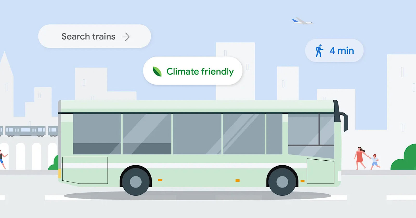
Google announced updates to its Maps and Search products on Monday aimed at helping users find and choose more sustainable transportation options over gas-powered vehicles.
James Byers, Google Search’s Group Product Manager, states:
“When it comes to traveling and commuting, we want people to have the right information to make more sustainable choices.”
Eco-Friendly Route Suggestions

If travel times are comparable, one of Google Maps’ key new features will be the provision of transit and walking route suggestions alongside driving routes.
This update will be rolled out in over 15 major cities worldwide in the coming weeks, including Amsterdam, Barcelona, Paris, Rome, and Sydney.
Train & Bus Route Information

Google is expanding its ability to find long-distance train and bus routes through search.
Users searching queries like “Boston to Philadelphia train” will see schedules, prices, and direct links to book tickets on the results page.
Train route information will now be available for 38 countries, while long-distance bus routes will initially be added for 15 countries.
When users search for flights on Google’s dedicated Flight tool, they will see train route suggestions as an alternative for applicable routes.
“So it’s easy to find the more sustainable option no matter where you begin your search,” Byers stated.
Highlighting Lower-Emission Flights
In cases where flying remains the best option, Google will show you the environmental impact.
Byers explains:
“These estimates are powered by the Travel Impact Model (TIM), a methodology we published in 2022 for predicting per-passenger flight emissions. To make this information even more accessible, TIM estimates are now also available through a developer API that allows any app or website to display flight emissions.”
Google is also releasing a Google Sheets add-on and online calculator to make the emissions estimates more widely available.
Looking Ahead
While Byers acknowledged “there’s still a long road ahead when it comes to sustainable travel,” he expressed hope that “today’s updates will give more people the information they need to choose lower-carbon alternatives.”
The new features come as consumers increasingly seek ways to make sustainable choices. By integrating these metrics into its flagship maps and travel tools, Google is nudging users towards greener options.
Featured Image: Screenshot from blog.google/products/search/, April 2024.
Matt G. Southern, Senior News Writer, has been with Search Engine Journal since 2013. With a bachelor’s degree in communications, ...
Subscribe To Our Newsletter.
Conquer your day with daily search marketing news.
- Share full article
For more audio journalism and storytelling, download New York Times Audio , a new iOS app available for news subscribers.
The Opening Days of Trump’s First Criminal Trial
Here’s what has happened so far in the unprecedented proceedings against a former u.s. president..
This transcript was created using speech recognition software. While it has been reviewed by human transcribers, it may contain errors. Please review the episode audio before quoting from this transcript and email [email protected] with any questions.
It’s the first day of the Trump trial and just walking out the door in my house. It’s a beautiful day, 6:11 AM. The thing that keeps running through my head is it’s kind of amazing that hundreds of jurors are going to show up at the Manhattan courthouse. And some of them are going to know what they’re there for — probably talking to their friends, their relatives about it.
Some of them are going to learn this morning talking to other jurors in line, asking what all the fuss is about. But I really do imagine that there’s going to be at least one potential juror who, headphones on, getting into court. Here they’re going to be there for the first criminal trial of Donald J. Trump. And just, I mean, how would you react?
[MUSIC PLAYING]
From “The New York Times,” I’m Michael Barbaro. This is “The Daily.” Today, what it’s been like inside the lower Manhattan courtroom, where political and legal history are being made? My colleague, Jonah Bromwich, on the opening days of the first criminal trial of a US President. It’s Thursday, April 18.
Is that his mic? Hi, there.
Hello. How are you?
I’m doing good.
OK. Thank you for coming in, Jonah —
Thank you for having me.
— in the middle of a trial. Can you just explain why you’re able to even be here?
Sure. So we happen to be off on Wednesdays during trial, so.
We being not “The New York Times,” but the courts.
That’s right.
Which is why we’re taping with you. And because we now have two full court days of this history-making trial now under our belts. And the thing about this trial that’s so interesting is that there are no cameras in the courtroom for the wider world.
There’s no audio recordings. So all we really have is and your eyes and your notebook, maybe your laptop. And so we’re hoping you can reconstruct for us the scene of the first two days of this trial and really the highlights.
Yeah, I’d be happy to. So on Monday morning, I left the subway. It’s before 7:00 AM. The sun is just rising over these grandiose court buildings in lower Manhattan.
I’m about to turn left onto Center Street. I’m right in front of the big municipal building.
And I turn onto Center Street. That’s where the courthouses are.
I’m crossing.
And I expected to see a big crowd. And it was even bigger than I had anticipated.
Here we go. Here we go. Here we go. Now, I finally see the crowd.
You have camera banks. You have reporters. You have the beginnings of what will eventually become a protest. And you have this most New York thing, which is just a big crowd of people.
[CHUCKLES]: Who just know something is going on.
That’s right. And what they know is going on is, of course, the first trial of an American president.
All right, I’m passing the camera, folks. Camera, camera, camera, camera. Here we go.
Let’s start with Sharon Crowley live outside the courthouse in Lower Manhattan.
I want to get right to ABC’S Aaron Katersky who’s outside of the courthouse.
Robert Costa is following it outside the courthouse in Lower Manhattan. Bob, I saw the satellite trucks lined up all in a row. Good morning.
Talk to us how we got here exactly.
So this is the case that was brought by the Manhattan district attorney. So prosecutors have accused Donald Trump of covering up the actions of his former fixer, Michael Cohen, after Cohen paid hush money to Stormy Daniels. Stormy Daniels had a story about having had sex with Donald Trump, which Trump has always denied.
Cohen paid her money, and then Trump reimbursed Cohen. And prosecutors say that Trump essentially defrauded the American people because he hid this information that could have been very important for the election from those people when he reimbursed Cohen.
Right. And as I remember it, he also misrepresented what that reimbursement was. Claimed it was a legal fee when, in fact, it was just reimbursing Michael Cohen for a hush money payment.
Exactly, yeah. He definitely didn’t say reimbursement for hush money payment to Stormy Daniels. It’s a cover up case. It’s a case about hiding information you don’t want people to see.
Right. And of course, the context of all this is that it is in the middle of a presidential election. It’s 2016. Trump wants to keep this secret, prosecutors allege, so that the American public doesn’t know about it and potentially hold it against him.
Right. And prosecutors are telling a story about election interference. They’re saying that Trump interfered with an election. And Trump himself is also using the phrase “election interference.” But he’s painting the trial itself as election interference as he now runs again in 2024.
Fascinating.
And because we’re in Manhattan, and because the jury pool is going to be largely Democratic, and the judge is a Democrat, and the district attorney is a Democrat, Trump keeps claiming he cannot get a fair shake. This is democrat central. And in democrat central, Trump doesn’t have a chance.
OK. So, what happens once you actually enter the courthouse?
Outside, there’s all this fanfare. But inside, it’s a little bit business as usual. So I go up to the 15th floor, and I walk into the courtroom, and I sit down, and it’s the same old courtroom. And we’re sitting and waiting for the former president.
Around 9:30, Trump walks in. He looks thin. He looks a little tired, kind of slumping forward, as if to say with his body like let’s get this over with. Here we go.
The judge walks in a little bit after that. And we think we’re all set for the trial to start, but that’s not what happens here. And in fact, there are a series of legal arguments about what the trial is going to look like and what evidence is going to be allowed in.
So, for example, prosecutors ask that they be allowed to admit into evidence headlines from “The National Enquirer” that were attacks on Trump’s 2016 opponents — on Ted Cruz, on Marco Rubio, on Ben Carson.
Because prosecutors are in some sense putting Trump’s 2016 campaign on trial. These headlines are a big part of that because what prosecutors say they show is that Trump had this ongoing deal with “The National Enquirer.” And the publisher would promote him, and it would publish damaging stories about his opponents. And then crucially, it would protect Trump from negative stories. And that’s exactly what prosecutors say happened with Stormy Daniels. That “The National Enquirer” tipped Cohen off about Stormy Daniels trying to sell her story of having had sex with Donald Trump, which he denies. And that led to the hush money payment to her. So what prosecutors are doing overall with these headlines is establishing a pattern of conduct. And that conduct, they say, was an attempt to influence the election in Trump’s favor.
And the judge agrees. He’s going to admit this evidence. And this is a pretty big win for the prosecution. But even though they win that one, they’re not winning everything.
They lose some important arguments here. One of them was that after the Access Hollywood tape came out, there were allegations of sexual assault against Donald Trump. And you know this, Michael, because you reported two of them — two of the three in question at this very trial.
Prosecutors had hoped to talk about those during trial in front of the jury to show the jurors that the Trump campaign was really, really focused on pushing back against bad press in the wake of the Access Hollywood tape in which Trump seemed to describe sexual assault. That was a big problem for the campaign. Campaign did everything it could to push back, including against these allegations that surfaced in the wake of the tape.
But the judge, saying that the allegations are hearsay — that they’re based on the women’s stories — says absolutely not. That is incredibly prejudicial to the defendant.
Interesting.
And that Donald Trump would actually not get a fair trial were those allegations to be mentioned. And so he will not let those in. The jurors will not hear about them.
So this is a setback, of course, for the prosecution, a victory for Trump’s legal team.
It’s a setback. And it also just shows you how these pre-trial motions shape the context of the trial. Think of the trial as a venue like a theater or an athletic contest of some sort. And these pre-trial motions are about what gets led into the arena and what stays out. The sexual assault allegations — out. “The National Enquirer” headlines — in.
OK. And how is Trump sitting there at the defense table reacting to these pre-trial motion rulings from the judge?
Well, as I’ve just said, this is very important stuff for his trial.
Right. Hugely important.
But it’s all happening in legal language, and I’m decoding it for you. But if you were sitting there listening to it, you might get a little lost, and you might get a little bored. And Trump, who is not involved in these arguments, seems to fall asleep.
Seems to fall asleep — you’re seeing this with your own eyes.
What we’re seeing, overall, including our colleague, Maggie Haberman, who’s in the overflow room and has a direct view of Trump’s face — I’m sitting behind him in the courtroom, so I can’t see his face that well.
You guys are double teaming this.
That’s right. I’m sitting behind him, but Maggie is sitting in front of him. And what she sees is not only that his eyes are closed. That wouldn’t get you to he is asleep.
And we have to be really careful about reporting that he’s asleep, even if it seems like a frivolous thing. But what happens is that his head is dropping down to his chest, and then it’s snapping back up. So you’ve seen that, when a student —
I’ve done that.
(CHUCKLES) Yeah. We all kind of know that feeling of snapping awake suddenly. And we see the head motion, and it happens several times.
Lawyers kind of bothering him, not quite shaking him, but certainly trying to get his attention. And that head snapping motion, we felt confident enough to report that Trump fell asleep.
During his own criminal trial’s opening day.
Does someone eventually wake him up?
He wakes up. He wakes up. And in fact, in the afternoon, he’s much more animated. It’s almost as if he wants to be seen being very much awake.
Right. So once these pre-trial motions are ruled on and Trump is snapped back to attention, what happens?
Well, what happens in the courtroom is that the trial begins. The first trial of an American president is now in session. And what marks that beginning is jurors walking into the room one by one — many of them kind of craning their necks over at Donald Trump, giggling, raising their eyebrows at each other, filing into the room, and being sworn in by the judge. And that swearing in marks the official beginning of the trial.
The beginning is jury selection, and it’s often overlooked. It’s not dramatized in our kind of courtroom dramas in the same way. But it’s so important. It’s one of the most important parts of the case. Because whoever sits on the jury, these are the 12 people who are going to decide whether Trump is guilty or whether Trump is innocent.
So how does jury selection actually look and feel and go?
So, jury selection is a winnowing process. And in order to do that, you have to have these people go through a bunch of different hurdles. So the first hurdle is, after the judge describes the case, he asks the group — and there are just short of 100 of them — whether they can be fair and impartial. And says that if they can’t, they should leave. And more than half the group is instantly gone.
So after we do this big mass excusal, we’re left with the smaller group. And so now, jurors are getting called in smaller groups to the jury box. And what they’re going to do there is they’re going to answer this questionnaire.
And this part of the process is really conducted by the judge. The lawyers are involved. They’re listening, but they’re not yet asking questions of the jurors themselves.
And what’s on the questionnaire?
Well, it’s 42 questions. And the questions include, their education, their professional histories, their hobbies, what they like to do whether you’re a member of QAnon or Antifa.
Whether you’re far left or far right.
That’s right. Whether you’ve read “The Art of the Deal,” Trump’s book, which some prospective jurors had.
Right. It was a bestseller in its time.
That’s right. And some of it can be answered in yes/no questions, but some of it can be answered more at length. So some of the prospective jurors are going very, very fast. Yes, no, no, no, yes.
Right. Because this is an oral questionnaire.
That’s right. But some of them are taking their time. They’re expanding on their hobbies. So the potential juror in seat 3, for example, is talking about her hobbies. And she says some running, hiking. And then she said, I like to go to the club, and it got a huge laugh. And you get that kind of thing in jury selection, which is one of the reasons it’s so fun. It’s the height of normality in this situation that is anything but normal.
Right. The most banal answer possible delivered in front of the former president And current Republican nominee for president.
Well, that’s one of the fascinating parts about all this, right? is that they’re answering in front of Trump. And they’re answering questions about Trump in front of Trump. He doesn’t react all that much. But whenever someone says they’ve read “The Art of the Deal —” and there are a few of those — he kind of nods appreciatively, smiles. He likes that. It’s very clear. But because there are so many questions, this is taking forever, especially when people are choosing to answer and elaborate and digress.
This is when you fall asleep.
This Is. When I would have fallen asleep if I were a normal person.
And by the end of the day. Where does jury selection stand?
Well, the questionnaire is another device for shrinking that jury pool. And so the questionnaire has almost these little obstacles or roadblocks, including, in fact, a question that jurors have seen before — whether they would have any problem being fair and impartial?
Hmm. And they ask it again.
They’re asked it again. And they’re asked in this more individualized way. The judge is questioning them. They’re responding.
So, remember that woman who said she liked to go to the club got a big laugh. She reaches question 34. And question 34 reads, “Do you have any strong opinions or firmly-held beliefs about former President Donald Trump or the fact that he is a current candidate for president that would interfere with your ability to be a fair and impartial juror?” She said, yes, she does have an opinion that would prevent her from being fair and impartial. And she, too, is excused.
So that’s how it works. People answer the questionnaire, and they get excused in that way, or they have a scheduling conflict once they reach the jury box. And so to answer your question, Michael. At the end of day one, given all these problems with the questionnaire and the length of time it’s taken to respond to and people getting dismissed based on their answers, there is not a single juror seated for this trial.
And it’s starting to look like this is going to be a really hard case for which to find an impartial jury.
That’s the feeling in the room, yeah.
We’ll be right back.
So Jonah, let’s turn to day 2. What does jury selection look like on Tuesday?
So when the day begins, it looks almost exactly like it looked when the day ended on Monday. We’re still with the questionnaire, getting some interesting answers. But even though it feels like we’re going slow, we are going.
And so we’ve gone from about 100 people to now there’s about 24 the room there’s 18 the jury box. And by the time we hit lunch, all those people have answered all those questions, and we are ready for the next step in the process.
Voir dire. And what it is the heart of jury selection. This is the point where the lawyers themselves finally get to interview the jurors. And we get so much information from this moment because the lawyers ask questions based on what they want out of the jurors.
So the prosecution is asking all these different kinds of questions. The first round of wajir is done by a guy named Joshua Steinglass, a very experienced trial lawyer with the Manhattan District Attorney’s Office. And he’s providing all these hypotheticals. I’ll give you one example because I found this one really, really interesting. He provides a hypothetical about a man who wants his wife killed and essentially hires a hitman to do it. And what he asked the jurors is, if that case were before you, would you be able to see that the man who hired the hitman was a part of this crime?
And of course, what he’s really getting at is, can you accept that even though Michael Cohen, Trump’s fixer, made this payment, Trump is the guy who hired him to do it?
That’s right. If there are other people involved, will jurors still be able to see Donald Trump’s hands behind it all?
Fascinating. And what were some of the responses?
People mostly said, yes, we accept that. So that’s how the prosecution did it.
But the defense had a totally different method of voir dire. They were very focused on their client and people’s opinions about their client.
So what kind of questions do we get from them?
So the lawyer, Todd Blanche, is asking people, what do you make of President Trump? What do you think of President Trump?
And what are some of the responses to that?
Well, there’s this incredible exchange with one of the jurors who absolutely refuses to give his opinion of Donald Trump. They go back and forth and back and forth. And the juror keeps insisting you don’t need to know my opinion of him. All you need to know is that I’m going to be fair and impartial, like I said. And Blanch pushes, and the guy pushes back. And the only way the guy budges is he finally kind of confesses almost at the end that, yes, I am a Democrat, and that’s all we get.
And what ends up happening to this potential juror?
Believe it or not, he got dismissed.
[LAUGHS]: I can believe it. And of course, it’s worth saying that this guy and everybody else is being asked that question just feet from Trump himself.
That’s right. And you might think you were going to get a really kind of spicy, like, popcorn emoji-type exchange from that. But because these are now jurors who have said they can be fair and impartial, who, to some extent, want to be on this jury or at least wouldn’t mind being on this jury, they’re being very restrained.
Mostly, what they are emphasizing — much like that guy just described dis — is that they can be fair. They can be impartial. There’s one woman who gives this really remarkable answer.
She says, I thought about this last night. I stayed up all night. I couldn’t sleep, thinking about whether I could be fair. It’s really important to me, and I can.
What ends up happening to that particular juror?
She’s also dismissed. And she’s dismissed without any reason at all. The defense decides it doesn’t like her. It doesn’t want her on the jury. And they have a certain number of chances to just get rid of jurors — no questions asked.
Other jurors are getting dismissed for cause — I’m doing air quotes with my hands — which means that the lawyers have argued they actually revealed themselves through their answers or through old social media posts, which are brought up in the courtroom, to be either non-credible, meaning they’ve said they can be fair and they can’t, or somehow too biased to be on the jury.
Wait, can I just dial into that for a second? Are lawyers researching the jurors in real time going online and saying — I’m making this up — but Jonah Bromwich is a potential juror, and I’m going to go off into my little corner of the courtroom and Google everything you’ve ever said? Is that what’s happening in the room?
Yeah, there’s a whole profession dedicated to that. It’s called jury consultant, and they’re very good at finding information on people in a hurry. And it certainly looked as if they were in play.
Did a social media post end up getting anybody kicked off this jury?
Yes, there were posts from 2016 era internet. You’ll remember that time as a very heated one on the internet, Facebook memes are a big thing. And so there’s all kinds of lock him up type memes and rhetoric. And some of the potential jurors here have used those. And those jurors are dismissed for a reason.
So we have these two types of dismissals, right? We have these peremptory dismissals — no reason at all given. And we have for cause dismissals.
And the process is called jury selection. But you don’t actually get selected for a jury. The thing is to make it through all these obstacles.
You’re left over.
Right. And so when certain jurors are not dismissed, and they’ve made it through all these stages, by the end of the day, we have gone from zero juror seated to seven jurors who will be participating in Donald Trump’s trial.
Got it. And without going through all seven, just give us a little bit of a sketch of who so far is on this jury. What stands out?
Well, not that much stands out. So we’ve got four men. We’ve got three women. One lives on the Upper East Side. One lives in Chelsea. Obviously, they’re from all over Manhattan.
They have these kind of very normal hobbies like spending time with family and friends. They have somewhat anonymous jobs. We’ve got two lawyers. We’ve got someone who’s worked in sales.
So there’s not that much identifying information. And that’s not an accident . One of the things that often happens with jury selection, whether it be for Donald Trump or for anyone else, is the most interesting jurors — the jurors that kind of catch your attention during the process — they get picked off because they are being so interesting that they interest one or the other side in a negative way. And soon they’re excused. So most of the jurors who are actually seated —
Are not memorable.
Are not that memorable, save one particular juror.
OK. All right, I’ll bite. What do I need to know about that one particular juror?
So let me tell you about a prospective juror who we knew as 374, who will now be juror number five. She’s a middle school teacher from Harlem. And she said that she has friends who have really strong opinions about Trump, but she herself does not. And she insisted several times, I am not a political person.
And then she said this thing that made me quite surprised that the prosecution was fine with having her on the jury. She said, quote, “President Trump speaks his mind, and I’d rather that than someone who’s in office who you don’t know what they’re thinking.”
Hmm. So she expressed approval of President Trump.
Yeah, it was mild approval. But the thing is, especially for the defense in this trial, all you need is one juror. One juror can tie up deliberations in knots, and you can end with a hung jury. And this is actually something that I saw firsthand. In 2019, I was the foreperson on a jury.
How you like that?
Yeah. And the trial was really complicated, but I had thought while we were doing the trial, oh, this is going to be a really easy decision. I thought the defendant in that case was guilty. So we get into deliberations, but there’s this one juror who keeps gumming up the works every time we seem to be making progress, getting a conversation started.
This juror proverbially throws up his hands and says, I am not convicting. This man is innocent. And we talked and we talked. And as the foreperson, I was trying to use all my skills to mediate.
But any time we made any progress, this guy would blow it up. And long story short, hung jury — big victory for the defense lawyer. And we come out of the room. And she points at this juror. The guy —
The defense lawyer.
The defense lawyer points at this juror who blew everything up. And she said, I knew it. I knew I had my guy.
OK. I don’t want to read too much into what you said about that one juror. But should I read between the lines to think that if there’s a hung jury, you wonder if it might be that juror?
That’s what everyone in the courtroom is wondering not just about this juror, but about every single person who was selected. Is this the person who swings the case for me? Is this the person who swings the case against me?
These juries are so complex. It’s 12 people who don’t know each other at the start of the trial and, by the end of the trial, have seen each other every morning and are experiencing the same things, but are not allowed to have talked about the case until deliberations start. In that moment when deliberations start —
You’re going to learn a whole lot about each other.
That’s right. There’s this alchemical moment where suddenly, it all matters. Every personality selected matters. And that’s why jury selection is so important. And that’s why these last two days are actually one of the most important parts of this trial.
OK. So by my math, this trial will require five more jurors to get to 12. I know also they’re going to need to be alternates. But from what you’re saying what looked like a really uphill battle to get an impartial jury or a jury that said it could be impartial — and Trump was very doubtful one could be found — has turned out to not be so hard to find.
That’s right. And in fact, we went from thinking, oh, boy, this is going awfully slowly, to the judge himself saying we could be doing opening arguments as soon as Monday morning. And I think that highlights something that’s really fascinating both about this trial and about the jury selection process overall.
One of the things that lawyers have been arguing about is whether or not it’s important to figure out what jurors’ opinions about Donald Trump are. And the prosecution and, I think, the judge have really said, no, that’s not the key issue here. The key issue is not whether or not people have opinions about Donald Trump.
Right. Who doesn’t have an opinion about Donald Trump?
Exactly. They’re going to. Automatically, they’re going to. The question is whether or not they can be fair and impartial. And the seven people we already have seated, and presumably the five people that we’re going to get over the next few days and however many alternates — we expect six — are all going to have answered that question, not I hate Trump; I love Trump, but I can weigh in on the former president’s innocence or guilt, and I can do it as fairly as humanly possible.
Now, Trump is not happy about this. He said after court yesterday, quote, We have a highly conflicted judge, and he’s rushing this trial.” And I think that he is going to see these beats of the system the criminal justice system as it works on him as he is experiencing it as unfair. That is typically how he talks about it and how he views it.
But what he’s getting is what defendants get. This is the system in New York, in the United States. This is its answer to how do you pick a fair jury? Well, you ask people can you be fair? And you put them through this process, and the outcome is 12 people.
And so I think we’re going to see this over and over again in this trial. We’re going to see Trump experience the criminal justice system.
And its routines.
Yeah, openings, witnesses, evidence, closings. He’s going to go through all of it. And I think, at every turn, it makes sense to expect him to say, well, this is not fair. Well, the judge is doing something wrong. Well, the prosecutors are doing something wrong. Well, the jury is doing something wrong.
But at the end of the day, he’s going to be a defendant, and he’s going to sit, mostly silently if his lawyers can make him do that, and watch this process play itself out. So the system is going to try and treat him like any other defendant, even though, of course —
— he’s not. And he is going to fight back like no other defendant would, like no other defendant could. And that tension, him pushing against the criminal justice system as it strives to treat him, as it would anyone else, is going to be a defining quality of this trial.
Well, Jonah, thank you very much. We appreciate it.
Of course. Thanks so much for having me. [MUSIC PLAYING]
PS, have you ever fallen asleep in a trial?
I have not.
[CHUCKLES]:
Here’s what else you need to know today.
It’s clear the Israelis are making a decision to act. We hope they do so in a way that does as little to escalate this as possible and in a way that, as I said —
During a visit to Jerusalem on Wednesday, Britain’s foreign Secretary left little doubt that Israel would retaliate against Iran for last weekend’s aerial attack, despite pressure from the United States and Britain to stand down. The question now is what form that retaliation will take? “The Times” reports that Israel is weighing several options, including a direct strike on Iran, a cyber attack, or targeted assassinations. And —
Look, history judges us for what we do. This is a critical time right now, critical time on the world stage.
In a plan that could threaten his job, Republican House Speaker Mike Johnson will put a series of foreign aid bills up for a vote this weekend. The bills, especially for aid to Ukraine, are strongly opposed by far-right House Republicans, at least two of whom have threatened to try to oust Johnson over the plan.
I can make a selfish decision and do something that’s different, but I’m doing here what I believe to be the right thing. I think providing lethal aid to Ukraine right now is critically important. I really do. I really — [MUSIC PLAYING]
Today’s episode was produced by Rikki Novetsky, Will Reid, Lynsea Garrison, and Rob Zubko. It was edited by Paige Cowett, contains original music by Marion Lozano, Elisheba Ittoop, and Dan Powell, and was engineered by Chris Wood. Our theme music is by Jim Brunberg and Ben Landsverk of Wonderly Lake.
That’s it for “The Daily.” I’m Michael Barbaro. See you tomorrow.

- April 19, 2024 • 30:42 The Supreme Court Takes Up Homelessness
- April 18, 2024 • 30:07 The Opening Days of Trump’s First Criminal Trial
- April 17, 2024 • 24:52 Are ‘Forever Chemicals’ a Forever Problem?
- April 16, 2024 • 29:29 A.I.’s Original Sin
- April 15, 2024 • 24:07 Iran’s Unprecedented Attack on Israel
- April 14, 2024 • 46:17 The Sunday Read: ‘What I Saw Working at The National Enquirer During Donald Trump’s Rise’
- April 12, 2024 • 34:23 How One Family Lost $900,000 in a Timeshare Scam
- April 11, 2024 • 28:39 The Staggering Success of Trump’s Trial Delay Tactics
- April 10, 2024 • 22:49 Trump’s Abortion Dilemma
- April 9, 2024 • 30:48 How Tesla Planted the Seeds for Its Own Potential Downfall
- April 8, 2024 • 30:28 The Eclipse Chaser
- April 7, 2024 The Sunday Read: ‘What Deathbed Visions Teach Us About Living’
Hosted by Michael Barbaro
Featuring Jonah E. Bromwich
Produced by Rikki Novetsky , Will Reid , Lynsea Garrison and Rob Szypko
Edited by Paige Cowett
Original music by Dan Powell , Marion Lozano and Elisheba Ittoop
Engineered by Chris Wood
Listen and follow The Daily Apple Podcasts | Spotify | Amazon Music
Political and legal history are being made in a Lower Manhattan courtroom as Donald J. Trump becomes the first former U.S. president to undergo a criminal trial.
Jonah Bromwich, who covers criminal justice in New York, explains what happened during the opening days of the trial, which is tied to Mr. Trump’s role in a hush-money payment to a porn star.
On today’s episode

Jonah E. Bromwich , who covers criminal justice in New York for The New York Times.

Background reading
Here’s a recap of the courtroom proceedings so far.
Mr. Trump’s trial enters its third day with seven jurors chosen.
There are a lot of ways to listen to The Daily. Here’s how.
We aim to make transcripts available the next workday after an episode’s publication. You can find them at the top of the page.
The Daily is made by Rachel Quester, Lynsea Garrison, Clare Toeniskoetter, Paige Cowett, Michael Simon Johnson, Brad Fisher, Chris Wood, Jessica Cheung, Stella Tan, Alexandra Leigh Young, Lisa Chow, Eric Krupke, Marc Georges, Luke Vander Ploeg, M.J. Davis Lin, Dan Powell, Sydney Harper, Mike Benoist, Liz O. Baylen, Asthaa Chaturvedi, Rachelle Bonja, Diana Nguyen, Marion Lozano, Corey Schreppel, Rob Szypko, Elisheba Ittoop, Mooj Zadie, Patricia Willens, Rowan Niemisto, Jody Becker, Rikki Novetsky, John Ketchum, Nina Feldman, Will Reid, Carlos Prieto, Ben Calhoun, Susan Lee, Lexie Diao, Mary Wilson, Alex Stern, Dan Farrell, Sophia Lanman, Shannon Lin, Diane Wong, Devon Taylor, Alyssa Moxley, Summer Thomad, Olivia Natt, Daniel Ramirez and Brendan Klinkenberg.
Our theme music is by Jim Brunberg and Ben Landsverk of Wonderly. Special thanks to Sam Dolnick, Paula Szuchman, Lisa Tobin, Larissa Anderson, Julia Simon, Sofia Milan, Mahima Chablani, Elizabeth Davis-Moorer, Jeffrey Miranda, Renan Borelli, Maddy Masiello, Isabella Anderson and Nina Lassam.
Jonah E. Bromwich covers criminal justice in New York, with a focus on the Manhattan district attorney’s office and state criminal courts in Manhattan. More about Jonah E. Bromwich
Advertisement
- CBSSports.com
- Fanatics Sportsbook
- CBS Sports Home
- Champions League
- Motor Sports
- High School
- Horse Racing
Men's Brackets
Women's Brackets
Fantasy Baseball
Fantasy football, football pick'em, college pick'em, fantasy basketball, fantasy hockey, franchise games, 24/7 sports news network.
- CBS Sports Golazo Network
- PGA Tour on CBS
- UEFA Champions League
- UEFA Europa League
- Italian Serie A
- Watch CBS Sports Network
- TV Shows & Listings
The Early Edge
A Daily SportsLine Betting Podcast
With the First Pick
NFL Draft is coming up!
- Podcasts Home
- The First Cut Golf
- Beyond the Arc
- Eye On College Basketball
- NFL Pick Six
- Cover 3 College Football
- Fantasy Football Today
- My Teams Organize / See All Teams Help Account Settings Log Out
2024 WNBA Draft results: Tracker, order, grades with Caitlin Clark taken by Fever, Angel Reese heading to Sky
Cameron brink, kamilla cardoso and rickea jackson rounded out the lottery behind clark.
The star-studded 2024 WNBA Draft tipped off in style Monday, as the Indiana Fever selected Iowa superstar and back-to-back Naismith Player of the Year Caitlin Clark with the No. 1 overall pick . Clark will pair with former South Carolina star Aliyah Boston, who the Fever took at No. 1 last year.
Naismith Defensive Player of the Year Cameron Brink was the No. 2 pick, and she's heading south from Stanford to Los Angeles to join the Sparks. There, she'll team up with Rickea Jackson from Tennessee, whom the Sparks add with their second lottery pick at No. 4 overall.
The SEC championship game was headlined by the post battle between Kamilla Cardoso and Angel Reese. Now, just a few weeks later, the two stars are teammates after the Chicago Sky selected them at No. 3 and 7, respectively.
Also in the first round, the Dallas Wings took Ohio State's Jacy Sheldon with the No. 5 overall pick, while UConn forward Aaliyah Edwards was selected sixth by the Washington Mystics, becoming the 27th Husky to be selected in the first round of the WNBA Draft.
Some notable players drafted outside of the first round include Nika Muhl (No. 14 to the Storm), Dyaisha Fair (No. 16 to the Aces), Elizabeth Kitley (No. 24 to the Aces) and Charisma Osborne (No. 25 to the Mercury). Later in the night, the Aces took Jackson State's Angel Jackson with the No. 36 pick, and with that another draft is in the books.
While the draft is over, anticipation for the forthcoming WNBA season is only rising, and fans can help ease the wait by purchasing Clark's Fever jersey .
Angel Jackson closes out the show
Jackson State center Angel Jackson went No. 36 overall to the Washington Mystics, and with that the 2024 WNBA Draft is officially over. She was a two-time SWAC Defensive Player of the Year who averaged nearly three blocks per game for the Tigers as she led them to the NCAA Tournament this season.
Osborne off the board to Phoenix
Charisma Osborne's long wait is over. She was the last player left in the green room and is finally off the board at No. 25 overall to the Phoenix Mercury. While no one wants to drop that far, the Mercury is a great landing spot for Osborne, as she has a real chance to make that roster. This is a steal for the Mercury in the third round
Aces take Kate Martin
Kate Martin admitted she was at the draft mainly to support her college teammate Caitlin Clark, but she was also hopeful to hear her name called. She did in the middle of the second round, when the Aces selected her with the No. 18 overall. It may be an uphill battle for her to make the roster, but she works had and is a versatile player.
Muhl goes to the Storm
Nika Muhl is finally off the board. The UConn star dropped out of the first round, which was great news for the Storm, who did not have a pick until No. 14 overall. Muhl is a floor general and a dogged defender who can knock down open shots and profiles as a long-term back-up point guard. Nice get for the Storm here
CBS Sports HQ Newsletter
We bring sports news that matters to your inbox, to help you stay informed and get a winning edge., thanks for signing up, keep an eye on your inbox., there was an error processing your subscription..

Caitlin Clark press conference takeaways

Favorites for No. 1 pick in 2025

A post-draft look at the league

Staley: Clark 'sole reason' for viewership growth

WNBA Draft first-round results, grades

Sparks among three winners from 2024 WNBA Draft

WNBA Draft: Caitlin Clark selected No. 1 by Fever

Brittney Griner re-signs with Phoenix Mercury

WNBA All-Star Game will be Team USA vs. Team WNBA

How can Luka escape becoming Harden 2.0?
IMAGES
VIDEO
COMMENTS
On your computer, open Google Maps. Click Directions . Click points on the map, type an address, or add a place name. Choose your mode of transportation. Tip: To choose another route in any transportation mode, select it on the map. Each route shows the estimated travel time on the map.
At the bottom, tap Go . Search for your destination in the search bar at the top. At the bottom, tap on "Directions.". At the top, select your transportation mode. Select your preferred route. At the bottom, tap Pin . You can pin your trip and find it back in the Go tab next time you need it. Tip: Pinning only works with "Driving" and ...
Find local businesses, view maps and get driving directions in Google Maps.
On your computer, open Google Maps. Make sure you're signed in. On the left, choose an option: Get directions to relevant places: Click a place in the list. You'll get places based on your Gmail, Calendar, and recent travel history. Get directions to saved places: If you saved your work or home address in your Google Account, click Home or ...
Google Maps Timeline is a personal map that helps you remember routes and trips you've taken and places you've been based on your Location History. You can edit your Timeline at any time and delete your Location History in Timeline. If you have settings like Web & App Activity turned on and you turn off Location History or delete location data from Location History, you may still have location ...
Google calculates journey time by measuring the distances between your two chosen points, and applying any speed limits that are in place on the route to provide a perceived average speed for the journey. This is then used to compute the forecast arrival time at the destination. Crucially, however, Google Maps also layers over additional live ...
The Travel Time Calculator on Google Maps is a valuable tool that enables users to estimate travel durations, helping them make informed decisions about commuting, travel itineraries, and more. This article delves into the functionality of this tool, offering insights into its formula, usage, and providing practical examples. ...
To schedule a trip: On your computer, open Google Maps. Set directions to a place. Click Leave now Depart at or Arrive by . Set a time and date under "Depart at" or "Arrive by." Tips: This feature is only available if you have one destination. You must be signed in to use this feature.
Next time you're on your way or running late, you can share your real-time location and trip progress from navigation as well. During your next trip, tap the "More" button on the bottom on the navigation screen, and then tap "Share trip.". When you share your trip with people, they'll see your expected arrival time and can follow ...
Find the best route when driving, with real-time updates on traffic jams, accidents, road closures and speed traps. You can also keep fellow drivers in the know by reporting incidents yourself. Hands-free help with the Google Assistant. Your Google Assistant is now integrated into Google Maps so you can message, call, listen to music and get ...
Travelmath helps you find the driving time based on actual directions for your road trip. You can find out how long it will take to drive between any two cities, airports, states, countries, or zip codes. This can also help you plan the best route to travel to your destination. Compare the results with the flight time calculator to see how much ...
Twindesign/123RF. Google Maps has added a helpful feature to navigation that should make it a little easier to plan your next journey. The app will now tell you how long your travel time may be ...
To calculate travel time on Google Maps, the algorithm accounts for various transportation modes, including walking, driving, cycling, and public transit. It also considers many factors, such as weather conditions, traffic patterns, and terrain. 4 Factors That Help To Calculate Travel Time on Google Maps
Click one of the blue bars at the top-left of the screen or enter a specific day to see all the places you traveled on that day.; Click the red Places option in the bottom-left to see every ...
Predictive travel time uses historical time-of-day and day-of-week traffic data to estimate travel times at a future date. This makes it easier than ever to predict how long it will take to get somewhere and suggest the best route even when the departure time is far in the future. Since traffic conditions in the future will vary greatly, we ...
Provide up to 26 locations and Route Planner will optimize, based on your preferences, to save you time and gas money. Find the shortest routes between multiple stops and get times and distances for your work or a road trip. Easily enter stops on a map or by uploading a file. Save gas and time on your next trip.
Realtime driving directions based on live traffic updates from Waze - Get the best route to your destination from fellow drivers
Typically, if you want to track your journey in Google Maps, you have to unlock your phone, open the Google Maps app, and then check the directions. With glanceable directions, you can track your journey right from your smartphone lock screen. This feature displays the remaining distance, upcoming turns, and estimated time of arrival (ETA).
On your Android phone or tablet, open the Google Maps app . At the bottom, tap Go . Search for your destination in the search bar at the top. At the bottom, tap on 'Directions'. At the top, select your transportation mode. Select your preferred route. At the bottom, tap Pin . You can pin your trip and find it back in the Go tab next time you ...
Plan your trip with Google. Find flights, hotels, vacation rentals, things to do, and more.
Google Earth Engine combines a multi-petabyte catalog of satellite imagery and geospatial datasets with planetary-scale analysis capabilities and makes it available for scientists, researchers, and developers to detect changes, map trends, and quantify differences on the Earth's surface. Platform. overview;
The tool outputs shapes, also known as travel time isochrones visualise where's reachable. Sometimes these shapes are incorrectly labelled as a 'travel time radius map'. A radius is always just a circular shape, but a travel time shape is completely unique as it analyses all locations reachable using a specific mode of transport.
The system maintains past data about journey times and also gives real-time information. Users can use this data to compare travel times via various methods, including driving, walking, and taking public transportation. Moreover, Google Maps processes past trip information with the use of complex algorithms.
Use Google Flights to explore cheap flights to anywhere. Search destinations and track prices to find and book your next flight.
Google has announced several new features for Google Maps and Google Search aimed at helping people find less carbon-intensive ways of traveling and commuting. One of the key additions is a new EV ...
Step 1 - Open a New Tab. Step 2 - In the search bar type/paste "chrome://flags" and hit Enter. Step 3 - Now in the 'Search flags' search bar enter "History Journeys" or "Enables the History Journeys UI". Step 4 - Select "Disabled" from the drop down menu. As shown in the screenshot. Step 5 - Relaunch your Chrome app. That's all there ...
The estimated emissions on Google Flights are powered by the Travel Impact Model (TIM) — a Google-based methodology published in 2022 for predicting flight emissions per passenger.
Webinar Google 3rd-Party Cookie Deprecation [Update] + 5 Best Strategies. Stay ahead of the game with the best marketing tools and ensure your tactics are primed for success in this new era of ...
12. Hosted by Michael Barbaro. Featuring Jonah E. Bromwich. Produced by Rikki Novetsky , Will Reid , Lynsea Garrison and Rob Szypko. Edited by Paige Cowett. Original music by Dan Powell , Marion ...
The star-studded 2024 WNBA Draft tipped off in style Monday, as the Indiana Fever selected Iowa superstar and back-to-back Naismith Player of the Year Caitlin Clark with the No. 1 overall pick ...