

Turn your road trip into an adventure .
Find amazing stops along your route.
- What are you looking for?
- Local Favorites
- Places to Camp
- Pop Culture
- Veg Friendly
- Unique Stays
- National Parks
- Activities & Experiences
- I'll decide when I get there

The Gemini Giant
Wilmington, IL

World's Largest Catsup Bottle
Collinsville, IL

Blue Whale of Catoosa
Catoosa, ok.

Golden Driller

Albuquerque
Albuquerque, NM

You’re always a short detour from an
Extraordinary place.
Our collection of more than 300 Extraordinary Places will take your trip to the next level. Look for the illustrations on our maps and read our takes on what make these places so special. We’ve been there, and we think you should go, too.

Yellowstone National Park
Mammoth, wy.

Salvation Mountain

Walt Disney World
Lake buena vista, fl.

Mount Rushmore National Memorial
Keystone, sd.

Graceland Mansion
Memphis, tn.

Glacier National Park
West glacier, mt.

World's Largest Buffalo Monument
Jamestown, nd.

Yosemite National Park
Yosemite valley, ca.

Cadillac Ranch
Amarillo, tx.

Acadia National Park
Bar harbor, me.

Mothman Statue
Point pleasant, wv.

Grand Canyon National Park
Grand canyon village, az.

Statue of Liberty
Liberty island, ny.

Las Vegas Strip
Paradise, nv.

The Fremont Troll
Seattle, wa, build your perfect road trip.
Tell us where you want to go and what you'd like to see and do. Roadtrippers will help you find all the best stops along the way.
- Sights & Attractions
- The Great Outdoors
- Bars & Restaurants
- Hotels & Unique Stays
- Fuel & Rest Stops

On all your devices
Any trips you've saved or places you love will sync automatically across devices.

In-app RV navigation
Hit the road with safety and ease by using turn-by-turn directions, designed specifically for your RV. Simply enter your rig’s size and propane restrictions, and we’ll find the best routes to your next destination.

Ready to start your adventure?
- Trip guides
- Voices from the Road
- Destinations
- Trip Planner
- Sign up Log in Sign out
- Log in Sign out
- ROADTRIPPERS MEMBERSHIP
Plan your journey, find amazing places, and take fascinating detours with our app.
We couldn't find an existing Roadtrippers account using that service. Please try signing in with another option or create a new account with Roadpass.
We need your email address to send you trip itineraries and other updates.

The Lovers Passport
Home » Blog » Best Highway 1 Road Trip Itinerary & Guide
Best Highway 1 Road Trip Itinerary & Guide
Disclaimer: This post may contain affiliate links. Please see our Disclosure Policy for details.

Highway 1 is arguably one of the most beautiful stretches of coastal roads in the United States, perhaps even in the world. Our first road trip together was actually this very itinerary! If you’re looking for jaw dropping views of never ending coast, beautiful blue water beaches, and gorgeous overlooks, this is Highway 1 Road Trip for you.
Disclaimer : The Lovers Passport is reader-supported. Your engagement on this site allows us to bring you this content for free! Since this website contains affiliate links, if you make a purchase through these links, we may earn a commission at no extra cost to you. It’s one of the ways I can keep producing free guides and resources for all of our readers. This has absolutely no effect on our recommendations or evaluations and all opinions are our own. Thanks for supporting our adventures!
ROAD TRIP ITINERARY
Living in California for all of our lives, both Stephen and I have done this road trip several times. In fact, we’ve probably done this itinerary at least 4 or 5 times in the past year. So this blog post is all based on our own personal experiences down the coast, as well as some recommendations from fellow adventurers we’ve met along the way.
WHERE TO START & END YOUR HIGHWAY 1 ROAD TRIP
Since LAX is one of the most popular starting spots for this trip, we’ll be starting off on a route from LA up the coast and back, as well as a route for those that would rather make a loop around after completing the stretch of Highway 1. In saying that, you could jump on either of these itineraries at any stage of your Highway 1 road trip and you may choose to start/finish in different spots. Or, if you start from San Francisco, you can drive down the route in reverse and just complete it in a different order. This itinerary is more geared toward those driving the whole way, whether it’s in your own car, a rental, or a campervan , rather than flying in between major cities.
If you decide to go the camper van route, we loved doing this itinerary in our Kuga Rental from Traveller’s Autobarn . We picked it up in Los Angeles and drove all the way up to Point Reyes and Back using this itinerary. The van was so convenient in terms of spaciousness, comfortability, and transportability. We usually car camp, so this was our first van life experience, and the rental worked out super well for us in terms of getting us from Point A to B in a super easy and hassle free way!
If you’re interested in booking a camper van for your Highway 1 Road Trip, make sure to use the code “LoversPassport ” at checkout with Travellers Autobarn to receive a $50 discount on a Kuga camper van rental. The coupon will work on a 5 day minimum rental for a Kuga Campervan model for the rest of 2021!
HIGHWAY 1 ROAD TRIP TIPS:
Best time of year to visit highway 1.
California generically has fantastic weather year round. However, when it comes to the coast, expect several mornings to be socked in with low hanging clouds or fog. Usually it will burn off by the afternoon, but we’ve encountered the Big Sur Coast to be cloudy and moody like 7/10 times we’ve gone so just be prepared.
Honestly, the summer months of June, July and August are the most foggy. The best weather is usually in September or October with still moderately warm temperatures, less crowds, and less likelihood of clouds. Mid-to-late February through April is also pretty nice, just with mildly colder temperatures.
WHERE TO RENT A VEHICLE FOR YOUR HIGHWAY 1 ROAD TRIP
Choosing a Highway 1 rental car will depend on the type of trip you plan to take and whether you would prefer to stay in Air BnBs, hotels, tents, or stay in a camper van. If you plan to stay in hotels or guest houses then you can opt for a regular rental car and we would recommend picking it up after you fly into Los Angeles International Airport.
We personally love to either travel via a SUV with a camper build or rooftop tent or a camper van when traveling around the coast of California. That way we have more flexibility in terms of where we want to go each day and what we want to do, as well as where we want to stay the night. Other perks of renting a car camper or camper van is that you can adjust your plans on the go without having to worry about a spot to sleep. Click here to book your Highway 1 campervan rental (we highly recommend using Travellers Autobarn if flying into Los Angeles or San Francisco ). If you plan to tent camp then you’re probably best to opt for a small rental car as that will be your most budget-friendly option.
WHERE TO STAY ALONG THE CALIFORNIA COAST
The biggest piece of advice when it comes to finding accommodations is to plan in advance! Campground reservations along the latter part of Highway 1 up closer to Big Sur book out several months in advance. If you want to stay in established campgrounds, make sure to set reminders on your calendar of when campground permits are released.
However, there are several other options. If you don’t mind dispersed camping in which you are completely self sustained, then make sure to check out freecampsites.net or iOverlander to find campsites along the route that you’d like to stay at.
If you are going along the hotel route, some of the most popular hotels along this route tend to run on the more pricey side. That being said, we’d still recommend some popular favorites like the Ritz Carlton Bacara or Rosewood Miramar Hotel in Santa Barbara, The Cliffs Hotel in Pismo Beach, the Madonna Inn in SLO, Ragged Point Inn near San Simeon and Big Sur, and Ventana in Big Sur.
LOGISTICS OF A HIGHWAY 1 ROAD TRIP
Gas in California has gotten quite expensive recently. Mapping out your route ahead of time can give you a good idea of how much you’re going to need to budget for gas since this road trip does cover quite a bit of miles! We always like to use Gas Buddy to find the best gas prices along our route.
Theft is also quite prominent in major cities. Always make sure to be wary of your surroundings and keep your valuables with you and out of sight when exiting your car along Highway 1 Road Trip stops.
CAR SICKNESS
Also, it should be noted that there are a lot of curvy roads along the way. If you get carsick, make sure to take proper precautions!
CLEANLINESS ON THE ROAD
While road tripping for a week, you are likely going to want to shower. We love bringing our Rinsekit on road trips like this where we are typically car camping. It’s a portable shower that is so easy to just pack in the car so you can basically shower anywhere you want! We lay down a tarp we bought from Walmart and hang a towel across the back of the car with magnets for privacy, but you can also invest in a pop up shower tent to go along with your Rinsekit.
LENGTH OF YOUR HIGHWAY 1 ROAD TRIP
If you are dedicated and don’t mind driving a ton with less time at each stop, you could totally do this itinerary in 3 days. However, if you want to fully experience Highway 1, I’d recommend allotting 5-7 days to really experience each town along the way. Since the total drive is quite a bit of miles, it will be nice to pace your itinerary out a bit rather than rushing through the whole thing.
That being said, Stephen and I both work full time office jobs during the week and are able to do this road trip with modifications on a Friday Night-Sunday Night. If you have less time, I would cut out 3-4 of the stops listed below so that way you can still enjoy your Highway 1 Road Trip without feeling rushed. You’ll also have an excuse to come back and see the beauty of the California Coast again in the future!
EPIC HIGHWAY 1 ROAD TRIP ITINERARY
Any Highway 1 Road Trip is going to be jam packed with lots of beautiful spots and lots of driving. BUT, it’ll totally be worth it! Thankfully, the California Coast has some of the most scenic coastal viewpoints where your mind will be blown for the majority of the ride,
SANTA MONICA
Whether you love relaxing at the beach or hiking in the mountains, Santa Monica has a variety of things to do. Make sure to stop by the Santa Monica Pier and shop around the Third Street Promenade. If you are a history or fine arts lover, the Getty Villa is also close to Highway 1 and is a great little stop to enjoy beautiful views of the Santa Monica coastline.
For our avid hikers, check out Tuna Canyon for beginners, or one of our favorites in the Santa Monica recreation area called Sandstone Peak. If you head up to hike Sandstone Peak for sunrise or sunset, you may just get treated to a cloud inversion depending on the cloud elevation!
The Malibu coastline boasts some of the best beaches in all of California. My home beach of Zuma Beach is a classic one to visit to enjoy a summer day or learn how to surf. Leo Carrillo State Beach is another gorgeous option for a beautiful beach day.
For some classic brunch spots along the Malibu coast, check out Duke’s Malibu and try to get an early reservation for brunch outside for a view or Malibu Farm along the pier for a trendy (but expensive) brunch or cocktail with a gorgeous beach in front of you! If you are a wine lover, make sure to check out Malibu Wine Safari and Rosenthal Winery right along Highway 1.
For our outdoorsy lovers, check out Point Dume. If you love outdoor rock climbing, you can actually climb here! As previously mentioned, the surfing in the area is fantastic, or you can enjoy a variety of coastal hikes found here on All Trails. Finish up your time in Malibu with a sunset at El Matador State Beach.
OXNARD & VENTURA
This is our stomping ground, so if you’re ever in the area make sure to reach out and say hi! Check out the Oxnard or Ventura Harbor and even rent a kayak or paddleboard if you want to get out on the water. Enjoy a beautiful view of the beach towns up at Serra Cross, grab a delicious brew from Madewest Brewery on the Ventura Pier, and check out the surfers at Surfers Point before heading on up the coast further. If you want a more in- depth guide on just Ventura, check out this video on a day in the life of the gorgeous coastal city.
OPTIONAL HIGHWAY 1 ROAD TRIP ADD ON: CHANNEL ISLANDS NATIONAL PARK
While at either city harbor, you can check out Island Packers, where you can book a day trip or overnight trip to one of the Channel Islands in Channel Islands National Park! We recently did an overnight trip to Anacapa Island and it was beautiful, but you could definitely do it as a mini day trip! Santa Cruz is by far the most popular island and offers a lot more diversity on the island! Make sure if you decide to camp out there that you book your sites in coordination with your f erry tickets out to the islands.
Check out our Youtube video of our experience camping on Anacapa to see the full experience!
SANTA BARBARA
Just around 40 minutes north from Ventura, you’ll find a beautiful paradise in Santa Barbara. This city is a MUST stop along the way! Stephen and I both lived here for 4 years and it’s honestly our favorite city in all of California. There’s a little something for everyone.
For the adventure lovers, make a little detour from Highway 1 up the Santa Barbara Mountains via the 154 and check out Lizards Mouth or La Cumbre Peak for sunrise or sunset. If you are into hiking, check out Inspiration Point or 7 Falls Trail for beautiful views of the Santa Barbara Coast and the Channel Islands in the distance on a clear day. For more on Santa Barbara, check out our Couple’s Guide to Santa Barbara or our Santa Barbara videos on Youtube.
Make a stop at East Beach and set up your hammock or slackline among the palm trees. Swing by East Beach Tacos or La Superiqua for some amazing Mexican food for lunch. Some of our other favorite beaches in the area are Hendry’s Beach (dog-friendly, too, and has a great restaurant called Hendry’s Boat House there), as well as Butterfly Beach and Santa Claus Beach. There’s also the beach that is next to the Santa Barbara Pier which is often nice, and you can also rent kayaks or paddle boards here.
For the city lovers, check out the Funk Zone in downtown Santa Barbara for some of the finest wine, beer, and food. We always love checking out The Lark, Loquita, Helena Avenue Bakery, the Lucky Penny, Finneys, and there are so many more options for amazing restaurants in the area. Once you’re done exploring there, you can cruise on up to State Street and check out the amazing outdoor shopping and other dining opportunities. Lastly, make sure to get some ice cream from McConnell’s Ice Cream on State Street before heading to your next road trip stop!
North of Santa Barbara, you’ll encounter Gaviota, which is a quaint little area with beautiful, quieter beaches than Santa Barbara. We always love checking out Gaviota State Park! Our favorites are the Gaviota Hot Springs Hike as well as the Gaviota Wind Caves hike, which is a great one for kids as well. Please make sure to leave no trace and keep the trails better than you found them when recreating in these areas since they are more fragile and less maintained.
OCEANO & PISMO
We always love making a pit stop at the Oceano Sand Dunes right near Pismo Beach. If you’ve ever checked out the Sand Dunes in Death Valley, you probably won’t be as impressed. However, these dunes are still super fun to walk around. We love coming here for sunrise photography since there’s usually no one else around. Beware, walking on the sand is much more strenuous than you think though! Allot yourself more time than you think you’ll need when visiting here.
We love stopping at Brooks Burgers here for lunch before we keep heading up Highway 1.
AVILA BEACH
One of our favorite hidden gems along the coast is Avila Beach. Right after Pismo and right before you get to San Luis Obispo, check out Avila Beach. It is tucked away off the side of Highway 1 and is the cutest little beach town! We love parking in the beachfront area and ordering a pizza from Mission Pizza (their Maui Wowie pizza and Cheese Sticks are awesome) and having a beach side picnic. There’s also a cool mini hike down to Pirate’s Cove. This requires descending down a cliffside rope, so make sure to be wearing the right shoes and don’t do anything you aren’t comfortable with. Beware, you might see some nude people hanging around since there’s a neighboring nude beach right there as well!
SAN LUIS OBISPO
Stephen’s all time favorite donut place in California is SLO Donut Company and it’s right off of Highway 1. If you’re driving late, it’s open from 5am-12am (*check Yelp as hours may change with pandemic restrictions), and it has the best donuts and fantastic coffee.
We always love heading into downtown SLO as well for other restaurants, fun nightlife, and nice shopping. If you are a Spanish food lover, we cannot recommend the Paella from Luna Red enough.
SLO is also an adventure lovers playground. Bishop Peak offers several amazing outdoor climbing routes and an amazing view of the city when hiking the peak itself. Madonna Mountain, also known as Cerro San Luis, also offers some nice hikes. Another stop to include would be Terrace Hill for a beautiful view of the ocean.
Morro Bay State Park and Morro Strand State Park are amazing parks to check out if you have time. They both offer stunning views of Morro Rock and are great areas to sit and enjoy the sunset. If you have extra time, also add the nearby Montana De Oro State Park to the list. Monta De Oro State Park features rugged cliffs, quiet sandy beaches, coastal plains, streams, and more.
Unless you are into surfing, the only pitstop in Cayucos you really need to make is visiting the Brown Butter Cookie Company. You will thank us later. They have some of the best homemade cookies you will ever try.
San Simeon is home to the famous Elephant Seal Lookout and is pretty close to Hearst Castle as well. If you have kids, this is a great stop along your Highway 1 Road Trip! Due to the pandemic, Hearst Castle hasn’t been open recently; however, it’s definitely worth checking out when it reopens!
RAGGED POINT
Ragged Point is known as the “Portal to Big Sur.” It truly is the first amazing look at the Big Sur coast line on your way up from LA. We like to stop here for a coffee and we’ll take it around the property so we can look at all the beautiful viewpoints around the inn. If you are in need of some food, too, they usually have a cafe as well!
For more information on Big Sur specifically, make sure to check out our ultimate guide to Big Sur . This blog covers all information from campsites, hikes to do, and beaches to see across the Big Sur stretch of Highway 1.
We highly recommend checking out all of the following stops along the Big Sur Coast!
- Sand Dollar Beach
- Limekiln State Park
- Julia Pfeiffer Burns State Park
- Mcway Falls
- Hike Partington Cove
- Andrew Molera State Park
- Bixby Bridge: Make sure to not park illegally here or you will get a ticket. People drive quite crazily trying to pull off here, so just be aware.
- Notley’s Landing: if you blink, you might miss it! This is just a tiny little pullout for a few cars with a gorgeous look at Bixby Bridge from a far.
- Garrapata State Park: One of the few dog friendly beach areas in Big Sur!
The Big Sur area, in particular, is especially known for limited accommodations. Make sure to know exactly where you will be camping or staying before since you can get in trouble for staying overnight on certain parts of Highway 1, and campgrounds fill up incredibly quickly.
Before you get to San Francisco, also try hitting Monterey, Santa Cruz, and Davenport along the way for beautiful views of beaches! Shark Fin Cove is also along the way if you happen to be driving by it for sunset.
Monterey is a beautiful coastal city right along Highway 1 after Big Sur. There are so many family friendly activities in Monterey. For a more in depth guide to exploring this beautiful area, check out our weekend recommendations for visiting Monterey .
SAN FRANCISCO
A note before visiting San Francisco, this city, especially now, has been experiencing more theft and break ins ever than before. Please remember when visiting to take all of your valuables with you and leave nothing in sight in your car or van to prevent theft. If you can’t find a reputable campground, there are a variety of hotel options as well.
As more outdoorsy people, we hardly ever venture into the city because of the insane amount of traffic and trash. HOWEVER, we try to make a point to hit the following spots in San Francisco when doing our typical Highway 1 Road Trip.
- Battery Spencer
- Bunker Hill Hike
- Golden Gate Overlook
- Baker Beach
- Marshall’s Beach
- Muir Woods National Monument (Make sure to make a parking reservation ahead of time!)
- Muir Beach Overlook
- Mt. Tamalpais State park
- Stinson Beach
Food wise, Aristicault’s Bakery is a MUST for pastry lovers. Their croissants are seriously next level. When we take people with us to visit SF, we will also do the touristy clam chowder bowls down in Fisherman’s Wharf or take them to the Ferry Building to look around.
POINT REYES NATIONAL MONUMENT
Point Reyes was one of those spots that we had little expectations for, but it absolutely blew us away! That’s why we chose to end the road trip itinerary here! Make sure to hit the Cypress Tree Tunnel and the Lighthouse area to take in mind blowing views of the California Coast line that almost compare to those of Iceland’s Black Sand Beach.
If you are lucky enough to have more time in this area, definitely check out the hikes in the monument. The coastal bluffs are ridiculously beautiful.
And that’s it for this itinerary! If you continue on heading up North via Highway 1, you’ll get some amazing chances to visit the Redwoods. But we’ll save that for a specific Northern California Road Trip itinerary! If you decide to do a more Northern CA road trip, we would recommend picking up your campervan in San Francisco and doing a loop from there.
Have you ever taken a road trip up Highway 1? If so, which spot was your favorite?
The Lovers Passport is reader-supported. Your engagement on this site allows us to bring you this content for free! Since this website contains affiliate links, if you make a purchase through these links, we may earn a commission at no extra cost to you. It’s one of the ways I can keep producing free guides and resources for all of our readers. This has absolutely no effect on our recommendations or evaluations and all opinions are our own. Thanks for supporting our adventures!
You may also enjoy:

Flying Delta with a Dog: Top 6 Things to Know

Best Waterfalls Guide for Washington State (Updated)

All You Need to Know About Bora Bora, Tahiti Vacations

Love this! thank you!

You may also like

- Privacy Overview
- Strictly Necessary Cookies
This website uses cookies so that we can provide you with the best user experience possible. Cookie information is stored in your browser and performs functions such as recognising you when you return to our website and helping our team to understand which sections of the website you find most interesting and useful.
Strictly Necessary Cookie should be enabled at all times so that we can save your preferences for cookie settings.
If you disable this cookie, we will not be able to save your preferences. This means that every time you visit this website you will need to enable or disable cookies again.
- Search Please fill out this field.
- Manage Your Subscription
- Give a Gift Subscription
- Sweepstakes
- Destinations
The Perfect Pacific Coast Highway Road Trip
Where to stay, eat, and sightsee on the drive between San Francisco and Los Angeles.
Laura Itzkowitz is a freelance writer and editor based in Rome. She has been contributing to Travel + Leisure since 2014, when she started as a fact checker before becoming a contributing digital editor in 2015 and going freelance in 2016. She has also held positions as a contributing editor at The Points Guy and the NYC cities editor at DuJour Magazine. In addition to Travel + Leisure , her writing has appeared in Architectural Digest , Surface Magazine , Brooklyn Magazine , T Magazine , The Wall Street Journal , Vogue, GQ, Departures, Afar, Fodor's, Town & Country , Condé Nast Traveler , Robb Report , Hemispheres, and others. When she's not jetsetting around Italy and beyond, she can be found in Rome, enjoying some cacio e pepe or relaxing at home with her husband and two dogs. Originally from the Boston area, Laura moved to New York City in 2011 to pursue a master's degree in creative writing and translation at Columbia University. She also holds a bachelor's degree in French from Smith College. * 10+ years of experience writing and editing * Co-wrote "New York: Hidden Bars & Restaurants," an award-winning guide to New York City's speakeasy scene published by Jonglez Editions in 2015 * Contributed to "Fodor's Brooklyn," published by Penguin Random House in 2015, which won silver in the Lowell Thomas Travel Journalism competition * Contributed an essay to "Epic Hikes of Europe," published by Lonely Planet in 2021 * Updated the 2022 edition of "Fodor's Essential Italy"
:max_bytes(150000):strip_icc():format(webp)/Laura-Itzkowitz-7768a0f140c54a79a100af7f9a83e829.jpg "travel on this highway")
California’s Pacific Coast Highway is one of America’s most scenic drives, with stunning bluffs and designated vista points featuring sparkling ocean views. While Highway 1 extends more than 600 miles, the most photogenic stretch can be found along California’s Central Coast between San Francisco and Los Angeles. In addition to picturesque panoramas, this classic road trip offers plenty of restaurants (Korean barbecue!), beaches (Santa Barbara!), and attractions (the Henry Miller Memorial Library!) along the way.
I hit the road with the mission of plotting out the best itinerary for a weekend trip from San Francisco to Los Angeles. Here's my play-by-play guide, complete with stops for photos in Big Sur, antique shopping in Solvang, and craft cocktails at one of L.A.'s coolest bars.
Looking to finally take that perfect Pacific Coast Highway road trip? Read on.
Breakfast at the Ferry Building Marketplace in San Francisco.
If you're departing from San Francisco, it's a good idea to kick-start your Pacific Coast Highway road trip with a hearty breakfast. Welcome to the Ferry Building Marketplace on the Embarcadero, an 1898 transit hub that's something of an icon thanks to its handsome white clock tower. Inside, you'll find artisanal bakeries, cheese shops, cafes, and a mushroom shop. Grab a cup of joe from the Oakland-born Blue Bottle Coffee and a pastry at the Acme Bread Company .
Stop for photos at Bixby Bridge in Big Sur.
Valerie de Leon/Travel + Leisure
It'll take you about three hours to reach Big Sur from San Francisco, and by then you'll be ready to stretch your legs. As soon as you hit the section of the Pacific Coast Highway connecting Carmel-by-the-Sea to Big Sur, you'll start seeing vista points where you can pull off the road and take photos. Be sure not to miss the one approaching Bixby Bridge. Sure, there will be plenty of other tourists getting out of their cars to take selfies, but with a stunning view like that, how can you blame them? Join in and snap away — you'll want to remember this landscape forever.
Lunch in Big Sur with breathtaking views.
After you've filled your camera roll, it's time to fill your stomach. If you feel like splurging, the Post Ranch Inn's restaurant Sierra Mar offers a $75 prix fixe lunch menu and a chance to dine at a clifftop restaurant with a breathtaking view of the Pacific Ocean. For more casual fare with equally fantastic ocean views, stop at Nepenthe , which serves sandwiches and salads in a rustic lodge dating back to the 1940s.
Visit the Henry Miller Memorial Library.
Big Sur has inspired many famous writers, and seeing the natural beauty of the cliffs overlooking the Pacific, it's easy to understand why. Walt Whitman wrote about its charms, and the Beats were drawn to the enchanting landscape and bohemian way of life. Henry Miller lived in Big Sur from 1944 to 1962, and his experiences informed his book "Big Sur and the Oranges of Hieronymous Bosch." After Miller died in 1980, his good friend, the painter and writer Emil White, founded the Henry Miller Memorial Library within his own home — now an art-filled reading room, bookstore, and performance venue in the heart of the woods.
Spend a night in Big Sur.
If you want to stay overnight in Big Sur, the Post Ranch Inn is an excellent choice. There's also Alila Ventana Big Sur , which landed a spot on the T+L 500 best hotels of 2023 list and boasts villas and glamping tents spread out over 160 acres of redwood forest, a restaurant overlooking the ocean, and a spa that uses organic and locally made skin care products. As you sip your morning coffee with views of the Pacific, you might never want to leave.
Stop to see the elephant seals in San Simeon.
As you continue south on the Pacific Coast Highway, you won't want to miss the Elephant Seal Rookery at San Piedras Beach in San Simeon. Over 15,000 elephant seals migrate here every year. From the viewing platform, you can watch them sunbathe and flop around on the sand.
Get your retail fix in Solvang.
Nestled in the Santa Ynez Valley is the charmingly anomalous town of Solvang , which was settled in the early 20th century by Danish pioneers. Take a quick detour off the Pacific Coast Highway to explore quaint streets full of Danish architecture, antique shops, restaurants, and more. The town square features a bust of Hans Christian Andersen and a replica of Copenhagen's famous Little Mermaid statue. Pop into the family-owned Mortensen's Danish Bakery for strudel, butter cookies, and other treats.
Rest and refuel near Santa Barbara.
After a full day of driving, you'll be ready for a good meal and some R&R. The Leta Santa Barbara Goleta, Tapestry Collection by Hilton , just outside of Santa Barbara, offers both — plus cocktails and SoCal vibes. The easygoing hotel centers on the pool, where bands perform some evenings, and people gather around fire pits with margaritas and beers. Grab a table at the restaurant and order fish tacos, ahi poke nachos, and cauliflower tempura for an eclectic feast. After dinner, unwind with a nightcap at the bar or head up to your room, with its plush bed, coastal furnishings, and turntable.
Breakfast at Renaud's Patisserie in Santa Barbara.
In the morning, head over to Renaud's Patisserie , a Santa Barbara institution just a short drive from the Leta. Sample their excellent pastries, or order organic eggs prepared any style for a heartier meal.
Enjoy the art and views at the Getty Center.
Before heading into the heart of Los Angeles, stop at the Getty Center to get your culture fix. Oil tycoon and art collector J. Paul Getty originally built the Getty Villa in Malibu to house his collection of European art. His foundation continues to fund the museum and the Getty Center, designed by Richard Meier. Ride the tram up to the top of the hill and spend a few hours exploring the galleries and grounds — they have excellent views thanks to their elevated vantage point.
Explore Los Angeles' most dynamic neighborhood.
The Line LA is not only a great base for exploring the city's hip Koreatown neighborhood, but it's also a destination in and of itself. The hotel's revamped midcentury building features a raw but polished aesthetic (think exposed concrete custom furnishings and original art), a great restaurant by renowned chef Josiah Citrin, a cafe, an outdoor pool, and multiple bars including the '80s-themed Break Room 86 (complete with private karaoke chambers). Be sure to request a room with a view of the Hollywood Hills — the beds face the windows. so you can wake up to a stunning vista.
Feast on Korean barbecue at Park's BBQ.
While you could easily stay within the bounds of the Line and dine at Openaire , you'd be remiss not to venture out and see what else the neighborhood has to offer. Beeline to Park's BBQ , a no-frills restaurant in a strip mall, for authentic Korean barbecue that draws locals and celebrities alike. Feast on shrimp or Wagyu beef grilled tableside and a smorgasbord of sides, including veggies and savory kimchi pancakes.

Best Stops on Highway 1: California Road Trip Itinerary
Post Topic: Best Stops on Highway 1
Our road trip down the coast on California’s Highway 1 was a bittersweet one. It was the start of a long road trip back to the Lone Star State. Randy and I had spent over five months away from home, working remotely, and exploring America’s vast beauty and diversity. We had mixed feelings about heading back to Dallas, but we were just trying to soak up every last minute of our epic trip.
After heading up to Redwoods National Park and making it within 5 miles of the Oregon border (still kicking ourselves for not crossing that border), we were a grand total of 2,100 miles away from home. We started our grand trek home with an unforgettable trip down the California Coast on the famous Highway 1.
Is your California Pacific Coast Highway Road Trip a part of a longer trip? You may also like these articles:
10 Can’t Miss Stops on the Oregon Coast
Channel Islands National Park – Santa Cruz Island
10 Jaw-Dropping Things to do in Redwoods National and State Parks
How to Plan an Unforgettable U.S. Road Trip
Disclaimer: This post contains some affiliate links, which means if you buy something through those links my blog will receive a small commission at no extra cost to you. This helps me to create free resources like the one you just read. Thank you for the support!
Map of the Best Stops on Highway 1
You can experience the magic of Highway 1 from either direction. Although, I do highly recommend driving from north to south as you’ll have the ocean views and pull offs to the right.
Leggett to San Francisco: Best Stops on Highway 1

Did you know that Highway 1 doesn’t go all the way up California to the border of Oregon? It actually starts much further south in Leggett, California.
If yo u’re wanting to explore the coast of California north of the start of CA-1, check out my post on Redwoods National Park which has lots to see and do on the coast.
There’s actually not much to do in Leggett, but it’s where we’ll start this road trip. The first city you’ll come to on the California 1 is Fort Bragg where you can check out the Glass Beach in MacKerricher State Park .
A bit further south you’ll find Jug Handle Beach, which wasn’t originally on our road trip itinerary. As we were driving past, I got a glimpse of this small beach perfectly situated in a little alcove and I insisted that Randy pull the car over for a quick stroll on the beach. So glad we did!
Mendocino is a short drive south from Fort Bragg. Check out Mendocino Headlands State Park for insane views of the coastal bluffs. There are a couple of easy trails along the cliffs that provide epic sights of the ocean and rock formations below. Keep your eyes open for seals and other wildlife in the area.
After checking out the state park, spend some time strolling the streets of charming Mendocino. Some great local places to check out are Mendocino Country Store , which offers wine tastings on the weekends, and Mendocino Jams and Preserves.
Up for some exercise? Head to the Big River Estuary and rent a kayak from Catch a Canoe or check out one of the nearby hiking trails.
Point Reyes National Seashore
Our next big stop on the Pacific Coast Highway is Point Reyes National Seashore . Point Reyes was one of the places that I was most excited to visit on our road trip down the coast. Unfortunately, we visited on a day with super dense fog that impeded our view of a lot of the most popular landmarks in the park.
If you’re wanting to “better your chances” of seeing the famous Point Reyes Lighthouse and other sights, plan to visit in the afternoon after the sun has burned off most of the fog.
Here’s a few things to see while you’re at Point Reyes:
- Visit the abandoned Point Reyes Shipwreck in Inverness . This interesting landmark is a must-see!
- Take a short hike to the Chimney Rocks , one of the best views in Point Reyes National Seashore.
- Visit the iconic Point Reyes Lighthouse . What’s a coastal drive without a few lighthouses?
Palace Market in Point Reyes Station is the perfect place to grab a deli lunch. Head to the back of the grocery store for a selection of pre-made and build-your-own sandwiches that are delicious and super fresh! Their buffalo milk soft-serve ice cream is also delicious and worth a try!
Stinson Beach
Stinson Beach is located only an hour north of San Francisco and is known for its long sandy beaches. It’s also the first town on this road trip that gives off a surf-town vibe.
If it’s a sunny day, park your car at the beach and then spend some time strolling the walkable tiny town.
Wanting more epic views of the coast? If it’s a clear day, head up to the Muir Beach Overlook .
San Francisco Area: Best Stops on Highway 1

Next up, the great city of San Francisco! If you can, stay here for a couple of days to take in all of the sights and sounds.
San Francisco has a special place in my heart as it was the first city I traveled to as an adult. Planning that trip did a lot to inspire me to start this blog. I actually wrote my first blog post ever on San Francisco, which I’ve since revamped. Go check it out here!
There’s lots to do here but make sure that you check out these epic stops on Highway 1!
But before you actually get to San Francisco, stop at Muir Woods National Monument which is in Mill Valley, just 30 minutes north of the city. Muir Woods, named after naturalist John Muir, is one of the best places in California to see the Coastal Redwoods. Parking at Muir Woods requires a reservation which you can obtain here .
You can easily spend a couple of hours or all day hiking the trails in Muir Woods. I recommend hiking the Main Trail and Hillside Trail for an easy loop trail that features the best views of Redwood Trees that Muir Woods has to offer.
San Francisco
No California Coast road trip would be complete without a drive over the Golden Gate Bridge. For a different vantage point of the bridge, check out Fort Point, Marshall’s Beach , and Golden Gate Overlook . Riding a bike across the Golden Gate is also an unforgettable experience.
Continuing along highway 1, you’ll find lots of great beaches in SF like Ocean Beach . I once found over a dozen perfectly intact sand dollars from this beach.
Note: If you plan to fly home, sand dollars may trigger an additional search at airport security . I may or may not know this from experience.
Add Golden Gate Park to your San Francisco Highway 1 itinerary. Fun fact, Golden Gate Park is the 3rd most visited park in the United States. You’ll find lots of great museums, gardens, and even a Dutch windmill.
Is this your first visit to San Francisco? Check out my First Timer’s Guide to San Francisco.
San Francisco to Big Sur: Best Stops on Highway 1

We didn’t make too many stops on our way to Big Sur from San Francisco but there are a few places that we highly recommend stopping at. One of those places is the Fitzgerald Marine Reserve to explore the tide pools. This stop is a must if you’re traveling with kids! Spend some time hunting for crabs and other sea creatures – you may also be able to see sea lions down the beach.
Further down the coast, check out the Pigeon Point Light Station State Park , one of the most picturesque lighthouses on this coastal road trip. If you’re visiting this area near lunch or dinner time, make a stop at Highway 1 Brewing Company for some bites and brews.
No trip down the Pacific Coast would be complete without a stop in Monterrey . While we only made a quick stop in Monterrey, you could easily spend several days in this part of California.
If you’re looking to get out of the car and stretch your legs, walk the Monterrey Bay Coastal Trail. Or rent a bike and explore on two-wheels! Carmel Beach is a great spot to soak up some rays.
Monterrey (and Carmel-by-the-Sea) is located just north of Big Sur which makes it a great place to stop for food and essentials before continuing south where amenities and services become limited.
Big Sur: Best Stops on Highway 1

Big Sur is by far the most popular and well-known section of the Pacific Coast Highway and it’s not hard to figure out why. This 90-mile stretch of coast is absolutely breath-taking around every bend.
Although some disagree on where the Big Sur area begins and ends, most agree that the northern end starts at the Carmel River and the southern end, San Carpoforo Creek.
There are many state parks, state beaches, coastal hikes, redwood tree groves, and other amazing things to see in Big Sur. And like I just mentioned, this area is full of incredible nature parks but few food and gas services so make sure you plan accordingly.


Travel Babbo
A Family Travel Blog
A Perfect Highway 1 California Road Trip
By Eric Stoen on September 10, 2021 • Last Updated November 17, 2021 This post may contain affiliate links. Read my Disclosure here .
Note: This Highway 1 California road trip post is sponsored by Ecolab .
Travel in 2021
I’ve loved road tripping the past two summers. Last year it was all about treading lightly as we were in the height of COVID-19. This year, our 18-day road trip from California to The Broadmoor in Colorado Springs in June only made me want to travel more, but at the same time, the news from day-to-day is a roller coaster.
A Highway 1 California Road Trip through Big Sur to Monterey
Because Highway 1 through Big Sur closed several times the past few years due to landslides, it had been at least a decade since I had driven the iconic highway. I thought it was time to change that before the next rainy season possibly shuts things down again.

I took a three-day / two-night road trip from Ventura to Monterey and back along Highway 1. It’s around half an hour faster to travel inland, but then I’d miss some of the best coastal scenery in the world. Where’s the fun in that?
I LOVED this quick trip, fitting in as much as possible. But not everything went right. Here’s how I planned this trip, everything I did, and what didn’t quite work out.

My Planning
I booked this trip on a Monday night and then left Tuesday morning – embrace the spontaneity! I had two priorities when it came to selecting accommodations: 1) the hotel is committed to a higher level of cleanliness; and 2) it’s situated in a walkable location (a must I’ve learned after visiting Monterey several times). Casa Munras Garden Hotel & Spa fit the bill as the location has earned the Ecolab Science Certified ™ seal and was near all the sites and restaurants.
Cleanliness has never been more important to me, especially when traveling. I wanted to feel confident in my hotel choice and that the location was committed to clean – from the products being used to the behind-the-scenes practices.

I stayed mid-week so the tourist destinations would be less crowded, more enjoyable, and less expensive than the weekends.
With a hotel booked, I looked into activities – specifically those that were outside and adventurous. The activities that immediately jumped out were an ebike ride around 17-Mile-Drive and Pebble Beach, and a whale watching excursion. I booked both online – the whale watching for my first night (a sunset sailing) and the ebike ride for the next morning.
Driving to Monterey
I planned my departure so that I would arrive in Cambria, one of my favorite small towns, around 11:30 am to beat the lunch rush. I parked in a public lot and walked to Robin’s – recommended by an Instagram follower. After a quick lunch (the lamb burrito is great), I got back on the road heading north.
If you’re only going to travel one direction on California’s Highway 1, I’d recommend traveling north to south. Virtually all pullouts are on the west side of the road, so it’s a lot easier to stop when you’re heading south. Knowing that I would be driving the highway back down the coast, I only stopped a few times heading to Monterey.
One of my stops was at Bixby Creek Bridge, the second most famous bridge in California. This is also the only exception to the north-south guidance, as the easiest parking is on the east side of the road just past the bridge.

I also stopped whenever the view was just too good not to photograph! This is one of my favorite pictures.

My attempted stop at Pfeiffer Beach was a failure. The beach looked stunning, so I mapped to it. There’s virtually no signage at the road and then there’s a two-mile very narrow road to the beach. I made it one mile down the road before a person heading the other way told me that there was a three-hour wait for parking. So I turned around and drove on to my hotel.
Casa Munras Garden Hotel and Spa
I mentioned Casa Munras and its Ecolab Science Certified seal above. In addition to adhering to the highest standards of cleanliness, the hotel is simply a great place to base in Monterey. I loved the location. When a follower recommended Alta Bakery for breakfast, I looked it up and it was only a four-minute walk from my room! The staff at the front desk had a lot of Monterey recommendations for me, parking was easy, the pool was great, and my room was perfect.

A Two-Day Monterey Itinerary
The farmers market at old monterey marketplace.
After checking into Casa Munras and finding out that my sunset whale watching was cancelled due to high winds, I walked towards Fisherman’s Wharf and quickly found myself at the Old Monterey Farmers Market, which stretches down four blocks of Alvarado Street on Tuesday evenings. In addition to fruit, berries and vegetables, there were countless street food stands, arts & crafts and even a walk-up COVID-19 vaccine table. If you’re planning a Highway 1 California Road Trip, you may want to time it so you’re in Monterey on a Tuesday!

Whenever I’m somewhere new and there’s street food, I head to the stand with the longest line. It’s a good indicator that the locals like that one best! In this case, there was an Indian food vendor with maybe 20 people in line. I purchased dinner and found a place to stand up and dine along Alvarado Street.

Fisherman’s Wharf
The Monterey Fisherman’s Wharf has restaurants and shops, and it’s where whale watching excursions and harbor cruises leave from. My whale watching was cancelled, but I still walked all around the area – a perfect place to watch the sun go down (the last time I would see the sun for a day and a half).

An Ebike Ride Around 17-Mile-Drive
I had never been on the 17-mile Pebble Beach loop, and I thought a bike ride sounded like a great way to see the area. I booked through Big Sur Adventures , met up with Rob our guide and eight others near Cannery Row, and we set off towards Pebble Beach. I’ve been ebiking in Europe several times but never before in the US, and this was fun…and social! We stopped often, and there was a half-hour break at the Pebble Beach Visitor Center where we relaxed, snacked and talked. I’d recommend this for anyone 10 and over who can ride a bike – the biking was very easy (the ebikes do all the work) and there was very little traffic.

Cannery Row
Cannery Row isn’t my favorite area as it always feels a little too touristy, but I walked around, looked for otters and sea lions, and had lunch at the fisherman-owned, non-touristy Sea Harvest Fish Market, recommended by Rob the bike guide.

One of Monterey’s top-rated restaurants happened to be at my hotel – convenient, plus knowing it had earned the Ecolab Science Certified seal made me feel confident dining there. Reservations for Estéban typically fill up well in advance, but I managed to get a table at 5:45 p.m. on my final night in Monterey. I brought a book with me but ended up talking with the hostess most of the time while waiting for my food. The empanada and the coca were excellent!

Carmel Beach
After my failed attempt to visit Pfeiffer Beach, and the clouds and rain present for most of my trip, I wasn’t planning on seeking out another beach. But a follower on Instagram highly recommended Carmel Beach, so I picked up croissants and coffee from Lafayette Bakery in Carmel when they opened at 7am and drove to the beach. Parking is easy that early! I sat on a bench overlooking the beach and enjoyed breakfast, and then walked up and down the beach with my coffee. So glad I went since the sun finally came out and the beach in the morning was absolutely perfect.

Point Lobos State Natural Reserve
When I checked into Casa Munras, Bob at the front desk said that his favorite place to hike near Monterey was at Point Lobos State Natural Reserve. So after Carmel Beach I drove over to Point Lobos, arriving just after they opened the gate at 8am (entry is $10). I drove the standard loop through the reserve, stopping frequently and hiking the marked trails I saw. Such a gorgeous setting! I highly recommend visiting early in the day as most of the trailheads and overlooks have small parking areas.

Driving South on My Highway 1 California Road Trip
From Point Lobos I headed south towards home, but I was in no hurry. I stopped whenever the view of the coastline was particularly stunning, I hiked at Garrapata State Park, and then I headed to McWay Falls. At Point Lobos I talked with a woman at the Whalers Cove overlook who, after learning that I was driving south, brought out her phone to show me all of her favorite stops along Highway 1. One that jumped out at me was McWay Falls. She said to look for a line of cones near the road, park and view the falls from the road. I did that, but then I turned into the parking area (parking is free if you’ve already paid to enter Point Lobos the same day) and I walked out to the main overlook. I’m posting photos from both areas below so you can decide whether the free overlook is sufficient or you want to pay $10 to park. It’s a short, easy hike if you do decide to pay to park.

I then drove further down the coast and found a turnout with a great view where I stopped and ate lunch (I had purchased a sandwich from Lafayette Bakery), and talked with others who were also enjoying the perfect scene. Then I drove home, completing my north-south road trip in roughly seven hours, including hiking stops.

What I Skipped
There are a lot of famous sites between Cambria and Monterey. Some I visited on this trip, but four notable ones that I skipped were:
Hearst Castle
Hearst Castle in San Simeon has been closed to visitors since the start of the COVID-19 pandemic.
Elephant Seal Vista Point
Also in San Simeon, the Elephant Seal Vista Point is usually crowded, but well worth a stop at least once since it’s fun to see dozens of elephant seals lazing on the beach and occasionally waddling into the ocean. I’ve been several times with the kids.

The Monterey Bay Aquarium
Likewise, I’ve visited the Monterey Bay Aquarium many times with my kids. It’s one of the world’s great aquariums, but I wasn’t tempted to spend $49.95 and several hours visiting again solo. I highly recommend a visit if you’ve never been. Buy tickets in advance (they often sell out) on their website .
Carmel-by-the-Sea
I’ve visited Carmel a lot over the years, so I didn’t explore the town this time. Definitely recommended.

Scientific Clean
Throughout my travels, I’ve come to discover that there is a difference between “clean” and “Scientific Clean.” A “Scientific Clean” is deeper than just shiny surface or a fresh scent – it’s advanced cleaning and disinfecting products, combined with repeatable practices and periodic check-ups, that help businesses deliver a higher level of cleanliness. A higher level of cleanliness is one that makes me feel more confident as I get back to the moments and places I’ve been missing.
And it’s for exactly that reason that I look for establishments that have earned the Ecolab Science Certified seal.
Ecolab Science Certified
I’ve written about the Ecolab Science Certified seal a lot the past two years. It really is a great way to feel confident that any hotel, restaurant, grocery store or other business that has earned the seal has committed to a higher level of cleanliness – it brings the same scientific cleaning expertise used in hospitals to the places you eat, stay, shop and play. When you see the Ecolab Science Certified seal, you know they:
- Use the broadest product portfolio proven to kill the COVID-19 virus as well as other germs. This includes hospital disinfectants and food-contact sanitizers like Ecolab ’s Sink & Surface Cleaner Sanitizer, proven to kill the COVID-19 virus in just 15 seconds.
- Implement protocols created to support a higher level of cleanliness informed by the U.S. Centers for Disease Control and Prevention (CDC) and developed by Ecolab’s team of food safety and public health experts, backed by decades of experience helping keep hospitals, restaurants and hotels clean.
- Train their employees on current public health and food safety cleaning and disinfecting practices.
- Are subject to independent audits by Ecolab specialists to verify practices are being followed and products are being used correctly. They receive additional support and training to resolve any gaps.

Before the Ecolab Science Certified program, it was difficult to feel confident that an establishment adhered to a higher level of cleanliness before booking. Now even before we arrive, we know there will be science-based products and practices behind the surfaces!
This post is sponsored by Ecolab , the global leader in cleaning and disinfecting expertise for commercial environments. Follow them on Facebook , Instagram and Twitter to learn how they are using scientific expertise to deliver a higher level of cleanliness. To view a list of some of the businesses that have earned the Ecolab Science Certified seal, visit sciencecertified.com/partners/ .
All photos and text are mine. I planned every element of this Highway 1 road trip, including choosing activities and restaurants, and did not receive media discounts.
A Highway 1 California Road Trip: Your Turn
Have you taken a Highway 1 California Road Trip? What did you like best? What did I miss? And if you made it to Pfeiffer Beach, what’s your secret? 🙂

More from Travel Babbo

Leave a Reply Cancel reply
Your email address will not be published. Required fields are marked *
Newsletter Signup
Sign up to receive email updates and to hear what’s going on with Travel Babbo!
Privacy Overview
The Ultimate Pacific Coast Highway Road Trip Planner
Planning to go on the best road trip in the world? You have come to the right place.
Welcome to our ultimate Pacific Coast Highway road trip planner!
We are the #1 resource dedicated to planning a road trip along the Pacific Coast Highway.
Pacific Coast Highway road trip ranks pretty high among bucket list travel experiences – in fact its one of the most scenic drives in the entire world!
Highway 1 is a gorgeous drive along sprawling cities, charming coastal towns, beautiful beaches, majestic forests, and stunning landscapes.
Whether you are planning a trip to California, Oregon, or Washington….
….or planning the ultimate West Coast Road Trip from San Diego to Seattle;
We have multiple Pacific Coast Highway road trip itinerary recommendations that cover different areas of the West Coast!
That means you can use this as a Washington / Oregon Highway 101 road trip planner or California coastal road trip planner for Highway 1.
This Pacific Coast Highway road trip planner will help you plan your entire trip and cover the following:
- The Best Cities to begin your Pacific Coast Highway Road Trip
- Best PCH Itineraries for all types of travelers
- Best Stops / best attractions to visit on the Pacific Coast Highway
- Where to stay along the Pacific Coast Highway
- Best places to eat along the Pacific Coast Highway
- Hidden Gems / Offbeat attractions along the Pacific Coast Highway
This Pacific Coast Highway road trip guide also covers other useful and important information including
- Best time to visit the Pacific Coast
- How much to drive each day along the PCH
- What to pack for Pacific Coast Highway road trip
- How much does a Pacific Coast Highway road trip cost aka Budgeting for your PCH trip
It is quite easy to plan a PCH road trip by yourself using our Highway 1 / Highway 101 trip planners and online booking sites to reserve your flights/rental car/hotels.
Awesome, right? Then let’s start planning your Pacific Highway road trip itinerary now.
Before you begin
As an American, you probably know what goes into planning an epic cross country road trip.
After all, we are pretty road-trip obsessed country!
However, what if you are traveling from abroad and are interested in the Pacific Coast Highway drive itinerary?
You’re in luck – we have many resources to help you plan your trip including information on visas, renting a car, and driving in America.
Our detailed PCH road trip planners will take you step by step through the process of planning your trip:
- The initial steps in planning the Pacific Coast Highway road trip involve: Deciding what part of the PCH will you drive How many days will you devote to the entire trip and When is the best time to visit. Information to help you in deciding these is covered in Step 1: PCH FAQs and Step 2: Best PCH Stops
- You also need to pick a PCH gateway city, decide how will you reach there, and whether you need to rent a car or drive your own. Find information on the best cities to start your PCH Road Trip in Step 3: PCH Gateway Cities
- If you want to see the highlights of central California, specifically Highway 1, then refer to the California coast road trip planner. If you want a Pacific coast trip through PNW, then focus on the Oregon coast and Olympic peninsula. Information on specific Itineraries is covered in Step 4: PCH Itineraries
- Finally, book your trip! Find our recommended hotels, car rental companies, and flight aggregators in Step 5: Book your PCH Road Trip .
Also, don’t forget to join our Pacific Coast Highway Road Trip Facebook Page where you can ask questions or share your photos or itinerary with fellow travelers. Click here to join now .
Ready to get started? Let’s start planning the ultimate Pacific Coast Highway road trip together!
Don’t believe us when we say that the PCH road trip is the most beautiful road trip in the world?
Then check out these beautiful photos from the USA West Coast!
Step 1: PCH FAQs
The Pacific Coast Highway is pretty large and rather confusing.
It is essential to understand the PCH before you plan a trip.
Here’s some basic information:
Where does the Pacific Coast Highway start and end?
Wondering where is the Pacific Coast Highway and how long it is? Also, where does the PCH start and end?
One of the things that creates confusion while planning a Pacific Coast Highway road trip is that the road is simply huge.
Plus everybody seems to be talking about a different stretch of the road when they refer to the PCH.
We experienced this several times while planning our first trip to the region.
The coastal route or the PCH starts at San Diego near the Mexican border and ends near Seattle in the city of Olympia in the Pacific Northwest.
It is not officially named the Pacific Coast Highway but has always been called so since it parallels the Pacific Coast.
The routes to follow for the road trip include Highway 1 in southern and central California and Highway 101 in northern California, Oregon, and Washington.
How long is the Pacific Coast Highway?
Since it goes the entire length of the West Coast, just how long is the Pacific Coast Highway?
The road beginning in San Diego to its end in Olympia, the capital of Washington State is roughly 1700 miles long!
And yes, it really does go parallel to the Pacific Ocean for the most part!
What is the PCH1?
The road officially called the PCH1 is located in California. Its other name is California State Route 1 (SR1) or Highway 1.
Where does Hwy 1 start and end?
The PCH1 drive extends from the I-5 intersection in Orange County, Southern California to Highway 101 intersection near Leggett in Northern California.
Also, the name PCH 1 is interchangeably used with Highway 1 (Hwy 1) or Route 1 or California 1 or SR 1.
Add to that, certain parts of California PCH 1 near Pismo Beach on Central Coast are known as Cabrillo Highway while a section north of San Francisco is called the Shoreline Highway.
Many times Hwy 1 merges with Hwy 101, creating even more confusion.
This is most noticeable from Pismo Beach to San Luis Obispo and along the Golden Gate Bridge where the two roads merge.
The Hwy also simply disappears and takes street names in San Francisco (19th Avenue) and in Santa Monica (Lincoln Blvd).
If you are planning a trip along this route, then the Highway 1 trip planner will help you discover attractions between Los Angeles and San Francisco.
So how do you ensure you don’t get lost while planning a road trip up PCH?
The easiest way is to ensure that you are following the PCH1 between Monterey and San Luis Obispo in California.
This is the most spectacular stretch that passes through Big Sur and the road here is clearly marked, causing no confusion.
Our California Highway 1 road trip planner will guide you towards the best stops on Highway 1 California in Big Sur including McWay Falls and Pfeiffer Beach.
Which section of the Pacific Coast Highway should you drive?
For first-timers, we recommend driving the California Highway 1 or PCH 1 from San Francisco to Los Angeles for multiple reasons.
This stretch of PCH1 passes through the beautiful Big Sur region.
For many people, Big Sur is the #1 attraction along the route.
Also, the gateway cities of Los Angeles and San Francisco are very well connected and easy to fly in or out after your trip.
One-way car rentals between the two cities are easily available or you also have the option of a loop road trip.
Our San Francisco road trip planner will help you plan your trip to SF, LA, as well as the attractions in between.
Have already been to this part of California Coast? Don’t want to begin in SF? You have many other options to customize the itinerary as you want!
After the PCH 1 ends, you can either drive south along the coast to San Diego or all the way up to Olympic National Park and the Canadian border in the north.
Alternatively, you can also begin the Pacific Coast Highway road trip from San Diego and drive north.
The entire route is scenic and has plenty of attractions.
In northern California you will find beautiful redwood trees while in Oregon, you can see stunning capes and lighthouses as well as unique geological formations.
In Washington, you will find everything from deep blue lakes and dense rainforests to sea stacks and driftwood covered beaches.
And that’s why it is so important to decide which stretch of the Pacific Coast Highway you want to drive before you plan your trip.
Which direction to drive the Pacific Coast Highway?
All right, so you have decided which section of the Pacific Coast Highway you are going to be driving.
You know how much time you have in hand.
So which gateway city do you begin your PCH Road trip?
Is it better to drive north or south on the Pacific Coast Highway?
While many people recommend driving from south to north, our favorite is to drive south.
Yes, you will see the most gorgeous sites first and might end in the chaotic city of Los Angeles but you will be closer to the stunning views plus have easier access to parking lots and pull-outs.
That being said, if you have enough time to savor the trip then the direction won’t really matter much!
When to visit the Pacific Coast Highway?
The best part? You can drive the Pacific Coast Highway year round!
There are, however, certain times of the year when the PCH road trip is more scenic than others.
Spring is our personal favorite.
You can see wildflowers along the Pacific Coast Highway plus spot wildlife including migrating whales.
The temperature is pleasant for hiking, during the daytime it is neither too hot nor too cold.
An added bonus, the crowds are fewer than in summer or winter holidays.
However, you should skip spring break week, if possible.
Remember: Spring can be too windy and cold but the gorgeous wildflowers tip the scales.
Our second favorite time of the year for this road trip is from late summer to early fall, just after the schools are in session.
September and October on the coast are mild and sunny.
A pleasant breeze flows from the ocean making hikes more fun.
Wineries along the PCH in Napa, Sonoma, and along the Central Coast have beautiful fall colors and are ready for harvest.
Visitors can enjoy grape stomping at wineries if they time it right.
Winter and summer both have their pros and cons.
In winter, you can whale watch and enjoy the scenic beauty without the fog.
But temperatures, especially for northern California, can be quite chilly.
It can also rain, causing landslides and slippery trails.
The PCH may stay closed for days due to extended storm damage.
The very end of winter – from mid to late February – is a good time with mild weather and low crowds.
The summer months of June, July, and August can be quite foggy.
Big Sur looks beautiful and dramatic in the fog but the roads can be treacherous for driving.
The fog usually prevails in the morning and evening so you should still have clear blue afternoons.
As you continue south, it can get too hot to hike or stay outdoors for longer times.
Peak tourist times are winter holiday season and summer vacations.
Expect accommodations to fill up faster, potential delays on the road, and full parking lots at major attractions like Bixby Bridge and McWay Falls.
To read more about the best time to visit and see photos in different seasons, read our post When to Drive the Pacific Coast Highway .
How to rent a car for a PCH road trip? Which car should you rent?
The best way to travel Pacific Coast Highway is by car!
Look for one way car rentals unless you plan to do a round trip.
However, one-way rentals can be expensive so factor that in while planning your itinerary.
If you have more time and want to do the Pacific Coast Highway road trip on a budget, then you can definitely return to the original destination to reduce costs.
An SUV is really useful while negotiating the twisting turns of the PCH however, it is also easy to break in into.
Because of that, we prefer a sedan if we are driving with kids and have a lot of luggage in the trunk.
A muscle car or a convertible is also a great option for driving the Pacific Coast Highway.
The coast has stunning views and a top down lets you feel the ocean breeze and enjoy the panorama.
A recently popular option is to rent an RV for the Pacific Coast Highway travel itinerary.
This allows you to enjoy the natural attractions along the coast to the maximum.
How much should you budget for Pacific Coast Highway road trip?
The famous question, how much does it cost to drive the Pacific Coast Highway?! Or what should be your Pacific Coast Highway road trip budget?
In general, we recommend budgeting $200 per person per day including hotel, car, and food for road tripping the Pacific Coast Highway.
That’s why the easiest way to do the trip on a budget is to choose a shorter Pacific Coast Highway trip itinerary.
The fewer number of days on your trip, the fewer the costs.
That said, California, in general, is expensive and we have never been able to go on an extended California trip under $1000 per person including airfare.
You can also consider road tripping the PCH 1 along Oregon or Washington to reduce costs as these states are somewhat cheaper than California.
More Pacific Coast Highway FAQs
To read more Pacific Coast Highway FAQs including the following common doubts, click here .
- Is the Pacific Coast Highway dangerous to drive?
- What should you not miss on the Pacific Coast Highway?
- Which part of California should you visit?
- How long does it take to drive the entire Pacific Coast Highway?
Step 2: Best PCH Stops
If you have decided to visit the most popular part of coastal California:
Begin your Pacific Coast Highway road trip planning by exploring the major attractions and things to do along California’s Hwy 1.
Popular attractions including West Coast lighthouses , waterfalls, state parks, hiking trails, beaches, coastal towns await you on this marvelous drive – and off course the iconic Bixby Bridge!
You can find information about these and other essential attractions in our California Coast trip planner.
Also, explore other stops on Highway 101 in northern California if you have more time.
Here you will find majestic redwood trees and the Redwoods State and National parks.
Road trip the Redwoods Scenic Byway and explore cities like Eureka and Crescent City.
There are also plenty of stunning stops along the Pacific Coast Highway in both Oregon and Washington.
You can read more about the best stops along the PCH here.
This will give you an idea of the most important places to visit and help in planning the trip around your interests.
Step 3: PCH Gateway Cities
Once you have selected your itinerary, you need to select which West Coast cities you can fly into.
While there are many cities on the West Coast, the 5 major ones which make perfect places to begin your PCH road trip are these:
Begin a Pacific Highway trip around the Evergreen State in the Emerald City of Seattle.
Read our post on things to do in Seattle now to plan your trip.
To see Oregon’s dramatic coastline, redwood trees, rock formations, and sand dunes, start a Hwy 101 road trip in Portland.
Read our post on Things to do in Portland now.
San Francisco
San Francisco is our personal favorite to start an epic Pacific Coast road trip.
It also makes an excellent starting destination for California fly drive route planner.
Read our post on things to do in San Francisco now.
Los Angeles
Tinseltown is exciting and glamorous.
It also happens to be cheap to fly into and makes a perfect start to PCH drive.
You can plan a California coastal highway itinerary up or down the coast and have whale of a time.
Read our post on Best Things to do in Los Angeles now.
San Diego is the perfect destination to plan a trip using our SoCal trip planner.
Read our post on Best Things to do in San Diego now.
How to reach the PCH Gateway Cities?
The major airports for road tripping the Pacific Coast Highway 1 in California are San Francisco and Los Angeles.
San Francisco actually has three airports: San Francisco, Oakland, and San Jose.
You need to research airfares to all three to ensure you are getting the best deal.
Similarly, Los Angeles also has a couple of nearby airports including Long Beach, Burbank, Orange County, etc and is a great California PCH trip start point.
If you are extending your trip along the West Coast, then fly into San Diego, Portland, or Seattle to start your Pacific Coast Highway road trip itinerary.
Budget airlines that often have great deals to California or the Pacific Northwest include Frontier Airlines, Spirit Airlines, Alaska Air, and Southwest.
To get the best flight deals, we recommend booking using flight aggregators like Skyscanner or CheapOair.
Step 4: PCH Itineraries
This is our favorite part of trip planning!
This is also where we can help you the most as we have been planning road trips since the past 12 years.
We recommend that you go through our many itineraries, pick the one that is the best fit, and customize it to suit your needs.
Let’s plan the perfect Pacific Coast Highway road trip ever!
Fly and Drive PCH Itineraries by number of days
Since you will already be driving a lot every day along the PCH we generally recommend fly and drive itineraries.
However, if you happen to live nearby or have enough time to travel, then you can definitely drive to California and then go on the Pacific Coast Highway road trip.
You can spend anywhere from 4 days to 10 days on the Pacific Coast Highway.
Here are the highlights of our popular itineraries.
Click the link to read in-depth each itinerary for Pacific Coast Highway.
Pacific Coast Highway 4 day itinerary
The simplest California road trip planner.
If you have only 4 days, then spend one day in San Francisco and see the highlights including the Golden Gate Bridge, Lombard Street, Fisherman’s Wharf, and Alcatraz.
Visit one of the beaches: Ocean Beach, Crissy Field Beach, or Baker Beach are the most popular ones!
The next day, leave early from San Francisco and explore Half Moon Bay and Monterey.
See the Monterey Bay Aquarium and Cannery Row, visit the sandy beaches of Half Moon Bay, and take some time to explore Santa Cruz or Pebble Beach.
Stay the night in Carmel or Monterey and leave early for Big Sur.
See Bixby Creek Bridge, hike McWay Falls, spend time at San Dollar Beach before reaching San Luis Obispo for the night.
Spend some time to see SLO attractions including Mission San Luis Obispo de Tolosa, Historic Downtown, Bubblegum Alley, and the Madonna Inn – a famous hotel with eclectic decor!
Then stop at Santa Barbara. Sandwiched between the Pacific Ocean and the Santa Ynez mountains, this coastal city feels very Mediterranean.
Santa Barbara has many attractions including the charming white colonial downtown, Mission Santa Barbara, museums, zoo, and more!
Enjoy shopping or dining at Stearns Wharf or take a whale watching cruise before heading for Los Angeles.
In Los Angeles, visit the Walk of Fame, see Griffith Observatory, and the Hollywood Sign before calling it a day.
You can read this itinerary here for this Highway 1 trip planner.
Pacific Coast Highway 5 day itinerary
Looking for Pacific Coast Highway itinerary of 5 days?
We would recommend following our 4-day pacific highway 1 itinerary with just a few changes: you can spend the extra day exploring either San Francisco, Big Sur Coast, or Los Angeles.
In San Francisco, use your second day to see Muir Woods, Mission District, Chinatown, and Twin Peaks.
If you chose to stay in Big Sur, then stay at the romantic Ventana Resort or Post Ranch Inn.
Stop at each pull-out and look for wildlife.
Tour the Point Sur Lightstation, photograph the Bixby Bridge, and see the seals at Elephant Seal Rookery in Piedras Blancas.
Make the detour to explore Central Coast’s wine country.
If you chose Los Angeles then the sky is the limit.
You can explore the museums especially the Broad and LACMA or spend a day at Universal or Disney!
If you ask us, we would pick Big Sur over the cities, any day!
You can read about this itinerary in detail here for the 5 Day PCH trip planner.
Pacific Coast Highway 7 day itinerary
Our favorite! A week is a perfect time to drive this stunning route.
On your first day of California pacific coast highway itinerary 7 days, start at the northern end in Leggett and see those majestic coastal redwoods.
Drive your car through the Chandelier Tree tunnel.
Then eat oysters in Tomales Bay and visit Point Reyes Lighthouse before spending the night in San Francisco.
For the rest of your coast to coast road trip planner, spend 1 day each in San Francisco, Monterey, Big Sur, Solvang, Santa Barbara, and Los Angeles.
With 7 days in hand, you have enough time to explore Big Sur’s hidden gems such as Henry Miller Memorial Library and Andrew Molera State Park.
View this itinerary now to read all the details of the 7 day Pacific Coast Highway trip planner.
Pacific Coast Highway 10 day itinerary
With 10 days in hand, you have so many options.
One way is to follow the 7- day itinerary but drive all the way down to San Diego to create the ultimate California driving trip planner.
Another is to start in Los Angeles, follow our 7-day itinerary heading north, and explore up to the Avenue of Giants in northern California.
If you love slow travel, then drive from Leggett to Los Angeles but spend time hiking in Point Reyes and Point Lobos, visiting the remote Channel Islands National Park, and touring the wineries of Santa Ynez Valley.
The epic 10 day California road trip for families and RVers.
The ultimate chilled-out California Pacific Coast Highway trip!
You can also do a Northern California road trip from San Francisco for the Pacific Coast Highway Itinerary 10 days.
Or you can drive all the way up to Portland and see the Oregon coast attractions along the way.
You can also visit the Olympic Peninsula on a Pacific Coast Highway 101 road trip in Washington.
To decide which itinerary to choose, click here now .
If you have less than 4 days
If your Pacific Coast Highway drive time is too long, then you won’t have enough time to enjoy all the attractions on the way.
We would not recommend driving the entire length of the PCH or Highway 1 if you have less than 4 days.
For short weekend trips, consider the below trips in our California road trip route planner.
We also suggestions for PCH day trips in Oregon and Washington.
Best PCH road trips from San Francisco
If you have 3 days or under, then it is not feasible to drive the entire length of PCH.
You can make the drive but will miss out on a lot of attractions.
Instead, consider day trips and weekend getaways along the coast for Pacific Coast Highway road trip itinerary 3 days.
Our top 3 getaways for Pacific Coast Highway road trip itinerary 1 day from San Francisco are Point Reyes, Monterey, and Big Sur.
Carmel by the Sea, only a short drive from Monterey and Pebble Beach, is also a great weekend trip from San Fran.
Best PCH road trips from Los Angeles
For day trips and weekend getaways along Hwy 1 from Los Angeles, consider visiting La Jolla, Malibu, Santa Barbara, Solvang, Pismo Beach, or San Luis Obispo.
Or drive south towards San Diego, Newport Beach, and La Jolla.
These destinations are just a few hours away from LA and great to visit.
Visiting Big Sur from Los Angeles is hectic if you have only 2 days but possible with 3 days in hand.
Best PCH road trips from San Diego
You can also road trip up the pacific coast highway from San Diego to Los Angeles or Anaheim.
Enjoy Hollywood or city life in Los Angeles or see Disney and other theme parks in Anaheim.
Relax at Huntington Beach. Or visit Coronado island for a different type of trip.
The San Diego trip planner has many ideas to enjoy the attractions of southern California.
Best PCH road trips from Portland
Combine a visit to Portland with an adventure down the PCH.
While you cannot use Portland to San Francisco road trip planner in just 4 days, you can visit Astoria or Cannon Beach.
Go hiking in Ecola State Park or drive the Three Capes Scenic Loop.
Best PCH road trips from Seattle
There are plenty of PCH trips from the Emerald City.
Drive the Highway 101 south to Tacoma or Olympia.
Or take the ferry to Port Angeles and Olympic peninsula and follow Highway 101 all around the peninsula.
If you have more than 10 days
If you have anywhere around two weeks, we would recommend driving either down to San Diego in the south or driving towards Portland or Seattle in the north from LA or SF.
You can also drive from San Diego to Seattle or vice versa using our west coast road trip planner.
2 Week West Coast Road Trip Itinerary
2 weeks is the ideal time to go on an epic US West Coast Road trip.
From the Olympic peninsula in Washington to southern California, you can use our border to border coast trip planner to plan the most amazing, once in a lifetime, USA West Coast Road Trip Itinerary.
You can either start in San Diego and drive towards Portland or Seattle or start in the Pacific Northwest and drive south.
The entire drive is over 1700 miles and should be done only if you have 2 weeks or more in hand.
Point to Point PCH Itineraries
You can also plan PCH road trip itinerary depending on your start city and destination rather than days.
Pacific Coast Highway Itineraries by State
San diego to los angeles drive.
Wondering how to plan a trip to California coast between Los Angeles and San Diego?
This California Highway 1 road trip itinerary will take you through stunning beaches of La Jolla, Laguna Beach, and Oceanside.
You can see charming coastal towns and enjoys SoCal’s relaxed vibe.
California Coast Road Trip from LA to SF
This is the ultimate CA road trip planner.
Visit two of California’s biggest cities and visit the natural attractions on the coast including beautiful Big Sur, McWay Falls, and 17 Mile Drive.
This Pacific Highway 1 road trip is our favorite road trip along the West Coast! Read this itinerary now.
Northern California Coast Road Trip
This Highway 101 road trip itinerary in Northern California will take you through giant, majestic redwood trees and the most remote parts of the coast.
From attractions like Point Reyes and Muir Beach to charming cities like Mendocino and Eureka, this itinerary for driving Pacific Coast Highway will leave you spellbound.
See the glass beach at Fort Bragg, tour the famous Point Arena Lighthouse, enjoy hiking at Mendocino State Parks, and drive the Avenue of Giants on this epic PCH itinerary.
Oregon Coast Road Trip Planner
Plan a trip from Brookings in the south to Astoria in the north using our Oregon Highway 101 road trip planner.
Visit attractions such as Cannon Beach, Natural Bridges, and Devil’s Punchbowl on this amazing Oregon Coast Road trip .
Washington Olympic Peninsula Road Trip
Our Highway 101 trip planner in Washington follows the road around the Olympic peninsula.
It can be used to visit attractions such as Ruby Beach, Hoh Rainforest, Hurricane Ridge, Port Angeles, and Seattle. Read this itinerary now .
We would recommend going through our list of Suggested PCH Itineraries and deciding upon an itinerary based on your interests before finalizing your trip.
Pacific Highway Road Trip Map
Looking for map of Pacific Coast Highway Road Trip?
Among our resources, we have plenty of Pacific Coast Highway road trip maps, depending on the section you want to drive.
If you are interested in Big Sur, use the California Highway 1 road trip map.
Use the Northern California road trip map planner to see the redwoods.
Follow Pacific Highway itinerary maps for Oregon or Washington to plan a Pacific Northwest trip.
Be sure to finalize your Pacific Coast Highway Map and print copies before you embark on your trip.
Step 5: Book your PCH Road Trip
And finally we come to the task of booking your PCH vacation.
When to book and plan your PCH trip
In general, we recommend booking your trip at least 6 months in advance, though ideally, earlier is better.
While you can always plan a last-minute PCH road trip, especially if staying nearby, it is not recommended.
This especially applies if you are traveling in peak periods and in the Golden State.
Every California trip planner suggests booking in advance.
As we have experienced, booking hotels closer to the trip can definitely make the trip twice as expensive.
Before booking your trip, we recommend researching destinations and finalizing your Pacific Coast Highway Road trip itinerary.
In some instances, we have booked first and then planned the trip but this can lead to more hectic trips.
Here’s what all you need to book for your trip.
Book flight tickets to the West Coast
For best deals, book your tickets to San Francisco, Los Angeles, Portland, or Seattle by checking on Skyscanner or Google flights.
Book car rental
All major companies have their branches in California.
You can rent from a variety of companies including Hertz, Fox, Enterprise, Dollar, and Thrifty for your trip.
Book hotel accommodations as per the itinerary
There are a variety of hotels, resorts, and motels for every budget along the PCH.
We have covered the best places to stay along the PCH in detail in this post.
Purchase travel insurance
We recommend getting travel insurance from World Nomads.
Purchase attraction tickets, if any
There are several attractions along the PCH for which you can purchase tickets in advance.
We recommend the advance purchase of tickets for attractions like the Monterey Aquarium, San Francisco museums, etc.
Purchase tours and cruises, if any
You can go on a variety of wildlife watching cruises along the PCH including whale watching, dolphin cruises, etc.
You can also reserve tickets for the Alcatraz cruise prior to your trip.
Recommended group tours
There are no tour companies that take you the entire length of PCH.
This is very much a self-drive trip.
However, there are companies that will take you to Malibu from Los Angeles or to Monterey from San Francisco.
Also in Monterey, you can take whale watching tours.
Reserve a table at restaurants, if needed
You will find amazing restaurants serving a variety of cuisine along the PCH.
Our favorites are seafood restaurants in Monterey, oysters in Tomales Bay, Mexican food in Mission District of San Francisco, and a variety of cuisines in Los Angeles.
If you like to plan every detail or want to plan for a special meal for birthdays or anniversaries, then you can reserve a table at the hotel of your choice in advance.
Prepare, pack, and go on the best road trip ever!
What other preparations should you make.
If you are traveling internationally then check your passport validity and visa status.
Apply for visas, if necessary.
Also, check whether you need IDP (International Driving Permit).
Other preparation includes print and/or having virtual copies of all maps, itineraries, tickets, and bookings easily accessible on your phone.
Also, budget your trip and convert currency, if needed.
Read below for more detailed information.
Understand internet and phone coverage
You will find that there is extremely poor and at times zero cell coverage along many stretches of the PCH, especially in the Big Sur region.
That’s why we recommend carrying a GPS in addition to your phone as well as saving offline maps on your phone.
You can also get printed maps of PCH1 for the section you are planning to drive.
If you are traveling internationally
The three main areas to take care of if you are traveling internationally include taking care of passports and visas, renting a car and driving in USA, and converting money to USD.
If you are traveling with kids
Pacific coast highway road trip with kids? Been there, done that!
Our final section of the ultimate Pacific Coast Highway road trip planner.
Did you know that you can drive the Pacific Coast Highway with kids?
The first time we went with our kids was when our daughter was just a 6 months old baby and our son was 3 years old.
We started in San Francisco, cycled the Golden Gate Bridge with the kids, drove through Big Sur, watched the elephant seals at Piedras Blancas rookery near San Simeon, and ended our trip at Anaheim in Disney.
Both the kids loved every bit of it.
Also, most places and businesses in California, Oregon, and Washington and especially along the Pacific Coast Highway are kid-friendly.
When we road tripped, most hotels provided crib or baby cots, all the restaurants had high chairs, and even the wineries had kid-friendly areas.
Throughout our trip, we met friendly people who smiled and waved at our kids.
We always felt welcome wherever we went and felt quite at ease.
Read our post on Best Kid-friendly resorts along the Pacific Coast Highway to book your accommodations.
There are so many things to do along the Pacific Coast Highway road trip that are perfect for the kids.
They will love exploring nature: hike through redwood forests, discover tide pool creatures, play in the sand and on the beach, splash in the water, hike to see waterfalls, whale watch using binoculars, plus spend quality time with the parents.
There are also many kid-friendly attractions on the route including the Aquarium of the Bay at Pier 39, Santa Cruz Beach Boardwalk, the Monterey Bay Aquarium, Oceano Dunes Railroad museum, sand dune buggy rentals, whale watching tours, Santa Monica Pier, Disney theme parks, etc.
For more information, read our post on the Best Things to do on the West Coast with kids.
In fact, driving the Pacific Coast Highway is one of the most fun family holiday vacations for families.
Other things to consider
Stretches of the Pacific Coast Highway can get closed due to storms or landslides or wildfires, so we recommend keeping an eye on the news before your trip and getting travel insurance for just in case anything goes awry.
What should you pack for Pacific Coast Highway road trip?
It can get chilly along the PCH any time of the year, so we recommend packing in layers: long sleeve shirts, short sleeve t-shirts, and tank tops.
Pack long hiking pants for the northern and central coast and shorts for SoCal.
Pack a rain jacket and a sweater for the chilly days.
Take hiking shoes and socks and water shoes for beachcombing.
Pack some heels and a silk blouse for date nights in San Francisco, Monterey, and Los Angeles.
If you plan to drive north towards Portland and Seattle in the winter, then add thermal underwear and a packable jacket.
In summer, take sunglasses, a sunhat, and sunscreen.
Do not forget to pack a camera and binoculars.
Read this before you leave
We have got many excellent resources on planning a Pacific Coast Highway road trip.
We suggest that you browse around the site – take a look at our PCH Road Trip itineraries , bookmark us for a later visit, sign up for our newsletter, or follow us on social media to know more about the Pacific Coast Highway.
If you need to ask us questions about the trip, then join our Pacific Coast Highway Facebook Community now – it’s the perfect place to ask any itinerary related questions and plan your PCH road trip.
We hope that our Pacific Coast Highway road trip planner helps you in planning an awesome road trip.
Other useful posts to plan your Pacific Coast Highway Road Trip
Pacific Coast Highway 4 day Itinerary PCH 5 day itinerary Pacific Coast Highway 7 day itinerary Pacific Coast Highway 10 Day itinerary All PCH Itineraries Best Places to Stay along the Pacific Coast Highway Best Pacific Coast Highway Stops
Leave a Comment Cancel reply
These Are the Best and Worst Times to Hit the Road This Holiday Season
Holiday travelers, take note
:max_bytes(150000):strip_icc():format(webp)/20181217_112519-2fd56b5f13324df3925efef91eade357.jpg "travel on this highway")
If you're planning a holiday road trip over the next few days, be prepared for heavy traffic.
This year, more than 109 million Americans are expected to travel 50 miles or more between Dec. 23 and Jan. 2, according to a new study from American Automobile Association (AAA) and transportation analytics company INRIX. Of that number, just over 100 million are planning to reach their holiday destinations by car—a 27.6 percent increase from 2020.
“Americans who canceled their vacations in 2020 want to gather with family and friends for the holidays this year, although they will still be mindful of the pandemic and the new omicron variant,” said Paula Twidale, senior vice president of AAA Travel. “With vaccines widely available, conditions are much different and many people feel a greater level of comfort with travel.”
While the roads will be near pre-pandemic levels this holiday season, there are two days in particular that travelers need to be especially mindful of. "The worst days for delay are actually right before New Year's ... so the 27th and 28th," Bob Pishue, a transportation analyst at INRIX, told USA TODAY .
The best days for travel? Not surprisingly, Christmas Day and New Year's Day.
"With kids out of school and many Americans taking extended time off for the holidays, drivers will experience incremental delays throughout the week. Although congestion will be overall lighter than normal, knowing when and where major delays will likely happen will help save time and reduce stress this holiday season,” said Pishue in the AAA report.
While INRIX predicts "only marginal delays overall" the week between Christmas and New Year's, the company says that the biggest metro areas in the U.S. may see "more than double the delays versus typical drive times. The New York City metro area—specifically I-278 South from I-495 to 3rd Avenue—will experience the biggest delays, with a 358 percent increase above average on Dec. 27 between 4:30 p.m. and 6:30 p.m.
AAA concedes that their predictions could fluctuate over the next few days: With the U.S. seeing a seven-day moving average of 125,000 new COVID cases per day, we may end up seeing fewer drivers on the road as would-be travelers cancel their trips.
However, Dr. Anthony Fauci, chief director of the National Institute of Allergy and Infectious Diseases (NIAID) assured travelers during an appearance on CNN on Wednesday : "I believe if people follow the recommendations of the CDC about indoor masking, take the advice of getting vaccinated and getting boosted, we should be fine for the holidays, and we should enjoy it with our family and our friends."
American Automobile Association. "'Tis the Season: More Than 109 Million Americans to Travel for the Holidays." December 14, 2021.
Centers for Disease Control and Prevention. "Trends in Number of COVID-19 Cases and Deaths in the US Reported to CDC, by State/Territory." December 17, 2021.
Here's What the CDC Recommends for Holiday Travel
This Year's Thanksgiving Saw the Third-Highest Travel Numbers in 20 Years
These Are the Best and Worst Times to Hit the Road This Fourth of July Weekend
What Travelers Should Know About the Delta Variant
What to Expect If You’re Going on a Cruise This Winter
Air Travel Is at Record Highs Since the Pandemic Started—But Is It a Comeback?
Bike Travel Is Surging Around the World. Will It Last?
Air Travel Is Decreasing Again—Here’s Everything You Need to Know
The CDC Won't Require COVID-19 Testing for U.S. Domestic Travel. Here's Why
The CDC "Strongly" Recommends That You Don't Travel for Thanksgiving
CDC Says to Avoid Non-Essential Travel Even If You’re Vaccinated
What to Ask Before Renting a Vacation Home
Where to Go for the Holidays in 2019
What to Do if Your Holiday Travel Doesn't Go as Planned
United Airlines Anticipates a Busy Thanksgiving Week, Adding 1,400 Flights
8 Air Travel Rights You Didn’t Know You Have
Why you should drive California's scenic Highway 395

Jan 29, 2021 • 6 min read

A road trip along California’s Hwy 395 from Lake Tahoe to Death Valley will take your breath away © Mark Read / Lonely Planet
US Highway 395 is California ’s backbone. Running east of the Sierra Nevada mountain range, it’s also a road of superlatives: highest, lowest, hottest, deepest, oldest – the 395 passes close by a whole host of -ests. And then there are the ghost towns, living towns, ski resorts, tufa formations, film locations and more.
Yet for all its many attractions, it’s relatively unexplored, especially compared to California’s other big name draws. It takes about four days to get a good feel for the region so join us on a north-south, semi-secret, always spectacular road trip.

Day one: Lake Tahoe
Start your adventure in Tahoe , a year-round destination for outdoor enthusiasts, with skiing in winter and just about every other activity the rest of the year (the east shore’s Flume Trail is a must for mountain bikers). The lake is the calm centerpiece of the action, famous as the largest alpine lake in North America and for its amazingly clear water – thanks to its height (6225ft above sea level) and the water’s depth (1644ft in places) algae can’t grow here, allowing unparalleled underwater views.

Stay and eat: For easy access to the 395 stay in South Lake Tahoe at Basecamp Hotel . Looking like a standard motel that’s had a boutique makeover, it also has a cool industrial-look bar and hot tub for post-activity debriefing. For eating options, book in advance for Cafe Fiore because its superb Italian food is no secret. Or for solid American cooking head to Evans or the Beacon Bar & Grill , both west of town on the way to not-to-be-missed Emerald Bay.

Day two: Tahoe to Mammoth Lakes
Two hours south of Tahoe, on a side, not fully paved road off the 395, you’ll find Bodie , a mining ghost town with (allegedly) real ghosts. Take a self-guided tour with the map from the small museum, peering into homes eerily still filled with their last owner’s belongings. Or go on a guided tour to gain access to otherwise closed-off buildings.
Just 45 minutes south is Mono (pronounced moh-no) Lake . Head to the South Tufa Area where you can learn more about the weird, tower-like limestone formations known as tufa (created by the action of the lake’s water with the salts in it), the billions of tiny shrimp that call the lake home, and, if you’re here in autumn, the millions of migrating birds who feast on the shrimp and flies.
From Mono Lake it’s a 30-minute drive to Mammoth Lakes , regional hub, famous ski resort and a great place to spend the night.

Stay and eat: Time it right (it’s generally only open in the evenings) and Mono Inn , on the 395 just north of Lee Vining, will give you one of the most memorable meals-with-a-view you’ll have along the whole route. For sleeping, Mammoth Lakes has plenty of decent, alpine-style options including Tamarack Lodge . For an evening of fine food and fun, nowhere in town beats Mammoth Rock ‘n’ Bowl , a bowling alley/arcade downstairs with an excellent, French-influenced restaurant upstairs.

Day three: Mammoth Lakes to Lone Pine
Start your day with a short detour west to Minaret Vista , a stunning panorama taking in a large swath of the Sierra Nevada – imagine the very different reaction that early settlers would have had when faced with this daunting natural barrier. Then drive, hike or bike around Mammoth’s eponymous lakes and check out the curious basalt columns of the Devil’s Postpile.
Back on the 395, it’s only 100 miles to Lone Pine but there’s plenty to see and do on the way. Stop at Bishop for any supplies you might need and make the side trip to Ancient Bristlecone Pine Forest to see trees that are the oldest living things on earth – some have been around for 5000 years.
Just before you reach Lone Pine , be sure to call in at the Manzanar National Historic Site , a Japanese internment camp from WWII. The story told here, of how thousands of Japanese Americans were seen as a security threat and forcibly moved from the coast to live in the harsh desert environment, is an overlooked and controversial episode in the country’s history.

Arriving in Lone Pine it’s tempting (and you should definitely give in to temptation in this instance) to take Whitney Portal Road as it winds up thousands of feet to the trailhead for Mt Whitney itself. The drive goes past the Alabama Hills , a popular film location for dozens of movies and TV shows thanks to its varied landscapes.
The hike up the highest peak in the lower 48 states is straightforward – the path, opened in 1904, had to be easy enough for mules carrying building materials for the Smithsonian Institution shelter at the summit, constructed to observe a transit of Venus – but obtaining the permit for the climb is not quite so simple: there’s a lottery held each year to restrict numbers. Whether you have a permit or not, it’s worth the drive up here for the views on the way, the fresh mountain air, and the chance to eat and pick up souvenirs (and tales of the trail) at the Whitney Portal Store .

Down in Lone Pine, the Museum of Western Film History delves more deeply into the area’s connections with shows like The Lone Ranger and movies such as Django Unchained . The scenery around the town has doubled as everywhere from India to Spain – pick up a locations map from the museum to explore more.
Stay and eat: The Whitney Portal Hostel & Hotel (run by the same people who run the store at the trailhead) is the best place to stay in town, with both dorm beds and motel-style rooms available – ask for one with a view of the mountain. Just along the road is Lone Pine’s best place to eat, Seasons , serving up well-cooked, hearty dishes.

Day four: Lone Pine to Death Valley
Leaving the Sierra Nevada and the 395 behind, it’s time to hit Death Valley , notorious as the hottest place on earth: 134°F (56.6°C) was recorded here in 1913. It’s also the largest US national park outside Alaska. The lowest point in North America, Badwater Basin, is here too, an area of strikingly white salt flats sitting at 282ft below sea level.
Along with Badwater, it’s worth visiting Zabriskie Point to see the erosion-carved rocks that appear to ripple across the landscape. To cool off, head up to Dante’s View where the rewards are not just lower temperatures (you’re at nearly 5000ft here) but also the chance to end your trip with a view of the contiguous US’ highest point, Mt Whitney, in the distance, and North America’s lowest point, Badwater Basin, below you. Have your camera ready.
Stay and eat: There are three main sleeping and eating areas in the park: Panamint Springs ; Stovepipe Wells ; and The Oasis at Death Valley . Most accommodation options are of the classier motel variety. For a relaxed setting, the Toll Road Restaurant has filling fare, as does Panamint Springs Resort. Grab a refreshing beer to toast the end of your trip along the highway of superlatives.
You might also like:
How to see the Yosemite firefall in 2021 california's-10-best-hiking-trails-link" href="https://www.lonelyplanet.com/articles/california-best-hiking-trails"> California's 10 best hiking trails california's-top-experiences-link" href="https://www.lonelyplanet.com/articles/top-25-experiences-in-california"> California's top experiences
Clifton Wilkinson traveled along the 395 with support from Visit California. Lonely Planet contributors do not accept freebies in exchange for positive coverage.
Article first published in October 2015, and last updated in January 2021.
This article was first published October 2015 and updated January 2021
Explore related stories

Apr 2, 2024 • 7 min read
The roads around Yosemite National Park are a driving utopia. Here are the very best road trip routes.

Mar 28, 2024 • 4 min read

Mar 19, 2024 • 8 min read

Mar 15, 2024 • 10 min read

Mar 13, 2024 • 3 min read

Mar 4, 2024 • 8 min read

Feb 21, 2024 • 8 min read

Feb 8, 2024 • 9 min read

Feb 7, 2024 • 6 min read

Feb 1, 2024 • 7 min read

Are you ready for a Road Trip? Explore these eleven incredible cross-country road trip routes across the U.S.!
Pacific Coast
Border to Border
The Road to Nowhere
The Great River Road
Appalachian Trail
Atlantic Coast
The Great Northern
The Oregon Trail
The Loneliest Road
Southern Pacific
Home / Pacific Coast

The Pacific Coast Highway Road Trip

For some reason, when people elsewhere in the country refer to the Pacific Coast, particularly California, it’s apparent that they think it’s a land of kooks, an overbuilt suburban desert supporting only shopping malls, freeways, and body-obsessed airheads. All this may be true in small pockets, but the amazing thing about the Pacific Coast—from the dense green forests of western Washington to the gorgeous beaches of Southern California—is that it is still mostly wild, open, and astoundingly beautiful country, where you can drive for miles and miles and have the scenery all to yourself.
Planning a West Coast Road Trip
Road Trip USA’s Pacific Coast route begins at the northwest tip of the United States at Port Townsend near Olympic National Park, and remains within sight of the ocean almost all the way south to the Mexican border. This 1,650-mile (2,655 km), mostly two-lane route takes in everything from temperate rainforest to near-desert. Most of the Pacific Coast is in the public domain, accessible, and protected from development within national, state, and local parks, which provide habitat for such rare creatures as mountain lions, condors, and gray whales.

Heading south, after the rough-and-tumble logging and fishing communities of Washington State, you cross the mouth of the Columbia River and follow the comparatively peaceful and quiet Oregon coastline, where recreation has by and large replaced industry, and where dozens of quaint and not-so-quaint communities line the ever-changing shoreline. At the midway point, you pass through the great redwood forests of Northern California, where the tallest and most majestic living things on earth line the Avenue of the Giants, home also to some of the best (meaning gloriously kitsch) remnants of the golden age of car-borne tourism: drive-through trees, drive-on trees, houses carved out of trees, and much more. The phenomenally beautiful coast-line of Northern California is rivaled only by the incredible coast of Big Sur farther south, beyond which stretches the beachfronts of Southern California. The land of palm trees, beach boys, and surfer girls of popular lore really does exist, though only in the southernmost quarter of the state.
Along with the overwhelming scale of its natural beauty, the West Coast is remarkable for the abundance of well-preserved historic sites—most of which haven’t been torn down, built on, or even built around—that stand as vivid evocations of life on what was once the most distant frontier of a new nation. While rarely as old as places on the East Coast, or as impressive as those in Europe, these diverse sites include the Spanish colonial missions of California, Russian and English fur-trading outposts, and the place where Lewis and Clark first sighted the Pacific after their long slog across the continent.
Last but certainly not least are the energizing cities— Seattle and Portland in the north, San Francisco in the middle, and Los Angeles and San Diego to the south—that serve as gateways to (or civilized respites from) the landscapes between them. Add to these the dozens of small and not-so-small towns along the coast, with alternating blue-collar ports and up-scale vacation retreats, and you have a great range of food, drink, and accommodations options. Local cafés, seafood grills, and bijou restaurants abound, as do places to stay—from youth hostels in old lighthouses to roadside motels (including the world’s first, which still stands in lovely San Luis Obispo, California) to homespun B&Bs in old farmhouses.
10 Best Pacific Coast Highway Stops
For more insight into each stop along a West Coast road trip, our content is arranged by state, with California’s coastline broken into its northern, central, and southern sections. Here are ten major sights along the Pacific Coast Highway where travelers aiming to follow only a section of the full cross-country route may wish to use to plan their drive:

- Olympic National Park, Washington – Combines the features of Maine’s rocky coast, the snowy peaks of the Rocky Mountains, and the unique rainforests of the Pacific Northwest
- Astoria & Fort Clatsop, Oregon – Part of the extensive Lewis and Clark National Historic Park, Fort Clatsop is just outside the oldest American city west of the Rockies
- “Dune Country,” Oregon – Hop out of the car and into a dune buggy to travel through some of the tallest sand dunes in the world
- Redwood National Park, California – Stretch your legs with a walk through Lady Bird Johnson Grove
- Mendocino, California – One of the prettiest towns on the California coast, and extra fun for fans of the TV show Murder, She Wrote
- San Francisco, California – Easily one of the most enjoyable cities in the US and a great place to start, end, or spend a weekend along the Pacific Coast Highway
- Monterey, California – Home to the excellent Monterey Bay Aquarium and the internationally famous Monterey Jazz Festival
- San Simeon, California (Hearst Castle) – One of the truly unique attractions to see on a classic Highway 1 road trip
- San Luis Obispo, California – A lively college town with a beautiful 18th-century Spanish mission to tour, and the Madonna Inn, one of the quirkiest places to spend a night
- Los Angeles, California – Hollywood, Sunset Boulevard, and an intersection with another storied road trip: Route 66
- San Diego, California – Beautiful beaches, grand buildings, and home to the San Diego Zoo, one of the largest and most popular zoos in the world
Related Travel Guides

- Barnes & Noble
- Books-A-Million
- Indigo (Canada)
- Powell's Books
- Apple Books
Pin it for Later

Top Tips For Driving Highway 1: Ultimate California Road Trip
Update: April 1, 2024
BiG SUR IS CLOSED! Do not try to drive to Big Sur. Part of the highway washed out over the Easter weekend.
For more information check here and the Caltrans Social media channels .
The Ultimate California Road Trip
Want to take the ultimate California road trip? Drive California’s Highway 1 along the Central Coast. It’s rightfully rated as one of the top road trips in the world.
This is a particularly breathtaking drive, especially through Big Sur where the Santa Lucia mountains plunge into the sea, and the surf and wind relentlessly pound the rocks and shore bending the native cypress trees into otherworldly shapes. You’ll see coves painted in shades of turquoise, sapphire, and teal, that will make you long to plant your flag and declare that beach your own.

Photo courtesy of See Monterey
Before you embark on the ultimate California road trip, let me share some of my top tips to help you along the way . While it’s a fun drive, it can be very challenging and demands 100 percent of your attention.
I’ll also share some of the top attractions from Monterey to Cambria . Keep in mind this is a small selection. Honestly, there is so much to see and do, especially if you’re an outdoor enthusiast, I can’t cover it all in one article.
Be sure to read 5 Things to Love About Monterey which includes information about restaurants and tours in the area. You’ll also find there are more than 5!
How long does it take to drive California Highway 1?
The trip takes about five hours if driven at a leisurely pace. You can drive from the north to the south (Monterey to San Luis Obispo), or south to the north. I drove it in both directions, taking longer to drive back because I had no place I had to be at the end of the day. I also liked driving north to south best, because the ocean was on my right side and it was easier to pull off in the turn-outs to take pictures.

Top tips for the ultimate California road trip
Tip: 1 drive a comfortable car.
Driving a comfortable and reliable car is a must. This is a two-lane mountain road. In some places the shoulder is quite narrow, and there’s not much between you and the sea below. There’s a forty to fifty-mile stretch that’s full of hairpin twists and turns. Since you’ll be pulling over a lot to take photos and admire the views, a car that picks up speed quickly is also important.

Asilomar Beach, Pacific Grove
Tip 2: The Best Time To Go
Go in the offseason. The main reason to go in the offseason is probably obvious, but let me be clear: driving this road with heavy traffic would make it that much more challenging. The distance from Cambria to Big Sur is only 60 miles but it takes at least two hours depending on how many stops you make, not to mention the curves in the road make the distance pass a little more slowly.
California gets plenty of sunshine and it’s not that cold in the winter– even in the offseason the weather is temperate. I was there the first week of January and it was chilly in the mornings but sunny; and got warmer as the day went by. Just be sure to wear layers that you can easily remove and you’ll be fine.
If you go during the off-season, the only activity that you may miss out on is working on your tan. You can still surf, hike, go whale-watching, and enjoy everything else that makes California so popular.
Winter Weather
There is one possible drawback to the winter season – winter is the rainy season. Be sure to check for updates on the road conditions. Excess rain in California can mean road closures due to mudslides.
Here’s a great article from USA Today about whale watching on the California coast.
Tip 3: Fill Up Your Car
Be sure you’ve filled up the car with gas before you hit the road. There are 40 miles of highway between Cambria and Big Sur–and no gas stations.
Tip 4: There are no bathrooms
If you need to use the bathroom, don’t wait. Again, there’s no place to stop, even on the roadside. The only places to pull over are turnouts where there will be other tourists. No privacy.
Tip 5: Take Your Time
Don’t rush it. This drive is truly one of the bucket list experiences that people dream about. Take your time. Smell the ocean air. Notice the natural beauty around you; stop and look for whales migrating up the coast, then, feel the tension leave your body. Relax, you’re in California. Do you feel it?

Just a typical view along California’s Highway 1
Tip 6: Charge Your Camera
Make sure you have a great camera with you, and that you have a fully charged battery and plenty of memory on the card. Be sure to ask someone to snap a photo of you in that stunning scenery. I saw plenty of people with selfie sticks, a trend I won’t imbibe in, but it is an option if you’re traveling alone. Your phone is also a great camera and many times it’s the best choice.
Tip 7: It’s Better To Drive Than Ride
If you suffer from carsickness it’s best if you drive because once you enter the Big Sur area the road is a bit of a roller coaster. If for some reason you cannot drive, be prepared with some non-drowsy Dramamine. It would be a crime to fall asleep on this bucket list road trip.
Have questions? Feel free to email me via my contact page and Subscribe to receive more useful content like this

Top Attractions Along Highway 1
Hearst Castle
When publishing mogul William Randolph inherited the land from his mother, the story goes that he told the architect, Julia Morgan, that he wanted to “build a little something.” That little something is Hearst Castle.
As a young boy Hearst and his father spent a lot of time camping on the land that comprises San Simeon. The glamorous castle, once his private residence is now a stat park and vacation destination about twenty miles north of San Luis Obispo.

I took the Grand Rooms Tour. T hough the house is a magnificent example of Mediterranean and Gothic architecture, filled with antiquities from all over the world, my favorite part of the tour remains the indoor Roman Pool . From the exquisite blue tile work to the soft ambient lights, and the mirror reflection of the water, this pool begs you to lose yourself in its deep blue calm.
I love the stories of famous personalities and frequent guests at the castle who would sneak out to the pool after hours for a little romantic interlude in one of the many secluded corners. Cary Grant was quoted as saying “The Roman pool is a great place to get to know someone just a little bit better.” I wouldn’t mind meeting up with him there at all.

The Roman Pool at Hearst Castle
You’ll want to book a castle tour in advance. After the tour, you can wander around the grounds outside to your heart’s content. Plan to spend at least two hours here.
For more information about Hearst Castle and the various tours available you can book online .
Elephant Seal Viewing Area
Just five miles from Hearst Castle is the Piedras Blancas Elephant Seal Rookery. These animals are really quite ugly, but very interesting to watch. They’re also really noisy, especially during the mating season. The shore area is dotted with large lava rocks, and it can be hard to distinguish the seals from the rocks when they are in the water. The day I drove past, there was a backup of cars waiting to get into the parking lot. This is another good reason to go off-season or on a weekday.

Elephant seals on the beach near San Simeon.
Attractions in the Big Sur Area
Bixby bridge.
This may be the most photographed bridge in California, aside from the Golden Gate Bridge in San Francisco. Bixby Bridge is a single-span concrete arch more than 260 feet high and 700 feet long. You can park at a turnout at either end to take photographs. Bixby Bridge, along with Garrapata and Rocky Creek Bridge, was built in the 1930s and paved the way for tourism to come to Big Sur. Before the completion of Highway 1, the Old Coast Road was the only access. It remains an unpaved road and is not suitable for standard passenger automobiles.
Imagine building bridges along this road.
Julia Pfieffer Burns State Park
A great place for hiking, this park is best known for McWay Falls , a 100-foot waterfall that cascades from an 80-foot high drop-off into the cove below. The trail to get there is quite easy and it’s such an iconic spot that you can’t skip it.
Don’t park on the side of the road. You’ll see that a lot of people do, but I think it could be dangerous. There’s plenty of parking in the park itself, at least in the off-season.
The falls used to drop into the ocean but due to a landslide several years ago, now they fall onto the sandy cove. It’s an idyllic spot and one that makes you wish you could access the beach and the falls. There is signage everywhere warning against it. Be smart and admire safely from afar.

McWay Falls, a top attraction in Big Sur
Nepenthe Big Sur
Nepenthe is an indoor/outdoor restaurant best known for its views, but it also has an interesting history. The restaurant and surrounding land have been in the family for over 50 years. It’s still a popular spot with locals and tourists alike. There’s a very nice gift shop with handcrafted jewelry, unique fragrances, books, and children’s gifts, carefully curated from around the world.
The view from Nepenthe, Big Sur
Highway 1 North of Big Sur
After you pass Big Sur it’s about thirty or forty minutes to Carmel by the Sea. Carmel is also known as “the little town in the forest by the sea,” an apt description. Much like a European village it’s a place to walk, not drive. There are many unique shops, galleries, and great restaurants. The beach there is known as one of the best places on the Monterey Peninsula to watch the sunset.
Carmel was voted #2 Best Small City in the USA by Conde Nast Traveler last year.

Carmel by the Sea
Monarch Butterfly Sanctuary
The black-and-orange butterflies spend much of the fall and winter in the local Monterey Pine trees, roughly from Halloween until Valentine’s Day. Residents of Pacific Grove help the butterfly’s habitat by planting purple and yellow flowers, such as lantana, yellow aster, Pride of Madera, and Mexican Sage, in what is called Butterfly Gardens.
Point Pinos Lighthouse
Since 1855, the Point Pinos Lighthouse has been a beacon for ships on the Pacific coast . It’s the oldest continually operating lighthouse on the West Coast and is on the National Register of Historic Places. Hours of operation are Thursday – Monday 1:00 – 4:00 pm.
A personal side note: I left a ring in the bathroom at the lighthouse and didn’t realize it until I was back in my room several hours later. Luckily I thought to check if they had a Facebook page. I left a message about leaving the ring in the bathroom and asked if it had been found. The next morning, I was on my way to pick it up. You might say the lighthouse provided the lumens I needed to know the best way to make contact with them, thereby reuniting me with my ring. Either way, I will never forget the lighthouse.

Monterey Bay Aquarium
Monterey Bay Aquarium opened in 1984, quickly becoming one of the most visited aquariums in the world. Today the aquarium receives over 2 million visitors per year. Located on the north end of Cannery Row, it’s on the former site of the Hovden Cannery, the last cannery to close, in 1973.

Cannery Row
Cannery Row, originally Ocean View Avenue, became famous largely due to John Steinbeck’s eponymous novel. The book was the basis for a film named Cannery Row and starred actors Debra Winger and Nick Nolte. One of the main characters, Doc, was a real person – a scientist- named Edward F. Rickets. His lab still exists and across the street is a Chinese-American-owned store, also mentioned in the novel. Today, Cannery Row is filled with shops, restaurants, and hotels, and is a tourist attraction in Monterey.
I am reading an excellent book about Steinbeck and Monterey by author Susan Shillinglaw, A Journey Into Steinbeck’s California . You can purchase this book at the Aquarium or the Steinbeck house in Salinas. You can also obtain a copy through Roaring Forties Press.
Where To Stay
The Monterey Bay area has a good selection of places to stay from bed and breakfasts to cottages and modern hotels. If you want to be in the middle of it all, stay in Monterey. You are five to ten minutes from Carmel, twenty from Big Sur, and only two hours from San Francisco.

Bungalow at Casa Munras, Monterey, California
I stayed at the historic Casa Munras, one of the Inns of Monterey . Located just off the 101, it’s an excellent location for walking downtown and to the Fisherman’s Wharf.
If you truly want to be in the thick of it, or you just want a hotel with a more modern flair, stay at the Intercontinental on Cannery Row.
Great weather almost 365 days a year, a laid-back attitude, and scenery that has inspired romantics, creatives, explorers, and adventurers for centuries – any time of year is a great time to take the Ultimate California Road Trip.
Alternate Routes Are Listed Below
If you are driving from San Francisco or the San Jose area, take the 101 south to Highway 156 through Castroville. 156 will connect to Highway 1 where you can continue your journey south, to Monterey.
From Los Angeles take the 101 north to the 156. Alternatively, you can drive the 101 north to Santa Barbara where you will connect with Highway 1 (this is not the most scenic stretch). From there you can drive to Morro Bay and Cayuga, a beautiful stretch of highway. If there are road closures you’ll need to take Highway 46 and reconnect with the 101 to continue north. If your road trip begins or ends in Los Angeles , be sure to visit this historic winery in downtown LA.
Highway 46 will take you to the city of Paso Robles , a great place for tasting Rhone varietals. Or, visit the tasting rooms along Highway 46 – there are 40 to choose from!
No matter when you go, California’s Highway 1 is the Ultimate California Road Trip.

Looking north from McWay Falls, Big Sur.
My road trip was sponsored by Kia and See Monterey. However, all content is editorial and I am under no obligation to write anything at all.
Like the images you see? Please be respectful. If you’d like usage just shoot me an email.
Looking for more articles like this? Sign up for email updates.
Related posts:

Vote! For Bernini, Italy, and Me
Where would you go creating a bucket list, if you liked this article check out another.

Tips For A Perfect Weekend In Santa Barbara, California 2024

How To Have A Solo Adventure In Enchanting Bath, England

6 Fascinating Dark Tourism Sites In France You Shouldn’t Miss

5 Reasons To Visit Malibu Any Time Of Year

Castello di Amorosa, An Italian Castle in Napa Valley
89 comments.
[…] about five hours north of Los Angeles and two hours south of San Francisco on California’s Central Coast, the sublime scenery attracts artists, photographers, tourists, and locals, all of whom come for […]
[…] January, I packed the car and headed north to discover California’s Central Coast and drive iconic Highway 1 from Los Angeles to Monterey County, staying in Cambria, Big Sur, and […]
[…] boomers road-tripping in the Golden State, Penny Sadler offers Top Tips for Driving Highway 1: Ultimate California Road Trip. But even a walk in the neighborhood can be an adventure, she says with a laugh. (If only at our […]

My driver will drive an International 24 passenger bus from a town called Seaside, CA 93955 going on to Hwy 1 to Los Angeles, what is the best route please?

I love your detail article! I am taking my husband for the first time to Monterey Bay on September 3, and I am so excited!! This will be my third time going to Monterey Bay, and I’ve already made my list of stops to see along route 1. I will be driving from Los Angeles to Monterey Bay so he can see the most beautiful aquarium and walk the beach, see Cannery Row. Thanks for the additional point of interest.

Hi there, We visited CA last year and drove down Hwy 1 from San Francisco to the Paso Robles area, and used your guide every step of the way. We took many of your suggestions of where to stop, sights to see, and places to lodge and eat. We really enjoyed all of your suggestions. So I just tried to find that online guide again, and can no longer find it. Wondered how we can get to it? We are traveling this fall from Santa Barbara down to Newport Beach and would like to use your guide again. Thank you!!!

Hi Brenda, First of all, thank so much for the message. As a writer and blogger I focus on writing what I love and hope that others will too. Your affirmation means a lot. I’m not sure what guide you speak about though as I have several articles about traveling on Highway 1 from Cambria to Monterey, but they are not in a guide format. I don’t have one for Santa Barbara to Newport Beach either, but there are many articles about what to do in Santa Barbara, especially where to go wine tasting. You may have read one of my articles published on another site perhaps? There’s also an article about a few sites along the Malibu coast and the Getty Museum, downtown LA, Long Beach and a few others. Just look under destinations, Californai. Hope this helps! I’m actually working on some new content for southern California. Thanks for being a loyal fan and reader. I’d love to hear from you how you think the site could be a better resource. Cheers!

I would like to travel highway #1 in July this year from San Francisco to LA. What is your suggestion what to see and for how many days travel.
Hi there, There is a lot of content about what to see along the way in the article. Of course, there is also much more. I’ve also provided links to other websites that can provide more information to help you plan your trip. If you’ve never done the drive before, I’d allow at least 5 days, with overnight stops at your desired locations. Of course, what will be open may dictate where you stop. If you’d like me to map out an itinerary including hotels for you I can send you a questionnaire to fill out and we can go from there. Just send you info through the contact form on this site. Thanks!

Hi, love this article! Me and my partner are also planning on doing San Fran to LA this July. Have you got any tips on car hire? Also, if you have this itinerary still, I would be really grateful to have a copy? Thank you so much!
Hi Dee, Sorry I’m just getting around to approving article comments. I don’t have an “itinerary” but you can make your own via the article. I was traveling on my own so I just stopped where I wanted to really. As for car hires, I’m really sorry but I have not rented a car in a long time.

Hi Penny, I am travelling to the US for the first time and would like to get the link to the questionnaire as I am planning to rent a camper van and drive from San Francisco to LA for 5 days. Looking forward to your reply and guidance on the road map itinerary.
Hi there, I’m not sure what questionnaire you are referring to?

place me on your email list

Thanks for the tips. My sister and I are planning this drive from Seattle in March. We are so excited! Glad to hear the road is clear through Big Sue!
You will love it. Be sure to read my other article Reasons To Visit Monterey, California. There’s more info, not the same …

Awesome post, Penny. Very informative and helpful. I’ll be going to Monterey next week and plan on driving along this coast. Thank you so much for all the fantastic tips.
Glad to know that you found it helpful. That’s what it is all about!

Hi Penny, Just want to say I enjoyed this report as Im in California 4 weeks today for a 24 day holiday. Travelling from Spain where I live now. So looking forward to the drive down the PCH isn´t fully booked yet as trying to cram so much in. We have 4 days in San Francisco booked (Tues to Sat) then pick up hire car and move to Vallejo (six flags) for 2 days(Sat and Sun). next booked in at Santa Cruz for a night (Mon)and next day booked in at Monterey(Tues). Now we have nothing booked until we arrived in Downtown L.A (Sat to Sat). Obviously we don´t want to rush but would lo love to be in San Diego by the Friday before heading to L.A Saturday afternoon. So we´re thinking as leaving Monterey (Tues), next night stop Cambria or San Luis Obispo(Weds) , then next stop Santa barbara or Ventura (thurs) and travel to San deigo on the Friday morning. In your opinion do you think we have given us enough time to see everything or are we cramming too much in? San Diego isn´t a must but would love to see it. Would it be safe to just drive and book when we want to stop? After L.A. we have two free days to get to Las Vegas where we drop off hire car and have booked 4 nights before heading home. Any help would be appreciated. Regards Rob and Kike.
Hi Rob, I’m afraid I’m not clear exactly what you’re doing but I can say that I would spend at least 4 days in the Monterey/Big Sur area. Have a great time!

How many beaches, state parks, and national parks did you visit along your trip? I am debating buying a California Explorer Vehicle Day Use Annual Pass ($195) and/or a National Parks & Federal Recreation Lands Annual Pass ($80). Do you think it would be worth it or should I just plan to pay as I go?
Hello Dakota, I can’t really say if you’d find it worth it or not. I didn’t actually visit that many because I had limited time. If you’re going to have more than a week or two it may be worth it to you. Maybe decide where you want to go and add up the costs individually compare to the passes?

Amazing tips for highway driving. Thaks for share for fantastic this tips.
Thanks Lisa!

Loved ur writing!! Question for you? I have done the Carmel to big sur route in the past and have to agree it’s truly amazing! I am heading to Napa now and want to do the northern shore (1 North) – is it as good as this one? Ocean on one side and mountains on the other? Thanks!
Hi there, I can’t really comment. I’ve only been as far north as River’s End at Jenner Beach. However, my friends from the area say yes! Enjoy your trip!
[…] and explore. For boomers road-tripping in the Golden State, blogger Penny Sadler offers these “Top Tips for Driving Highway 1: Ultimate California Road Trip.” But even “a walk in the neighborhood can be an adventure!” she laughs. (Now if only at our […]
[…] cost you a fortune, either. Join me on a photo walk along California’s famous Pacific Coast Highway. We’ll stop for happy hour and watch the surfers ride the waves. Then, we’ll continue […]

Thank you for sharing all this info of this wonderfull place! I’m from Brazil and planning driving from San Francisco down to LA next year with my boyfriend, but we can only go by the end of March. Could you please tell me what to expect in this time of year? We’ll probably be in SF on March 20. I’ve read a lot about the weather but nothing conclusive…I understand it’s in the very beggining of spring and can still be a little cold for brazilian references. It’s not the cold we are worried about but the cloudy days! Can you please help me? Thanks!
Hi Emilia, Unfortunately it is very hard to predict. This year California had a lot of rain but next year, who knows. The end of March should be ok. There could be fog in the mornings and sunshine in the afternoon. Ultimately, does it matter? Go and have a great time enjoying the beauty – never mind the weather!
Hello Penny, thanks for the feedback! Actually that’s what everyone says right? It’s beautiful no matter when! We are thinking perhaps we should postpone the trip and go on september or novemeber, would it be better?
It might be warmer but I don’t know what to tell you. Go when it works best for you. Off season will be less expensive. Maybe that’s a factor?
Well it could be! I’ve done a little research and people say it’s the best time to visit… I think we will stick to September! Thank you!

It’s really a cool and helpful piece of information. Thanks for share.
Thanks Lara

Amazing and informative road tips about California! I did not know most of them. Thanks dear for sharing with us.
So happy to hear you found the information useful. Best wishes to you
[…] Cambria, about 60 miles, you’ll come to the coastal area known as Big Sur – this is the ultimate Highway 1 experience. Travelers who want to immerse themselves in the great outdoors and fall asleep to the sound of waves […]
[…] I’d heard a lot about California’s scenic 17 Mile Drive, it was on my list of recommended attractions in the Monterey Bay area. Would it really be worth it I wondered. I’d just driven Highway 1, the most spectacular coastline I’d seen since my 1999 trip to Italy’s Amalfi Coast. (read my article The Ultimate California Road Trip.) […]
[…] Willow City Loop is one of the prettiest drives anywhere and I should know. I’ve driven California’s scenic central coast and the gorgeous Hudson River […]
[…] meal at the Harmony Cafe is a must when traveling Highway 1 in San Luis Obispo County. Chef Giovanni will woo you with his passion for preparing and serving […]

Your post brought back wonderful memories of a girlfriend’s road trip I did back in the day. I’d love to do it again and this time focus on the outdoor activities instead of just the drive.
Those are exactly my thoughts Mary. It’s a lot to see and the drive is only part of the experience, or it can be the entire experience.

What a dreamy area! It’s definitely one of those places where renting a car makes full sense. We’ve got to head back there soon!
Highly recommend. 🙂

When I was in undergrad, I drove that highway from Stanford to L.A. Solo. Got a ticket on my way back but it was such a wonderful expression of freedom at such a young age, I’m baffled thinking about it. THanks for the trek down memory lane.
So glad you enjoyed it and it brought back good memories.

Love this part of the world.
One tip though, go from Carmel / Santa Cruz in the north to the south. This way, the passenger is overlooking the ocean without another lane in the way (and all those cars in high season) and the driver has a better view too.
For those moments when a glimpse can be snatched while driving that road!
Stop for food at the Big Sur River Inn or Fernwood Resort (also a nice place to stay, they even have cabins in among the Redwood trees).
Hi Jack, I totally agree with you, the drive from north to south is the easier and prettier for caching a glimpse or pulling over. I stayed at the Big Sur River Inn but did not eat there. Interesting place right on the river. Unfortunately it was too cold to enjoy sitting in the river, but the atmosphere and location were perfect.

America really is the best country for road tripping! We went to Monterrey on our trip from Seattle to Vegas and I have to say I didn’t enjoy it. Left after a night!
Hey Bethaney Sorry you had a bad time. I have to wonder where exactly you were. The entire area which includes Big Sur, Carmel by the Sea, Pacific Grove and lots more, is stunning. But if you stayed near Cannery Row or some other more urban touristy areas then I can’t really comment. If you’re ever back in the area go to Big Sur. I’m sure you will love it.

We’re considering this for a mini moon before heading back abroad – great article, and our other ideas have some serious competition!
thanks Cat!
[…] fresh food, and great museums. I recently crossed one of my California wishes off my list – driving Hwy. 1 and seeing Big Sur. That was epic. Of course I’d like to do it again, but slower this […]

I haven’t been on the PCH-1 in a long time. Many years ago, we drove out from Malibu on the 1 in an attempt to arrive in the South Bay Area later that very same day. Riiiiiggghht; yeah, no. Of course, we underestimated the driving time by a ridiculous amount. We decided by committee, and “surrendered” by heading inland at San Luis Obispo, with cuts back to 101 then up I-5 the rest of the way north.
Years later, I’m on a big coach/bus for a comfortably reclined 7-hour ride from Santiago, Chile to the small coastal resort town of La Serena. The drive takes place on Ruta-5 (Route 5), also known as the Carretera Panamericana or the Panamerican Highway. Much of the Chilean Pacific coastline is very similar to scenery along the PCH-1.
Wow that is really interesting. South America is appealing because no time zone change! LOL. I also underestimated this drive because my GPS kept saying it’s only 60 miles. I didn’t factor 60 miles of switchbacks!

Highway 1 through Big Sur is indeed a spectacular scenic drive. Thanks for the great tips & article.
Thank you for the comment!
Thanks for stopping by Marilyn.

Very nice article! I would like to add that gasoline is available in Gorda.
Steve, thank you very much! I remember passing through Gorda. How far is it from Cambria?

California road trips are near and dear to my heart and the Central Coast is amazing. You’ve captured it brilliantly in your photos. Great tips, too. There are so many wonderful places to visit along the way — Hearst is definitely a must. Love your pic of the indoor pool – that’s one of my favorite places in the castle, too.
Cathy I envy you living there. I hope to be able to spend most of my summer there.

I have done this road trip a few years ago. Unfortunately when I visited in August it was quite misty and the views weren´t as clear. It is a beautiful landscape and the perfect drive. It is great to see yoour photos of the trip

I have done quite some Road Trips in the US but I have never done this one. It looks like a stunning trip with lots of attractions along the way. Definitely added to my list, thanks for the great tip !
The US is a great place for road trips. My family used to drive from Texas to California often enough when I was a kid. Now that’s a road trip I could have done without out! LOL

I’ve been top to bottom and bottom to top on the PCH — When people ask me for vacation recommendations — this is number 1 for sure. Nothing like it anywhere!

California is one of thos places I am determined to get to, and this post makes me want to do it even more. Carmel looks like my kind of place, although it all looks lovely.
California is “one of those places.”

Love the look of Carmel, Penny. This sounds like a road trip best experienced from the passenger seat. I knew there was a reason I still haven’t got my licence.
Ha! I hope you have a good driver!

Awesome post, we’re actually leaving for the Highway 1 April 10 so these tips are great! Thanks!
Glad you find them useful.
There is a place just south of Nepenthe – very rustic place to stay – Lucia Lodge. We have stayed there several times. No frills, but breathtaking views!!!
Nancy, I stopped at Lucia because they have a little market there. I hoped to get a look at some of the rooms but they were all booked. I agree it’s in an amazing spot. I’d love to go back and stay there a couple of days though you aren’t close to anything except nature so you have to prepare. 🙂

This post brought back great memories. I’ve only done a few of the side trips – elephant seals and the Monterey Aquarium and for the beauty alone it’s a drive worth repeating. I don’t know if there is a foggy time of the year but that’s the only time I’d really not want to go.
Leah, good point! There is a foggy time of year and I believe it’s summer. Definitely would not be a fun drive in the fog!

ooooh lovely! These photos brought back some wonderful memories of when my friend and I made this tour. We got super lucky at the car rental place, and they upgraded us to a convertible for only $20 extra per day, so that really made the trip and view amazing. We drove from LA up to Carmel-by-the-Sea and then back down the same way we came. Beautiful shot of the jellyfish, by the way! Love that color contrast.
Hi Dana, Yes I did the drive both ways. It’s not easy but worth it. A convertible would be fun! I had a sun roof, not quite the same. 🙂 thanks for the compliment on the photo. I loved the jellyfish!

We just did the coast road trip at Christmas time, It was an amazing trip.we were heading to San Diego. I’m surprised that you didn’t go to” Point Lobos ” It is my favorite place to visit. it also has the beautiful rugget landscape. it was also the setting for alot movie scenes.”A Summer Place”one of my favored movie.
Moneypenny that is also one of my nicknames. 🙂 I now will have to watch a Summer Place.

Penny, check out “The Sandpiper” w/Liz Taylor and Richard Burton for another Big Sur-locale film. It will take you back to a 60s vibe (which still exists in some ways in the area). Nice article and good shots!
I agree. And thanks for the film tip.

VERY top tip: do not head north from LA towards Pacific Grove/Big Sur on Hwy 1 after dark! We left LA around sunset. The lady we were to meet in Monterey/Pacific Grove called to ask where we were, as we should have arrived around 4 PM. I told her we were coming up Hwy 1. She asked if she might suggest an alternative route. I said we’d wanted to see the water and wanted to do this. She wished us luck. Now, back when E-Systems sent me to Stanford to attend an AI seminar for two weeks, I drove *south* from Palo Alto to the Monterey peninsula on Hwy 1, and it was beautiful. Thus I did not expect the AAAAAAA experience of having the sheer cliff dropoff to the ocean on the left and the mountains on the right. Hubby drove this, including the Bixby Bridge (XOXOX), in the pitch blackness with no moon and other cars on the two-lane road coming the other way. He said he enjoyed it and that it was like the first-person videogames he has played. I think my mother began her decline as she clung to the sides of the back seat of the van because she could actually see the ocean. I was looking straight ahead and willing the oncoming vehicles to go more slowly and NOT come into our lane, as there was NOWHERE to go. Man! We arrived at our host house around midnight. Do not do as we did. Do the drive during the day when you can be properly terrified!
Too Funny. You’re right though, very good tip, drive during the day! Otherwise, what’s the point.

Just gorgeous! And what fantastic (and useful) tips – thank you!
Thanks Jessie.
Thanks Tawanna and don’t forget to vote.
Leave a Comment Cancel Reply
Save my name, email, and website in this browser for the next time I comment.
Notify me of follow-up comments by email.
Home > Road Trip Itineraries > West Coast > California Road Trip Itineraries > California Coast > Pacific Coast Highway: The Road of the American Dream

Pacific Coast Highway: The Road of the American Dream
This site may contain affiliate links. We may receive a commission for purchases made through these links.
Also known as Route 1 or Highway 1 , the Pacific Coast Highway is the road of the American Dream, a U.S. route that offers beautiful views of the coast along the 620-mile road from Orange County (near Dana Point, south of Los Angeles ) to Mendocino County (just above San Francisco , in Leggett), that covers almost the entire California coast.
A Pacific Coast Highway road trip passes through desolate moors and viewpoints that allow you to enjoy the rare and amazing natural beauty of the coast. The possibilities are endless but a common route is to take the coastal scenic route from Los Angeles to San Francisco (or vice versa), and often people extend the journey and continue south to San Diego , a city with beautiful beaches and pleasant temperatures.
But a road trip on Highway 1 doesn’t only offer unforgettable scenic views. Even history buffs will find something of interest. Along the Pacific Coast you will find the many Franciscan missions that were built in California starting the eighteenth century, all included in the historical itinerary El Camino Real . We start our Pacific Coast Highway itinerary from the south, from the beaches of Orange County, and will head north towards San Francisco Bay and beyond.
Pacific Coast Highway Map
Orange county, located south of los angeles, from los angeles to santa barbara, hearst castle and big sur, the monterey peninsula, san francisco bay area and marin county, north of san francisco: the last stretch of highway 1, how long is the pacific coast highway.

Usually, the last stretch of the Pacific Coast Highway, which crosses Orange County, is traveled on the way from Los Angeles to San Diego . Best known for Disneyland , Orange County is a region that can boast many incredible attractions, including the beautiful beaches and charming hidden coves that characterize Laguna Beach , the area’s most popular beach destination, but also interesting historical places, such as San Juan Capistrano , 11 miles south of Laguna Beach, which, in addition to its historic district , has one of the most fascinating missions on the entire California coast.

If you love surfing, there are a few places where you can go in search of the perfect wave, starting with Huntington Beach . Many consider it the surf capital of the United States (not surprisingly it was renamed “Surf City USA”). There are also Newport Beach and The Wedge , on the southern end of the Balboa Peninsula .
This section of Highway 1 is not particularly impressive to drive along, but it can be very rewarding if you decide to stop in the various coves and inlets that the Laguna Beach area offers along the way (e.g. the cliffs of Treasure Island Park ). For a list of recommended stops, please refer to our guide of Laguna Beach.

Continuing north, pass through Long Beach and plan to stop next in Santa Monica , one of the most famous destinations in the Greater Los Angeles area , known throughout the world for its amusement park on the pier (Santa Monica Pier ) and for being the end of Route 66 . Next, head to Malibu , a stretch of the coast that was renamed “27 miles of great views”, and then on to Santa Barbara , at the foot of the Santa Ynez Mountains, a green valley full of vineyards and farms that you can also cross via Highway 101 , an alternative and faster road that goes from Los Angeles to San Francisco .

Santa Barbara is a destination that really deserves an extended visit, especially because of the multiple pieces of history and the many Spanish Colonial buildings. Since you are here, take the opportunity to make a detour in a very unusual town, Solvang , a Danish town in the USA.

Further north, the Pacific Coast Highway begins to show its most majestic and impressive scenery, rising 1640 to 3280 ft above the roaring waves of the Pacific. Considered by many as America’s most fascinating scenic road , the rugged and wild 90-mile drive that stretches from Hearst Castle , just past the interesting towns of Morro Bay and San Luis Obispo , is bound to win the hearts of road trip enthusiasts.
Big Sur , which is bordered by the rugged mountains of Saint Lucia to the east and the Pacific to the west, is certainly the most fascinating section of the coast, “A place of greatness and eloquent silence”, as described by Henry Miller, the author of the novel Tropic of Cancer .
It was practically inaccessible before the Pacific Coast Highway was built. Thanks to the work of prisoners and New Deal funds, Big Sur was completed in 1937 and began to attract tourists. Its beauty has inspired artists and writers like Miller, whose books and photographs can be found at the Henry Miller Memorial Library, and alternative thinkers, some of whom helped found the Esalen Institute.
Proudly protected by its 1,500 inhabitants, Big Sur offers landscapes that seem to be taken from a Romantic painting. The land is splashed by the impetuous waves of the ocean and circumscribed by curved and narrow roads that wind along the edge of the sheer mountains. You will definitely want to take pictures at Bixby Bridge , the famous symbol of this road.

Hearst Castle, located near Pfeiffer State Beach , a beach with violet sand and picturesque sea stacks, is another unforgettable place, and if you are looking for somewhere to take a break and relax, stop by Nepenthe for a drink, a restaurant with an outdoor patio 2,625 ft above the sea.
For more details about things to do in the area, check out our guide on how to visit Big Sur .

The most spectacular section of Highway 1 is behind us, but this road still has a lot of surprises for us. The Monterey Peninsula is a treasure trove with many places to discover, starting with Carmel By the Sea , a charming town with a beautiful mission, then Monterey , famous for its large aquarium and many well-preserved historic buildings, the 17-mile Drive , a winding scenic road that runs along the ocean around Carmel Point, and Pebble Beach , an area frequented by wealthy people that has golf courses, luxurious villas, as well as charming views of the sea and trees with unusual shapes.
In addition, there is also Pacific Grove , which has a rugged coastline dotted with pink flowers and embellished with the striking lighthouse of Point Pinos , and Point Lobos , a beautiful protected area where you can go and view the perfect inlet.
For a complete recap of everything that awaits you on this stretch of the Pacific Coast Highway, please read our Monterey Peninsula guide.

You’ve arrived in San Francisco and most people decide to conclude the trip on America’s most scenic road here, yet this fascinating itinerary still has so much to offer. Highway 1 continues along one of the most famous bridges in the world, I’m not talking about the aforementioned Bixby Bridge but the famous red bridge that crosses San Francisco Bay (read our tips for driving across the Golden Gate Bridge ) and will take you to the giant redwood forest of Muir Woods , but before you get there, I recommend a small detour from the main road to visit Point Bonita Lighthouse , one of the most scenic lighthouses on the West Coast.

Continuing further north, the coast of Marin County has stunning views of cliffs and sea stacks; it is an area known as the Gulf of the Stacks and part of the Greater Farallones National Marine Sanctuary . Those who love lighthouses will enjoy visiting Point Reyes Lighthouse , one of California’s most scenic and well-known lighthouses.

After crossing Marin County, the lesser-known and less touristy part of the coast awaits us. Highway 1 continues along the ocean and still offers some breathtaking views of the cliffs overlooking the sea. The first interesting stop is Bodega Bay , which Hitchcock used as the set for the movie The Birds . If you go on Westshore Road, you can visit Bodega Head , where you can enjoy one of the best views of Highway 1 (the area is also recommended for whale watching).
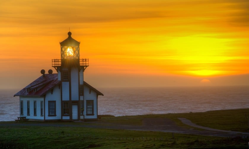
Mendocino, famous for being used as a set for Jessica Fletcher’s Cabot Cove , is certainly the most picturesque area of this stretch of the road because of the sea stacks and cliffs of Headlands State Park . Those who love lighthouses will still find points of interest, namely Point Arena Lighthouse and Point Cabrillo Lighthouse , both built after the devastating earthquake in San Francisco in 1906. The lighthouses can be visited by taking a short detour from Highway 1. Also worth mentioning is the very special Bowling Ball Beach : the name says it all!

The Pacific Coast Highway officially ends in Leggett, 53 miles north of Mendocino, where it connects to Highway 101 , which leads to the area with the world’s tallest redwoods ( Redwood National Park ) and then to more spectacular views on the coast of Oregon .
The travel time is not to be underestimated. If you are in a hurry, this is not the right road for you. There are several alternative roads further inland that allow you to travel more quickly (but alas what you will see will be less rewarding). To travel the main stretch of Highway 1, the one between Los Angeles and San Francisco, I suggest you plan 1 or 2 stops (for directions on how to break the journey, you can read my guide on where to stay between Los Angeles and San Francisco ). Here are some guides to the most important destinations you will find along the way:
- Santa Barbara
- San Luis Obispo
- Hearst Castle
- Point Lobos
If you want to continue to the end of the Pacific Coast Highway, keep in mind that from San Francisco Bay to Mendocino the drive is slow and depending on the length of the stops, you may need another stop to break up the journey, for example, in Gualala . Before Leggett, the best stop is Mendocino (about 90 minutes away). We also have an article in which you can read our advice on what to do and where to stay in Mendocino .
For more detailed information about finding accommodations in Los Angeles and San Francisco, read our in-depth articles:
- Where to stay in San Francisco: Recommended areas and neighborhoods
- Where to sleep in Los Angeles: Staying in the city and the surrounding area
The Pacific Coast Highway is the ideal route for those who dream of going on a road trip and gives you the chance to admire the natural wonders of California’s coast. It is one of the most popular routes traveled by those who love to take road trips around the USA and who love adventure.
Warning: Operating hours can change and closures for extraordinary events can occur, so we strongly suggest to check the venues official websites.

lorenzo puliti
I am fascinated by the wonders of the world I never tire of going in search of them.
Related posts

Discover the Main Filming Locations of Top Gun and Maverick!

17-Mile Drive: Pebble Beach’s scenic road in California

Pigeon Point Light Station State Park, a fascinating lighthouse on the California Coast

How to Plan a Visit to the Historic Point Arena Lighthouse in Mendocino, California
Leave a comment cancel reply.
This site uses Akismet to reduce spam. Learn how your comment data is processed .
- CBSSports.com
- Fanatics Sportsbook
- CBS Sports Home
- Masters Live
- Champions League
- Motor Sports
- High School
- Horse Racing
Men's Brackets
Women's Brackets
Fantasy Baseball
Fantasy football, football pick'em, college pick'em, fantasy basketball, fantasy hockey, franchise games, 24/7 sports news network.
- CBS Sports Golazo Network
- PGA Tour on CBS
- UEFA Champions League
- UEFA Europa League
- Italian Serie A
- Watch CBS Sports Network
- TV Shows & Listings
The Early Edge
A Daily SportsLine Betting Podcast
With the First Pick
NFL Draft is coming up!
- Podcasts Home
- Eye On College Basketball
- The First Cut Golf
- NFL Pick Six
- Cover 3 College Football
- Fantasy Football Today
- My Teams Organize / See All Teams Help Account Settings Log Out
Yankees' DJ LeMahieu: Will travel on road trip
Share video.
Manager Aaron Boone said LeMahieu (foot) will travel with the Yankees on their road trip this week to Cleveland and Toronto, Bryan Hoch of MLB.com reports.
LeMahieu took batting practice Wednesday and has been incorporating more baseball activities into his rehab regimen, and his ability to join the team on their road trip is a sign that he isn't too far off from starting a rehab assignment. The veteran infielder has been out since late March with a bone bruise and non-displaced fracture in his right foot.
Yankees' DJ LeMahieu: Fields some grounders
Yankees' dj lemahieu: participates in batting practice, yankees' dj lemahieu: mri reveals bone fracture, yankees' dj lemahieu: goes on 10-day injured list, yankees' dj lemahieu: starting season on il, yankees' dj lemahieu: may miss opening day, our latest fantasy baseball stories.
Tuesday's waiver wire
Chris towers • 7 min read, rankings movers: holliday is here, scott white • 12 min read.
Top 45 IL stash rankings
Scott white • 3 min read.
Monday's waiver wire targets
Chris towers • 4 min read.
Can't pick up everyone? Here's what to do
Scott white • 5 min read.
Pitchers risking up Towers' rankings
Chris towers • 9 min read.

- Got a Scoop?
- Arts & Entertainment
- Food & Drink
- Real Estate
- Indy Parenting
- Cover Stories
- Classifieds
- Create Event
Roadway Collapse on California’s Iconic Highway 1 Disrupts Coastal Travel
Big Sur Landslide Spurs Evacuations and Closure of Popular State Parks
Share this:
- Click to share on Facebook (Opens in new window)
- Click to share on X (Opens in new window)
- Click to email a link to a friend (Opens in new window)
- Click to print (Opens in new window)
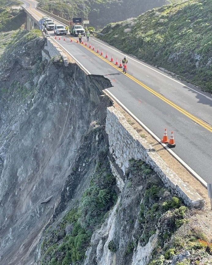
A sizable section of California’s Highway 1 collapsed and slid off between Carmel and Big Sur over Easter weekend in late March, isolating the cliff-dwellers along the Big Sur coast. The southern end of the scenic highway, a favorite of travelers from Santa Barbara, has been closed since January 2023 due to a series of giant landslides. The state parks from Andrew Molera to Limekiln are also off-limits with all reservations canceled.
Daily convoys are being sent through the affected areas, bringing workers and supplies to repair the road, Caltrans public information officer Kevin Drabinski said. Hundreds of tourists were evacuated after the slide, and they are bringing food and water to the residents.
Matt Wilkins, general manager of the Big Sur Lodge at Pfeiffer Big Sur, said around 1,500 motorists were stranded when a portion of the highway near Palo Colorado fell down the cliff around 4 p.m. on March 30. “We sheltered something like 53 people in our conference room and another 50 in the lobby,” he said. “But almost everyone was evacuated by noon the next day.”
Wilkins said the local businesses have been in constant communication with safety officers and Caltrans, which has been restoring normalcy by getting traffic lights operational again.
Big Sur’s Santa Lucia Mountain Range stretches 140 miles along the coast from Carmel to the Cuyama River in San Luis Obispo County. With steep pitches and crashing waves, the eroding mountain face that supports Highway 1 has undergone 1,500 recorded landslides. The winding roadway has been closed more than 55 times since its completion in 1937 after 18 years of construction , almost entirely due to landslides. Most recently, the storms of 2022 and 2023 closed stretches of the Big Sur parks entirely, including Nacimiento Road over the mountains.
While the Big Sur Chamber of Commerce has said there is no official schedule for completing the “temporary roadway stabilization,” restaurants, stores, galleries, campgrounds, and hotels are eager for visitors to regain access: “The local businesses rely heavily on tourists for income,” said Wilkins. “We’ll just have to cross our fingers and hold our breath.”
Related Posts

Santa Barbara Airport Receives $3.9 Million in Federal Funding

Santa Barbara County Approves $130 Million Bond for Jail Remodel and Other Big-Ticket Projects

Big Changes Underway for Hollister Avenue Through Old Town Goleta
- Recent News

New Rules for Deltopia 2024: What to Know Before Partying in Isla Vista

Tenants Fight Displacement in Santa Barbara’s West Beach Neighborhood

Broken Hearted

Police Evacuate Bank of America in Downtown Santa Barbara Following Bomb Threat

Santa Barbara Man Who Shot at Teens Near Stevens Park Faces Prison Time, Civil Lawsuit
Courage, not bluster, congratulations, carpinteria politics .

All Booked: Reader Spotlight: Brit

Praise the Lord and Pass the Homeless Housing
Get news in your inbox.
Please note this login is to submit events or press releases. Use this page here to login for your Independent subscription
Username or Email Address
Remember Me
Not a member? Sign up here.

Looking to Travel the North Cascades Highway? Here's What You Need to Know!
If you're looking to experience the natural beauty of the North Cascades, then a drive along the North Cascades Highway is a must!
The North Cascades Highway ( also known as Highway 20 ) takes travelers through the stunning North Cascades National Park in northern Washington. Whether you're looking for a weekend getaway or an extended road trip, the North Cascades Highway has something for everyone. From breathtaking views of Diablo Lake to picturesque mountain passes, this highway is sure to provide you with an unforgettable experience.

The Best Time to Go
When it comes to the North Cascades National Park Road, the best time to drive is during the late spring and summer months to the beginning of fall. From late May to early October, the North Cascades Highway is open and fully accessible. During this time, you will have the chance to take in the scenic views, clear blue lakes, and majestic mountains of the region.
However, the highway is closed during winter months due to hazardous conditions. The North Cascades Highway closure typically starts in mid-November and ends in late May.
During this time, some roads may be accessible for short periods if weather conditions allow. But for the most part, drivers should expect road closures during these months.
Drivers should also be aware that road conditions during winter can vary greatly from day to day.

It is important to check the local weather forecasts before planning any trips along the North Cascades Highway, as snow and ice can make driving dangerous. High winds and snow can cause road closures and delayed openings, so be sure to be prepared for unexpected changes in road conditions.
What to Expect
Stretching across northern Washington, Highway 20 is a winding well-maintained road that takes you through the majestic landscapes of North Cascades National Park. Along the way, you'll be treated to views of snow-capped peaks, emerald-blue alpine lakes , and vistas that will take your breath away.

One of the highlights of the highway is Washington Pass Overlook (read more about Washington Pass below!), where you can get a stunning view of Liberty Bell Mountain.
Further along the route, you'll pass by Diablo Lake and its postcard-perfect setting, surrounded by steep cliffs, mountain peaks and deep green forests. Take a break from driving to explore the shoreline or rent a boat to explore the lake in greater detail.
In addition to these natural wonders, you'll have a chance to visit several charming small towns along the route.

Stop in Newhalem for some local treats, or continue on to Winthrop for an old west experience complete with wooden boardwalks.
North Cascades Highway Highlights
Traveling the North Cascades Highway is a beautiful way to experience the North Cascades National Park in Washington State (and often the only way most people see the park!).

Technically, Highway 20 begins all the way west on Fidalgo Island and ends in Omak. But, the section that's most commonly driven (to see the national park) starts in Sedro-Wooley and ends in Okanogan. Along the way, you'll pass several small (yet well-known towns) like Winthrop and Mazama, as well as all of the North Cascades Highway Highlights, mentioned below.
A small, well-loved town along Highway 20 that's a popular spot for rock climbing, hiking, and pit-stopping before embarking on multi-day adventures. It's home to the famous Fly Boys route, one of the longest multi-pitch sport routes in North America.

Cutthroat Pass Trail
The spectacular Cutthroat Pass Trail offers hikers an incredible view of Cutthroat Lake and nearby mountain peaks.The trailhead is just outside of Mazama before reaching (or just after reaching) Washington Pass.
Washington Pass Overlook
The overlook is accessible just after or before the famous hairpin turn at the base of Liberty Bell Mountain. It has a parking lot and accessible trails to help you explore the area more deeply. From this vantage point, you can take in sweeping views of jagged mountain peaks, lush meadows, and ancient forests.

Diablo Lake
Diablo Lake is a stunning deep blue lake surrounded by snow-capped mountains. Here you can take pictures, enjoy some of the best views in the region, and even go fishing. The lake is visible from the road as well if you don't have time to stop. A popular trail takes you from the Ross Dam Trailhead all the way to the Diablo Lake Trailhead (or in the other direction). We also recommend driving across the 389-foot Diablo Dam.

Make sure you also check out the Ross and Diablo Lake Overlooks .
Cascade River Road
This road is easily accessible in Marblemount, just before where the highway closes in the winter (Cascade River Road will also close in the winter).

The road runs for a few miles paved before turning into gravel. It dead ends at the Cascade Pass Trailhead , a very popular jumping off point for those hoping to hike to Cascade Pass, Sahale Peak, or even start the famed Ptarmigan Traverse across the North Cascades.
Reccomended Trails Along North Cascades Highway
The highway has a number of hiking trails which offer views of glaciers, mountain peaks , and waterfalls . Our recommended hikes include:
Wing and Lewis Lakes from Rainy Pass
A gorgeous trail that gains minimal elevation before providing a gorgeous, expansive view of Wing and Lewis Lakes with Black Peak dominating the distant skyline.

Thornton Lakes
This is another moderate-hard trail that takes you up to a fantastic viewpoint above Thornton Lakes (and onward to Trappers Peak if you want a little more of a workout).

Easy Pass Trail
This is a hard, 8+ mile hike that ends in another spectacular viewpoint along the North Cascades Highway.
Tips for the Trip
Traveling the North Cascades Highway is a great way to explore the beauty of northern Washington. However, it is important to be prepared for your trip, especially when it comes to getting gas and food and knowing when to expect closures.

Gas Along Highway 20
When it comes to getting gas, there are a few different gas stations to choose from and long sections of roads where there is no gas available. There are two gas stations in Marblemount and no other options until you get to Diablo, about 40 miles away. From there, you'll need to make it all the way to Mazama, where there is a single gas station. You're in the clear after Mazama as you'll quickly pass through the towns of Winthrop and Twisp.
Food and Drinks
As for food, there are several small towns along the highway where you can find some great places to eat. Marblemount is the last best place to stop if you're traveling from west to east. After Marblemount, you'll be driving at least 20 minutes before you reach Newhalem, a small town based around an electrical plant. and Mazama both offer restaurants and cafes serving up local cuisine as well as more traditional American favorites.
Winter Conditions on Highway 20
When it comes to driving on the North Cascades Highway, it is important to know when to bring chains and when not to bring them. During the winter months, chains are often required due to snowy or icy road conditions. It’s a good idea to check the North Cascades Highway "Open" or "Closed" status before heading out in order to know what to expect.

During the summer months, however, chains are typically not necessary unless a closure has been issued due to rock slides or other natural hazards.
Overall, a trip along the North Cascades Highway can be a great way to explore the beauty of Washington state. Be sure to take some time to plan ahead by checking on gas and food options, as well as the current road conditions, in order to make the most of your journey!
You Might Also Like
Ultimate Guide to Rattlesnake Ledge Trail | Map, Facts - Washington
Mount Pilchuck Trail | Maps, Guide, Fire Lookout
Volcanoes in Washington | Danger Zones, Facts, and More!
Pins to Share:

- State and National Park Guides
Recent Posts
Guide to Visiting Beacon Rock State Park in Winter
The North Cascades in Winter: A Guide to Visiting this Stunning National Park
Discovering the Beauty of the Umpqua National Forest
- Skip to main content
- Keyboard shortcuts for audio player

Solar eclipse 2024: Follow the path of totality
Thinking of taking a last-minute drive to see the eclipse here's what to know.

Geoff Brumfiel

RV traffic sits at a standstill along a two-lane road near Madras, Ore., a few days before the 2017 total solar eclipse. Experts say traffic could be heavy, but eclipse watchers shouldn't necessarily be deterred. AFP Contributor/AFP via Getty Images hide caption
RV traffic sits at a standstill along a two-lane road near Madras, Ore., a few days before the 2017 total solar eclipse. Experts say traffic could be heavy, but eclipse watchers shouldn't necessarily be deterred.
NASA says that roughly 31.6 million people live in the path of this year's total solar eclipse, and a little under half of the U.S. population lives within 200 miles driving distance of the path of totality .
That could mean many millions of Americans will hit the road to get a better view on April 8. If you're still pondering whether or not you want to make the journey, here's what to consider.
Have some destinations in mind, and check the weather and cloud cover forecasts in advance
It's a good idea to scout out one or more locations within driving distance, so that you have some flexibility if traffic or weather is threatening your plans, says Jonathan Upchurch, a professor emeritus of civil engineering at Arizona State University who has studied travel around solar eclipses.
There are several interactive tools that show the path of totality, including Eclipse2024.org and the National Solar Observatory . You can use them to figure out what sites might work best for you.
In terms of weather, check not just the weather forecast, but also the cloud cover forecast. Some websites, such as Windy.com will predict cloud cover ahead of time, giving you a sense of whether you'll actually be able to see the eclipse in all its glory.

Everything you need to know about solar eclipse glasses before April 8
During the total solar eclipse in 2017, Upchurch says he chose to go to Idaho "because there were some great chances of having sunny skies, and I had the opportunity to be nimble and relocate if I wanted to."
Before driving into the path of totality, make sure your gas tank is full and that you've got everything you need
During the last total solar eclipse in 2017, it's estimated some 5 million people took to the roads, and those numbers will potentially be much higher this year.
Given all that, Upchurch says it's important to make sure you're taking what you need into the path of totality. You should make sure your car is gassed or charged up, and that you have plenty of snacks and water with you in case you get stranded for a while, especially when trying to leave.

Solar Eclipse 2024: Totality stretches from Texas to Maine
Simple tips to safely photograph the eclipse with your cellphone.
Also don't forget to bring eclipse glasses, which must be worn anytime you're looking at the sun, except for the few minutes when it is completely blocked by the moon.
Some state emergency planners also recommend bringing a paper map or road atlas in case cellular networks become overloaded with visitors seeking directions from their phones.

Don't forget your eclipse glasses everyone! Erika Goldring/FilmMagic hide caption
Don't forget your eclipse glasses everyone!
Arrive early and stay late
Once you figure out where you're going to watch the eclipse, and you've got your supplies, try to get there early. Although traffic is likely to be heavier than normal on the morning of eclipse day, it still should be possible to reach many destinations without too much hassle, says Upchurch.
"Leaving is definitely going to be more of a problem," he says. As the eclipse concludes, people will take to the roads all at once to try and get home as fast as they can. In 2017, that led to traffic jams that lasted many hours in some areas. If possible, Upchurch says, people should stay put for a while to try and avoid the worst of the post-eclipse rush, which in 2017 stretched even into the following day in some parts of the country.

Here's what time the eclipse will be visible in your region
And one more thing: If you do find yourself on the move near the time of the eclipse, state officials stress that you should not simply pull over to the side of the road or highway you're driving on. It's important to be parked legally and safely at the moment of totality.
If you're already in the path of totality: Relax and enjoy!
Several major metropolitan areas including Dallas, Indianapolis, Cleveland and Buffalo are already inside the path of totality, so there's no need to seek a better view, Upchurch says. You'll probably have the most fun simply staying where you are.

Shots - Health News
Watching a solar eclipse without the right filters can cause eye damage. here's why.
If you're on the edge of the path of totality, however, you might consider making a short trip to get closer to the center of the eclipse's path.
"If you're within about 40 miles of the center line, you'll have two-and-a-half minutes or more" of complete totality, Upchurch says. It's up to you to decide whether it's worth making the trip to a more central location.
Despite studying the potential hassles of traveling extensively, Upchurch says he's still looking forward to seeing the 2024 eclipse, which he plans to watch from Texas.
"Totality is absolutely spectacular," he says. "If you have a chance to witness it, I would do it."
- 2024 solar eclipse
- eclipse 2024
- 2024 eclipse
- Traffic patterns
- total eclipse
Highway 1: It’s getting riskier to perch a road on the edge of the continent

- Show more sharing options
- Copy Link URL Copied!
Good morning. It’s Tuesday, April 2 . Here’s what you need to know to start your day.
- Heavy weather continues to hamper Highway 1
- Your guide to California’s new $20-an-hour fast-food minimum wage
- Where to find fresh soba noodles in Los Angeles
- And here’s today’s e-newspaper
Start your day right
Sign up for Essential California for news, features and recommendations from the L.A. Times and beyond in your inbox six days a week.
You may occasionally receive promotional content from the Los Angeles Times.
It’s one of the most iconic roadways in California if not the nation, in many stretches clinging to the edge of the Central Coast’s stunning sea cliffs, providing unparalleled views of the Pacific Ocean, lush forests and even a high-gliding condor, if you’re lucky.
But traveling the length of Highway 1 can be a gamble as it is frequently shut down by landslides and cliff erosion that block the highway and strand people — particularly in the Big Sur region.
The most recent trouble came Saturday, when a chunk of cliffside and the southbound lane that sat atop it crumbled and fell into the sea . Caltrans closed more than a mile of the highway between Big Sur and Carmel-by-the-Sea.
“It’s the latest setback for the beloved but volatile highway,” Times reporter Corinne Purtill wrote Sunday . “The area is still struggling to recover from landslides triggered by last year’s soaking wet winter , which forced the closure of a 12.1-mile section along the Big Sur coastline.”
The closure initially stranded an estimated 1,600 tourists and residents. On Monday, Caltrans decided the northbound lane was stable enough to get people out. Daily convoys have been scheduled to pass through the affected roadway “under close supervision by engineers,” Caltrans officials said in a news release . The convoys could be canceled based on conditions or more wet weather, the agency said.
Officials also shut down several popular state parks along the Monterey County coast: Pfeiffer Big Sur State Park, Andrew Molera State Park, Limekiln State Park, Julia Pfeiffer Burns State Park and Point Sur State Historic Park.
It shouldn’t come as a shock that a layer of asphalt perched on the edge of sea cliffs would be vulnerable to rain and erosion — especially with back-to-back years of abnormally high rainfall.
Caltrans sure isn’t surprised. It has long been assessing Highway 1 and the rest of the transportation system as part of its Climate Resilience Improvement Plan . A picturesque view of Highway 1’s famous Bixby Bridge even adorns the front cover of the public draft of the report, published last September .
“While infrastructure has traditionally been designed to endure a set of extreme weather events and frequencies, climate change is increasing the severity, frequency, and duration of these events, requiring advanced planning and innovation to adapt to the new norm,” the report states.
In that plan, Caltrans notes it has prioritized four projects to “address sea level rise and cliff retreat on Highway 1.” It’s easy to spot Highway 1 on this map showing the roadways Caltrans is prioritizing to study for climate change adaptation. Most of the stretch between Carmel-by-the-Sea and San Simeon is colored in.
Separate from Caltrans’ analyses, a 2022 study published in the journal Geomorphology identified Big Sur as one of the top “hotspots” for coastal cliff erosion in California.
So what’s being done to build resilience against further events like this along Highway 1? I put that question to Caltrans but did not hear back.
Its Climate Resilience Improvement Plan is a bit light on specifics but includes several mentions of enacting “policies and best practices” for engineers working in coastal environments, as well as for stormwater management and drainage designs “that consider long term changes in precipitation, wildfire and subsequent soil erosion, and ocean tides.”
A better question might be: As climate change fuels more intense weather events — like the intense rain and sea level rise that put the state’s precarious infrastructure at even greater risk — what version of Highway 1 can continue to exist?
I’ll let you know if I hear back.
Today’s top stories

California’s mandatory minimum wage
- Your guide to California’s new $20-an-hour minimum wage for fast-food workers.
- Higher prices are on the menu as fast-food chains brace for California’s big minimum wage jump.
- Starbucks, Chipotle, McDonald’s: Who’s raising prices as California fast-food law starts.
California housing costs
- California is building fewer homes . The state could get even more expensive.
- Southern California home prices rise in February , near a record.
- ‘Way, way, way above normal’ rains could set all-time L.A. record as wet weather continues.
- California storms deliver above-average snowpack , and replenish reservoirs.
- How the last 20 years of Sierra snowpack stack up, in one graphic .
More big stories
- More than $150 in credits coming to Southern Californians’ utility bills this month.
- Landlord Arnel Management illegally withheld security deposits , attorney general alleges.
- Exhausted, hungry and sleep-deprived: UCLA student super-commuters search for relief .
- Influencer, professional gambler Mikki Mase questioned by police after gunfire reports in Chatsworth.
- Two Warner Bros. Discovery board members step down amid DOJ investigation.
- Disney’s biggest shareholder fight in 20 years will shape the company’s future.
- A teen, reported kidnapped, was killed by deputies as she followed their instructions , video shows.
- A federal judge rejects Hunter Biden’s bid to dismiss tax case in L.A. , paving way for trial.
Get unlimited access to the Los Angeles Times. Subscribe here .
Commentary and opinions
- LZ Granderson: Caitlin Clark is having a moment in women’s basketball. She shouldn’t be the only one .
- Jonah Goldberg: Voters wishing for an alternative to Trump and Biden got one. Unfortunately, it’s RFK Jr.
- Michael Hiltzik: It’s not just Shohei — a massive scandal involving sports betting is just around the corner.
Today’s great reads

The Hawaiian steel guitar changed American music. Can one man keep that tradition alive? The Hawaiian steel guitar, an Indigenous instrument and once a cultural force, now garners little recognition even in the place of its birth.
Other great reads
- Why aren’t wildflowers bursting everywhere? Don’t expect a superbloom.
- The power of Beyoncé’s ‘Cowboy Carter’ isn’t its country twang. It’s her imagination, unlocked.
- Swifty Blue raps about L.A. gang life — and finds himself dodging real-life violence.
How can we make this newsletter more useful? Send comments to [email protected] .
For your downtime

- 🍜 Where to find fresh soba noodles in Los Angeles .
- 🪴 Spring into the world of native plants at the L.A. Times Plants booth at Festival of Books.
- 🌻 15 best native plants to grow in your yard if you also want fragrant bouquets.
- 📚 10 books to add to your reading list in April
- 🧑🍳 Here’s a recipe for roasted chicken and potatoes with salsa verde .
- ✏️ Get our free daily crossword puzzle, sudoku, word search and arcade games .
And finally ... a great photo
Show us your favorite place in California! We’re running low on submissions. Send us photos that scream California and we may feature them in an edition of Essential California.

Today’s great photo is from Times photographer Gina Ferazzi at a struggling California vineyard where a tectonic shift in generational drinking habits has led to a global glut of wine .
Have a great day, from the Essential California team Ryan Fonseca, reporter Kevinisha Walker, multiplatform editor Stephanie Chavez, deputy metro editor
Check our top stories , topics and the latest articles on latimes.com .

Ryan Fonseca writes the Los Angeles Times’ Essential California newsletter. A lifelong SoCal native, he has worked in a diverse mix of newsrooms across L.A. County, including radio, documentary, print and television outlets. Most recently, he was an associate editor for LAist.com and KPCC-FM (89.3) public radio, covering transportation and mobility. He returns to The Times after previously working as an assistant web editor for Times Community News, where he helped manage the websites and social media presence of the Burbank Leader, Glendale News-Press and La Cañada Valley Sun. Fonseca studied journalism at Cal State Northridge, where he now teaches the next generation of journalists to develop their voice and digital skills.
More From the Los Angeles Times

Why would anyone steal $300,000 in Lego sets? Believe it or not, there’s a booming black market

William Howell wrote Arizona’s 1864 abortion ban. He modeled it on California’s

Impeached Homeland Security secretary navigates working with Republicans who want him out
April 10, 2024

Mother who pushed kids from moving car, killed partner was astrology influencer disturbed by eclipse
- Share full article
Advertisement
Supported by
Travelers Stranded by Highway Collapse Begin to Leave Big Sur
About 2,000 motorists, mostly tourists, were stuck in the area on Saturday night after a section of Highway 1 fell into the ocean. No injuries were reported.

By Edgar Sandoval , Colbi Edmonds and Emma Goldberg
Edgar Sandoval reported from San Antonio, Colbi Edmonds from New York and Emma Goldberg from Big Sur, Calif.
Officials in California on Sunday slowly began guiding drivers past a collapsed section of scenic Highway 1 in the Big Sur area, one day after the damage left about 2,000 motorists stranded overnight.
Officials with the California Department of Transportation urged the public on Sunday to avoid that section of the southbound highway in the Central Coast, and Monterey County issued a disaster declaration. The highway remains closed to the public while crews work on the affected areas, where large chunks of the road fell into the ocean. The agency, known as Caltrans, did not give an estimate of when the highway would fully reopen.
#Hwy1 remains closed on the #BigSur Coast due to a slip out of the road just south of the Rocky Creek Bridge. Convoys will lead essential travelers through closure area daily at 8 am and 4 pm. Engineers on site to observe conditions. Crews working to stabilize edge of roadway. pic.twitter.com/0AfyOcSIkB — Caltrans District 5 (@CaltransD5) April 1, 2024
Highway 1, also known as the Pacific Coast Highway, features stretches of rocky cliffs, lush mountains, panoramic beaches and coastal redwood forests.
Officials did not say what led to the collapse, but torrential rain on Saturday battered the area near Rocky Creek Bridge, the site of the damage, which is about 17 miles south of Monterey.
There were no reported injuries from the collapse. Many of those stranded on Saturday were visitors who were driving through the area over the Easter holiday and had to sleep in temporary shelters, said Nicholas Pasculli, a spokesman for Monterey County. Others stayed in local hotels, bed-and-breakfasts and campgrounds, and some slept in their cars, he added.
On Saturday evening at Nepenthe, a famed cliffside restaurant, customers slowly learned the news of the road closure from servers and bartenders, and groans could be heard as families scrambled to find empty rooms to spend the night.
Linda Molinari, a Pilates instructor from Hollister, Calif., and her boyfriend were two of those customers. They were making a day trip to Big Sur for lunch on Saturday and ended up arriving around 4 p.m. After hearing the news about the highway, they decided to head back home. At about 5:15 p.m. they were met with a roadblock and told by the authorities that they would have to turn around.
“We came here just to have lunch and go home, and now it’s like everyone is trapped here,” Ms. Molinari recalled thinking. “All the little hotels and stuff, you could tell everybody was swarming.”
Ms. Molinari and her boyfriend had brought their camper with them in case they wanted to pull over to watch the ocean. Instead, it ended up being their room for the night.
The couple went to a general store and bought some emergency supplies: water, hot dogs and instant oatmeal. They stayed near the Big Sur River Inn, which provided breakfast and Wi-Fi to travelers.
On Sunday, uniformed officials were guiding some motorists around the damaged road in organized convoys. As cars moved past the damaged area, drivers could see that a chunk of the highway had entirely disappeared, along with the rock barrier separating the highway from the cliff’s edge.
Another convoy was scheduled for Monday morning in case the crews were not able to reach everyone by Sunday night, Mr. Pasculli said.
“We’re hoping we can get all the visitors out today — that’s our hope, that’s our goal,” he said. “Suffice it to say, it’s a holiday weekend.”
An unseasonably cold and vigorous storm system cut through the southwestern Pacific Coast over the weekend, bringing rain, flash flooding and snow to parts of California and elsewhere.
Over the years, landslides have taken out portions of Highway 1, which stretches more than 650 miles, from south of Los Angeles to north of San Francisco, through Big Sur and across the Golden Gate Bridge. Most notably, in May 2017, some six million cubic yards of earth moved after heavy rains, adding 15 acres of coastline. The highway underwent repairs and reopened a year later.
Last year, relentless winter storms in California caused landslides that blocked a 20-mile stretch of Big Sur for several weeks.
Ms. Molinari and her boyfriend were among those who were able to leave with the convoy on Sunday afternoon. They made it back home around 2:30 p.m.
“Everything went fine,” she said, adding that they had not needed to eat the hot dogs. Still, she added, “it was a crazy, weird Easter.”
Edgar Sandoval covers Texas for The Times, with a focus on the Latino community and the border with Mexico. He is based in San Antonio. More about Edgar Sandoval
Colbi Edmonds writes about the environment, education and infrastructure. More about Colbi Edmonds
Emma Goldberg is a business reporter covering workplace culture and the ways work is evolving in a time of social and technological change. More about Emma Goldberg

Stretch of California Highway 1 that collapsed in Big Sur closes again as new storm arrives
B IG SUR, Calif. (AP) — A new storm swept into California on Thursday and again forced the closure of scenic Highway 1 in iconic Big Sur where one of its two lanes collapsed into the ocean after heavy weekend rains .
The Monterey County Sheriff’s Office had warned residents of the region to consider leaving before the highway was shut down Wednesday afternoon, especially if they have medical issues. The route was not expected to reopen until Saturday.
The California Department of Transportation had been cautiously running convoys of residents and essential workers past the slide area in both directions twice daily on the remaining undamaged lane.
Leaving the area requires heading north toward Monterey Bay because a 12-mile (19-kilometer) stretch of Highway 1 to the south has been blocked for some time by three previous slides requiring massive repair projects.
The San Francisco Bay Area weather office said the unusually cold storm arrived in the morning with brief heavy rain, hail, low-elevation snow and lightning. Snow also fell in the Sierra Nevada, where winter weather warnings and advisories were issued Thursday.
The Big Sur highway slide site got rain early in the day but there was little precipitation through the middle of the day. A second weather disturbance was expected in the area Friday, before heading toward Southern California.
The closure disrupted visitor Tammy Fisher's trip from San Francisco to San Diego.
“One of our attractions was the Big Sur, but as you can see, we got a little hiccup,” Fisher said in an interview at a roadblock. “Now we’re gonna bust a U-turn and figure out where the detour will lead us.”
Big Sur is a 90-mile (145-kilometer) stretch of the state’s central coast where often misty, forested mountains descend to the ocean. Much of Highway 1 is perched on the edge of cliffs, presenting dramatic views that draw tourists. The route experiences frequent closures because of landslides stemming from severe weather.
The latest collapse occurred Saturday near Rocky Creek Bridge, about 17 miles (27 kilometers) south of Monterey, temporarily stranding as many as 1,600 people in Big Sur. Most were able to leave when the single lane was reopened Sunday, Caltrans spokesperson Kevin Drabinski said earlier this week.
Five California state parks in the area were closed indefinitely after the slide and local media reported that the Carmel Unified School District said the evacuation warning led to the closure of an elementary school and preschool on Thursday and Friday.
Engineers were to remain on site through the storms to watch for any changes, Caltrans said in a statement.
"Crews are continuing to focus on strategies to stabilize the edge of the roadway and work will continue once the rain event passes," Caltrans said Thursday.
Total losses to Big Sur businesses since the latest slide have exceeded $1 million each day, Kirk Gafill, president of the Big Sur Chamber of Commerce, told the San Francisco Chronicle on Wednesday.
Work also continued at the sites of three other major landslides along the highway in Big Sur, Caltrans said.
About 300 miles (480 kilometers) to the northeast, parts of Interstate 80 in the Sierra Nevada were shut down Thursday afternoon after multiple semi-trailer trucks and passenger vehicles collided amid snowy conditions west of Lake Tahoe. There were no injuries.
Meanwhile a 40-mile (64-kilometer) stretch of I-80’s westbound lanes were closed from Truckee to the California-Nevada line as snow accumulated. Chains were required on tires of all vehicles headed east. Winter weather warnings and advisories were in effect into Friday morning, with 6 inches (15 centimeters) of snow possible in mountains and about a foot (30 centimeters) expected at higher elevations.
Antczak reported from Los Angeles. Associated Press writer Scott Sonner contributed from Reno, Nevada.
")
Is it safe to drive during the solar eclipse?

The upcoming solar eclipse will mean lots of folks looking to the skies on Monday.
That might raise a key question for you, especially if you expect to be on the road that day.
Is it safe to drive during the eclipse?
“Since they are such a rare occurrence, we don’t often think about how an eclipse might impact driving conditions due to the unique challenges it brings to roadway safety,” according to Katie Bower, director of the Michigan Office of Highway Safety Planning. “As the eclipse unfolds, and visibility decreases, drivers and pedestrians should be extra cautious, patient and alert to ensure everyone makes it home safely.”
Bower noted that “we’ve heard that many Michiganders are heading to Ohio to view the eclipse and we urge everyone who will be traveling to buckle up, slow down and drive for the conditions, so we can all enjoy this rare event safely with family and friends.”
Only a very small piece of Michigan, around Luna Pier , is expected to be in the so-called path of totality, but Michiganders elsewhere will still experience varying degrees of the spectacle.
It’s not safe to look at the sun with the naked eye , and for the vast majority of us it won’t be safe to watch any part of the eclipse without protective eyewear at any point.
But what happens when you’re on the road? For starters, do not try to watch the eclipse if you're driving.
What's the advice for driving during the eclipse?
Various agencies have been offering tips. Here’s what AAA Michigan recommends:
- Keep your vehicle’s headlights on.
- Put the sun visor down to block your view of the sun.
- Don’t wear eclipse glasses while driving.
- Don’t try to photograph or video the eclipse while driving.
- Don’t pull over to the side of the road, highway or interstate to view the eclipse.
- Exit the roadway and park in a safe area away from traffic to view the eclipse.
- Be mindful of pedestrians who may be walking around with their eyes on the sky.
A group focused on rail safety even put out its own advisory for Monday warning drivers and eclipse watchers to “stay clear of railroad tracks and trains.”
Federal Highway Administrator Shailen Bhatt advised in a video safety message that “this rare event may be a once in a lifetime for some but could have widespread impacts on the traveling public, so please plan ahead to arrive early and if you can, stay put to avoid traffic congestion. … Don’t have an eclipse in judgment. Be safe.”
What's the data show?
There doesn’t appear to be a ton of data on how eclipses affect road safety. The data around what for Michigan was a partial solar eclipse in August 2017 showed a decrease in crashes based on activity for the same day two weeks before and afterward, according to the state Office of Highway Safety Planning.
But circumstances elsewhere were more directly affected by the event. Places that saw a total eclipse that year attracted lots of visitors and extra road activity as evidenced by a photo from the Wyoming Department of Transportation included in a Federal Highway Administration document about eclipse preparations. That photo showed bumper-to-bumper traffic on a rural highway.
A research letter posted on the Journal of the American Medical Association website highlighted national data for the 2017 eclipse, which would include those areas that experienced a total eclipse. It found an increase in fatal crashes at that time.
“In absolute terms, this averaged to 1 extra crash-involved person every 25 minutes and 1 extra crash fatality every 95 minutes,” according to the letter.
The study cited increases in traffic, travel on unfamiliar roads, speeding to arrive on time, driver distraction, viewing from unsafe roadside locations and drug- or alcohol-induced impairment related to eclipse celebrations beyond just changes in lighting as factors.
More than 200 million people are within driving range of the upcoming eclipse the letter noted, highlighting the potential for out-of-the-ordinary traffic safety issues next week.
Free Press staff writer Kristen Jordan Shamus contributed to this report.
Contact Eric D. Lawrence: [email protected]. Become a subscriber .
IMAGES
VIDEO
COMMENTS
Keep exploring with the Roadtrippers mobile apps. Anything you plan or save automagically syncs with the apps, ready for you when you hit the road! Tall tales, trip guides, and the weird and wonderful. Plan your next trip, find amazing places, and take fascinating detours with the #1 trip planner. Every trip is a road trip.
36.668 | -78.387. Got it. Realtime driving directions based on live traffic updates from Waze - Get the best route to your destination from fellow drivers.
The Great Northern Road Trip: US Highway 2. Though many come close, no other cross-country route takes in the variety and extremity of landscape that US Highway 2 does. Dubbed the Great Northern in memory of the pioneer railroad that parallels the western half of the route, US-2 is truly the most stunning and unforgettable, not to mention ...
EPIC HIGHWAY 1 ROAD TRIP ITINERARY. Any Highway 1 Road Trip is going to be jam packed with lots of beautiful spots and lots of driving. BUT, it'll totally be worth it! Thankfully, the California Coast has some of the most scenic coastal viewpoints where your mind will be blown for the majority of the ride, SANTA MONICA
The Highway 1 California road trip is a popular itinerary among travelers to California. While this historic highway goes over 600 miles along the coast, most visitors drive the stretch from Los Angeles to San Francisco. The trip can be done in various ways, including along the coast or with inland stops at unique towns like Ojai or Los Alamos.
The Perfect Pacific Coast Highway Road Trip. Where to stay, eat, and sightsee on the drive between San Francisco and Los Angeles. California's Pacific Coast Highway is one of America's most ...
San Francisco to Big Sur: Best Stops on Highway 1. We didn't make too many stops on our way to Big Sur from San Francisco but there are a few places that we highly recommend stopping at. One of those places is the Fitzgerald Marine Reserve to explore the tide pools. This stop is a must if you're traveling with kids!
Note: This Highway 1 California road trip post is sponsored by Ecolab.. Travel in 2021. I've loved road tripping the past two summers. Last year it was all about treading lightly as we were in the height of COVID-19. This year, our 18-day road trip from California to The Broadmoor in Colorado Springs in June only made me want to travel more, but at the same time, the news from day-to-day is ...
Check its condition online or call 800-427-7623 before you go. It's always good practice to follow these safety tips, but they become even more important along busy CA Hwy 1: Drive defensively. Avoid dangerous situations and allow plenty of distance between your vehicle and the one in front of you.
Pacific Coast Highway road trip ranks pretty high among bucket list travel experiences - in fact its one of the most scenic drives in the entire world! Highway 1 is a gorgeous drive along sprawling cities, charming coastal towns, beautiful beaches, majestic forests, and stunning landscapes.
Before 1 p.m., after 5 p.m. 1/1/22. Minimal congestion expected. 1/2/22. 2-6 p.m. Before 1 p.m. Source: INRIX. "With kids out of school and many Americans taking extended time off for the holidays, drivers will experience incremental delays throughout the week. Although congestion will be overall lighter than normal, knowing when and where ...
US Highway 395 is California 's backbone. Running east of the Sierra Nevada mountain range, it's also a road of superlatives: highest, lowest, hottest, deepest, oldest - the 395 passes close by a whole host of -ests. And then there are the ghost towns, living towns, ski resorts, tufa formations, film locations and more.
Planning a West Coast Road Trip. Road Trip USA's Pacific Coast route begins at the northwest tip of the United States at Port Townsend near Olympic National Park, and remains within sight of the ocean almost all the way south to the Mexican border. This 1,650-mile (2,655 km), mostly two-lane route takes in everything from temperate rainforest ...
Tip: 1 Drive a comfortable car. Driving a comfortable and reliable car is a must. This is a two-lane mountain road. In some places the shoulder is quite narrow, and there's not much between you and the sea below. There's a forty to fifty-mile stretch that's full of hairpin twists and turns.
The Pacific Coast Highway officially ends in Leggett, 53 miles north of Mendocino, where it connects to Highway 101, which leads to the area with the world's tallest redwoods (Redwood National Park) and then to more spectacular views on the coast of Oregon. How Long is the Pacific Coast Highway? The travel time is not to be underestimated.
LeMahieu (foot) will travel with the Yankees on their road trip this week to Cleveland and Toronto, Bryan Hoch of MLB.com reports. LeMahieu has been incorporating more baseball activities and him ...
A sizable section of California's Highway 1 collapsed and slid off between Carmel and Big Sur over Easter weekend in late March, isolating the cliff-dwellers along the Big Sur coast. The southern end of the scenic highway, a favorite of travelers from Santa Barbara, has been closed since January 2023 due to a series of giant landslides.
The TripCheck website provides roadside camera images and detailed information about Oregon road traffic congestion, incidents, weather conditions, services and commercial vehicle restrictions and registration.
The Best Time to Go. When it comes to the North Cascades National Park Road, the best time to drive is during the late spring and summer months to the beginning of fall. From late May to early October, the North Cascades Highway is open and fully accessible. During this time, you will have the chance to take in the scenic views, clear blue ...
NASA says that roughly 31.6 million people live in the path of this year's total solar eclipse, and a little under half of the U.S. population lives within 200 miles driving distance of the path ...
Good morning. It's Tuesday, April 2. Here's what you need to know to start your day. Heavy weather continues to hamper Highway 1; Your guide to California's new $20-an-hour fast-food minimum ...
The road distance is 58.6 km. Get driving directions ... Rome2Rio is a door-to-door travel information and booking engine, helping you get to and from any location in the world. Find all the transport options for your trip from Elektrostal to Moscow right here. Rome2Rio displays up to date schedules, route maps, journey times and estimated ...
A 40-mile stretch of California's Highway 1 remained closed Monday after a landslide during a major storm over the weekend caused chunks of the road to fall down a cliff, in an incident that ...
Travelers Stranded by Highway Collapse Begin to Leave Big Sur. About 2,000 motorists, mostly tourists, were stuck in the area on Saturday night after a section of Highway 1 fell into the ocean. No ...
A landslide destroyed part of Highway 1 south of Rocky Creek Bridge on the Big Sur coast. Part of a roadway on California's Big Sur coast crumbled into the ocean over the weekend after part of a ...
A slip-out of the cliffside underneath Highway 1 in Big Sur has forced the closure of the roadway, trapping tourists and people who live in the area on March 30. Convoys allowed most to escape ...
A motorist looks at a road closure on Highway 1 near Big Sur, Calif., Thursday, April 4, 2024. The closure was caused by a break in the southbound lane of Highway 1 at Rocky Creek Bridge.
Federal Highway Administrator Shailen Bhatt advised in a video safety message that "this rare event may be a once in a lifetime for some but could have widespread impacts on the traveling public ...
Noginsk (Russian: Ноги́нск), known as Bogorodsk (Russian: Богородск) until 1930, is a city and the administrative center of Noginsky District in Moscow Oblast, Russia, located 34 kilometers (21 mi) east of the Moscow Ring Road on the Klyazma River.Population: 103,891 (2021 Census); 100,072 (2010 Census); 117,555 (2002 Census); 123,020 (1989 Census).