
Highway 12 Utah: A Journey on America’s Most Scenic Road
By Author Tara Schatz
Posted on Published: March 6, 2023
Categories Destinations , road trips , Southwestern United States , United States , US National Parks , Western United States
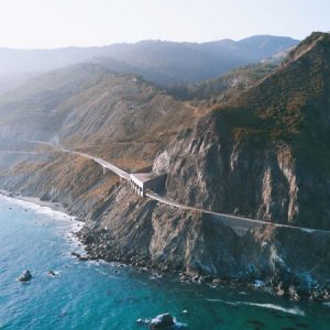
Pillars of enchanting red rocks. Secret slot canyons. Endless acres of beautiful public lands. Welcome to Highway 12 in Utah, 123 miles of the most stunningly beautiful landscape in the Southwest.

If you are looking for a unique road trip that features enchanting national parks, great camping, and endless opportunities for outdoor adventures, stop what you’re doing and plan a Highway 12 road trip through southern Utah.
Our family has embarked on back road journeys all over America, but we happened upon Scenic Byway 12 in Utah by accident. Since that fateful day, we’ve been fueling our road trip dreams on the mere memory of the time we spent there.
Highway 12 in Utah is a National Scenic Byway and has also been designated an All-American Road for a rustic landscape that isn’t found anywhere else on earth.
Driving Highway 12 is truly an epic experience, and one of the most memorable visual feasts in America, bringing you through landscapes so ruggedly desolate that the drive alone is an experience worth reading about.
But there’s more to Utah Scenic Byway 12 than extraordinary beauty as viewed from the window of your road warrior machine.
Your journey could be extended for weeks and weeks as you explore two national parks, three state parks, and millions of acres of national recreation and forest lands. Highway 12 in Utah is one of our favorite road trips for couples and for families!
Ready to plan your adventure on Highway 12 in Utah? First some practicalities, and then the good stuff!
Table of Contents
When is the Best time to Drive on Highway 12 in Utah?
The best time to drive this stunning route is in October when the weather is dry and days and nights are cool. March and April are lovely too and you will see more vegetation and flowers blooming in the spring.
Highway 12 is passable year-round unless there is a major snowstorm, but the white-knuckle driving in winter makes the road unpleasant to drive on. Summer, while hot, is beautiful in the canyons and honestly not as crowded as I would have thought.
What’s the Best Way to Get to Scenic Byway 12?
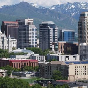
If you have to fly in and rent a car, you will be driving just under four hours to get to Panguitch where your Highway 12 journey begins. It’s a toss-up between using McCarran Airport in Las Vegas or Salt Lake City International Airport, so do your research ahead of time and find the best deals on flights and car rentals before booking.
Insider tip : Las Vegas and Salt Lake City both have Escape Campervan depots if you want to make your trip a bit more adventurous! This is one of the best road trips we can think of for van camping under the stars!
How Long Should I Spend Driving on Highway 12 in Utah?
From a technical standpoint, you could drive Highway 12 in a single day, but what would be the fun in that?
To take full advantage of the recreation opportunities, I recommend spending 2-3 nights in Bryce Canyon National Park, 1-2 nights on Highway 12 (we’ll list more suggestions below), and 2 nights in Capitol Reef National Park, for a 5-7 day road trip with lots of hiking and exploring.
Will I Have Access to Amenities on Highway 12?
There are grocery stores and gas stations at either end of Route 12, and a few more gas stations along the route. I suggest getting all of your provisions and filling your tank in Panguitch before heading east. There are small stores in both Bryce Canyon and Capitol Reef National Parks.
The Best Stops on a Highway 12 Utah Road Trip
Here are some highlights of this fabulous road trip on Scenic Byway 12 – an absolute must for everyone who wants to fall hopelessly in love with the open road.
Panguitch and Red Canyon

Traveling from west to east, you will begin your foray in the little town of Panguitch . A historically-rich village that is steeped in the weather-beaten charm of the wild west, Panguitch is the place to stock up on provisions, throw back a drink at an authentic saloon, or embark on a historical walking tour.
Just 25 miles from Bryce Canyon, Panguitch boasts a growing tourist economy while still maintaining its small-town roots.
From Panguitch, you will enter Red Canyon, which is where the excitement begins.
Turn up your favorite tunes and prepare to be amazed at the pillars, pinnacles, and spires that stretch out for miles and offer jaw-dropping spectacles around every bend. The performance continues for miles, but the red rocks will entice you to get a closer look before you’re too far into your journey.
Your first stop is not far from Panguitch.
The Red Canyon Visitor Center is the perfect place to stretch your legs, learn more about the geological forces behind the landscape, and eat a picnic lunch.
You might want to take a leisurely stroll on the Pink Ledges Trail . It’s a short, interpretive hike from the visitor center that leads you through a conifer forest to the base of a red rock cliff. Don’t forget your camera – even the cliffs around the visitor center are stunning!

If you’re into careening down a mountain on two wheels as the scenery blurs past and hikers run for safety, pull off at the trailhead of the Thunder Mountain Trail , just before the Red Canyon Visitor Center.
This is a world-class mountain biking destination and when combined with the paved Red Canyon bike path, it makes a great loop for experienced riders. At one point, the cliffs drop off on two sides and you can see for miles in every direction. Just don’t look down.
Welcome to Bryce Canyon National Park

Sure, you can drive through Bryce Canyon National Park , stopping at all the vistas and taking some photos before heading on your way, but to really appreciate this otherworldly landscape, I recommend pitching your tent (or parking your Escape Campervan ) for a couple of days.
If camping isn’t your thing, book a room at the Lodge at Bryce Canyon .
There are two campgrounds in Bryce Canyon National Park. Sunset campground has 100 tent/RV sites that can be reserved ahead of time between May 20 and October 15 on Recreation.gov . North campground has 99 first-come-first-serve sites, 30 of which are open year-round.
During our recent visit, we scored the last campsite at Sunset Campground without a reservation, but we don’t recommend doing it that way!
If you make a point of getting up before the sun, you can watch it rise over the hoodoos and bathe the canyon in a rainbow of colors. Then, before the campground comes to life and you head back down for your morning coffee, you will feel like you are the only one in the vast empty canyon, and you’ll embark on a life on the road, changed forever.
Okay, that’s just my little fantasy, but Bryce Canyon and this particular road trip really did rock my world.
One more thing, please take advantage of the ranger-led night walk if it is offered during your stay. There are full-moon hikes and astronomy programs that will leave you breathless. On a clear, dark night, the milky way shines like a silver streak across the heavens and 7500 stars are visible to the naked eye.
You can also sign up for a guided tour of Bryce Canyon, where you can visit the most scenic spots in the park and learn about the impressive history of the area.
Best Vistas and Trails in Bryce Canyon National Park
With only a couple of days to explore this magical place, you want to hit the best vistas and trails before heading on your way. Here’s where we’d recommend going.
Visitor Center – Stop here to grab a map, learn about trail closures and special programs, and visit the museum.
Sunset Point and Navajo Loop Trail – If you only have time for one hike, do the 1.3-mile Navajo Loop , which will take you past some of the most stunning hoodoos in the park, including Thor’s Hammer, Wall Street, and Twin Bridges. This trail has an elevation change of 515 feet.
Fairyland Loop – The 8-mile Fairyland Loop will take you most of the day, but it is a great way to get into the canyon without the crowds, and the scenery is gorgeous.
Rim Trail – 5.5 miles one-way, the Rim Trail is a paved path between Fairyland Point and Bryce Point with numerous viewpoints and vistas from above the canyon. If you just want to walk a portion of the Rim Trail, walk the mile between Sunset and Sunrise Point.
Escalante Petrified Forest State Park

Travelers on Scenic Byway 12 in Utah often pass this park by in favor of more majestic and popular scenic attractions, but this quiet underachiever has some secrets to share if you give it half a chance.
At Escalante Petrified Forest State Park , you will find a small 22-site campground, a reservoir for bird watching, canoeing, and swimming, and some cool geological wonders.
While this petrified forest is less impressive in color and magnitude than the Petrified Forest National Park in Arizona, Escalante’s beauty lies in its obscurity and opportunities for solitude.
Two short trails snake through the park. The first – Petrified Forest Trail, climbs up behind the campground and offers panoramic views of the surrounding park. The Trail of Sleeping Rainbows is a bit steeper with larger petrified specimens.
In July, when we passed through, we shared the whole park with one other camper. Day use is $10, camping is $25 or $30 with hookups. Campsites can be booked in advance .
Coffee with a View and a Pueblo Village

Heading east on route 12 in Utah, you will just start to get into your driving groove when you will spot a sign for coffee. The magnetic pull of the road may be too strong for you to resist, but I urge you to pull off and visit Kiva Koffeehouse .
This one-of-a-kind building is modeled after a traditional southwestern kiva, and it’s perched on the side of a cliff with expansive views of the canyon.
What’s more, the coffee is really good, especially if you’ve been drinking gas-station mud since San Francisco. On this particular road trip, our family had a thing about visiting coffee shops. They were our weakness and a huge source of comfort, especially in foul weather.
Anyway, by the time we reached Kiva Koffeehouse, we hadn’t had a decent cup since the coast, and we didn’t have high hopes for remedying the situation any time soon. We were happily surprised by the quality of the pastries and the coffee at Kiva, and we were stunned by the beauty of the building and the amazing views.
Next stop – Anasazi State Park Museum . This small museum and reconstructed Anasazi village is a quick and interesting spot, perfect for your picnic lunch, and especially fun if you have kids.
The museum contains authentic pottery and a number of artifacts that were excavated on-site. The Anasazi, or Ancestral Pueblos, occupied the spot from 1050 until about 1200. The village is a combination of original excavation and reconstruction and is very well done, a perfect side trip for history buffs and homeschoolers like us.
Capitol Reef National Park

The last stop on your highway 12 adventure isn’t even on highway 12, but just to the east. Capitol Reef is a small national park, but rich in history and full of charm.
Nomadic hunters inhabited the area before the Fremont people finally settled down in 500 CE. You can view petroglyphs from this time period from a boardwalk just a short walk from the parking area. It is incredible to think that this ancient art has stood the test of time and the elements.
Mormon pioneers settled the valley in the 1800s as a mission, planting an abundance of fruit trees and farming the fertile land. This settlement was short-lived, but the orchard is still maintained by the National Park Service. In fact, the historic orchard at Capitol Reef is the largest in the national park system, with more than 3,100 fruit and nut trees.
The orchard is open to the public for picking, but we were a bit early for the harvest when we headed through in July. We did, however, score a fresh-baked cherry pie and homemade ice cream at the Gifford Homestead store. Fresh-baked pie when you’re living out of your car is a pretty big deal indeed.
The campground at Capitol Reef is small and unassuming, with a tiny river for swimming (we saw a snake in the water), and nice walking trails. The whole park has a hometown and leisurely feel to it. The rangers, as usual, were awesome, and even in the busy July travel season, the crowds were minimal.
If you want to spend time exploring Capitol Reef National Park, but don’t want to camp, consider Capitol Reef Resort , which is close to the park entrance, features amazing views, and you can choose from a standard hotel room, a teepee, or a covered wagon for your lodging. There’s also a casual restaurant on site, an outdoor pool and hot tub, and a fitness center.
Ready to plan your next road trip on America’s most scenic highway? Highway 12 in Utah promises endless opportunities for every type of adventurer!
Where to Stay on Highway 12 in Utah
We recommend book-ending your drive at Bryce Canyon National Park and Capitol Reef National Park, but you should also consider spending one night somewhere in between the two. Camping at Escalante Petrified Forest State Park is a great choice, if you don’t want to camp, here are a few more ideas.
Budget option – Ponderosa Inn, Escalante . This small unassuming motel has just five cozy rooms. It’s located in downtown Escalante and within walking distance of eateries.
Glamping – Yonder Escalante . Looking for a special glamping getaway to celebrate this awesome road trip? Yonder Escalante is an upscale glamping resort with private cabins and Airstreams for rent. Amenities include a pool and hot tub, grab-and-go meals, a general store, and a drive-in theater. Pets are welcome for an additional fee.
Bed & Breakfast – Slot Canyons Inn . Choose from rooms, suites, or the Isaac Riddle Cabin on 160 acres near Grand Staircase Escalante National Monument. All rooms have an outside entrance and breakfast is served daily.
What to Pack for Your Highway 12 Road Trip Through Southern Utah
Not sure what to pack for your Highway 12 road trip ? Go for 100% activewear, as you’ll be doing lots of outdoor adventuring, and spending minimal time in town. Nightlife will include stargazing and marshmallow roasting, so leave the heels at home. Here are a few useful items to throw into your bag for this road trip.
- Clothes for hiking – You’ll be spending some time outdoors, so clothes that are rugged and comfortable are best. Opt for sturdy non-cotton pants ( like these ) and a breathable, moisture-wicking shirt. I love merino wool shirts because they keep you cool when it’s hot out and warm when it’s cold out, plus they don’t stink like polyester blends and they dry quickly.
- Sturdy shoes – You want your feet to take you wherever you need to go. Rugged hikers will work for visiting in every season and will protect your feet from spiny plants and creepy crawlies.
- Jackets – The weather in Utah is variable, especially since you will be exploring at different elevations. In the summer, you will be fine with a fleece and a windbreaker . For fall travel, add a down puffy jacket and a wool hat. These down jackets pack down really small and are perfect for travel.
- A Camera – Perhaps your phone doubles as your camera. Awesome! If your phone camera doesn’t take great photos, consider bringing a separate camera to capture all the beautiful scenery. If you want a dedicated point-and-shoot camera that packs neatly into a backpack, check out the Canon PowerShot SX740 . Overall, this little camera takes better photos than the best smartphone with a powerful zoom and 4K video. It’s almost as amazing as a DSLR with none of the weight. I love traveling with mine!
Need more adventures in the American Southwest? Read these next:
- The Best Things to Do in Lake Havasu City, Arizona
- Incredible Glamping Near the Grand Canyon
- Discover Oatman, Arizona on Route 66
- Family Adventures in Joshua Tree National Park
Follow us on social media for more outdoor inspiration!

Tara is a freelance writer and travel blogger with a passion for outdoor adventures. She is the co-author of AMC’s Best Day Hikes in Vermont and currently blogs at Back Road Ramblers and Vermont Explored , where she shares travel tips, adventure destinations, and vacation ideas for the wanderer in everyone.
Thursday 15th of September 2022
Greetings Tara, I truly enjoy and appreciate your travels, insights and scope of your blogs. Your writing is natural and very fact-friendly and complete!! I really enjoy how completely you cover your areas and side-lights!! Thank-you, Sincerely, AVP
Tara Schatz
Saturday 17th of September 2022
Thank you so much! Your comment means the world to me!
2-FOR-1 GA TICKETS WITH OUTSIDE+
Don’t miss Thundercat, Fleet Foxes, and more at the Outside Festival.
GET TICKETS
BEST WEEK EVER
Try out unlimited access with 7 days of Outside+ for free.
Start Your Free Trial
Powered by Outside
Utah Scenic Byway 12 from Bryce Canyon to Capitol Reef
Is this the most scenic highway in america.
Utah Scenic Byway 12 has it all: isolated canyons, grand plateaus that rise 9,000-feet above sea level, deep valleys that plunge to 4,000-feet and the natural and human-made history to prove it.
A State Road With Impressive Ratings
Utah Scenic Byway 12 is one of the 10 most scenic highways in the nation. This 124-mile byway is Utah’s first All American Road and it takes you from Bryce Canyon to Capitol Reef . It has been named by Forbes as one of America’s best snowy drives, and it was named by our sister publication Backpacker magazine as a favorite “Wild Roads.”
Locals say you can do it in three hours or three days. Others say it will take three years to fully take advantage of all it has to offer. The Henry Mountains are to the south and home to the country’s only free roaming bison. On the way out, take a break at Head of the Rocks Overlook to catch the pastel hills and dales.

View the official road map at www.fhwa.dot.gov/byways/byways/2020/maps .
Stop at these natural attractions along the route (from west to east).
- Bryce Canyon National Park
- Kodachrome State Park
- Dixie National Forest
- Grand Staircase-Escalante National Monument
- Escalante State Park
- Calf Creek Recreation Area
- Glen Canyon National Recreation Area
- Anasazi State Park Museum
- Boulder Mountain
- Capitol Reef National Park
Hellish 27-mile Bypass from Boulder to Escalante

Hell’s Backbone Road is a high-country alternative to the paved Utah Scenic Byway 12, which also connects Boulder and Escalante, 27 road miles apart. From late spring to autumn, the road, which climbs to more than 9,000 feet elevation, is easily passable by ordinary passenger vehicles, but it is very narrow and winding, and not for the faint of heart.
For current road conditions from the Utah Dept. of Transportation, visit www.udot.utah.gov/connect/current-conditions/ .
Popular on Utah National Park Trips

Get a free Utah national park trip planner for inspiring itineraries and essential information.
Healthy Living
- Clean Eating
- Vegetarian Times
- Yoga Journal
- Fly Fishing Film Tour
- National Park Trips
- Warren Miller
- Fastest Known Time
- Trail Runner
- Women's Running
- Bicycle Retailer & Industry News
- FinisherPix
- Outside Events Cycling Series
- Outside Shop
© 2024 Outside Interactive, Inc
Highway 12 Utah: Take A Scenic Road Trip Through Time

Utah State Route 12, also known as Scenic Byway 12 (SR-12) or “Highway 12—A Journey Through Time Scenic Byway,” is an approximately 123-mile-long state highway designated as an All-American Road.
One of the many scenic drives in Utah, State Route 12 takes you through stunning views of canyons, plateaus, and valleys, with plenty of vantage points as well as historic sites in between.
State Route 12 starts at an intersection with US-89 near Panguitch, UT to the west, then passes Red Canyon, the towns of Bryce, Tropic, Cannonville, and Henrieville. It then continues to the northeast to the towns of Escalante, Boulder, Aquarius Plateau, and Grover. The scenic byway ends at Torrey, UT, at its intersection with State Route 24.
In today’s article, find out how to plan and which stops you should make on your road trip along Highway 12 Utah.
Prepare for Your Highway 12 Road Trip
As I’ve mentioned, Byway 12 Scenic Byway begins at U.S. Highway 89, seven miles south of the city of Panguitch and eight miles north of the town of Hatch.
Either of these towns is a great jumping-off point for your road trip, with plenty of places to stay, stores for any last-minute shopping supplies, and rental shops for bicycles and ATVs.
If you’re coming from Panguitch, follow Center Street southbound to Highway 89 and turn left at Scenic Byway 12. On the other hand, if you’re coming from Hatch, follow N Main Street northbound to Highway 89 and turn right at Scenic Byway 12.

Driving west to east without stopping will take you around 4 to 5 hours, but you’ll want to take a few days and camp or stay in accommodations along the way if you want to completely explore what the surroundings have to offer.
Depending on how many stops you plan to make and how long you plan to stop, you’ll want to set aside at least 3 days for your road trip.
Summer is a popular time to go on this scenic Utah road trip, so if you want to avoid the crowds and get better rates on accommodations, the spring and fall months are probably your best bet.
Winter is a bit tricky; you can expect some road closures as parts of the highway will need to be plowed.
No matter what time of the year you go on this trip, make sure to stay hydrated and wear sunblock all throughout the trip. Take as many water bottles with you as you can carry comfortably, and whenever you encounter a visitor center, refill them.
Think about whether you want to stay in hotels and lodging in the towns, camp in the many campgrounds you can find along the highway, or if you want to take an RV or any camper-type vehicle.
Scenic Byway 12 Utah Road Trip Itinerary
These are several Highway 12 Utah stops, organized from west to east, that are worth stopping for to hike, climb, take pictures, or simply to marvel at nature’s beauty.
These are organized from west to east, traveling from Panguitch to Torrey.
1. City: Panguitch, UT
As I mentioned, you can start your Highway 12 road trip from either Panguitch or Hatch. But I’d recommend starting from Panguitch, especially if you have a little more time to explore.

Panguitch is a national historic district with roots in the early Mormon pioneers. History and culture are found everywhere you look, with beautiful red brick homes and buildings scattered throughout the small town.
Where to Eat in Panguitch
- Tandoori Taqueria
- Cowboy’s Smokehouse
- Desert Grill
Where to Stay in Panguitch
- The Panguitch House Bed & Breakfast
- Blue Pine Motel
- Purple Sage Motel
2. Red Canyon

Part of the Dixie National Forest, the Red Canyon features spectacular red sandstone hoodoos, spires, and formations formed through wind and water erosion.
Stop and explore the vermilion sandstone tent rocks by hitting the well-marked trails for hiking and cycling, as well as ATV and horseback riding.
In particular, the Red Canyon Bicycle Trail is a five-mile paved bike trail that takes visitors on a scenic route through ponderosa pine forests to the great Paunsaugunt Plateau.
3. Bryce Canyon National Park

From Highway 12, take a right at UT-63 to get to the entrance of Bryce Canyon National Park, where you get treated to the sight of a series of amphitheaters etched into red-stained limestone.
This is one of the big 5 national parks in Utah .
They look kind of similar to the hoodoos at Red Canyon because they were made the same way: by wind and water erosion.
There are plenty of viewpoints, hiking trails, and winter activities to fully experience the park’s beauty.
During the summer, you can park your car at designated parking lots and take the shuttle to certain points of interest inside the park.
There are also campgrounds in the area, as well as places for mobile homes to park. Restrooms and showers are available.
4. Town: Tropic, UT
Tropic is one of two towns you’ll pass on the way to Kodachrome Basin State Park.
At first glance, Tropic doesn’t seem to have much to offer. But there’s more here than meets the eye from Highway 12 (also their main road).
Stop by the Tropic Museum and Heritage Center to know more about the natural and cultural resources of the Bryce Canyon Region, including its geological and paleontological artifacts as well as pioneer history.
This town also has some hidden culinary gems, outdoor activities, and places to stay the night.
Where to Eat in Tropic
- Bryce Canyon Coffee Co.
- Stone Hearth Grille
- i.d.k. Barbeque
Where to Stay in Tropic
- Red Ledges Inn
- Bryce Canyon Inn
- Bryce Country Cabins
5. Town: Cannonville, UT
Cannonville is a small community named after a Mormon official.
Cannonville Visitor Center offers displays of Native American and Pioneer history. The staff here can also help with trail maps, hiking recommendations, and weather reports, which are invaluable when visiting the nearby parks.
Where to Stay in Cannonville
- Bryce Canyon Villas
- Grand Staircase Inn
6. Kodachrome Basin State Park

From Highway 12, turn into Kodachrome Rd/Main Street and continue until Kodachrome State Park Road, where you turn left toward Kodachrome Basin State Park.
Named after the then-revolutionary Kodak film, the Kodachrome Basin State Park features 67 monolithic stone spires with multicolor sandstone layers.
It offers a modern campground if you want to stay longer, but you can explore the area during the day by hiking and cycling.
In fact, there are six hiking trails traversing the park, with the Panorama Trail being the longest and hardest, but worth the trouble when you reach Panorama Point and get amazing views of the park’s colorful landscape.
7. Town: Henrieville, UT
Once you make your way back to Highway 12 from Kodachrome Basin State Park, the next town you’ll pass is Henrieville, a small ranching town and the third of three towns lying in Bryce Valley.
There are some small cafés and eateries around for dining before you make your way to your next stop.
Where to Stay in Henrieville
Sunrise Hollow
8. Wayside: The Blues Overlook
Around 12 miles east of Henrieville along Highway 12 is a short stop overlooking a section of blue-gray-green badlands.
The Blues Overlook is high above “The Blues,” named for the color of these shales deposited millions of years ago when the area was submerged in an ocean.
This overlook sits across the pink limestone ledges of Powell Point, so stopping on this overlook provides you a view of both contrasting landscapes.
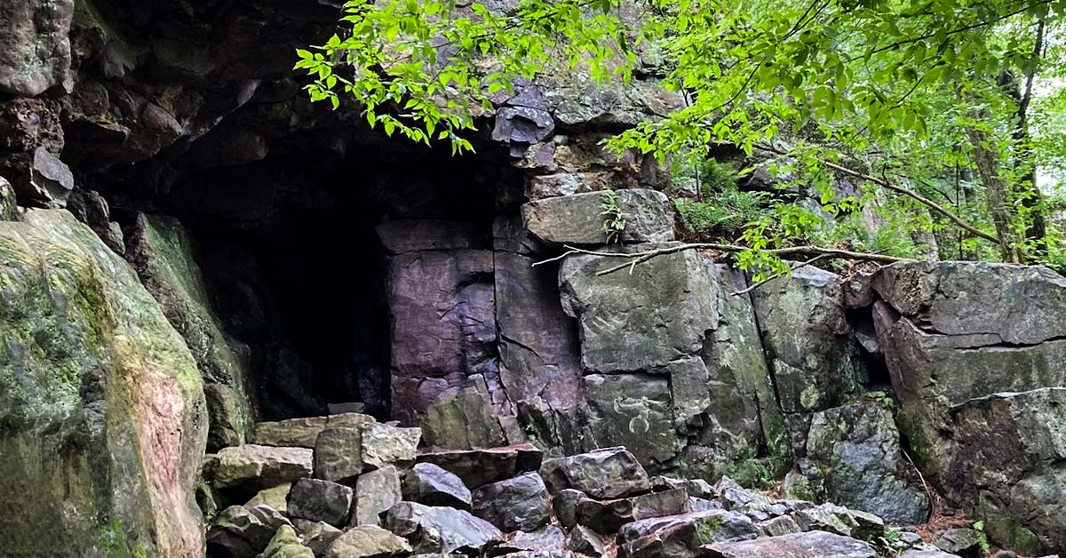
9. Wayside: Upper Valley Granary
Another 10 miles east on Highway 12 is a cave carved into a cliff face by Native Americans, probably used as storage for grains, corn, and other crops.
It blends well with the surrounding cliffs, but a viewing tube helps visitors zoom in to look at the structure.
10. Escalante Petrified Forest State Park
From Highway 12, turn left on Reservoir Road and follow it north until you get to the entrance of the Escalante Petrified Forest State Park.

Petrified wood is fossilized trees from millions of years ago. They look like rocks from a distance, but when you get up close, you get to appreciate the unique colors of the petrified wood.
Remember, though, that it’s illegal (and reportedly bad luck) to take petrified wood from the state park.
The park offers plenty of hiking trails, as well as water activities like boating, kayaking, fishing, and swimming in the Wide Hollow Reservoir. There are full-service campgrounds, including a disabled-friendly campsite.
11. City: Escalante, UT
When you exit the petrified forest, you’ll pass by Escalante City, also known as the “Heart of Scenic Byway 12.”
Even with only 850 residents, Escalante is still the largest city on this highway, which means there are more options for lodging and food compared to the other towns on this route.
Visit the Escalante Heritage Center to learn about the pioneering expedition in this area. Going to the Escalante Interagency Visitors Center can help you plan your trip to the nearby parks, as well as appreciate the ecology of the area.
Where to Eat in Escalante
- Kiva Koffeehouse
- Circle D Eatery
- Ranch Dog Kitchen
Where to Stay in Escalante
- Canyons Bed & Breakfast
- Cowboy Country Inn
- Escalante Outfitters
12. Wayside: Boynton Overlook
Boynton Overlook is another wayside stop that offers a breathtaking view of the valley carved out by the Escalante River.
It’s a great place to take photos of escarpments, red rock domes, and arches in the distance.
13. Grand Staircase-Escalante National Monument

This national monument stretches around 2,900 square miles established to preserve the wilderness and its ecosystems. It is divided into three regions: the Grand Staircase, the Kaiparowits Plateau, and the Canyons of the Escalante.
The “staircases” or sandstone cliffs are visible from the highway, but if you want to get up close and personal, you’ll have to be driving a vehicle that can handle unpaved, uneven roads, and you need to have plenty of water (at least 1 gallon per person per day), as there aren’t any establishments or homes nearby.
14. Calf Creek Recreation Area

Calf Creek is a perennial stream within the Grand Staircase-Escalante National Monument.
If you have it in you to hike 5 miles to and from the trailhead, you can visit the Lower Calf Creek Falls, where a clear stream descends 126 feet into a pool where visitors can take a swim.
When hiking to the falls, you’ll pass plenty of points of interest, so you won’t get bored of seeing red rock on all sides.
15. The Hogback

When you exit Calf Creek, before you get to Boulder, you’ll get to drive an internationally famous stretch of the highway known as the Hogback.
It features hairpin turns on a very steep ridge that drops off into deep canyons on both sides.
You shouldn’t have to be reminded to be extremely cautious when driving the Hogback.
16. City: Boulder, UT
Another peaceful city on your route, Boulder offers a few lodging options and restaurants to rest and recharge before you go on your final leg.
There are also some shopping options here and a chance to gas up as well.
Where to Eat in Boulder
- Hell’s Backbone Grill
- Magnolias Street Food
- Burr Trail Grill
Where to Stay in Boulder
- Boulder Mountain Lodge
- Circle Cliffs Motel
- Pole’s Place Motel & Gift Shop
17. Anasazi State Park Museum
The Anasazi are considered to be descendants of the Pueblo Native Americans, who abandoned this area due to drought or fire.
Their abandoned village is now preserved as a state park, and the unearthed artifacts displayed in the museum also showcasing their history.
18. Boulder Mountain

Also known as Utah’s Aquarius Plateau, Boulder Mountain is part of the High Plateaus section of the Colorado Plateau. It ranges over 11,000 feet in elevation and covers more than 900 square miles.
The mountain is covered in various trees, such as ponderosa pine, pinyon, and juniper.
19. Capitol Reef National Park
Capitol Reef National Park was established to preserve around 380 square miles of desert landscape, especially the Waterpocket Fold.

Photo Credit: Anna Irene
The park features several cliffs with dome formations, similar to the white domes often placed on top of capitol buildings, which give the park its name.
You can see some of these domes from the highway, but if you want to explore them further, you’ll have to take a significant detour.
20. Town: Torrey, UT
Highway 12 ends at its northernmost point where it joins Highway 24, in the town of Torrey.
You don’t have to leave right away though; Torrey offers small-town charm, with tree-lined streets set in rose-colored cliffs and green meadows.
It has been accredited by the International Dark-Sky Association to have very minimal light pollution, and is thus a great town to spend a night stargazing.
Where to Eat in Torrey
- Slacker’s Burger Joint
- The Wild Rabbit Cafe
- The Saddlery Cowboy Bar and Steakhouse
Where to Stay in Torrey
- The Chuckwagon
- Red Sands Hotel and Spa
- Motel Torrey
Take A Road Trip on Highway 12 This Weekend!
A Scenic Byway 12 Utah road trip is truly unique. Getting to see a national forest, two national parks, a national monument, and three state parks along a single road is something only Highway 12 in Utah can offer.
Want other great ideas for your next road trip? Check out our other posts below:
- Pacific Coast Highway
- Great River Road
- Florida Keys
Go Out and Explore
The 20 Most Scenic Drives in America
Visiting Salt Lake City: The Best Things to Do
9 Must-Visit Clear Water Beaches in Florida
6 Caves in Wisconsin That Will Blow Your Mind
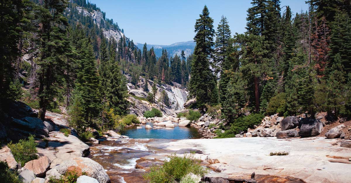
Kayaking in Yosemite: The Best Spots and Tours

10 Unusual Things To Do In New York City
Roadstotravel
Find the best roads, scenic byway 12: utah’s captivating 124-mile drive.
Scenic Byway 12, is an extraordinary 124-mile stretch in the core of Utah. The road has earned its position among the world’s most stunning and visually striking drives. This road links Capitol Reef National Park and Bryce Canyon National Park and offers a unique blend of natural splendor, geological marvels, and cultural attractions that are bound to enthrall any traveler.
Where is Byway 12 located?
Byway 12 is located in southern Utah, running through the heart of the state’s red rock country. The byway begins in the town of Panguitch, near Bryce Canyon National Park. It ends in the town of Torrey, near Capitol Reef National Park. Along the way, the road passes through a variety of landscapes, including high desert plateaus, deep canyons, and towering mountains.
What makes Scenic Byway 12 special?
Byway 12 in Utah is one of the most scenic drives in the United States and for good reason. The road offers travelers a unique opportunity to experience Utah’s vast natural beauty up close. Indeed, the road is full of stunning views and geological wonders at every corner.
As one of the main attractions along the byway, the Grand Staircase-Escalante National Monument attracts visitors from all over the world. It is a vast zone that spans more than 1.9 million acres. The monument has a diverse array of geological features, such as towering cliffs, deep canyons, and vivid rock formations.
Another must-see destination along the byway is Bryce Canyon National Park, which is famous for its distinctive hoodoo rock formations and breathtaking vistas. The park offers a range of hiking trails and scenic overlooks, allowing visitors to explore the area’s natural wonders in depth.
What are the driving conditions like on Byway 12?
While Scenic Byway 12 is a beautiful drive, it can also be challenging at times. The road is narrow and winding, with steep drop-offs and sharp turns. Be prepared for changing weather conditions, including snow and ice in the winter months.
Although the road presents some challenges, it is generally well-maintained and provides ample opportunities for travelers to pause and appreciate the surroundings. Visitors are encouraged to enjoy the journey rather than rushing through.
How to get to Scenic Byway 12?
Visitors typically reach Byway 12 by driving to one of the nearby towns, such as Panguitch or Torrey, and then following the signs to the byway. The road is easily accessible from major highways, including Interstate 15 and Highway 89.
You can have a preview of the itinerary on the map below :
What to do along Byway 12?
Along Scenic Byway 12, there is plenty to see and do, from hiking and camping to sightseeing and photography.
- Bryce Canyon National Park, known for its unique hoodoo rock formations and many hiking trails and scenic overlooks, is one of the most popular attractions along the byway.
- Explore Grand Staircase-Escalante National Monument’s perplexing wonders, where deep canyons and towering cliffs beckon the daring.
- Immerse yourself in Capitol Reef National Park’s captivating tapestry of colorful rock formations, scenic drives, and abundant hiking trails and camping sites.
- Discover Kodachrome Basin State Park’s extraordinary geological features, which include vibrant rock formations, spires, and arches that will take your breath away.
- Drive other cool roads in Utah such as the Shafer Canyon Road or the Moki Dugway .
- Step into the past at Anasazi State Park Museum and gain intriguing insights into the lives and culture of the Anasazi people, who thrived over 1,000 years ago.

Is Byway 12 open?
Before embarking on a journey along Byway 12, visitors should check for any road closures or restrictions. The road is typically open year-round but may be closed during periods of heavy snow or other inclement weather.
Always keep in mind that road conditions can quickly change due to weather, accidents, or other factors. So, before you embark on your journey, always double-check. Also, be aware that the campsites can’t be open all year-round
Preview of the road :
Prepare for an unforgettable journey along Scenic Byway 12, Utah’s remarkable route showcasing awe-inspiring landscapes. To catch a glimpse of this extraordinary drive and gather itinerary inspiration, check out this YouTube video.
In conclusion, Scenic Byway 12 is a must-see destination for anyone visiting Utah’s red rock country. With stunning vistas, unique geological formations, and a rich cultural heritage, the byway offers travelers a unique opportunity to experience the state’s natural wonders up close. Whether you’re a hiker, photographer, or simply a lover of the great outdoors, Scenic Byway 12 is sure to leave a lasting impression.
Credits: By Wolfgang Staudt from Saarbruecken, Germany – Scenic Byway 12, CC BY 2.0, https://commons.wikimedia.org/w/index.php?curid=24319050 / By W. Bulach – Own work, CC BY-SA 4.0, https://commons.wikimedia.org/w/index.php?curid=85054376
Discover our other roads in Italy: click here or see our road map!
Related posts:
- Skip to primary navigation
- Skip to main content
- Skip to primary sidebar
- Skip to footer
TravelAwaits
Our mission is to serve the 50+ traveler who's ready to cross a few items off their bucket list.
The Best Stops On Beautiful Highway 12, Utah’s Scenic Byway

Sara Broers
- Activities and Interests
- Destinations
- National Parks
- Road Trips In The U.S.
- Scenic Byways
- Types of Travel
- United States
- United States National Parks
Utah’s Scenic Byway, Highway 12, is located in south-central Utah. It features some of the most incredible scenery that you will find on any drive in America. The landscape offers magnificent red rock formations along this drive that runs through Bryce Canyon National Park and Capitol Reef National Park. With national parks, historic towns, state parks, and a national monument along this route, there’s a new experience around every bend in the road.
Here is a list of my favorite things to do along this scenic drive. I hope you will plan a visit and enjoy the views as much as I did. Spring and fall are fantastic times of year to make this drive. It’s not too hot, and the flowers, as well as the trees, burst with seasonal colors. You can easily spend three full days exploring along this route or do it all in one day. It depends on how many things you want to see and do along the scenic drive.

James Marvin Phelps / Shutterstock
The rich, red rocks in the Red Canyon make this a colorful part of the drive, and tunnels add to the experience. The ponderosa pines set this canyon apart from other canyons in the country. Whether you are a novice or experienced hiker, you will find a hiking trail that meets your needs. If you choose to hike, take plenty of water with you, as the sun can be scorching in the summer. The winter season brings opportunities for snowshoeing and cross country skiing.

Bryce Canyon National Park
Enjoy sunrise in Bryce Canyon National Park . Choose one of the two first parking areas to view the overlook of the canyon. We arrived 30 minutes before sunrise, and it turned out to be a perfect time. The skies had started to lighten up, and the colors immediately began to turn throughout the canyon. The hoodoos, cliffs, canyon, and the sky place you in what seems to be an otherworldly place. Have your camera ready for some magnificent photo opportunities. Your epic sunrise experience at Bryce Canyon is sure to be something that you talk about for months on end.

Jeffrey B. Banke / Shutterstock
Kodachrome Basin State Park
Kodachrome Basin State Park is home to towering monolithic spires and chimneys. This beautiful park was named after the popular 1948 film Kodachrome by a National Geographic Expedition. Hiking, mountain biking, camping, and horseback riding are all popular things to do in this state park. This park has an elevation of 5,800 feet. As with all state parks in Utah, annual or day-use state park passes are required to visit. You can easily spend two hours or a few days in this park, depending on your travel schedule.

kojihirano / Shutterstock
Grand Staircase-Escalante National Monument
It was not until 1996 that President Bill Clinton set Grand Staircase-Escalante as a National Monument. As you drive Highway 12, you will notice the colorful cliffs that surround you. These vertical drops are known as the Pink Cliffs, Grey Cliffs, White Cliffs, Vermillion Cliffs, and Chocolate Cliffs. Hiking, fishing, ATV trail riding, and camping are among the most popular things to do in this area. Several parking areas sit along the highway and offer stunning views. Trails often begin in these parking areas, which often lead to a beautiful experience along a sandy, rocky path. Dress in layers and take water with you. When you step off the beaten path, you’re guaranteed to see something that many others have never seen.

Dan Tiego / Shutterstock
Escalante Petrified Forest State Park
Escalante Petrified Forest State Park offers camping, hiking, fishing, and stunning views. The visitor center is home to displays of plant and marine fossils, along with petrified wood. Fossilized dinosaur bones over 100 million years old are also on display. Camping with hookups is available for RV units up to 40 feet. Daily use passes or annual park passes are required.
As you hike, keep in mind that you need to pack out what you pack in. The Petrified Forest Nature Trail is an easy loop trail that is a little under two miles. With a panoramic lake view, this trail is short and offers impressive views. You will also find petrified wood all along the trail. Please do not pick up the wood, as you will want to leave nature as you found it. Inquire at the visitor center about any closed trails due to any weather issues to make sure you have a safe hike. You can spend an hour here or spend several days enjoying the quiet sounds of this state park.

BlaineT / Shutterstock
Calf Creek Falls
Calf Creek Falls is one of the most well known and unique features in Grand Staircase-Escalante National Monument. The Lower Calf Creek Falls Trail follows Calf Creek to the falls. This 6.7-mile round-trip hike has a minimal elevation gain of 521 feet. Sand on the trail adds to the hike’s difficulty, so plan accordingly. If the temperatures are on the extreme side, it can be a difficult hike. Pictographs that represent life in a much different period of time are visible on this hike. Pay attention to the rocks that are near the trail, and you will find these drawings. The stunning waterfalls at the end of your hike make every step worth it.
Dogs are allowed on this trail but must be leashed at all times. The parking area fills quickly, and the best tip that I can give you is to begin your hike early in the day, as at 6:30 a.m. Plan to spend a minimum of four hours hiking this trail. Spring and fall are ideal times to make the trek to Calf Creek Falls, as the temperatures are milder.

OLOS / Shutterstock
Near the town of Boulder, there is a stretch of highway referred to as Hogback. This is a unique road as there are steep drop-offs on both sides. The hairpin curves and winding road will keep you alert on your drive. This part of this scenic drive caught me off guard, and once I realized that we had steep drop-offs beside us, I realized how beautiful this stretch of road was.
Do not try to take any pictures while driving this route (or any route). Let your passengers take Instagram photos for you. The pull-outs that are nearby are there for a reason. When you come upon one, use it and take in all the beauty nature has tossed your way.

Thierry Guinet / Shutterstock
Boulder Mountain
Boulder Mountain takes you to the top of Bluebell Knoll, which has an elevation of 11,313 feet. While driving this mountain, be sure to use the slow vehicle pull-outs when necessary to keep traffic flowing while climbing the incline. The mountain has several pine trees and is located in the Dixie National Forest .
If you decide to drive on one of the spurs that take off from Highway 12 in this area, make sure you have a 4-wheel drive vehicle with high clearance. These side roads are bumpy but do offer exceptional views that very few people experience. With 90 lakes and several streams, trout fishing is prevalent on Boulder Mountain. It’s important to note that these fishing areas are closed from November to mid-April.

Galyna Andrushko / Shutterstock
Capitol Reef National Park
While traveling Highway 12, you will come upon Capitol Reef National Park . This national park offers a little bit of everything, including stunning red canyons, hiking, history, and petroglyphs. Hop on the Grand Wash Hiking Trail , which is an easy hike that offers incredible views. A highlight of this hike is the Grand Wash Narrows. This is a one-half mile section that reminds hikers of the famous narrows of Zion National Park.
Picnic areas are available and offer fantastic green spaces with towering red rocks that spiral toward the sky as the backdrop. Several hiking trails are located near the drive in the national park, and all offer unforgettable experiences. You can spend two hours in this park or spend a full day here on an epic adventure.
Once you begin your 120-mile drive across south-central Utah, you will find yourself succumbing to beauty that you will not find anywhere else. Nature experiences await you around every curve in the road as you trek across Highway 12. The valleys that surround this scenic drive seem to go on for miles. The rich, red rocks rise above the trees in several areas of the scenic route. Begin your road trip with a full tank of gas, pack plenty of water, snacks, and layers of clothing.
Fun Fact: Sara is also an auctioneer.
Adventures in Destinations Unknown

Driving the Scenic Highway 12 in Utah
Last modified on January 29th, 2021 at 15:29
After visiting Capitol Reef’s Strike Valley, Dan and I found ourselves racing along Utah’s Highway 12 in order to catch a return flight to Seattle. Our path to the Salt Lake City Airport followed the Burr Trail to Boulder, then veered right—ascending a hair-raising road up Boulder Mountain, toward Torrey.
Though spectacular views turned our heads every which way, the scenery sped by in a blur. I tried to snap photos of the moving landscape, but failed to capture its majesty through the car’s dusty windows.
Then and there, we vowed to return to the area and explore at leisure.
So one month later, while road tripping through the American Southwest, we made sure to include Highway 12 into our travel plans.
Table of Contents
ATTRACTIONS AND DETOURS ALONG UTAH’S HIGHWAY 12
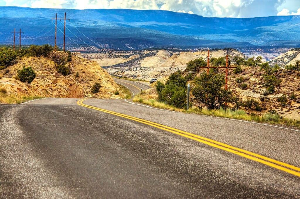
Utah’s scenic Route 12 is 122 miles of pure road trip bliss. Also known as the ‘Million Dollar Road to Boulder,’ the scenic byway has been enchanting travelers since the early 1900s.
As the road cuts through southern Utah’s parched red rock, it passes by unforgettable landscapes. The highway connects Bryce National Park with Capitol Reef National Park . In between, it traverses the Grand Staircase-Escalante National Monument and produces offshoots into remote corners of southern Utah.
In total, Route 12 winds past two national parks, three state parks , a national monument, a national recreation area, and a national forest.
It is no wonder that the scenic byway has been designated an All-American Road.
RED CANYON IN THE DIXIE NATIONAL FOREST
Utah’s Red Canyon marks the westernmost end of Highway 12. It is located in the Dixie National Forest, 10 miles west of Bryce Canyon National Park.
Like a mini version of Bryce, Red Canyon’s ochre-colored hoodoos rise from the ground like rusty stalagmites.
Many of the canyon’s most striking formations lie within eyeshot of Highway 12. In fact, in order to construct a road through the area, engineers had to blast arches through red rock spires.
Though we caught glimpses of the rock formations from our vehicle, Dan and I didn’t have time to explore the inner reaches of Red Canyon during our road trip.
BRYCE CANYON NATIONAL PARK
Bryce is a fairyland of elegant beauty and fiery colors. Renowned for its oft-photographed rock formations that pierce the sky, the canyon’s ethereal landscapes are as enchanting as they are iconic.
The long and narrow park hugs the eastern edge of Utah’s Paunsaugunt Plateau. Over millennia, ephemeral streams and snowmelt have sliced the plateau’s sandstone and carved horseshoe-shaped bowls. The largest and most striking bowl in the area is the Amphitheater —a stadium-like hillside that lies at the scenic heart of Bryce Canyon National Park.
Bryce’s must-see attractions line the eastern edge of the park’s 20 mile scenic drive. Near the park entrance, iconic vistas showcase sweeping aerial snapshots of the Bryce Amphitheater. Toward the end of the road, lesser-known panoramic points offer intimate glimpses into the canyon’s more remote reaches.
KODACHROME BASIN STATE PARK
Kodachrome Basin State Park lies 26 miles southeast of Bryce. The park is most renowned for its dozens of delicate sandstone chimneys that point to the sky like crooked fingers.
When the National Geographic Society traveled to the area in 1948, its members found themselves struck by the colorful sandstone spires. They named the area Kodachrome Flat, after the brand of Kodak film known for its vibrant color rendition.
Following our sunrise visit to Bryce, Dan and I spent a morning in Kodachrome Basin. With limited time in the area, we chose to hike the scenic Angel’s Palace Trail.
Angel’s Palace is among the most beautiful short hikes in Kodachrome State Park. It provides 360 degree aerial views over the basin’s unique landforms.
Other popular trails include the 1.5 mile Grand Parade and the 3 mile Panorama Trail.
Past the camping area, a gravel spur road deviates toward Chimney Rock—a 170 ft pipe that soars above the surrounding desertscape.
GROSVENOR ARCH IN GRAND STAIRCASE-ESCALANTE
Utah is famous for its rock arches. In fact, there is an entire national park dedicated to the state’s delicate stone bridges.
But despite southern Utah’s plethora of similar attractions, Grosvenor Arch is unique.
The colossal landmark towers over sage-speckled desert like a golden fortress surveying its surroundings. Its twin arches soar 150 ft. The larger of the two measures nearly 100 ft in diameter.

Grosvenor Arch lies down a dirt track, about 11 miles south of Kodachrome Basin State Park.
For those traveling along Utah’s Route 12, it constitutes a must-see detour.
CALF CREEK RECREATION AREA
Calf Creek is a verdant oasis that lies among tumbled stone monoliths.
Unfortunately, Dan and I had to skip Calf Creek due to lack of time.
From my understanding, however, the recreation area is one of the top places to visit along Highway 12. It boasts mineral-streaked sandstone cliffs, pre-historic carvings, photogenic waterfalls, and paradisiacal pools.
THE HOGBACK
Highway 12 in Utah features terrific hikes, spellbinding vistas, and fascinating detours.
Yet sometimes, the road itself is the main attraction.
East of Escalante, Highway 12 traces the Hogback’s spine for eleven miles. On each side of the road, 1,000 ft drops afford vertigo-inducing views over the monument’s cliffs and canyons.

Along the way, viewpoints reveal the route’s precarious nature.
As I looked out at the ribbon of road with its sheer drops on either side, I was just glad to have a competent driver behind the wheel (thanks Dan!).
THE BURR TRAIL ROAD
Though it isn’t expressly a part of Highway 12, the Burr Trail Road makes for a fantastic detour.
The scenic route showcases a remarkable number of breathtaking attractions—including slot canyons, scenic viewpoints, and lonely offshoots that traverse juniper-laden desert.
The lightly-trafficked backway winds through dramatic portions of southern Utah. It extends for 66 miles, from the town of Boulder, to the Bullfrog Marina on Lake Powell.

The Burr Trail Road highlights some of Grand Staircase-Escalante’s most awe-inspiring scenery. Its three distinct sections contain narrow orange canyons, rust-colored hillsides, and views of Capitol Reef’s Strike Valley.

The first portion of the Burr Trail travels through the northeastern corner of Grand Staircase-Escalante. The second, is a rough-and-tumble gravel road that cuts across the Waterpocket Fold in Capitol Reef National Park. The third, is a ribbon of pavement that connects the national park with Lake Powell’s Bullfrog Marina.
BOULDER MOUNTAIN
Boulder Mountain—the highest step in Utah’s Grand Staircase—is visible from hundreds of miles away. The colossal mountain makes up half of southern Utah’s Aquarius Plateau.
Rising over 11,000 feet in elevation, it is the highest timbered plateau in North America.

Boulder Mountain is a destination worth exploring. It boasts colorful aspen groves, rolling meadowlands, and dozens of alpine lakes.
As Highway 12 ascends the plateau on its way to Torrey, it reveals spectacular aerial views of Capitol Reef to the east.
CAPITOL REEF NATIONAL PARK
Capitol Reef National Park is the least visited of Utah’s Mighty 5 . The park’s main feature is the Waterpocket Fold—a buckle in the earth’s crust that extends for over 100 miles.
Capitol Reef consists of three main sections: the Fruita District, the Waterpocket District, and the Cathedral District . The Fruita District is the hub of tourism in Capitol Reef. It is by far the most trafficked area of the park.
Visiting the other two areas requires a 4 wheel drive vehicle that can negotiate bumpy dirt roads.

Within its confines, the national park harbors fantastic hiking trails, towering monoliths, natural arches, and 1000-year-old petroglyph panels.

Capitol Reef National Park isn’t the type of place that can be easily visited in an afternoon. Its disjointed sections require lengthy drives on bumpy roads.
However, if given the time and patience that it deserves, Capitol Reef is every bit as impressive as Utah’s other more renowned national parks.
LODGING ALONG UTAH’S HIGHWAY 12
Highway 12 in Utah snakes through a rugged expanse of barren desert. While much of it lies within a patchwork of federally protected lands, a few tiny towns interrupt the endless landscape. Noteworthy towns include Tropic, Escalante, Boulder, and Torrey. Each has gas stations and a handful of accommodation options.
Tropic lies just east of Bryce Canyon National Park, near Kodachrome Basin. It houses the Bryce Country Cabins and Happy Trails B&B .
Escalante sits at the midway point of the drive and is a hub for exploring the Grand Staircase-Escalante National Monument. It offers some of the best lodging options along the route—including the Ponderosa Inn and the Slot Canyons Inn Bed and Breakfast.
In Boulder, Annie’s Place Bed and Breakfast boasts fantastic reviews.
And in Torrey, the Capitol Reef Resort offers unique rooms that provide views of the park’s red rock landscape.
Highway 12 in Utah is no ordinary road. The spectacular route is chock full of roadside attractions, sweeping vistas, and fascinating detours.
The scenic byway’s little-known attractions are often unexpectedly epic. Along each bend in the road, adventure beckons.
I have no doubt that Highway 12 is one of the Southwest’s great road trips.
For while many race to the national parks that bookend its expanse, the ‘Million Dollar Road to Boulder’ is a destination unto itself.
____________________________________________
Did You Enjoy this Guide to Highway 12 in Utah? Pin It!

- Tours & Guides
- Places To Stay in Boulder
Highway 12 Scenic Byway
- Anasazi State Park
- Boulder Mountain
- Hole in the Rock
- Hells Backbone
- Utah's Outback Region
- Visit our facebook
- Visit our pinterest
Highway 12 is one of the most scenic highways in America. No joke.
Receiving the designation of 'All American Road'. The highway has two National Parks; Bryce Canyon and Capitol Reef, at each end and many other scenic points in between.
Promotional Links
Places you'll see.
Highway 12 passes through Red Canyon, Bryce Canyon National Park, Grand Staircase-Escalante National Monument and over Boulder Mountain in the Dixie National Forest to its conclusion near the entrance to Capitol Reef National Park.
Capitol Reef State Park
A small community rich in pioneer heritage, Tropic is typical of the other small towns on U-12 east abreast of Bryce Canyon. Near the town of Cannonville, is the northern boundary of the Grand Staircase-Escalante National Monument. A visitor center in Cannonville may help visitors experience the local culture past and present. A 7-mile paved road leads south from Cannonville to Kodachrome Basin State Park.
- Kodachrome Basin State Park
One mile west of the town of Escalante is Petrified Forest State Park. The town itself borders the Grand Staircase-Escalante National Monument. The road continues through the Escalante canyons with panoramic views over miles of colorful slickrock. After crossing the Escalante River, visitors may picnic at Calf Creek Campground. From here, a six-mile round-trip trail takes visitors to Lower Calf Creek Falls.
- Escalante Petrified Forest State Park
Nearing the town of Boulder, Highway 12 twists and turns through the Hogsback, a section of the road where cliffs drop steeply into narrow canyons on both sides of the highway. In Boulder, a museum and remnants of a prehistoric Indian village at Anasazi State Park.
Following the summit of Boulder Mountain, the byway travels a spectacular forested course where views of colorful Capitol Reef National Park, the Circle Cliffs and the Henry Mountains are framed by the trees of the Dixie National Forest.
Dixie National Forest
ADDITIONAL INFORMATION
- Capitol Reef National Park
- Hell's Backbone Backway
- Calf Creek Falls
- Escalante River Trailhead
- Canyons of the Escalante
- Upper Valley Granaries
- The Blues Overlook
- Grand Staircase National Monument
- Bryce Canyon National Park
OTHER UTAH SCENIC DRIVES
- Mirror Lake Highway
- Beaver Canyon - Scenic Drives & Byways
- Indian Creek Scenic Drive
- Potash Moab Scenic Drive
- Bear Lake Scenic Drive
- St. George Scenic Drives
- Dead Horse Point Scenic Drive
- Fish Lake Scenic Drive
- Cedar Breaks Scenic Drive
- Vernal Scenic Drives
- Trail of the Ancients Scenic Drive
- Monument Valley | Highway 163 Scenic Drive
- Highway 128 Colorado River Scenic Byway
- Alpine Loop
- Heber Valley Scenic Drives
- Mt Carmel to Long Valley Scenic Drive
- Moab Scenic Drives & Byways
- Indian Canyon Scenic Drive
- Brian Head Scenic Drive
- Zion Scenic Drive
- Dinosaur Diamond Scenic Drive
- Capitol Reef Scenic Drive
- Grand Canyon Scenic Drives
- Huntington Canyon Scenic Drive
- Bryce Canyon Scenic Drives
- Provo Canyon
- Park City Scenic Drives
- Mount Nebo Scenic Byway
- Little Cottonwood Canyon
- Logan Canyon
- Flaming Gorge Scenic Drives
- Fall Colors Scenic Drives
- Big Cottonwood Canyon
Happy Trails in Piute County
What do Delano Peak, the Paiute ATV trail and Butch Cassidy all have in common? Utah’s Piute County,...
8 Secrets to Sustainable Travel in Park City
Want a big adventure to Park City without a big environmental footprint? Utah.com can help you explo...
Utah County Is Festive As Heck
Fireworks, parades and corn on the cob — oh my! Utah.com has the scoop on the best festivals and fai...
Natural Bridges National Monument: A Hidden Gem, Not a Second Fiddle
An under the radar destination that should be on your radar. Learn all about Natural Bridges, Utah a...
Plan a Guys Getaway in Vernal
Planning a guys trip? Why not hit the ATV trails in Vernal, Utah with your crew? With all kinds of w...
Treat Yourself to a (San Rafael) Swell Winter
The San Rafael Swell is one of Utah’s hidden gems, and it gets even more hidden in the winter. Utah....
Plan a Triathlon of Fun in Greater Zion
Looking for things to do in St. George this fall? In addition to the IRONMAN 70.3 World Championship...
Color Me (Insert Emotion Here): Where to See Cedar City’s Feel-Good Fall Foliage
Richly hued views await you in southern Utah this autumn. Peep the changing leaves on a scenic drive...
Play Outside and See a Play Outside in Cedar City
Take a visit to Cedar City, Utah, and see why its access to both world class theater and stunning ou...
Mapping Out Utah’s Tastiest Cuisine
Getting to know the Beehive State means experiencing its sites and unique flavors. Discover both whe...
Get Your Peach Thrills in Box Elder County
Utah’s Box Elder county is a peachy paradise — part mountain range, part desert, part orchard and al...
9 Highest Peaks Across Utah
Take a peek at the tallest peaks in Utah. From Kings Peak to the Deep Creeks, Utah.com gets to the t...
Paving the Way for Everyone: All-Access Trails in Utah
From a wheelchair accessible waterfall trail to a lakeside boardwalk laden with wildflowers, these U...
Local Legends in Utah
Ever been curious about urban legends in Utah? Utah.com fills you in all things folklore with our gu...
Views like this delivered to your inbox
Recently visited.
BACK TO TOP

My Itchy Travel Feet
The Baby Boomer's Guide To Travel
How to Drive Highway 12 Scenic Byway in Southern Utah
This article may contain referral links. Read our DISCLOSURE
It’s no secret here at My Itchy Travel Feet that Alan loves road trips . When we decided to drive Highway 12 Scenic Byway on a late spring road trip through southern Utah , he walked around the house for days with a big grin on his face.
But this last-minute trip, while beautiful, proved to be challenging. Choosing Memorial Day weekend was not exactly a good move. But it wasn’t all our fault. A lodging cancellation caused us to change our plans.
Table of Contents
Where is Highway 12 Scenic Byway located?
Utah’s Scenic Byway 12—A Journey Through Time—travels through southern Utah on a geological road trip across ancient seabed remains to an alpine forest that tops out at 9,000 ft—one of the highest in the world. And it’s packed with outdoor recreational opportunities.
The state of Utah boasts 13 Utah national parks , (counting national monuments, historic parks and national recreation areas) filled with scenic hiking trails and off-road adventure . On Highway 12, you’ll find two national parks (Bryce and Capitol Reef), Grand Staircase-Escalante National Monument and four state parks, plus more boomer adventure than you’ll ever have time to do.
No wonder this 124-mile stretch of pavement has been named an All-American Road by the U.S. Department of Transportation.
Starting out in Torrey on Highway 12 Utah

Our itinerary started at Torrey, Utah , at the eastern end of Highway 12 Utah, where we had allotted several days to explore Capitol Reef National Park . Things began to unravel when the bed and breakfast owner notified us less than a week before the trip that she was closing for the foreseeable future due to a bad case of shingles.
Offering her sympathy and understanding, Alan and I quickly began working on alternate arrangements. Only this was the week of Memorial Day weekend—one of the busier tourism seasons for driving Highway 12 Scenic Byway.
It had been hard enough finding accommodations during the planning stages of this last-minute trip, now it was almost impossible to locate decent lodging in a remote area with limited accommodation choices.
Alan and I changed dates and itinerary, then settled on a place in Escalante that I won’t be writing about.
If you’re looking to escape summer’s heat, plan your Utah Highway 12 Scenic Byway drive for April-May or September-October. Book lodging ahead as these are popular months for tourism.
We’ll plan the trip far enough in advance to book a room at the all-inclusive Cougar Ridge Lodge in Torrey. In Capitol Reef National Park, hiking to Hickman Natural Bridge and exploring a portion of the Cathedral Valley Scenic Byway are on the to-do list.
Boomer Travel Tip
We bring a Utah Road & Recreation Atlas on all of our Utah adventures.
Moving up to Boulder

Keeping the original driving itinerary, minus the visit to Capitol Reef, our Highway 12 road trip begins in Torrey. Quickly the pavement climbs in elevation along the eastern slopes of Boulder Mountain to over 9,000 ft on the Aquarius Plateau.
The lush, forested landscape surprises us. I make a mental note to return in the fall to see golden-colored aspen leaves accented against the evergreens. Or maybe we’ll bring the ATV next time to explore any number of jeep trails or backcountry roads in the Dixie National Forest .
During our stay in Escalante, we dedicate a morning for driving the Burr Trail near Boulder. Finding a small slot canyon to explore is a special treat.

We’ll build in a couple of days at either Boulder Mountain Guest Ranch or Boulder Mountain Lodge . That way, there will be time to visit Anasazi State Park Museum to explore the six-room replica of an ancient dwelling plus a portion of the partially excavated Ancestral Puebloan village dating between 1050 and 1200.
Of course Alan will want to drive Hell’s Backbone Scenic Byway . The gravel and dirt road that travels between Escalante and Boulder does look fun!
Need to update your road trip gear? Start with our recommendations for best road trip gear .

Finding adventure in Escalante on Utah route 12
As we drive Highway 12 Scenic Byway from Boulder to Escalante, the colorful rocky scenery changes from pink to beige to yellow depending on which geological time period we’re traveling through. At the Hogback portion of the road, I hold my breath as the pavement travels across a thin, slick rock ridge with steep drop-offs on both sides.

Escalante makes a good adventure base . During our stay, we return to the Calf Creek Recreation Area between Escalante and Boulder to hike to Lower Calf Creek Falls .

On another day, we drive a portion of Hole-in-the-Rock Scenic Byway to explore Devils Garden .
We’ll stay south of town at the Slot Canyons Inn Bed & Breakfast . Alan already has plans to drive the Posey Lake/Pine Creek Scenic Byway, which goes from slick rock to forests on the slopes of Escalante Mountain in Dixie National Forest.
And then there’s hiking at Kodachrome Basin State Park or exploring Escalante Petrified Forest State Park . And if we’re really feeling brave—and the weather is dry—the 46-mile adventurous dirt journey on Cottonwood Canyon Road Scenic Backway will make Alan a happy man.

Arriving at the western end of Highway 12 Scenic Byway
As Alan and I drive the last few miles of Utah route 12, we regret not including time in the itinerary to visit Bryce Canyon National Park . But driving through Red Canyon is a good reminder of the pink rock beauty of the Bryce Area. We’re definitely coming back again for more boomer travel adventure .
We’ll stay in Tropic at Stone Canyon Inn . First up on the agenda will be hiking and exploring Bryce Canyon. But Alan has his eye out on Skutumpah Road .
Check out our Utah Travel Resources page when planning your trip to Utah.
Pin for Later

Scratch those itchy travel feet!
Boomer travelers rely on our weekly email newsletter for fresh travel inspiration, tips, and advice. It's free! No spam, unsubscribe anytime.
You may also like

- Skip to main content
- Skip to primary sidebar
- Skip to footer
Lita of the Pack
US National Parks, Van Life & Travel Tips!
in Bryce Canyon , Capitol Reef , National Parks , Road Trips · March 16, 2022
8 Epic Spots on Utah’s Scenic Byway 12

I magine driving with your windows down, hair blowing in the wind as you pass by outlandish rock formations with a kaleidoscope of colorful mountains . If this sounds like an amazing adventure to you, then you have to add driving Scenic Byway 12 in Utah to your bucket list!
After spending six months living in a van and driving across countless roads, I can confidently say that this drive is one of the most epic . There’s nothing better than a road that begins at one National Park and leads to another. Route 12 in Utah begins in Bryce Canyon traveling by numerous state parks before winding its way 122 miles to the underrated Capitol Reef National Park. The entire drive only takes two and a half hours!
Why not make this drive your next vacation? Read below to learn all the details about this highway and the stops you should make along the way!
You Might Also Like These Posts:
- One Day in Bryce National Park
- Arizona to Utah Road Trip
Table of Contents
8 Scenic Spots on Utah’s Scenic Byway 12
Stop #1: Red Canyon
Begin your journey on route 12 through Red Canyon. You’ll know you’ve gotten to this area when you see the stunning rock formations all around, while driving through incredible tunnels.

Most people just drive through this area. However, it is usually uncrowded, so it’s a great stop to get off of the beaten path. Stop by the visitor center , get information about the area, and take one of the amazing trails listed below through the hoodoos.
Hikes in Red Canyon:
- Pink Ledges
- Red Canyon Tunnel
- Cassidy Trail .
Stop #2: Dixie National Forest
As you continue driving scenic byway 12, you’ll come across Dixie National Forest, approximately 20 minutes from Red Canyon. When we went in the winter, the area was covered in snow, and the dark green fir trees contrasted the pure white snow below. In summer, the fir trees provide shade on a hot day. This forest encompasses more than 2 million acres and is broken up into four distinct areas.

This particular area has wonderful views over the areas below and it is incredibly picturesque. Stop at the overlooks as you drive, go on a short walk through the forest line, or rent a snowmobile for the day! You may want to keep your pets in the car during the winter to avoid any snowmobile collisions.
Stop #3: Bryce Canyon
Bryce Canyon is one of the most beautiful and important stops along the drive. I have been to over half of the national parks and this remains as one of my all-time favorites. Astounding hoodoos cover the landscape of Bryce, which contrast the bright blue skies overhead. Bryce is a small park, so it is a great place to visit for a day or a few hours. You can read my comprehensive guide to One Day in Bryce Canyon for great tips for your trip!

If you only have a short amount of time, you can easily see the highlights and don’t miss out on watching a magical sunrise or sunset in the park!
Best Viewpoints in Bryce:
- Rainbow Point
- Inspiration Point
- Sunset Point
- Natural Bridge
Great Hikes in Bryce:
- Queen’s Garden
- Peekaboo Trail
- Fairyland Loop
Stop #4: Kodachrome Basin State Park
After exploring Bryce, you can continue on for 30 minutes to get to more astounding rock formations in Kodachrome Basin State Park . This park, named after the Kodak film color, contains hundreds of monolithic spires that extend into the sky. It’s a photographer’s dream.
This park is a family-friendly park with activities to fill up a whole weekend. You can choose to go on a quick visit to the overlooks and trails or camp at their campgrounds and stay longer to try new adventures.
Activities in Kodachrome Basin:
- Wildlife Watching
- Horseback Riding (Hour long ride costs $30)
- Hiking the Panorama Tail (3 miles)
- Mountain Biking
- Playing Disc Golf at the new 18 Hole Course
Stop #5: Grand Staircase Escalante

Grand Staircase Escalante is a spectacular national monument that is larger than the state of Delaware, which means there is a lot of ground to cover. You’ll have to visit many different towns and spend months to see it all. This monument is famous for the colorful rock formations throughout.
Passing through this area, you can spend time hiking, ATV riding, fishing and biking or simply watching the landscape change on the drive. There are many beautiful overlooks on the drive to take pictures.
Wonderful Stops Here:
- Visit Escalante Petrified Forest State Park
- Escalante Natural Bridge
- Eat at Kiva Koffehouse and Georgie’s Outdoor Mexican Cafe
Stop #6: Calf Creek Recreation Area:

15 miles from the town of Escalante, you’ll see the Calf Creek Recreation Area. This area is a wonderful place to visit Calf Creek, hike to Lower Calf Creek Falls or spend a night camping. Make sure to bring some cash or your America the Beautiful Pass, because there is a fee of $5 per vehicle!
Last time I drove this route, I missed this hike and I knew that I had to come back! The falls cascade off the cliff edge into a pool below, which visitors often swim in during the warmer months. It’s one of the prettiest small falls I’ve seen!
The Lower Calf Creek Falls trail is one of the most popular hikes along Route 12, so you’ll want to plan accordingly. The hike itself is 6.7 miles, which sounds long, but it’s fairly easy and flat! This trail gets very crowded in the warmer months and parking can fill up quickly. You’ll want to get there early to get a spot.
Stop #7: Boulder

This remote town along Scenic Byway 12 has plenty to offer with 70 miles of backcountry roads, which are popular for ATVs, snowmobiles, and 4WD vehicles. One of the most popular is the Burr Trail , which leads all the way to Capitol Reef National Park. So you can stop your drive along Byway 12 here and take an alternate route if you have the right vehicle!
Despite only having a population of 200 people, the town has plenty of charm and an amazing restaurant. Stop in town to see the area and visited the highly rated Hell’s Backbone , a restaurant focused on local and sustainable foods.
Stop #8: Capitol Reef National Park
Drive one more hour and complete your drive on Scenic Byway 12 in Torrey, Utah right outside of Capitol Reef National Park . After visiting many national parks, I have decided this is one of the most underrated parks in the country! The wall of red cliffs that greets you as you enter the park is extraordinarily imposing.

I recommend that you stay in Capitol Reef for a couple days to explore all that this park has to offer. You can fill your time going on hikes, picking fruit in the orchards, picking up a pie at Gifford Homestead, or star gazing in the dark sky.
Great Hikes in the Park
- Hickman bridge (1.7 miles)
- Cohab Canyon (3 miles)
- Cassidy Arch (3 miles, read my complete guide linked here!)
Final Thoughts
After driving on hundreds of scenic routes and thousands of miles in our van, this route is still one of my favorites in the country! Scenic Byway 12 will absolutely blow you away and fill your weekend with explorations. If you plan on going to Bryce Canyon and Capitol Reef, then you need to take this route between the two parks. You won’t be disappointed.
Was this guide to road tripping Utah’s Scenic Byway 12 helpful? If so let me know in the comments and feel free to pin it to Pinterest!

About Lita Talisman
About lita of the pack.

Reader Interactions

March 16, 2022 at 7:01 pm
Stunning photos.. Bryce Canyon was my favorite spot..love Wall Street.. but how did I miss Calf Creek!! Return trip ASAP!!!

March 16, 2022 at 7:37 pm
I missed it the first time too! I had to go back to get there.

March 16, 2022 at 8:05 pm
I have road tripped through Utah but unfortunately not on the scenic byway 12. It just looks like I will have to go back!
March 16, 2022 at 8:43 pm
Yes, there’s always a great excuse to go back to Utah!

March 16, 2022 at 9:31 pm
Utah’s national parks are some of my favorites! Somehow I hadn’t found this drive though so when we go back to see capital reef we will have to check this out!! I’m also sooooo envious of the vanlife! Goals for one day!
March 17, 2022 at 3:52 pm
Yes, this drive is the best. You have to do it! We really love living in a van, if you ever do it I can give you tips!

March 17, 2022 at 12:07 pm
Never thought of Utah as a travel destination to visit but wow your images have definitely sold it to me! Stunning!
March 17, 2022 at 4:12 pm
Utah is one of my favorite states! There is so much to see

March 18, 2022 at 12:14 am
Amazing! I would love to see the Bryce National Park and Capitol Reef! Such incredible photos as well! Thanks for sharing
March 18, 2022 at 4:46 pm
Thank you! I hope that you make it out there.
Leave a Reply Cancel reply
Your email address will not be published. Required fields are marked *
Save my name, email, and website in this browser for the next time I comment.
Latest on Instagram

litaofthepack_
Living & traveling with @sunburntpickle in our van 🚐 📍56/63 NPs, 50/50 states, 48 countries ⬇️Van life, US Travel & MS

Have Questions?
If you have questions please contact me .
Inspiring you to get out and see the world!
Thanks for visiting my blog, I hope you come back soon!
- Privacy Policy


Exploring the Scenic Route 12 in Utah, USA: A Road Trip Adventure
Are you ready for an unforgettable road trip adventure through the breathtaking landscapes of Utah , USA ? Route 12, often hailed as one of the most scenic drives in America, promises an exhilarating journey through canyons, forests, and quaint towns. In this comprehensive guide, we’ll explore the highlights, best time to visit, key stops, route details, and ideal places to stay with your RV or campervan . So, buckle up and get ready for an epic journey!
Table of Contents
Route 12, also known as the “Journey Through Time Scenic Byway,” spans 124 miles through the heart of Utah. This iconic road trip takes you on an enchanting journey, offering a blend of natural wonders and historical sites. As you wind your way through this remarkable route, you’ll be captivated by the diverse landscapes, from lush forests to mesmerizing red-rock formations.
1. Bryce Canyon National Park
Link: Bryce Canyon National Park
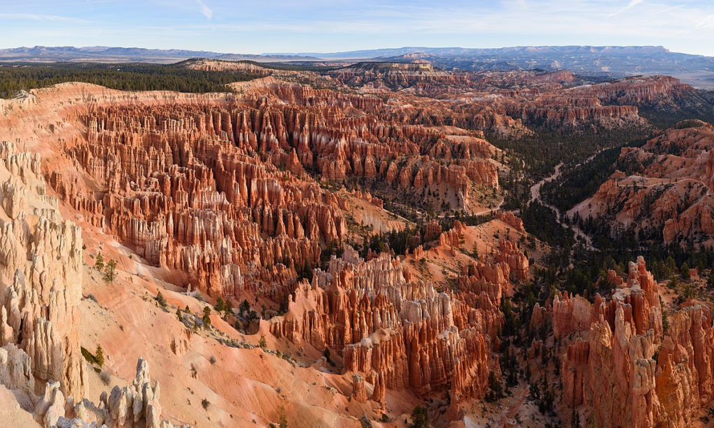
Your journey begins with a visit to Bryce Canyon National Park, renowned for its remarkable hoodoos—tall, thin spires of rock that create a surreal, otherworldly landscape. Hike along the various trails and viewpoints to witness the sunrise or sunset casting vibrant hues over the canyon. Be sure to bring your camera, as this park promises some of the most breathtaking vistas you’ll ever see.
2. Grand Staircase-Escalante National Monument
Link: Grand Staircase-Escalante National Monument
As you continue your journey, you’ll enter the expansive Grand Staircase-Escalante National Monument. This vast wilderness showcases a labyrinth of slot canyons, rugged terrains, and hidden treasures.
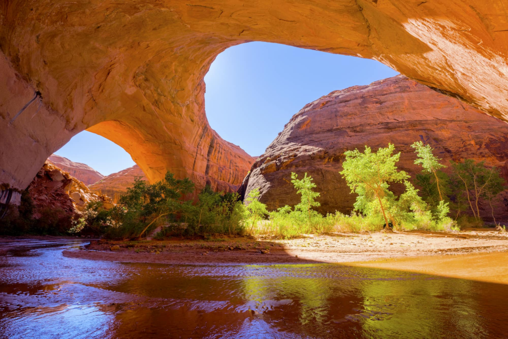
Hiking enthusiasts can explore the famous Coyote Gulch or Peek-a-Boo and Spooky Gulches for a true adventure in the heart of nature.
3. Kodachrome Basin State Park
Link: Kodachrome Basin State Park
Named after the famous Kodak film, this state park offers a kaleidoscope of colors and unique geological formations. The park features over 67 monolithic spires, making it a paradise for photographers and geology enthusiasts. Hike the Angel’s Palace Trail for panoramic views of the park, or embark on a horseback riding adventure through the vibrant desert landscape.
4. Escalante Petrified Forest State Park
Link: Escalante Petrified Forest State Park
Nature and history converge at Escalante Petrified Forest State Park. Explore the preserved petrified wood from ancient trees that once thrived here, and take a stroll around Wide Hollow Reservoir for a tranquil experience. Don’t miss the opportunity to cast your line and try your luck with fishing in the pristine waters of this serene state park.
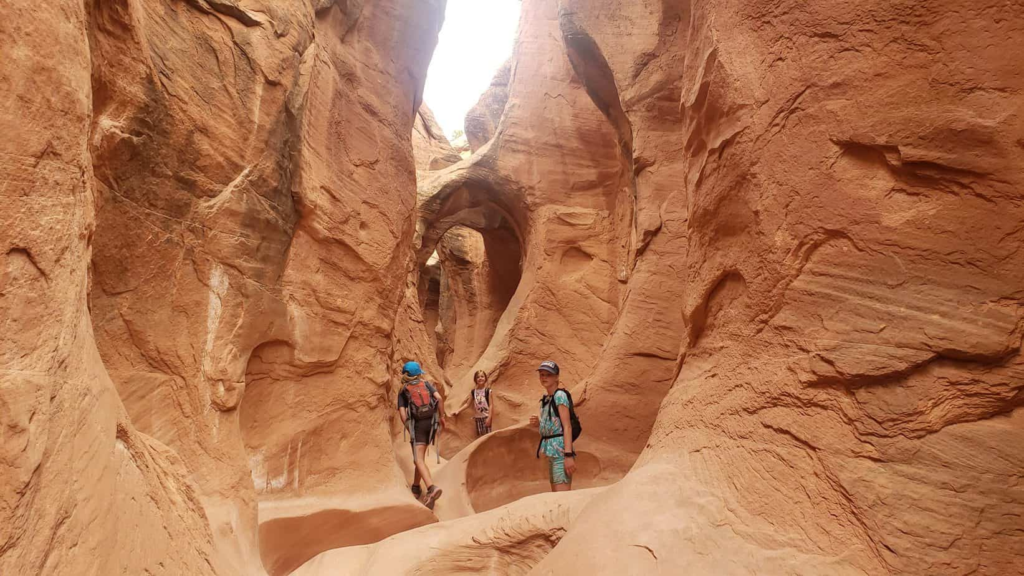
5. Capitol Reef National Park
Your road trip adventure culminates at Capitol Reef National Park, a hidden gem in the heart of Utah. Explore the Waterpocket Fold, a stunning geological feature that stretches for nearly 100 miles. Hike to Hickman Bridge or drive along the Scenic Drive to witness the incredible rock formations and ancient petroglyphs that tell the stories of the past.
Best Time to Visit
The ideal time to embark on your Route 12 road trip is during the spring and fall seasons. These periods offer pleasant weather and fewer crowds, allowing you to fully immerse yourself in the natural beauty and serenity of the journey. Spring, in particular, brings the added bonus of colorful wildflowers in full bloom, enhancing the already stunning landscapes.
1. Panguitch
Panguitch, a charming western town, is an ideal starting point for your Route 12 adventure. Stroll down its historic main street, lined with well-preserved 19th-century buildings. Don’t forget to sample some delicious pie from the local bakery before hitting the road.
Boulder, a picturesque town nestled in the mountains, is a must-visit on Route 12. Enjoy a meal at one of the cozy restaurants, explore the Anasazi State Park Museum, and soak in the small-town charm that this hidden gem exudes.
Torrey serves as the gateway to Capitol Reef National Park. It’s a great place to refuel and relax before your exploration of the park. Check out the local art galleries and savor a meal at one of the town’s renowned restaurants.
Route Details
Day 1: starting point – panguitch.
Your Route 12 adventure commences in the charming town of Panguitch, where you can stock up on supplies and immerse yourself in the town’s historic ambiance. Spend the afternoon exploring the local shops and enjoy a hearty meal at one of the restaurants.
Day 2: Bryce Canyon National Park
Your journey truly begins with a visit to Bryce Canyon National Park, renowned for its remarkable hoodoos—tall, thin spires of rock that create a surreal, otherworldly landscape. Hike along the various trails and viewpoints to witness the sunrise or sunset casting vibrant hues over the canyon. Be sure to bring your camera, as this park promises some of the most breathtaking vistas you’ll ever see.
Day 3: Escalante
Continue eastward, and you’ll reach the town of Escalante, an ideal place to rest and refuel. Consider exploring the Grand Staircase-Escalante National Monument while you’re in the area. The vast wilderness showcases a labyrinth of slot canyons, rugged terrains, and hidden treasures. Hiking enthusiasts can explore the famous Coyote Gulch or Peek-a-Boo and Spooky Gulches for a true adventure in the heart of nature.
Day 4: Boulder
Travel south from Escalante to Boulder, a town that embodies the essence of mountain serenity. Enjoy a meal at one of the local restaurants, explore the Anasazi State Park Museum, and soak in the small-town charm that this hidden gem exudes.
Day 5: Capitol Reef National Park
Day 6: ending point – torrey.
Complete your Route 12 adventure in the town of Torrey, which serves as the gateway to Capitol Reef National Park. It’s a great place to refuel and relax before your exploration of the park. Check out the local art galleries and savor a meal at one of the town’s renowned restaurants.
Places to Stay with a Campervan or RV
1. bryce canyon pines rv park.
Link: Bryce Canyon Pines RV Park
Located near Bryce Canyon National Park, this RV park offers full hookups and a convenient location for exploring the park. Enjoy the serene surroundings and the convenience of being close to the park’s entrance.
2. Wonderland RV Park
Link: Wonderland RV Park
Situated in Torrey, Wonderland RV Park provides a peaceful and well-maintained setting. It’s the perfect spot to unwind after your adventures in Capitol Reef National Park.
3. Calf Creek Campground
Link: Calf Creek Campground
For a more rustic camping experience, consider Calf Creek Campground near Boulder. It’s nestled in the stunning wilderness and offers a unique opportunity to immerse yourself in nature.
4. Thousand Lakes RV Park
Link: Thousand Lakes RV Park
Located in Torrey, Thousand Lakes RV Park offers stunning views of the surrounding red rock formations. It’s a tranquil spot to relax and enjoy the natural beauty of the area.
5. Fruita Campground
Link: Fruita Campground
If you plan to spend more time in Capitol Reef National Park, Fruita Campground is an excellent choice. It offers a convenient location within the park, allowing you to fully immerse yourself in the park’s beauty.
Route 12 in Utah
Embarking on a road trip along Route 12 in Utah is an adventure of a lifetime. With its stunning natural wonders, historical sites, and charming towns, this journey promises unforgettable memories. Whether you’re traveling in an RV or campervan, the diverse landscapes and key stops along the way will leave you in awe. So, pack your bags, hit the open road, and prepare to be amazed by the wonders of Route 12!
- Skip to content
- Skip to primary sidebar
Tips For Family Trips
Start planning your dream trip today
7 Adventure Stops Along Utah’s Scenic Byway 12
Southwestern Utah / August 27, 2018 by Jason / Leave a Comment This article may contain sponsored content or affiliate links.
Hey Adventurers,
It's Jason with Carltonaut's Travel Tips . Since I was a kid, my family has taken an annual vacation to Escalante, Utah, located along Utah's Scenic Byway 12. As a kid, our trip consisted of fishing, camping, hiking and watching an amazing small-town Pioneer Day parade in July. Now that I'm older, I enjoy taking my kids on adventures that span from Panguitch to Boulder. The route is not only scenic, but if you know where to stop, you'll be able to have a lot of family adventures in some of the world's most beautiful country.
Here are 7 stops for a fun family road trip on Utah's Scenic Byway 12.

If you've ever wondered where the engineers of Big Thunder Mountain in Disneyland got their inspiration, wonder no more. A drive through Red Canyon makes you feel like you're looking at the formations of the roller coaster. In fact, Red Canyon has Thunder Mountain Trail. So it's the perfect stop for any Disney fan.
As a kid, we never stopped in Red Canyon – except to take the obligatory photo in front of one of the two small tunnels. As an adult, I've spotted a bike path alongside the road and am determined to get down there with my wife to take a ride.
You can spend a few minutes in the Visitor Center to learn more about the geology and features of the area. You can decide which trail you want to take if you're looking for a hike. Or you can simply grab a quick souvenir and hop back in the car. But if Red Canyon looks this cool from the roadway, imagine how spectacular it would look as you explore it along a trail.
There is no cost to stop and explore Red Canyon.

Bryce Canyon National Park
Bryce Canyon National Park is one of the five parks in Utah. Visitors travel from all over the world to explore the trails and viewpoints scattered throughout the park. You could spend days exploring the park, but if you only have a few hours, here are three things I would recommend:
- Visitor Center: There are a few reasons to start at the Visitor Center. First, you can talk to a Ranger about the trail you want to take. They can offer some great advice. The other, almost more important reason to stop: You can fill up all your water bottles. Bryce Canyon is hot, and if you don't have adequate water with you as you're exploring, you may find yourself in trouble.
- Rim Trail: Park near Sunrise Point and make your way south along the Rim Trail. There are great views of the orange and red rocks scattered below. You can hike the Rim Trail as far as you want to go. It does reach Sunset Point, so if you want to hike from Sunrise Point to Sunset Point, then take the Navajo Loop Trail, you can.
- Navajo Loop Trail: Park at Sunset Point and make your way to the trailhead. You can start the Navajo Loop Trail one of two ways: hiking down some switchbacks toward wall street; or starting with a view of Thor's Hammer. The advantage to starting with the steep switchbacks is that you don't have to hike them at the end of your hike along the loop. There are lots of families who take the hike, so it's okay for kids and adults.
There is a National Park entrance fee for Bryce Canyon National Park – $35 per vehicle. If you plan to visit multiple national parks, you should consider buying an National Parks Annual Pass.

Kodachrome Basin State Park
Kodachrome Basin State Park makes for an excellent day trip along Utah's Scenic Byway 12. There are multiple trails, each one offering spectacular views of the colorful cliffs, sandpipes, box canyons and more.
One trail that brings you through some of the most spectacular scenery is the 2.9-mile Panorama Trail. You can also keep an eye out for lizards, birds, scorpions and other wildlife.
If you want to spend more time at the park, you can grab a campsite in the full-service campground.
One interesting fact about the park: The National Geographic Society Expedition named the park in honor of the then revolutionary Kodak film. There's also a song by Paul Simon, Kodachrome, that is bound to get stuck in your head as you explore the park.
There is an entrance fee to visit the park – $8 per vehicle. You can purchase a Utah State Parks annual day pass if you plan to visit any one of the 40+ Utah State Parks. Three of them are easily accessible from Utah's Scenic Byway 12.

Escalante Petrified Forest State Park
The forest may be petrified, but you shouldn't be scared.The Escalante Petrified Forest State Park may be small, but it offers a full-service campground, access to a reservoir (if you like boating, kayaking, swimming or fishing), and hiking.
If hiking's your thing, stop in the Visitor Center and grab a Nature Trail Guide before heading up the roughly one-mile trail. There's adequate parking at the trailhead. Along the trail, there are signs with numbers on them that coincide with numbers in the guide. You can learn about foliage, rock formations, minerals and of course, petrified wood. The trail offers a great view of the city of Escalante and Wide Hollow Reservoir below.
Petrified wood are fossilized trees from millions of years ago. While they look like rocks from a distance, as you get closer you can see the features of the wood. The colors in the petrified wood are amazing and unique. Along the trail, you'll find logs that have been petrified and laying there for you to look at. Keep in mind, it's illegal to take petrified wood from the state park.
There is an entrance fee to the Escalante Petrified Forest State Park – $8 per vehicle.

Devil's Garden
An hour in the Devil's Garden is sure to entertain the kiddos. There are no hiking trails, but rather rock formations that are longing to be explored. You'll find Metate Arch and a few hoodoos in the garden. It's the perfect stop for a picnic lunch or to let the kids get their wiggles out.
The Devil's Garden is 12 miles down Hole in the Rock road, a short drive off of Utah's Scenic Byway 12. The road is dirt, but well managed in the summer months. So almost any vehicle can make the drive.
There is no fee to enter the Devil's Garden.
Calf Creek Recreation Area
A very popular spot, especially following the Pioneer Day parade in Escalante, the Calf Creek Recreation Area is a fun water stop. There are 13 campsites, which are all first-come, first-served. They are located along the creek. But if you're just planning to stop over for some fun, that's okay, too.
Calf Creek is a shallow creek that can easily be explored. Near the campground, a small dam has been built to provide a shallow pool of water for people wanting to immerse themselves in the water. Otherwise, the creek is about one foot deep, making it the equivalent of a splash pad – without the water spouts.
Water shoes are great to have, but not required.
If you're in the mood for a hike, the 6-mile roundtrip moderately strenuous hike to Calf Creek Falls is a must do. The falls are iconic to the Grand Staircase-Escalante National Monument and one you won't regret doing. Just be sure to bring a lot of water with you. The last thing you need it to end up dehydrated along a trail in the middle of summer.
There is a $15 fee for camping, but I've also been charged a day-use fee when I've been down there around the 24th of July holiday.

Anasazi State Park Museum
The Anasazi State Park Museum is another quick stop along Utah's Scenic Byway 12. You'll find a museum with artifacts, interactive exhibits and information about the Anasazi people who once lived in the area.
Just behind the visitor center is a replica of a native American dwelling. There are multiple rooms to explore, but if you're tall, you'll likely be hunched over. The ceilings aren't very high.
After exploring the dwelling, you can venture along the path and see the foundation footprints of the small village that was built here in Boulder, Utah. The inhabitants burnt the dwellings when they abandoned it in about 1175 A.D. The pit house they have there as well is neat to see.
If you're interested in having your kids do the Junior Ranger Program at the museum, be sure and ask for the booklet at the front desk.
There is an entrance fee to the Anasazi State Park Museum – $10 for a family.

Other Activities Along Utah's Scenic Byway 12
There are other fun places to stop along Utah's Scenic Byway 12. They include:
- Escalante River Trailhead
- Grand Staircase-Escalante National Monument Visitor Center
- Hell's Backbone road
- Slot canyons along Hole in the Rock road
- The Hogsback
- Upper Valley Granaries
A roadtrip along Utah's Scenic Byway 12 can be a single day trip with a few stops, or you can turn it into a few days and really get a taste for the beauty Utah's wilderness has to offer.

Thanks for Sharing!
Reader Interactions
Have a question or comment add it here. cancel reply.
This site uses Akismet to reduce spam. Learn how your comment data is processed .


Driving Utah Scenic Byway 12 in 2024
Scenic Byway 12 spans a route of 123 miles in southern Utah, and travels through some of the most diverse, remote and ruggedly beautiful landscapes in the country. It has been designated an "All-American Road".
It runs through Utah's Garfield and Wayne Counties and is home to two national parks, three state parks, a national recreation area, a national monument, and a national forest. The road climbs from 5,223 feet to 9,636 feet above sea level.
Highway 12 passes through Red Canyon, Bryce Canyon National Park, Grand Staircase-Escalante National Monument and over Boulder Mountain in the Dixie National Forest to its termination in Torrey near the entrance to Capitol Reef National Park.
It is a popular connecting road for tourists visiting both Bryce Canyon and Capitol Reef national parks.
From the west, it begins between Hatch and Panguitch, on U.S. Highway 89, and travels mostly northeast through Bryce Canyon City, Tropic, Cannonville, Henrieville, Escalante and Boulder, ending in Torrey with the byway's intersection with Utah 24.
The road is open year-round, but after major winter storms, sections might be impassible until plowed.
Below we take a road trip on Scenic Byway 12, starting from the west end of the road, and highlighting some of our own original photos we have taken during our many trips on Byway 12!
The Start of Scenic Byway 12 Near Panguitch and Hatch
Panguitch is located along Highway 89, 7 miles north of the junction with Scenic Byway 12.
We have toured Panguitch, and spent overnight stays there as well. It is a great jumping off locale for tourists to Bryce Canyon, Scenic Byway 12 and Zion National Park.
The city offers a wide range of services to visitors, including lodging, dining, automobile services, museums, campgrounds, a hospital, library and much more.
Read Panguitch lodging reviews, check availability and make reservations via TripAdvisor
Visit the City of Panguitch website
Hatch is located next to the winding Sevier River on Highway 89, 8 miles south of the junction with Scenic Byway 12.
The town offers tourist services and various lodging options, fishing venues and campgrounds.
Read Hatch lodging reviews, check availability and make reservations via TripAdvisor

In addition to its scenery, Red Canyon offers many easily accessible hiking and bicycling trails, a campground and a U.S. Forest Service Visitor Center.
It is located directly on Utah 12.
Shown below is the arch over Utah Scenic Highway 12 at Red Canyon, a recreation area managed at the U.S. Forest Service ... 13 miles west of the entrance to Bryce Canyon National Park.
A "must see" stop for visitors to Utah driving Byway 12 ... Bryce Canyon National Park
Located in the southwestern section of Utah not far from Scenic Byway 12, Bryce Canyon features the largest collection of hoodoos, odd-shaped pillars of rock left standing from the forces of erosion, in the world.
Read more about Bryce Canyon National Park
Tropic, Cannonville and Henrieville
As Utah 12 continues east, it passes through the pleasant town of Tropic . Tropic is one of three towns in Bryce Valley along Scenic Byway 12. It offers more than a dozen lodging options.
Only 11 miles from the east entrance of Bryce Canyon National Park, this thriving ranching community is the perfect place to stay when you want to explore Bryce Canyon Country.
Further along is the town of Cannonville , home to the annual Old Time Fiddlers and Bear Festival. Just a short distance to both Bryce Canyon National Park and Kodachrome Basin State Park, Cannonville is an ideal base for a number of outdoor adventures and tours. Cannonville offers a variety of lodging, inns, haciendas and campgrounds.
Originally settled in the 1870s, the town of Henrieville retains much of its pioneer charm, and is conveniently located to man Byway 12 attractions.
Cottonwood Canyon, Kodachrome Basin and Grosvenor Arch
Cottonwood Canyon Scenic Backway runs for 46 miles traversing southward through Grand Staircase-Escalante National Monument from Cannonville to Highway 89.
The road is paved for 9 miles between Cannonville and the turn to Kodachrome Basin State Park.
Then the road is graded dirt with an underlying clay base making it impassable when wet.
Kodachrome Basin was named during the late 1940s by a National Geographic Society Expedition in honor of the then popular Kodak film.
The park offers unusual geological forms, including a series of upright cylindrical chimneys called sand pipes.

Grosvenor Arch

The Grosvenor Arch is located within Grand Staircase-Escalante National Monument, near Escalante and close to and south of Kodachrome Basin State Park. It is accessed from the north or south via Road 400, a dirt road that traverses Cottonwood Canyon in the western portion of the national monument.
Escalante is often called the Heart of Scenic Byway 12 as it lies between the meadows of the Aquarius and Kaiparowits Plateaus and the low desert country surrounding the Escalante Canyons.
Read Escalante lodging reviews, check availability and make reservations via TripAdvisor

Escalante Interagency Visitor Center
The Visitor Center is a great stop while driving the Byway, and offers information, educational displays, water, movie and auditorium, picnic tables, rest rooms, and a gift shop.
It is located at 755 West Main in Escalante. Phone 435.826.5499
More information about the Escalante Visitor Center
Hole-in-the-Rock Road
Beginning 5 miles east of Escalante off Scenic Byway12, the 57-mile-long Hole-in-the-Rock Road is a gravel and dirt road that follows the route taken by Mormon pioneers in 1879-80 in an attempt to establish a shortcut across the Colorado River.
Today, Hole-in-the-Rock Road provides access to a number of recreational and historic sites.

Head of the Rocks Overlook
Head of the Rocks Overlook provides expansive views across the Escalante Canyons as well as the meandering path of Scenic Byway 12 below.
A popular stopping point, plenty of free parking is provided.

The Hogsback
Between Calf Creek Recreation Area and Boulder Town is an internationally famous stretch of byway known as “ The Hogsback .”
The terrain drops steeply off to each side of the road's hairpin turns toward the creeks and canyons below.
Driving is slow and cautious, but the vistas are incredible.
Boulder Town
Boulder Town was long known as the last frontier in Utah, as the town was isolated until 1935, and mail was delivered by horseback rider and fresh milk was delivered by mules.
Anasazi State Park Museum is located in town on the site of an Ancestral Puebloan habitation that archaeologists believe was occupied between A.D. 1050 and 1175.
Boulder takes its name from nearby Boulder Mountain, a vast timbered plateau of the Dixie National Forest that rises to 11,316 feet.
The Boulder population today totals about 180 residents.

The area offers bountiful camping, off-roading, hiking and other outdoor activities and options.
Several lodging and dining options are available in Boulder.
Burr Trail Scenic Backway
The Burr Trail, which begins at Boulder, and ends at Bullfrog, is one of our favorite back roads in the country.
We have driven it several times, sometimes in a 4x4 Jeep, other times in a 2WD Toyota 4Runner.
It is typically quiet, with little or no traffic. In earlier years the entire length of the road was dirt; today parts are paved.
The drive and views are stunning! The switchbacks are breathtaking!
The road which connects Boulder with Bullfrog passes through the painted rock country of Glen Canyon National Recreation Area, Capitol Reef National Park, and Grand Staircase-Escalante National Monument.

Read more about the Burr Trail
Driving time from the Bullfrog Visitor Center to Boulder is about 2 hours, while continuing on to the Escalante Visitor Center will make the total trip about 3 hours. The trip can take longer depending on how many stops are made along the way. Part of the trail is paved, the unpaved part is accessible via a typical passenger car most times of the year. One way mileage is approximately 67 miles. About 30 miles are paved.
Hell's Backbone Road
Construction of Hell's Backbone Road was completed in 1933 by Civilian Conservation Corps (CCC), allowing vehicle traffic between Escalante and Boulder for the first time.
Hell's Backbone Bridge offers great photo ops as it passes above Sand Creek with views of the spectacular Box-Death Hollow Wilderness Area.
Seen to the right is a sign about the history of the Hell's Backbone Road.
Torrey on Highway 24
As it winds along the east banks of Boulder Mountain, Scenic Byway 12 climbs to an altitude of more than 9,000 feet and presents breathtaking views of the rugged landscape stretching out below. Thousands of Aspen trees offer color in the summer and fall.
Torrey is the Eastern Gateway to Scenic Byway 12 and lies about 9 miles west of Capitol Reef National Park. It was settled in the 1880s
The Wayne County Travel Council and U.S. Forest Service Visitor Information Center are located in Torrey, and provide maps, brochures, and area travel information.
Read Torrey lodging reviews, check availability and make reservations via TripAdvisor
The Capitol Reef Visitor Center , constructed of native stone and located just east of Torrey, provides information on travel, weather, trails, and backcountry conditions. A short orientation video is shown in the small theatre.

The most popular feature of Capitol Reef National Park is the Waterpocket Fold, a 100-mile-long monocline, or fold, in the Earth's crust that towers as much as 2,000 feet above its eastern base.
The Notom Road Scenic Backway leaves from Highway 24, along the east side of Capitol Reef National Park to the junction of Burr Trail Road in the southern section of the Park. Allow up to two hours to make the trip.
Map of Utah Scenic Byway 12

Interactive Map of Utah Scenic Byway 12
More Information about Scenic Byway 12
Scenic ByWay 12 Foundation website at www.ScenicByway12.com Scenic Byway 12 on VisitUtah.com website
More About the Burr Trail
Read more about the Burr Trail, with photographs, travel information and maps Burr Trail at the ScenicByway12.com website Burr Trail on the Glen Canyon National Recreation area official website at NPS
More Information About Boulder
BoulderUtah.com website Boulder on VisitUtah.com website Read more about the community of Boulder Utah on this website
More Information about Bryce Canyon
Bryce Canyon National Park official website at NPS > The address of the park is P.O. Box 640201, Bryce, UT 84764. Phone 435.834.5322 Bryce Canyon National Park at Utah.com Bryce Canyon National Park at VisitUtah.com
SITE MAP | PRIVACY POLICY | TERMS OF USE | CONTACT US
Copyright © 2024 • RoadTravelAmerica.com • All Rights Reserved
- Things To Do
- Top Road Cycle Touring Routes
- Cycling All-American Road: Scenic Byway 12
Scenic Byway 12
There’s perhaps no more scenic road in America than Southern Utah’s All-American Road: Scenic Byway 12, a designated scenic byway, part of the U.S. Bicycle Route System and one of only 31 All-American Roads in the country. This 124-mile ride will bring you past brilliant red rock, towering forests, two national parks, one national monument, and seven charming small towns. The pros at Larry H. Miller Tour of Utah can complete it in just five hours, but taking your time and riding it as a multi-day tour allows you to take in the otherworldly landscapes and majestic scenery.
Here’s the best way to experience Highway 12 from the seat of a bike.
Day 1: Panguitch to Bryce Canyon, 16 miles
Named for the colorful hoodoos and spires that line the Byway, this first stretch of Highway 12 is the beginning of the Dixie National Forest and gateway to Bryce National Park. While the road here can be narrow at times, cyclists can stay safely off of it thanks to the Red Canyon five-mile paved path, which runs parallel to the road through pines, spruce, and red rock formations.
The ride starts at the beginning of Highway 12 in Panguitch and climbs pretty steadily to Bryce Canyon City, one of Utah’s newest towns. Along the ride take in the glorious views of Red Canyon and the Dixie National Forest — and much of the ride is on a protected bike lane, which makes the stretch of the U.S. Bicycle Route System ideal for families. Grab a snack or refill water at Bryce Canyon City before continuing the last three miles to the entrance of Bryce Canyon National Park .
Take in the majestic hoodoos of this national park from stunning viewpoints right off the road, or ride through the park on your bike to add on mileage. You can also park your bike and try out any of the 50 miles of hiking trails that will bring you up close to these impressive formations.
Where to Eat and Stay: Only 25 miles from Bryce Canyon National Park, Panguitch is an ideal base camp for exploring the Byway’s wonders. Historic buildings and western shopping are fun tourist diversions, and cyclists can choose to stay at the KOA’s rustic cabin or campground sites and have free access to daily hot showers and a swimming pool.
Historic Ruby’s Inn, the closest lodging to Bryce National Park, is the place to stock up on any groceries or gear you may need thanks to their huge gift shop, rock shop, and general store. Stay in their comfortable hotel rooms, or ‘rough it’ in cabin, tent, or tipi lodging just next door. No electricity or beds are included in the tipis so you’ll need camping gear to enjoy this experience. Restrooms, showers, and pool use included. Experience old-fashioned cowboy cuisine, music, and entertainment at nearby Ebenezer’s Barn and Grill, which is open seasonally April-October.
Day 2: Bryce to Escalante, ~48 miles
From Bryce, you’ll ride downhill 10 miles, into Bryce Valley to the town of Tropic , so named because settlers claimed the climate was more temperate than nearby towns. Make a stop at the visitor center in the pioneer-founded town of Cannonville for maps or information. And if you have time, take a 7-mile paved road detour to visit colorful Kodachrome Basin State Park, home to 67 dazzling stone spires.
Back on the Byway, pedal on to the small town of Henrieville before climbing about 30 miles through the Dixie National Forest to reach the town of Escalante and Grand Staircase–Escalante National Monument.
Where to Eat and Stay: Escalante Outfitters — just 50 miles east of Bryce Canyon National Park on Scenic Byway 12 — sits at the halfway point of you cycling adventure and is your one-stop shop for lodging, dining, and gear. Furnished cabins with common bathrooms and showers are available for as low as $50 a night. You’ll want to write home about their stellar breakfast menu and handcrafted, gourmet pizza.
Day 3: Escalante to Boulder, ~27 miles (4,000 feet of elevation gain)
Riding from Escalante to Boulder is a challenging, but beautiful ride. On your way out of Escalante, ride past unique geological formations and across the Escalante River, fueling up at Kiva Koffeehouse if needed. Continue riding through Grand Staircase–Escalante National Monument, past Calf Creek Falls (one of the area’s best hikes), and up the steep famed Hogsback.
This spine’s sheer drops and stunning vistas make it a highlight of the Byway, but you’ll need cardiovascular endurance to reach the summit. Once you do, scenic pull-offs let you take in the colorful cliff formations from this small ridge of paved slickrock.
Where to Eat and Stay: Farm-to-table organic eatery, Hell’s Backbone Grill, and hip, locally owned Burr Trail Grill — both in Boulder — are the region’s best-known eateries and specialize in modern American cuisine. They source ingredients locally whenever possible and both are located right along Scenic Byway 12.
Treat yourself by staying at the gorgeous, luxurious Boulder Mountain Lodge, home of Hell’s Backbone Grill. The Lodge overlooks an 11-acre bird sanctuary with lake views. Fully relax in the hot tub or warming up around the fire pit.
Day 4: Boulder to Torrey and Capitol Reef National Park, ~36 miles
Once rejuvenated from your stay at Boulder Mountain Lodge, get back on the S.R. 12 and cycle toward Capitol Reef National Park . As you pass Anasazi State Park Museum , stop and explore an Ancestral Puebloan village and its artifacts. Then it’s back to climbing Boulder Mountain.
You’ll climb through the Dixie National Forest past massive aspen stands, vibrant spruces and pines, and small mountain lakes before reaching the Homestead Overlook at 9,400 feet. See views of Capitol Reef’s famous Waterpocket Fold and the Henry Mountain’s five peaks before descending to the town of Torrey , a gateway to Capitol Reef National Park.
Park your bikes in town and fuel up on coffee and cuisine, or ride a slightly uphill road 9 miles east into the park. If your legs can take it, this stunning stretch of highway showcases Capitol Reef’s varicolored sandstone cliffs, massive red rock outcroppings, and historic fruit orchards, and shouldn’t be missed.
Where to Eat and Stay: Awe-inspiring patio views of Capitol Reef National Park and fine or casual dining options, as well as lodging, makes Rim Rock Inn and Restaurant your all-in-one option in Torrey. The pizza and local beer selections are on point, and there’s even a disc golf course out back. Take advantage of their free WiFi here as cell service is spotty at best in this national park.
Campers should arrive early enough to secure a site in the park’s only developed campground, Fruita, a lush oasis in the desert filled with mature fruit trees. While in Capitol Reef, pick and eat peaches, apricots, pears, and apples from these orchards for free — paying only if you take fruit outside the park.
Riding the length of Scenic Byway 12 is 124 miles with elevation ranging from 5,223 feet to 9,636 feet above sea level, and there are enough ups and downs to challenge any cyclist. When riding in summer, expect hot temperatures while pedaling through Utah’s deserts, although cycling in Bryce Canyon National Park can be cool as the elevation is much higher there — about 9,000 feet. Please take note, the rapidly changing elevation can be challenging for those coming from sea level, so take time to let your body adjust, drink plenty of water, eat healthy and take breaks to prevent altitude sickness.
Well-prepared travel is responsible travel.
Do your part by planning ahead

Scenic Byway Route 12
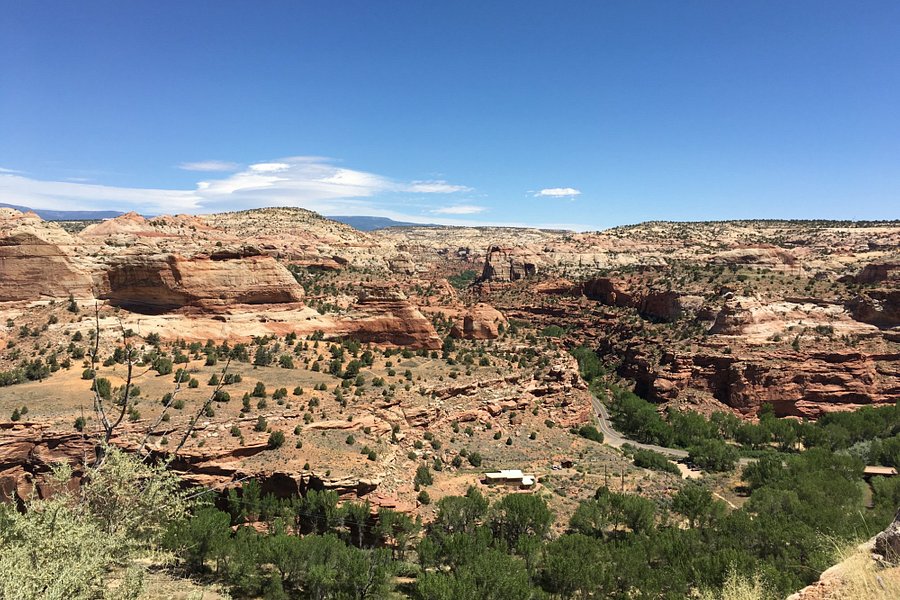
Top ways to experience Scenic Byway Route 12 and nearby attractions
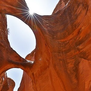
Most Recent: Reviews ordered by most recent publish date in descending order.
Detailed Reviews: Reviews ordered by recency and descriptiveness of user-identified themes such as wait time, length of visit, general tips, and location information.

Also popular with travelers
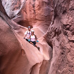
Scenic Byway Route 12 - All You Need to Know BEFORE You Go (2024)
- (2.27 mi) Entrada Escalante Lodge
- (1.69 mi) Slot Canyons Inn
- (2.03 mi) Escalante Cabins & RV Park
- (2.89 mi) The Loubird Inn
- (3.44 mi) Escalante Yurts
- (2.44 mi) Escalante Outfitters Cafe
- (2.54 mi) Escalante mercantile
- (3.07 mi) Magnolias Kitchen
- (2.29 mi) Circle D Eatery
- (2.58 mi) Mimi's Bakery & Deli

How to do the great American road trip: Idaho and Utah
N othing prepared us for the mountain vistas of Utah ; not Yellowstone, not Glacier National Park, nor any of the magnificent scenic areas we had visited on the first four months of our grand US RV tour.
Utah took the sum of all that we had witnessed on the initial 4,635 miles from Florida to America’s Great West and turned it into an elegant equation of ultimate grandeur, a mountainous melting pot for the ages.
Our usual WPMs (Wows per Minute) were replaced by OMGs as we encountered a spectacular mix of 12 national parks and monuments that simply demanded we recalibrate our vocabulary and turn it all the way up to 11.
- Read part one of Diaries from the Road here
- Read part two of Diaries from the Road here
- Read part three of Diaries from the Road here
- Read part four of Diaries from the Road here
We’d had a pretty good tune-up, mind you. After leaving the wilds of beautiful, immense Wyoming behind, we had reached southern Idaho – via motorways I-80 and I-84 – and two unique geological marvels that immediately set our pulses racing as they filled our windscreen, twin exemplars of what was to come.
City of Rocks National Reserve presented an outlandish terrain of granite monoliths several hundred feet high and spread across 22 square miles, a rocky labyrinth of bewildering proportions but ideal for rock climbers and hikers alike. For once, our luck with the weather went awry, though – a sudden, huge thunderstorm sent us scrambling for cover.
Happily, we discovered the pizza perfection of Rock City Mercantile in the adjacent town of Almo, and devoured a magnificent 12-inch pizza, washed down by two excellent craft ales from the local Highlander Beer brewery, as we sat in our car and let the lightning rage around us.
Read more on USA travel :
- How to do the great American road trip: Florida to Minnesota
- Nine best USA holidays for the ultimate American experiences
- USA travel guide: Everything you need to know before you go
The next day took us to another planet. Craters of the Moon National Monument & Preserve burst out of the ground like the lunar landscape that inspired its name. Here, amid 15,000-year-old cinder cones, lava tubes and volcanic discharge, we goggled at the dark, alien shapes that proliferated across the 53-mile Great Rift, a lurking subterranean fissure that remains dormant but not extinct.
The tumultuous Snake River, a historic waterway that has sliced a startling 80-mile canyon through the basaltic substrate, also cut right across our route. The city of Twin Falls, where Evel Knievel famously failed to leap its 1,600ft width in 1974, straddles the canyon at one point.
Here, amid 15,000-year-old cinder cones, lava tubes and volcanic discharge, we goggled at the dark, alien shapes that proliferated across the 53-mile Great Rift
Today, Twin Falls offers the massive Perrine Bridge , with its steel span 485ft above the river. It’s loved by base-jumpers as a place to test their parachuting mettle by attempting to hit a prepared target on the south bank rather than the oily green waters of the river itself. For several hours we watched, amazed, as jumpers leapt off a minuscule platform halfway across the bridge and pulled their ripcords just in time to land gracefully on terra firma. We were even more impressed that many then opted to mountaineer their way back up the canyon, with ’chutes carefully packed, ready for another jump.
From Idaho, we headed down I-15 to Utah. Knowing the state’s mountain profile, we were wary of journeying too far off the highway in our RV, Indefatigable (or Fati for short), with the Rockies forming a major challenge for heavyweight traffic down the spine of the state.
Instead, we identified three bases from which we could explore further in our car, Nippy . The first of these was Layton, just north of Salt Lake City. With access to the Great Salt Lake, the birding Mecca of Antelope Island State Park and great hiking into the Rockies, Valley View RV Resort provided the perfect launch point.
Here, we enjoyed pickleball, swimming in the resort pool, and dining from visiting food trucks, while also learning the bizarre history of Antelope Island, where prehistoric peoples first appeared 6,000 years ago before it became a Mormon ranch and then a bison-hunting preserve. The bison still roam, but the only hunting is done by photographers keen to snap the 250 species of bird that make their homes by the thousand, including ring-necked pheasants, burrowing owls, California quails and peregrine falcons.
A 19th-century counterpoint was provided by Golden Spike National Historic Park , an unexpected outdoor homage to the pivotal moment in US history when the country was united by the first transcontinental railroad in 1869. The story is beautifully presented and celebrated daily with a reconstruction of that momentous occasion, complete with reconditioned steam trains.
Thick ponderosa pine forest guarded the entrance, and then, Bam! Blockbuster view after blockbuster view filled our sights in a non-stop cavalcade of canyon-esque wonders
Our second stop along I-15 was a golf course, and an exceedingly smart one, too. With a section of redundant car park reconfigured with 37 RV sites, Gladstan Golf Course in Payson opened the way to Utah’s hinterland via US Highway 6, a key route through the Rockies.
We had long decided this was a mountain road too far for Fati , but we were confident in Nippy and set our sights on the desert town of Green River for a three-day stopover that would put us on the doorstep of four national and state parks.
The charming River Terrace Inn provided a boutique bolthole at the end of each day as we chalked up 739 miles of epic exploring, starting with the astounding Goblin Valley State Park – a kaleidoscopic collection of hoodoos, or eroded rock spires – and finishing with the magnificent Arches National Park , a stupendous realm of weather-sculpted sandstone that defied the imagination. It felt more like a landscape created by Gaudi, Da Vinci or Van Gogh rather than Mother Nature.
In between, we toured Canyonlands National Park, with its stunning plateau views that appeared to stretch to the horizon, and the more modest but still compelling Potash Road , rife with 1,000-year-old petroglyphs, prehistoric dinosaur tracks, and awesome windows into the seemingly endless canyons. For hiking, Little Wild Horse Canyon provided close-ups of the more human-scale slot-canyon formations.
Heading back to Payson along Highway 6 via Soldier Summit – the 7,493ft-high pass through the Rockies – the return journey seemed even more dramatic as the landscape transitioned from the stark high desert of the Colorado Plateau to the river canyon of Castle Gate, then the red sandstone cliffs of the towering Wasatch Mountains, complete with pine and cottonwood forests.
After reuniting with Fati we headed south to Cedar City, hoping for more national park splendour. We weren’t disappointed.
From Cedar City RV Resort , we were able to cruise along Highway 12, designated an All-American Road, which started with the impressive cliffs of the Red Canyon and blossomed into the steepling immensity of Bryce Canyon National Park , where every turn revealed a majestic new vista. Thick ponderosa pine forest guarded the entrance, and then, Bam! Blockbuster view after blockbuster view filled our sights in a non-stop cavalcade of canyon-esque wonders.
At the 9,115ft finale of Rainbow Point, we simply stood staring in awe at this multicoloured colossus, a panorama of staggering dimensions that tailed off into the far distance, testament to a “wind, water and time” scenario that defied any human scale.
Equally captivating was Cedar Breaks National Monument , which took us over 10,000ft and delivered its own symphony of weathered wonders, while Parowan Gap took the opposite tack and laced its river-hewn cliffs with mysterious petroglyphs, mute signs of the art and symbolism of the Fremont peoples, who date back almost 5,000 years.
Like Yellowstone and Wyoming, Utah captured our hearts in ways both expected and unforeseen – with inspiring scenery, pristine wilderness and age-old wildlife, but also with cute towns and a level of genuine friendliness that seemed to stem from its Mormon foundations.
There were also the freight trains. Very long freight trains. We measured one at more than a mile as it chugged stoically through the emptiness of the Great Basin, part of the high desert plain that shape-shifted in subtle ways as we headed south through a beguiling mix of quixotic terrains.
After the relaxed affability of Utah, we wondered how the gambling mindset of Sin City would compare...
Next stops: Nevada and Southern California ...
How to do it
- Learn the measurements of your RV by heart, especially the height and width, to avoid low bridges and narrow lanes. Our Winnebago Sightseer is 36ft long, 12.5ft high and 8.5ft wide.
- Use a specialist RV GPS for mapping journeys, not the one on your phone (which might direct you on a route unsuitable for long or high vehicles). We have the Garmin 890.
RV fact file
- El Monte RV Rentals has a rental base in Salt Lake City, Utah , which is ideal for touring this part of the world.
- When things go wrong, consult myrvresource.com .
Read more on the best USA hotel reviews
From news to politics, travel to sport, culture to climate – The Independent has a host of free newsletters to suit your interests. To find the stories you want to read, and more, in your inbox, click here .

IMAGES
VIDEO
COMMENTS
Utah's Scenic Byway 12 begins in Panguitch ( 37.749625, -112.376541) in the west and ends in Torrey ( 38.298762, -111.402073) to the northeast. It can be enjoyed by driving either east or west — or both, multiple times. The road is open year-round, but after major winter storms, sections might be impassible until plowed, and ice can make ...
The Best Stops on a Highway 12 Utah Road Trip. Here are some highlights of this fabulous road trip on Scenic Byway 12 - an absolute must for everyone who wants to fall hopelessly in love with the open road. Panguitch and Red Canyon. ... Heading east on route 12 in Utah, you will just start to get into your driving groove when you will spot a ...
A State Road With Impressive Ratings. Utah Scenic Byway 12 is one of the 10 most scenic highways in the nation. This 124-mile byway is Utah's first All American Road and it takes you from Bryce Canyon to Capitol Reef.It has been named by Forbes as one of America's best snowy drives, and it was named by our sister publication Backpacker magazine as a favorite "Wild Roads."
Utah State Route 12, also known as Scenic Byway 12 (SR-12) or "Highway 12—A Journey Through Time Scenic Byway," is an approximately 123-mile-long state highway designated as an All-American Road. One of the many scenic drives in Utah, State Route 12 takes you through stunning views of canyons, plateaus, and valleys, with plenty of vantage ...
When visitors plan a road trip between Utah's Mighty 5 National Parks, they often type their destinations into Google Maps and take the "shortest" route, and that is a huge mistake.Google defaults to the shortest (time) route unless you change your preferences, and will nearly always route travelers through Koosharem, Utah to travel between Capitol Reef and Bryce Canyon.
Utah Scenic Byway 12 Route Guide. Utah Scenic Byway 12 is a 123-mile state road that connects Capitol Reef National Park to the east in Torrey with Bryce Canyon National Park to the west in Panguitch. The road also bypasses the north side of Grand Staircase Escalante National Monument in the middle. You'll climb from 5000 feet to 9600 feet of ...
Highway 12 Utah: There are no tolls. It's 124 miles long and can take 3 hours or more if you make a stop or about 2.5 hours if you never stop (highly unlikely) It's all paved, but there are many secondary unpaved scenic roads that require a 4×4. It crosses many nature parks and landscapes.
Scenic Byway 12, is an extraordinary 124-mile stretch in the core of Utah. The road has earned its position among the world's most stunning and visually striking drives. This road links Capitol Reef National Park and Bryce Canyon National Park and offers a unique blend of natural splendor, geological marvels, and cultural attractions that are ...
Utah's Scenic Byway, Highway 12, is located in south-central Utah. It features some of the most incredible scenery that you will find on any drive in America. The landscape offers magnificent red rock formations along this drive that runs through Bryce Canyon National Park and Capitol Reef National Park. With national parks, historic towns ...
Utah's scenic Route 12 is 122 miles of pure road trip bliss. Also known as the 'Million Dollar Road to Boulder,' the scenic byway has been enchanting travelers since the early 1900s. As the road cuts through southern Utah's parched red rock, it passes by unforgettable landscapes. The highway connects Bryce National Park with Capitol ...
Nearing the town of Boulder, Highway 12 twists and turns through the Hogsback, a section of the road where cliffs drop steeply into narrow canyons on both sides of the highway. In Boulder, a museum and remnants of a prehistoric Indian village at Anasazi State Park. Anasazi State Park. Following the summit of Boulder Mountain, the byway travels ...
Moving up to Boulder. The Burr Trail Scenic Byway is a beautiful addition to any Highway 12 road trip itinerary. Keeping the original driving itinerary, minus the visit to Capitol Reef, our Highway 12 road trip begins in Torrey. Quickly the pavement climbs in elevation along the eastern slopes of Boulder Mountain to over 9,000 ft on the ...
Route 12 in Utah begins in Bryce Canyon traveling by numerous state parks before winding its way 122 miles to the underrated Capitol Reef National Park. The entire drive only takes two and a half hours! ... Arizona to Utah Road Trip; Table of Contents. 8 Scenic Spots on Utah's Scenic Byway 12. Stop #1: Red Canyon;
Route 12 in Utah. Embarking on a road trip along Route 12 in Utah is an adventure of a lifetime. With its stunning natural wonders, historical sites, and charming towns, this journey promises unforgettable memories. Whether you're traveling in an RV or campervan, the diverse landscapes and key stops along the way will leave you in awe. ...
Utah's Scenic Byway 12 is a gorgeous stretch of road that connects Wayne County and Garfield County, and a popular drive for both tourists and locals. In FoxNews.com's 2013 list of the 10 most beautiful highways in the world, Utah Highway 12 was ranked #2! One of the best experiences in Capitol Reef Country is taking a scenic drive on Byway 12.
It's the perfect stop for a picnic lunch or to let the kids get their wiggles out. The Devil's Garden is 12 miles down Hole in the Rock road, a short drive off of Utah's Scenic Byway 12. The road is dirt, but well managed in the summer months. So almost any vehicle can make the drive. There is no fee to enter the Devil's Garden.
Scenic Byway 12 spans a route of 123 miles in southern Utah, and travels through some of the most diverse, remote and ruggedly beautiful landscapes in the country. It has been designated an "All-American Road". ... Below we take a road trip on Scenic Byway 12, starting from the west end of the road, and highlighting some of our own original ...
There's perhaps no more scenic road in America than Southern Utah's All-American Road: Scenic Byway 12, a designated scenic byway, part of the U.S. Bicycle Route System and one of only 31 All-American Roads in the country. This 124-mile ride will bring you past brilliant red rock, towering forests, two national parks, one national monument ...
I drove Route 12 from Bryce Canyon NP to Route 24 near Capitol Reef NP. This is a magnificent drive that goes through the Dixie National Forest and Grand Staircase-Escalante National Monument. It was the most scenic drive on my 1700 mile road trip through the National Parks in southern UT.
You'll visit all of the "Mighty 5" Utah national parks in 8 days on this loop. Here are the approximate driving distances between the parks. Las Vegas to Zion: 2.5 hours / 160 miles (3.5 hours / 275 miles from Salt Lake City) Zion to Bryce Canyon: 2 hours / 85 miles. Bryce Canyon to Capitol Reef: 2.5 hours / 120 miles.
Set on a journey along Scenic Byway 12 - All American Road in Utah. Listen to a great music and enjoy magnificent scenery. The landscapes are breathtaking. T...
Highway 12 thrills with 122 miles of narrow passages and stunning hoodoos near Utah's national parks One of Utah's thrilling scenic drives, Highway 12 winds over mountain passes, past national ...
There are plenty of scenic Utah national park road trip routes, especially since the state offers unique national parks with dramatic formations like arches, bridges, and canyons. Invest in an ...
National parks are top US travel destinations, with 64 to explore, especially in states like California, Alaska, and Utah. A well-planned road trip can help tackle overwhelming numbers of parks ...
Utah to Arizona Road Trip Itinerary | Table of Contents ... You'll hop on and off of historic Route 66 on this trip. ... Escalante is located on one of Utah's scenic roads, Highway 12, which ...
Utah Golf Preparing for Final Trip to Pac-12 Championships Carefree, Arizona is the site of the 2024 Pac-12 Tournament. Story Links 2024 Pac-12 Men's Golf Championships ... Barcos will be attempting to become the first Ute to ever achieve back-to-back top 10 finishes at the Pac-12 Championships. Utah was 6-under as a team during the final round ...
Known to many as "The Utah National Parks Road Trip" or "Mighty 5 Road Trip", this famous US route is often considered the best road trip in America and, by some, even the best in the world.
With a section of redundant car park reconfigured with 37 RV sites, Gladstan Golf Course in Payson opened the way to Utah's hinterland via US Highway 6, a key route through the Rockies.