
10 Best Self-Guided Walking Tour Apps to Explore More for Less!
- October 27, 2023
- Lauren Stuttaford
Let’s step into a world of self-guided exploration and uncover the hidden gems of iconic destinations like London, Rome, New York City, and Paris. That’s right, we’ve put together a list of the best self-guided walking tour apps. Imagine strolling long cobblestone streets, discovering charming neighborhoods, and immersing yourself in the vibrant local culture, all at your own pace. In this article, we’ll introduce you to the 10 best self-guided walking tour apps that will transform your tourist experience from ordinary to extraordinary. Say goodbye to rigid itineraries and hello to the freedom of discovering these renowned cities on your terms. Lace up those walking shoes!
10 Best Self-Guided Walking Tour Apps
Perfect for Scavenger Hunt-Style Exploration
Price: Free with in-app purchases
Location: Available worldwide
Available: iOS and Android
- Create thrilling scavenger hunt adventures for friends or family.
- Customize challenges and missions for an interactive experience.
- Real-time tracking to keep an eye on your fellow explorers.
- Engaging leaderboards for competitive outdoor fun.
- Ideal for team building, parties, and educational quests.
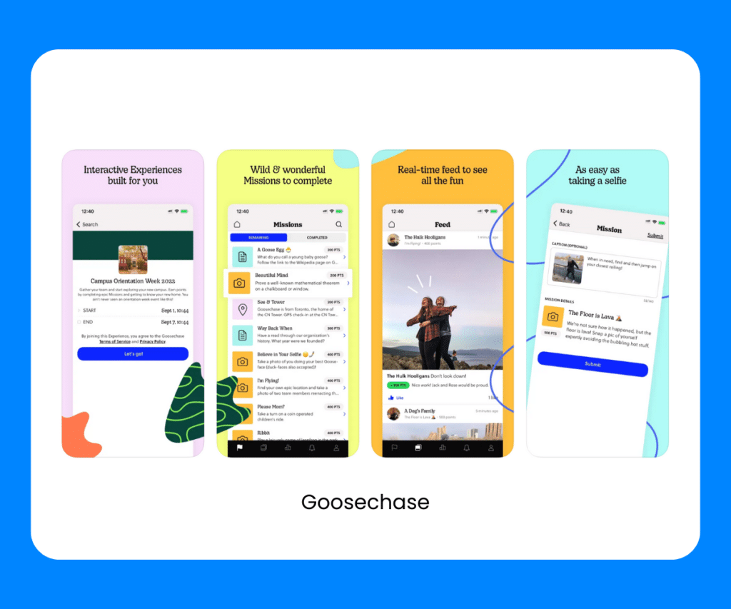
Goosechase turns any location into an exciting scavenger hunt. Whether you’re exploring a new city or simply want to add an adventurous twist to a day out, this app takes your outdoor escapades to a whole new level. Whish is why it’s earned a spot on our list of best app for self-guided walking tours. It’s perfect for families, friends, and team-building activities, making every step you take an opportunity for adventure and fun.
PocketSights
Perfect for Exploring With a Wealth of Historical Insights
- Access a rich library of self-guided tours in various cities.
- Offline maps and GPS navigation for seamless exploration.
- Dive deep into history with engaging audio guides and multimedia content.
- User-friendly platform ideal for tourists and history enthusiasts.
- Explore hidden gems and untold stories in popular tourist destinations.
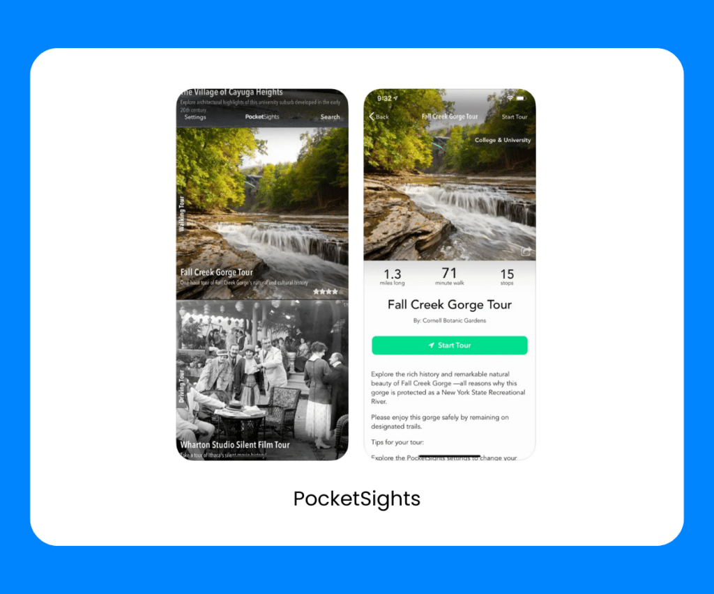
PocketSights isn’t just like ordinary self-guided walking tour apps, it allows you to learn historical and cultural knowledge as you explore the streets and landmarks. Offline maps and user-friendly features, mean you can explore the past and unearth fascinating stories that bring each destination to life.
STQRY Guide
Perfect for Immersive Cultural and Historical Tours
- Explore a diverse collection of interactive stories and tours.
- Immerse yourself in museums, historical sites, and cultural landmarks.
- Enjoy offline content availability for uninterrupted tours.
- Share your experiences with fellow travelers.
- User-friendly platform designed for tourists and history enthusiasts.
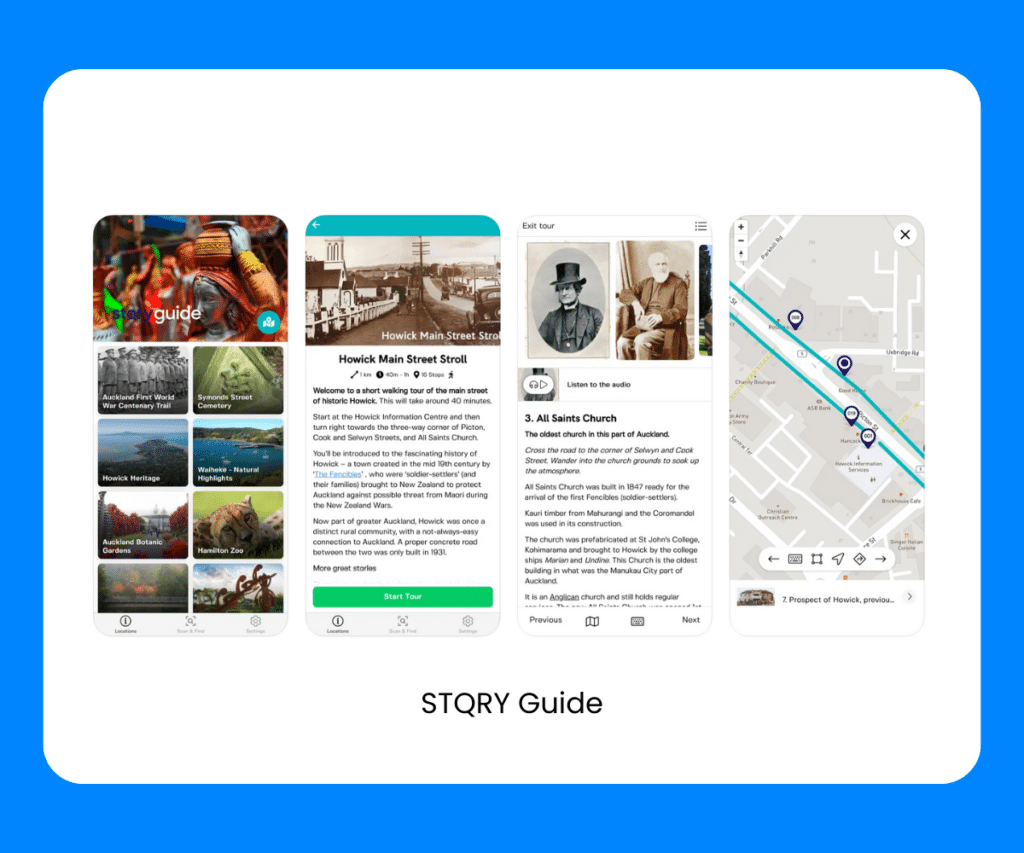
STQRY Guide is undoubtedly one of the best free self-guided walking tour app. It’s ideal for travelers looking for immersive cultural and historical tours in popular tourist destinations worldwide. It’s got an extensive library of interactive stories, so you can explore museums, historical sites, and cultural landmarks like never before. Whether you’re traveling solo or with friends, STQRY Guide provides a seamless, offline experience, allowing you to explore at your own pace and share your discoveries with others.
Roadside America App
Perfect for Discovering Quirky and Unique Attractions
Price: $4.99
Location: Covers the United States and parts of Canada
- Unearth offbeat and bizarre roadside attractions.
- Navigate with detailed maps and directions.
- Discover hidden gems, oddities, and curiosities.
- Plan memorable road trips with customizable itineraries.
- User-friendly interface for all adventure seekers.
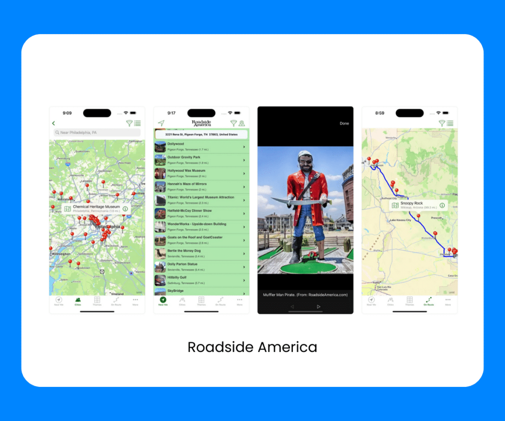
When it comes to the best self-guided tour apps, this one offers up something no other apps do. The Roadside America app helps you uncover the weird and wonderful world of offbeat roadside attractions across the United States and Canada. From giant rubber band balls to quirky museums and oddball landmarks, this app is perfect for discovering hidden gems and curiosities. Plus, detailed maps, directions, and customizable itineraries, mean you can plan unforgettable road trips filled with unique experiences.
Perfect for Curated City Tours and Local Recommendations
Location: Covers popular cities worldwide
- Access a treasure trove of expert-curated city tours.
- Discover hidden local gems, foodie hotspots, and cultural experiences.
- Offline maps and navigation for seamless exploration.
- Create custom itineraries based on your interests.
- Capture memories with in-app photo and journal features.
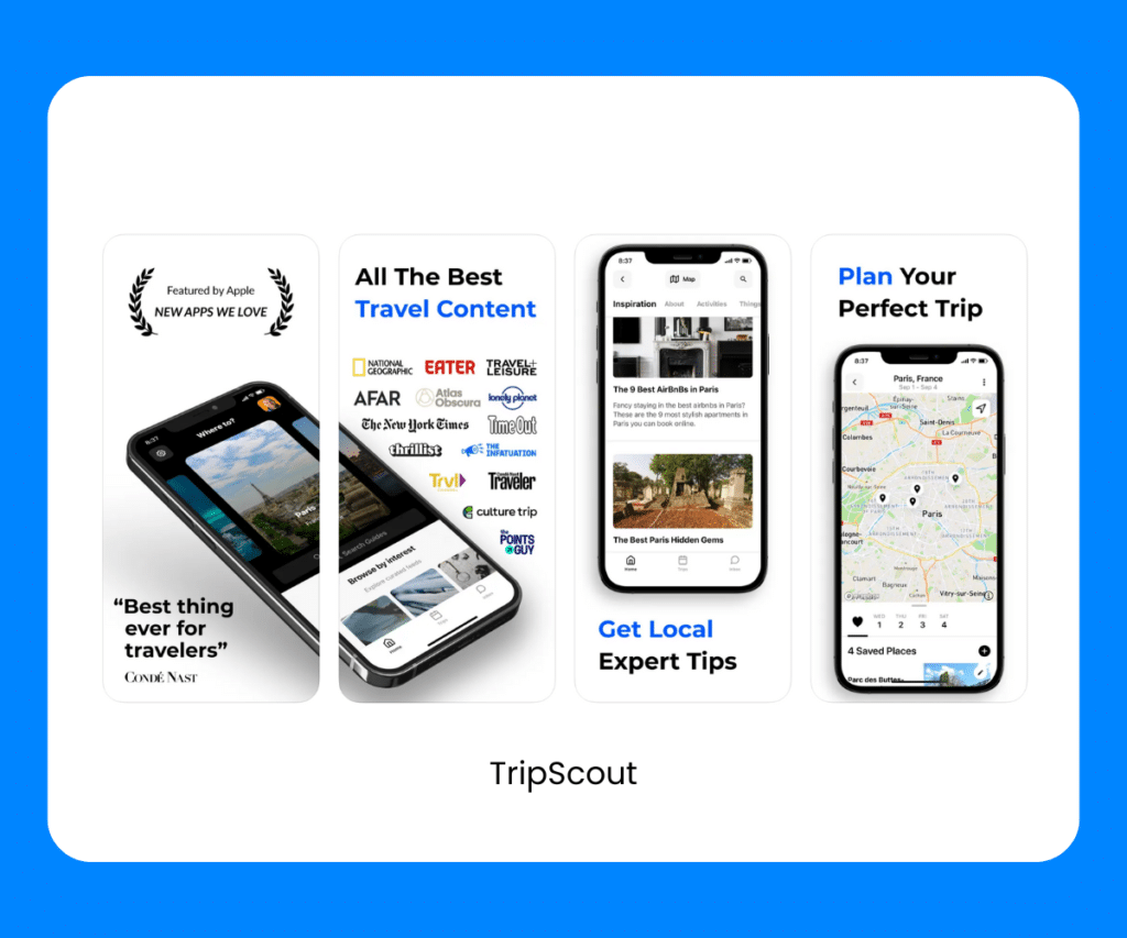
TripScout is a well-loved option on this list of best self-guided walking tour apps, mainly because it offers authentically curated city tours and insider recommendations in popular cities across the globe. It gives you access to a wealth of expert-curated content, so you can easily find hidden local gems, savor culinary delights, and immerse yourself in cultural experiences. You can also explore even when you don’t have an internet connection, since the app provides offline maps and navigation. Whether you’re a foodie, history buff, or simply an adventurous traveler, TripScout is worth download one of the best self-guided tour apps!
Rick Steve’s Audio Europe
Perfect for In-Depth Exploration of European Destinations
Price: Free
Location: Covers various European cities and destinations
- Access a library of immersive audio tours personally narrated by Rick Steve.
- Dive deep into European culture, history, and local insights.
- Offline audio content for on-the-go exploration.
- User-friendly interface suitable for tourists and independent travelers.
- Save and organize your favorite tours for future reference.
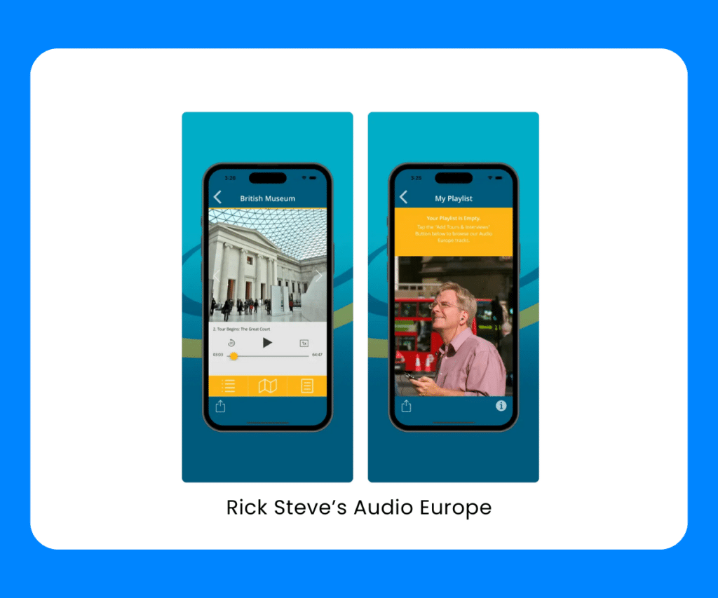
Looking for the best self-guided walking tour apps in Europe? Rick Steve’s Audio Europe offers an immersive exploration of European cities and destinations. Be guided across the country by travel expert Rick Steve, and you’ll quickly see why this is one of best city travel self-guided tour apps. Access offline audio content and explore at your own pace, even without an internet connection. Plus, you can save and organize your favorite tours!
Perfect for Guided Tours with Local Narrators
Location: Offers tours in various global destinations
- Explore with captivating audio-guided tours narrated by local experts.
- Discover hidden stories, historical insights, and cultural gems.
- Offline mode for uninterrupted adventures, no need for an internet connection.
- GPS integration ensures you never miss a point of interest.
- Create personalized tours and share your experiences with fellow travelers.
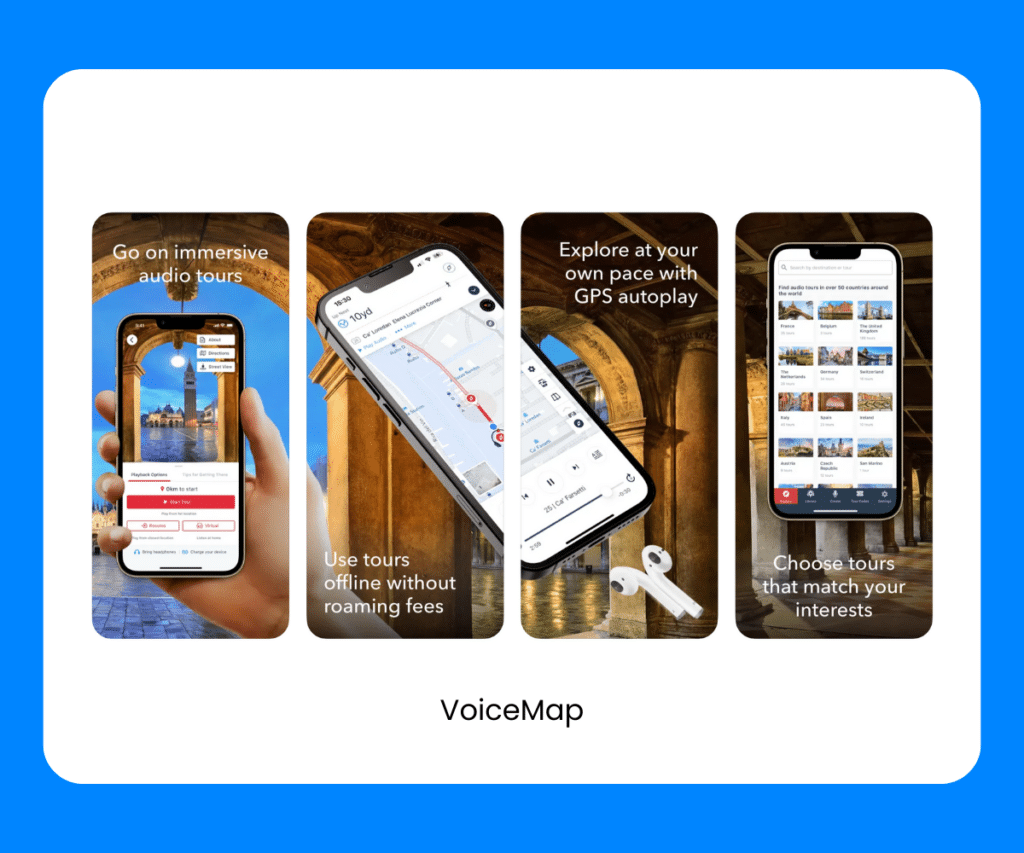
VoiceMap is another one of the best self-guided walking tour apps you should consider downloading. It offers an immersive exploration led by local narrators across diverse global destinations, as well as offline mode and GPS integration – so you never miss a point of interest along the way! Plus, VoiceMap lets you get creative and craft your own personalized tours, making it easy to share your experiences and insider knowledge with fellow travelers.
When it comes to the best self-guided tour apps, VoiceMap is one of our top picks.
Perfect for Self-Guided City Tours and Exploration
Location: Covers numerous cities worldwide
- Access an extensive library of self-guided city tours and travel articles.
- Turn-by-turn directions to popular landmarks and hidden gems.
- The flexibility to explore at your own pace.
- Ideal for both first-time tourists and seasoned travelers.
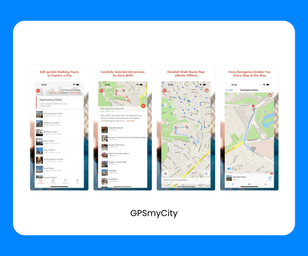
GPSmyCity is your go-to app walking tour guide app offering a vast library of guided city walks and travel articles. With offline maps and GPS navigation, you can effortlessly explore your chosen destination, receiving turn-by-turn directions to popular landmarks and hidden gems. This walking tour guide app provides the freedom to explore at your own pace, making it suitable for both first-time tourists and seasoned travelers looking for a deeper dive into a city’s culture and history.
Perfect for Engaging, Location-Based Storytelling
Location: Offers tours worldwide
- Explore destinations with captivating location-based audio tours.
- Access a diverse range of tours covering cultural, historical, and natural highlights.
- Offline mode for uninterrupted travel, no need for an internet connection.
- Create your own tours and share your personal stories with the world.
- A user-friendly platform suitable for curious travelers and history enthusiasts.
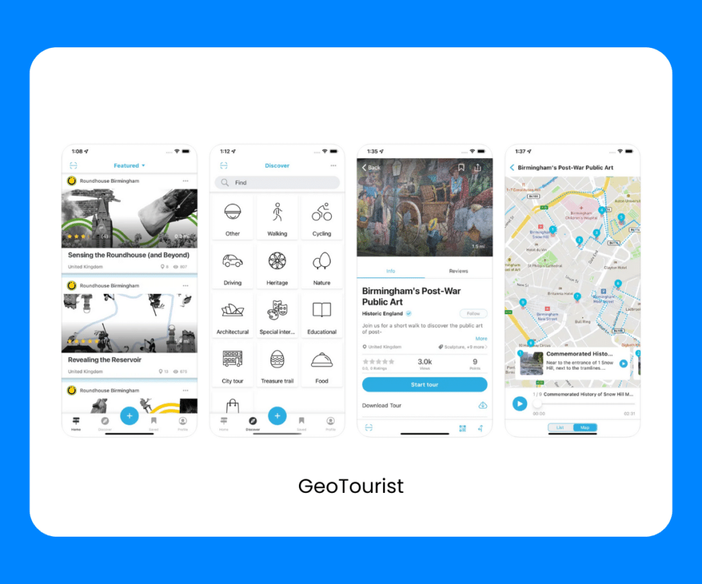
GeoTourist offers an immersive, location-based storytelling experience as you explore destinations around the world. And that’s why we think it’s one of the best self-guided walking tour apps. It’s captivating audio tours provide cultural, historical, and natural insights, plus, the app’s offline mode means you can explore, even without an internet connection. You can also become a storyteller yourself by creating your own tours and sharing your personal stories with the world. Nifty, eh? It’s another reason, GeoTourist is one of our favorites for the best self-guided tour apps.
izi.TRAVEL Audio Tours
Perfect for Exploring with Expert-Guided Tours
Location: Covers numerous cities and cultural sites worldwide
- Access a vast collection of expert-guided tours at your fingertips.
- Offline mode for uninterrupted exploration without an internet connection.
- Rich multimedia content enhances your tour experience.
- Personalization options to create a tailored adventure.
- User-friendly platform suitable for tourists and history enthusiasts.
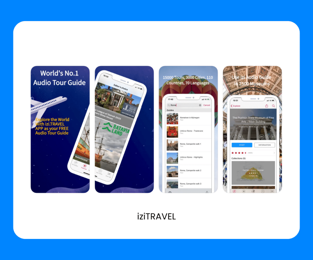
izi.TRAVEL is our final one on the list of apps for self-guided walking tours, and it’s also one of THE best self-guided audio tour apps. It offers expert-guided tours in numerous cities and cultural sites around the world, and personalization options, mean you have the flexibility to create a tailored adventure that suits your interests. Whether you’re a tourist or a history enthusiast, izi.TRAVEL makes every step of your journey more enriching and memorable.
How Air Doctor Can Help
Air Doctor is an easy-to-use app that connects you with a global network of multi-lingual doctors and specialists so you can access medical care anywhere, anytime.
Air Doctor offers a wide range of benefits, including:
- A global network of over 20,000 multi-lingual doctors and specialists
- Choice of clinic, at-home (hotel), and video consultations
- Most common medical specialties
- Valid, local prescriptions
- 24/7 multi-lingual support
- Active in 75 countries
- Telemedicine services in up to 21 languages
- Transparent pricing, and reviews
Download the Air Doctor app and experience the world worry-free.

The Ultimate Guide To Elopement Packages
In this guide, we'll break down what elopement packages are, what to expect, and how to find the perfect package...

5 Best Places To Elope To (+ Tips To Plan The Trip)
Let's be honest, eloping is the best way to tie the knot. So here's a list of the best places...

The Ultimate Guide To Cheap Cruises For Families
All aboard for the ultimate cruise guide! Join us as we tell you everything you need to know to plan...

Super Easy Vacation Meals For Family Trips
In this guide, we'll look at some super easy vacation meals for family trips. Plus, other tips and tricks for...

26 Best Family Vacation Planning Apps
From booking accommodations to organizing your packing, we've got the top family vacation planning apps to make vacay planning a...

Ultimate Guide to Entertaining Your Kids While Traveling
Whether you're traveling by plane or car, we'll give you everything you need to know about entertaining kids while traveling!

6 Inexpensive Family Vacations For Spring Break
Here's a list of the 6 best inexpensive family vacations for spring break, as well as rough costs, and activities...

The Ultimate Guide To Affordable Fall Family Vacations
Let's take a look at everything you need to know about planning the ultimate affordable fall family vacations, plus perfect...

Planning Affordable Family Winter Vacations
In this guide, we'll look at everything you need to know when planning affordable family winter vacations. Ready to start...

Jenny Cohen Derfler
Air dr ceo & co-founder.
Jenny is the CEO and one of the Co-Founders at Air Doctor. She spent more than 20 years at Intel, most recently as general manager of its manufacturing facility in Israel and before that in various engineering and manufacturing roles in Silicon Valley. Air Doctor is her second startup having previously founded electric vehicle company ElectRoad.

18 Best Websites & Apps for Self Guided Tours

- 1 Pinterest
Don’t like traveling in groups? Do you prefer to experience a destination on your own?
Discover the best apps and sites for self-guided tours and enjoy an interactive way to navigate through an attraction or a location while also getting the benefits of a traditional tour guide.
Pick your favorite provider and be your own tour guide for your next holiday. 🙂
Best Apps & Websites for Self Guided Tours
We hope you enjoyed our selection of self guided tours sites & apps. Don’t hesitate to comment below if you wish to recommend other providers.
Wishing you an excellent time and travel safe!! 🙂
Route Planner
- Login | Sign up
Save on Summer! Use code SUMMER24 for $250 USD ($250 CAD) off trips starting June, July, & August 2024
Maps & Routes by App
Our new app is now available to make following your route and staying on track simple, and help you find all of your trip information in one handy place. Make sure you download the app, check you can locate the details of your trip and the daily maps, and download the maps for offline use before you go on your trip.
Where to get the app
Find the app using your smartphone on the App Store (iPhone) or Play Store (android). Search for "Macs Adventure" and download the free app, or visit these links from your phone:

Here on the App Store for iPhone

Here on the Play Store for Android
Log in with your Macs Adventure Account details to access:
Detailed Route Description Each downloadable walking or cycling route has a detailed description including: - Grade - Duration - Distance - Elevation gain and loss - Detailed description - Directions - Points of interest - Directions to the trailhead - Images
GPS Tracks and Outdoor Mapping Detailed outdoor maps with you and your route plotted. It is as easy as following the blue dot on the map. - Detailed outdoor mapping with terrain, footpaths, natural features and more. - Your route marked on the map. - Your hotels and points of interest on the map. - Download the map for offline use (when no signal or to save data) - Your current location and elevation.
All of your booking details and itinerary
- Your day to day itinerary. - Payment and balance information. - Important documents. - Your hotel and service details. - Useful information and advice. - Details of anyone travelling with you.
You will need to sign in or register. Make sure you use the same email address that you have used to make the booking with us. If you use social sign-in (for example Facebook), make sure that account uses the same email address.
Browse through your Upcoming Trips in the app and click on the trip you want to view.
Here you will find all of your trip information in one handy place, including your itinerary, traveler details, payment information, important documents, and much more. The app is an essential tool for navigating on your trip, and you can see your daily maps listed under My Maps .
In each daily map, you must toggle the option to Download for Offline Use on before your trip. This will make sure you don't need to use any mobile data on your trip (so if you are in a remote area, you will still be able to see all the navigation information).

You can use these useful shortcuts to navigate to Home, My Bookings, My Maps and My Profile at any time:

Help and FAQs
We have a range of FAQs listed here . Please do browse this page if you have any questions at all, as it contains useful tips about using the app or finding the information for your upcoming trip. You can contact us on [email protected] if you can't find the answer you need there.
If you have any more general suggestions or feedback about the app, please do forward these to [email protected] (do not use this address for any urgent issues about your upcoming trip).
The app is designed as a simple and straightforward navigation tool, which will give you all the mapping information you need and peace of mind that you are on the right track. We hope you have a wonderful trip!
Before you depart for your adventure, make sure you download the app. This short step by step video will show you how to see your trip information and find your way around the app, and use it to navigate on your trip.
Our specialists are here to help connect you with your perfect adventure. Just get in touch if you have any questions.

Follow us on social media
- twitter-x-logo@2x
11 best tour guide apps to create amazing tourism experiences

In this article, you will get a short overview of 11 tour guide apps that give you the possibility to build your own tour routes or add audio guides to specific locations. There are many ways to explore a city or a route. No matter if it is a walking tour , sailing, boats, train trips, food tour , bicycle sightseeing, birdwatching , or rally with cars , in 2022 technology offers multiple ways to enrich the experience.
Tour guide apps suit well to introduce the best locations and facts about a destination to a foreigner as well to locals who can find hidden gems or experience an adventurous mystery story-game about their home location. As a tour company, the range of platforms you can choose to build the experience your customers will benefit from is wide.
As of 2022, most tour guide apps cover at least the basics – setting up a route, points of interest, adding media files like mp3, images, and video to each location, and offline tours. The apps included in this article, do all of the mentioned, but we also point out the specific differences of each app to emphasise the strengths of each one.
With Loquiz tour guide app you can build indoor and outdoor self-guided routes with the amount of gamification you need. Special features: a tour template for tourism businesses that allows building layers of different waypoints of interest within a destination. What cuts it apart is API which connects to booking and ticketing platforms. Secondly, there is a powerful content editor to keep the ever changing info about locations in sync with the possibility of translating the app to any real or imaginary language on Earth. Try out for an instance a sample tour of Paris. Download the Loquiz app from Google Play or App Store and scan the QR code on the image below. (alternatively username: GEMPARISTour and password: justvisitit will also start the game).

2. Pocketsights
Pocketsights is a self-guided tour app focused on community and historical organizations, as well as colleges and universities. Special features involve asking visitors to donate to any charity. Enterprise package involves priority reviews. PI team reviews new and updated tours to ensure they meet quality guidelines. Your tours will go to the top of the review queue and be reviewed before free package tours.
3. Voicemap
Voicemap is solely an audio tour app. It automatically estimates speaking recording times and word counts has support from VM editors with comments, tracked changes and email notifications. Includes text directions as a fallback to make sure listeners don’t get lost. Available in 12 languages.
MyTours includes the same basics as all the other tour guide apps on our list. Multimedia, GPS locations, visitor analytics. Apps work with accessibility options on most devices for the visually- and hearing-impaired. The focus is on building an experience as a self-guided tour app and then publishing it on Apple or Google Play stores. Features 18 different languages.
5. Geotourist
Geotourist lets you build your own journeys and inspire travelers to follow in your footsteps. Audio will trigger as they walk along your dawn path. Tours are available in 40 languages. Specialty is a simple interface aimed at creating a tour guide app in smartphones without detailed settings.
Create games, self-guided and audio tours, team building events and educational content that captures peoples' attention.
6. Locatify
Locatify puts heavy emphasis on indoor positioning. This feature is also present in other walking tour apps in this list, but this platform includes Ultra-wideband (UWB) technology, which makes it stand out among others.
Anytour is a self-guided audio tour app for smartphones in 30 cities. The app offers up-to-date audio-guided walks around cities all over the world. The tours are researched, written, and read by locals and travel writers. To create and promote your tours you need to sign up.
Scavify is a scavenger hunt platform that also lets build an experience at destinations that are interactive and impactful for visitors. Incorporates rewards to send visitors to revenue-generating places such as dining, gift shops, and reward visits. Includes linkable banner ads.
Navicup is a new solution for building tours. It allows automatic translation of texts and there is a quality check process before you can publish your tours. Their team will review if the content is ready for public use.
10. Your Audio Tour
Your Audio Tour is the only tour guide app on the list which is focused on audio guides only. It is a simple and straightforward audio guide app solution which has a few advanced features – for example, the text to speech option with a choice of 9+ different voices.
11. GPSmyCity
GPSmyCity is a platform that connects tourists with knowledgeable local guides through self-guided city walks and GPS-powered travel articles. This tour guide app introduces local attractions, malls, restaurants, places of culture, and nightlife. It is all covered with insider knowledge only the locals are privileged to have. The city tour app also has a feature that allows users to create their own walks.
No matter if you are building tours aiming to serve international tourism travelers or delight domestic tourists, a tour guide app can speed up or even automate the sales of tour tickets, engage visitors with easy to edit content, and ease the worries of the workforce.
We hope this article will help you will find a suitable tour guide app to build your awesome products on and, through that, a successful travel season.
*This article is written by the information available on the selected apps websites and reflects only the experience of the author.
Related stories

With a normal Loquiz game, you can track time on the header and points on the menu. So, how can...
Do you ever wonder how all the information on Google Maps is gathered? Have you ever noticed that you can contribute to...

When your game has many rules, it’s crucial to maintain simplicity and clarity. The simpler the game, the easier it...
Start free trial to bring your ideas to life
Sign up and create games, tours, team events and educational content that captures peoples' attention Start from the scratch or use templates to kickstart!
Privacy Overview

- For HR & Businesses
- For K-12 Educators
- For Universities & Colleges
- For Tourism
- For Events & Conferences
- For Non-Profits
- For Experience Facilitators
- Lessons from the Chase
- Reviews from Participants
- Company Updates
- Goosechase in the News
- Go to Goosechase.com
5 Top Apps for Self-Guided Tours: Create Unique Experiences for every Guest
It's always a thrill to see visitors flock to your doors. Whether you're a museum operator, give guided tours of historic sites, or manage the entertainment at a ski resort, your ultimate goal is to give guests the experience of a lifetime. That's what all the planning, organizing, pomp, and circumstance is about, after all — enriching people's lives and leaving them fuller than when you met them.
When you make your visitors' experience and engagement a priority, your guests are more likely to share the love for your destination. Encouraging folks to explore independently is one of the ways to ensure they have a totally unique experience.
Now, how do you do that? Support your efforts with interactive experience and self-guided tour apps that allow your guests to learn, discover, and explore at their own pace. And what a difference that can make!
How a Self-Guided Tour Can Enhance Your Visitor Experience
An app is the simplest way to implement a self-guided tour for visitors. Their phones are already an extension of how they view and communicate with the world. Your visitors don't want to roam your premises with paper maps. Beyond the environmental implications (and mess for you 🗑), they'll spend so much time trying to follow directions that they won't have the opportunity to be present. Today, self-guided tour apps make it possible (even...easy?) to connect your guests to information without distracting from their environment and surroundings. And they'll stay engaged long after they’ve visited!
Self-guided tours give people the opportunity to explore at their own leisure. Apps provide the support your visitors need to get the most out of the experience. They can include interesting facts and trivia about your destination or exhibit, for example. They can gamify the tour by incorporating a scavenger hunt or a mystery for visitors to solve. Of course, apps are also there to provide the bare-bones support that every participant requires, including routes and maps.
5 Best Apps for Self-Guided tours
If you’re ready to elevate the experience for your visitors, these apps make an enormous difference. Here are five of the best apps for self-guided tours to consider:
Goosechase lets you create interactive experiences that coax curiosity and joy out of every guest. Founded over 10 years ago as a scavenger hunt app, Goosechase has evolved into an app you can build virtually any kind of interactive experience on. Trivia game with strangers? Photo tour of your sculpture garden? Scavenger hunt in a maze of local graffiti alleys? It's all possible.
Use the three Mission types (Photo/Video, Text, and GPS) to construct a checklist of fun things to do or discover at your destination. Used as an interactive tour guide, you can have your guests test their knowledge by answering trivia questions about your latest exhibit or hunting down easter eggs in your art work.
Drive friendly competition amongst guests and see who can do the most ski runs in a weekend by having riders post pics of themselves at the start of every trail. (Even better if they have to strike a pose that represents the trail name!) Inspire exploration at your park by having people GPS check-in at each interest point. The more involvement you ask of your visitors, the more fun they’ll have immersing themselves in your attraction — and walking out far richer in knowledge and enjoyment than they would have otherwise.

Loquiz is a walking tour guide’s dream because it makes gamifying locations simple. The app includes a variety of built-in templates that are easy to apply to your business. Among the templates is one for tours that makes it simple to create fun and engaging routes for each stop on the tour. Whether your tours take place indoors or outdoors, you can use the app to create useful maps that help people feel more connected to the attraction they’re visiting.
PocketSights
Designed especially for universities, colleges, community organizations, and historic sites, this app allows administrators to create tour routes from scratch. This is especially useful for organizations that may have attractions in unusual locations, like fields or parking lots: your visitors can go anywhere you tell the app to guide them! Using GPS, the app makes it easy for your guests to navigate the tour on their own. Plus, it allows you to include valuable and engaging content about each of the stops, giving people extra incentive to stop and explore while on their tour.
If you’re all about scavenger hunts, Scavify is a great option that allows for a ton of customization. Guests respond to a variety of photo, video, GPS, QR code, and question prompts that get them to engage with your material. Maybe you’re highlighting a new attraction at your museum and want to call attention to its rich subject matter - guests can scan QR codes that reveal more information, or answer trivia questions directly in the app.
STQRY has a variety of platforms to support all types of programming - walking tours, group tours, and even kiosks. Whether you work at a department of tourism or run historic walks through heritage sites in your city, you can use their platforms to create audio experiences, self-guided tours, and even your own apps to introduce visitors to your premises.
FAQs About Self-Guided Tour Apps
Q: how can these apps accommodate users with disabilities, such as visual or hearing impairments, to ensure the self-guided tours are accessible to everyone.
Self-guided tour apps can enhance accessibility through features like audio descriptions, text-to-speech functionality, and sign language videos for users with visual or hearing impairments. Interactive maps and voice navigation can assist users with mobility challenges. Developers also incorporate adjustable text sizes and contrast settings for better readability.
Q: What are some specific examples of how these apps have been used successfully in educational settings, such as schools or museums, to enhance learning?
In educational settings, self-guided tour apps are used to create immersive learning experiences . For instance, museums use apps to provide detailed explanations, historical context, and interactive quizzes related to exhibits . Schools might employ these apps for educational field trips , enabling students to explore historical sites or nature trails with curated information and tasks designed to complement their curriculum.
Q: Can these self-guided tour apps integrate with social media platforms, allowing users to share their experiences in real-time with friends or the public?
Many self-guided tour apps offer social media integration, allowing users to share their journey and discoveries in real-time. This feature encourages user engagement, as participants can post photos, videos, and comments directly from the app to their social media profiles, fostering a community of explorers and learners. The specifics of how each app integrates with social media platforms can vary, so for detailed capabilities regarding social sharing features, it's best to consult the respective app's feature list or support documentation.
Ultimately, it’s all about the experience — and finding the right interactive experience platform to partner with makes all the difference. You’ll take every single visit to the next level when you make your self-guided tour a journey that gives guests plenty of opportunity to surprise themselves along the way. That’s how the best memories are made.
What is Goosechase?
At Goosechase, experience is everything. Originally inspired by scavenger hunts, Goosechase is an online platform that enables organizations and schools to engage, activate, and educate their communities through delightful interactive experiences. Sign up and try creating a free recreational game, or contact us to learn more about our enterprise solutions!
Integrated Marketing Manager
Recommended for you

Unique Las Vegas Scavenger Hunt Ideas

Top Toronto Scavenger Hunt Ideas

The Best Boston Scavenger Hunt Ideas
No results for your search, please try with something else.

Build Self-Guided Walking Tours for Mobile Users
Provide Your Visitors with an Interactive Way to Explore Everything You Have to Offer
Sign Up Now

Tour Guide App
Our mobile tour guide app will guide your visitors from one point of interest to the next using GPS. Our tour builder allows you to create a tour route that takes your visitors anywhere you want — you're not restricted to roads or major pathways.

Tour Builder
Our enterprise tour builder accounts are for CVBs, DMOs, universities, businesses, non-profits, and other tourism organizations interested in features such as analytics, visitor engagement, data collection, and commercial use (local advertising).

Featured Walking Tours
Glasgow Boys' Brigade West End Walking Tour
The Biggest Little Movie City
Ithaca, New York
Historic Public Gardens of Cheltenham
See More Tours
The People and Organizations Building Tours — Which One Are You?
Historic Societies
Boost Heritage Tourism; Encourage Preservation
Communities
Revitalize Communities and Local Economies
Universities
Excite Prospective Students and Parents
Everyone Else
Share the Places You Love With The World
- International edition
- Australia edition
- Europe edition
Five of the best online mapping apps
Plan runs, rides and walks with this selection of navigation aids – all of which allow you create, follow and share hiking and cycling routes
S prawling an unwieldy and mug-stained Ordnance Survey sheet across a kitchen table to plan a walk is one of life’s great joys. But while poring over a paper map will always have its place, today there is a large and rapidly growing array of sophisticated digital tools to help with the business of planning hikes – a good way of sating wanderlust until the lockdown lifts.
Here are some of the options. If you’ve never used an online mapping tool before, their interfaces take varying degrees of getting to grips with. All, however, share a similar system: you plot a dot-to-dot route using waypoints and the app automatically generates information on the route (distance, elevation, and sometimes duration). Many of the apps described here can also be used as navigation aids when actually on the walk, although any digital tool should only be used a supplement to – not as a replacement for – being able to navigate with a paper map and compass.
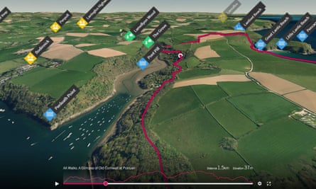
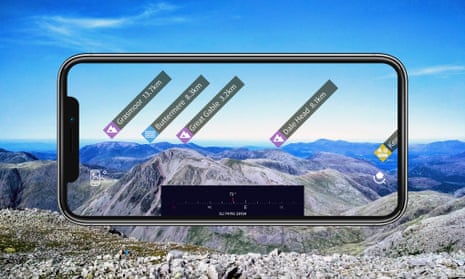
Best for general hiking and hillwalking Works with iOS, Android, web With the weight of Ordnance Survey (Britain’s national mapping agency) behind it this will be all many walkers need. The free, registered version provides access to Britain-wide basic mapping, plus the ability to create, print and share routes with other users. The app works in conjunction with a web version, so you can pore over the maps and routes on a large screen, which is a lot easier than trying to fiddle around with them on your phone. With a route ready to go, you can then follow it with your phone’s GPS (but please note the disclaimer above), with an arrow showing your location on the map. A £23.99 annual subscription unlocks Explorer and Landranger mapping, plus other gimmicky – but undeniably fun – features, such as 3D walk flythroughs and augmented reality showing local hill names and landmarks. ordnancesurvey.co.uk
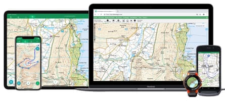
Best for more challenging hillwalking and trekking overseas (but to be discontinued from February 2022) Works with iOS, Android, web, Apple Watch, Wear OS Viewranger can be seen as a beefed-up alternative to OS Maps (albeit with a clunkier interface), offering many of the same features – alongside extra ones that more “committed” walkers tend to appreciate. As well as Ordnance Survey, Viewranger offers digital versions of more specialist walking maps, such as Harvey , and it’s possible to buy and use top-quality mapping abroad (remember abroad?). A £4.99 annual subscription unlocks functions including automatic route generation – which makes plotting routes on paths easier – plus live tracking and augmented reality (including a feature that brings up virtual arrows showing your route in the real world). For £24.99 you can get Ordnance Survey map coverage across Britain. viewranger.com
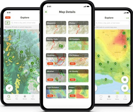
Best for country rambling Works with iOS, Android, web This is a handy app if you’re looking for “off the shelf” walks in a particular area. As with other apps here, AllTrails makes it possible to create and follow your own routes. However, its main selling point is the easily browsable collection (5,889 in England alone) of curated walks. Enter a location and it provides a selection of ready-made routes nearby, each with at-a-glance information such as map, description, difficulty level, useful attributes (eg dog-friendly), even a weather forecast – plus features including Google Maps directions to the walk start. The lack of Ordnance Survey mapping is a downside, though what’s available is fine for most rambling. alltrails.com
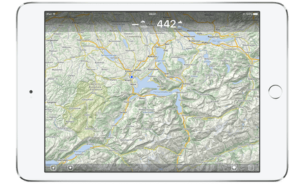
Best for easily planning a route Works with iOS only This is a great app for creating a walking route with minimal fuss. It costs £4.99 but its streamlined interface – which is far more intuitive than any other app of its kind – makes route-plotting a breeze. It works with OpenStreetMap , a worldwide open-source map, which is less detailed than Ordnance Survey, but fine for rambling. It is also possible to import and archive gpx files (the standard file format for hiking routes). The catch is it only works with iOS. mapout.app
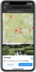
Best for sharing routes with other people Works with iOS, Android, web, Apple Watch, Samsung Gear, Wahoo, Garmin Komoot’s main claim is to take the effort out of planning a ride, run or hike. Enter start and finish points and it works out a route for you, along roads, paths and trails – like a car GPS. This is similar to the automatic route-finding features found in other apps, though there is also a surprisingly detailed description of the difficulty and the underfoot terrain. The app has nice community elements, such as users being able to pin “highlights”’ on the map for others to see. Ordnance Survey maps aren’t available, but the mapping provided is usable for rambling and country walking. komoot.com
This article was amended on 7 January 2022 to note that ViewRanger is being discontinued from February 2022, and to update the (lower) price of an OS Maps annual subscription.
- Travel websites
- Walking holidays
Comments (…)
Most viewed.
- visitPA.com
- Hospitality Jobs
Type To Search

30 Self-Guided Walking & Driving Tours of Greater Philadelphia
How to do philly your own way — and at your own pace....
Copied to Clipboard
Sometimes the best way to learn something new — or discover history that’s hidden in plain sight — is to explore on your own.
Take advantage of these self-guided driving and walking tours of Greater Philadelphia that put you in control of when and how you explore top attractions and important historical sites.
Great for solo excursions or small groups, these self-guided explorations (many of which are free!) are an excellent way to uncover interesting facts about Philadelphia — and encounter surprises along the way.
Philly’s self-guided tours also span a wide range of interests. Get an immersive history lesson on the nation’s Founding Fathers; take your time exploring significant stops along the Underground Railroad; learn the story behind the city’s jaw-dropping architecture; or indulge in a curated culinary journey sampling the city’s most quintessential foods.
Want a little more interactivity? Some experiences offer scavenger hunts that let you upload photos of their finds, while others include augmented reality apps that transform the world in front of your eyes.
Check out our guide below for a list of great self-guided walking and driving tours to help you explore Philadelphia and the Countryside on your own.
History: Black History
7th ward legacy reclaimed self-guided tours.
The art and history experience Legacy Reclaimed: A 7th Ward Tribute honors the lives — and lesser-known history — of 19th-century Black residents of Philadelphia’s old 7th Ward. An important part of the Underground Railroad and Great Migration, the 7th Ward was the former home to 15,000 Black residents including Octavius V. Catto and W.EB. Du Bois. Legacy Reclaimed ’s self-guided tour brochure takes you to two dozen historically significant homes, landmarks and institutions throughout what is now known as Society Hill and Washington Square West .
Where: Various locations including Church of the Crucifixion, 807 Bainbridge Street
Anti-Slavery Walking Tours from The Philadelphia Inquirer

Philadelphians were heavily involved in the abolitionist movement, and the Underground Railroad passed through the city, helping enslaved people find freedom here and north into Canada. Two free audio tours from The Philadelphia Inquirer guide people through Old City and Society Hill and around Northwest Philadelphia to visit anti-slavery landmarks like Congo Square (now Washington Square ), a convening space and burial ground for the Black community; and Germantown’s Johnson House Historic Site , which served as an Underground Railroad stop and may have even hosted Harriet Tubman.
Where: Various locations including Mother Bethel A.M.E. Church, 419 S. 6th Street
Black History Historical Marker Tour from The Philadelphia Inquirer

Philadelphia’s history is rich with important moments involving the Black community , many of which aren’t tied to a specific attraction. Fortunately, historical markers around the city help preserve these legacies. This map from The Philadelphia Inquirer can help you wind your way through the city and learn more about 19th- and 20th-century painter Henry Ossawa Tanner; the Christian Street YMCA, where a young Wilt Chamberlain got his start; and Laura Wheeler Waring, who painted portraits of W.E.B. DuBois and Marian Anderson.
Where: Various locations including the Paul Robeson House, 4951 Walnut Street
Sweet Chariot: The Long Journey Through Time
Part walking tour, part high-tech scavenger hunt, Sweet Chariot empowers visitors to uncover history that is often hidden in plain sight. Using a map and a smartphone app, visitors search for murals, plaques and other landmarks to unlock immersive videos and clues as they trace hidden stories of the Black struggle for freedom in Philadelphia. The experience begins in Washington Square and ultimately leads to the final resting place of Amelia Brown, who was uncovered in an 18th-century graveyard during a construction project in 2013.
Where: Various locations including Washington Square Park, 210 W. Washington Square
History: The American Revolution
The nps app for independence national historical park.

The National Park Service’s free official app offers a complete guide to what’s been dubbed the most historic square mile in the United States . Choose from one of five self-guided audio tours (on topics like civil rights and Benjamin Franklin ) or use the interactive map to explore the 35 included sites at your own pace. Bonus: Kiddos can sign the Declaration of Independence, ring the Liberty Bell and more in a separate Junior Ranger app .
Where: Various locations including Franklin Court, 317 Chestnut Street
Official Audio Tour of Valley Forge National Historical Park

No battles were fought in Valley Forge , but the time the Continental Army encamped here in 1777 and 1778 went down as one of the Revolutionary War’s most trying periods. Take a deep dive into Valley Forge’s history at your own pace via the park’s official audio tour, available for purchase to stream or on CD . Drive through the park, accompanied by period music, while character voices help you envision the 18th-century encampment during a 60-minute tour.
Where: Valley Forge National Historical Park, 1400 N. Outer Line Drive, King of Prussia
History: LGBTQ+ History
Lgbtq+ history tour from the philadelphia inquirer.

Philadelphia was the site of the country’s first major demonstration for LGBTQ+ rights, the Annual Reminders , in 1965. But Philly’s history of equality activism long predates that and continues today, as evidenced by the city’s public art, historical markers and notable LGBTQ+ institutions that honor people and events that paved the way. This self-guided LGBTQ+ history tour from The Philadelphia Inquirer visits many of these sites, including the historic marker for John Fryer, who helped declassify homosexuality as a mental illness, and Giovanni’s Room, the country’s longest-running LGBTQ+ bookstore.
Where: Various locations including Annual Reminders Marker, South 6th Street & Chestnut Street
History: Specific Attractions
Audio tour of old pine church.
Founded in 1768, Old Pine Church became known as “the Church of Patriots” during the Revolutionary War, thanks to parishioners like John Adams and other prominent Founding Fathers. Today, the church grounds serve as the final resting place for more than 200 veterans of the Revolutionary War. Visitors can download a free smartphone app to hear narrated stories about those who are buried at Old Pine and their enduring impact on the nation’s history.
Where: Old Pine Street Church, 412 Pine Street
IWalk at the Horwitz-Wasserman Holocaust Memorial Plaza

Tour the Horwitz-Wasserman Holocaust Memorial Plaza with interactive testimonials from real Holocaust survivors and witnesses . The IWalk app offers custom self-guided tours of the space spanning three major topics (history, propaganda and antisemitism) along with historical pictures, contexts, maps and discussion questions. All tours are available in both English and Spanish, and tours can be tailored to middle school, high school or general public audiences. IWalk is free to download and available on iOS or Android.
Where: Horwitz-Wasserman Holocaust Memorial Plaza, 16th Street & Benjamin Franklin Parkway
Self-Guided Tours of Laurel Hill Cemetery

This circa-1836 Northwest Philly cemetery with picturesque views of the Schuylkill River offers more than pleasant outdoor strolling. Download the cemetery’s free app and venture out on one of three themed tours — Art & Architecture; Pop Culture & Contemporary Stories; and Lore & Legends — to visit permanent residents like Sarah Josepha Hale (author of Mary Had a Little Lamb ) and former Philadelphia Phillies announcer Harry Kalas. Pair a visit with gorgeous bike- and pedestrian-friendly Kelly Drive via the park’s southwest entrance , or explore nearby East Falls’ dining offerings (like pasta at the romantic BYOB Fiorino, or rustic wood-oven pizza from In Riva).
Where: Laurel Hill Cemetery, 3822 Ridge Avenue
History: Assorted
Philadelphia's lost waterfront.
Before highways and new construction, Philadelphia’s Delaware River waterfront was a national hub of trade and commerce. There, businesses were built, deals were struck, fortunes were made and devastating diseases were spread. This 2-mile audio tour along the Delaware River waterfront dives deep into Philly’s maritime history, from the enterprises that began on Philly’s riverside to the long-lost caves where early Quakers once lived.
Where: Starts at Christ Church, 20 N. American Street
Philadelphia Historic Architecture Tours
As the nation’s birthplace, nearly every brick and stone in Philly has a story to tell, and Philadelphia Historic Architecture Tours offer two compelling self-guided tour options. The Road to Revolution: A Colonial Philadelphia Walking Tour explores some of the most significant events that took place in and around Old City, while the Philadelphia Architecture Tour: From the Gilded Age to the Postmodern Present highlights the stylings of iconic buildings throughout Center City and around City Hall , spanning Baroque, Victorian Gothic, Art Deco and more. Tours are available to purchase through VoiceMap website or via the VoiceMap iOS and Android app.
Where: Various locations including Masonic Temple, 1 N. Broad Street
Self-Guided Driving Tour of the Barns of Bucks County

Have you checked out the historic barns of Bucks County ? No? Well, you’re missing out. Our partners at Visit Bucks County have partnered with the Heritage Conservancy to create this self-guided driving tour of more than 30 historic barns, split between Upper and Central Bucks County. Look forward to rolling hills, pretty back roads and, as promised, cute barns.
Where: Various locations including the Thompson-Neely Barn, 1632 River Road, Washington Crossing
Self-Guided Driving Tour of Brandywine Valley's Covered Bridges

Charming covered bridges dot Chester County ’s Brandywine Valley, located south and west of Philadelphia. Explore 14 of them — with one dating all the way back to 1850 — via this self-guided driving tour from our partners at the Chester County Conference & Visitors Bureau. Don’t forget your camera!
Where: Various locations including the Pine Grove Covered Bridge, Forge Road, Oxford

Self-Guided Driving Tour of Bucks County’s Covered Bridges
Bucks County, less than an hour north of Philadelphia, is home to 12 picturesque covered bridges, each over 150 years old. Visit Bucks County’s self-guided driving tour guides you through the preserved bridges (literally), as you explore the innovative construction style pioneered by legendary American architect Ithiel Town. Each bridge also has its own story to tell, from the illuminated Pine Valley bridge (nearly 200 years old!) to the totally-not-haunted Van Sant bridge.
Where: Various locations including Van Sant Covered Bridge, Covered Bridge Road, New Hope
Self-Guided Tours from USHistory.org
Seven free and enlightening self-guided walking tours of Philly await online, courtesy of the nonprofit Independence Hall Association. Each comprehensive tour shines a small light on sights both iconic ( Independence Hal l, LOVE Park ) and sometimes overlooked ( American Street in Society Hill, Musical Fund Hall in Washington Square West) in Center City and Northwest Philly.
Where: Various locations including Musical Fund Hall, 808 Locust Street
SelfTour of Historic Philadelphia

For a comprehensive look at one of Philly’s most history-rich neighborhoods, check out the SelfTour of Historic Philadelphia (available for $9.99 for both Apple and Android ). Users embark on a two-and-a-half-mile journey to more than 50 sites, including stops at lesser-known spots like the Dolley Todd House and the site where Ben Franklin conducted his famous kite experiment. Bonus: Hear a recreation of the sound of the Liberty Bell, last heard in 1846. Can’t do it all in one day? Maybe a stay in one of the district’s hotels is in order.
Where: Various locations including The Betsy Ross House, 239 Arch Street
The Constitutional Walking Tour App

Learn more about the many historic sites throughout Philadelphia’s Historic District on this 75-minute, 1.25-mile self-guided walking tour from the folks behind the popular Constitutional Walking Tours . More than 20 attractions are included, from the iconic (Independence Hall) to the lesser-known (Old City Hall). The app costs $18.99 and is available for both Android and Apple .
Where: Various locations including the National Constitution Center, 525 Arch Street
Arts & Culture
Overtime from monument lab.
Explore the living history of Philadelphia starting from atop the iconic steps of the Philadelphia Museum of Art via this free augmented reality app . Created by public art and history studio Monument Lab , the app offers self-guided tours of the space and art around the museum through three different tour options guided by Philly poet-activist-heroine Ursula Rucker. The app is currently available for iOS and for Android .
Where: Philadelphia Museum of Art, 2600 Benjamin Franklin Parkway
Self-Guided Tours from Mural Arts Philadelphia

See how Philadelphia earned its “City of Murals” moniker on one of two free self-guided tours from Mural Arts Philadelphia . The Mural Mile tour guides users to 50 Center City murals mostly on or near Broad Street, while the Love Letter Market Frankford Trail Line follows 30 lovely West Philly murals that can be viewed from the elevated Market Frankford subway line or on foot. Or create your own tour using the site’s mobile-friendly interactive map (then learn more about specific artworks here ).
Where: Various locations including Untitled Amy Sherald Project, 1118 Sansom Street
Self-Guided Tours from the Association for Public Art
Take a deep dive into one of the largest collections of public art in America on the Association for Public Art’s free self-guided tours. The biggie is the Museum Without Walls audio program, which offers expert insight into more than 75 outdoor artworks in Center City and Fairmount Park (available via mobile app , phone, audio download or online.) The organization has also compiled eight smaller tours , focusing on works on Kelly Drive, around City Hall, around the Philadelphia Museum of Art and more.
Where: Various locations including the Benjamin Franklin Parkway, 20th Street & Benjamin Franklin Parkway
Self-Guided Walking Tour by Philadelphia’s Magic Gardens
A winding, tessellated labyrinth designed by local artist Isaiah Zagar, Philadelphia’s Magic Gardens is known for its vibrant ceramics, colored glass, mirror tiles and found art. This free self-guided excursion takes you to see over a dozen different Zagar mosaic sites around South Street , and provides the stories, history and insights behind the artist’s distinct works.
Where: Various locations including Philadelphia's Magic Gardens, 1020 South Street
The Rocky Tour Experience
Experience Philadelphia by retracing the steps of fictional boxer Rocky Balboa. Stops on this self-guided tour include the Italian Market, Mickey’s gym, Adrian’s restaurant and the iconic “Rocky Steps” at the Philadelphia Museum of Art . Protip: The Rocky statue now rests at the bottom of the Philadelphia Museum of Art steps, so strike a pose and snap a picture before you run up those 72 stairs. Take the tour at your own pace, and feel free to provide your own soundtrack. Getting strong now!
Where: Various locations including the Italian Market, South 9th Street
Food & Drink
Authentic flavors of philly self-guided tour.

This one’s for the foodies. Eat all the Philly staples on your own time with this self-guided edition of the popular Flavors of Philly food tour. The tour treats you to Philly history tidbits and fun food facts, and hits five different local stops, featuring classics like cheesesteaks, tomato pie, soft pretzels and snacks at Reading Terminal Market . Tour tickets are $16 and are good for one week after activation. All food items are pay as you go, but show your tour ticket to a cashier at any of the stops to get a sweet discount.
Where: Various locations including Reading Terminal Market, 1136 Arch Street
North 5th Street Food Guide Tours
Eat your way across the globe with these two pay-as-you-go food tours along North 5th Street in North Philadelphia. The Where Global is Local Self-Guided Food Tour lets you sample some of the neighborhood’s best internationally inspired restaurants, from Korean barbecue at Kim’s to Colombian sweet treats at La Caleñita Bakery & Cafe. Or if you’re all about that cake life, the Bakery Blocks Self-Guided Food Tour connects you to some of the neighborhood’s tastiest sweet pastries and savory breads. Full belly making it hard to walk? The Route 47 bus runs down 5th Street every five minutes.
Where: Various locations including La Caleñita Bakery & Café, 5034 N. 5th Street
Lights of North Broad Augmented Reality Tour
Augment your reality on this futuristic tour of North Broad Street. Install the free Lights of North Broad app , visit one of five featured locations along a 2-mile stretch of North Broad Street, tap the location in the app and watch history come alive. Through the magic of augmented reality, your virtual tour guide — NBC10’s Aunyea Lachelle — appears in front of you to explain the past, present and future of some of North Broad’s most pivotal spaces. Current stops can be found at The Rail Park (an urban greenspace built atop a retired railway), the Divine Lorraine (a historic hotel complex first opened in 1892), Blue Horizon (a legendary boxing venue) and more.
Where: Various locations including The Rail Park, North Broad & Noble streets
Operation City Quest Scavenger Hunt
Charge up your mobile device (consider bringing a portable charger!) and put on your detective’s hat for this outdoor scavenger hunt that starts on Independence Mall. Great for solo adventure seekers or small groups, this 150-object hunt is a game, knowledge test and history lesson all rolled into one. Take photos of your finds to score points and complete the challenge.
Where: Starts at Independence Mall, Chestnut and South Fifth Streets
Our Market Public Art & Visual Stories at the South 9th Street Italian Market

Created and led by artist Michelle Angela Ortiz, the Our Market project is revitalizing Philly’s South 9th Street Italian Market (also known as the 9th Street Market) with public artwork, renovated produce stands, light installations and an archive of video interviews with the market’s diverse community members. Video interviews and art descriptions can be accessed online or via QR codes at eight different stores and stalls along Ninth Street.
Where: Various locations along the South 9th Street Italian Market including Mole Poblano Restaurant, 1144 S. 9th Street
Self-Guided Tour from GPSMyCity

Download this app from the App Store or Google Play for a walking introduction to Philadelphia. Concentrated in the Historic District and around City Hall, this two-hour tour provides a crash course on 13 top attractions. Use your mobile device as both a map and an audio guide for a two-mile walk to spots like Independence Hall, the Liberty Bell and Reading Terminal Market.
Where: Various locations including Independence Hall, 520 Chestnut Street
More Self-Guided Tour Options
Top free things to do.

Can’t get enough of these independent excursions? Satisfy your spirit of exploration (with no commitment) at any of Philly’s free attractions and public spaces . Many of these attractions also offer self-guided tours, like the self-guided tour of the United States Mint , which highlights America’s first coining press, stunning 120-year-old glass mosaics and a view of the coining operations on the factory floor. Or stroll verdant pathways, explore 50 acres of flora and view historic landscape photos with the self-guided tour and interactive map of Bartram’s Garden .
Where: Various locations including Bartram's Garden, 5400 Lindbergh Boulevard
- Tours in Philadelphia
- Center City
- Philadelphia Neighborhoods
- Public Art & Architecture

Come for Philadelphia. Stay (Over) for Philly.
The only way to fully experience Philly? Stay over.
Book the Visit Philly Overnight Package and get free hotel parking and choose-your-own-adventure perks, including tickets to the Philadelphia Museum of Art, The Franklin Institute, or the National Constitution Center and the Museum of the American Revolution.
Or maybe you’d prefer to buy two Philly hotel nights and get a third night for free? Then book the new Visit Philly 3-Day Stay package.
Which will you choose?
Related Articles

Top Things to Do with Kids in Philadelphia
Iconic Philadelphia Foods and Must-Have Philly Eats

Philly Voted Most Walkable City in America by USA Today

Stay in Touch
- Plot a Route
- Upload a Route
Make Me a Route
Plot with waypoints.
- Combine Routes
- Split a Route
- Trace a Route
- Create a Collection
- Challenge Tracker
- Plot a Radius Map
- My Collections
- My Challenges
- My Linked Apps
- Find a Route
- Browse Routes
- Browse Collections
- Browse Challenges
- GPS Art Gallery
- Hotels and B&B's
- Weather Forecast
Popular Routes
- Walking Routes
- Running Routes
- Cycling Routes
- Horse Rides
- Motorbike Routes
- Browse Clubs
- Create a Club
- About Clubs
- Tutorial Videos
- How-To Guides
- Registration Help
- Maps for Events
- Latest News
- Feature Requests
- My Settings
- My Notifications
- My User Profile
- My Home Page
Route Planner
ROUTE TIMER
Split a route, plot a route using waypoints.
The maximum number of waypoints has been reached. For more complex routes please use the standard route plotting features.
COMBINE NEARBY ROUTES
Select the AUTO -PLOT setting to use for joining the two routes together before clicking the button above.
Sorry, this route starts too far away to join it to the end of the current route. Please select a route less than 10km away.
MAKE ME A ROUTE
Drag marker A to the start then click MAKE ROUTES
SNAP ROUTE TO MAP
Search results.
No routes were found in this area matching your criteria. Try zooming out or changing your search criteria.
You can also use our Make Me a Route feature to automatically generate routes from a chosen start point.
ROUTE OPTIONS
Use the Reshape Route tool from the toolbar to make make any adjustments to the route after you've accepted it.
PLOT A RADIUS MAP
Inspect terrain, directions / notes, advertisement.
You don't have any places bookmarked yet!
- TERRAIN MAP
- SATELLITE MAP
- TRANSPORT MAP
- WORLD TOPO MAP
- USGS TOPO MAP (US)
- ACCUTERRA (US)
- ORDNANCE SURVEY (GB)
- ROAD BIKEABLE BETA
- All OFF All ON
- Further options available under My Settings
PREMIUM Membership
PREMIUM Feature
- faster route plotting
- higher usage limits
- additional features
- an ad-free experience
- PREMIUM member status
Sign In to My Account
Saved route information refresh edit, creator's notes for this route back to route info, save the route, about this route, directions/notes, print the route, download the route to a file for use with other devices or applications, share this route.
Please save the route first before sharing it.
Private Routes Can't Be Shared
This route is currently marked as Private. To share it you need to first make it Public.
Please Now Activate Your Registration
Thank you for registering. We've sent an activation email to: Please click on the link in this email to complete your registration. If the email hasn't arrived it would be worth checking your Spam folder.
Once your account has been activated you can sign in to save and share all your favourite routes.
DISPLAY NO SYMBOL Select a symbol to use
Select a turn arrow, deselect photo select a photo to use, checking to see if you're signed in....
Please wait while we check to see if you are signed in.
You are not currently signed in.
Please sign in first to do this.
Compressing route for saving...
Large routes like this are compressed before saving so that they load more quickly. Please note that this can sometimes result in tiny adjustments to the measured distance.
This Route Is Owned By Someone Else
Upload a route.
Routes can be uploaded to plotaroute.com from GPS data files in any of the following formats: GPX, TCX, FIT or KML.
Upload Photos
Reload unsaved route.
The last route you edited wasn't saved. Would you like to reload this or start with a clear map?
You will need to create an account to save and share any routes you plot
Delete this route?
You are about to permenently delete the following route. Please confirm you want to do this?
Where would you like to plot a route?
Choose one of the following options or just close this box to explore the map.
If you want to save any routes you plot please create an account first SIGN UP FOR FREE
TIP: Bookmark places you often plot routes from - click this symbol above the map
TIP: Click the Locate Me icon above the map at any time to show your current location
Search for routes on the map
- Choose where you want to search.
- Use the Find menu to refine your search criteria.
To search for a route by name close this message and use the search box next to the menus
Bookmarked Routes MANAGE BOOKMARKS DONE
Number of routes you've bookmarked: -
You can also access your Bookmarked Routes on your home page.
Please confirm...
Delete relocate duplicate edit info at , road side plotting, delete relocate duplicate add symbols and labels to the map, delete edit a detour, usage limit reached.
You have reached your Private Routes limit. The route has not been saved.
Private Routes Limit: Private Routes saved:
We recommend that you save this route as a Public Route for now and review the Privacy status of your routes on the My Routes page.
UPGRADE NOW You can increase your limits by upgrading to PREMIUM Membership.
Points Limit Reached
You have exceeded your Route Points limit for this route. It has not been saved.
Points Limit: Points Plotted: REDUCE POINTS
We recommend that you use our Reduce Points feature to compress large routes with minimal loss of accuracy.
Photos Limit Reached
You have reached your Photos limit for this route.
Photos Limit: Photos Added:
Before uploading any new photos, you will need to delete existing photos to stay within your Photos limit.
Make Me a Route Limit Reached
You have reached your Make Me a Route request limit for today.
Credits Per Day: Credits Used:
Credits are replenished 24 hours after they are used.
UPGRADE NOW You can increase your Make Me a Route credits and other usage limits by upgrading to PREMIUM Membership.
Filter Search Results
The Make Me a Route feature will generate a selection of routes for you given a start point and a target distance. To begin click on the map to select the start point.
NOTE: This feature is subject to usage limits so you need to be signed in to use it.
The Plot With Waypoints feature enables you to plot a route by placing a small number of waypoints on the map, which you can drag to different positions to experiment with different route options.
To plot a more complex route with many waypoints, close this message, turn on the Auto-Plot switch and plot points on the map.
Combine Routes
The Combine Routes feature enables you to join together two or more routes.
The start of the route being appended must be near the end of the route it is being attached to. If there is a gap, a interconnecting path will be automatically plotted between the two routes, taking into account the Auto-Plot mode you have selected.
Start typing the name of a route and select from the options listed.
Clear the Map
This will clear the current route from the map so that you can plot a new one. If the route has been saved it won't be deleted (you can do this on the My Routes page).
Please choose whether you would like to clear the current route completely from the map (CLEAR MAP) or leave it on the background map for future reference (LEAVE TRACE) . You can temporarily hide Traces using the switches under DISPLAY OPTIONS. To permenently remove all Traces from the background map select CLEAR MAP.
CLEAR MAP LEAVE TRACE
Choose a Type of Map
Your route has been saved.
The route has been saved but has been flagged for moderation due to possible spam content. You can continue to edit the route but it will not be listed on pubicly accessible parts of the website until it has been reviewed and approved - you can check the approval status of the route on your My Routes page.
The Route is currently Private . If you want to share it with friends, just save the route again and change its Shared status to Public .
SHARE THIS ROUTE CONTINUE EDITING MANAGE MY ROUTES
* My Abbreviated Directions
Add a new abbreviation, by bike auto-plot options.
- Avoid Unpaved - tries to avoid roads and paths with unmade surfaces that may not be suitable for road bikes
- Avoid Major Roads - avoids the major classes of road where possible.
- Prefer Off-Road - gives preference to off-road routes
These options are by nature more restrictive than the standard By Bike option, so you may need to turn them off if you find that you can't auto-plot a route to your next point.
Routing with both of these options is carried out using map data from OpenStreetMap (OSM). Their effectiveness will depend on the availability of surface and cycling access data in your local area. If you would like to help improve the map data in your area, please take a look at our How-To Guide .
It may sometimes be necessary to dismount from your bike. Please observe local laws regarding right of way.
On Foot Auto-Plot Options
Premium members have the option to refine this by selecting Prefer Off-Road . This will give priority to waymarked trails and other footpaths, while trying to avoid roads, particularly busier ones. Obviously this will depend on the availablity of suitable trails and paths in the area. It works best if there is a bigger distance between the points you plot, as there are then more alternative routes to consider.
Please be careful to observe all signs for rights of way when following routes you are not familiar with, as we cannot guarantee that they are safe for your chosen activity or that they do not cross private land.
Save the Split Routes
- The new split routes will be saved with the same attributes (terrain, privacy, etc.) as the original route, subject to any usage limits. You can alter the attributes of each route later from your My Routes page.
- The split routes will not include any detours from the original route.
- The split routes will not include any photos from the original route.
- The split routes will not include any symbols or labels added directly to the map rather than the route's directions.
Auto-Plot Feature
If you find that you are unable to auto-plot on a road or path you see on the map, it usually means that the route engine couldn't find a viable route between the last point you plotted (the origin) and the one you are trying to plot (the destination). Route calculations are made using OpenStreetMap (OSM) maps, so this problem means that one or more of the origin, the destination or an unavoidable road in between are not tagged on OSM as suitable for the Auto-Plot mode you chose (BY ROAD, ON FOOT or BY BIKE). To overcome this you can temporarily change the Auto-Plot switch to another setting (ON FOOT usually has the widest access) or turn it off to plot manually. Deselecting any of the Auto-Plot sub-options (e.g. Unvoid Unpaved, Prefer Off-Road) can also sometimes help, as these options are by nature more restrictive.
You can also contribute to improving the OSM maps by adding missing access tags, as OSM is a community project where anyone can make edits. See our guide on correcting map errors for more details on this. Changes you make on OSM will flow through to plotaroute.com as we implement regular updates.
It is also worth noting that the exact positions of roads and paths can vary between map providers, for example some intentionally move map features very slightly to make their maps clearer to read. So, if you are plotting a route on a non-OSM map, you may occasionally find that the route is not perfectly aligned with the map. However, any discrepancies will not be visible if you then share your route, as routes are shared using OSM maps.
Assign Tags to this Route
Local heatmap.
Select an activity type to continue.
- For guidance only - Based on routes shared on Plotaroute. We cannot guarantee the suitability of routes created by other users.
- Subject to usage limits - Standard: 1 per day, Premium 30 per day.
- Zoom out first for a wider search and in for a more detailed search.
- Use the +/- controls on search results area to show/hide the routes.
Sign In Successful
You are now signed in!
Official Freedom Trail® App 4+
The freedom trail foundation, designed for ipad.
- #14 in Travel
- 2.0 • 5 Ratings
Screenshots
Description.
Experience more than 250 years of history with the official Freedom Trail® app! Boston’s revolutionary past comes to life with this innovative app, including a self-guided audio tour, interactive map, pictures, and more. The iconic 2.5-mile Freedom Trail connects 16 of America’s most significant historical landmarks, including museums, churches, meeting houses, burying grounds, parks, a ship, and historic markers that tell the story of the American Revolution and beyond. Special Features of this App: - Over 1.5 hours of audio content tells the stories of the Freedom Trail, including music and guest interviews with historians, academics, authors, and others. - The audio for each stop plays automatically thanks to GPS mapping. - An interactive map helps you find your next stop on the Freedom Trail with ease. - Photos and illustrations help direct your eyes and place you within the stories covered. This app is an official product of The Freedom Trail® Foundation. Established in 1964, the Freedom Trail Foundation is a 501(c)3 nonprofit organization that markets, promotes, and helps to preserve the Freedom Trail through visitor services and programs, educational programs, and marketing and public relations efforts. The Foundation’s Preservation Fund helps support preservation, rehabilitation, and capital projects for official Freedom Trail historic sites; these projects help avoid, minimize, or mitigate adverse effects of the elements and manmade wear and tear of Boston’s precious 17th-, 18th-, and 19th-century sites. For more information about the Freedom Trail, please visit TheFreedomTrail.org
Version 9.0.96
Minor Bug Fixes and Improvement
Ratings and Reviews
Functionality not so good.
The information here is great, but the app’s functionality still has a ways to go. The GPS sometimes works, and sometimes doesn’t. It’s very hard to go back-and-forth between the information and the map. Every time you go back to the map, it zooms all the way out, so you have to fiddle with it to see where you are. On a cold day this made it really difficult to navigate. Because the GPS triggering didn’t always work, I ended up reading the information more than I listened to it.
App drops audio
The app has a lot of good content and quotes from different people, etc. But - At many sites the audio would stop abruptly at the same spot no matter how many times I tried to play it - the transitions between stops can be a bit glitchy and hard to follow. You had to manually go back and play different segments
Tech Support Was Great
I sent a message to The Freedom Trail App support yesterday at 11:06a, because Stop 27 was not listed on the map. By 1:54p I received a response from Freedom Trail. The message said the technician was going to make an adjustment. Later in the afternoon, I noticed the glitch was fixed. The app will be great to have when I’m in Boston this summer!
App Privacy
The developer, The Freedom Trail Foundation , indicated that the app’s privacy practices may include handling of data as described below. For more information, see the developer’s privacy policy .
Data Not Linked to You
The following data may be collected but it is not linked to your identity:
- Diagnostics
Privacy practices may vary, for example, based on the features you use or your age. Learn More
Information
- Developer Website
- App Support
- Privacy Policy

Family Sharing
Up to six family members can use this app with family sharing enabled., you might also like.
Freedom Trail Scavenger Hunt
Freedom Trail Boston Guide
Free Walking Tours Presents
Salem Witches Tour
Harvard Campus Cambridge Tour
Boston Travel Guide .

Rome Map and Walks
About this app
Data safety.
What's new
App support, more by gpsmycity.com, inc..

IMAGES
VIDEO
COMMENTS
Create Your Own Self-Guided Walks. Exploring 1,500+ cities on foot gets easy with GPSmyCity's city walks app and guided walking tours.
Rich multimedia content enhances your tour experience. Personalization options to create a tailored adventure. User-friendly platform suitable for tourists and history enthusiasts. izi.TRAVEL is our final one on the list of apps for self-guided walking tours, and it's also one of THE best self-guided audio tour apps.
The app is free to download. Afterwards, you can evaluate the walking tours - see the attractions and use the fully functional offline maps included in each of the city walk guides, all for free. A small payment - fraction of what you would normally pay for a guided group tour or tour bus tickets - is needed for accessing the walk route ...
Take a self-guided tour with VoiceMap's audio guide app. There are walking tours, driving tours and even boat rides in over 300 destinations around the world. Or create your own self-guided tour with our straightforward publishing tools. ... After you download a tour, the audio will be available offline along with an offline map. • With GPS ...
Thousands of self-guided walking tours, travel articles, and offline city maps in 1,500+ cities around the world included in this handy app. The app turns your mobile device into a personal tour guide using its built-in GPS functions. The walking tours and travel articles will guide you to the landmarks, historical sites, museums, restaurants ...
Discover the best apps and sites for self-guided tours and enjoy an interactive way to navigate through an attraction or a location while also getting the benefits of a traditional tour guide. ... The GPSMYCITY app features self guided walking tours and GPS-powered travel articles for 1,000+ cities ... Maps.me is a mobile app that provides ...
Mobile Devices. To run a GPSmyCity app you need any of the following gadgets: iPhones or iPads. They must be running an iOS that is within two versions of the latest iOS version. For example, if the latest iOS is 17. Your iPhone or iPad must run iOS 17, 16, or 15. iPad must be cellular+wifi models. Note: the cheaper wifi-Only iPad models are ...
Plan your perfect outdoor adventure with Komoot, the world's most powerful route planner for cycling, hiking, walking, MTB and running. Discover amazing attractions and trails near you.
Download the free mobile app GPSmyCity: Walks in 1K+ Cities from the iTunes App Store or Google Play on your phone and create a new user account via the Account screen. Browse the existing travel articles and when you find one you like, simply download it for free. There are hundreds of travel articles on cities all around the world.
A small payment - fraction of what you would normally pay for a guided group tour or tour bus tickets - is needed for accessing the walk route maps and activating turn-by-turn navigation functions. The highlights and features of the FREE app include: * See all included walking tours in this city * See all attractions featured in each walking tour
Create Your Own Self-guided Walking Tour. Create your own self-guided walking tour in 600+ cities worldwide to explore the city of your choice at your own pace. See these samples for London, England and Rome, Italy, or view this introduction video to learn more. Specify Continent:
Maps & Routes by App. Our new app is now available to make following your route and staying on track simple, and help you find all of your trip information in one handy place. Make sure you download the app, check you can locate the details of your trip and the daily maps, and download the maps for offline use before you go on your trip.
7. Anytour. Anytour is a self-guided audio tour app for smartphones in 30 cities. The app offers up-to-date audio-guided walks around cities all over the world. The tours are researched, written, and read by locals and travel writers. To create and promote your tours you need to sign up. 8. Scavify.
Walking Tour allows you to download maps so you can use your favorite tours without roaming charges. Simply choose a region to download while you are connected to WI-FI, in your home country or wherever you desire and the map will be saved on your device. ... Walking tour is fast, power efficient and simple to use. I hope you enjoy this app ...
Loquiz is a walking tour guide's dream because it makes gamifying locations simple. The app includes a variety of built-in templates that are easy to apply to your business. ... you can use the app to create useful maps that help people feel more connected to the attraction they're visiting. ... Self-guided tour apps can enhance ...
Tour Guide App. Our mobile tour guide app will guide your visitors from one point of interest to the next using GPS. Our tour builder allows you to create a tour route that takes your visitors anywhere you want — you're not restricted to roads or major pathways. Learn More About the App.
Komoot. Best for sharing routes with other people. Works with iOS, Android, web, Apple Watch, Samsung Gear, Wahoo, Garmin. Komoot's main claim is to take the effort out of planning a ride, run ...
14 Best Walking Route Planners and Apps for 2023. Here is a list of the 13 best walking route planner apps that you are looking for.. 1. Google Maps. Best for: Regular walkers. Price: Free. Google Maps is one of the most widely used route planners and has been that way for many years. Google Maps or Google fit is completely free to use and is easily accessible whether you or on your desktop or ...
Part walking tour, part high-tech scavenger hunt, Sweet Chariot empowers visitors to uncover history that is often hidden in plain sight. Using a map and a smartphone app, visitors search for murals, plaques and other landmarks to unlock immersive videos and clues as they trace hidden stories of the Black struggle for freedom in Philadelphia.
Local Heatmap. X. Free walking route planner for walking, hiking and all other outdoor pursuits. How far did I walk? Map my walk - plan and accurately measure routes. Print, share and download route maps, directions and elevation profiles.
Screenshots. Experience more than 250 years of history with the official Freedom Trail® app! Boston's revolutionary past comes to life with this innovative app, including a self-guided audio tour, interactive map, pictures, and more. The iconic 2.5-mile Freedom Trail connects 16 of America's most significant historical landmarks, including ...
The app is free to download. Afterwards, you can evaluate the walking tours - see the attractions and use the fully functional offline maps included in each of the city walk guides, all for free. A small payment - fraction of what you would normally pay for a guided group tour or tour bus tickets - is needed for accessing the walk route maps ...
VoiceMap's walking tour app gives you the freedom to explore at your own pace. You can start our walks at any time and stop whenever and wherever you like, for as long as you like. You don't even need to hit pause. The app uses your location to play audio automatically, at exactly the right time and place, and when you start moving again ...