- Open Today 9:00 am to 5:00 pm
Colorado Scenic and Historic Byway

Gold Belt Tour
The Gold Belt Tour is a Colorado Scenic and Historic Byway and a National Scenic Byway. Drive the Gold Belt Tour and retrace the historic travel routes connecting Cripple Creek and Victor Mining District, site of the world's largest gold rush, to the communities of Florence, Cañon City and Florissant.
Today, the communities of the Gold Belt Tour invite you to experience the rich local heritage as you follow the "Roads to Riches." The Gold Belt Tour is located in southern Colorado, just one hour from Colorado Springs or Pueblo and two hours from Denver.
You can reach the northern end of the Byway from U.S. Highway 24 and the southern end via U.S. Highway 50.
Each of the roads offers distinct scenery ranging from rolling mountain parklands to deep rocky canyons. Each of the communities offers its unique character and convenient services including a variety of restaurants, lodging, shops, entertainment and events.
Ways You Can Support Gold Belt Byway!
Support Gold Belt Byway

Need Help With Ideas For Your Itinerary Of Your Tour?
We can help contact gold belt tour scenic and historic byway.

Gold Belt Tour

Length: 131 miles Driving time: 5 hours
In the early 1890s, the mining towns in the shadow of Pikes Peak enjoyed the greatest gold boom the state has ever known. This 131-mile circuit tours historic Cripple Creek, Florence, McCourt, Adelaide, Wilbur, Victor, and other former gold camps. The roads are narrow and rugged in places - one stretch of the Shelf Road clings to a canyon wall 200 feet above the stream bed - but the payoff comes in the outstanding scenery: majestic Pikes Peak, the unspoiled Beaver Creek Wilderness Study Area, spectacular Royal Gorge, and miles of high-country beauty. Two significant fossil areas — Florissant Fossil Beds National Monument and the Garden Park Dinosaur Fossil Area — lie along the route. The Gold Belt Tour was designated by the U.S. Secretary of Transportation as a National Scenic Byway in 2000. It is one of 13 America’s Byways® designated in Colorado.
Gold Belt Photo Tour
- MyScenicDrives Road Trip Map
- Royal Gorge Bridge
- Mueller State Park
- Florissant Fossil Beds National Monument
- Designated a National Scenic Byway
- Kids: Junior Paleontologist Ages 5-12
- Garden Park Fossil Area
Local Chamber(s) of Commerce
- Cripple_Creek
Byways Corridor Management Plan
- Colorado Scenic Byways Economic Development Strategies (Gold Belt, Collegiate Peaks, Frontier Pathways) 2015
- Gold Belt Tour Scenic Byway Partnership Plan
- Gold Belt Tour Scenic Byway Corridor Management Plan 2018
- Geology of the Gold Belt Byway Junior Explorer Book
Special Considerations
- 4WD recommended on Upper Shelf
- No vehicles over 25 feet long on Phantom Canyon Road

- Skip to right header navigation
- Skip to main content
- Skip to primary sidebar
- Skip to footer
- Trip Planner

Gold Belt Tour Byway – Florissant-Florence
The Gold Belt Tour is a jaw-dropping 131-mile drive through Colorado’s former mining country. It retraces the supply routes between the Front Range’s biggest gold camps.
In 2000, the Gold Belt Tour was declared a national scenic byway. You can reach it easily by heading west from Colorado Springs or Pueblo. It loops from Florissant to Florence, passing through Cripple Creek, Victor, and Cañon City, as well as by countless landmarks and relics.
The thrilling drive gets narrow in places, but 2WD should be fine, just take it slow. One optional part, Shelf Road, has a section that hangs 200 feet above the valley floor. 4WD is highly recommended on Upper Shelf Road for these reasons.

Phantom Canyon Road is another stunning detour, which should be fine for 2 wheel drive vehicles with higher clearance. No vehicles longer than 25 feet are allowed on this road. The entire tour can take about 5-6 hours, depending on whether you stop along the way.
With rugged roads along certain stretches, the Gold Belt Tour is great for those who want to push their vehicles, however, individuals with RVs or trailers should consider switching cars before heading onto the road. Official tours are offered by companies like The Gold Belt Tour which includes rafting and ATV rides.
Landmarks along Gold Belt Tour
There are a lot of historic sights to see, aside from mining ruins and relics. The following are a mix of natural and manmade landmarks that you’ll pass along the Gold Belt Tour Byway.
- Florissant Fossil Beds – Discover petrified redwood up to 14 feet wide and thousands of plant and insect fossils.
- Garden Park Dinosaur Fossil Area – Two-legged, plant-eating dinosaur fossils, dinosaur eggs, and dinosaur tracks have been discovered here.
- Royal Gorge Bridge – It’s a steep, narrow canyon with a depth of 1250 feet in places.

The route passes nearby sections of both the Pike National Forest and San Isabel National Forest . The possibilities for recreation like camping, fishing, and hiking are nearly limitless.
- Read about the camping near Cañon City and the Royal Gorge .
- Read about the camping near Divide, Cripple Creek, and Victor .
- Read about the camping near Lake George and Eleven Mile Reservoir .
Nearby Towns:
- Cripple Creek
Season: Year-round
Length: 131 miles, 5 hours
Roads: 2WD, Free
Map: Gold Belt Tour (.png)
Website: codot.gov/…
Get In Touch
- Privacy Policy
- Disclaimer—Terms of Service
Things To Do
- Travel Blog
- Colorado Activities
- Colorado Events
- Colorado Towns
- Colorado Hotels
- Colorado Restaurants
- Colorado Transportation
- Made in Colorado
Fall Activities
- Federal Lands
- Ghost Towns
- Hot Springs
- Ski Resorts
- State Parks
- Train Rides

21 best stops along Colorado’s Gold Belt Tour Scenic Byway
The Rockies are calling. There’s gold in those mountains, and you can find it—not just the yellow metal, but gold aspens in the fall and daily casino winnings. Sign up for a high-altitude adventure in Colorado’s former mining country. Parts of the historic drives are white-knuckle experiences through North America’s greatest gold camp. The famous roads are narrow and rugged in places; one stretch of the Shelf Road clings to a canyon wall 200 feet above the Four-Mile Creek. Don’t want to drive? Ride an excursion train instead. Whatever your transportation, prepare to be amazed on the Gold Belt Tour National Scenic Byway.

Colorado’s Gold Belt Tour is on the west side of majestic Pikes Peak, an hour from Colorado Springs or Pueblo, and two hours from Denver. The 131-mile circuit tours Florissant through Cripple Creek, ending in Florence and Cañon City. This Arkansas River Valley trip through Southern Colorado will require at least three days. Remember, every season features beautiful scenery in the Rocky Mountains. Experience rich local heritage in the shadow of Pikes Peak.
Related: Ascend Pikes Peak in Manitou Springs .
Roxie’s reliable recommendation : Fill your gas tank and water bottles before you explore the Colorado scenic byway because no services are available between communities.
If you use our affiliate links, including Stay22, to make a purchase, we might earn a small commission for our time and website costs (at no additional cost to you). These links are always disclosed.

1-2. Be petrified and crystallized in Florissant’s Gold Belt Tour
The Pikes Peak Historical Museum in Florissant features area history and geology exhibits. But the museum’s show-stopper is the pair of gigantic smoky quartz crystals. One weighs 345 pounds and the other weighs 439 pounds.
Roxie’s reliable recommendation : Learn about rural education and see miniature historic buildings at the Florissant Schoolhouse Museum , open by appointment only.
Survive being petrified at Florissant Fossil Beds National Monument
Thirty-four million years ago, sequoia forests blanketed what would become Florissant Fossil Beds National Monument . The tree trunks were 14 feet around. Volcanic mud buried the forest. Above the mud, the trees rotted away. Below the mud, silica preserved the trunks, making world-class fossil sites. Take time to appreciate the subtle shades in these remnants. The visitor center holds smaller, very detailed, fossils.
Roxie’s reliable report : If you’re adapting to altitude, the monument’s relatively easy trails are a good way to adjust to the Gold Belt Tour. The one-mile Geologic Trail explains the monument’s formation. In the summer, visit the Fossil Learning Lab .
Related: Escape to Florissant Fossil Beds National Monument .
Continue on Teller County Road One to Cripple Creek. The winding paved road threads through the mountains.

3-8. Explore Cripple Creek, the Golden City on the Gold Belt Tour
Start the Cripple Creek Heritage and Information Center , explaining the goldfields of Cripple Creek. While you’re there, crawl through a mining tunnel and enjoy the detailed model train layout. Look at the Sangre de Cristo Mountains through the center’s wall of windows.
Go underground with Mollie Kathleen
Experience hard rock mining at the Mollie Kathleen Gold Mine Tour . Mollie Kathleen Gortner was the first Cripple Creek woman to strike a claim. Descend 1,000 feet and ride an underground rail car. Above ground, examine historic mining equipment and enjoy whimsical paintings of hard rock miners. You even receive a piece of gold ore.
Roxie’s reliable recommendation : Underground temperatures are in the 50s. Bring a jacket and wear walking shoes. Every person who tours the mine receives a piece of gold ore. Maybe yours will hold riches.
Tour today’s mines and the world at the Victor Lowell Thomas Museum
At the Victor Lowell Thomas Museum , pan for gold and tour the working Cripple Creek and Victor Gold Mine. At the vast terraced mine pit, giant trucks, shovels, and drill rigs bring gold from the ground. Reserve mining tours ahead of time and wear close-toed shoes.
Lowell Thomas was a famous radio commentator, lecturer, author, and world traveler. He lived through the Victor mining district’s labor strikes and Victor’s boom times, when mines produced millions of dollars of gold a year. After leaving Victor, he hosted an evening radio broadcast from 1930 until 1976. The trailblazer became the first television newscaster in 1940 and later hosted a PBS series. President Gerald Ford presented Thomas with the Medal of Freedom in 1976. The museum’s Thomas Room holds memorabilia.
Find another gold source above the ground in the Gold Belt Tour’s casinos
To collect gaming gold, head to Cripple Creek’s nine casinos . They feature slot machines, off-track betting, and table games. Cripple Creek often enjoys Colorado’s highest payback percentage .
Ride a train behind a real “Thomas the Tank Engine”
The Cripple Creek and Victor Narrow Gauge Railroad ’s locomotive at Stop 7 is reminiscent of Thomas the Tank Engine. Trains leave every 70 minutes and the ride lasts 45 minutes. On the four-mile ride, the train stops for points of interest and photo opportunities.
Roxie’s reliable report : Download a coupon.
Experience Cripple Creek’s dark sides
View the dark side of Cripple Creek at Stop 8, The Old Homestead House Museum , which used to be a brothel. Madam Pearl de Vere supposedly charged $250 a night — when miners were paid $3 daily. On the upstairs landing, look for the Reviewing Room window, where guests would choose their preferred companion.
The former Teller County Jail is now the Outlaws and Lawmen Jail Museum . For 90 years, the 100-bed jail was often full. Robert Curry of the Wild Bunch was the most famous person held there. Try on the striped uniforms . Step behind the bars in one of the tiny 6.5-by-9-foot cells, and take a selfie.
Feed the donkeys; enjoy aspens and ice during Cripple Creek events
Watch a donkey herd roaming the streets of Cripple Creek from mid-May to mid-October. During Donkey Derby Days , enjoy donkey races, and more. During optimal fall aspen viewing season, join free shuttle tours . Enjoy the world’s finest ice sculptors perform at Cripple Creek Ice Festival . Purchase donkey food from Cripple Creek museums and shops.
Where to eat and stay in Cripple Creek
At the Boiler Room Tavern , you can eat delicious food while gazing at the Sangre de Christo Mountains. McGill’s Pint and Platter serves classic Irish pub fare.
The Hotel St. Nicholas (ad) started life as an 1890s hospital. It’s now a 15-room bed and breakfast. At 10,000 feet, Cripple Creek KOA is the world’s highest KOA.
Email address
Just to make things easy, we don't sell or share your information.
I have read and agree to the terms & conditions.

9-10. Drive mountain stagecoach routes south of Cripple Creek
During good weather, drive Phantom Canyon Road from Cripple Creek to Florence. The narrow, unpaved road follows the route of the Florence & Cripple Creek Railroad. Its altitude rises from 5,500 feet to 9,500 feet. Interpretive signs explain historic sites. Watch for a wide range of plants and wildlife along the road.
On November 24, 1914, miners uncovered a large chamber in the Cresson Mine. Gold crystals as large as thumbnails completely covered the chamber’s walls. In response, the owners installed vault doors, and armed guards escorted the ore to the mills. The Cresson was one of more than 500 historic mines. Current mining techniques extract gold from low-grade ore. Please stay on public roads for your safety.
Roxie’s reliable report : Phantom Canyon Road is one lane wide but carries two lanes of traffic. As a consequence, the speed limit is 20 mph, and vehicles are limited to 25 feet or less.

Let the Gold Belt Tour put you on a shelf
For a more adventurous route, take the rugged, four-wheel-drive Shelf Road to Cañon City. The Florence to Cripple Creek Railroad was the West’s busiest narrow-gauge railway. Miners shipped gold ore to Florence, and Florence sent food and other supplies to the mines.
The five-mile stretch of road leads to many rock climbing routes. The lower tollkeeper climbed from the canyon’s bottom to collect tolls every time a wagon or stagecoach passed above. The upper tollkeeper had an easier life, but drivers had to pay both keepers.
Garden Park Fossil Area has produced numerous fossils that are now on display in museums like the Smithsonian Museum of Natural History. It also shelters two rare plant species, the Brandegee wild buckwheat and inch milkweed.
Roxie’s reliable report : Look for the 1.7-billion-year-old Window Rock. Cripple Creek runs parallel to part of the Shelf Road. Watch for Rocky Mountain bighorn sheep.

11. Find it in Florence: Colorado’s Antique Capital on the Gold Belt Tour
Numerous antique stores line Florence’s streets. If you enjoy architectural salvage, visit Salvage Antiques Vintage Etc. ( S.A.V.E. ). Support Colorado artists and buy heirloom-quality antiques at Blue Spruce Art & Antiques . Shop for antiques and women’s apparel while enjoying wine at Barn and Barrel .
Where to eat and stay in Florence
Try Thai and Japanese cuisine at Ito Steakhouse , or enjoy handcrafted brews at Florence Brewing Company .
As the sun sets behind the Wet Mountains, relax at the seven-room Red Rosebud Bed & Breakfast ‘s gazebo hot tub.

12-21. Enjoy Cañon City’s canyons, fossils, and recreation on the Gold Belt Tour
In Canon City, life centers around the Arkansas River and its spectacular Royal Gorge Park, a deep gash in the earth. Experience high-flying adventure at Royal Gorge Bridge and Park . Allow at least a day to explore all the park offers. Save on admission by buying online.
Embrace the Arkansas River from all angles
Start visiting one of Colorado’s oldest cities on the seven-mile Arkansas Riverwalk Trail . Enjoy biking, hiking, walking, and horseback riding. At the Canon City Whitewater Recreation Park on the trail adds interest for boaters and anglers. Enjoy championship whitewater competition at the annual Royal Gorge Whitewater Festival .
Canon City outfitters offer whitewater rafting on the Arkansas River for every experience level.
Stay dry on the Royal Gorge Route Railroad . Dine on board while watching some of Colorado’s greatest scenery roll by. Food is prepared on the train from local ingredients. For the best views, choose the Vista Domes passenger car.

Walk with the dinosaurs on the Gold Belt Tour
Kids of all ages will love the Royal Gorge Dinosaur Experience . On the Dinosaur Wild Walk , interact with 16 animatronic dinosaurs. Try the ropes courses and watch fossil preparation in the Paleo Lab.
Roxie’s reliable report : Tickets often cost less online.
During the “ Bone Wars ,” Cañon City was the center of a dinosaur tug-of-war as collectors excavated several hundred fossils from the earth. The Royal Gorge Regional Museum and History Center tells the story.

Explore prison life at the Colorado Prison Museum
While fossils were imprisoned below the surface, the Colorado Prison Museum remembers a different kind of prisoner. The museum is housed in the former women’s prison, which shares a stone wall and towers with a current prison. Each of the 30 cells explains some aspect of prison life.

Colorado’s last gas chamber yawns open in an extra exhibit. No wonder the museum is one of the state’s most haunted places.

End the day on Skyline Drive
The one-way Skyline Drive follows the top of a high razorback ridge overlooking Cañon City. Enter from Highway 50 on Cañon City’s west edge between steep drop-offs on both sides. Yes, it’s hair-raising!

Stop in pullouts to enjoy the view, but ensure your vehicle clears the road. An interpretive display at the top guides guests to dinosaur tracks embedded in the cliff face. Skyline Drive is free.
Where to eat and stay in Cañon City
Whitewater Bar and Grill is not only a good place to eat, but it’s a daily party with games and live music. However, it’s only open during whitewater rafting season. Happy Endings Caboose is also a seasonal restaurant. The owners turned a caboose into a food truck serving breakfast, lunch, and happy hour.
Experience food Nirvana at the Nirvana Culinary Paradise . Try the chicken saag, boneless chicken chunks in a spinach and mustard green sauce spiced with ginger.
Roxie’s reliable recommendation : Don’t miss the delightful Winery at Holy Cross Abbey .
Stay at the Bighorn Mountaintop Lodge , high above the Arkansas River within Royal Gorge Bridge and Park, or camp at the Mountain View RV Resort , only three miles from the Royal Gorge.
You’re going to love your Gold Belt Tour!
Enjoy this blog? Please spread the word :)
- Order a Guide
- Accessibility
- Garden of the Gods
- Attractions
- Arts & Culture
- History & Heritage
- Spas & Wellness
- Annual Events
- Royal Gorge Region
- Cripple Creek
- Downtown Colorado Springs
- Manitou Springs
- Monument & Palmer Lake
- Old Colorado City
- Woodland Park & Divide
- Casual & Family Dining
- International Dining
- Sweet Treats
- Fine Dining
- Distilleries
- Wine & Cider
- Coffee Shops & Tea
- Bars & Nightlife
- The Crafts & Drafts Passport
- Cabins & Cottages
- Vacation Homes
- Bed & Breakfasts
- Hotels & Motels
- Campgrounds & RV Parks
- Dude & Guest Ranches
- Extended Stay
- Hostels & Bunkrooms
- Vacation Planner
- Itinerary & Trip Ideas
- Coupons & Deals
- Colorado Springs Airport
- Interactive Map
- Moving to Colorado Springs
- Getting Around
- Newsletter Signup
- Visitor Info Center
- Weather & How to Pack
- Trip Planner
- International Tour Operators
- Group Tours
- Weddings & Reunions
- Media Resources
- Destination Inclusion
Updated: November 20, 2023
Gold Belt Scenic Byway
The Gold Belt Scenic Byway is a national scenic byway running through Colorado’s gold country.
Just an hour from Colorado Springs, this byway consists of many routes featuring famous roads and byways such as Phantom Canyon Road, Shelf Road, High Park Road and Teller County Road 1. You’ll also get a chance to see major landmarks, such as Pikes Peak , the Royal Gorge and Phantom Canyon .
One of the major roads you’ll encounter on the Gold Belt Tour is Phantom Canyon Road, which connects Cañon City and Victor. There’s plenty to see on this stretch – which goes through Phantom Canyon, has two tunnels and three elevated bridges.
Also along the Gold Belt Tour is Shelf Road , originally used as a stagecoach road that delivered goods back and forth from Cripple Creek and Cañon City. Now, it’s widely known as an ideal spot for sport climbing in Colorado.
Unlike Phantom Canyon Road and Shelf Road, High Park Road doesn’t run through a canyon and is paved. It was the first route that connected the gold mines with the Arkansas Valley. As you drive along this byway, you'll cattle ranches and the Sangre de Cristo Range.
Teller County Road 1 was the first stagecoach route to Cripple Creek. This road heads south from Highway 24 and is near the Florissant Fossil Beds National Monument.
The Gold Belt Scenic Byway offers breathtaking scenery that you won't find anywhere else, so don't forget your camera!
Check out more scenic drives here.
Posted: March 9, 2022
While you’re driving on Phantom Canyon Road you’ll see old town sites, cattle herds, rolling hills, rock formations and much…
The road remains unpaved and the cliffs in the area offer some of the best sport climbing in the state.
Get Your FREE Official Vacation Planner for Colorado Springs and the Pikes Peak Region.
This website uses cookies to enhance your user experience on our website. Learn More

An official website of the United States government
Here’s how you know
Official websites use .gov A .gov website belongs to an official government organization in the United States.
Secure .gov websites use HTTPS A lock ( Lock A locked padlock ) or https:// means you’ve safely connected to the .gov website. Share sensitive information only on official, secure websites.
U.S. Department of Transportation Federal Highway Administration 1200 New Jersey Avenue, SE Washington, DC 20590 202-366-4000
Select a State to View Byways Alabama - 4 Alaska - 5 Arizona - 6 Arkansas - 3 California - 8 Colorado - 13 Connecticut - 2 Delaware - 2 District of Columbia - 0 Florida - 8 Georgia - 1 Hawaii - 0 Idaho - 6 Illinois - 7 Indiana - 4 Iowa - 3 Kansas - 2 Kentucky - 7 Louisiana - 4 Maine - 7 Maryland - 6 Massachusetts - 4 Michigan - 3 Minnesota - 8 Mississippi - 2 Missouri - 3 Montana - 1 Nebraska - 2 Nevada - 4 New Hampshire - 3 New Jersey - 6 New Mexico - 9 New York - 4 North Carolina - 5 North Dakota - 2 Ohio - 6 Oklahoma - 4 Oregon - 10 Pennsylvania - 4 Puerto Rico - 0 Rhode Island - 1 South Carolina - 4 South Dakota - 2 Tennessee - 9 Texas - 0 Utah - 9 Vermont - 1 Virginia - 5 Washington - 8 West Virginia - 6 Wisconsin - 3 Wyoming - 2

Gold Belt Tour Scenic and Historic Byway
The Gold Belt Tour follows historic railroad and stagecoach routes leading to North America s greatest gold camp, three world-class fossil sites, and numerous historic sites. The Shelf and Phantom Canyon Roads cut along unpaved routes through winding canyons. Five byway communities allow a glimpse into this area s rich heritage.
Local Information
BLM-Royal Gorge Field Office 719-269-8500 Send E-mail Canon City Chamber of Commerce 719-275-2331 Send E-mail Gold Belt Tour Information 719-689-2461 Send E-mail

An official website of the United States government
Here’s how you know
Official websites use .gov A .gov website belongs to an official government organization in the United States.
Secure .gov websites use HTTPS A lock ( Lock A locked padlock ) or https:// means you’ve safely connected to the .gov website. Share sensitive information only on official, secure websites.
Open Search
Mobile Menu
Gold Belt Recreation Management Area

Geographic Coordinates
External map.
- Mission/Vision
- Support NSBF
- Board of Directors
- Staff (part-time)
- America’s Byways Collection
- Best Scenic Drives by State
- Seasons Along Byways
- Iconic Multi-State Trips
- Plan A Byway Adventure
- Newsletters
- Current Members
- Become a Member
- NSBF Byway Awards
- IPW and more
- Webinars & Workshops
- Byway Leader and State Coordinator Training
- Conferences
- Our Supporters
- Byway Journeys
- Visitor Information
- Webinars Access
- Byway Resource Library
- Travel Byways
Gold Belt Tour Scenic and Historic Byway
Points of interest.
- Designation National Scenic Byway (2000)
- Intrinsic Qualities Historic
- Location CO
- Length 135 miles

The Gold Belt Tour follows historic railroad and stagecoach routes leading to North America's greatest gold camp, three world-class fossil sites, and numerous historic sites. The Shelf and Phantom Canyon Roads cut along unpaved routes through winding canyons. Five byway communities allow a glimpse into this area's rich heritage.
- Cripple Creek Heritage Center Website 719-689-3315
- Care for Colorado Coalition Website
- Royal Gorge Chamber Alliance Website 719-275-2331
- Colorado Byways Map Download Website
Story of the Byway
The Gold Belt Tour Scenic and Historic Byway is a 131-mile route that features an abundance of old mining towns and supply towns for the Gold Rush in the shadow of Pikes Peak. Among these towns are Cañon City, Cripple Creek, Florence, Florissant, and Victor. These towns were responsible for a renowned gold boom in the early 1890s. A journey through these narrow roads arrives to the reward of outstanding scenery, rolling hills, narrow canyons, historic tunnels and bridges and views Pikes Peak. Travel between High Dessert and above Timberline, to see various eco systems. Miles of high country reveal vistas to astound, roaring waters of the Arkansas River in the Royal Gorge, and two significant fossil areas—Florissant Fossil Beds National Monument and the Garden Park Dinosaur Fossil Area.
Driving Directions
From Florissant (Hwy 24 West of Colorado Springs), take Teller County Road 1 to Cripple Creek & Florence or travel Teller one and Teller 11 to connect with Hwy 9 and Hwy 50 to Canon City. Two routes can be entered in the Cripple Creek & Victor area, out of Cripple Creek turn south onto Shelf Road which brings you out in Canon City. Or out of Victor connect with Phantom Canyon Road (Teller County Road 86, turns into Fremont County Road 67) which takes you to Florence. To gain access to all routes from the Southerly edge, use Hwy 50 West out of Pueblo). Reserve the routes mentioned above.
The Royal Gorge Bridge is a tourist attraction near Cañon City, Colorado.
Mueller State Park is a park encompassing 5,112 acres of land outside Divide, Colorado, west of Colorado Springs, Colorado.
The Florissant Formation is a sedimentary geologic formation outcropping around Forissant, Teller County, Colorado.
Garden Park Fossil Area reveals dinosaur-fossil quarries with trails and scenic overlooks in a rugged setting.
Day 1 Starting in Cañon City, enjoy an early breakfast before rafting down the scenic Arkansas River. Take a leap on a zipline before returning to town for lunch. Spend your afternoon with an ATV or helicopter tour of the area. Or for a more simple afternoon visit Florence, known as Antique Capital of Colorado Rest over a leisurely dinner and head to bed early in preparation for the next day. Day 2 After breakfast in Cañon City, take a stroll along the Historic Main Street. All aboard the Royal Gorge Route Railroad to enjoy the Canyon of the Arkansas River. Return to town for lunch before traveling Phantom Canyon Road, which brings you to Victor, CO. Enjoy a leisurely walk around town with interpretive panes to tell the stories, Have a treat, before traveling over to Cripple Creek for a dinner and some gambling at the casinos there. You may choose to stay in Cripple Creek or drive back down to Canon.
Update this byway information today!
Quick Links
- NSBF Membership
- Training, Events & Advocacy
Keep up with the latest news of byway efforts and events
First Name *
Last Name *
Your Email *
Byway Affiliation(s), if any
Byway Organization Position, if any
© 2024 National Scenic Byway Foundation.

- Scenic Drives
- Road Trip Planner

- Suggestion Box
- Campgrounds
- Charging Stations
Home ▼ » Southwest » Colorado Scenic Drives and Road Trips
Share Link Open in new window
Gold Belt Tour Scenic Byway
Literally rich in history and fossils
- Download Map/GPS
- Send to Phone
- Print Directions
Related Drives
- Share Pictures
Our free Road Trip Planner will reverse the route and include the places of interests. Click the “Add to Road Trip” above to start planning your next road trip.
Send this link to your phone. Standard text messaging rates apply.
Get directions from your start address to the beginning of and including this scenic drive. Choose either an alternate ending or same as start.
- Starting: * Use GPS
- To: Gold Belt Tour Scenic Byway
- Ending: Same?
Have more destinations? Use our free Road Trip Planner to completely plan your adventure. Click the “Add to Road Trip” above to start planning your next road trip.

Get a Park Pass
Natural areas along this route require an entrance fee used to protect and maintain our most scenic treasures. Save time by purchasing your forest passes before you go.
- America the Beautiful Annual National Parks Pass 2024-2025
The Gold Belt Tour Scenic Byway travels through the prehistoric past of dinosaurs and follows historic railroad and stagecoach routes to gold mining towns. Stunning scenery and abundant recreation opportunities await in this “Road to Riches” drive through five fascinating byway communities.

The scenic loop drive begins in Florissant, travels down to the mining towns of Cripple Creek and Victor, to Florence, Cañon City and back to Florissant. If you are coming from Denver, head south on I-25 for 68 miles, then east on US-24 for 33 miles. This route is not recommended for wide vehicles or trailers.
In Florissant, drive south onto Teller Country Road 1, where you will soon enter Florissant Fossil Beds National Monument (A1) . The fossils here were created by the constant eruption of volcanoes which created mudflows and ash storms, which in turn petrified plants and animals. Among the most diverse and rich fossil beds in the world, they tell the story of a warmer Colorado than we know today. For example, redwood and avocado trees thrived here, as did the tsetse fly, now found only in Africa. Begin your adventure at the Visitor Center for exhibits, fossil displays and short film and then head outside. Two short, easy self-guided trails, Ponderosa Loop (wheelchair accessible) and the Petrified Forest Loop, provide an opportunity to experience the forest and wildflowers of today as well as petrified redwood tree stumps. The Petrified Forest Loop passes Scudder Excavation Pit where you can learn from rangers and paleontologists how excavations are conducted and how fossils are found. The 2.3-mile Sawmill Trail explores the wondrous forests of pine, spruce and fir, peaceful streams and offers the chance to spot elk, Richardson’s ground squirrels and rabbits. The Monument has an active archaeology program with demonstrations and classes to learn more about the fascinating geology and prehistoric past.
Continuing south on Teller Country Road 1, you soon arrive in the town of Cripple Creek, where you can ride the narrow-gauge Cripple Creek and Victor Railroad (A2) . Climb aboard this restored steam locomotive and step back in time passing abandoned mines and the incredible views. These mines were responsible for making Cripple Creek an important financial center during the boom, extracting more gold than California and Alaska combined. Stop at the Cripple Creek Heritage Center (M2) for information about the area and hiking opportunities. Experience the life of a “Hard Rock Miner” at the Mollie Kathleen Gold Mine (M1) , descending 1,000 feet into a gold mine. Mining still continues in the region, focusing on gold that was not able to be processed with historic mining methods. The mine is open from April to September.
In Cripple Creek, turn right onto CO-67 towards Victor. Along the road are remnants from the mining past and views of the beautiful Sangre de Cristo Mountains. Founded in 1891, downtown Victor is a National Historic District and many buildings are on the National Register of Historic Places. The Victor Lowell Thomas Museum features exhibits, books and photographs depicting life in Victor as well as memorabilia from the famous journalist and author Lowell Thomas. Here you can also pan for gold and tour a working gold mine. Victor enjoyed its share of success and at one point, had streets literally paved with gold.
Eventually the road becomes the unpaved, narrow, and twisty Phantom Canyon Road. Interpretative signs and displays dot the scenic route as bridges and tunnels reveal the area’s history. The road gains 4,000 feet in elevation, bestowing expansive views of mountain ranges and Pikes Peak. The road crosses the Arkansas River and arrives in Florence.
From here, the road meanders to Cañon City, known as the gateway to the Royal Gorge Bridge and Park (B1) . To get there, head west on US-50 for 8-miles, and turn left onto Country Road 3A. The Royal Gorge Bridge stands 955 feet above the Arkansas River, which made it the highest bridge in the world between 1929 and 2003. You can walk or drive across the bridge. Or experience it by taking the Incline Railway. Built in 1931, it features a 45-degree angle as it travels to the bottom of the granite gorge. Or if a bird’s eye view is more your style, take the Aerial Gondola which glides more than 1,100 feet above the canyon floor with stunning panoramic 360-degree views. Looking for more of an adrenaline rush, dangle from the Royal Rush Skycoaster or soar on the Cloudscraper Zip Line, the highest zip line in North America! Kids will love the Tommy Knocker Playland. There is a general admission fee with additional charges for the Zipline and Skycoaster
From Cañon, you have two choices to return to Florissant. You can take Shelf Road (T2) , but being unpaved, it’s not for everyone. The adventurous with a 4-wheel drive vehicle, will love the challenging road and steep drop-offs, in a land where dinosaurs once roamed. Leave Cañon City on 15th St north towards Red Canyon Road CO-9, which eventually becomes Garden Park Road and Shelf Road before re-joining CO-67 in Cripple Creek. Along the way, explore the Garden Park Fossil Area (H3) where the first stegosaurus was excavated in 1876, and granite rocks preserve traces of the Agnathid fish, the oldest vertebrate known to the world. There are interpretive displays, and hiking trails. At Red Canyon Park (H5) , behold spectacular rock formations, spires and monoliths that soar 100-feet high, making this area very popular with hikers, rock climbers, and photographers. Keep your eyes out for the aptly-named Window Rock.
Our map describes the drive back to Florissant on the paved High Park Road. Head west on US-50, and take the turn for CO-9 in 9-miles. After 8.5 miles, turn right onto Country Road 11 which becomes High Park Road. Enjoy stunning views of the Sangre de Cristo mountains, wildlife watching, and cattle ranches. Turn right on Teller Country Road 1 and head north towards Florissant where our drive officially comes to an end.
- Frontier Pathways Scenic Byway
- Collegiate Peaks Scenic Byway
- More Colorado scenic drives
- Find more scenic drives
- Plan a Road Trip
- Recommend a Stop
- Gas Calculator
- Jump to the map
myscenicdrives.com
How it works.

Gold Belt Tour Scenic and Historic Byway
Department of Transportation.
The Gold Belt Tour follows historic railroad and stagecoach routes leading to North America's greatest gold camp, three world-class fossil sites, and numerous historic sites. The Shelf and Phantom Canyon Roads cut along unpaved routes through winding canyons. Five byway communities allow a glimpse into this area's rich heritage.
Getting to the Byway:
- Take I-25 south out of Denver.
- In Colorado Springs turn right on to US-24 west.
- Stay on US-24 till you reach Florissant where the byway begins.
Navigating the Byway: The Gold Belt Tour Scenic Byway connects six of Colorado's major historic towns using four stunning roads. **Phantom Canyon Section:** * The first section of the byway starts in Florence, CO, at the junction of CO 67 and West Main Street. * From here, head north on CO 67 and continue as it changes to Phantom Canyon Rd. * At the junction of CO 67 and 4th St. head south on CO 67 to W. Victor Ave., then head west on CO 67 into Cripple Creek. * In Cripple Creek, head west on E. Carr Ave. and continue as the road becomes Teller County Rd. * Follow this into Florissant. **Shelf Road Section:** * At the junction of CO 67 and Main Street in Florence, drive west on Main Street to Ash St. in Brookside. * In Brookside, drive north on Ash St. as it changes to S. Reynolds Ave., then to Fremont Dr. * After the road becomes Fremont Dr, drive west to Field Ave. * Drive north on Field Ave. to Red Canyon Rd. and continue north as the road becomes Shelf Rd. * Continue again as the road changes to Xenia St. and continue to CO 67 south of Cripple Creek. **High Park Section:** * Start at the junction of Cedar Ave. and Ash St. in Brookside. * Drive west on Cedar Ave. to Chestnut St. and head north. * Once you reach Elm Ave., drive west to 9th St. then drive north to Royal Gorge Blvd. * Drive southeast on Royal Gorge Blvd to CO 9. * At CO 9, drive north to High Park Rd. * Continue north on High Park Rd. to County Road 11. * Drive north on County Rd. 11 to County Rd. 1 where the byway ends.
Additional Information
- Gold Belt Tour Scenic and Historic Byway Map
Photo Gallery

Camp, RV, and Explore Outdoors
Recreation.gov is your gateway to explore America's outdoor and cultural destinations in your zip code and across the country. We provide tools and tips to discover new adventures through a one-stop shop for inspiration and ideation, trip planning, information sharing, and reservations. Find incredible places and experiences that help you bring home a story through Recreation.gov!
Get to Know Us
- Rules & Reservation Policies
- Accessibility
- Media Center
Plan with Us
- Find Trip Inspiration
- Build a Trip
- Enter a Lottery
- Checkout our Mobile App
- Get Involved
- Use Our Data
- Add Your Facility
Let Us Help You
- Help Center
- Submit Feedback
- Responsible Disclosure
- Scenic Byway Map
Route Information
- Photo Gallery
- Road Conditions
- Visitor Resources
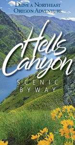
Wallowa Mountain Loop Road Is:
The route of the Hells Canyon Scenic Byway is a loop that encircles the Wallowa Mountains, intersecting with Interstate 84 at La Grande and Baker City.
Small towns, scattered along the drive, offer visitor services. The entire route is on a paved highway. Plan ahead – you’ll find stretches of more than eighty miles without gas and with few services. A segment of the Byway between Joseph and Halfway closes with snow in winter, but allows access to winter recreation areas, offering a whole other kind of Northeast Oregon adventure. Visitor information for communities in each of the three counties through which the byway passes is available by clicking the links in the list of cities below. Find visitor information and plan your visit to the entire region at visiteasternoregon.com . There are five ports of entry into the Byway:
- La Grande from I-84
- Elgin via OR Hwy. 204
- Enterprise via OR Hwy. 3
- Oxbow via Idaho Hwy.71
- Baker City from I-84.
See Map | See Byway Segment Details
You can drive the Byway in about four to five hours, but to really enjoy it, you will need a few days. We recommend you reserve lodging accommodations prior to your trip.
Here is a list of mileage for several byway segments and side trips:
- La Grande to Enterprise = 63 miles; paved
- Enterprise to Joseph = 15 miles; paved
- Joseph to Imnaha = 30 miles; paved
- Imnaha to Hat Point = 24 miles; gravel (Highly recommended for the best view of canyon, but it is an investment of about 5 to 6 hours in time, round trip from Joseph). Pack a picnic or plan a stop at the iconic Imnaha Tavern.
- Imnaha to intersection with FSR 39 = 26 miles; gravel
- Joseph to Hells Canyon Overlook = 35 miles, plus 2 miles; paved (We highly recommend this side trip to get a good view of the canyon from above.)
- Joseph to intersection with OR 86 = 54 miles; paved
- Halfway to Copperfield (at the Snake River) on OR 86 = 21 miles; paved
- Copperfield to Hells Canyon Dam = 27 miles; paved (Highly recommended side trip for experiencing the canyon from river level.)
- Copperfield to Baker City = 70 miles on OR 86; paved
Although the digital world is great, we still strongly recommend people pick up a free official Oregon State Highway map, put out by the Oregon Department of Transportation, for travels throughout Oregon, available at visitor centers throughout Oregon. Also good to have is a Wallowa-Whitman National Forest Map for travels in the mountains of northeast Oregon, including the HCSB. Purchase this map at any Forest Service District Ranger office (Baker City, La Grande, Joseph, Halfway) and many other locations.
BYWAY TRAVEL SAVVY
Before starting out, take notice of the travel times as well as mileage between stops and keep your fuel tank as full as possible.
If you plan to hike, ski, snowmobile or otherwise explore off the main Byway routes, pick up detailed maps and additional information from the offices listed on the links shown above.
Be prepared for temperatures that vary as much as fifty degrees as the day wears on.
Remember to take along plenty of drinking water, your camera, binoculars, a picnic or snack foods, plant and wildlife guides, first aid kit, a blanket and jackets.
Unless familiar with the byway country, please stay on the byway proper or the identified side trips. Do not rely only on GPS generated driving instructions as they may lead to little traveled roads or roads that are not suitable for passenger vehicles or closed seasonally.
Salmon River Scenic Byway
Explore Idaho’s wild and scenic side along the Salmon River Scenic Byway. This 161-mile route follows the Salmon River providing access to jaw-dropping outdoor opportunities as well as a chance to visit ghost towns and other historical sites. Add in wonderful views of the rugged Sawtooth Mountains, and it’s easy to understand why this is a must-see scenic byway.
163 miles 262 km
3 hours, 9 minutes
Central Idaho
When to Visit
April-november.

31 Byways. 31 Ways to Be Inspired.
A variety of scenic, natural, historic, recreational, archeological and cultural experiences can be found on Idaho’s 31 scenic byways. View the video to get a taste of the adventures that await you, and start planning your next road trip.
Road Trip Tips
Turn-by-Turn Directions: From the Montana state line south on U.S. 93 to Challis, then west to Stanley on Idaho 75.
Full services in: Stanley, Challis, Salmon and North Fork
Partial Services in: Clayton and Gibbonsville
Motorcycle Route: Yes
Full services: When gas, food and lodging are available Partial services: When gas and a few other facilities are available
Nearby Adventures
Discover pristine forests, wild whitewater, historic trails and more during your road trip along the Salmon River Scenic Byway.
- Salmon River
Middle Fork of the Salmon River
- Frank Church-River of No Return Wilderness
- Salmon-Challis National Forest
- Sawtooth National Forest
- Land of the Yankee Fork State Park & Interpretive Center (Bayhorse, Bonanza and Custer)
- Redfish Lake
- Nez Perce (Nee-Mee-Poo) National Historic Trail
- Continental Divide National Scenic Trail
- Sacajawea Interpretive, Cultural & Educational Center
- Lewis and Clark National Historic Trail

Land of the Yankee Fork State Park

Lewis and Clark National Historic Trail – Idaho

Sacajawea Interpretive, Cultural & Educational Center
Download before you hit the road.
Start planning your epic Idaho road trip with the help of these free travel publications.

Idaho Roadsider
State Highway Map
Travel tips.
Need some ideas for your next Idaho road trip? Check out these travel tips and start planning your adventure.

Highlights of a Salmon River Scenic Byway Road Trip

Travel Through History in the Land of the Yankee Fork

Ready to Explore More Scenic Byways?
IMAGES
VIDEO
COMMENTS
The Gold Belt Tour is located in southern Colorado, just one hour from Colorado Springs or Pueblo and two hours from Denver. You can reach the northern end of the Byway from U.S. Highway 24 and the southern end via U.S. Highway 50. Each of the roads offers distinct scenery ranging from rolling mountain parklands to deep rocky canyons.
Gold Belt Tour. Length: 131 miles. Driving time: 5 hours. In the early 1890s, the mining towns in the shadow of Pikes Peak enjoyed the greatest gold boom the state has ever known. This 131-mile circuit tours historic Cripple Creek, Florence, McCourt, Adelaide, Wilbur, Victor, and other former gold camps. The roads are narrow and rugged in ...
The Gold Belt Tour is a jaw-dropping 131-mile drive through Colorado's former mining country. It retraces the supply routes between the Front Range's biggest gold camps. In 2000, the Gold Belt Tour was declared a national scenic byway. You can reach it easily by heading west from Colorado Springs or Pueblo.
12-21. Enjoy Cañon City's canyons, fossils, and recreation on the Gold Belt Tour. In Canon City, life centers around the Arkansas River and its spectacular Royal Gorge Park, a deep gash in the earth. Experience high-flying adventure at Royal Gorge Bridge and Park. Allow at least a day to explore all the park offers.
In Cañon City, use the self-guided Fremont County Heritage Tours to navigate the charming downtown historic district or take a stroll down Tunnel Drive, an old railroad bed that boasts a spectacular view of the Arkansas River and surrounding canyons. From here, the Gold Belt Tour heads back up into the hills via the rugged and more desert-like ...
The Gold Belt Tour Scenic and Historic Byway is a National Scenic Byway, a Back Country Byway, and a Colorado Scenic and Historic Byway located in Fremont and Teller counties, Colorado, USA.The byway is named for the Gold Belt mining region.The Cripple Creek Historic District is a National Historic Landmark.The byway forms a three-legged loop with the Phantom Canyon Road (narrow gravel), the ...
The Gold Belt Scenic Byway is a national scenic byway running through Colorado's gold country. Just an hour from Colorado Springs, this byway consists of many routes featuring famous roads and byways such as Phantom Canyon Road, Shelf Road, High Park Road and Teller County Road 1. You'll also get a chance to see major landmarks, such as ...
The Gold Belt Tour follows historic railroad and stagecoach routes leading to North America s greatest gold camp, three world-class fossil sites, and numerous historic sites. ... Local Information. Gold Belt Tour Scenic and Historic Byway BLM-Royal Gorge Field Office 719-269-8500 Send E-mail Canon City Chamber of Commerce 719-275-2331 Send E ...
Gold Belt Tour Scenic and Historic Byway. BLM-Royal Gorge Field Office 719-269-8500. Canon City Chamber of Commerce 719-275-2331. Gold Belt Tour Information 719-689-2461. The Gold Belt Tour follows historic railroad and stagecoach routes leading to North America's greatest gold camp, three world-class fossil sites, and numerous historic sites
Gold Belt Tour Scenic Byway - Composed of 3 roads (High Park Road, Shelf Road and Phantom Canyon Road), this 135-mile scenic byway takes drivers through many of south-central Colorado's former mining towns. Gamble in Cripple Creek, check out Florissant Fossil Beds' dinosaur bones and walk the suspension bridge at the Royal Gorge.
The Gold Belt Tour National Scenic Byway retraces the historic travel routes for the World's Greatest Gold Camp, Cripple Creek. Travel on a historic, narrow-gauge railroad bed, an old stage road, and a county road on the Byway. The three legs of the route, which form a loop, have a total length of about 131 miles of historic sites, museums ...
The Gold Belt Tour Scenic and Historic Byway is a 131-mile route that features an abundance of old mining towns and supply towns for the Gold Rush in the shadow of Pikes Peak. Among these towns are Cañon City, Cripple Creek, Florence, Florissant, and Victor. These towns were responsible for a renowned gold boom in the early 1890s.
The Gold Belt Tour Scenic Byway travels through the prehistoric past of dinosaurs and follows historic railroad and stagecoach routes to gold mining towns. Stunning scenery and abundant recreation opportunities await in this "Road to Riches" drive through five fascinating byway communities. Gold Belt Tour Scenic Byway is a scenic drive in Colorado.
Navigating the Byway: The Gold Belt Tour Scenic Byway connects six of Colorado's major historic towns using four stunning roads. **Phantom Canyon Section:** * The first section of the byway starts in Florence, CO, at the junction of CO 67 and West Main Street. * From here, head north on CO 67 and continue as it changes to Phantom Canyon Rd.
Gold Belt Tour Scenic Byway, Guffey, Colorado. 850 likes · 604 were here. The Gold Belt Tour is 131 miles, which includes, High Park Rd, Shelf Rd, Phantom Canyon Rd and Teller One.The Byway touches...
Gold Belt Tour Scenic and Historic Byway State: Colorado Length: 135 miles / 216.0 km Time to Allow: Allow a minimum of 8 hours to cover all segments of the Byway. If you want to stay closer to Colorado Springs, try the Gold Belt Tour Scenic and Historic Byway. The byway does not offer a
Route Information. The route of the Hells Canyon Scenic Byway is a loop that encircles the Wallowa Mountains, intersecting with Interstate 84 at La Grande and Baker City. View Brochure. Small towns, scattered along the drive, offer visitor services. The entire route is on a paved highway. Plan ahead - you'll find stretches of more than ...
The scenic route passes through 10 states and hundreds of river towns. The Great River Road is arguably the longest and most important scenic byway in America. The Drive. It takes about 36 hours of straight driving to travel from north to south along the byway. Most people take four to 10 days to make the journey. Pilot's Wheel Road Signs
Welsh Scenic Byway. This byway celebrates the Welsh immigrants who settled in southeastern Ohio in the 19th century. Ohio's 27 scenic byways celebrate the state's unique position as an historic transportation hub for America. A trip down an Ohio Byway offers adventures, history lessons and relaxing scenery that renews your appreciation in nature.
Explore Idaho's wild and scenic side along the Salmon River Scenic Byway. This 161-mile route follows the Salmon River providing access to jaw-dropping outdoor opportunities as well as a chance to visit ghost towns and other historical sites. Add in wonderful views of the rugged Sawtooth Mountains, and it's easy to understand why this is a ...