
- Art Galleries
- Shopping Centres
- Suburbs - Bondi
- Suburbs - Circular Quay
- Suburbs - City & CBD
- Suburbs - Darling Harbour
- Suburbs - Manly
- Suburbs - Parramatta
- Theme Parks


Sydney Opera House

Sydney Harbour Bridge

Taronga Zoo

Bondi Beach

Royal Botanic Gardens

Sydney Tower EYE

Sydney Harbour Bridge Climb

Queen Victoria Building

Wild Life Sydney

Blue Mountains National Park

Raging Waters Sydney

Blue Mountains

Hunter Valley

Port Stephens

Hunter Valley Wine Tours

Sydney Harbour Cruises

Whale Watching

Home and Away Tour

Sydney International Piano Competition
Spring Cycle

NRL Grand Final

Murrumbateman Moving Feast
Camden Festival

Ironman 70.3 Western Sydney

Oz Comic-Con

Manly Jazz Festival

Sydney Running Festival
Cabramatta Moon Festival

Sculpture in the Vineyards
- Boutique Hotels
- Luxury Hotels
- Budget Hotels
Kings Cross
- North Sydney
- Potts Point
- Surry Hills
Circular Quay
Darling Harbour
- Restaurants

Weather Forecast

Flights to Sydney
Places to visit in sydney.

Sydney Airport

Sydney Time

Where To Go In Sydney
- General Enquiries
- Advertising Enquiries
- Add Your Business
- Add Your Event

The Sydney Light Rail is a light rail system that serves the city of Sydney in New South Wales. The network comprises the Dulwich Hill Lane; a single line that spans a length of approximately 13 kilometres with 23 stations along the line. Plans are underway to build additional lines to serve the western part of the city.
The light rail system’s history can be traced back to the early 20 th century, at a time when the city developed a tram network.
Sydney Light Rail, Route Map, Timetable, Stops, Fares & Network, NSW
In recent years, the line has undergone development, which has allowed the system to be integrated with other forms of transport within the city . Today, the light rail lines of Sydney serve different parts of the city. L1 Dulwich Hill Line, which is the original line, links the inner Western suburbs to Pyrmont, Darling Harbour and the CBD. The other lines under construction include the CBD and the South East line, which will in future, operate between Central Station in the southern end and Circular Quay .
The Sydney Light Rail uses the Opal Ticketing system; a smart card-based system that makes it easy to get around Sydney. Perhaps the most exciting aspect of this rail system is that it is also valid on ferry , train and bus services for seamless connections. Note, however, that different fares are applicable across these modes of transport. Additionally, fares cannot be combined, so make sure you check with the various service providers.
For history buffs interested in learning more about the history of the Sydney Light Rail, public documents and reports are available at the library. From planning documents to newsletters, these offer an in-depth look into the evolution of the light rail system and how it has become a fundamental part of Sydney’s transport infrastructure.
Light Rail Images & Photos
Other places we recommend.
Cancel reply
Please Enter Your Question Below
Your Name *
Your Email *
Where can I get a printed timetable of light rail from central to high street Randwick Ie Prince of Wales Hospital or a site I can PRINT one from DEFINITELY . Not given the run around as in click on here and led to nowhere.
I looked at the TransportNSW website and i believe I found exactly what you are looking there.
There is a downloadable PDF file that you can print off at https://transportnsw.info/documents/timetables/93-L2-Randwick-Line-20210122.pdf .
Thanks Michael
Upcoming Events
Operation art, orange wine festival, australian beer festival, sydney craft week, the big design market, wingham music festival, lake macquarie kokoda challenge, the everest, yours and owls.

Trip Planner - NSW Transport 4+
Sydney opal public train & bus, jerrycan co pty ltd, designed for iphone.
- #100 in Travel
- 4.2 • 996 Ratings
- Offers In-App Purchases
iPhone Screenshots
Description.
Plan any trip via any mode to anywhere in Sydney for free. Store favourite trips and stops for quick reference on your commute. Get the latest trackwork or service alerts Whether you're old enough to remember MX newspapers on trains, or new to Sydney, this app is designed to make horrific commutes slightly less so! Simple trip planning for all modes of travel, up-to-date train network alerts, stored favourite trips - everything you need to get to and from work and play hassle-free...for free. The only thing this app can't do is cancel trackwork or prevent people playing music loudly enough that you can hear it in spite of their headphones! Trip Planner • Train, Metro, Bus, Ferry, Light Rail, Foot • Mixed-mode planner • Take the same route often? Save your favourite Trips • Simple, easy to use interface Trackwork and Service Alerts • If you use public transport in Sydney, chances are you know how useful these will be! • Service alerts by journey • Know in advance if you need to make a detour or avoid a particular line due to trackwork Subscribe to Trip Planner and get: • Exactly the same app, but with a feeling of mutual appreciation between us • No ads, ever! • All for the low, low price of bugger all, which is Australian for $1/month Please note that while we make our best effort to ensure timetable accuracy, we cannot guarantee the accuracy or completeness of those provided. If you purchase a subscription, payment will be charged to your iTunes account. Your subscription will automatically renew unless auto-renew is turned off at least 24-hours before the end of the current subscription period. Your account will be charged for renewal within 24-hours prior to the end of the current subscription period. Automatic renewals will cost the same price you were originally charged for the subscription. You can turn off auto-renewal at any time by going to your Account Settings on the App Store after purchase. Privacy Policy: https://jerrycan.co/metro/privacy.html Terms of Service: https://jerrycan.co/metro/terms.html
Version 2023.15
- Hotfix for a rare bug.
Ratings and Reviews
996 Ratings
Being able to save trips has been a lifesaver in this app. If not for that, the interface is quite confusing at first (which is unlike Apple). I do also wish that the “departing now” interface was removed and replaced with infinite scrolling like on the TripViewLite app. Other then that I think it’s a nice app.
Developer Response ,
Thanks very much for the thoughtful review!
Easy for high school
I’m going into high school and it was terrifying thinking about catching trains but with trip planner it’s so easy! There aren’t any ads and honestly I love it! It’s similar to the website, but easier to access.
Previous version 100% better. Previous version was more user friendly & gave greater detail especially when transferring to different modes of transport ie:- train to bus or walk in between without having to go back to start again. When trying to find which mode of transport is faster to get to destination current version was more difficult than previous version and become frustrating To use. It also did not help when trains were delayed.
Hey thanks for taking the time to write such a useless and unhelpful review! It’d be great if you could provide some reasons or examples next time. Merry Christmas!
App Privacy
The developer, Jerrycan Co Pty Ltd , indicated that the app’s privacy practices may include handling of data as described below. For more information, see the developer's privacy policy .
Data Used to Track You
The following data may be used to track you across apps and websites owned by other companies:
- Identifiers
Data Not Linked to You
The following data may be collected but it is not linked to your identity:
- Diagnostics
Privacy practices may vary, for example, based on the features you use or your age. Learn More
Information
English, Simplified Chinese, Traditional Chinese
- Remove Ads $2.99
- Full Version $9.99
- Remove Ads $7.99
- Serendipity - 1 Day $1.99
- Serendipity - 1 Month $34.99
- Serendipity - 1 Week $9.99
- App Support
- Privacy Policy
More By This Developer
Great Reads
You Might Also Like
Sydney Transport: Bus & Rail
TripView Lite
Opal Travel
How can we help you today?
Popular searches.
- Contactless payments
- Routes and timetables
- Concessions
- School student travel
- Opal Travel app
- Help with planning
- How to use public transport
Ways to plan your trip
There are various trip planning tools and resources you can use to plan your journey. Options include:
Digital tools
Digital trip planning tools are simple to use and have all the information available to assess your trip options. You can also use these tools to get the following information:
- real-time service information and timetables
- accessible route options
- the ability to
- save your favourite trips for future reference
- copy and share a link to your trip plan with a friend
- print a copy of your trip plan to have a paper back up
Trip planning tools will let you know how long each proposed trip will take, what modes of transport you will be using and how many change overs are required.
Learn how to use the following digital tools featured on this site:
- The Trip Planner on this website
- Opal Travel App
- Google Maps website and digital app
Trip planning support is available on the Transport Info Line. Call 131 500 , and select Option 5 to speak with a Transport worker who can walk you through the journey planning process and help you identify the best travel options for you. The Info Line is available from 6am to 10pm every day.
If you are deaf or have a hearing or speech impairment, contact the National Relay Service for help to make a call.
Plan with someone
If you prefer plan your journey in person, you can always ask a trusted friend or family member to assist you in planning your journey and helping you get prepared.
Identify one person who is your special support person for public transport. Keep them informed about your planned journeys and be in touch with them in transit in case of disruptions along the way.
Trip Tap Go’s Guide to Sydney’s Light Rail Network

The Sydney light rail network is a light rail/tram network operating within the city of Sydney. Having begun operations in 1997, the network experienced its largest ever expansion with the opening of the Randwick Line in December 2019. The network’s recent expansion increased the number of station to 42, covering a length of 24.7 km.
The recent expansion is great news for travellers making it even easier for visitors to travel between the different attractions located across Sydney. Popular attractions such as Circular Quay, the Queen Victoria Building and the Sydney Fish Market are all easiley accessible via the Sydney light rail network. The Kingsford Line, the systems third, is expected to open in March 2020 with a separate Parramatta Line (located in Sydney’s west) expected to follow in 2023.
Visitors wishing to use the Sydney light rail network will need either an Opal card, credit card/contactless payment method or a single trip ticket available for purchase at every light rail stop. Check trip planner for current service times as service frequency is dependent on rider volume and traffic conditions. If you’d like to know more, check out the network’s official website for more information.

Share this:
- Click to share on Facebook (Opens in new window)
- Click to share on Twitter (Opens in new window)
- Click to share on Pinterest (Opens in new window)
- Click to share on WhatsApp (Opens in new window)
- Click to share on LinkedIn (Opens in new window)
Leave a Reply Cancel reply
Discover more from.
Subscribe now to keep reading and get access to the full archive.
Type your email…
Continue reading
- Airport Transfer
Things to Do

Traveloka Team
27 Feb 2024 - 5 min read
A Guide to Getting Around Sydney with Sydney Light Rail

Sydney has a large public transportation network that includes trains, buses, ferries, and light rail. Sydney Light Rail refers to the modern light rail network that operates in Sydney, making it a unique form of transportation that you can find in Australia. The system was designed to provide efficient and convenient transportation options by connecting different communities and essential locations.
The light rail system has been integrated into Sydney's larger public transportation network, providing seamless transfers between trains, buses, ferries, and other means of transportation. In this article, you will find a complete guide to using Sydney light rail.

About Sydney Light Rail
The Sydney light rail connects Central Station in the city centre to Dulwich Hill in the Inner West, going through several areas, and connects Circular Quay in the city centre to Randwick and Kingsford in the South East, serving locations such as Surry Hills and Moore Park.
The Sydney light rail runs through several stations, offering access to important destinations, business centres, and residential neighbourhoods. Central, Capitol Square, Darling Harbour, Circular Quay, Wynyard, Surry Hills, Moore Park, UNSW High Street, and Randwick are the light rail routes. The light rail system is connected with other means of public transit, allowing for seamless transfers between trains, buses, ferries, and light rail.
Sydney Light Rail Service Times and Frequency
The service times and frequency of the Sydney Light Rail may vary depending on the line and time of day. It's important to note the light rail timetable. The Sydney Light Rail consists of two main lines: the L1 Dulwich Hill Line and the L2 Randwick Line. These lines connect various neighbourhoods and key destinations in and around Sydney.
1. L1 Dulwich Hill Line
The L1 Dulwich Hill Line is normally operational from early morning to late evening, with service changes for weekends and public holidays. During busy hours, such as weekday mornings and evenings, trains on the L1 line may run more often to meet increased demand.
2. L2 Randwick Line
The L2 Randwick Line typically operates during the same hours as the L1 line, with services beginning in the early morning and continuing until late evening. Similar to the L1 line, the L2 line may have a slightly lower frequency on weekends and off-peak hours and a higher frequency during peak hours.


Sydney Light Rail Routes
Both light rail lines are connected to various modes of public transit, allowing passengers to smoothly switch between trains, buses, ferries, and light rail. Here are the key Sydney light rail routes for the two main lines.
The L1 Dulwich Hill Line connects Central Station in the city centre to Dulwich Hill in the inner west.
The rail routes include:
Central Station- Capitol Square- Darling Harbour- Pyrmont Bay- Glebe- Jubilee Park- Rozelle- Lilyfield- Leichhardt North- Hawthorne- Marion- Taverners Hill- Lewisham West- Dulwich Hill (Terminus).
The L2 Randwick Line connects Circular Quay in the city centre to Randwick and Kingsford in the southeast.
Circular Quay- Wynyard- Surry Hills- Moore Park- Kensington- UNSW High Street- Randwick- Wansey Road- Royal Randwick- High Cross Park- Clara Street- Royal Hospital for Women- Barker Street- Kingsford (Terminus).

Sydney Light Rail Fares and Tickets
The Sydney Light Rail uses the Opal card system for fare payment. The Opal card is a smart card that can be loaded with credit and used on numerous types of public transportation, such as trains, buses, ferries, and light rail.
Opal cards are classified into four types: adult, child/youth, concession, and senior/pensioner. Opal cards can be bought from machines located in train stations, light rail stops, and other transportation hubs. Credit can be added at Opal card machines, online, or at retail outlets.
Fares are often calculated based on the distance travelled. The fare increases as you travel further away.
Hotel Recommendations Near Sydney Light Rail Popular Routes
Areas along the popular routes of the Sydney Light Rail are where you can find hotel accommodations.

1. W Sydney
The light rail passes through Darling Harbour and Pyrmont, offering a vibrant area with waterfront views. W Sydney is perfect, only 2.1 km from Darling Harbour and Sydney light rail, making it a strategic place for those who want to experience the uniqueness of Sydney’s transportation.
While in the area, try to do fun things with loved ones by joining Darling Harbour Sea Kayaking with a very professional guide and taking in the amazing views by paddling up that you can book from Traveloka.
Address: 31 Wheat Road, Pyrmont, Sydney, New South Wales, Australia, 2000

31 Wheat Road

Darling Harbour Sea Kayaking Explorer Tour by Sydney Harbour Kayaks | Sydney

2. ibis Styles Sydney Central
The L1 Dulwich Hill Line starts at Central Station, and the CBD area has numerous hotels catering to various budgets. The ibis Styles Sydney Central is our recommendation due to its service and friendly price, and better yet, it is near the CBD’s light rail station.
Near the area, try to visit Sydney Tower Eye to marvel at the cityscape from the observation deck of the Sydney Tower, Sydney's highest structure. The Sydney Tower Eye, which is situated 250 metres above the ground, provides sweeping views of the city and its well-known sites, such as the far-off Blue Mountains and golden beaches, that you can book from Traveloka.
Address: 27 Wentworth Avenue, Sydney CBD, Sydney, New South Wales, Australia, 2010

ibis Styles Sydney Central

27 Wentworth Avenue

Sydney Tower Eye

3. Rydges Sydney Harbour
Circular Quay is a central hub where the L2 Randwick Line starts. Rydges Sydney Harbour is a luxury hotel with views of the Sydney Opera House and Sydney Harbour Bridge. There are plenty of things to do around Rydges Sydney Harbour for everyone, whether they are travelling alone, with adults, or with their complete family.
Address: 55 George Street, Sydney CBD, Sydney, New South Wales, Australia, 2000

Rydges Sydney Harbour
55 George Street

Sydney Opera House Official Architectural Tour | Australia
Organising a trip to Australia offers a wide variety of activities, from energetic cities to breathtaking natural settings. Research and book your flights to Sydney and within Australia on Traveloka!
Payment Partners
About Traveloka
- How to Book
- Help Center
Follow us on
- Traveloka Affiliate
- Privacy Notice
- Terms & Conditions
- Register Your Accommodation
- Register Your Experience Business
- Traveloka Press Room
- Vulnerability Disclosure Program
Download Traveloka App
How can we help you today?
Popular searches.
- Contactless payments
- Routes and timetables
- Concessions
- School student travel
- Opal Travel app
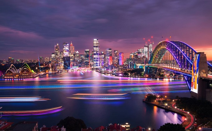
Vivid Sydney Vivid Sydney
Friday 24 May to Saturday 15 June Friday 24 May to Saturday 15 June
Southwest Link Southwest Link
Train replacement bus services during the final conversion period of the T3 Bankstown Line Train replacement bus services during the final conversion period of the T3 Bankstown Line
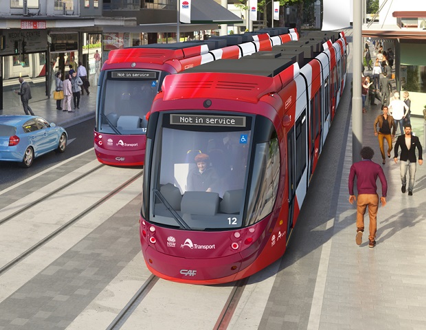
Parramatta Light Rail is now being tested Parramatta Light Rail is now being tested
Stay safe around the new light rail Stay safe around the new light rail
Getting Sydney back on track Getting Sydney back on track
View the latest rail repair trackwork updates View the latest rail repair trackwork updates
- Slide 1 of 4
- Slide 2 of 4
- Slide 7 of 4
- Slide 8 of 4
- Lost property
- School transport

Open 11am | Close 6pm | Wednesday close 9pm
Biennale of Sydney - Rozelle
Plan your trip to the Biennale of Sydney at White Bay Power Station in Rozelle from Saturday 9 March to Sunday 10 June. Buses run regularly to the venue.
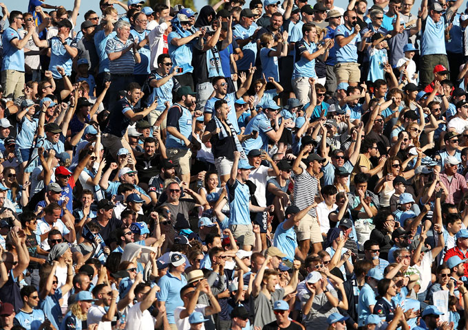
Gates open 18:45 | Kick-off 19:45 | Full time 21:30
A-League Men Semi Final: Sydney FC v Central Coast Mariners
Plan your trip to see Sydney FC take on the Central Coast Mariners in the A-League Men Semi Final at Allianz Stadium in Moore Park on Friday 10 May.
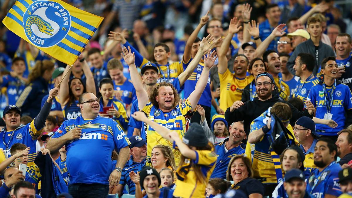
Gates open 18:30 | NRL kick-off 20:00 | Full time 21:45
NRL: Eels v Broncos
Plan your trip to the see the Eels take on the Broncos on Friday 10 May at CommBank Stadium in Parramatta.
Transport news
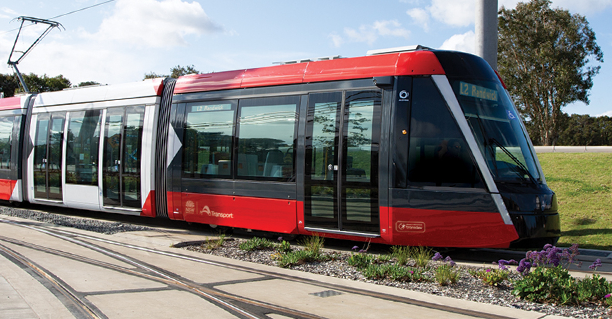
L2 Randwick Line and L3 Kingsford Line weekend full closures due to maintenance
Saturday 18 and Sunday 19 May, L2 Randwick Line and L3 Kingsford Line light rail services will not run due to planned trackwork and maintenance works.
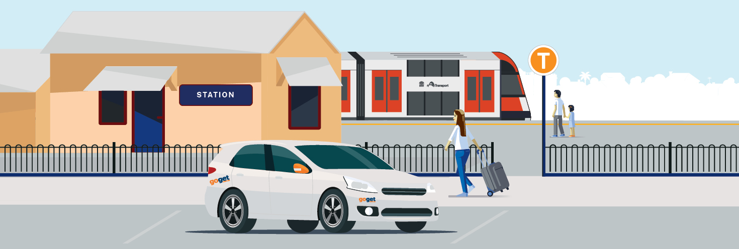
GoGet car share now at Wollongong and Katoomba stations
Travel by train to Wollongong or Katoomba and then hire a GoGet car right at the station.

Parramatta Wharf Temporary Closure
From Monday 13 to Thursday 23 May, the F3 Parramatta River service will be replaced by shuttle bus service Route 60F3 between Parramatta Wharf and Rydalmere Wharf.
Skip to content
- Decrease text size
- Increase text size

NSW Government - Opal
Get an Opal card
Customer care.
- What services can I use it on?
Opal can be used to pay for travel on public transport including metro, trains, buses, ferries and light rail in Sydney, the Blue Mountains, Central Coast, the Hunter and the Illawarra. Find out more about Opal or plan a trip using Trip Planner .
Quick links
- Transport Info
- Website Terms
- Opal Terms of Use
- Accessibility
- Website Help
- Get Adobe Reader
- Transport for NSW
- My reservations
How to get around Sydney using the new light rail
Cosy Winter Deals with Frasers Hospitality Australia
Frasers Hospitality Launches North Park Place in Thailand
Sydney is a wonderful place to visit and explore, but it’s population is bursting at the seams and the traffic can be enough to give you a migraine. The daunting size of its sprawling metropolitan and suburban areas doesn’t help either, and it can make for long journeys to and from your destination if you visit any major attractions that aren’t huddled within the CBD.
Thankfully, Sydney has substantial public transport infrastructure with trains, buses, ferries and light rail servicing routes that snake throughout the entire city. While the locals like to bond over a common dissatisfaction with the network, it’s more than efficient enough to get you from A to B and often far more quickly than it would take in a taxi or your own car.
For some years, Sydney only had one light rail running from Central Station to Dulwich Hill as part of the Inner West Light Rail network. This has now been complemented by two brand-new routes in the CBD and southeastern areas of the city, substantially expanding the city’s light rail services for locals and tourists. It’s welcome news, too: trams offer smoother rides than buses, can fit up to 450 each and operate at high frequency seven days a week.
Where The New Routes Are Running
Both the new L2 and L3 routes travel along George St from Circular Quay and skirt around Central train station before heading east along Devonshire Street and turning down Anzac Parade. After Moore Park – where passengers can disembark for access to the Sydney Cricket Ground and Sydney Football Stadium – the L2 turns down Alison Road into Randwick while the L3 continues down Anzac Parade towards Kingsford.
Inner West Light Rail network
L1 Dulwich Line – Running in both directions between Dulwich Hill and Central Station.
CBD and South East Light Rail network
L2 Randwick Line – Running in both directions between Randwick and Circular Quay via Central Station.
L3 Kingsford Line – Running in both directions between Juniors Kingsford and Circular Quay via Central Station.
Head to the Transport for NSW website to use the online Trip Planner and check the network map.
How To Check The Timetable
Here’s the thing, there isn’t actually a timetable for any light rail in Sydney. Before you consider this a bad thing, part of the reason there are no set times is because the service runs at high frequency with trams departing as often as every 4 minutes at peak times. This makes it easy to turn up and hop on the next tram without worrying too much about departure times, just be sure to check online for specific service times and frequency to get an idea of how often they run on particular days of the week.
How To Buy Tickets
Just like catching any other form of public transport in Sydney, the best thing to do is buy an Opal card. These can be picked up at most train stations and transport hubs, any participating retailers (look for an Opal sign or sticker on the shopfront), the airport or online. Opal cards work like many other smart cards you’ll find in cities all over the world: simply top up your balance online, in-store or at a self-service machine, tap it on a card reader when you start your journey and tap it again when you finish. Simple! If you find yourself stuck without a card, you can use a Mastercard, Visa or American Express credit or debit card instead for a higher fee.
Things To See And Do On The Light Rail Routes
The L1, L2 and L3 light rail routes connect numerous major attractions, some of which had little to no public transport links before the new network was introduced.
L1 Dulwich Line:
- Paddy’s Markets
- Glebe Markets
- Harbourside
- Darling Harbour
- Powerhouse Museum
- Sydney Fish Market
L2 Randwick Line/L3 Kingsford Line:
- Martin Place
- Circular Quay
- Sydney Opera House
- Allianz Stadium
- Sydney Cricket Ground
- Royal Randwick
- University of New South Wales
- The Entertainment Quarter
In addition to the above, the L2 line offers access to the Royal Randwick racecourse and Randwick’s hub of bars and eateries, while the L3 takes passengers through Kensington’s bustling shopping strip.
Explore The New George Street Boulevard
The new light rail routes aren’t just a bonus for those who need to travel to and from southeast Sydney. Designed to ease pressure on roads and other forms of public transport, these new services have allowed town planners to convert the once-congested section of George Street between Hunter and Bathurst Streets into a spacious pedestrian thoroughfare. Now you can shop your way along George Street and hop on a light rail service at your convenience without the chaos of traffic jams causing any disruptions.

Not a Fraser World Member? Sign up today for free membership and enter a world of privileges
- Complimentary Stays
- Up to 20% off Best Flexible Rate
- Room Upgrade
- Early Check-in
- Exclusive Rewards
- Welcome Voucher

- NSW Road trips
- Accommodation
- Be inspired
- accessibility
Accessible Sydney - Getting Around
Planning an accessible trip .
Want to start exploring our beautiful Harbour City? Understanding the location of potential barriers such as stairs, access features including lifts, accessible toilets or taxi ranks, and the best modes of accessible transport available provides people with disability greater confidence to navigate Sydney and enjoy it’s many attractions.
In Sydney, the majority of public transport services are accessible. Mobility aids including wheelchairs, scooters, walking frames, prams and strollers can safely board and travel on all metro and light rail services and most trains, buses and ferries. Assistance animals are permitted on all public transport in NSW.
Transport NSW provides an online Trip Planner showing accessible service information for every trip plan in Sydney. Users can refine the results by selecting the accessibility check boxes that apply to them. You can also get real-time service information and view route maps; save your favourite trips; copy and share a link to your trip plan; and print a copy of your trip plan.
Alternatively, download a transport accessibility app that best suits your needs.
Transportnsw.info incorporates ferry services, buses and trains. Specific information about accessible travel in Sydney is available.
All Sydney Ferries vessels are accessible to people using essential mobility aids, but several older-style wharves have steps that prevent access. Trip Planner displays which services are accessible. View a list of Sydney’s accessible wharves.
If you use a wheelchair or other mobility device that meets Transport NSW’s mobility aid specifications , you can board all Sydney and Intercity trains. Accessibility features offered on each train may vary. Trains for intercity services have accessible toilets. Look for the wheelchair symbol for accessible entrances located at the end of carriages.
Sydney Metro is a fully accessible railway. If you have limited mobility, you can travel on all metro services.
Buses that are accessible have the wheelchair symbol displayed on the front of the bus. They have lower floors, wide doors and aisles, and there are no steps in the front half of the bus. Other features include handrails, accessible stop buttons and highly visible LED destination signs on the front of the bus.
Light rail
If you have limited mobility, you can travel on all light rail services. There are ramps or lifts for getting to and from the platform and all light rail stops have network maps and electronic information displays indicating when the next service is due. Staff can assist you with getting on and off light rail vehicles. Check the accessibility facilities at Sydney’s light rail stop locations here .
Information about wheelchair-accessible taxis is available on Transport NSW . Accessible taxis are available in Sydney. Zero200 is a centralised booking service for wheelchair-accessible taxis in Sydney (phone +61 2 8332 0200).
Mobility parking
If you hold an approved permit, you can enjoy free parking for a certain period of time in designated parking zones in Sydney. The City of Sydney provides a list of the mobility parking spaces in the Sydney city centre, as well as a map .
Sydney Airport
Sydney Airport provides special assistance for people with disabilities and can help with baggage, getting around the airport, and getting on and off the plane. For a full list of accessible facilities throughout the terminals, visit Sydney Airport’s accessible facilities and services page . A sensory map identifying high sensory and low sensory areas to help you navigate through the terminal is also available.
Accessible toilets
The National Public Toilet Map is an initiative of the National Continence Management Strategy. It allows tourists to identify appropriate places for toilet breaks and also whether toilets are wheelchair accessible.
Please note that some accessible toilets are locked and require an MLAK (Master Locksmith’s Access Key) to gain access. The MLAK is a master key that fits into specially designed locks allowing 24-hour access to public toilets. Eligible people can purchase a key that opens all accessible toilets displaying the MLAK symbol. Eligibility is restricted to people who have a disability or have written authority from a doctor, a disability organisation, a local council or community health centre or the owner or management of a building with an accessible toilet on site.
For more information, or to purchase an MLAK from your local member of the Master Locksmiths' Association of Australasia, please call 1800 810 698 or visit the website .
Access maps
The Rocks access map - Sydney Harbour Foreshore Authority
Sydney CBD and Circular Quay access map - City of Sydney
Manly CBD access map - Manly Council
Sydney Opera House venue access maps - Sydney Opera House
Royal Botanic Garden Sydney accessibility - Royal Botanic Garden Sydney
Accessible things to do in Sydney
Museums & galleries
History & heritage
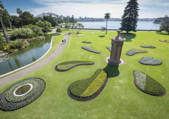
Outdoors & wildlife
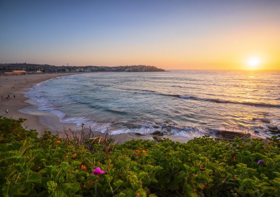
Bucket-list attractions
Subscribe to our newsletter.
Stay connected to Sydney for all the latest news, stories, upcoming events and travel inspiration.
Discover Somewhere New
All the insider news, tips and inspiration you need to plan your next trip, delivered straight to your inbox.
Destination NSW acknowledges and respects Aboriginal people as the state’s first people and nations and recognises Aboriginal people as the Traditional Owners and occupants of New South Wales land and water.
- NSW Government
- Destination New South Wales (Corporate site)
Sydney.com is the official tourism site for Destination NSW. © Copyright 2024 Destination NSW. All rights reserved
10 Incredibly Scenic Day Trips From Sydney By Public Transport
Looking to escape to an idyllic spot not far from the city? Head to one of these beautiful places in NSW that are easily accessible via Sydney's public transport network.
Abundantly lined with quaint little cafes, winding streets and clear blue waters, NSW towns offer the perfect escape from city life. If you’re lucky enough to own a car and brave the city traffic, the sky is the limit. If not, there’s still heaps of exploring you can do via day trips on public transport . Sydney’s public transport network will take you almost anywhere you need to go with buses, trains, ferries and the light rail at your disposal. If you want to plan a budget-friendly trip, Sydney transport also offers an Opal card price cap on Sundays, which means you can get quite the bang for your buck exploring the city and surrounds and pay the bare minimum.
Although Sydney is jam-packed with exciting activities , if you’re looking for a change of scenery, you can visit a number of striking towns in NSW using without the need for your own set of wheels – just remember to carry your Opal card (and check the weather app). Here are some of our destinations near Sydney which not only provide a refreshing change of pace from city life, but also make for easily accessible day trips on public transport.
The best day trips on public transport from Sydney
1. katoomba.

Katoomba is the place to go if you’re after a town with some character. About two hours from Sydney, Katoomba delivers both natural landscapes and a quirky lifestyle. A visit to the iconic Echo Point and The Three Sisters lookout is essential, plus enjoy art-deco buildings, lovely waterfalls, and more. Katoomba also has a pretty thriving food scene with a number of excellent spots close to the station which are definitely worth checking out when you need a break from all the sightseeing.
Make sure to visit the Hominy Bakery for some brilliant pies and sandwiches and True to the Bean café if you’re keen on some sweet local treats and a caffeine fix. 8Things , located on the main street of Katoomba, comes highly recommended and serves food from eight different countries including Korean baos and Mexican tacos.
If you’re planning a trip to the Blue Mountains , check out our comprehensive guide and get planning.
How to get there: Get a direct train from Central and get off at Katoomba Station. Distance: 2 hours.
2. Newcastle

Newcastle is one of the most easily accessible cities from Sydney using public transport, with regular direct trains available from Central. This harbourside city is filled with stunning beaches, excellent food and a number of coastal walks. Much like Sydney , Newcastle is also famous for its many ocean baths , except you can actually enjoy them without having to worry about the crowds. Some to take a dip in include the Merewether Ocean Baths , the iconic Bogey Hole ocean pool and heritage-listed The Entrance Ocean Baths .
Nature buffs can also go on a number of picturesque coastal walks and lookouts around Newcastle . If you prefer to explore the city, you can find a number of art galleries, street art and boutique shops lined across town. Don’t forget to grab a drink from one of their many acclaimed local breweries and distilleries.
If you’re lucky you can also spot whales migrating from June to November. Fort Scratchley and a walk along Nobby’s Beach are also must-do activities in Newcastle.
How to get there: Get a direct train from Central and get off at Broadmeadow Station. Distance: 2.5 hours.

Kiama has been an age-old favourite NSW town for Sydneysiders. It’s a charming little seaside spot with a strong sense of community and picturesque views all around. Known for its blowhole , quirky little eateries and many lookouts, you can visit Kiama at any time of the year and enjoy its many touristy offerings.
The Kiama Coastal walk is one of the most beautiful coastal walks in the state and includes incredible ocean views and beaches along the track. Other attractions include the Cathedral Rocks , the popular Kiama Lighthouse and the lovely Minnamurra Lookout . Or just pack a picnic and have a lazy beach day on one of Kiama’s many scenic beaches.
To grab a bite to eat, head to The Hungry Monkey for burgers, milkshakes and classic fast food or Penny Whistlers for all the seaside vibes and live music. You’ll also want to check out the unique basalt columns of Bombo Headland which will have you feeling like you’re walking on the moon according to Destination Kiama .
How to get there: Grab a direct train from Central and get off at Kiama Station. Distance: 2.15 hours
View this post on Instagram A post shared by Plantation Cafe Bowral (@plantationcafebowral)
A personal favourite, Bowral is Australia’s best-known booktown , having held the distinction since 2002. The charming and elegant town is a dream destination for book lovers with a number of striking bookshop cafes, libraries and old-world accommodations. Although the largest town in the Southern Highlands of NSW, it’s peaceful and laidback enough if you just want to get out of town and pretty easy to get to using public transport.
Start your day with coffee and breakfast at The Press Shop , located in an old bespoke letterpress studio, or head to The Mill Cafe for chic, industrial vibes and plenty or vegan and vegetarian options. A stop at Harry’s on Green Lane and Plantation Café is absolutely essential for bookworms with floor-to-ceiling bookshelves and bright, breezy interiors.
There’s heaps to do aside from all the bookish activities. Step back in time with a visit to Empire Cinema — the country’s oldest commercial cinema — or make your way to Mount Jellore Lookout in the Mount Gibraltar Reserve for stunning views of the bush. Corbett Gardens hosts the annual Tulip Time Festival with thousands of tulips on display, arguably one of the best spring day trips on public transport. Here’s our full guide to Bowral .
How to get there: Catch a direct train from Central and get off at Bowral Station. Distance: 2 hours

Just 2 hours from the CBD and nestled comfortably between the sea and the mountains, you should be berry excited for this trip. Warm, welcoming and very chic, Berry is one of our favourite day trips on public transport from Sydney. Be sure to visit the Seven Mile Beach National Park for some sun, sea and sand. Foodies will find a number of delicious breakfast, lunch and drink options along the way. The famous Berry Donut Van , which has been in operation for over 55 years, is also a local staple.
History buffs should keep the Berry Historic Museum on their radar while lovers of the great outdoors can look forward to mountain vistas, beaches, rivers and National Parks . Berry is a bit further ahead with the total journey by public transport under 3 hours, but the hike is totally worth it. Read more about Berry here .
How to get there: Catch a direct train from Central and get off at Bowral Station. Distance: 2 hours, 40 minutes
6. Wollongong

Just an hour and a half from Sydney is the beautiful coastal city of Wollongong . It’s a popular destination for Sydneysiders for its beaches, small bars, lovely lookouts and rainforest walking tracks . Its proximity to Sydney also makes it a good choice for people wishing to work in the city but save some money on living expenses. Wollongong makes for an exciting day trip adventure and a picturesque getaway using public transport – though drivers have the advantage of the Grand Pacific Drive to enjoy.
Essential activities include a visit to the Wollongong Botanic Garden , Nan Tien Temple and an afternoon at Jamberoo Action Park . The coastal city is also home to a number of spectacular lookouts including the Instagram-famous Bald Hill Lookout at Stanwell Tops. The Illawarra Fly treetop walk will also take you through a lush beautiful rainforest with treetops and ocean views to boot.
How to get there: Direct train from Central to Wollongong. Distance: 1 hour, 45 minutes
7. Palm Beach

The Northern Beaches suburb of Palm Beach is instantly recognisable for being the setting of the iconic show Home and Away (and more recently, it featured in 2023 rom-com Anyone But You ). This fairly underrated part of Sydney is packed with insanely gorgeous lookouts , hikes and places to eat. While within city limits, it’s far enough to warrant a day trip.
Spots to visit include the historic Barrenjoey Lighthouse , the hidden Bible Garden and the idyllic Palm Beach Markets . It’s also a popular spot during the whale-watching months . You’d be seriously missing out if you didn’t stop for lunch at The Boathouse. The waterside venue offers incredible views of Palm Beach along with excellent breakfasts and seafood options. If you love water activities, there are options to kayak, swim and catch a ferry to a number of nearby locations.
How to get there: Catch a B-Line bus from Wynyard and get off at Observation Point, Barrenjoey Rd Distance: 2 hours
8. Avoca Beach

Avoca Beach is a pretty coastal village in the Central Coast chock full of activities for water lovers . Swim, surf, go on coastal walks or just enjoy the sweeping views of the ocean in this idyllic spot. There’s heaps to do in and around Avoca Beach. You can hire pedal-boats and kayaks for some fun in the water at the Avoca Lake or shop from 90+ stalls and enjoy live music at the Avoca Beachside Markets . The Bouddi Coastal Walk is also a superb activity that takes you through hidden beaches and scenic views.
In the surrounding area, you’ll find the famous Avoca Beach Theatre , a charming theatre playing a variety of films for cinema goers including new releases and classics. It also hosts Italian evenings, Bollywood nights, film festivals and live concerts over the year. For food and drink, The Point Cafe located right on the beach should be your number one pit stop along with Block ‘n Tackle Brewery for beers and ciders.
How to get there: Catch the train from Central Station to Gosford, and pick up the 66 bus. Distance: around 2 hours, 30 minutes.
9. Long Jetty & The Entrance
View this post on Instagram A post shared by 𝘛𝘩𝘦 𝘎𝘳𝘦𝘦𝘯 𝘛𝘢𝘯𝘨𝘦𝘳𝘪𝘯𝘦 (@greentangerinelongjetty)
Sticking around the Central Coast, the place often dubbed ‘ Newtown by the sea’ offers a home away from home for Sydneysiders, and one of the most accessible day trips on public transport. Long Jetty is home to an array of retro clothes shops like Plain Janes, Webster’s, and Tiki La La (who also stock vintage furniture pieces), and once you’re done thrifting, you can quench your thirst at Upstairs Wines, who stock a variety of local and international wines. Snapping a picture of the famed ‘Welcome to Long Jetty’ mural (it’s on Thompson Street, on the side of Green Tangerine café) is a must, and you can’t leave without exploring The Long Jetty itself, which stretches 351 metres into Tuggerah Lake and commands views of some truly impressive sunsets.
Neighbouring Long Jetty to the north is The Entrance , and we’d encourage you to pair the two beach towns for an ideal day trip. Swim or surf in the turquoise waters of The Entrance Beach, or rent a bike and cycle along the shore of Tuggerah Lake . At the foreshore and along high street, you’ll find a number of eateries and pubs along with live music and ice cream parlours, all feeding into the effortlessly laidback beachy vibes of this must-visit town.
How to get there: Catch the train from Central Station to Gosford, and pick up the 21 bus towards Entrance North. Distance: around 2 hours, 20 minutes.
10. Scotland Island

Scotland itself is a bit far, but Scotland Island is a much more accessible spot – like Palm Beach, it’s within the city limits, making it one of the most convenient day trips on public transport. You’ll need to hop a ferry to reach the island, which is home to around 1000 residents – some year-round, some who visit for the weekends only. Scotland Island attracts guests for the serenity of the place; surrounded on all sides by the shimmering waters of the Pittwater estuary, the island is home to bushland reserves and native animals. There’s a strong sense of community here, which extends to the community-run café in Catherine Park , and seasonal events such as summer’s Shakespeare in the Park .
How to get there: from the CBD, catch a bus to Church Point or Newport and catch the Church Point Ferry to one of the island’s four wharves (note: Opal cards are not accepted on the Church Point Ferry). Distance: around 1 hour, 40 minutes.
TYPE IN YOUR SEARCH AND PRESS ENTER
Mandatory maintenance on nsw.gov.au will occur from 9pm until midnight on Sunday, 12 May 2024. During this time form submissions will be unavailable.
- MyServiceNSW
- Manage account
- Logout of MyServiceNSW
Parramatta Light Rail Stage 2 receives federal approval
Published: 30 April 2024
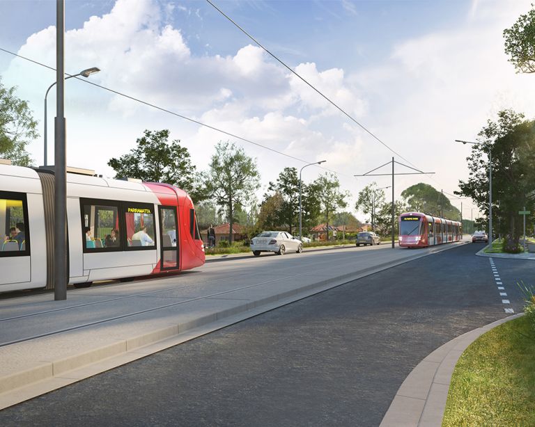
Parramatta Light Rail Stage 2 has received final project planning approval after the Federal Minister for Environment and Water endorsed the Western Sydney mega project.
The Federal approval covers the full project, which will connect Stage 1 and the Parramatta CBD to Sydney Olympic Park via Camellia, Rydalmere, Ermington, Melrose Park and Wentworth Point.
The first phase of delivery is the construction of a new 320-metre public and active transport bridge over Parramatta River between Wentworth Point and Melrose Park.
State planning approval was granted in February 2024 and came after the NSW Government allocated an additional $200 million in the 2023-24 NSW Budget to expedite the project’s planning processes.
The bridge will provide a much-needed active and public transport link to connect the growing communities north and south of the river, unlocking the Greater Parramatta and Olympic Park peninsula.
Procurement to deliver the $602.4 million bridge works is currently underway, with the contract for enabling works expected to be awarded later this year. Major construction work on the bridge is expected to begin in 2025.
The planning and design phase is being further developed through consultation with the community and stakeholders.
- International edition
- Australia edition
- Europe edition

‘The cheap option’?: why the Gold Coast may be on track to build the most expensive light rail in the world
Limiting reliance on the private sector, hiring foreign experts, and improving contracting transparency could be ways to keep costs down, experts say
- Get our morning and afternoon news emails , free app or daily news podcast
L ight rail is as much a fixture of the Gold Coast as bikinis or boogie boards; the attractive yellow vehicles trundling up and down the coast suit the place so well it feels as if they’ve been there much longer than their decade in service.
As in Queensland’s second city, light rail has sprung up in Canberra, the Sydney CBD, Parramatta and Adelaide. Similar “trackless trams” are soon opening in Perth and Brisbane. One of the only places there aren’t plans is Melbourne, home to the world’s largest tram network. Around the country, there has been a proclaimed renaissance in light rail .
On opening in 2014, the Gold Coast light rail was an immediate success . Public transport patronage jumped by 32% in the first three years, even before stage two opened in 2017. At the 2018 Commonwealth Games , the G:link zipped 100,000 passengers a day around the glitter strip in its distinctive yellow carriages.
“Since the year 2000 almost 200 cities [around the world] have introduced new tramways and I can confidently say Gold Coast light rail has been one of the most successful,” said the GoldLinQ chair, John Witheriff, in 2021 , after 10 years of operation. GoldLinQ is the private consortium contracted to finance, design, build, operate and maintain the network for 18 years.
Transport planners are attracted to light rail because, without the need for tunnelling, it’s cheaper and more deliverable. All you need is a wide road.
Urban planners like it because it can unlock higher-density, high-amenity developments – without the traffic jams.
And politicians like it because it can be done on a lower budget. Until it can’t.
Last month the Queensland transport minister, Bart Mellish, released a preliminary business case that estimated stage four of the 40km G:link network could cost up to seven times more than stage one, for the same length of track.
The business plan estimated the 13km stretch of track will cost between $3.13bn and $7.6bn. If it does hit the top cost estimate, the project may be the most expensive light rail project of its type, per kilometre, on the planet.
As one transport expert said: “Queenslanders should ask why we’re expecting to pay Ferrari prices for a Subaru.”
‘Light rail used to be regarded as cheap’
Alon Levy, co-lead of the transportation and land use program at New York University’s Marron Institute, has spent years studying why some countries are able to build transport infrastructure cheaply and others aren’t.
Though the preliminary business case of the expansion of Gold Coast light rail includes few details, Levy estimates that the project may ultimately cost as much as 10 times more than comparable European infrastructure.
The middle cost estimate for the next stage of the light rail, of $343m a kilometre or $4.5bn in total, would be expensive in Europe even for a fully underground subway with all the trimmings, according to Levy’s estimates.

At this middle cost, the final stage of the Gold Coast light rail would also be the most expensive comparable Australian project ever designed, 20% more costly than the Sydney CBD and south-east light rail schemes, the current record-holder . It would be up to 11 times as expensive as Canberra’s first light rail line stage (completed 2019), which is 1km shorter.
Transport economist Neil Douglas pointed to Auckland’s proposed underground light rail system as an example of the sort of project that runs off the rails. It was costed at NZ$1bn for each of its 24 kilometres, before it was cancelled, he says.
Sign up for a weekly email featuring our best reads
Douglas has evaluated and peer reviewed transport projects across Australia and agrees the Gold Coast project’s estimated costs are high. He says “construction costs are now ludicrous”.
“It defies the point of it, because light rail used to be regarded as the cheap option for rail,” he says.
Levy says there is an endemic problem in what he calls “the peripheral Anglosphere”.
“We’re seeing the same things in Australia, Canada, and to the extent that there’s enough data there, New Zealand is just a steady increase in costs,” they say.
“Often, it’s just a matter of shared institutional factors.”
Those include, Levy says, a lack of contracting transparency, over-engineering, politicisation, poor allocation of cost risk – and above all, contracting out to the private sector.
Private sector efficiency and a ‘delusion’
Scott Elaurant, a transport planner and 35-year veteran of the industry, says the most efficient place he ever worked is the Queensland department of roads in the 1980s.
The state government had a steady supply of work planned years or decades in advance, with economies of scale, zero profit margin, and extremely low borrowing and insurance costs to manage risk. It contracted out discrete technical tasks to private firms, but routine tasks like project management were done in-house.
But in the 80s, governments started hiring private firms to do project management. The thinking was that the government was slow and old-fashioned and if the entrepreneurial private sector was given the job it could do things better, cheaper, faster. The idea was much less popular in mainland Europe.
Elaurant says the idea was simply wrong.
“This desire to have just simple competition on lowest fixed lump sum price was based on the delusion that the private sector is better at managing risk than government,” Elaurant says. “I’ve worked on both sides; I have no ideological preference. But I have seen no evidence of that in my entire career.”

Contracting can also mean hollowing out. Many transport engineers, planners and economists spoken to for this story said the public sector bureaucracy no longer has the skills to complete infrastructure projects in-house.
That means governments have little choice but to hire a private expert firm to act as “lead contractor” – responsible for the entire job, not just a small part of it. The lead contractor then sub-contracts to the same specialist firms the department once did.
Dependence on private sector contractors can create its own problems . The federal Labor government has ordered the commonwealth bureaucracy to set targets for banishing their use in core business , bringing skills and knowledge back in house.
after newsletter promotion
Melbourne Law School senior fellow Kiri Parr says small government can also prove to be less-informed government as well.
If the government is managing a project at arm’s length, it is likely to have less information about the infrastructure than the lead contractor, she says. The contractor is in a position to exploit that to its advantage.
Sign up for Guardian Australia’s free morning and afternoon email newsletters for your daily news roundup
Parr says the “very few, very large contractors who can deliver these very large projects”, are largely concerned about commercial risk: “Can I make money on the project?”
“One way or another, the government agency pays the bills.”
Gold Coast-based Griffith University transport researcher Prof Matt Burke says the cost of fixing up utilities – like water piping or power lines – was adding so much complexity and cost to Australian transport projects that many sector academics believe it’s time to consider not upgrading the utilities, even if it means passengers will be delayed by flooding in the future. Canberra’s light rail line – which bucked the trend and delivered under-budget – is known to have been stingy about funding utilities upgrades.
Burke also wants a more healthy contracting environment, with more players.
Projects are now so complex and expensive, he says, only a handful of companies can afford to bear the weight of risk in order to bid for them, driving prices up more. In Queensland, there are just two companies the government can pick from, CPB and Thiess John Holland.
“It’s not the same as a truly competitive market with five infrastructure bidders competing in one space,” he says.
“We don’t have a market like that. Market concentration is a real problem.”
What can we do better?
Levy argues the upper cost estimate in the Gold Coast preliminary business case – intended to prevent cost overruns – virtually guarantees it.
Contractors will aim their bids at the publicised figure.
“7.6 guarantees 7.6.”
Levy says if Australia wants to get better at building public transport, it needs governments to hire many people with the technical skills to build it. In France, for example, the Parisian public transport agencies employ thousands of engineers, project managers, economist and other experts – and contract them out to smaller regional centres for their own projects at low cost.
“If Queensland is too small for this, it’s OK to set up a system in which New South Wales does it and other states pay at-cost to New South Wales,” Levy says.

Several transport experts said Australia should hire foreign experts to work as project managers, who are likely to be trained in more efficient processes.
A spokesperson for the Queensland Department of Transport and Main Roads said the central $4.5bn figure “represents a preliminary cost estimate only and the final cost would be subject to completion of the detailed business case”, while the range of cost estimates published – from $3.13bn to $7.6bn – allows for “unknown risks, which will be further clarified and updated in the detailed business case”.
The detailed business case is due for completion in late 2025.
The spokesperson said the major differences of stage three compared with previous, cheaper sections of the light rail include “the length, two major creek crossings and bridge works, alignment within an international airport, and the width of the Gold Coast Highway corridor.
“Finally, costs increase over time. This can be seen in the comparison between stage one and three. The stage two alignment did not travel through as much urban corridor compared to stage one and three so its cost is not comparable.”
Elaurant says that the answer is not to give up on public transport. Without good cost control, he argues, Queenslanders will lose faith in rail transport.
That means projects like high speed rail, or improved suburban rail, may lie forever out of reach.
“We can build a light rail system with the capacity of a six-lane freeway for about two-thirds the price of the six-lane freeway. And yet we still get a lot of six-lane freeways. So obviously people are making decisions on things other than price,” Elaurant says.
- Australia news
Most viewed
Parramatta rapidly transformed into Sydney's second CBD. Hopes are high for the next phase
When Peter Wynn headed to his first training session with the Parramatta Eels in the late 1970s he drove through Church Street lined with "old Colonial, supposedly heritage type buildings".
A decade later he opened a sports store in the Murray Brothers building on the same central thoroughfare.
As the food scene expanded, trendy cafes opened and high-rise office towers sprung up around him, Mr Wynn's racks of rugby league merchandise have remained a constant amid the development.
That is, until last year, when he was forced to move to make way for a mega tower and luxury hotel. Even then, he didn't go far, securing a lease across the road.
It hasn't always been easy running a business in the midst of a CBD transformation, including construction of the light rail, but he feels lucky to be there.
"I've been fortunate enough to be where I am, with so much activity ... I think there's so much to look forward to in the future."
Overnight success
If you haven't been to Parramatta in the past few years, get ready for a shock.
It is the second largest economy in New South Wales worth $32.3 billion and by 2040 Greater Parramatta will be home to more than 446,000 people.
Business Western Sydney executive director David Borger says it really is an "overnight success".
"Literally every major piece of infrastructure in the city has been redeveloped, expanded and freshened up."
Visually, the change is striking. As you leave the train station, you walk into the new-look piazza space, known as Parramatta Square, surrounded by major retail and commercial office towers.
"You could be anywhere in the world, it looks like a fantastic piece of public domain, urban design. It looks like it's very new."
Government departments and corporations are filling up those shiny office towers, including ABC Radio Sydney which will officially begin broadcasting from its new studios in Parramatta Square next week.
David Hagger, real estate sector leader at Deloitte, says about $10 billion in public and private investment has been pumped into Parramatta since 2018.
"It's a complete transformation," he says.
Mr Hagger, who is based in Parramatta, recently hosted staff from a property group, including one person who had spent part of their early career in Parramatta.
"When they came back to the city, they almost didn't recognise what's there," he says.
"Even when I first worked in Parramatta at the end of 2010, you used to park basically in a car park where Parramatta Square is now."
Before: Parramatta CBD in 2004. . . After: In 2024, the completed Parramatta Square skyscrapers cast long shadows, while the Sydney Metro construction site shows that development is far from over. . .
Instructions: Use left and right arrow keys to control image transition
The change has happened so fast that many people's perceptions of Parramatta have not kept up.
Many picture a somewhat tired, low-rise CBD of 15 to 20 years ago, where the NSW Police headquarters and a criminal court were its most regular newsmakers.
Shifting that perception is a key challenge to attracting more businesses to Sydney's second CBD, Mr Hagger says.
Demographic changes
Lunch crowds in Parramatta have changed a lot in the 30 years since Parramatta institution Temasek opened, according to chef Jeremy Cho.
Mr Cho says early customers were Singaporeans and Malaysians keen for a taste of home, but as word got out about their delicious laksa, that expanded to people of all backgrounds.
In the past five years he has seen more suit-and-tie workers from the new offices and students from the Western Sydney University Parramatta CBD campus that opened in 2017.
"The people that come on Friday are a bit more casual, they stay a bit longer," Mr Cho says.
Centre for Western Sydney executive director Rhonda Itaoui says the "astronomical" physical change has been matched by a demographic shift.
A higher population of 24-49 year olds which means young families and more primary school-aged children, and people earning more and with higher levels of education have made the city home.
"I think the best aspects of Parramatta are its people and its diversity," Dr Itaoui says.
She encourages newcomers to take a walk through Parramatta Park, along the river, through Church Street and through the square.
"Through that connected walk, they'll see the growing opportunities for employment, the vibrant culinary offerings, the cultural hub in Parramatta … it's a very well connected and vibrant city."
What's next?
The most recent addition to the landscape is a 34-storey build-to-rent project on Hassall Street and construction is set to begin on the 31-storey luxury hotel that forced Peter Wynn's store to move.
Mr Hagger calls it a second wave of residential buildings, while the pace of commercial development has slowed.
"The new buildings and Parramatta Square have generally filled up," Mr Hagger says. "The question is what comes next, what developments can be initiated in the commercial market to attract more and more businesses?"
Another challenge is companies are reviewing the amount of office space they need in a post-COVID hybrid model of working from home and office.
"The next wave of development has been, if you like, paused a bit because of this surplus supply that came into the market."
It's hoped the new metro line connecting Parramatta and Olympic Park, set to open about 2032, will be the catalyst that's needed to drive more development.
While the change in the city might seem rapid to outsiders, at Temasek, Mr Cho says living through the disruption has felt slow.
Mr Cho's restaurant will move later this year, but just to a newer space across the road.
He expects there will be a lot more business in the area when the metro and light rail are completed.
"More business will come in when things are less messy," Mr Cho says.
Ten years to go
Mr Borger says there's another 10 years of major investment to go.
The metro west underground line will come with massive above-ground development and now's the time to consider what that will look like, he says.
Mr Borger is pushing for it to include more entertainment and late-night venues to boost the city's night life.
"When they do the design brief, the key thing is to make sure this is actually written into it from day one. And there has to be a bigger conversation about that."
At the same time, work on the Powerhouse Museum continues in the "biggest investment in museum infrastructure we've had since the Sydney Opera House". The new museum is set to open to the public next year.
The bulk of construction is now happening on the eastern side of the city with about 10 major build-to-rent projects in various stages which will house 20,000 people within the next decade.
"I think we're starting to build out the various neighbourhoods and rooms of the house and they're all going to have a different character."
Dr Itaoui says consultation with community suggests residents' priorities for future development are maintaining housing affordability, liveability and celebrating cultural diversity.
Future development should be sustainable and the risk of gentrification should be mitigated so as not to push out long-term residents.
"We need to ensure that growth is sustainable and that it continues to bring its residents along through the journey of growth and not leave any of our residents behind."
- X (formerly Twitter)
Related Stories
Football, ice-cream and the best cafes for writing in to feature in author yumna kassab's 'dictionary of parramatta'.
'Terrible idea': NSW government ditches plan to rebuild historic house
- Housing Policy
- Small Business
- Urban Development and Planning

IMAGES
COMMENTS
Use the Trip Planner to plan a trip on public transport by metro, train, bus, ferry, light rail, coach or by walking, cycling, taxi or rideshare anywhere in Sydney and NSW, with real-time information where available.
The Sydney Light Rail is a light rail system that serves the city of Sydney in New South Wales. The network comprises the Dulwich Hill Lane; a single line that spans a length of approximately 13 kilometres with 23 stations along the line. ... From planning documents to newsletters, these offer an in-depth look into the evolution of the light ...
Trip Planner • Train, Metro, Bus, Ferry, Light Rail, Foot • Mixed-mode planner • Take the same route often? Save your favourite Trips • Simple, easy to use interface Trackwork and Service Alerts • If you use public transport in Sydney, chances are you know how useful these will be! • Service alerts by journey
Telephone. Trip planning support is available on the Transport Info Line. Call 131 500, and select Option 5 to speak with a Transport worker who can walk you through the journey planning process and help you identify the best travel options for you. The Info Line is available from 6am to 10pm every day. If you are deaf or have a hearing or ...
Sydney Light Rail - what you need to know. Sydney's eagerly anticipated CBD and South East Light Rail has opened to the public. This means for the first time since the 1960s, Sydneysiders and visitors can travel through the streets of the CBD and beyond via a tram service. Here's everything you need to know about Sydney Light Rail.
The Sydney light rail network is a light rail/tram network operating within the city of Sydney. Having begun operations in 1997, the network experienced its largest ever expansion with the opening of the Randwick Line in December 2019. The network's recent expansion increased the number of station to 42, covering a length of 24.7 km. The ...
The Sydney light rail projects are designed to integrate with other transport services, to create more connections and more travel options. Increasing and improving the light rail network in Sydney will provide a cleaner, quieter and less invasive form of transport. It will also work safely alongside the places where people live, work and relax.
Use the trip planner at transportnsw.info to plan your travel. Opal card info The Opal card is an easy, convenient way of paying for your travel on public transport in Sydney. It can be used on all public transport, including trains, ferries, buses and light rail.
The Sydney Light Rail consists of two main lines: the L1 Dulwich Hill Line and the L2 Randwick Line. These lines connect various neighbourhoods and key destinations in and around Sydney. 1. L1 Dulwich Hill Line. The L1 Dulwich Hill Line is normally operational from early morning to late evening, with service changes for weekends and public ...
About this app. TripWatch allows you to plan your trips on Sydney public transport, including trains, buses, ferries, light rail, and metro, all right from your Wear OS watch. Start by configuring your trip, then view a list of available trip options, with the ability to combine different modes of transport to get to your destination.
Transport Now Sydney is a public transport trip planner which displays train, bus, ferry and light rail scheduled timetables. Users can search for a trip from departure to arrival and view a summary of available services along with real-time service information. This app helps you to find the quickest trip with the least transfers. You can plan ...
Transport and travel information to help you plan your public transport trip around NSW by metro, train, bus, ferry, light rail and coach. Trip Planner, travel alerts, tickets, Opal fares, concessions and timetables. ... Plan your trip to see Sydney FC take on the Central Coast Mariners in the A-League Men Semi Final at Allianz Stadium in Moore ...
Stage 2 will have: 14 stops over a new 10km two-way track. travel times of around 31 minutes from Camellia to the Carter Street Precinct via Sydney Olympic Park, and a further 7 minutes to the Parramatta CBD. high frequency 'turn up and go' services every 7.5 minutes on weekdays between 7am to 7pm, and around every 10-15 minutes outside ...
Light rail. Opal can be used to pay for travel on public transport including metro, trains, buses, ferries and light rail in Sydney, the Blue Mountains, Central Coast, the Hunter and the Illawarra. Find out more about Opal or plan a trip using Trip Planner. Opal.
CBD and South East Light Rail network. L2 Randwick Line - Running in both directions between Randwick and Circular Quay via Central Station. L3 Kingsford Line - Running in both directions between Juniors Kingsford and Circular Quay via Central Station. Head to the Transport for NSW website to use the online Trip Planner and check the ...
In Sydney, the majority of public transport services are accessible. Mobility aids including wheelchairs, scooters, walking frames, prams and strollers can safely board and travel on all metro and light rail services and most trains, buses and ferries. Assistance animals are permitted on all public transport in NSW.
Sydney's public transport network will take you almost anywhere you need to go with buses, trains, ferries and the light rail at your disposal. If you want to plan a budget-friendly trip, Sydney transport also offers an Opal card price cap on Sundays, which means you can get quite the bang for your buck exploring the city and surrounds and ...
Parramatta Light Rail Stage 2 has received final project planning approval after the Federal Minister for Environment and Water endorsed the Western Sydney mega project. The Federal approval covers the full project, which will connect Stage 1 and the Parramatta CBD to Sydney Olympic Park via Camellia, Rydalmere, Ermington, Melrose Park and ...
From 9.30pm Friday and throughout the weekend, trains will not run on the City Circle, or between Central and Wynyard. For travel around the city, passengers will need to use the light rail between Central and Circular Quay, or local bus services. There are extra CBD light rail services running between 7am and 7pm across the weekend.
Add articles to your saved list and come back to them any time. Sydney's $21.6 billion metro rail system under the harbour and CBD, along with the existing driverless train line it connects to ...
The business plan estimated the 13km stretch of track will cost between $3.13bn and $7.6bn. ... 20% more costly than the Sydney CBD and south-east light rail schemes, the current record-holder ...
Overnight success. If you haven't been to Parramatta in the past few years, get ready for a shock. It is the second largest economy in New South Wales worth $32.3 billion and by 2040 Greater ...
A standard light rail fare applies. L1 Dulwich Hill Line light rail services will continue to run as per normal schedule. Allow extra travel time and use the Trip Planne r or check travel alerts to see if your travel is affected. L2 and L3 light rail services between Circular Quay and Randwick or Juniors Kingsford will resume as normal, from ...
L1 Dulwich Hill Line light rail services run between Central Station (Grand Concourse) and Dulwich Hill via Darling Harbour and the Inner West. Services run regularly from 5am to 1am daily. Plan your trip using the Trip Planner. From Central, change for a light rail service on the L2 or L3 Line to Moore Park leaving from Chalmers Street.