360° Panoramic Creations:

We create high-quality stabilized video having 8k and 4k resolution, 48 or 24 frames per second together with high-quality post-processing. Videos are supported by the most advanced technologies, such as virtual reality headsets (including Samsung Gear VR), different electronic devices and YouTube channels.
We use different types of moving and fixed objects (tripods, monopods, cars, helicopters, building cranes, etc.) to record videos. For aerial shooting we usually use drones with fully gyro-stabilized unique suspension. Panoramic video covers up all the space around the camera 360x180 degrees without black spots at both nadir and zenith viewing angle.
360° videos are available in any format you choose: .mp4, .avi, .mov, etc. All the videos are made and kept in frames, making it possible to encode them into any available format and bitrate with the resolution up to 8k.

360° PHOTOGRAPHY
Our team creates high-quality 360° photo-panoramas with 35000x17500 pixels resolution (in the equidistant projection) and carries out professional post-processing and corrections of any complexity. We develop virtual tours which are suitable for all browsers, support both Flash and HTML5 technologies and are compatible with different mobile devices and virtual reality headsets (including Samsung Gear VR).
We use different types of moving and fixed objects (tripods, monopods, cars, helicopters, building cranes, etc.) to record videos. For aerial shooting we usually use drones with the fully gyro-stabilized unique suspension. Panoramic video covers up all the space around the camera 360x180 degrees without black spots at both nadir and zenith viewing angle.
Ready 360° photo-panoramas cover up all the space around the camera 360x180 degrees without black spots at both nadir and zenith viewing angle.
Info-points (description buttons that can be placed in the panorama), embedded pictures, video and audio can be added to the virtual tour.
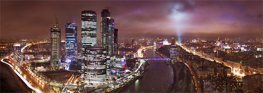
360° GIGAPANORAMA
Our team creates high-quality 360° photo-panoramas with resolution from 1 to 3 gigapixel and carries out professional post-processing and corrections of any complexity. We develop virtual tours which are suitable for all browsers, support both Flash and HTML5 technologies and are compatible with different mobile devices and virtual reality glasses (including Samsung Gear VR).
Info-points (description buttons that can be placed in the panorama), embedded pictures, video and audio can be added to the ready virtual tour.
360° TIMELAPSE
We can make panoramic timelapses with the given viewing angle and resolution up to 12k with professional post-processing and without black spots at both nadir and zenith viewing angle. 360° timelapses are supported by the most advanced technologies, such as virtual reality glasses (including Samsung Gear VR), different electronic devices and YouTube channels.
360° timelapses are available in any format you choose: .mp4, .avi, .mov, etc. All the timelapses are made and kept in frames, making it possible to encode them into any available format and bitrate with the resolution up to 12K.
Content sales:
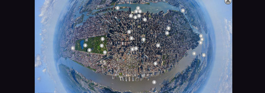
VIRTUAL TOURS
On the basis of 360° panoramas we create virtual tours of any complexity, branded with logos and design elements of the company’s website together with embedding interactive elements, such as photos, slideshows, videos, descriptions, switch-points to other panoramas, audio descriptions, 3D sounds.
Our clients receive a fully functional virtual tour developed in HTML5 and supported by any computer or mobile device (iOS, Android, Windows Phone).
360° Photo Price List
STOCK PHOTOS
For almost 10 years of travelling around the world our team has gathered an extensive stock of pictures, taken from both flying devices and the ground.
Any picture presented at our stock can be licensed for any kind of possible use. We can also offer the photos of ultra-high quality (the longer side up to 103,000 pixels).
You can also take a look at the spherical panoramas published on the website www.airpano.ru . Any of the 360° panoramas represented on the website can be converted into a printed image of very high quality.
Photogallery Price List

STOCK 360° VIDEOS
By filming 360° video since 2011, our team has gathered an extensive stock of clips, taken from both flying devices and the ground.
Any video presented on our website can be licensed for any kind of possible use.
360° videos are available in any format you choose: .mp4, .avi, .mov, etc. All the videos are made and kept in frames, making it possible to encode them into any available format and bitrate.
360° Video Price List
APPLICATIONS
We are one of the software developers of applications based on 360° photos and videos. Currently, there are 7 applications in our portfolio. One of them was top-rated in 84 countries and listed among the best applications of the year 2014 according to App Store.
These applications can also be used for demonstration of panoramic content with the help of virtual reality devices, such as Samsung Gear VR, Google Cardboard and analogues.
Exhibition installations:
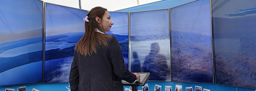
EXHIBITION INSTALLATIONS
AirPano team has the experience of creating panoramic cinemas and video-walls, making it possible to demonstrate our panoramic content at different kinds of events, exhibitions and in museums. The size is only defined by the premises, the quality of projector and the dimensions of plasma screens. Such solutions usually make a deep impression on visitors.
The control is carried out by a tablet or Kinect devices.
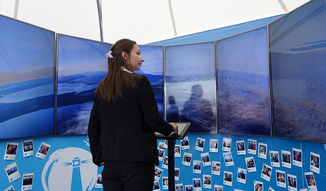
TOUCH SCREENS
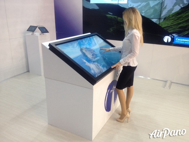
We are ready to create applications with panoramic content working on touch screens of any size. Both AirPano panoramas and the client’s material can be the basis for this kind of software.
We create virtual tours of any complexity, branded with logos and design elements of the company’s website together with embedding interactive elements, such as photos, slideshows, videos, descriptions, switch-points to other panoramas, audio descriptions, 3D sounds.
VR HEADSETS
Our virtual tours and 360° videos are supported by all the types of virtual reality headsets (VR): Google Cardboard, Oculus Rift, Samsung Gear VR, Sony Morpheus and others.
We can also develop special software for operating on Samsung Gear VR, if required.
AirPano in cooperation with Polden Studio carries out the installation of the binocular usage of the client’s or our own content. With the help of binoculars, the client can present the panoramic content at different kinds of events, exhibitions and in museums. This kind of devices usually attract a lot of visitors and leave a deep impression on them.

Google Earth
- Sea Level Rise and the Fate of Coastal Cities Climate Central Carbon pollution locks in sea-level rise for centuries. See how the fate of coastal cities depends on cutting emissions now. View in Earth
- Earth at Night NASA After the sun goes down, there’s more to explore. Learn about NASA’s Black Marble project and some of the brightest places on Earth. View in Earth
- Kākāpō: The Endangered Parrot of the Night Kākāpō Recovery Programme Meet the kākāpō. These charismatic parrots are critically endangered with fewer than 200 remaining. View in Earth
- The World's Ocean Underwater Earth Discover the wonders found under the sea with imagery collected by Underwater Earth and The Ocean Agency. View in Earth
- The Leuser Ecosystem Forest, Nature and Environment Aceh (HAkA) Explore the Leuser Ecosystem, the last place on Earth where orangutans, rhinos, elephants and tigers still co-exist in the wild. View in Earth
- Warming Planet Timelapse in Google Earth See the effects of rising temperatures on our planet's delicate ecosystems. View in Earth
- Celebrating Indigenous Languages Google Earth Learn about Indigenous languages around the world in a new collection from Google Earth. View in Earth
- Changing Forests Timelapse in Google Earth From logging to wildfires, explore the threats to our forests, and see what's being done to protect them. View in Earth
- Mapping London's Air Pollution Environmental Defense Fund Learn how state-of-the-art technology and improved data analysis helps researchers understand Londoners' exposure to air pollution. View in Earth
- Fragile Beauty Timelapse in Google Earth Wonder at the mesmerizing changes that have taken place around the globe in the past several decades. View in Earth
- Urban Expansion Timelapse in Google Earth Cities around the world are growing rapidly. See how different regions are handling increasing urban populations. View in Earth
- Sources of Energy Timelapse in Google Earth From mining and fracking to wind and solar power, explore how our need for fuel has impacted the planet. View in Earth
- Crab Migration on Christmas Island Google Street View Follow the migration of the red crab of Christmas Island as they head to the beach to spawn. View in Earth
- This is School Google Street View From London to the Himalayas, explore classrooms around the world in Street View. View in Earth
- I Am Amazon Brazil Marketing An interactive experience between you and the forest View in Earth
- Buildings Inspired by Nature Google Earth Education Community Investigate how architects use biomimicry to design a more sustainable future by incorporating form, function and systemic processes from nature. View in Earth
- Canada’s Original Place Names Canadian Geographic Indigenous Peoples named many places in present-day Canada. Discover Canada’s original place names and their Indigenous origins. View in Earth
- Quilombolas in the Amazon Associaçãode Remanescentes Quilombolasde Oriximiná The Brazilian Amazon is home to many quilombolas, the descendents of enslaved Africans. After fleeing slavery, they established communities on Pará and fought for their land rights. View in Earth
- Tokyo's Heat Island Effect Nikkei Tokyo's average temperature has risen in the past 100 years. As the Tokyo Olympics approach, we take a look at how the city is battling the heat. View in Earth
- Blue Gold. Our Lakes. Our Lives. Google Earth Education Community The Great Lakes are one of the world’s most valuable resources. Explore the five lakes, and learn why they are also at risk. View in Earth
- Modern Human Migration Google Earth Education Community Why do people move? Follow this journey through some of the largest mass migrations in recent human history. View in Earth
- Canada’s Residential Schools Canadian Geographic The residential school system represents a dark legacy of Canadian history. The government-sponsored schools aimed to assimilate Indigenous children. View in Earth
- Orang Asal Indigenous Lands of Malaysia Jaringan Orang Asal SeMalaysia Recognizing the Indigenous territories of the Orang Asal assures the protection of many unique identitites and the environment View in Earth
- Indigenous Cultural Heritage Canadian Geographic Travel across Canada to learn about some of the traditions and culturally significant objects that are still important to Indigenous Peoples in Canada today. View in Earth
- I am Water Brazil Marketing An educational story about the formation of the rain that fills the reservoirs and irrigates the farms in the highest GDP area of the region. View in Earth
- Back to Roots Center for Orang Asli Concerns After 30 years of involuntary resettlement, the indigenous Temiar people of Kampung Cunex returned to their ancestral homelands. View in Earth
- The True People of the Amazon Associação Metareilá Learn about the journey of the Paiter Suruí, the Indigenous people of Rondônia and Mato Grosso who call themselves "Gente de Verdade." View in Earth
- Life of the Tembé People Povo Tembéda Terra Indígena Alto Rio Guamá Earth. Life. Culture. For the Tembe these three elements are always together. View in Earth
- I am Food Brazil Marketing A story of the forest’s products that feeds not only the people living in the Amazon, but those all around the world. View in Earth
- I am Change Brazil Marketing The transformation of Paragominas: from deforestation leader to an example for other municipalities. View in Earth
- Panderey PATJAMAAJ Panzyrééj saní Amazônia ka aajtjáá mááj panaé. View in Earth
- I am Roots Brazil Marketing The story of the Yawanawá people and their inspiring outlook on women empowerment and a sustainable economy. View in Earth
- Cinta Larga PATJAMAAJ The story of a people in the middle of the Amazon. View in Earth
- Tangier Island's Troubled Waters Virginia Foundation for the Humanities Explore Virginia’s only inhabited offshore island and find out what makes it so unique and why it’s at risk. View in Earth

- New Account / View Pricing
- 360° Video Gallery
- Editors' Picks
- 360° Stereoscopic Panoramas
- EARN $ FROM YOUR WORK
- FREE RESEARCH

3D Map of Mt. Everest & the Himalaya
Trekking in the khumbu region, realitymaps app, outdoor navigation with ultra realistic 3d maps, interactive 3d map of mount everest, the himalaya and popular trekking tours, video - route to the summit of mount everest, video - route to the summit of mount everest.
The video shows the route from Lukla through the Khumbu region to the Base Camp of Mount Everest. From there, it leads through the dangerous Khumbu icefall, followed by the glacial valley of the Western Cwm, where Camp 1 and Camp 2 are located. A steep ascent then leads up Lhotse Face to Camp 4 on South Col at roughly 8000 m. On the summit day, climbers need to first need to master the Southeast ridge and Hillary Step, before they finally reach the summit. Find out more about all routes to the roof of the world and its climbing history .
Trekking and climbing peaks in the Everest area
The Everest region offers a multitude of trekking tours. The Earth’s ‘ceiling’ makes a profound impression on those travelling here. The local landscape is defined by its many 8,000 m peaks – Mount Everest, Lhotse and Makalu in particular- but is also appreciated for aesthetically-pleasing peaks like Ama Dablam and Pumori. Along with the classic expeditions to Everest Base Camp, plenty more trekking summits await, accessible via comfortable to demanding ascents.
RealityMaps App - Ultra realistic 3D maps for adventurers

Unique route planner and GPS navigation tool
The award-winning RealityMaps app is the perfect tool for planning your next outdoor adventure. The ultra realistic 3D representation of the mountain landscape allows an intuitive, realistic assessment of the terrain and the technical requirements of a tour.
On the way the digitized landscape is displayed in 3D on your smartphone. Your current location is shown live on the map . This this simplifies orientation on the go. You can navigate freely in the map and you can check not yet visible parts of your route. Your planned track and other important information is displayed onscreen.
GPS tracking
3D RealityMaps GmbH offers GPS tracking services for individuals and expeditions in the Himalaya and especially Khumbu Region of Mount Everest. GPS tracking devices such as Garmin inReach or SPOT devices are supported. GPS positions are instantly displayed in the interactive 3D map. This allows followers, interested parties and family members to follow the progress of the expedition in real-time from home.
- You are here
Go on a virtual tour around the world with Google Maps 3D immersive view

Recommended Stories

Enjoy the hottest mobile tech storylines, delivered straight to your inbox.
Things that are NOT allowed:
- Off-topic talk - you must stick to the subject of discussion
- Trolling - see a description
- Offensive, hate speech - if you want to say something, say it politely
- Spam/Advertisements - these posts are deleted
- Multiple accounts - one person can have only one account
- Impersonations and offensive nicknames - these accounts get banned
Popular stories

Latest News

Screen Rant
Super nintendo world interactive tour lets you experience it from home.
Super Nintendo World has released an interactive map letting fans fly around the theme park in a 3D virtual tour of every stop to make in the park.
Super Nintendo World's grand opening is coming up, and to give fans a sneak peek of the park that they may not be able to visit for a while, Universal Studios Japan has released an interactive map of the Mario-themed world. Unfortunately COVID-19 will probably be keeping tourists out of the park for several months still, so for now they will have to settle for the virtual tour of this slice out of Mario and the gang's life.
The characters from the Mario games have become iconic ambassadors of Nintendo, so it is only fitting that the next step in Nintendo's alternate media endeavors surround the well-known characters like Mario, Princess Peach and Yoshi. Nintendo saw a decline in popularity after the Wii U came and went, but the Nintendo Switch has taken off thanks to Animal Crossing: New Horizons and global sales for 2020 were excellent . With their IP back in the forefront of gamers' minds, Nintendo was originally going to open their new theme-park in July of 2020 before the Tokyo Olympics. However, the pandemic delayed the launch until it's new and confirmed opening date, February 4th. The Osaka park will be the first Super Nintendo World to open, but Universal Studios plans to build one in all of their locations.
Related: Super Nintendo World Images: First Official Look At Mario Kart Rollercoaster
Although the park will open less than a month from now, international travel is still banned in many parts of the world, and will still be a hazardous activity for some months to come. Nintendo has released an interactive map of the park that can be seen on the Super Nintendo World website for fans to travel through until they can visit the real thing. Those taking the virtual tour can fly through the park rendered in 3D, stopping at each attraction where they can click the little button on the bottom right to get more information about what they're seeing, from a Yoshi ride to the food and merchandise stores.
Super Nintendo World is doing something completely new and different from other theme parks as well with the power of technology. While moving around the park visitors can collect various items including virtual coins and character stamps by using an app on their phones connected to a special Nintendo-themed wristband . According to Nintendo, the wristband and app will make visitors use their entire bodies to interact with and explore everything in the park.
Visitors will get the chance to feel just like Mario as they hit Question Blocks around the park, once they are finally allowed to take a trip to see the Mushroom Kingdom. Until then taking a virtual tour through Super Nintendo World will have to satiate fans' anticipation for a long-time favorite franchise come to life.
Next: Super Nintendo World Video Brings Fans Inside The Theme Park
Source: Super Nintendo World
Create immersive experiences with Map Tiles
High-quality map tiles.
Access Google’s high-quality 2D, 3D and Street View Tiles.
Expansive coverage
Access photorealistic 3D Tiles in over 49 countries, and 2D Tiles in 250+ countries and territories.
Flexible development
Build immersive experiences at scale, for virtually any type of application stack.
Create 3D visualization experiences
Access a 3D mesh model of the real world, textured with our high-res RGB optical imagery, with the same 3D map source as Google Earth.
Provide imagery with unmatched realism in your maps
Help your users more easily explore, navigate, and evaluate an area with 3D imagery of buildings, landmarks, terrain, and natural surroundings.
Design 3D experiences the easier way
Utilize one of the world’s most comprehensive 3D geo datasets; use the renderer of your choice and overlay your own data.
Use Google’s Map Tiles for virtually any type of application
Map Tiles enable use cases for all applications, including platforms that are incompatible with JavaScript API and Android and iOS SDKs.

Create highly customized visualizations
Map Tiles give you the flexibility to design unique interfaces and interactions. You can also overlay custom data and graphics.
Build immersive Street View experiences
Create powerful, immersive experiences by leveraging images taken from the street level using Street View images and tile metadata.
Duke Nukem 3D: 20th Anniversary World Tour
- View history
- 1.1 Alien World Order
- 1.2 Faces of Death
- 2 New enemies
- 3 New weapon
- 4 New commentary
- 5 New engine
- 6 New audio
- 7 New rewind feature
- 8 New software bugs
- 10 External links
Alien World Order
Main Article: Alien World Order
The 20th Anniversary Edition includes a new fifth episode known as Alien World Order . The episode was designed by Allen Blum and Richard “Levelord” Gray , both of whom designed all the levels in the original Duke Nukem 3D . The new levels include:
- High Times , based in Amsterdam
- Red Ruckus , based in Moscow
- Bloody Hell , based in London
- Mirage Barrage , based in Giza
- Tour de Nukem , based in Paris
- Golden Carnage , based in San Francisco
- Hollywood Inferno , based in Hollywood
- Prima Arena , a secret level based in Rome
Faces of Death
Main Article: Faces of Death
As a special bonus, the classic level Faces of Death can now be completed normally as a secret level in L.A. Meltdown . Faces of Death appeared as a Dukematch level in the classic Duke Nukem 3D , but it could also be reached during the singleplayer campaign by exploiting cheats and glitches. However, the level did not contain an exit button , so it could not be completed. In the 20th Anniversary Edition, a secret exit button is now accessible on The Abyss and will take the player directly to Faces of Death without requiring the use of cheats. Faces of Death also now includes an exit button, so it can be completed normally during solo playthroughs.
New enemies
Main Article: Enemies (DN3D)
The 20th Anniversary Edition includes four new enemies:
- Firefly Troopers , which can fly, shrink themselves, and fire flamethrowers
- Overlord Sentries , which are miniature versions of the Overlord
- Cycloid Sentries , which are miniature versions of the Cycloid Emperor
- A new final boss, the Cycloid Incinerator
The Firefly Trooper was created using alternate sprites for the Assault Trooper that were scrapped before the 1996 release of Duke Nukem 3D . These alternate sprites were publicly known as far back as 1996, when one sprite was accidentally leaked on the back cover of the Duke Nukem 3D Screen Saver & Entertainment Pack .
Main Article: Incinerator

The 20th Anniversary Edition features a new weapon known as the Incinerator . The Incinerator resembles the Freezethrower , but it launches fiery projectiles instead of ice. These fiery projectiles burn enemies and coalesce into pools of lava on the ground. The Incinerator shares the same number assignment as the Freezethrower, analogous to how the Shrinker shares a number assignment with the Expander .
The Incinerator was inspired by the Flamethrower that appeared in early prototypes but was scrapped before the 1996 release of Duke Nukem 3D .
New commentary
Main Article: 20th Anniversary Developer Commentary
The 20th Anniversary Edition features developer commentary by Randy Pitchford , Allen Blum , Richard "Levelord" Gray , Keith Schuler , and Roger Kort . In total, there are 206 snippets of audio commentary scattered throughout the levels. There is an option in the game that allows the player to toggle the commentary on or off.
A team of programmers led by Roger Kort updated the Build engine to allow for fully 3D rendering, comparable to modern first-person shooters. An option in the game allows for toggling between the classic and modern renderers.
As a special perk for the 20th Anniversary Edition, Duke 's one-liners have been re-recorded by voice actor Jon St. John , and some of the sound effects have been updated.
New rewind feature
Upon dying, a new playback feature has been added to the game that allows the player to scroll through a moment-by-moment replay of their performance on the level. The player is then able to choose any scene from the playback reel and rewind to that point. This allows the player to resume from the middle of a level without relying on manually saved games. An option in the game allows the player to toggle this feature on or off.
The rewind feature is automatically disabled if the player uses cheat codes , and it remains disabled even after any cheat codes are turned off. The rewind feature is only re-enabled once all cheat codes have been turned off and the player has either reached the next level or restarted the current level.
New software bugs
The 20th Anniversary Edition contains a few known software bugs not found in other versions of Duke Nukem 3D :
- If a Shark is frozen using the Freezethrower , then it becomes invincible, even after it is unfrozen.
- If a boss (e.g., the Overlord ) or mini-boss (e.g., an Overlord Sentry ) is reduced to zero health using the Incinerator , then it becomes invincible.
- The Cycloid Incinerator will mistakenly fire its flamethrower from a long-range distance, even though its flamethrower is a short-range weapon.
- If an enemy is eaten by a Protozoid Slimer , then that enemy will count towards the "Enemies Remaining" statistic instead of the "Enemies Killed" statistic on the level-end screen.
- If cheat codes are used to turn off enemies and subsequently turn them back on, then enemy corpses will have collision boxes as though they are still alive, creating invisible obstacles.
- When approaching the Battlelord 's spaceship on The Abyss , the audio clip associated with the humming ambiance of the spaceship does not loop correctly and results in a memory leak . Slightly before the audio clip finishes playing, the next audio clip in the loop will begin playing simultaneously. Eventually, numerous audio clips can be heard playing simultaneously, producing a loud roar. This can drastically reduce the game's frame rate and even cause the game to crash .
- Because the auto-aim feature now affects the "use" action, some switches and Access Card panels are difficult to use while the auto-aim feature is enabled. In the developer commentary , Allen Blum tells Roger Kort that the bug impacted his approach to level design for Alien World Order . In particular, he was forced to use a "shootable" switch on the boat on Golden Carnage because he could not get other types of switches to work in that location. (NOTE: The auto-aim feature can be disabled in the in-game menu.)
Other bugs were corrected with a patch released November 2, 2016 (see patch notes ).
Continuing into the 2020s, Gearbox Software still maintains an online submission form for reporting bugs and other technical issues with the game, though no patch notes have been released since 2016 ( link to submission form ).
- The Small Medkit , Large Medkit , and Portable Medkit have all had their sprites updated in this version of the game such that the symbolic red cross has been replaced with a symbol of a red and white pill. This was done because the International Committee of the Red Cross had previously filed lawsuits against other game developers for using the red cross symbol, which is not public domain.
- There is unused data in the game's files for an enemy that would have been a smaller, weaker version of the Alien Queen . Some of the unused code also appeared in Duke Nukem 3D: Atomic Edition , but the enemy was coded differently, suggesting it was updated but again scrapped. This would make the " Alien Queen Sentry " the only enemy that was twice created and scrapped in the game's development history.
- The multiplayer -only map, Dukematch Level 1 , was updated to include the Incinerator in this version of the game. However, the level can no longer be accessed using the "dnscotty" cheat, and it cannot be accessed from the multiplayer setup menu, even though the map is included as "E1L8.MAP" in the game's files.
- User maps from outside the Steam workshop can be played by first copying them into the game's root directory and then loading them through the in-game console. The console can be opened by pressing the backtick (`) key, and maps can then be loaded by entering "map" followed by a space ( ) and then the name of the map file. The console is insensitive to file extensions and does not distinguish between uppercase and lowercase characters.
External links
- Official Steam Page (via Steam)
- Official Portal on GearboxSoftware.com (via Gearbox Software)
- 1 Levels in Duke Nukem 3D
- 2 Duke Nukem (character)
- 3 Enemies in Duke Nukem 3D
Select an option

MICHELIN Guide Honors 48 Orlando Restaurants in 2024

Seven Seas Food Festival at SeaWorld® Orlando
Virtual Tours

Look at this cool new tool for exploring Orlando!
Orlando Virtual Tour: SeaWorld® Orlando
Learn more about SeaWorld® Orlando before your visit, and save on discount tickets from Visit Orlando powered by BestofOrlando.com .
Orlando's Only Official Website
- Accessibility
- Copyright & Trademarks
- Privacy Policy & Terms of Use
- Cookie Preferences
Receive Visit Orlando news
and special offers.

© 2024 Visit Orlando
- Patch Notes
- Hardware and Tech
- PC Invasion Staff
Duke Nukem 3D: 20th Anniversary Edition World Tour new maps revealed
More details have emerged for the Duke Nukem 3D: 20 th Anniversary Edition World Tour in a map reveal.
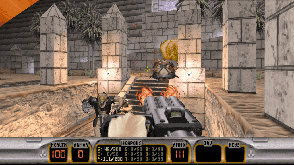
This updated version of the shooter classic comes with a new episode called Alien World Order featuring maps created by Allen Blum III and Richard “Levelord” Gray. These have now been revealed in an update from 3D Realms.
The new maps are set in numerous different global locations such as Moscow, London, San Francisco, Egypt, Rome, Los Angeles, and France. Each map has some personal connection with the map makers or tie-in with the original game.
“We took the same approach that we did 20 years ago – making fun maps was our primary goal,” said Gray. “The most important thing specific to the new content was to make the biggest levels ever in a Duke game, and we did! Players will be amazed by how massive some areas are.”
The update comes with new shots but if you don’t want any spoilers then give it a miss. Here are all the new map shots out of context to avoid too many spoilers.
Duke Nukem 3D Anniversary Edition will release on 11 October on Steam costing $19.99. Pick it up if you want more Duke.


Duke Nukem 3D: 20th Anniversary World Tour


Explore your data in a 3D Maps tour
A Microsoft 3D Maps tour can show a time-based relationship between geographic locations and their associated data—such as population numbers, temperature highs or lows, or flight arrival delays.
When you start 3D Maps from a workbook that doesn’t already contain a tour, a new tour with a single scene is automatically created. Tours and scenes are the basic way to save the 3D Maps visualizations of your data.
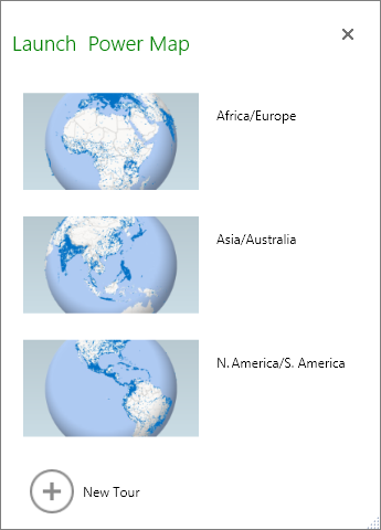
You can create as many tours as you want in a workbook. You switch between tours and create new tours by using the Launch 3D Maps box. This example has three tours that show world population by continent.
Create a tour
Select any cell in the Excel table or range of cells that has your data. Be sure to do this before you create the tour; it makes it easier for you to hook up the data to the new tour.
Click Insert > 3D Map > Open 3D Maps .
The Launch 3D Maps window appears, showing your new tour.
Add another tour to your workbook
The Launch 3D Maps box appears.
Click New Tour .
The new tour appears in the Launch 3D Maps window. If another tour was already open, 3D Maps closes it.
Save your tours
There’s no Save button in 3D Maps; all tours and scenes are preserved in the state in which you close the window. When you save your workbook, any 3D Maps tours and scenes are saved with it.
All changes you make to a scene in 3D Maps while editing are saved automatically, but any changes you make to a scene in tour playback mode—such as resizing, removing a legend, or removing a timeline—aren’t saved. All tours open in edit mode by default, and all the scenes in a tour are shown in the Tour Editor pane.
Add a scene to a tour
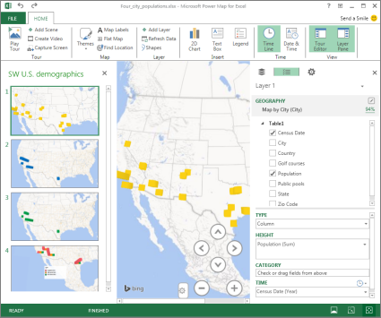
A tour can have a single scene, or multiple scenes that play sequentially to show different views of your data, such as highlighting a section of a map, or showing other data related to the geographic locations. For example, the first scene in your tour could show population growth for cities over time, followed by a scene showing the number of public swimming pools in those cities over the same time period, followed by more scenes that show other information about those cities. This example shows a four-scene tour for a selection of cities in the U.S. Southwest region.
Play a tour
3D Maps always plays a tour in full-screen mode. Playback buttons are available at the bottom of the screen.
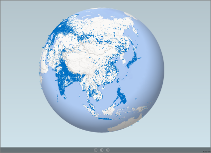
Open the tour from the Launch 3D Maps box.
In the 3D Maps window, on the Home tab, click Play Tour .
You can pause, play, move to the previous or next scene, or go back to edit mode. When you pause the tour, you can explore the 3-D environment and interact with it. Any changes you make in play mode aren't saved as part of the scene. Once you resume playback or go back to edit mode, the changes you made in play mode are lost.
Note: The Play Tour button always plays the tour beginning with the first scene. You can navigate to the scene you want with the Next and Previous buttons in Play mode.
Delete a tour
Note: The Undo command in Excel can't restore a tour you've just deleted.
In the workbook, click Insert > 3D Map > Open 3D Maps .
Right-click the tour, and click Delete .
Copy a tour
In the Launch 3D Maps box, right-click a tour and click Duplicate . This creates a new tour that you can fine tune, while leaving the original tour untouched.
Learn more about working with 3D Maps
Change the look of your 3D Maps
Add a heat map in 3D Maps

Need more help?
Want more options.
Explore subscription benefits, browse training courses, learn how to secure your device, and more.

Microsoft 365 subscription benefits

Microsoft 365 training

Microsoft security

Accessibility center
Communities help you ask and answer questions, give feedback, and hear from experts with rich knowledge.

Ask the Microsoft Community

Microsoft Tech Community

Windows Insiders
Microsoft 365 Insiders
Was this information helpful?
Thank you for your feedback.
Largest 3D map of our universe could 'turn cosmology upside down'
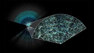
Scientists using the Dark Energy Spectroscopic Instrument have unveiled the largest 3D map of the universe ever. The results suggest that dark energy, the mysterious force pulling the universe apart, may be weakening, challenging prevailing theories of cosmology.
It has been over two decades since the discovery of dark energy .
Scientists have therefore had more than 20 years to decode the secrets of this invisible substance that appears to be pulling the universe apart. Yet, they still know close to nothing about it. Dark energy, in fact, may not even be a substance. It could be a force or even an intrinsic property of space itself.
For instance, the standard model of cosmology — our leading theory of cosmic evolution — does suggest dark energy is unwavering across the universe and throughout time, making it a fundamental property of space. If constant, the mysterious dark energy that makes up a whopping 70 percent of the universe would push away all stars and galaxies. However, the biggest survey of the universe's cosmic history could indicate that dark energy, also known as a hypothetical "anti-gravity" force, may evolve with time rather than remain constant, hinting at a less lonely future for residents of the universe.
If this early result holds with future observations, cosmologists may have to, at the very least, explore systematic uncertainties in the prevailing Lambda CDM (LCDM) model, a mathematical model of the universe in which lambda represents dark energy. They may also need to start sifting through dozens of other models of our universe to find the true best fit. Still, the evidence is tentative — it does not reach what's known as the "5-sigma threshold," which determines whether a signal can be celebrated as an official discovery. So, continuously emerging interpretations about dark energy's evolution could change with more data scheduled to come within the next few years.
"If this is true, this just turns cosmology upside down," said Dillon Brout of Boston University, who measures the acceleration of the universe with supernovas. Such a discovery would be a "paradigm shift in our thinking of what our best understanding of our universe is."
Related: James Webb telescope confirms there is something seriously wrong with our understanding of the universe
Streetlights of the universe
Perched atop the Nicholas U. Mayall 4-meter telescope at Arizona's Kitt Peak National Observatory, the Dark Energy Spectroscopic Instrument, or DESI, pinpoints positions of a million galaxies each month. Through these observations, cosmologists can measure the universe's expansion rate as it increased over the past 11 billion years. These faraway galaxies, which can be likened to the "streetlights of the universe," are thus helping cosmologists study the universe-permeating enigma of dark energy.
Sign up for the Live Science daily newsletter now
Get the world’s most fascinating discoveries delivered straight to your inbox.
And, on April 4, the DESI collaboration shared the largest-ever 3D map of the universe. It includes high-precision measurements of the universe's expansion rate over the past 11 billion years as well. In its first year of operations alone, DESI has proven to be twice as powerful at measuring the expansion history of the early universe as its predecessor, the Sloan Digital Sky Survey, which took more than a decade to build a similar 3D map.
This "is the next generation of data we've been waiting a long time for, so it's really nice to see it having arrived," said Brout, who is not involved with the DESI collaboration.
In addition to countless galaxies clustered together like knotted threads, DESI's new 3D map spotlights a faint pattern in the early universe known as Baryon Acoustic Oscillations, or BAO. These subtle, 3D wrinkles had flown through matter that existed during the first 380,000 years of our universe's history, freezing with time and turning into relics of an infant cosmos. By mapping the sizes of those frozen BAOs, researchers managed to estimate the distances to galaxies and infer how fast the universe was expanding at various points in time.
Because light from typical galaxies is too faint to see, as those galaxies sit very far away from us and the light they emit is relatively low-intensity, the DESI collaboration also studied over 400,000 intensely bright objects called quasars. As light from these objects glides through interstellar space, it gets absorbed by clouds of gas and dust, helping cosmologists map pockets of dense matter in a similar way to mapping galaxies.
"It lets us look out further to when the universe was very young," Andreu Font-Ribera, a scientist at the Institute for High Energy Physics in Spain and a member of the DESI collaboration, said in a statement . "It's a really hard measurement to do, and very cool to see it succeed."
'If this is real, we're in uncharted territory'
The preliminary conclusion that dark energy could be evolving with time comes from an early analysis of DESI data combined with data from other cosmological data. The researchers found a varying dark energy model agreed better with the data compared to the standard model. To be clear, no single dataset by itself convincingly reveals the time-evolving nature of dark energy, but the signal becomes slightly stronger when all datasets are combined.
"It is not a strong enough preference that I would say Lambda CDM is wrong," Kyle Dawson, the co-spokesperson for DESI at the University of Utah, told Space.com. "We've actually never found deviations from that model before with any real meaning."
— Here are the best photos of the April 8 total solar eclipse over North America
— Myth busted: Total solar eclipses don't release special, blinding radiation, NASA says
— Eclipse from space: See the moon's shadow race across North America at 1,500 mph in epic satellite footage
From the early analysis, however, it appears dark energy is transitioning from being a strong driver of acceleration of our universe to tapering off to some degree, said Dawson.
"If this is real, we're in uncharted territory," said Brout. The DESI collaboration used the second simplest model of our universe after Lambda CDM, which is unremarkable except for its ability to help cosmologists check for deviations from the standard model. If future observations in the pipeline indeed find dark energy is evolving with time, dozens of other models too would become viable, and cosmologists would have to start testing all of them individually, said Brout.
"If it's not Lambda CDM, who knows?"
Originally posted on Space.com .

Sharmila Kuthunur is a Seattle-based science journalist covering astronomy, astrophysics and space exploration. Follow her on X @skuthunur
Chemo side effect caused man's eyelash growth to go haywire
Eerie, orange skies loom over Athens as dust storm engulfs southern Greece
DNA analysis spanning 9 generations of people reveals marriage practices of mysterious warrior culture
Most Popular
- 2 Haunting photo of Earth and moon snapped by China's experimental lunar satellites
- 3 Dying SpaceX rocket tears blood-red 'hole' in the sky over Texas — again
- 4 Global 'time signals' subtly shifted as the total solar eclipse reshaped Earth's upper atmosphere, new data shows
- 5 Rare 'porcelain gallbladder' found in 100-year-old unmarked grave at Mississippi mental asylum cemetery
- 2 Claude 3 Opus has stunned AI researchers with its intellect and 'self-awareness' — does this mean it can think for itself?
- 3 NASA reveals 'glass-smooth lake of cooling lava' on surface of Jupiter's moon Io
- 4 'We were in disbelief': Antarctica is behaving in a way we've never seen before. Can it recover?
- 5 George Washington's stash of centuries-old cherries found hidden under Mount Vernon floor

IMAGES
VIDEO
COMMENTS
The first version of this websites used Google Earth plugin and Google Maps API. The Google Earth plug-in allows you to navigate and explore new travel destinations on a 3D globe. If the plug-in doesn't work correctly with Chrome, see the Chrome help center to learn how to update to the latest version. Earth Plug-in requirements: Microsoft ...
Discover cities around the world. ... Make use of Google Earth's detailed globe by tilting the map to save a perfect 3D view or diving into Street View for a 360 experience. ... Take a guided tour ...
AirPano is a VR project created by a team of Russian photographers focused on taking high-resolution aerial 360° photographs and 360° video. Today AirPano is the largest virtual travel resource in the world -- by geographical coverage, number of aerial photographs, and artistic and technical quality of the images — featuring 360° panoramas and 360° videos of the highest quality shot from ...
The world's most detailed globe. Google Earth. ... Create maps with advanced geospatial features on PC, Mac, or Linux ... Take a tour in Google Earth Resources
Take a guided tour around the globe with some of the world's leading storytellers, scientists and nonprofits. Explore stories and maps about sustainability, environment and cultural preservation.
Explore the world of 360Cities 360° panorama / VR images and videos by zooming in and clicking thumbnail images displayed on our world map by location. Find 360° content from all over the planet by using the map search window.
Latest high-resolution 3D satellite imagery. The globe is a three-dimensional model of the Earth. Earth 3D Map. ... Political Map of the World . Francis Scott Key Bridge, Baltimore, Maryland, USA ... Earth 3D Map . Earth 3D Maps for Chrome version 6.00 . Kansas City 3D Map . Los Alamos - Manhattan Project and Trinity Test Site . Page 1 Page 2 ...
3D RealityMaps GmbH offers GPS tracking services for individuals and expeditions in the Himalaya and especially Khumbu Region of Mount Everest. GPS tracking devices such as Garmin inReach or SPOT devices are supported. GPS positions are instantly displayed in the interactive 3D map. This allows followers, interested parties and family members ...
Google is here to help, and with the company's 3D immersive view feature, you can visit all the famous landmarks around the world in a matter of seconds. Today, Google announced that Android and iOS users will be able to get a glimpse of the new feature - it's rolling out as we type this, and it will offer an aerial view of close to 100 ...
The Steam Workshop for Duke Nukem 3D: 20th Anniversary World Tour. The Steam Workshop makes it easy to discover or share new content for your game or software. Each game or software might support slightly different kinds of content in their Workshop, so it's best to check out the official documentation for more details on what can be created ...
1. Go to the maps folder in the files of duke nukem 3d. 2. make a backup of "E1L1.MAP". 3. put the map in the folder and rename it "E1L1.MAP". Then play "Hollywood Holocaust". Another way is opening "Dukeworkshopuploader" and uploading it under private/friends only visibility and then subscribing to said map. -discovered by Redxplatinum.
A Collection of Duke Nukem 3d Single player maps. These maps are either made by me or other creators. This collection is for the 20th anniversary world tour edition. Duke Homies. Collection by pitmetak2. ADZXgedbfxv. Duke Nukem World Tour Maps. Collection by Redxplatinum. A collection of maps used to play multiplayer!
By Ariella Zimbler. Published Jan 11, 2021. Super Nintendo World has released an interactive map letting fans fly around the theme park in a 3D virtual tour of every stop to make in the park. Super Nintendo World's grand opening is coming up, and to give fans a sneak peek of the park that they may not be able to visit for a while, Universal ...
Access a 3D mesh model of the real world, textured with our high-res RGB optical imagery, with the same 3D map source as Google Earth. Provide imagery with unmatched realism in your maps Help your users more easily explore, navigate, and evaluate an area with 3D imagery of buildings, landmarks, terrain, and natural surroundings.
Duke Nukem 3D: 20th Anniversary World Tour, also known as Duke Nukem 3D: World Tour, is a 2016 special edition remake of Duke Nukem 3D, originally released in 1996. The remake includes all content from Duke Nukem 3D: Atomic Edition, but it adds new levels, enemies, a weapon, and several special features. Main Article: Alien World Order The 20th Anniversary Edition includes a new fifth episode ...
Open the tour from the Launch 3D Maps box. In the 3D Maps window, on the Home tab, click Play Tour. You can pause, play, move to the previous or next scene, or go back to edit mode. When you pause the tour, you can explore the 3-D environment and interact with it. Any changes you make in play mode aren't saved as part of the scene.
Orlando Virtual Tour: SeaWorld. Orlando. Learn more about SeaWorld ® Orlando before your visit, and save on discount tickets from Visit Orlando powered by BestofOrlando.com. Ride Mako, Manta, and then take an interactive virtual tour of SeaWorld Orlando, Aquatica Orlando, and Discovery Cove!
10. Rally Cry CS2 Finals Compilation April. Next. Stay. More details have emerged for the Duke Nukem 3D: 20th Anniversary Edition World Tour in a map reveal.which comes with new shots..
This guide shows you have to load a custom map that has not (yet) available in the Duke Nukem 3D: 20th Anniversary World Tour workshop. Although the old maps were great, I want to see mappers using the new content from World Tour like the fireflies and incinerator. I have only encountered one map that did that; Moontang. But the mapper decided ...
Frag like it's 1996 - this time with even more asses to kick! Join the world's greatest action hero in Duke Nukem 3D: 20th Anniversary World Tour as he saves Earth once again, kicking alien ass and saving babes across the globe along the way. Blast your way through hordes of ugly aliens in four classic Duke Nukem 3D episodes plus an ...
Download 7,507 3D World Tour Map Illustrations for your 3D projects & designs. Available for free or premium in PNG, BLEND, GLTF, C4D, OBJ, PSD or FBX formats for commercial and personal use.
Find local businesses, view maps and get driving directions in Google Maps.
Open the tour from the Launch 3D Maps box. In the 3D Maps window, on the Home tab, click Play Tour. You can pause, play, move to the previous or next scene, or go back to edit mode. When you pause the tour, you can explore the 3-D environment and interact with it. Any changes you make in play mode aren't saved as part of the scene.
And, on April 4, the DESI collaboration shared the largest-ever 3D map of the universe. It includes high-precision measurements of the universe's expansion rate over the past 11 billion years as well.