
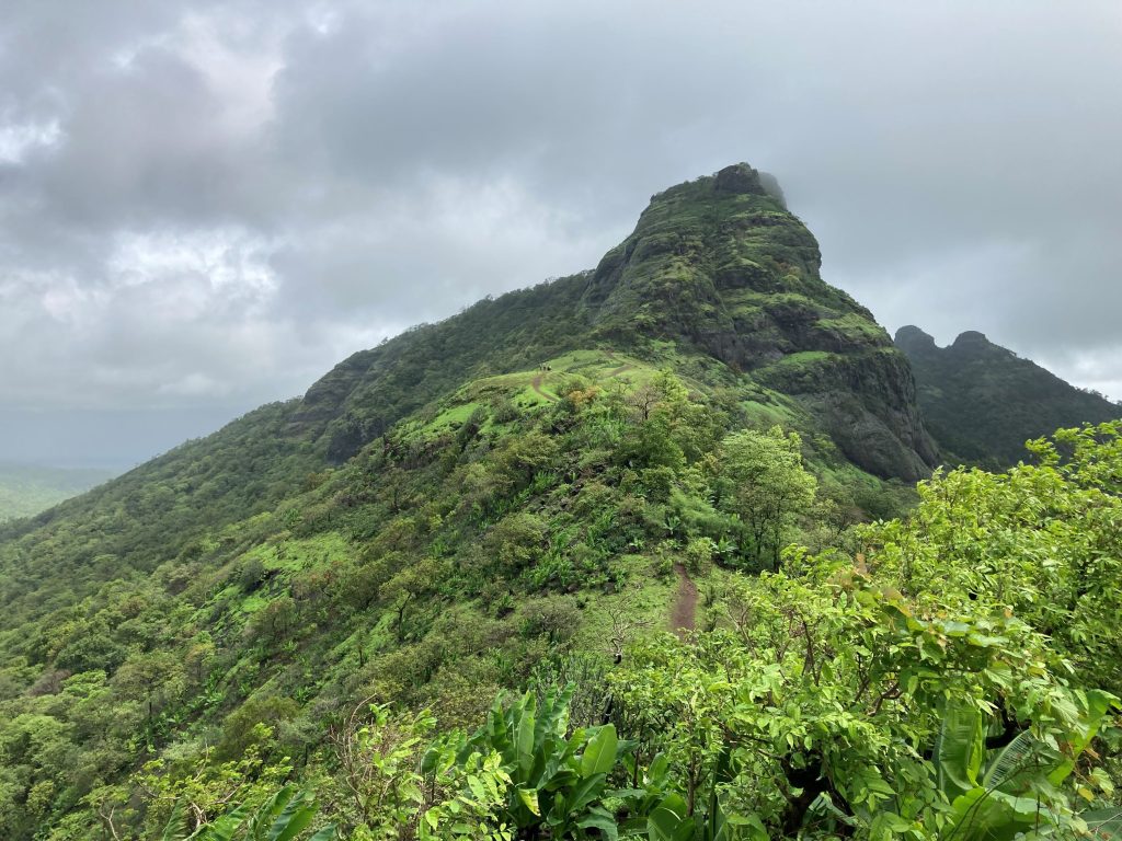
Tahuli Peak
#vocalforlocaltreks
O ne day trek to tahuli peak, let’s connect to our roots ..
Tahuli is one of the most beautiful treks of Sahyadri range. It comes under the region of Kalyan, Karjat and Pavel. Tahuli Mountain contains a number of pinnacles. The two important pinnacles are ‘Daadima’ and ‘Panch Peer’. The mesmerizing beauty of the uppermost part of the plateau known as “Dadimaa Tahuli” is a must-see place. On reaching the pinnacle, we can see five Islamic holy graves, highly worshipped by the locals. The Tahuli mountain ranges are surrounded by the green lush, dense forest and one cannot miss the scenic beauty of green carpet while walking between the flowers on the walkway. It has everything that makes an amazing trek for outdoor lovers.
2568 Feet (Approx.)
Trek Difficulty Level
Moderate to Difficult
Average Climbing Time
3 hours (One Way) from Kushivali
5.30 am : Leave from Mumbai
7.30 am: Reach our Base Village (Kushivali) & proceed for breakfast
8.15 am: Begin trek to Tahuli
11.00 am: Reach at the top, enjoy the view, capture your moments and start your journey towards the base village
1.30 pm: Reach Kushivali Village, proceed for lunch
2.30 pm: Proceed for Mumbai
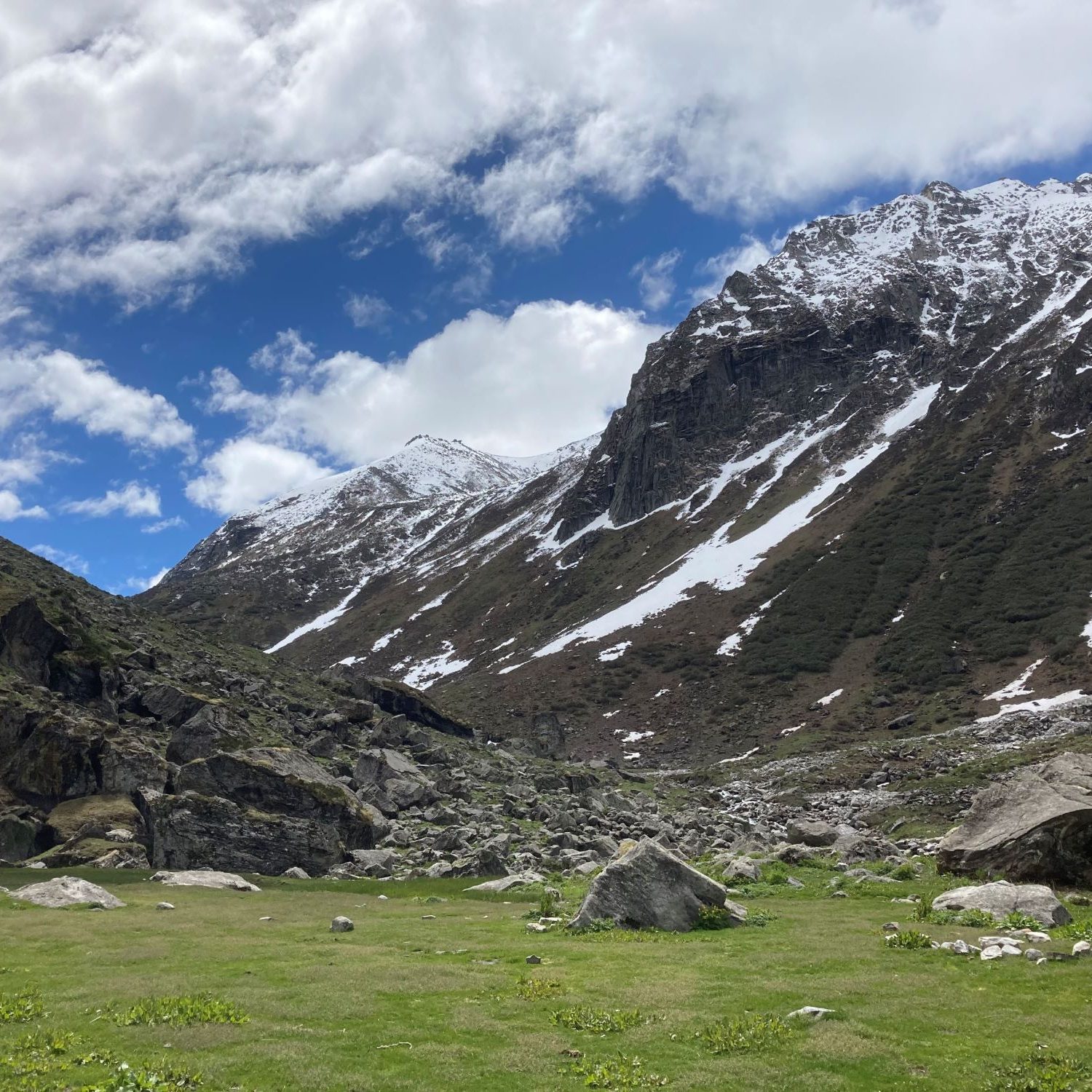
Trekking In Himalayas
Dayara Bugyal presents a larger than life panorama of Himalayan winter. Explore the widest expanse of snow with enchanting views of mesmerising peaks. From Dayara, you can see the Greater Himalayan range in all its beauty. The majestic summits of the Gangotri range, including Bandarpunch, Kala Nag, Srikanth, Jaonli, and Draupadi Ka Danda, are so close that you can almost touch them. Read more…
The dome shaped peak of Deo Tibba (6001m) is where Gods sit, according to the Hindu mythology. Hence, the name signifies Deo (God) and Tibba (Hill). It is believed that Lord Indra (the King of Heaven) conducts meeting with other Gods from his throne i.e. Indrasan Peak. Read more…
Chanderkhani Pass is located in the Kullu District of India at a height of 3,660 metres. It forms a way (pass) between the villages of Rumsu and Pulag to the well-known village of Malana, which indirectly forms a trekking route from Naggar to Malana across the Chanderkhani Pass. Read more…
Experience the beauty of the Himalayas by exploring a picturesque trek that concludes with a thrilling altitude gain. Located at an elevation of 4150 metres, Darwa Top, also known as Darwa Pass is a gorge connecting the Ganga and Yamuna River valleys. Darwa Top lies 5 Km ahead of Dodital. Read more…
Explore one of the most beautiful Himalayan treks, during the winter. Sarotu Meadows is a dreamy gateway to come across the rich Himalayan flora & herbal wealth. It is a paradise for cross-country Heli-skiers & offers a magnificent view of surrounding peaks of Pir Panjar Range. Read more…
The Valley of Flowers is one of the most popular treks in India. It is a breathtakingly beautiful alpine valley located in the western Himalayas in Uttarakhand. It is a UNESCO World Heritage Site and is known for its stunning natural beauty, diverse flora and fauna, and picturesque landscapes. Read more…
Nepal is considered as the Mecca of Mountaineering. It is home to the roof of the world – Mount Everest standing tall, luring the adventurers, around the word. A dream woven with immense determination, perseverance and passion takes you to the foot of the World’s Highest Mountain. Read more..
Trekking In Sahyadri
Kalsubai is the highest peak in Maharashtra (5400 ft.), located near Igatpuri, Sahyadri region. Climbing the peak from Indore route is less-explored and meant for experienced trekkers, especially during the monsoon. The trek offers a breath-taking combination of natural environments like waterfalls, forests and grasslands. Read more…
Kothaligad is a fort (3100 ft.) situated near Karjat-Murbad Road in Maharashtra. It is one of the famous treks in the Sahyadri range, known for its scenic beauty and moderate level of difficulty involved in climbing. The fort looks like an inverted funnel; it is also known as ‘Funnel Hill’. Read more…
Karnala Fort is a hill fort situated within the Karnala Bird Sanctuary in Raigad district, Maharashtra, India. It was a place of strategic importance since it overlooked the Bor pass, which connected the Konkan coast to the interior of Maharashtra (Deccan Plateau) on the main trade route between these areas. Read more..
Kohoj is a medieval military fortification located on the Manor-Wada road in Palghar district, Maharashtra. The fort is said to be about 800 years old and finds a mention in the Purandar treaty along with 22 other forts which were surrendered by ChhatrapatiShivaji Maharaj to the Mughals on 11 June 1665. Read more…
Tahuli is one of the most beautiful treks of Sahyadri range. It comes under the region of Kalyan, Karjat and Pavel. Tahuli Mountain contains a number of pinnacles. The two important pinnacles are ‘Daadima’ and ‘Panch Peer’. The mesmerizing beauty of the uppermost part of the plateau known as “Dadimaa Tahuli” is a must-see place. Read more…
Takmak Fort is one of the most beautiful and offbeat treks of Maharashtra. The fort is situated in the Vasai Tehsil, Palghar District. The base village for the trek is Sakawar which is at sea level. The trek gradually gains altitude and climbs up to 2000 feet from the base. Read more…
Sondai is a hill fort, located near Karjat in Raigad District of Maharashtra, India. The Sondai fort was built so that it could act as a watchtower for surveillance of nearby areas. It gets its name because of the presence of the temple of Goddess Sondai Devi, at the top of the mountain. Read more…
Forts and Treks
Our aim is to provide information regarding treks and detailed presentation of our cultured heritage (forts). We want people to visit forts and know about their history and their present condition. It is our sworn duty to provide you with information which helps trekkers find minimalistic routes to their destination. We hope information delivered is simple to understand and always accurate.

- Easy To Trek
- Trekkers Favourite
- Monsoon Treks
- Summer Trek
Tahuli Fort
Tuesday, March 13, 2018 Midlime Info 0 Comments A + a -
History of Tahuli Fort
Places to visit on the tahuli fort , lets find how to reach to tahuli fort, places to visit nearby the tahuli fort.

Midlime Info

Rockin Adventure
Our aim is provide information regarding treks and detailed presentation of our cultured heritage (forts). We want people to visit forts and know about their history and their present condition. It is our sworn duty to provide you with information which helps trekkers find minimalistic routes to their destination. We hope information delivered is simple to understand and always accurate.
- 127 Followers
- 7,123 Followers
- 395 Subscribers
Popular Posts
- Rangana Fort Trek. Rangana Fort Trek. Type Rangana is Hill fort. Difficulty level ...

- Vishalgad Fort Trek. Vishalgad Fort Trek. Type Vishalgad is Hill fort. Difficulty level Vishalga...

- Achala Fort Trek
- Ajinkyatra Fort Trek in Satara
- Alang Fort Trek
- Anjanvel Fort
- Chandragad.
- Harishchandragad
- Khandesh Mahostav in jalgaon

Welcome to your Adventurous Life. Whatever your starting point, we’ll use innovative teaching methods, superb instructors & unique activities to get you to your goals. We shorten the learning cycle to get you to new skills, fitness & fun as fast as possible.
Trekking and Hiking in the heart of Maharashtra - The Sahyadris
Mother nature has created you, she has a lot of mesmerizing stuff in her lap, and if you love her truly then you need to explore it. In my blog posts, you will get all the necessary, in depth information about the trekking destinations around Maharashtra.
Tuesday 2 January 2018
Trek to unexplored tavli / tahuli (panch peer and dadima), how to reach, difficulty level, time required for the trek, what to see, my experience, summary of this trek.
- Nearest Railway Station: Kalyan/Badlapur.
- Base Village: Kushivali.
- Routes: From Kalyan side and Badlapur side. The route from Badlapur side is difficult to traverse.
- Average Expenditure: Rs 100.
- Bus Ticket from Kalyan to Kushivali - Rs 20. The buses ply every 15-20 mins and the frequency is quite good. Catch the bus going towards Malanggad.
- Ascend time: 3 to 3.5 hrs from Kushivali and 4-5 hrs from Badlapur side.
- Descend time: 2.5 to 3 hrs.
- Difficulty Level: Easy to Medium.
- Endurance and Stamina Level: High.
- Best time to visit from rainy season to winters.
- Carry about 3 litres of water.
- Use good grip trekking shoes/ketoes, wear track pants and full sleeve shirts as the hills are full of wild shrubs.
- The Tavli hill can be trekked from Badlapur side as well; but the route is treacherous and very difficult, no villager is there on this route, hence one can easily lose track of the location and eventually get lost. Hence use this route only if you are a professional trekker with ample trekking experience.
11 comments:
Thanks a lot.. do visit the place
This place would turn magical during monsoons for sure..one more trek on my to-do list..!!
Nice info Madhur
Good blog very informative
Very much informative
Thanks.. do visit the place

Tahuli region is Less explored & neglected trekking spot.trekking ecscription is fluid & Impressive.good experience.informative & well written blog.
Thanks Dnyaneshwar, do visit the place; happy trekking.. :)
Nice blog, much info is given here like ticket price, how to reach, etc.. good and informative
Desitrails .
Tahuli Trail

Head towards Kushivali via Bus/Private Vehicle (Tum-Tum) from Kalyan
From Kalyan Bus Depot there are regular buses heading towards Malanggad. Kushivali is one stop before Malanggad, there are also Tum-Tum's available to reach Kushivali from Kalyan.
Hike to Tahuli
A gradual hike along a long but well-marked trail.
Places to see
Nearby trails
« All Events
- This event has passed.
Tahuli – Reverse Waterfall Trek
July 22, 2022 @ 5:00 am – 8:00 pm.

Tahuli – Reverse Waterfall Trek Date: Every weekend
Duration: One day trek Batch Size: 25 Participants only ★ We do not take a crowd of 80-100 people on treks, it’s against our safety policy.
Tahuli Reverse Waterfall Trek – Major attractions: ★ A moderate level trek for all the trek enthusiast ★ The thrill of walking through Dense forest ★ Experiencing one of the Reverse Waterfall. ★ Crossing Many small streams and waterfalls on our way.
★ Fees: 500/- per person participants need to reach the base village in their own vehicle 800/- per person with a pickup and drop from Kalyan local train station
Detailed Itinerary ↓ https://www.mischieftreks.in/weekend-day-trek-near-mumbai/reverse-waterfall-trek-tahuli
Weekend Events ↓ https://www.mischieftreks.in/weekend-day-trek-near-mumbai
Connect with us on WhatsApp Chat ↓ https://wa.me/message/NQTIP3Y25LLHO1
https://www.facebook.com/events/1427257054414814/?event_time_id=1427257094414810
- Google Calendar
- Outlook 365
- Outlook Live

Mumbai Trekkers
+91 7400 174767.

Tahuli Reverse Waterfall
Date : 15th August, 2023 Grade : Moderate Cost : ₹ 700 Highest Altitude : 1600 feet (488m)
Major Attraction : Reverse waterfall Multiple water streams on route View of Malanggad and Chanderi mountain range
Meeting Point : Kalyan bus depot (in Kalyan West, near Platform No. 1) at 07.00 am (After reaching meeting point, call our trek leader. Contact detail will be provided on the event day)
Trek Duration : 2 hours ascend, 2 hours descend, 3 hours trail walk
Water Sources : Base village
Washroom Facilities : Base village
Technical Climb : No
Base Village : Khushivali
Trek Elevation : 1600 feet (from base village)
Nearby City : Kalyan
Mode of Transport : Eeco or Omni from Kalyan
Vehicle Travel Distance : 15 kms one way
Vehicle Travel Duration : 45 mins one way
Batch Size : Minimum 7, Maximum 35 participants
Tentative Schedule :
07:00 am : Meet near Kalyan bus depot and move towards base village 08:00 am : Reach base village and have breakfast
08:30 am : Start trek with short briefing and introduction 12:00 noon : Reach Reverse waterfall point and explore 01:00 pm : Have lunch (Bring your own) 01:30 pm : Start descend
04:00 pm : Take break at water stream near base. 05:30 pm : Reach base village and have snacks
06:30 pm : Start return journey 07:30 pm : Reach Kalyan
Cost Inclusions :
Travel from Kalyan to Kalyan by private vehicle
Evening snacks
First aid, guide and expertise charges only
Things to Carry :
2 litres of water
Windcheater
Packed lunch or snacks for lunch
Trekking shoes (Action Trekking or Coaster CTR shoes are recommended, avoid Forclaz/Quechua/Running/Other sports shoes for treks in Maharashtra)
Glucon D or Elecrolyte Powder
Medicine as necessary to you
Important Note :
1) We will be only trekking till reverse waterfall point to be able to come back on time (and not till Dadima Pinnacle (Top) which is another 1-1.5 hours steep climb one way from this point). Dadima Pinnacle is situated at 2450 feet, Tahuli reverse waterfall at 1600 feet.
Overview :
Tahuli is hidden gem situated in outskirts of Mumbai. This trek is near Kalyan and the neighbouring mountain to the famous Malanggad. This trek has a lot to offer. One can not explore the entire Tahuli region in a day. There are few water streams to start the trek with an easy walk of 45 mins. Once you cross the streams, the climb of 1.5 hours starts through forest and rocky terrain followed by a forest walk of 30 mins and you will reach the reverse waterfall point. If it is windy and rains then we can get to see the waterfall droplets coming in reverse direction. On this trek we will go only till this point, whereas there is a lot more at Tahuli. Dadima Pinnacle and Paach Pir are 2 sides of Tahuli, exploring them will take more than a day. Tahuli Reverse Waterfall trek is a moderate level trek, which can be done by fit beginners as well.
Book Your Seat Now
11 Best Monsoon treks in Maharashtra
Do you want to experience the rhythm of the rain while traversing a canvas painted in shades of green? Whoa, the description sounds surreal! Well, we are talking about monsoon treks in Maharashtra that present a bewitching experience to those consumed by wanderlust.
The trekking places in Maharashtra brim with shimmering greenery during monsoon months and make for an ideal escapade to beat the blues. Let’s take a quick overview on what makes monsoon such an enticing trekking season in Maharashtra.
The state of Maharashtra
The coastal state of Maharashtra is famous for its idyllic caves, lush hill stations, and pretty hamlets. Its proximity to the coastline saves it from harsh winters or sweltering summers.

However, Maharashtra during peak summer months is sticky and hot. If you want to experience the beauty of this state at its pinnacle then monsoon and winter are your best bet.
Monsoon in Maharashtra is the ideal time to relish the trekking magnets of the heavenly state.This season bestows a unique charm on the region; the glossy green landscape presents an entirely new world to trekkers.
The clouds are mostly clear for great views. Sometimes the views are obscured by mist but the panorama of cascading waterfalls and small streams is like a painted canvas set against the misty backdrop. The water bodies shimmer with crystal-clear waters and the trails are lined by pretty blossoms in rainbow colors.
As one treks in this dreamy paradise, the offbeat attractions and naturalistic beauty offer unforgettable views to trekkers. The temperature ranges from 20 degrees C to 25 degrees C during the monsoon season, thus making the journey pleasant and comfortable.
In the coming sections, we have compiled monsoon treks in Maharashtra that make for the best trekking places in Mumbai and its vicinity.The best part is that these expeditions are just one-day trek near Mumbai and Pune. One can embark on these relaxing weekend getaways and come back rejuvenated and fresh.
Also Check: Trekking in Maharashtra
Lohagad fort trek
- Location- Lonavala
- Altitude- 3, 389 feet
- Difficulty level- Easy
- Duration- 5 hours
- Best time- Mid June to September
- Attractions- Lohagad fort, Narayani Dham temple, Bhaja caves, and Wax Museum.
- Trek trail- Easy and well defined trekking trail with steps and boulders all along till you reach the fort.
Lohagad fort trek is one of the easy treks near Mumbai. It also offers an exciting destination for adventurers looking for trekking in Pune. Lohagad fort lies on a beautiful hill at an imposing elevation of 3, 389 feet. The impressive fort was used by the great warrior Shivaji to keep his treasures safe. While on this Lonavala trekking getaway, one can explore the ancient architecture of the Shivaji era set amidst scenic views.
Lohagad fort trek is fairly easy and can be done in just a few hours.
Also Check: Adventure places in South India
Kothaligad fort trek
- Location- Karjat
- Altitude- 3,100 feet
- Duration- 6 hours
- Attractions- Kothaligad fort, idyllic views from the top, and historic caves.
- Trek trail- A fairly easy route with a rocky offbeat trail near the end.
Kothaligad fort trek is famous for Kothaligad fort, also called the Peth fort because village Peth is located at the base of this fort. The defense fort of Kothaligad was used to store ammunition. The focal attractions of the Kothaligad trek route include the two caves, first of a Goddess and the other Bhairoba cave with sculpted pillars. The view of windmills and sunrise from the pinnacle of the peak are other prime attractions. Another highlight of the trek is the presence of beautiful fireflies along the trail in the pre-monsoon season.
Therefore, the Kothaligad fort trek is one of the best night treks near Mumbai.The trek is easy for the most part except for a 10 feet rocky stretch near the top of Kothaligad.
Also Check: Pawna Lake Trek, Lonavla
Ratangad trek
- Location- Bhandardara
- Altitude- 4,260 feet
- Difficulty level- Moderate
- Duration- 6.5 hours
- Best time- Late monsoon season during September.
- Attractions- Ratangad fort, ancient Amruteshwar temple dedicated to Lord Shiva, splendid views from the top, and Nedhe peak.
- Trek trail- Exciting ascending and the descending trail that journeys along village fields, river crossings, water bodies, and forests.
Ratangad Trek is best done in September. During the late monsoon season, the whole mountain is bedecked with wild yellow Sonki flowers. The entire vista is just out of the picture book- one can relish the glimpses of surrounding mountain ranges of Katrabai, AMK, and Kalubai, Bhandardara backwaters, necklace waterfall, and the ancient Shiva temple. The focal attraction, however, is the natural rock at the peak with a cavity called Nedhe or Eye of the Needle.
Sagargad fort trek
- Location- Alibaug
- Altitude- 1, 482 feet
- Duration- Two days
- Best time- Monsoon and winter months
- Attractions- Sagargad fort, Dhodhane waterfall, Siddheshwar Temple, spellbinding views from the top.
- Trek trail- A well laid trekking trail amidst thick and expansive forests.
Sagargad fort is a sea fort on top of the hill. According to history, the prisoners were pushed to their death from the monkey point of the Sagargad fort.This trek is for someone seeking a thrilling adventure with a peek into history. The blissful trekking destination enthralls trekkers with steering views of the Arabian Sea and the town of Alibaug from the top. The monsoon breeze is rejuvenating for trekkers as they scale the gigantic plateau.
Tringalwadi fort trek
- Location- Igatpuri
- Altitude- 3, 238 feet
- Duration- 3 hours
- Best time- October to February and Mid June to September.
- Attractions- Tringalwadi fort, caves along the way, Bhawani Mata temple.
- Trek trail- It is mostly an easy to moderate trek on a gentle slope with a bit of steep climb in the last bit of the journey. The last part of the trek is through steps that are cut into a rock.
Tringalwadi fort is one of Igatpuri's most popular forts. The Tringalwadi trekking trails journey along the green plateaus, waterfalls, ancient caves, and mountains of Igatpuri. One can revel in the prime beauty of the monsoon season while embarking on this trek.The trek is pretty straight most of the time except for the last lap. It takes almost an hour (one way) to reach the top of the fort from the start point.
Vikatgad trek
- Location- Matheran
- Altitude- 2,100 feet
- Best time- October to February and June to September.
- Attractions- An ancient temple, 360° view of the surrounding peaks, caves, journey along the forest with a toy train rail track, and glimpses of Kadyavarcha Ganpati.
- Trek trail- Mostly easy except for the unique narrow trail to the pinnacle.
There is an old temple of Goddess Pebi at the base of the Vikatgad fort. According to history, Shivaji used the caves of the fort for grain storage. The pinnacle of the hill offers commanding glimpses of Prabalgad, Kalavantin, Chanderi fort, Malanggad, Nakhind hill, Tahuli, and Matheran plateau.
Vikatgad trek offers 5 different trek trails of varying grades of difficulty and is therefore ideal for amateurs as well as seasoned trekkers.
Anjaneri fort trek
- Location- Nasik
- Altitude- 4, 263 feet
- Best time- All year through
- Attractions- Hanuman temple, Anjani Mata temple, small Jain temples, Anjaneri fort, intricately carved caves, and lake.
- Trek trail- The trail traverses through mountain crossing, stony patches, and plateau leading to the hilltop.
Anjaneri fort trek is a popular trek among Nashik trekking places and the Trimbakeshwar region.It is located in the Nasik-Trimbakeshwar Mountain range of Maharashtra. According to local belief, the Anjaneri fort is the birthplace of God Hanuman. The trek is therefore also on the list of devotees for spiritual reasons.The focal highlight for the trek is the Anjani Maata temple devoted to Lord Hanuman’s mother. It is a rare highlight as one cannot find any other temple in India built for Anjani Maata.It is a moderately easy expedition that requires good agility to reach the hilltop.
Irshalgad Trek
- Altitude- 1,700 feet
- Difficulty level- Moderately difficult
- Best time- June to March
- Attractions- Temple of goddess Irshaldevi, Morbe dam, caves, Nedhe point, and Irshalgad summit.
- Trek trail- A well marked trail that goes through villages and lush forest. The final stretch is a bit treacherous.
Irshalgad is a gorgeous hill located in the vicinity of the iconic hill station Matheran. Irshalgad is easily distinguishable from far because of its typical boat shape.
The hill is connected to the Prabalgad fort by a ridge and can be reached through 3 different trails- first is the base of the summit, second the Needhe hole, and finally, the technical climb to the pinnacle.
The final lap of the trek is quite tricky and must be avoided unless one is adept at scaling treacherous peaks.The prime attractions are a small temple, caves, Nedhe point, and the splendid views of Matheran mountains from Irshalgad pinnacle.
Kalavantin trek
- Location- Raigad
- Altitude- 2,205 feet
- Best time- July to March
- Attractions- A steep staircase reaching the peak, caves, Prabalmachi Plateau, panoramic view of Prabalgad, PebMatheran, Chanderi fort, Ulhas River, and Irshalgad from the pinnacle.
- Trek trail- Thick vegetation, muddy trail, and uneven rocky terrain.
Kalavantin Durg Trek is one of the best trekking places near Mumbai. The trek traverses through dense forest trails, some muddy patches, and rocky terrain. The experience of scaling the summit of Kalavantin is a thrilling experience that is ideal for both amateurs or adventure seekers.
Kalavantin Durg Trek is covered in three phases: it starts with a gentle ascent till Prabalmachi Plateau. Then it leads to the COL and finally a climb from COL to the top of Kalavantin. However, the last stretch of the trek is a bit treacherous and one has to be extremely cautious while maneuvering this lap. One has to carefully walk on the hand-cut steps that are carved on a steep hill.Many adventure seekers combine the Kalavantin trek with the Prabalgad trek. Some trekkers love to camp at the vast Prabalmachi Plateau that lies en route this trek.
Torna Fort trek
- Location- Pune district
- Altitude- 4, 603 feet
- Difficulty level- Difficult
- Best time- Winter months
- Attractions- The historical Torna Fort, picturesque glimpses of Raigad, Mahabaleshwar, Pratapgad, Khadakwasla dam, Singhad, Bhatgar, and Makarangad from the summit of Torna fort.
- Trek trail- A bit slippery initially, followed by a gradual ascent and a journey along the ledge. It ends at a small rocky patch.
If you are a lover of history and love exploring forts then this challenging expedition should be on your wish list. The great warrior Shivaji conquered the Torna fort at the young age of 16. The fort is also called Prachandgad due to its humongous size. It is the tallest fort in Pune.The trail also offers beautiful river crossings, ridge walks, and seasonal waterfalls to admirers of nature. It is one of the toughest treks in Maharashtra but every ounce worth it.
Bhandardara Trekking
- Location- Ahmednagar
- Altitude- 5,400 feet (Mount Kalsubai)
- Difficulty level- Easy to difficult
- Best time- Winter and monsoon months
- Attractions- Elaborate views of Bhandardara dam, historical forts, Kalsubai temple, Amruteshwar temple, Mt. Kalsubai, Randha Waterfall, and Ajoba peaks.
- Trek trail- Varying trekking trails ranging from easy to moderate routes to slightly challenging ones.
Bhandardara is a breathtaking hill station perched in the Sahyadri ranges of Maharashtra. The roaring water cascades, majestic mountains, and sumptuous forests make Bhandardara the ultimate holiday location. This small hamlet also offers abundant thrilling attractions with unlimited trekking tours, ranging from easy to challenging climbs.
Mount Kalsubai is the most popular trekking locale in the region. It is also called the “Everest of Maharashtra''. Even though the Mount Kalsubai trek is quite tricky, it beckons tourists all year round, offering them splendid views of the surroundings. The best part is that one can also visit the Kalsubai Harishchandragad Wildlife Sanctuary, while on this trek.
Trekkers usually trek their way to the top but can also take the man-made stairs. Kalsubai temple, located at the pinnacle offers spiritual solace to fatigued travelers. Another attraction at the Kalsubai temple is a devout fair during the Navratris.
The magnificent Ratangad Fort is another alluring trekking spot and we have talked about it earlier in the blog. The history afficionados’ love the striking architecture of the opulent fort. The picturesque Amruteshwar temple, dedicated to Lord Shiva is the prime attraction of the trekking route.Another exciting trek in Bhandardara is the Randha Waterfall trek. The beauty of Randha waterfall gushing down with full force in the monsoons is a sight to behold. One can also trek to the imposing Ajoba peaks that are famous for typical rock formations.
Conclusion:
In a nutshell, these trekking places in Maharashtraoffer a quick rendezvous with nature. If you are seeking places for trekking near Mumbai or trekking in Mumbai this weekend, then set foot on these marvelous retreats. The offbeat destinations will leave you spellbound with their rich history and lush natural surroundings. Just explore!
Deals And Offer

Hampta Pass Trek
4.87 ( 438 ), hampta pass trek 2024 - chandratal lake trek | moxtain, free cancellation till 30 days prior trek, rental & gear available on rent, book with 20% initial amount.
See Dates / Book Now

Dayara Bugyal Trek
4.85 ( 398 ), dayara bugyal trek 2024 - 6 days trek | moxtain.

Kasol-Kheerganga-Tosh-Malana-Trek
4.56 ( 24 ), similar blogs.

Trekking in Jammu Kashmir: 8 Best trekking trails and adventure activities

Bali Pass vs Har Ki Dun Trek

8 Best treks in Himachal Pradesh

Why Kedarkantha trek is favorite of every trekker?

13 Offbeat Places To Visit In Kashmir In 2024
Similar trips, everest base camp trek, stok kangri, annapurna base camp trek, goechala trek, nag tibba trek, deoriatal chandrashila, sandakphu phalut trek, bara bhangal, mayali pass.
- Trekking & Travel Events
- Travel Organizations
- Himalayan Treks
- Maharashtra Treks
- Karnataka Treks
- Travel Guides
- Weekend Getaways
- Trekking Tips & Advice
Mahuli Fort – 5 things to know about this terrific trek
- Trekking Destinations

Table of Contents
Mahuli Fort: A brief introduction
Mahuli fort, the highest point in the Thane district , is a popular one-day trek for Mumbai residents. The fort stands tall at 2,815ft , and is the holy grail of Mumbai’s rock climbers because of its pinnacles.
The Mughals built this fort. It is well-known for its many battles for supremacy.
- Region: Thane District
- Best Season: Monsoons & Winters
- Altitude: 2815 ft.
- Difficulty: Easy-Moderate
You can also subscribe to our monthly travel newsletter, where we give information about treks, travel hacks, travel experiences & discounts on various travel gear, and treks organised by our partner.

How to reach Mahuli fort
The fort is in the Thane district; hence it is straightforward to go to the base village via public and private transportation.
Via Public Transport:
It would be best to take a train from CST/Dadar in Mumbai, get down at Asangaon station , and board a rickshaw to the base village. The rickshaw fare is INR 250 , and it will take approximately half an hour to reach via rickshaw, and the distance is around 20 kms.
Via Private Vehicle:
The distance from Mumbai is about 70 kms , and it will take around 2 hours to reach the base village.
The distance from Pune is 200 kms .

Trek route & Difficulty
The route to the top from the base is relatively simple and well-marked; however, there are a couple of tricky sections where one needs to be careful.
It takes about 3 to 4 hours to complete the trek , and the difficulty level is easy-moderate . A beginner can attempt this trek but needs to tread carefully on certain sections; however, one needs to be physically fit to attempt the hike.
The trail starts from a gate that mentions “entry to the fort” next to a small temple. It is a jungle trail .
A gradual climb throughout the trek makes the endurance level high , and one needs to take regular stops in between to enjoy the hike.
At the top is a shivling & a sculpture of Chatrapati Shivaji Maharaj and a famous spot called the Maha Darwaza.

Important Information
- One needs to pay an entry fee of INR 30.
- The trek timings are 7 AM – 5 PM.
- A different trail leads to Mahuli waterfall, which is at its peak during the monsoons. (However, the waterfall is closed during heavy rainfalls.)
- There are no food stalls or water points throughout the trek, and one must carry 3-4 litres of water and enough food for the hike.
- It would be best if you took the contact of the rickshaw driver because there are no other rickshaws available from the base village.
- There is a small hotel near the base village where you can have breakfast before the trek.
Mahuli fort trek video
Dhodap Fort | Nanemachi waterfall | Harishchandragad | Karnala Fort | Peb Fort | Jivdhan Fort | Irshalgad | Sondai Fort | Salher Fort | Aadrai Jungle Trek | Ganpati Gadad | Korigad Fort | Tandulwadi | Garbett Plateau | Sudhagad Fort | Kataldhar Waterfall | Plus Valley | Mangi Tungi | Malanggad | Gorakhgad | Bhairavgad | Kohoj Fort | Rajgad | Ratangad | Bhimashankar Trek | Visapur Fort | Kalsubai Trek | Tikona Fort | Rajmachi Fort | Sandhan Valley | Kalavantin Durg | Andharban Trek | Harihar Fort | Kalu Waterfall
Prefer going for a trek with a group? We have curated a list of over 200 groups with their events, social media links, contact details, reviews, photos & much more.
- where is Mahuli fort situated
Kohoj Fort - A Complete Trek Guide - Nomads of India
[…] notable nearby treks include Asherigad, TakMak fort, Mahuli fort, Asava fort & […]
Add a comment
Leave a reply · cancel reply.
Your email address will not be published. Required fields are marked *
This site uses Akismet to reduce spam. Learn how your comment data is processed .
- Share via...
- Quick Inquiry : +9779841480794
Difficulty of the Langtang Valley Trek

Table of Contents
Understanding the Difficulty of the Langtang Valley Trek: A Comprehensive Guide The Langtang Valley Trek is a popular trekking destination in Nepal, offering stunning landscapes, vibrant culture, and a more relaxed atmosphere compared to the busier Everest and Annapurna regions. Before embarking on this journey, it's crucial to understand the Langtang Valley Trek difficulty to ensure you're well-prepared. This guide will explore the factors contributing to the trek's difficulty, discuss the level of physical fitness required, and offer tips for a successful trek.
Overview of the Langtang Valley Trek
The Langtang Valley Trek takes you through the Langtang National Park, with its lush forests, traditional villages, and breathtaking views of the Himalayas. The trek typically begins with a drive from Kathmandu to Syabrubesi, followed by a multi-day trek through the valley. The journey culminates at Kyanjin Gompa, a picturesque monastery surrounded by towering peaks.
Factors Contributing to Difficulty
Terrain and altitude.
The Langtang Valley Trek involves a variety of terrains, including steep ascents, descents, and river crossings. The trek reaches an elevation of approximately 4,000 meters at Kyanjin Gompa, making altitude an important consideration. Trekkers should be aware of the risks of altitude sickness and take time to acclimatize during the trek.
Trek Duration
The typical Langtang Valley Trek itinerary spans 7 to 10 days, with daily trekking distances ranging from 5 to 15 kilometers. While the overall distance is manageable, the varying terrain and altitude changes can make the trek physically demanding, especially for beginners.
Weather Conditions
Weather plays a significant role in the difficulty of the Langtang Valley Trek. The best time to trek is during the spring and autumn seasons, when the weather is most stable. However, unexpected weather changes, such as rain or snow, can impact trail conditions and increase the level of difficulty.
Preparing for the Trek
To successfully complete the Langtang Valley Trek, a reasonable level of physical fitness is required. Regular cardiovascular exercise, strength training, and hiking experience are recommended to prepare for the trek. Proper gear, including trekking boots, layers of clothing, and a comfortable backpack, is essential for safety and comfort.
Hiring a guide or porter can also reduce the trek's difficulty by providing support and assistance with navigation. Guides are familiar with the region and can help you acclimatize properly, while porters can carry a portion of your gear, allowing you to focus on the trek itself.
FAQs About Langtang Valley Trek Difficulty
1. is the langtang valley trek suitable for beginners.
Yes, the Langtang Valley Trek is suitable for beginners with a reasonable level of fitness. The trek's duration and varying terrain require some physical endurance, but with proper preparation and acclimatization, beginners can complete the trek successfully.
2. What is the highest point on the Langtang Valley Trek?
The highest point on the Langtang Valley Trek is Kyanjin Gompa, which is approximately 4,000 meters above sea level. This elevation requires trekkers to acclimatize properly to avoid altitude sickness.
3. How many hours do you trek each day on the Langtang Valley Trek?
Trekkers can expect to trek between 4 and 6 hours each day, depending on the itinerary and pace. The daily distances vary, with some days requiring longer trekking hours due to elevation changes or trail conditions.
4. What is the best time to trek in the Langtang Valley?
The best time to trek in the Langtang Valley is during the spring (March to May) and autumn (September to November) seasons. These periods offer stable weather, clear skies, and vibrant landscapes.
5. What should I bring for the Langtang Valley Trek?
Essential items for the Langtang Valley Trek include trekking boots, weather-appropriate clothing layers, a warm sleeping bag, a comfortable backpack, and a first aid kit. Additional items such as trekking poles, water purification tablets, and energy snacks are also recommended.
The Langtang Valley Trek offers a rewarding experience with stunning scenery and cultural encounters. Understanding the Langtang Valley Trek difficulty and preparing adequately are key to ensuring a successful and enjoyable trek. By considering factors such as terrain, altitude, and weather, you can embark on this journey with confidence. With the right preparation and mindset, the Langtang Valley Trek is an adventure that promises unforgettable memories and breathtaking views.
We Are Associated With
Find & Follow Us on
© 2011 - 2024 All rights reserved. Life Dream Adventure. Developed By: Xenatech Nepal .
Notice. This site uses cookies to optimize your user experience. By using this site, you are consenting to our use of these cookies. Check out our Privacy Policy and our Cookies Policy.
IMAGES
VIDEO
COMMENTS
Trek Difficulty Level. Moderate to Difficult. Average Climbing Time. 3 hours (One Way) from Kushivali. Itinerary. 5.30 am : Leave from Mumbai. 7.30 am: Reach our Base Village (Kushivali) & proceed for breakfast. 8.15 am: Begin trek to Tahuli. 11.00 am: Reach at the top, enjoy the view, capture your moments and start your journey towards the ...
Difficulty level Tahuli fort is medium to trek. Height Tahuli Gad is 3487ft. (1062 mtrs) above sea level. ... and thick backwoods which make this trek testing and energizing. Amid the dry season water is just accessible at the highest point of the mountain. In the rainstorm, discovering a course is a testing assignment, particularly in the ...
Difficulty Level This trek is a combination of two treks - Panch Peer and Dadima Tahuli, which are two different hills. Trek to Panch peer is easy but the trail is confusing and has lots of multiple routes; hire a guide if you are a new trekker, one may easily get lost.
The places near to Tahuli are very crowded amongst trekkers. So, if you are looking forward to peaceful trekking then you can always trek at this location. Tahuli is misunderstood as a fort but, actually, Tahuli Mountain contains pinnacles. Tahuli comes under the region of Kajrat, Panvel, and Karjat. If you want to challenge your trekking ...
Day 0: 10:45 pm: Meet the Trikon team at Pritam Hotel Dadar East. 11:00 pm: Journey starts for Tahuli , Pickups on the way. 11:45 am: Pick up from Teen Hath Naka, Thane. Day 1: 03:30 am - Reach the base village and rest. 05:00 am - Good Morning.Have Breakfast. 06:00 am - Introduction Round ans Start the trek. 11:00 am - Reach the top.
Tahuli is a peak which lies near Malanggad, Kalyan. ... the top along with tombs of Panch Peer. Tahuli is a lesser known trail and is best in a group rather than a solo trek. Desitrails. Tahuli Trail . Kushivali, Maharashtra . 50.6 Km from Mumbai . Altitude . 1063 m . Duration . 3 hrs . Difficulty . Medium . Popularity . Low . Tahuli is a peak ...
Tahuli is located about 13km from Kalyan railway station of Shahapur Taluka in Thane district of Maharashtra, India. A top most peak of Tahuli is Known as "D...
We will talk about them one by one. The Trek Difficulty Rating has two parts: Broad category and specific level. Broad Category: Easy-Moderate, Moderate, Moderate-Difficult and Difficult. Treks are classified under the broad category by these criteria: Altitude gained every day of the trek. Highest altitude of the trek.
One of the thrilling monsoon trek.Special Note -I would not recommend this trek during heavy rains. You saw in the video that it was very difficult to cross ...
Tahuli is located about 13km from Kalyan railway station. The topmost peak of Tahuli is Known as "Dadimaa Tahuli".Tahuli remains relatively unexplored by tre...
FortHeight : 3487 ft. Type : Hill forts. Fort Range : Matheran. District : Thane. Grade : Medium. Tahuli comes under regions of Kalyan, Karjat and Panvel. Tahuli cannot be called as a fort. It is famous mainly for its three pinnacles. Heighted pinnacles and difficult ways render Tahuli significant one.
Tahuli Peak Trek| Near to Mumbai but exhausting trek place. High difficulty level. #Tahuli #tahulipeak #tahulipeaktrek #trekking #trekindia #sahyadri #incred...
Tahuli - Reverse Waterfall Trek Date: Every weekend. Duration: One day trek Batch Size: 25 Participants only ★ We do not take a crowd of 80-100 people on treks, it's against our safety policy. Tahuli Reverse Waterfall Trek - Major attractions: ★ A moderate level trek for all the trek enthusiast ★ The thrill of walking through Dense ...
On this trek we will go only till this point, whereas there is a lot more at Tahuli. Dadima Pinnacle and Paach Pir are 2 sides of Tahuli, exploring them will take more than a day. Tahuli Reverse Waterfall trek is a moderate level trek, which can be done by fit beginners as well.
Difficulty level- Easy. Duration- 5 hours. Best time- Mid June to September. Attractions- Lohagad fort, Narayani Dham temple, Bhaja caves, and Wax Museum. Trek trail- Easy and well defined trekking trail with steps and boulders all along till you reach the fort. Lohagad fort trek is one of the easy treks near Mumbai.
Kalsubai is a moderate difficulty level trek. We can call it enduring but not difficult as it not does have any rock climbing patches or requires technical mountaineering skills. Kalsubai is a long trek of 12 kilometres of ascent and descent and requires hiking up an inclined slope for long hours. It tests the patience as well as stamina levels ...
The Complete Guide To Peb Fort Trek. Peb fort, also known as Vikatgad, rises to a maximum altitude of 2,050 ft and was primarily used as a granary and watchtower by the ruling armies. The strategic location of the hill provides a commanding view of Chanderi fort, Nakhind hill, Malanggad, Tahuli, Prablagad, Kalavantin & Matheran plateau in clear ...
It takes about 3 to 4 hours to complete the trek, and the difficulty level is easy-moderate. A beginner can attempt this trek but needs to tread carefully on certain sections; however, one needs to be physically fit to attempt the hike. The trail starts from a gate that mentions "entry to the fort" next to a small temple.
A good one-day Trek near Mumbai, Mahuli Fort is at 2815ft above sea level. It is the highest point in the Thane district. A popular trekking choice and a paradise for rock-climbers because of its pinnacles. This mountain complex is actually a group of two or more hills with common cols and pinnacles. The forest surrounding Mahuli Fort Trek has ...
Tahuli Peak Trek | Tahuli Reverse Waterfall | We Found Hidden Waterfall & Cave In Kushivali Tahuli Trek - KalyanHeight: 3487 ft.Grade: Medium-Difficult (mons...
The best time to trek is during the spring and autumn seasons, when the weather is most stable. However, unexpected weather changes, such as rain or snow, can impact trail conditions and increase the level of difficulty. Preparing for the Trek. To successfully complete the Langtang Valley Trek, a reasonable level of physical fitness is required.
Mahuli Fort at 2815 ft, is a popular trekking destination and a paradise for rock climbers.. so guys do Visit and enjoy your weekend