Your browser is not supported for this experience. We recommend using Chrome, Firefox, Edge, or Safari.


visitors guide

subscribe to our
Enewsletter, 10 best 2-3 day virginia backpacking trips on the appalachian trail.
The Appalachian Trail courses 550 miles amidst Virginia’s mountains, passing through Virginia’s rich array of public wildlands, such as the Jefferson National Forest, Washington National Forest, Shenandoah National Park and lands along the Blue Ridge Parkway. The Appalachian Trail acts as the spine to a connected trail network covering thousands of miles of pathways threading through the aforementioned places adding to the backpacking possibilities in the Old Dominion.
Using the AT and its connector trails, we can create fantastic 2-3 backpacking adventures, traversing vast woodlands, untamed wildernesses and scenic features from old growth forests to waterfalls and overlooks. Being Virginia, there’s always a little history added to the mix.
So, pack your tent and sleeping bag, strap on your pack and let’s hit the AT for some rewarding 2-3 backpacking adventures in Virginia’s highlands.
Appalachian Trail, Virginia Creeper Loop

Nearest Town: Damascus
How Long: 13.8-mile loop
Elevation Highs and Lows: 2,190 low point, 3,410 high point
GPS trailhead coordinates: N36° 38.645', W81° 44.407'
Why Go: Historic rail trail, stream, trail shelter, partial views
The Skinny:
This fun circuit in Mount Rogers National Recreation Area cruises up the gorgeous Whitetop Laurel Creek Valley on the famed Virginia Creeper Trail. A steady but very mild grade takes you to meet the Appalachian Trail. Climb to the crest of Straight Mountain, where partial views can be had before reaching Saunders trail shelter and a second night’s camping option. Take the AT back to the trailhead, switchbacking downhill off Straight Mountain.
The Camping: Campsites are bountiful along the Virginia Creeper Trail . Your primary overnighting option along the AT is the Saunders Trail shelter and adjacent tent sites.
What You Need to Know: Backpackers will see beauty throughout, but they will also see other hikers, backpackers and bicyclers on the Virginia Creeper Trail -- this is not a circuit for solitude seekers.
Nearby Attractions:
- Mount Rogers Outfitters
- Virginia Creeper Trail
- Old Mill Restaurant
- Barter Theatre
Appalachian Trail, Elk Garden to Fox Creek

Photo Credit: Nicholas Moore, @nicholasmoorephoto
Nearest Town: Trout Dale
How Long: 17.0-mile end-to-end
Elevation Highs and Lows: 3,400 low point, 5,240 high point
GPS trailhead coordinates: Start: N36° 38.767', W81° 34.984' End: N36° 41.85', W81° 30.26'
Why Go: Two wildernesses, high country panoramas, wild ponies
This is the highest elevation segment of the entire Virginia portion of the Appalachian Trail. Situated at Mount Rogers National Recreation Area, this part of the AT presents fine views from beginning to end. Along the way it passes through rare and lofty spruce-fir forests and nears Mount Rogers, the highest point in Virginia. Numerous rock outcrops jut above meadows where wild ponies graze and blueberries ripen late in summer. Part of the trail passes through Grayson Highlands State Park .
The Camping: Backpackers can choose 3 trail shelters along the way or find their own tent site in numerous wooded areas.
What You Need to Know: Beware wind, fog, rain and cold weather in this most high country.
- Park Place Drive-in
- Hungry Mother State Park
- Grayson Highlands State Park
Appalachian Trail, Dismal Falls to New River

Photo Credit: Michael Speed, @photosbyspeed
Nearest Town: Pearisburg
How Long: 22.0-mile end-to-end
Elevation Highs and Lows: 1,620 low point, 4,000 high point
GPS trailhead coordinates: Start: N37° 11.259', W80° 54.058' End: N37° 19.757', W80° 45.063'
Why Go: Stream hiking, views, ridge running, lesser-trod trail segment
Start your hike off with a splash at Dismal Falls , a captivating cataract that is much prettier than its name implies. From there, take the Appalachian Trail northbound, cruising up valley of Dismal Branch. Enjoy some streamside Appalachian Trail hiking, relatively unusual within Virginia’s AT trail mileage. Rise to the top of Flat Top Mountain, flirting with 4,000 feet in elevation before joining Pearis Mountain, where views await from several locations, including the famed Angels Rest, where you gain an expansive aspect of the New River Valley from commanding heights. The final part of the adventure leads down to the brawling New River.
The Camping: Backpackers have their choice of two trail shelters, as well as campsites along Dismal Creek and some ridge top locales near springs.
What You Need to Know: This area is blessed with ample springs, creeks and other water sources, unlike some other stretches of the Virginia AT.
- New River canoeing, kayaking and fishing
- Nicholas R. Anderson Observatory
- Mountain biking at Pandapas Pond
- Cascade Falls
Appalachian Trail, Roanoke Triple Crown

Photo Credit: Brent McGuirt
Nearest Town: Roanoke
How Long: 28.0-mile end-to-end
Elevation Highs and Lows: 1,460 low point, 3,190 high point
GPS trailhead coordinates: Start: N37° 22.716', W80° 9.370' End: N37° 23.471', W79° 54.392'
Why Go: Visit three view laden rock outcrops -- Dragons Tooth, McAfee Knob, Tinker Cliffs, plus more views from Hay Rock and still more places
This end-to-end backpack encompasses the three most desired vista points for Western Virginia Appalachian Trail adventurers. Start with a climb up to reach the AT, then head southbound doing a modicum of rock scrambling to reach Dragons Tooth, with 360° panoramas. Head north, crossing the Catawba Creek Valley then rising to Catawba Mountain, where McAfee Knob awaits, the most photographed spot on Virginia’s Appalachian Trail. Continue onward, circling Carvins Cove Reservoir , coming to the Tinker Cliffs, a long stone vertical dropoff that will leave you dashing from view to view. Lastly, pass huge angular Hay Rock, as well as more geological wonderments before ending the adventure at I-81 near Daleville.
The Camping: Backpackers will pass four shelters on the way, plus other assorted campsites on this mostly ridge running trip.
What You Need to Know: Expect company at Dragons Tooth, Tinker Cliffs and especially McAfee Knob.
- Local Roots – A Farm to Table Restaurant
- Read Mountain Preserve
- The Roanoke Star atop Mill Mountain
- Paddle Roanoke River
Thunder Ridge, James River Face Wildernesses

Photo Credit: Jared Ladia, @jaredladiaphoto
Nearest Town: Glasgow
How Long: 17.3-mile end-to-end
Elevation Highs and Lows: 678’ low point, 4,225’ high point
GPS trailhead coordinates: Start: N37° 30.458', W79° 31.409' End: N37° 36.299', W79° 23.345'
Why Go: Elevation variation, The Guillotine, two wildernesses, James River Bridge
This hike traverses two wildernesses while starting high atop the Blue Ridge and ending down near the James River, making it more down than up. Leave the Blue Ridge Parkway northbound on the AT. Pass over Apple Orchard Mountain, your high point – and the highest point on the AT until New Hampshire -- after entering Thunder Ridge Wilderness. Walk under the geologically captivating Guillotine. Continue ridgetop hiking, entering big James River Face Wilderness at Petites Gap. Undulate through the heart of the wilderness, scanning for views of the James River down below, then make the long descent to the James River, saddling alongside gurgling Matts Creek. Reach the James River, where an impressive hiker footbridge spans this mighty Virginia waterway.
The Camping: Backpackers pass two trail shelters, Thunder Hill shelter early in the hike and Matts Creek shelter late in the hike. Another camp is located by Marble Spring and more sites are along lower Matts Creek.
What You Need to Know: Be prepared for varied weather conditions, since elevation changes exceed 3,500 feet.
- Otter Creek Recreation Area
- Natural Bridge of Virginia
- Scotto's Pizza
Mount Pleasant Scenic Area
Nearest Town: Buena Vista
How Long: 11.5-mile figure-eight loop
Elevation Highs and Lows: 3,110 low point, 4,030 high point
GPS trailhead coordinates: N37° 45.581', W79° 11.730'
Why Go: Meadow views, fields, good campsites, half loop possibility
This panorama-heavy upland hike rolls through a mix of woods and fields atop the Blue Ridge. Leave Hog Camp Gap on the AT to scale Cole Mountain, with its vistas and highland meadows. Descend to Cowcamp Gap, leaving the AT on the Old Hotel Trail, where a rolling track takes you through more mixed woods. You can cut off the trip halfway near the trailhead or join the Henry Lanum Trail to make a near figure eight. Scale Mount Pleasant, 4,021 feet, where dual summits deliver spectacular panoramas. Ridge run over Pompey Mountain before completing the circuit.
The Camping: Overnight at the Cowcamp Gap shelter, or at the head of Little Cove Creek. Ridgetop sites are available near Mount Pleasant.
What You Need to Know: A spring, accessed on a spur trail, serves the ridgetop campsites near Mount Pleasant.
- Hulls Drive-in
- Virginia Military Institute
- Glen Maury Park
- Original Italian Pizza
Three Ridges Wilderness Loop
Nearest Town: Amherst
How Long: 14.5-mile loop
Elevation Highs and Lows: 1,660 low point, 3,940 high point
GPS trailhead coordinates: N37° 54.101', W78° 59.113'
Why Go: Wilderness, views aplenty, streams, Campbell Creek Falls
This circuit adventure delivers both ridgetop panoramas and streamside scenery in federally designated Three Ridges Wilderness. The Appalachian Trail leads past several outcrops and views as it traverses the spine of Three Ridges. These views are spread out along the route, and include another vista from Chimney Rock. Eventually, the AT drops off the ridgeline into Harpers Creek where there are aquatic campsites. To complete the loop, join the Mau-Har Trail . It meanders the west slope of Three Ridges before dropping into Campbell Creek. Visit 50-foot Campbell Creek Falls. Close the loop by ascending Campbell Creek, passing lesser cascades.
The Camping: Tent sites and one shelter are available on the AT while streamside camps are located along Campbell Creek.
What You Need to Know: This backpack, though short, does have multiple ups and downs.
- The Briar Patch Restaurant
- James River State Park
Appalachian Trail, Moormans River Loop
Nearest Town: Charlottesville
How Long: 18.1-mile loop
Elevation Highs and Lows: 1,130 low point, 3,110 high point
GPS trailhead coordinates: N38° 9.174', W78° 46.366'
Why Go: Views, waterfalls, swimming holes, trout fishing, homesites
This loop in the southern end of Shenandoah National Park takes you along the crest of the Blue Ridge into the upper Moormans River watershed and back around to the high country. Start on the AT and savor some views before entering the North Fork Moormans River valley. Visit Big Branch Falls before reaching South Fork Moormans River valley, where deep pools and waterfalls await. Ascend the upper part of the valley before rejoining the AT and cruising the high country on the park’s rocky spine. In late spring and summer, bring a fishing rod and swimming trunks.
The Camping: Backpackers will find sites along the stream valleys, but must comply with Shenandoah National Park regulations and obtain a backcountry camping permit, available at entrance stations.
What You Need to Know: This loop entails several crossings of the South Fork and North Fork Moormans River. Bring hiking poles for balance.
- Continental Divide Restaurant
- Monticello Wine Tour and Coach Company
- Sherando Lake Recreation Area
- Humpback Rocks Visitor Center
Bearfence Mountain, Conway River Loop

Nearest Town: Elkton
How Long: 12.0-mile loop
Elevation Highs and Lows: 1,210 low point, 3,440 high point
GPS trailhead coordinates: N38° 28.068', W78° 27.445'
Why Go: Waterfalls, views, Bearfence Mountain Rock Scramble
This challenging loop has it all -- overlooks, waterfalls, and geologically exciting hiking. Leave the Blue Ridge and follow the scenic Conway River down through the Rapidan Wildlife Management Area . Next, head into the high country on the rarely trampled Slaughter Trail, passing a pioneer homesite. Pick up the Appalachian Trail then come to the Bearfence Mountain Rock Scramble. The scramble is doable with a full backpack. Fantastic panoramas open in all directions, including the Conway River drainage from where you came, Fork Mountain, Jones Mountain and Cat Knob -- one of the best views in Shenandoah National Park. The last part of the hike traces the Appalachian Trail along the Blue Ridge back to the trailhead.
The Camping: Backpackers will find sites along the lower Conway River as well as the upper Devils Ditch. The Bearfence Mountain Hut is available along the AT.
What you need to know: The trail travels through Shenandoah National Park and Rapidan WMA. A permit is needed to overnight within the park but get a permit anyway if you camp in Rapidan WMA, to let rangers know why your car is at the trailhead overnight.
- Ciro’s Italian Eatery
- Paddle Shenandoah River
- South River Falls
Appalachian Trail, Thornton Hollow Loop
Nearest Town: Sperryville/Luray
How Long: 15.4-mile loop
Elevation Highs and Lows: 1,440’ low point, 2,960’ high point
GPS trailhead coordinates: N38° 43.439', W78° 19.198'
Why Go: National park level scenery, old homesites, pretty river, some views
Backpack the North District of Shenandoah National Park. Travel the once-populated Thornton Hollow and take a walk through history. Camp along North Fork Thornton River. Explore the midlands along Hull School Trail. Visit Bolen Cemetery and hike up Keyser Run Fire Road into the high country. Overnight at the headwaters of the Piney River and complete your loop on a pleasant stretch of the Appalachian Trail. The hiking is neither long nor hard. Trout anglers and history buffs will especially enjoy this backpacking adventure.
The Camping: Backpackers will find sites along the Thornton River and upper Piney River along the stream valley, but must comply with Shenandoah National Park regulations and obtain a backcountry camping permit, available at entrance stations.
What you Need to Know: There are four river crossings on the upper Thornton River Trail. These crossings will be easy rock hops in summer but can be troublesome during after prolonged rains.
- Luray Caverns
- Big Meadows Lodge
- Paddle or fish South Fork Shenandoah River

Johnny Molloy
Johnny Molloy is an outdoor writer who has penned over 85 outdoor books covering hiking, paddling, camping, bicycling covering 28 different states. Having camped out over 5,000 nights throughout the United States, he continues to explore the great outdoors and write about it.
- New Here? Read Me First
- Must Read Articles
- Latest Articles
- This is My Story
- Countries I’ve Visited
- Media Appearances
- Follow the Adventures
- All Travel Destinations & Guides
- South America
- Budget Travel Tips
- Save Money for a Trip
- Best Resources to Book Your Trip
- What is Backpacker Travel Insurance?
- Travel Hacking
- Travel Gear
- Road Trip Planning
- Travel Inspiration
- Truck Camping
- How to Travel Forever
- Browse the Store
- My book: Big Travel, Small Budget
- Truck Camping Gear
- D2D Apparel
- Shop REI.com
- Shop Amazon.com
- Discount Outdoor Gear: Deals of the Day
- Write for D2D
- Work with Us – Media & Press
6 Best Places to Go Backpacking in Virginia
Sharing is caring!

Looking to go backpacking in Virginia? Then you’re in luck because Virginia is underrated when it comes to the outdoors , hiking, and backpacking, in my opinion… I know I certainly didn’t consider it to be a great place for hiking and backpacking when I first moved to Washington, D.C.
But I’m so glad I was wrong .
I’ve explored many, many trails in Virginia (with the exception of the far south), leading organized backpacking groups for many years, and these are what I would consider to be the six best overnight hikes in Virginia .
All of these can be shortened into day-hikes if that’s more your style.
At the end of the article, you’ll find the location of each of these backpacking trips in Virginia mapped out across the state .
Without further ado, here’s what I would consider being among the best hikes in Virginia:
#6 White Oak Canyon, Stony Man, and Old Rag – 19 Miles

Shenandoah National Park is the most famous outdoors destination in Virginia and sees quite a lot of crowds, owing to the fact that it is probably the best backpacking near DC.
And the crowds are especially heavy on the Old Rag day hike which sees throngs of people make their way to the top of this incredible view.
But you can beat the crowds if you make an overnighter out of the trip, and you also get to take in the stunning falls in White Oak Canyon and the view atop Stony Man.

Start the hike by ascending White Oak Canyon to connect with the Appalachian Trail northbound where you’ll reach Stony Man.
Near the Hot Short Mountain Trail, you can overnight camp before getting an early (pre-dawn) start for the climb up Old Rag.

You’re sure to beat the crowds to the top and have sunrise over the East Coast all to yourself…
Read my trip report for the map and details about the hike.
#5 Cold Mountain and Mount Pleasant – 18 Miles

Among my favorite Virginia backpacking trips in the state, with rolling hills, awesome vistas, and one of the coolest campsites around.
The hike starts out ascending the Appalachian Trail up Cold Mountain before breaking off to for Mount Pleasant.

Cold Mountain includes stunning high mountain meadows and open balds with 360 views of the surround countryside.
The campsite at Mount Pleasant offers views that look straight into forest wilderness, something almost unheard of in the region where you can usually see civilization.

A moderate and fun overnight hike.
See the details on Hiking Upward for Cold Mountain and Mount Pleasant (combine them).
#4 Duncan and Strickler Knob – 19 Miles

Duncan and Strickler Knob offers stunning vistas from the central portion of the Massanutten Mountains in the George Washington National Forest.
The central loop — also known as the Wil Kohlbrenner Memorial Circuit — covers about 13 miles. But I recommend hiking in from the south via the Massanutten Connector Trail, which makes it 19 miles total when you include the out and backs to both knobs.

The hike takes you up the ridiculously steep Waterfall Mountain 800 vertical feet in just half a mile, then includes beautiful ridge walking along Kern Mountain.
This trip can be done as an easy overnight hike with plenty of camping along the base of Duncan Knob or even down beside the Massanutten River.

On the second day, you hit Strickler Knob, perhaps the highlight of the route, which offers a full 360-degree view from a funky rock outcropping.
See the guest post I did for Section Hiker with full details or you can find the map and more photos here .
#3 Trout Run Valley – 27 Miles

A circumnavigation of Trout Run Valley was my very first time backpacking in Virginia. It remains one of my all-time favorites, so there’s no way I could leave it off this list of the best hikes in Virginia.
This trip includes great views and ridgeline walking through as you complete a circular hike with a valley at the center.
What I love about this hike, beyond the foliage and views, is that you see where you are going and you can see how far you’ve come at all times.
There are high points and vistas include Tibbett Knob, Halfmoon Mountain, and Big Schloss.

Map and details available from MidAtlanticHikes.com .
Read more from one of my trip reports of Trout Run Valley here .
#2 Three Ridges – 15 Miles

Three Ridges is a Virginia backpacking trip I have repeated over and over again . I loved it that much.
This hike offers vista after vista and includes some cool waterfalls and creeks.
Don’t let the 15 miles fool you, this is a tough hike that climbs more than 4,000 feet up a prominent, triple peak.
If you’re carrying a heavy pack or new to the world of backpacking, this climb will kick your butt. It certainly did mine, the first time.

But even on repeated visits after getting in better shape and lightening pack, I still found it to be a fun and worthy challenge.
Camping out at the summit of Three Ridges with friends is among my most cherished nights out on the trail in Virginia.
Don’t forget to visit the Devil’s Backbone brewery after the hike.
Maps and more details can be found from Hiking Upward .
#1 The Triple Crown – 37 Miles

This is the cream of the crop for backpacking in Virginia, which includes three of the most iconic vistas along the Appalachian Trail — McAfee Knob, Tinker Cliffs, and Dragon’s Tooth, which easily makes it one of the best hikes in Virginia.
This backpacking trip begins near Roanoke, Virginia in the south of the state.
To do all three vistas, you will need to cover 37 miles in one of the most beautiful loops in the country.
Sadly, when we were there, McAfee Knob was totally fogged in and we missed the best view of all. But Dragon’s Tooth made up for it.

Most parties can break this hike up into a three-night outing.
You should be a fit and experienced backpacker (with a light pack) before you attempt to conquer Virginia’s famed Triple Crown.
For more information or maps, see my detailed article about the Virginia Triple Crown .
Backpacking in Virginia Trail Map
Need trail maps or gear? REI.com has everything you might need.
Did you enjoy this post about backpacking in Virginia? Please take a moment to share it on Facebook, Pinterest, or Twitter.
- Latest Posts

Latest posts by Ryan ( see all )
- Kazakhstan Food: Exploring Some of its Most Delicious Dishes - August 7, 2023
- A Self-Guided Tour of Kennedy Space Center: 1-Day Itinerary - August 2, 2022
- Fairfield by Marriott Medellin Sabaneta: Affordable and Upscale - July 25, 2022
- One of the Coolest Places to Stay in Clarksdale MS: Travelers Hotel - June 14, 2022
- Space 220 Restaurant: Out-of-This-World Dining at Disney’s EPCOT - May 31, 2022

How heavy/light was your load when you climbed #1 & #2?
I’ve lightened my backpack without food down to around 12 lbs and I’m really not looking to go too ultralight. Is it possible?

My base weight was somewhere around there too. I was light but not in the ultralight threshold of below 10 lbs. But honestly, the difference between 15/12/10 pounds is pretty negligible for a weekend trip like this. It sounds to me like you will be fine if that’s your current weight without food and water.
I feel really excited about finding this page and all your recommendations on hikes. My son is now into it as I was as a kid being he’s 14 now so off we go. Any more details you could offer via email on Duncan Strickler would be appreciated.
Wow, fantastic info, thank you for taking the time to put it out there. I’m headed to Switzerland with friends in a couple months to walk the Haute Route and my wife and I need a couple hikes to get into shape. We’re veteran backpackers and just need a couple weekenders to get ready. We live in Ohio and happen to be headed to a wedding near Baltimore so I google hikes around DC and your site stood out. Your “6 hikes” exactly what I was looking for! I think I’ll try Old Rag or Three Ridges. The Triple Crown sounds great too and I’ll try to do that one around July 4th (we have another reason to be out that way). Anyway, thanks again for taking the time to share this, it’s much appreciated. (BTW you might consider the Haute Route Hiker’s version, I think you’d like)
Thanks SJ! Glad you enjoyed the post. You can’t go wrong with either Old Rag or Three Ridges — they are beautiful hikes, but I’m sure nothing compared to the Haute Route! I’d love to get over to Europe and do some hiking one of these days… Best of luck!

This is great! Some of these I have done and some I plan to do including the Triple Crown this spring/summer!
Awesome! Glad to hear you liked the post, I’m sure you’ll absolutely love the Triple Crown. It’s an incredible hike!
Leave a Reply Cancel reply
Your email address will not be published. Required fields are marked *
- Skip to primary navigation
- Skip to main content
- Skip to primary sidebar
- Skip to footer
Virginia Outdoors
Where and When? Backpacking in Virginia
Virginia’s pristine tracts of wild lands are home to crashing waterfalls, sweeping views and historic highlights. These destinations also include a wealth of awesome campsites to pitch your tent and relax.
The state offers backpacking trips that range in length and difficulty from short day hikes to multi day backpacking adventures. Here’s a look at 10 unforgettable backpacking trips in Virginia to get you started.
Best Times and Places to Go
If you’re looking to get out into the wild for a multi day backpacking trip in Virginia, there are plenty of options. From rhododendron thickets to rushing streams and wide-open meadows, the state is filled with backpacking destinations that will satisfy every outdoor enthusiast.
When it comes to finding the perfect spot for a multi day backpacking trip, there are a few things you should know. These include the best times to visit, what to pack, and how to prepare.
For starters, the most popular times to visit Shenandoah National Park are summer and fall, when temperatures are high and trails are crowded with hikers. This can make it hard to get a good spot on the trail.
Another option is to travel during the winter when the weather is much cooler and the trail is less crowded. This is also a great time to see wildlife, such as black bears.
During these months, it’s important to make noise as you hike and be sure to carry a bear spray. This will help keep the bears away from you and your food.
You should also take note of the weather, as colder months can be a bit more challenging for backpackers. It is recommended to bring a jacket and gloves, as well as a rain jacket.
It is also a good idea to check the weather forecast before you plan your hike so that you can decide whether or not to go. This will help you avoid getting stuck on the side of a mountain when it’s too cold to walk or ride a bike.
If you’re a beginner, then it is recommended to try out short overnight trips before going on longer multi day backpacking trips. This way, you can get a feel for the terrain and how to handle it without being overly tired or frustrated.
There are many different backpacking trips available in Virginia, so it’s important to choose the right one for your needs. For example, if you are planning to go on an overnight trip, then you should choose a destination that has a lot of different features, so you can have more variety while hiking.
Elevations of Peaks
Virginia is a mountainous state, and that means it’s home to many peaks with incredible views stretching to the horizon. Hiking these peaks is one of the best ways to appreciate their beauty, as well as to see some of the country’s most spectacular sights.
Whether you’re an experienced hiker or new to backpacking, there are a variety of peaks in Virginia with breathtaking views that will satisfy your appetite for adventure and challenge. These hikes range from short and easy day trips to longer overnights, with a wide array of terrain, trails, and viewpoints to suit your interests.
From Shenandoah National Park to High Knob Tower, Virginia offers a multitude of peaks with 360-degree views that can be enjoyed from atop these summits. From Mary’s Rock, a naked rock mantle stretches to the sky; from High Knob Tower in Southwest Virginia, you can peer across the Clinch River Valley and beyond to 4 other states (Tennessee, North Carolina, Kentucky, and West Virginia).
Another example of a hike with 360-degree views is Humpback Rocks, where the rocky outcrops offer a vista of Carter Farm. You can also look down over Shenandoah National Park, the spine of which stretches to the horizon.
You can also reach the highest point on the Appalachian Trail with a visit to Chestnut Knob. This lesser-trod section of the AT allows you to climb a little over 4,000 feet to the open grassy summit, where you’ll be rewarded with a view of Burkes Garden and the crest of Chestnut Ridge.
Finally, a visit to Dragon’s Tooth, another of the Triple Crown’s three crowns, will give you the chance to conquer a unique jagged peak, complete with an outcrop of boulders that will be sure to test your wits!
Located in the Carvins Cove Natural Area, this hike is just over 8 miles long and moderately difficult. It’s worth the effort for the stunning view of the Carvins Cove, Roanoke, and Blue Ridge Parkway ridgelines. You’ll also get to experience a maze of slender paths running between, around, and under huge sandstone monoliths that are called The Channels.
Water Sources Along the Way
Whether you’re hiking along the Appalachian Trail or taking a trip on one of Virginia’s many trails, water sources are key to avoiding dehydration. The state has abundant natural springs, streams and other sources of freshwater. However, some of these natural sources are unprotected and can be contaminated with pathogens such as bacteria and viruses that can cause diarrhea and stomach cramps.
To help hikers find the right water source for their needs, the Virginia Department of Health maintains a list of reliable sources in its Outdoor Guide. The water in these sources is safe to drink, but it must be treated before use for drinking, cooking, food preparation, handwashing or washing dishes.
There are also a few shelters with water, and these can be a great alternative to camping in a tent. They often have a fire pit, a privy and are near a reliable water source.
For example, the Mau-Har Trail follows Campbell Creek, which provides a constant water source throughout the day (may not be available year-round). Both Maupin Field Shelter and Harpers Creek Shelter have piped springs in front of them.
Hikers should plan accordingly and fill their bottles before heading out on a long trail, as these sources may dry up during late summer or early fall. The Three Ridges Loop, a popular route, features numerous small waterfalls and swimming holes as well as primitive campsites along the way.
Another good option is the Appalachian Trail and some other footpaths that form a loop in western Virginia. The trail passes through the Blue Ridge Mountains and offers hikers an opportunity to conquer three of the region’s most beautiful overlooks – McAfee Knob, Tinker Cliffs and Dragon’s Tooth.
While the Blue Ridge Mountain range is a major attraction of this area, it can be a challenging place to backpack. This section of the Appalachian Trail passes through some of Virginia’s highest elevations and includes a variety of steep climbs.
Fortunately, the peaks and ledges in this part of Virginia are protected by the National Park Service, meaning that most of the water in the Park is clean and safe to drink. The rocky, steep terrain makes for long days on the Trail, so hikers should pack plenty of water to keep them hydrated while they’re in the woods.
Gear That Hikers Should Bring
If you’re looking to experience a multi day backpacking trip in Virginia, you’ll want to make sure you have all the essential gear you need. This will ensure you have a comfortable time on your trip and that you have everything you need to stay safe and healthy.
When choosing gear, think about how long your backpacking trip is going to be and the weather conditions that you are likely to encounter. This will help you determine how much clothing, gear, food and water you need to bring on your trip.
For longer trips, you’ll need more than one set of clothes to wear during the day and a separate set that you will wear to sleep in. This will allow you to wash and dry your clothing and change into a different pair as needed.
Another essential for multi day backpacking trips is a tent or bivy sack. These items will protect you from the elements while on your trip and also provide you with a place to rest your head after a long hike.
You may also want to carry a raincoat or rain cover for your pack if the weather forecast calls for heavy precipitation. This will prevent you from having to lug around a wet backpack and it can be especially helpful when hiking in the mountains where it’s possible for afternoon showers to fall on your hiking trip.
It’s also a good idea to have a few emergency items in your backpack, such as biodegradable soap, a first aid kit, waterless hand cleaner and a cigarette lighter or fire starter sticks. These items will help you stay clean and healthy on your backpacking trip, and they won’t take up too much space in your pack.
The smallest but most important item you should have in your backpack is a compass. This will give you the ability to orient your topo map to true north and will save you from getting lost on your hike.
Other essentials for a backpacking trip include sunscreen, insect repellent, and sun hats. These will help you avoid being bitten by insects and they’ll also help to keep your skin from getting damaged.
Like this? Share it!
Virginia Triple Crown Loop
Home - Virginia Triple Crown Loop
The Triple Crown is a combination of three amazing hiking destinations in Virginia. And they’re all conveniently located right around Roanoke. This overnight backpacking trip begins and ends at the Route 311 Appalachian Trail head. This is a difficult hike totaling about 32 miles.

Click for detailed view.
There are several options for hitting the Triple Crown. There are shuttle systems that will transport you from trailhead to trailhead. You can also take advantage of the Appalachian Trail and hike your way between the trails on the Virginia Triple Crown Loop. The conditions for backpacking are subject to change. Stay updated before your trip and check in with the Roanoke Appalachian Trail Club .
Up for the challenge? We broke it down for you.
McAfee Knob
The most photographed site on the Appalachian Trail includes a nearly 270-degree panorama of Catawba Valley, Tinker Cliffs, and the Roanoke Valley. NOTE: the McAfee Knob trailhead parking lot on Rt. 311 is closed during 2024 while a pedestrian bridge is built across the highway. Learn more and plan accordingly.
- Where: Off Route 311
- Length: 8 mile round trip (out and back hike)
- Difficulty: Moderate (gradual uphill on way up, downhill on return)
- Estimated time: Plan for at least 5 hours
- WARNING : Only park in the trail head parking lot off Rt. 311. DO NOT park on the side of Rt. 311 – you will be towed.
- View Overview Map
- Map and directions

Insider Tips:
- Parking fills up quickly, and you can’t park on the shoulder of Route 311. Your best bet to guarantee parking is to visit on a weekday or before 8 a.m.
- Another option for larger groups is to stop at the I-81 Exit 140 Park and Ride (click on the green car right by the ‘R’ in Roanoke on the map for directions) and carpool to the trailhead.This hike is lengthy and not to be underestimated, despite being considered the “easier” of the three Triple Crown hikes.
Tinker Cliffs/Andy Layne Trail
- Where: Off Route 779 (Catawba Road)
- Length: 7 miles (out and back hike)
- Difficulty: Difficult (lengthy with steep elevation gain)
- Estimated time: 4-5 hours
Breakdown: You’ll start off of Catawba Road and follow the yellow-blazed Andy Layne Trail. You will cross two fence stiles, then two Catawba Creek bridges. Continue as trail bears left, then right after 100 feet. The hardest part of the hike includes a steep elevation gain with some areas of no switchbacks (zig-zagging). Three miles in, you will join the Appalachian Trail (white blazes). Continue and you will see a view of Broad Run Mountain. Next, you will reach a view of the Catawba Valley. The better view is 200 yards beyond this first view, with McAfee Knob clearly visible. Come back the way you went up.
- Stay on the trail – the area around the trail is private and belongs to Roanoke Cement Company.
- The trail gets steep in places, so be prepared.
- Explore the cliffs once you reach the top!
Dragon’s Tooth
- Where: Off Route 311, past Catawba Grocery
- Length: 5 mile round trip (out and back hike)
- Difficulty: Moderate to difficult (not lengthy, but steady incline that leads to a steep, rugged section)
- Estimated time: Plan for at least 4 hours
Breakdown: The trail starts with a kiosk at the back of the parking lot. You will follow the blue-blazed trail to the top. Go 0.25 mile and cross two small bridges. You’ll see the intersecting yellow-blazed Boy Scout Connector Trail. Bear right and continue on the blue-blazed trail. Continue for nearly 1.5 miles, crossing the creek several times on a steady incline before reaching the Appalachian Trail intersection. Turn right to go south on the white-blazed Appalachian Trail. There will be 0.7 miles of steep rock steps before bearing left at the intersection to follow the blue-blazed trail to Dragon’s Tooth. Come back the way you went up, or once you reach the Appalachian Trail, go beyond the blue-blazed trail you started on and continue north on the A.T. until you reach the yellow-blazed Boy Scout Connector Trail. You’ll go left on this trail until you reach the blue-blazed Dragon’s Tooth Spur Trail, and go right toward the parking lot. This second route back offers different scenic views.
- Take a picture of the map at the kiosk, or bring your own. Despite new signs and a well-marked trail, people can still get lost on the way back down.
- This hike is considered to be harder than McAfee Knob, and the last mile is very rugged, so conserve your energy.
- The parking lot here fills up quickly. The tips for McAfee Knob parking also apply.
Bonus Challenge: Virginia Triple Crown Loop
For added challenge, you can hike all three trails in one continuous backpacking adventure , since they’re all connected by the Appalachian Trail.
Heads Up: That’s 36 miles of hiking in one trip! (This route is not recommended for beginners.)
Don’t Forget Supplies
Here’s what we recommend taking for your day hike. (You’ll need more if you’re doing the Triple Crown Loop.)
- Water: Stay hydrated! These hikes are challenging. At least one quart of water per person (2 on a hot day) is strongly recommended. If you’re bringing a four-legged friend, make sure there’s enough water for them as well.
- Snacks/lunch: You’re going to want a bite to eat at some point. Plus, a picnic at the peak of the trail is a great reason to stay longer to soak in the view!
- Camera: Snap a picture from the top so you can always remember the view.
- Supportive shoes: You’ll need sturdy shoes to venture up the mountains – especially the rocks at Dragon’s Tooth.
- Hat/sunglasses/sunscreen: Protect yourself from the sun.
- Rain jacket: In case of pop-up showers.
- Flashlight or head lamp, and warm layers: If the hike takes longer than expected and the sun starts going down, you should be prepared.
Leave No Trace
Stay on the trails and don’t shortcut switchbacks in order to maintain the trails and prevent erosion. Take out anything you bring in. You can also volunteer to join the Roanoke Appalachian Trail Club or their Meetup group to keep the Triple Crown trails beautiful. (Special thanks to the Roanoke Appalachian Trail Club for their insider tips!)
Nearby Breweries
Big Lick Brewing Company was Roanoke’s first nano brewery and taproom; while it has grown the idea that it is “specializing in craft beer with an emphasis on quality and variety” has not. You might find anything from a cream ale to IPA to porter at any given time.
The taproom is open Wednesday through Saturday. Bring your growler for a fill-up to go.
We brew every week, usually a beer we’ve never made before to keep things fun and fresh. We’re colorful, kid friendly, and love to share behind the scenes of how we brew. Visiting us is like visiting your grandma’s greenhouse on a warm Spring day.
Hours of Operation
Mon. – Thurs. 3 pm – 9pm Fri. – Sat. 12 pm – 10 pm Sun. 1 pm – 8 pm
Specialty craft beer brewed in Downtown Roanoke, Virginia .
The newest Olde Salem Brewing Company location is on the corner of Church and Market Streets in Downtown Roanoke. Come have a beer with us.
Monday-Thursday: 11am-9pm Friday-Saturday: 11am-11pm Sunday: 11am-8pm
Be sure to check out our Salem location too.
Located at the very heart of Salem Virginia’s Historic Main Street District, Olde Salem Brewing Co. exudes history. The building was constructed just 114 years after the town was founded in 1806 by James Simpson; and was home to a well known appliance store for decades. Olde Salem believes its craft beers hold a piece of that history in every glass.
Open Tuesday through Sunday.
Be sure to check out our downtown Roanoke location on the corner of Church and Market Streets.
Parkway Brewing Company is a 4 vessel, 30 bbl micro-brewery with a 17,000 barrel capacity, in Salem, Virginia, specializing in distinctive ales for the discriminating beer enthusiast. Founded in 2012, Parkway Brewing offers several beers exclusively on-site, as well as flagship beers sold in bottles and kegs throughout Virginia.
Random live music, from old-time bluegrass to blues and rock, and a variety of food trucks make this a destination for weary travelers who need a break from driving on Interstate 81. A casual, low-key vibe, along with some stellar brews keep the locals coming back for more. Family friendly and boasting an outdoor beer garden, Parkway Brewing has become one of Salem’s most unique and welcome community assets.
The tasting room is open seven days a week:
- Mon. and Tues: 2-8pm
- Wed. and Thurs: 2-9pm
- Fri. and Sat: 12-9pm
- Sunday: 12-8pm
Starr Hill Pilot Brewery & Side Stage has 23 rotating taps of Starr Hill craft beer, including special pilot batches that you can only find in Roanoke. The location has live music and open mic nights and there’s often a food truck on-site. Brewery is open daily.
The Three Notch’d Craft Kitchen & Brewery – Roanoke is located in the heart of Downtown directly across from Center in the Square. The kitchen specializes in creating locally-sourced, beer-infused dishes designed to complement the season as well as what’s on tap. From Southern classics to modern favorites and our kid’s menu, you’ll find something for everyone. Location serves flagship and seasonal beers, plus unique, locally focused styles brewed on the pilot system and from other taprooms.
Twin Creeks Brewing Company is Vinton and Roanoke County’s first micro-brewery. The brewery has plenty of options on tap from blonde ales to IPAs to porters. The brewery also has food trucks and live music on site. Extra p arking at Vinton Farmer’s Market, Between the farmer’s market and post office, and Vinton Library (after hours).
Open Thursday through Saturday.

The Twisted Track Brewpub thrives to be a destination for the whole valley and beyond; the premier brewery in the Roanoke Valley, brewing everything from traditional European ales to American IPAs , stouts and sours, while specializing in lagers. The aim is to add a new twist to the existing craft beer scene and to serve and nurture our wonderful community – our home.
In addition to hand crafted beer, we offer pub fare with yet another twist and a selection of wines, ciders and soft drinks – something for everyone.
Open hours: 4:00pm to 9:00pm Tues. thru Thurs., 12:00pm to 10:00pm Fri./Sat., and 12:00pm to 7:00pm Sun
Nearby Food
Nearby shopping & gear.
Carvins Cove Natural Reserve is the second largest municipal park in the nation. It holds a major water source within its 12,700 acres and overflowing recreational opportunities including hiking, biking, fishing, and boat rentals. The cove includes 11,363 acres that are protected by the largest conservation easement in Virginia’s history.
With more than 60 miles of trails and an 600-acre reservoir Carvins Cove is a mountain biking, hiking, horseback riding, fishing, and boating paradise.
The Marina rents 14′ row boats along with single and tandem kayaks.
Scouting is about building character, developing personal fitness, and learning leadership and citizenship. These goals are achieved in the outdoors. The adventure of hiking, camping, swimming, boating, high-adventure challenges, and touring is woven into the scouting program.
- Cub Scouts: First through fifth grades (seven to 10 years old)
- Boy Scouting: Ages 11-17, program of fun outdoor activities, peer group leadership opportunities and a personal exploration of career, hobby and special interests
- Venturing: Youth development program for young men and women who are ages 14-20

If you’re going fishing at Smith Mountain Lake or hiking on the Appalachian Trail, make sure you’re prepared with a stop at the Roanoke Gander Outdoors. The store has a tremendous assortment of the top brand-name gear as well as technical clothing designed to make your day more enjoyable.
For almost 100 years Girl Scouts have been helping girls discover their self potential. Did you know that 70 percent of women in the U.S. Congress were Girl Scouts? They’re not alone. About 69 percent of female executives and leaders have participated in Girl Scouts.
Girl Scouts has age-appropriate programs that meet the needs of today’s girls from kindergarten to 12th grade. The model is based on three principles:
- Girls discover their world and their own potential and strengthen their values
- Girls connect with others through caring relationships and team building
- Girls become empowered to take action and be advocates for themselves and others

The Hunter’s Den in New Castle is a one-stop shop for hunting needs (rifle and archery).
Just The Right Gear is a full service mountain and road bike shop located on Route 311 as you head to Carvins Cove. As a factory authorized dealer for over a dozen of the most respected brands in the cycling industry, the shop offers a comprehensive selection of bikes. Whether you’re a hardcore mountain biker, a leg shaving roadie or a casual greenway cruiser, there’s a bike for you.
Sherwood Archers is a private archery club serving the Roanoke Valley of Virginia. Sherwood is affiliated with the Virginia Bowhunters Association. The purpose of the club is to foster, expand, and perpetuate the practice of all phases of archery and to encourage the use of the bow in the hunting of legal game. The range consists of one 28- and one 14-target field course, a five lane indoor range and seven outdoor practice targets.
As a member of Sherwood you have the opportunity to participate in archery events such as indoor winter leagues, 3D field tournaments, and you can shoot at your leisure. Sherwood has picnic and primitive camping areas available for member use.
Contact us via [email protected].

Whether your passion is hunting, fishing, camping, backpacking or shooting, it’s important to have the right equipment when you head into the great outdoors. That’s why Sportsman’s Warehouse carries only top-quality, brand-name products for the serious outdoor enthusiast.
Co-Owned by Kirk Miller, an Appalachian Trail thru-hiker and Eagle Scout; Walkabout Outfitter carries clothing, footwear, and equipment for camping, hiking, backpacking, travel and everyday wear.
Walkabout Outfitter sells outdoor, travel, and lifestyle clothing from The North Face, Patagonia, Mountain Hardwear and offer plenty of footwear options to include: Keen, Chaco, Merrell and Ahnu. Walkabout sells top of the line gear from Osprey, Eagles Nest Outfitters, MSR, Leki, Petzl, Black Diamond and more.
Create Your Own Land Adventure

The Virginia Triple Crown: 34 Iconic Miles of AT Backpacking
Dragon’s Tooth. McAfee Knob. Tinker Cliffs. Hike all three of these spectacular destinations along the Virginia Appalachian Trail to complete the coveted Virginia Triple Crown (aka the Roanoke Triple Crown).
The terrain is rugged, but you’ll be rewarded with lush forests, cool streams, pastoral scenery, and iconic AT viewpoints.
This hike is the perfect length for a long weekend adventure if you begin at VA 620 and end 34 miles north at the Daleville, VA Park and Ride. Because there’s more than one way to skin a cat, we’ll also outline a few alternate itineraries at the end of the post for day hikers and longer section hikers.
- Read next – The Appalachian Trail State by State Overview: Highlights, Hiker Tips, Maps, and More.

How to Hike the Virginia Triple Crown: At a Glance
Length: 33.6 miles Elevation Gain/Loss (ft.): 6700/7400 Starting Point: VA 620 Trout Creek Trailhead (37.390438, -80.196098) Ending Point: Hwy 220Park and Ride, Daleville, VA (37.391499), -79.905996) Difficulty: Moderate Navigation: The AT Guide by David “AWOL” Miller , Guthook Guides (smartphone app) Appalachian Trail Southern Virginia section
Quick Navigation
Getting There Best Direction to Hike Highlights Gear Suggestions The Nature Camping/Water/Itinerary Alternate Itineraries: Day Hikes and Longer Sections Conditions / When to Hike Additional Resources
Parking and Transportation
There’s technically a way to complete the Triple Crown as a loop hike, but it involves many miles on steep, rugged, little-used side trails with limited views. We think it makes more sense to complete this trek as a point-to-point journey, shuttling between the two trailheads.
If you have access to multiple vehicles, this should be a cinch. Otherwise, you leave your car at the Daleville Park and Ride (37.391499), -79.905996) and pay one of the many shuttles serving this region of the AT to ferry you down to your starting point, the Trout Creek trailhead off VA 620 (37.390438, -80.196098). (We find it’s always better to leave your car at the endpoint and hike back to it—that way, you can jump in the car and drive off and won’t have to worry about logistics, timing, or cell service when you finish the trek).
Return to top.
Best Direction to Hike
You can hike the Virginia Triple Crown northbound or southbound. We recommend northbound for the following reasons:
- The Daleville Park and Ride is likely the safer option for leaving a car overnight as it’s in a well-trafficked area. It’s also right off the highway, so easier to navigate to for most people.
- Most hikers travel northbound. If you travel in the same direction as most everyone else, you won’t cross as many people going the opposite direction and will likely enjoy more solitude during the day while hiking.
- Less climbing, more descending heading north. You will experience several steep, severe descents going this way (Dragon’s Tooth stands out as an example). If you have knee problems, you may prefer going south and taking these severe grades uphill.

Dragon’s Tooth. Photo via .
Dragon’s Tooth | Mile 702.3: Approached from the south, you’ll have a long, six-mile, rolling climb from Trout Creek trailhead to the summit. There, you’ll be rewarded with sweeping pastoral views and an opportunity to climb the eponymous Tooth, a dramatic stone monolith at the very top. Descending the mountain’s north side, you’ll encounter about three-quarters of a mile of technical, rocky trail. You’ll have to do a significant amount of rock scrambling, shimmy along narrow ledges, and stow your trekking poles to make use of rebar handholds in places. This stretch is a lot of fun as long as you’re prepared for it.
McAfee Knob | Mile 714.2: This distinctive rocky outcropping is one of the most iconic spots on the Appalachian Trail. In fact, it’s the most-photographed location on the entire 2,193-mile AT. It’s pretty awesome to stand out on the jutting rock ledge with the farm-and-woodland patchwork of the valley bottom some 1400 feet below. Tinker Cliffs is visible to the east as a dark smudge near the high point of a rolling ridge in the foreground.
- Read next – Appalachian Trail State Profile: Virginia.

A sliver of the view from Tinker Cliffs.
Tinker Cliffs | Mile 719.3: Enjoy continuous, stunning, 180-degree views during an easy half-mile stroll along Tinker Cliffs. On one side, you’ll see rocky ledges with westerly views of Catawba Valley (including a glimpse of McAfee Knob). On the other side of the trail is open, grassy woodland. Tinker Cliffs is an ideal place to watch the sunset.
Hay Rock | Mile 726.3: After enjoying multiple dramatic vantage points of Catawba Valley from each of the three Triple Crown points, change up your perspective with a glimpse of Corvin’s Cove Reservoir and Brushy Mountain from Hay Rock. There’s a short spur trail that leads to the best vantage point.
Three Li’l Pigs | Mile 730.3: There’s nothing quite like a big meal after a long hike. After finishing your trek, reward yourself with a pulled pork sandwich at Three Li’l Pigs. Daleville’s local barbecue joint is just a quarter-mile off-trail near the Kroger.
Gear Suggestions
A quality headlamp is a must for this hike, particularly if you plan to catch sunrises and/or sunsets from any of the Triple Crown spots. Camping isn’t allowed at Dragon’s Tooth, McAfee, or Tinker Cliffs, so you’ll be hiking in the dark at some point to get there for the big show. We like the Petzl Actik Core because it’s bright and has plenty of battery life for night hiking, but you can also check out our picks for the best backpacking headlamps of the year for some other great options.
- Read next: 12 Reasons You’ll Love (and Hate) Night Hiking.
Also, be sure to bring adequate sun and bug protection. Mosquitos and ticks (including Lyme disease-bearing deer ticks) are abundant in the area. The trail can be grassy and overgrown in places, so in addition to bug spray for your skin, you may want to wear long pants and treat your shoes and clothing with permethrin before hiking.
Although the trail is primarily a green tunnel, the canopy is pretty open in places, and there are numerous rocky viewpoints in full sun, so sunscreen, a hat, and sunglasses are a must. Not sun-related, but a foam sit pad for hanging out on said outcroppings and enjoying the view is also really lovely.
Other than that, your standard multi-night packing list will be adequate for this trek. Check out our Appalachian Trail Gear List if you’re unsure what to bring.

Corvin’s Cove seen from Hay Rock overlook. Mountain laurel blooms in the foreground.
Depending on the season, you’ll be treated to a range of brilliant wildflowers in this section. These include trillium, several species of aster, lady’s slippers, mountain laurel, and rhododendron. Sassafras is also abundant in the herb layer (rub the leaves to get a whiff of root beer or Froot Loops).
American chestnut sprouts can be seen in the undergrowth, clonal remnants of the iconic trees that once dominated Appalachian forests before being wiped out by blight in the early twentieth century. Meanwhile, an abundance of maples in the canopy provides shade and beautiful fall colors late in the year. Mid-October through early November is typically the best time for leaf peeping in this region.
In less exciting news, poison ivy thrives in this area, particularly in late spring and early summer. Keep your eyes peeled for hairy vines and leaves of three. Note that black bears are quite active in this area and have been known to enter campsites, so (as always) be sure to store your food and smellable items properly. Catawba, Campbell, and Lamberts Meadow shelters all have bear lockers.
Camping and Water Sources
Stealth camping is forbidden along most of this route because it’s such a high-use area. This restriction expressly includes the tops of Dragon’s Tooth, McAfee, and Tinker Cliffs. You’ll need to camp only in designated sites between VA 624 and Daleville.

Campbell Shelter is just past McAfee Knob and has space for many tents.
Because planning is confusing, we’ve detailed our recommended itinerary below. This plan keeps the mileage to a leisurely 7-10 per day, places you at campsites with water sources each night, and includes the option to take sunrise at McAfee Knob and sunset at Tinker Cliffs on Day Three.
Note: If you arrive at the Trout Creek trailhead late in the day, Pickle Branch Shelter is just 1.2 miles in and has water.
Suggested Itinerary

When in doubt, follow the white blazes!
Fill up your water at mile 698.2 (last water for seven miles—don’t miss it!), hike up and over Dragon’s Tooth, and stay the night at Four Pines Hostel. This option keeps the mileage reasonable for the first day and avoids the necessity of hauling tons of water to a dry campsite.
The hostel is accessible via a half-mile road walk from mile 704.5. Altogether, it’s an 8.3-mile day (including the road walk). We recommend calling ahead to confirm that the hostel has availability.
Hike to Campbell Shelter at mile 714.9. This is an 11.1-mile day including the walk back from Four Pines. There’s ample tenting here, and the Pig Farm campsite at mile 714.8 provides even more space to set up. The spring at this site is reliable. This shelter is less than three-quarters of a mile north of McAfee Knob. This is an ideal place to camp if you want to catch the sunrise the following morning (highly recommended).
Day 3 is a 7.4-mile day . From Campbell Shelter, retrace your steps for 0.7 miles to McAfee Knob for sunrise. Then, continue north past Tinker Cliffs to Lamberts Meadow Shelter (mile 721). If you’re comfortable with night hiking, you can spend the afternoon at Tinker Cliffs (mile 719.3 – roughly mile 719.8), catch the sunset, and night hike down to the shelter area.
There is space for many tents at Lamberts Meadow (as well as a reliable, gushing stream). Still, you may not want to wait until after dark to set up if you’re hiking during a busy time. There’s nothing quite like getting to your intended campsite only to find there’s no room left to set up.
From Lamberts Meadow, you have just nine more (mostly downhill) miles to Daleville and the end of your hike. You’ll get pretty views at a series of power line crossings. However, be aware that this section can be hot and sunny. There’s no water until basically the very end of the hike, so fill up before you leave camp. Grab a cold beer at the Three Li’l Pigs in Daleville at the end to quench your thirst.
Alternate Itineraries
Day hike the virginia triple crown.
Dragon’s Tooth: Park at the Dragon’s Tooth trailhead on VA 311 (37.378620, -80.156082). Follow the blue-blazed Dragon’s Tooth Trail 1.5 miles to link up with the AT at Lost Spectacles Gap. Turn right and follow the white blazes up a steep, technical, 0.7-mile rock scramble to the top of Cove Mountain. A 0.1-mile spur trail will take you to Dragon’s Tooth from there. The total hike is 4.6 miles. You’ll gain 750 feet on the Dragon’s Tooth trail and a further 400 between Lost Spectacles Gap and the Tooth.
You can change up the scenery on the way back by continuing north on the AT past Lost Spectacles Gap. One and a quarter miles later, turn left on the Boy Scout Trail. The Boy Scout Trail meets the Dragon’s Tooth Trail 0.3 miles later. Hang a right and head down the remaining quarter-mile to the parking area. The total length of the hike is a hair longer at 4.8 miles when you do it this way.
McAfee Knob: Park at the trailhead on VA 311 (37.380196, -80.089569). Try to get there early, especially on weekends and holidays, as the lot can fill up quickly. Cross the road to head north on the AT for 3.7 miles to reach McAfee Knob, gaining 1,00 feet along the way. The AT is rocky and, at times, steep on this stretch. A quarter-mile into the hike, you have the option to bear left on a fire road. This gentler, smoother alternate parallels the AT for two miles. The fire road links back up with the AT 1.3 miles below the summit.
There is limited access to water on this route. Both shelters (accessible from the trail but not the fire road) have springs, though they sometimes dry up in summer. There’s also a small, intermittent stream a few tenths north of where the fire road rejoins the AT. The round-trip hike is 7.4 miles.
Tinker Cliffs: Park at the Andy Layne Trailhead on Catawba Rd. (37.457569, -80.017159). Head up the steep, 2.8-mile blue-blazed trail to meet the AT at Scorched Earth Gap. Then, hang a right to travel southbound on the AT for half a mile to access the Cliffs. Enjoy the easy, half-mile stroll along the ledges before retracing your steps back to the parking area. The round trip, including the Cliff walk, is seven and a half miles.
You’ll gain a thousand feet of elevation climbing the Andy Layne Trail to Scorched Earth Gap and another 400 feet from there to the start of Tinker Cliffs.
Make the Hike Longer

Blue Ridge Parkway crossing at mile 744.7.
Instead of starting at the Trout Creek Trailhead, start 20 miles south at the VA 42 AT crossing (mile 677.7). And instead of ending in Daleville, continue on another 28 miles to Jennings Creek at mile 758.5. Middle Creek Campground is a couple of miles up the road from the Jennings Creek trail crossing. You can stash your vehicle there safely for $5/night. Also—just putting it out there—they have burgers and milkshakes at the camp store.
Highlights of the Extended Version
- The stately Keffer Oak (mile 678.9), the largest oak tree on the southern half of the AT.
- The Eastern Continental Divide between Atlantic Ocean drainage and Gulf of Mexico drainage (mile 685.2).
- The Audie Murphy Monument (mile 693), the site where America’s most decorated WWII veteran, Audie Murphy, died in a plane crash.
- Multiple gorgeous Blue Ridge Parkway overlooks. The first crossing is at mile 744.7 and there are five subsequent crossings.
- Swimming hole at Jennings Creek. Just off the gravel parking lot, there’s access to a deep swimming hole beneath the bridge. It’s a perfect place to cool off and celebrate the end of your hike.
Weather / When to Hike

McAfee Knob in winter. Photo via Eloise Robbins.
Timing is everything. You can hike this trail year-round, but there are a few things to note about conditions in each season. No matter when you head out, always bring rain gear and extra layers.
Winter: Best for maximum solitude and numerous peekaboo views through the leafless trees, but bring warm clothing and microspikes. Be EXTREMELY cautious of slick ice. Particularly on the northbound descent from Dragon’s Tooth and the rock ledges at McAfee and Tinker Cliffs.
Spring: Especially late April-mid-May, when you can see blooms including trillium, rhododendron, and mountain laurel. Be aware that this is a high-use time. The thru-hiking bubble is typically passing through the area during these weeks. So along with lovely flowers, you’ll have to contend with crowded campsites, overworked privies, and a general lack of solitude. In April, the weather can range from late-season snowstorms to unbearable heat waves. Best to be prepared for anything.

Rhododendron blooms in late May.
Summer: Be aware that it gets VERY hot and humid. Many water sources can dry up around this time, so plan ahead. Try to hike in the early mornings and avoid the heat of the afternoon. Carry plenty of water at all times. You’ll definitely want rain gear but probably won’t need many warm layers. Poison ivy is in full swing by now, so tread carefully—especially around trailheads and other woodland edge habitats.
Fall: Who doesn’t love a little crisp fall hiking? The weather typically cools down in this region by mid-October, and color change starts in November. Late-autumn hikers will be rewarded by a spectacular color change, largely thanks to the abundance of maples in the canopy. Some water sources will already have dried up in the heat of the summer, so be prepared for longer water carries. Nights and early mornings can turn chilly by this time of year.
Closing Thoughts
The Virginia Triple Crown hike is among the state’s premier backpacking destinations. No matter how (or when) you choose to hike it, you’re sure to have a great time. The Roanoke Appalachian Trail Club maintains this section. Be sure to check out their site for more information when planning your trip.
Additional resources:
- Roanoke Appalachian Trail Club
- Hiking the Triple Crown of Virginia
- To Hell and Back by Audie Murphy
All mileages are from the Guthook Guides Appalachian Trail: Southern Virginia map.
Featured image: Graphic design by Stephanie Ausfresser . Photo by Kristen Fielder .

This website contains affiliate links, which means The Trek may receive a percentage of any product or service you purchase using the links in the articles or advertisements. The buyer pays the same price as they would otherwise, and your purchase helps to support The Trek's ongoing goal to serve you quality backpacking advice and information. Thanks for your support!
To learn more, please visit the About This Site page.

Oh hey there! I'm Ibex, managing editor of this site. I mostly spend my spare time scheming new adventures and inadvertently setting my hair on fire while cooking. Thru-hikes: Appalachian Trail 2018 | Wonderland Trail 2019 | Colorado Trail 2020 + 2021 | Wind River High Route 2022 | Pyrenean Haute Route 2023
What Do You Think? Cancel reply

- 10 Reasons to Choose Us
- Getting Here
- Awards & Accolades
- Client Testimonials
- Berglund Center
- Salem Civic Center
- The Conference Center of Roanoke
- Full Service Meeting Hotels
- Select Service Meeting Hotels
- Unique Meeting Venues
- Meeting Services
- Activities & Tours
- Team-Building
- Destination Services
- Transportation
- Corporate Social Responsibility
- Digital Brochures
- Restaurants
- Meetings Newsletter
- Request a Visitor's Guide
- Submit an RFP
- Destination Profile
- Things to Do
- Discounts & Promotions
- Motorcoach Directions
- Guiding Notes
- Step On Guides
- Sample Itineraries
- Hub & Spoke Tours
- AAA & Travel Agents
- Request Hotel Availability
- Rehearsal Dinner Locations
- Guest Activities
- Historic Homes & B&Bs
- Hotel Venues
- Unique Venues
- Winery Venues
- Hotels & Lodging
- Discounts & Packages
- Bridal Publications
- Annual Events
- Media Gallery Request
- Press Trips
- Virtual Tours
- News Releases
- PR Newsletter
- Recent Media Coverage
- Story Ideas
- In the News
- Artist Directory
- Arts Events
- Exhibits Calendar
- LOVEworks Art
- The Crooked Road
- Performing Arts
- Sample Art Itinerary
- Natural Sites & Zoos
- Roanoke Star
- VBR Cheers Trail
- Peaks of Otter
- Safety & Guidelines
- Skyline Drive
- Fall Colors
- Events this Weekend
- Featured Exhibits
- Submit an Event
- Winter Events
- Fall Events
- New Year's Eve Events
- Christmas Lights & Decorations
- Free Things To Do
- Historic Gainsboro Tour
- Notable Figures in Black History
- Black History & Culture Itinerary
- Hidden in Plain Site
- Arts & Culture
- Museums & Attractions
- Family Fun Itinerary
- Downtown Roanoke Bar Crawl
- Leave No Trace
- Dragon's Tooth
- Parking Lot Closure
- Tinker Cliffs
- Triple Crown
- Fall Color Spots
- Roaring Run
- 10 Great Trails
- Horseback Riding
- Kayaking & Paddling
- Kid Friendly Outdoors
- Motorcycle Touring
- Outdoor Outfitters & Shops
- Blue Ridge Parkway
- Smith Mountain Lake Boat Rentals
- Wildlife Viewing & Birding
- Classes & Workshops
- Sample Itinerary
- Black Dog Salvage
- Farmers Markets
- Outdoor Outfitters
- VBR Savings Pass
- Gyms & Fitness
- Spectator Sports
- VT Football
- Exploring Botetourt County
- Franklin County Loop Tour
- Downtown Roanoke Walking Tour
- Historic Walking Tour of Salem
- Airport/Valley View Mall
- Downtown Roanoke/Berglund Center
- I-581/US 220
- Interstate 81
- New River Valley/Blacksburg
- Smith Mountain Lake
- Bed & Breakfasts
- Smith Mountain Lake Camping
- Extended Stay
- Hotels & Motels
- Pet Friendly
- Deals & Packages
- Famous Foods
- Heated Outdoor Patios
- Food Trucks
- Foodie Sample Itinerary
- Beer, Wine & Spirits
- VBR Coloring Sheets
- Virtual Backgrounds
- Scenic Images
- Share Your Memories
- Fall Photos
- Attractions
- Food & Drink
- Historic Sites
- Attractions & Things to Do
- Places to Stay
- Small Town Tour
- Outdoor Adventures
- The Moonshine Capital
- Roanoke River Blueway
- Roanoke Valley Greenways
- Ferrum College
- Hollins University
- Roanoke College
- Football Schedule
- Virginia Western Community College
- Photo Gallery
- Chambers of Commerce
- Real Estate & Apartments
- Fall Color Schedule
- Holiday Events
- Christmas Lights
- Christmas Shopping
- Holiday Playlist
- Holiday Deals & Packages
- 12 Days of VBR
- Valentine's Day Events
- Boat Rentals
- Social Media
- Virginia State Parks
- 75 Reasons to Visit
- E-Newsletter
- Insider Tips
- Week Vacation
- Holiday Deals
- Valentine's Day Deals
- Sweepstakes
- Location & Driving Directions
- Amtrak Train
- Car Rentals & Limo Service
- Downtown Roanoke Parking
- Star Line Trolley
- Visitor Center
- Visitor's Guide
Appalachian Trail - Overnight Backpacking Loop
- Catawba Valley Drive Catawba, VA 24070
- Visit Website
This loop is a great option for an overnight backpacking trip on the Appalachian Trail. The hike totals approximately 32 miles and is suggested as a three night trip. The hike starts and finishes at the Rt. 311 Appalachian Trail trail head. Begin by hiking north on the trail to McAfee Knob. After passing the knob, turn left down Andy Layne Trail and cross to North Mountain Trail. From North Mountain Trail, hike south to Rt. 311 and cross Rt. 311 to hike up to Dragon's Tooth. After hiking Dragon's Tooth, continue north on the trail back to Rt. 311 parking lot and the conclusion of your hike. Camping on the Appalachian Trail between Rt. 311 and Andy Layne Trail is ONLY permitted at shelters and the designated sites beside shelters. The same also applies with camping between Rt. 624 & Rt. 311. Suggested Itinerary: First night - hike in a little ways to one of the first shelters. Second night - camp at the shelter near the Andy Layne Trail. Third night - camp at the campsite on the Dragon's Tooth Trail (there is a convenience store 1/4 mile south on Rt. 311 from the parking lot for the Dragon's Tooth trail)
- Directions: •From Roanoke - take I-81 south to exit 141. •Turn left at the traffic light onto route 419 (Electric Rd.) and follow 0.4 miles to next traffic light (Rt. 311). •Turn right onto route 311N and follow 5.6 miles to the top of the mountain. •The trailhead parking lot is at the very top on the left.
- Difficulty Level: Difficult
- Distance in Miles - Round Trip: 32
- Friday Hours: Open
- Monday Hours: Open
- Saturday Hours: Open
- Sunday Hours: Open
- Thursday Hours: Open
- Tuesday Hours: Open
- Wednesday Hours: Open

- Atlanta 430 miles
- Baltimore 281 miles
- Charleston, WV 180 miles
- Charlotte 194 miles
- Columbia 284 miles
- Greensboro 104 miles
- Lexington 356 miles
- Pittsburgh 340 miles
- Raleigh 167 miles
- Richmond 164 miles
- Virginia Beach 295 miles
- Washington, DC 251 miles

Get a FREE Visitor's Guide
Want the latest on virginia’s blue ridge securely sign up for our free e-newsletter:.
Visit Virginia's Blue Ridge 101 Shenandoah Avenue NE Roanoke, VA 24016 (540) 342-6025 (800) 635-5535
Visit Virginia’s Blue Ridge is committed to cultivating an atmosphere that welcomes and celebrates the unique backgrounds, abilities, passions, and perspectives of our vibrant community. As our region’s only destination marketing organization, we have a responsibility to showcase the best the Roanoke Region has to offer, and those assets and strengths come in varied forms. We embrace differences in race, religion, sexual orientation, gender, gender identity or expression, language, visible and invisible disabilities, and all the intersecting identities that make Virginians and visitors alike so unique. We believe our differences make us stronger– and better.

Virginia Trail Guide
Category: backpacking
Duncan knob backpacking loop.
This nine-mile loop is perfect for a long day-hike or a quick overnight backpacking trip. We recommend backpacking, just to take advantage of the beautiful campsites near the summit. The rock scramble atop Duncan Knob is impressive and provides great views.
Full photo album is embedded at the bottom of the post!
Adam Says (Day 1)
When the weather forecast looked like it was setting up to be a great weekend, we decided on short notice to pack our bags and go for an overnight backpacking trip. We had originally planned to do some miles of the Appalachian Trail we still wanted to accomplish, but there was a potential gas shortage coming so we came up with an idea that was closer to us and also wouldn’t require us to drive two cars to shuttle.
Duncan Knob and Strickler Knob are some of the more adventurous hikes in George Washington National Forest, since they both require some rock scrambling to get to the summit views. We opted for this route since we have done both Strickler and Duncan Knob as day hikes and had missed part of the trail system that makes this a doable overnight loop.

We started our hike from the Scothorn Gap parking area, quickly crossing the creek. The trail starts an uphill climb that is a bit steep in parts. We reached the junction with the Strickler Knob trail at the top of Middle Mountain. We ran into a few people that were doing that as a day hike. If you wanted to add Strickler Knob onto this loop of a trail, it would add another 1.4 miles to the trip – if you haven’t done Strickler Knob before, I would highly recommend it. We weren’t sure about camping and how far we wanted to go the first day, so we decided to skip Strickler Knob. The trail crests shortly after the junction with Strickler Knob and then descends. The descent at times was rocky and very muddy. We’ve read about the bugs on this trail and that can be largely from standing water.

After descending for 2.2 miles, we came to another four-way junction with a campsite right next to a stream. There were already 4-5 guys there at the one spot that were setting up to camp, so we checked our water supply. Since we felt we had enough water to get us through the end of the hike and to cook with for dinner and breakfast, we decided to press on. The hike up from the creek was a very steep, narrow trail of .8 miles. With a full backpack, it made for slow work.

We decided to camp right at the saddle junction with the Duncan Knob trail. This area is called Peach Orchard Gap, and it has several awesome (but dry) campsites. We built a campfire and just relaxed for the rest of the afternoon and evening. Since we only did a bit over 5 miles that first day, it was a shorter trip that gave us a nice, relaxing time to enjoy our time in the woods. We decided to tackle the Duncan Knob peak the following morning where we didn’t have to haul our packs up the rock scramble.

Turn-by-Turn for Day 1
- Cross Passage Creek and hike uphill on the yellow-blazed Scothorn Gap trail for 1.5 miles to a four-way trail intersection.
- Stay straight at the intersection, heading uphill for .7 miles on the orange-blazed Massanutten Trail. At the top of Middle Mountain, you will see the pink-blazed Strickler Knob trail on the right.
- Pass the Strickler Knob trail, and continue over the crest of Middle Mountain on the orange-blazed Massanutten Trail. Descend for 2.2 miles. Much of this section of the trail is muddy and boggy. Check yourself for ticks!
- You will reach another junction near a streamside campground. The campsite will be on the right, turn left, heading very steeply uphill on the blue-blazed Gap Creek Trail. If you plan on camping at the top, this will be your last opportunity to refill your water supply. Campsites on the ridge are dry.
- Ascend via the Gap Creek Trail for .8 miles before the trail levels out at Peach Orchard Gap. There are several nice, flat, open campsites along this ridge. This is where we chose to stop for the day.

Christine Says (Day 2)
We got up with the sunrise, and hiked up to Duncan Knob without packs. It’s just a short few tenths of a mile to the rock scramble, so it was nice to leave everything behind and hike up empty-handed. As many of our regular readers know, I have chronic vertigo and don’t do well with rock scrambles. I can do them if I must, but it’s pretty scary and disorienting. I climbed about halfway up Duncan Knob’s scramble and found a nice flat rock that was high enough to provide an open view. Adam continued to the top of the knob on his own.

After enjoying the morning view, we headed back to our campsite at Peach Orchard Gap. We ate breakfast and broke down camp. The hiking on day two was mostly downhill or flat(ish). There were more muddy, swampy spots along the Scothorn Gap trail, but generally it was easy walking. There were plenty of native pink azaleas along the trail, and a few mountain laurels starting to get buds. Wild geraniums and spiderwort were also abundant.

When we reached the last bit of the loop. we retraced our steps from the day before. It was the only time we really saw many people along the trail – mostly day-hikers headed up Strickler Knob. The entire distance for the second day was under 4 miles, so we were back at the car by about 9:30 a.m. We had initially planned on going to Woodstock Brewhouse for lunch and beers after the hike, but it was so early that we just went home.

Turn-by-Turn for Day 2
- Start out from camp, following the white-blazed Duncan Knob trail for .3 miles. The trail will become rockier before turning into a boulder jumble. Climb as far up the boulders as you wish. There are one or two small campsites at the very top.
- After enjoying Duncan Knob, retrace your steps for .3 miles back to Peach Orchard Gap.
- Turn right, heading downhill on the blue-blazed Gap Creek trail. After .3 miles, you will reach an intersection – take a left onto the yellow-blazed Scothorn Gap trail.
- Follow the Scothorn Gap trail for 1.4 miles until you come to the four-way junction you passed on Day One
- Take a right, and follow the trail 1.5 miles back to your vehicle.
Trail Notes
- Distance – 9 miles ( 5.2 on Day 1, 3.8 on Day 2 )
- Elevation Change – 1780 ft. ( 1370′ on Day 1, 410′ on Day 2 )
- Difficulty – 3. This is an overall moderate hike with a couple steep sections. There is one section right before you reach camp on Day One that requires a steep 700′ climb in less than .75 miles.
- Trail Conditions – 3. There are some sections that are very boggy/muddy and some parts with quite a bit of loose rock.
- Views – 4 . Duncan Knob is a pretty nice vista, but you have to climb all the way to the top of the scramble to get open views. Not all hikers will choose to climb the full scramble.
- Streams/Waterfalls – 2. There are lots of small feeder streams along the route (may be dry certain times of the year). The beginning of the hike crosses Passage Creek. Camping near Duncan Knob is DRY. Fill up before climbing, or carry sufficient water if you plan to camp near the top.
- Wildlife – 3. We saw several turkeys and saw coyote scat.
- Ease to Navigate – 5. The trail is very well marked and easy to follow. When we hiked in 2021, there were fresh and abundant blazes.
- Solitude – 4. We hiked on a beautiful Friday-Saturday and only saw a few people until we got close to the car on Day Two. On Day Two, we saw many people ascending the Scothorn Gap trail toward Strickler Knob.

Directions to trailhead: The parking lot is the Scothorn Gap trailhead on Crisman Hollow Rd. GPS coordinates: 38.69143, -78.58004
Rockytop – Big Run Loop
View all the photos from this hike
Christine Says (Day 1)
We did this hike mid-week in September to celebrate my birthday! It was our only backpacking trip together in all of 2020. We did get out to car camp once earlier in the year, and I went backpacking in the fall with a girlfriend. But, overall 2020 was definitely the least I’ve hiked and backpacked in many, many years. The pandemic made traveling difficult and honestly… trails were so overcrowded with new hikers that it just wasn’t that enjoyable to hike most of the time.

We picked this area because it’s less visited than most other parts of the park, and we had never done this particular loop before. The trail was relatively easy until we passed the junction with the Lewis Mountain Trail. From there until we reached the Big Run basin, the trail was extremely rocky and overgrown. Parts of the trail are not really even trail – it’s just blazes and talus slopes.

The low foot traffic on this trail meant that tree limbs and undergrowth impeded our progress. My clothes kept catching on thorns and branches, and I had to stay on high alert for back-swinging branches that Adam passed first. Despite the challenging and rugged terrain, there were excellent views along the trail. I especially liked the long descent toward Big Run. Forest fires over recent years have left open vistas from the trail. It’s like walking on a balcony affixed to the side of a mountain; with continual views as you go.

We were both pretty tired of rocky footing by the time we got to the old road bed of the Big Run Portal. After crossing the metal bridge over Big Run, we explored an unmarked footpath paralleling the stream and found excellent campsites. The sites were clear and flat, and nicely distanced from the stream (backcountry regulations for Shenandoah dictate that you must be 10 yards from a stream.)

We set up camp. Adam got to try his UGQ quilt for the first time, and I got to test my Nemo Tensor pad. We collected water from the stream and found our Sawyer Squeeze completely clogged (probably leftover from silty water sources we used on our trip out west in 2019) We ended up having to treat our water with Aquamira. I always carry it as a backup in case my filter malfunctions. We had freeze-dried meals for dinner – sweet and sour chicken and risotto with chicken. They were both Backpackers Pantry, which I’ve decided is my least favorite brand of backpacking meal. For dessert, I had carefully packed two pieces of leftover birthday cake in a crush-proof container. Yum! We carried our small bear canister on this trip to save the hassle of doing a bear hang.
We played many rounds of Uno until the sun went down and then retired to the tent to read.

- Follow the AT north from the parking lot at Browns Gap (around MM 83 of Skyline Drive) for about .6 miles.
- Look for the cement post marking the blue-blazed Big Run Trail, turn left.
- Follow the Big Run Trail for .65 miles to a four-way intersection
- Follow the trail straight onto the blue-blazed Rockytop Trail
- Pass the junction of the Austin Mountain Trail in .4 miles (staying on Rockytop)
- Pass the junction of the Lewis Mountain Trail in 1.8 miles (staying on Rockytop)
- Follow the Rockytop Trail for another 3.5 miles, crossing many talus slopes with westward views showcasing Massanutten Mountain and Lewis Peak. The last two miles is a long (almost 1500′) descent into the Big Run basin.
- At the bottom of the descent, turn right onto the yellow-blazed Big Run Portal Trail. It follows an old roadbed for about a half mile until you reach a large, sturdy metal bridge over Big Run.
- Look for campsites after the bridge crossing – there are many and they’re all quite nice!
Adam Says (Day 2)
We had a good night of sleep and got up early to get breakfast started and continue our hike for the day. Rejoining the main Big Run Portal trail, we soon passed another large campsite to the right of the trail. The trail started off fairly flat as we were walking along the Big Run area. One difficult aspect about this section of the trail are all the water crossings.

There were several water crossings that made it difficult to follow since it wasn’t very clear where the blazes were on the other side. In fact, on one stream crossing, we missed a blaze on the left on an “island” about halfway across the stream. Our map did not indicate the partial stream crossing. We went past this and fully crossed the stream, only to find no blazes. We bushwhacked and scouted around for about 20 minutes before going back across and then we saw the not-so-obvious blaze that we had missed the first time. This trail is really not a very popular trail, so foot traffic doesn’t create as obvious of a trail as you would see in more popular sections of the park. A few more trail blazes would definitely help navigate this Big Run Portal Trail.

We continued along and passed the junctions with the Rocky Mountain Run Trail and Patterson Ridge Trail. When we reached the junction of the Big Run Portal and the Big Run Trail, we paused for a bit to gather some energy before the big climb up. This area used to have some established campsites, but these have been removed.
The climb up from here is brutal and relentless. Shortly after we started up this steep section of the Big Run Trail, a bear jumped off the trail and was booking it into the woods. The bear clearly had a lot more energy than we did and I’m sure my heavy-breathing up the trail had startled it. This uphill was quite a challenge for me, where my lack of hiking this year was showing. We paused for a bit at the four way junction.Taking a left here, we still had a little bit of climbing before getting back to the Appalachian Trail.

Once we reached the AT junction, the trail was smooth and relatively flat or downhill until we reached our car. Overall, this backpacking trip was tough for an overnight trip. The terrain the first day was rough and overgrown and the second day was a feeling of worried we were lost, followed by an incredibly tough uphill climb. While we hadn’t done this loop before, I’m not sure if we would do it again due to the toughness. The campsite was the real bonus of the trip and we enjoyed the location and the times near the water. I would camp again at this spot, but I think there are better approach trails that aren’t as challenging.

- Start out from camp, following the yellow-blazed Big Run Portal trail upstream. There will be many stream crossings. Pay close attention to blazes, they’re sometimes hard to find and the trail gets hard to follow at stream crossings
- Pass a junction to the left with the Rocky Mountain Run Trail (staying on the Big Run Portal)
- Soon after, pass the junction with the Patterson Ridge Trail, continue with several more stream crossings (staying on Big Run Portal). All told, you will remain on the Big Run Portal trail for about 4.5 miles.
- Reach the junction of the Big Run Portal and Big Run trails. Take a right onto the Big Run Trail and climb steeply uphill for 1.2 miles. At the top of the climb, you will reach the 4-way junction you passed on Day 1.
- At the junction, take a left and follow the Big Run trail for .65 miles back to the Appalachian Trail.
- At the AT junction, take a right and follow the AT south back to your vehicle.
- Distance – 14.3 miles ( 7.41 on Day 1, 6.89 on Day 2 )
- Elevation Change – 2881 ft. ( 1020′ on Day 1, 1861′ on Day 2 )
- Difficulty – 5. This is a tough hike with rugged terrain, water crossings, and steep climbs.
- Trail Conditions – 2. The trail was extremely overgrown on Day 1 (crossing Rockytop) and water crossings can be challenging on Day 2.
- Views – 4.5 . Excellent views from Rockytop summit and all along the descent to Big Run.
- Streams/Waterfalls – 5. Truly beautiful, rugged Shenandoah stream scenery and some of the nicest campsites near water in the park.
- Wildlife – 4. We saw some deer and a yearling bear.
- Ease to Navigate – 2. The overgrowth made the trail difficult to follow at times. The water crossings on Day 2 were poorly marked.
- Solitude – 4.5. We did this trail midweek during a stretch of perfect September weather. We only saw a couple people on Day 1 and nobody on Day 2.

Directions to trailhead: The parking lot is Brown Gap along Skyline Drive in Shenandoah National Park.
More Photos

Pete’s Cave

Adam Says… We were so pleased to find this hidden gem of a hike in Virginia! This hike has some jaw-dropping views, an interesting “cave” to explore, and great camping with not a lot of elevation difference.
The parking area has space for about four cars to park. From the parking area, head down about 10 yards further down the road and you will see two trails on the opposite side of the road from where you park on the right. Both of these spur trails connect to each other, so it doesn’t matter which one you pick. Climb up the short spur and the trail goes off to the left. The trail starts off hiking on a ridgeline. From .2 miles to .4 miles, you will notice a few short spur trails to the left. Climbing up these short spur trails leads to some amazing views that shouldn’t be missed. We always enjoy views without many signs of civilization and you get that here as you can soak up views of Big and Little House Mountains. I imagine that a lot of people could come to this trail to get such an amazing view with so little effort – great place for a sunrise view! We soaked in the view for a short time but decided we would get better pictures when we weren’t looking into the sun, so we picked a favorite overlook to return to at the end of the hike to reward ourselves.

Once the section of views is done, the trail moves into a more wooded area. At .5 miles, you see the only trail sign for the hike at a trail intersection with a small fire road (maybe used by bikes or hunters?) through the woods. Continue on the main trail. Pay attention to red blazes marking private property.
The trail from this point is mostly a flat walk through the woods with only some occasional rises or falls in elevation. The trail is not as well-blazed as many others, so we found it a bit difficult at times to make sure you were still on the trail. If you do this during the fall, this could be especially tricky if leaves have covered a lot of the trail. However, you are mostly walking on a ridgeline, so you likely won’t stray too far. There are a few stretches where we found the trail could use some maintenance since there were taller areas of knee-high brush that you were walking through. You do also get a few glimpses of obstructed views to the east.

At 3.2 miles, you come to a great couple of campsites that have some open views to the east. While there isn’t a nearby water source, this would be a great campsite if you lug your own water in for an overnight trip.
Continue on the trail past the campsite and at 3.4 miles you come to some stone steps that lead to the area known as Pete’s Cave. The rocks in this area remind me of rows of shark teeth that probably need to go to a dentist. This is an interesting area to explore, but please know your limits! This is a dangerous area with cracks and holes you could fall into or get an ankle stuck or hurt. We crawled through one area that had a cave-like feel to it, but there was a skylight that let some light in so you didn’t feel too claustrophobic. At the top of this “cave”, there was one area where I was able to scramble up to the top of a large boulder and got some incredible views to the west, but getting back down was a bit more sketchy. Again, be careful in this area if you choose to explore.

The trail climbs steeply up the other side which also leads to some nice views to the west. Go back the way you came to get back to your car and make sure to reward yourself with more of those views close to the finish line.

Christine Says… I really enjoyed this hike. The views were outstanding, there were very few people on the trail, and the “cave” at the end was fun to explore. There are several paths to the rocky outcroppings above the cave. Don’t miss checking those views out – they’re as nice as the views earlier in the hike. The trail continues beyond the caves, but apparently it’s just a walk in the woods – nothing noteworthy to see. It eventually descends back into the valley.
- Distance – 6.8 miles
- Elevation Change – 1000 ft.
- Difficulty – 2. There are rolling hills all along this hike, but generally it is easy terrain.
- Trail Conditions – 3. The trail was overgrown in some parts, but overall easy to follow and walk.
- Views – 4.5 . Spectacular panoramic views of Big House and Little House Mountains to the east and just past Pete’s Cave, there are views to the west.
- Streams/Waterfalls – 0. Non-existent and no water sources.
- Wildlife –3. We saw some deer and a few birds from the overlook.
- Ease to Navigate – 3. We didn’t have a lot of difficulty, but needed to mark it down some due to the lack of blazing and some of the trail was overgrown which made it a bit more difficult.
- Solitude – 4. We did this trail early and didn’t see many people, but I would expect it would be busier on most weekends. The viewpoints generally have a few places to spread out and soak in the scenery.

Directions to trailhead: The parking lot is a small turnoff on VA 770. GPS coordinates: 37.81906, -79.63468
Appalachian Trail and Creeper Trail – Holston River to Damascus
This 56-mile backpacking trip traverses some of Virginia’s very best Appalachian Trail scenery! There are panoramic vistas, windswept balds, meadows full of wildflowers, pretty streams, and even wild ponies. We were lucky enough to have six days of nearly perfect weather and not a single drop of rain!
View the Full Album of Photos From This Hike

Day One – South Fork Holston River to Hurricane Creek Campground (9 miles) – Christine
Bright and early on Monday, May 20, we piled into our car and made the three and a half hour trip down to Damascus, Virginia. Town was busy with many thru-hikers still lingering after Trail Days (the huge, annual hiker festival and party hosted by the town.) Knowing we had six days of oatmeal and trail mix ahead of us, we enjoyed a fresh lunch at Mojo’s Trailside Cafe. Their food is excellent and the place has such a cool hiker vibe. After eating, we drove over to Mt. Rogers Outfitters to meet our ride. Our shuttle driver turned out to be a local woodworking artist named Matthew Newman (he has a gallery in town.) He was right on time and the trip to our start point flew by as he shared stories about the area’s history and geology. The Appalachian Trail crossing of the South Fork of the Holston River is in the middle of nowhere – just a tiny one-car pullout along a lonesome back road. We crawled out of his van, made sure we had all our stuff, and hit the trail. It was already 1:30 and we had nine miles to go before we reached our first camp stop.
We signed the wilderness-area logbook and crossed the wooden footbridge over the Holston River. We immediately started a gentle climb uphill through the woods. Eventually we reached a gravel road that paralleled a farm field. We climbed over a stile into a livestock pasture. The cows were completely indifferent to us, grazing and swinging their tails to swat flies away. The trail climbed steadily across the open terrain. We had some nice views of mountains behind us, but the sun felt hot and strong. We were glad to get to the stile on the south end of the pasture and duck back into the shade. After leaving the pasture, we had almost four miles of non-stop climbing. It wasn’t terrible uphill, but it was steady. Kris and I took a detour and visited Trimpi Shelter about a mile into the climb. It was a cute shelter with a center aisle, indoor stone fireplace, and abundant flat space for tenting around the shelter. Even though it was only a bit after 2:00, there were already a few hikers stopped for the day.

We climbed for another three miles. At the end of the ascent, we had a gorgeous, flat ridgewalk through lush fern. We trekked along until we reached the junction with a blue-blazed side trail that leads down to the forest service campground at Raccoon Branch. We stopped at the junction for a snack and gave Kris a chance to check on her feet. She was feeling a few hot spots in her new hiking boots and was dismayed to find several big blisters already forming just several miles into our hike! From there, we had a long meandering downhill to Dickey Gap. We passed lots of blooming flame azaleas and Catawba rhododendrons – and even a few early mountain laurels. We got to Dickey Gap a bit after 4:30. We chatted with a couple thru-hikers sitting in the shade under kiosk at the road crossing. They asked about the terrain headed north and indicated that they were going to try and make it to Marion (which was still 14 miles away!) You really have to admire thru-hikers’ ability to crush big miles like that.
The trail sign on the other side of the road said we had about 2.5 miles to go to reach our first campsite of the trip. About a mile later, we found ourselves at the base of Comer Creek Falls. The bridge across the creek was partially sealed off with yellow hazard tape. A sign indicated that the bridge was closed and hikers should backtrack and follow the detour indicated on the map. Well… we were all tired, Kris’s blisters were excruciating, and Adam was having back spasms. We just wanted to get to camp. We made a joint judgment that the bridge looked sturdy enough and decided to cross it one by one. Clearly, since I’m now writing this post — we lived! It really wasn’t all that dangerous. And, I guess sometimes you have to break the rules and live on the edge.

A mile later, we found the spur trail down to Hurricane Creek Campground – one of the USFS campgrounds in the area. We had already paid for a site ahead of time, but found the entire campground pretty much empty. We easily could have claimed any of the walk-in, first-come-first-served sites. I chatted briefly with the campground host. He handed me a pamphlet and told me a bear had been opening car doors and stealing food. He recommended we store our food in the locked trunk of our vehicle. Hmmm… I guess he didn’t really notice that we all showed up on foot!
One of the perks of staying at the campground instead of an AT shelter was the fact that the campground had hot showers. I don’t need a shower every day on the trail, but any time I can get one, it’s a nice morale boost. It feels good to be clean when I crawl into my sleeping bag at night. We made a campfire, cooked dinner, and did our best to dodge the thick clouds of mosquitoes swarming around. Adam wrote a hilarious rap tune for our section hike, and each night during the trip he added and performed a new verse about our adventures for the day. After discussing the bear issues in the area, we ended up storing our food inside the vault toilet building across from our campsite. The door to the bathroom latched securely and the campground was empty, so it seemed like the best option. We ended up staying up until almost 10:00 – way past typical hiker midnight. Eventually, we headed to our tents and drifted off to sleep.
Download DAY ONE Maps and Elevation Profiles

Day Two – Hurricane Creek Campground to Old Orchard Shelter (8.7 miles) – Adam

We started off day two from the campground, following the spur trail for about .7 mile back to the junction with the Appalachian Trail. Most of the day consisted of uphill climbing, but fortunately there were many water sources, so we didn’t have to carry a large (and heavy) amount of water.
About 1.5 miles into our walk, we passed through a beautiful section of trail surrounded by blooming rhododendron and azaleas. For a while, the trail was rolling and easy, but at the junction with the Hurricane Creek Trail, the trail took a turn steeply uphill along a wide, road-like section. Around the 3.9 mile mark, we took the .1 mile side trail on the right that led us to Hurricane Mountain Shelter. It was a nice place to eat a snack and stretch out our legs and backs (and tend to our feet). After the shelter, we had just over a mile more of steep climbing to reach an area known as Chestnut Flats. We had climbed about 1400 feet already; this wasn’t that bad over a long stretch, but there were some short steep sections along the way. At this top bump, the AT also reaches a junction with the Iron Mountain trail. We passed lots of hikers sitting trailside, using their phones. This was one of the few spots on the hike that actually had cell reception. Lots of people were catching up with texts, calls, and social media. We also came across a thru-hiker that told us there was some great trail magic ahead. That is always a motivator to any backpacker – you want to move quickly so you don’t miss out.

It was a steep downhill for the next mile and a half, but we soon reached Fox Creek, VA 603. As soon as I crossed the road and parking lot, I saw a sign in the tree pointing to Trail Magic. When I walked into the area, I was blown away by the setup. There were two guys, Greybeard and Been There, that had set up a large trail magic area. They said all hikers – thru and section – were welcome. They had grilled hot dogs, marinated chicken, a tub of fruit, homemade pie, cold sodas, and tons of snacks to take with you. They had a table filled with medical supplies for the taking and a handwashing station. They even had camp chairs (with backrests – a true luxury) and a campfire. Greybeard has been setting up here for years on the week after Trail Days. He runs a GoFundMe page for contributions to buy all of the food and supplies. Been There was helping out with cooking and making sure everyone was in good health and spirits. It truly restores your faith in humanity to see people out there caring for other hikers and it was great to relax and talk trail with everyone there. Greybeard left camp while we were there because he found a stuff sack of food that one of the thru-hikers had left behind. He went further up the trail to leave it at a shelter the hiker would find – it would stink to leave days worth of food behind. They also told us the previous night they had a bear come into camp. After not getting food near the tents and campfire, he ambled over to the nearby parking area and broke into a trailer. Apparently, he made off with a full case of hot cocoa packets before moving on to steal feed from the horse camp across the road.

While it was tempting to stay near the trail magic camp, we pressed forward to our planned stop. We had another steep climb to reach our endpoint, but we felt renewed from our brief respite. At 8.7 miles, we reached Old Orchard Shelter. We were one of the first groups to arrive for the day, so we staked out a prime spot on in a flat grassy area – taking care to avoid the abundant poison ivy. Over the course of the evening, more than 20 people arrived and set up their own tent sites. The water source was a bit of a walk from the right side of the shelter, but was flowing nicely. We set up camp and then began to make some dinner – PackIt Gourmet Kickin’ Chicken Wraps. There was an odd-acting person at the shelter, so we ended up having about 14 people come sit at our campfire. We joked that we felt like the “cool kids” since everyone came to hang out with us. You always meet interesting people on these hikes. We met a Texas acupuncture doctor (who I discovered knew a mutual friend), a woman that was flying home to get married in just a few days, a woman from Germany out with a guide, a college professor hiking with her niece, and a couple of fire fighters from New York that drove down to do a section. It’s crazy how so many different people can come together over a fire that all share a passion for hiking. We had a great night talking with everyone and were excited about the next couple of days on the trail.
Download DAY TWO Maps and Elevation Profiles

Day Three – Old Orchard Shelter to Massie Gap (8.7 miles) – Christine

Our miles for the day started with a thousand foot climb to the summit of Pine Mountain. At the top of the mountain, we passed through a gate and followed the edge of a sunny meadow for a short distance before going through another gate where the trail went back into the woods. We descended through pretty forest for about a mile – there were pine roots, ferns, and abundant yellow flowers. As the trail leveled out, we found ourselves walking in a cloud. The sunshine we’d had back at the top of Pine Mountain had given way to low clouds settling between mountains. Through the mist, we could see a small building on a hillside off in the distance. At first I thought we were coming up on Wise Shelter, but I soon figured out the shelter was still miles away. What I actually saw was the vault toilet building at Scales Livestock corral. It has to be the most scenic privy in Virginia!

After Scales, we had a short but steep uphill to the top of Stone Mountain – the four mile mark for our day. The long, pleasant ridge-walk should have offered beautiful views, but we were still socked in by heavy clouds. It was cold and windy along the summit walk. After a gradual descent of Stone Mountain, we entered Little Wilson Creek Wilderness. It was lovely and green. At 6.2 miles, we reached Big Wilson Creek and the junction with the horse trail. We crossed the stream on a wooden footbridge and went over another stile. I was paying close attention to my footing as I crossed a rocky area. Adam looked back at me from ahead and nonchalantly said, “Hey… I’m going to stop here and take photos of some ponies.” PONIES! I thought he was kidding at first. I didn’t expect to see ponies until day four. But sure enough… there was a band of six ponies grazing in marshland along the trail. Adam stepped slightly off trail to get a better view when suddenly a tiny black foal popped out of the deep grass. He couldn’t have been more than a week old and he was beautiful! The three of us all greatly enjoyed spending time watching these wonderful animals. The ponies eventually wandered deeper into the marsh, and we continued another .2 mile to Wise Shelter – our lunch stop for the day.

We decided to take a long break and enjoy a hot lunch. We had some extra food to use up since we had a trail magic lunch the day before. Kris made a salmon pesto meal and Adam and I shared a package of Good To Go Mushroom Risotto (one of our favorites!). We had delightful lunch companions – two women from Sweden, a man from Kentucky, and a British guy – all thru-hikers. After they hiked on, we were joined by a man who was less-than-pleasant company, so we packed up and made our way into Grayson Highlands State Park. The park’s boundary is just south of the shelter.
From the shelter, we just had about 1.5 miles of climbing to reach the spur trail to the parking area at Massie Gap – our end point for day three. That 1.5 miles was incredibly scenic. The area is covered with only low shrubs and small pine trees, so the views are open in every direction. There are rock formations, wide meadows, ponies grazing, and (if you’re lucky like we were) blooming rhododendrons. We took tons of photos, watched ponies frolic, and enjoyed the magnificent views. It was everything we hoped the trip would be!

Around 2:30, we made our way down to Massie Gap where we were meeting the owner of the Grayson Highlands General Store and Inn. We had called him from the junction of the AT and the spur trail down to parking. After about 15 minutes of waiting, Dennis came along in a truck and whisked us away for a night of hiker-luxury. We had reserved the inn suite for the three of us. We also sent a resupply box with food for the second half of our trip. Carrying a full week of food is very heavy (backpackers typically carry 1 – 1.5 pounds of food per day), so it’s a treat to be able to resupply every 3-4 days. At the inn, we enjoyed pizza, beer/wine, and ice cream! Our suite had two bedrooms, a kitchen, a bathroom, and even a washer/dryer. We were all able to shower and wash our sweaty clothes. We spent most of the evening relaxing and repacking our bear canisters. It was nice to sleep in a queen size bed – so spacious compared to the floor space in our tiny tent! I would highly recommend the Grayson Highlands General Store for anyone who wants a night off-trail in the area. The accommodations are simple, but they’re very clean, affordable, and comfortable. Also, the staff at the inn takes great care of hikers! We really enjoyed our stay.

Download DAY THREE Maps and Elevation Profiles

Day Four – Massie Gap to Whitetop (10 miles) – Adam
Day four was the highlight of the entire trip. It turned out to be the toughest day physically, but everything we saw helped make the pain bearable. We started off our morning with breakfast at the inn. Kris and I had french toast with bacon and Christine had a grilled bacon and cheese sandwich. We also got some deli sandwiches to pack for lunch on the trail. Dennis, the inn’s owner, gave us a shuttle ride back to Massie Gap parking. We had about a mile walk back up to where we rejoined the Appalachian Trail.

We took a left and headed south on the AT. The climb was steep and slow going at the beginning, but we were soon greeted with expansive views all around. It was quite easy to just say that you were stopping to take photos when you really needed to catch your breath. The terrain was relentlessly rocky and rugged. The clouds that were hanging above the mountains added to the visual drama. We thought we were going to get stormed on, but luckily the rain held off all day. The one thing that amazes me about this area is how fitting the word “Highlands” is to describe the terrain – in this area you may feel like you are walking in Scottish Highlands.

At about the 1.5 mile mark, we reached the southern edge of Grayson Highlands State Park, marked by a turnstile to an open field. From here we went back onto national forest land. The trail climbs up steeply and we reached a spot called ‘Fatman Squeeze’ at 2.2 miles. It is an interesting rock formation that you can climb through. It wasn’t that much of a squeeze, but if you don’t want to risk humiliation or don’t like the claustrophobic feel there is a path that loops around the feature.
After the Squeeze, we reached Wilburn Ridge at 2.5 miles. As we crossed over the bump, we spotted another band of ponies lounging next to the trail. While they call these “wild” ponies, they are accustomed to people and may try to grab some food from an unattended backpack. The ponies all have such interesting markings and we talked about which one was our favorite. The trail had another short uphill bump before we came to Rhododendron Gap and a junction with the Pine Mountain Trail. On the ground, someone had arranged rocks into “500” noting the 500 mile mark of the Appalachian Trail for northbound hikers. There is another bit of fairly easy walking on this ridgeline – and the views keep coming if you’re lucky to visit on a clear day.

At 4 miles, we reached the Thomas Knob shelter. As I approached the shelter, I paused to take a photo and startled a retired police officer eating lunch there. Just a minute before I arrived, a bear had come right up to the shelter where she was sitting. She thought I was the returning bear. We stopped to eat lunch and heard more from the woman about the bear. The shelter log said that at night, gleaming bear eyes can be seen in the nearby trees, watching the open shelter.

The area has been extremely problematic for aggressive bears over the last couple years. In 2018, several miles of AT in this area were closed to camping after tents were shredded and over 70 hikers’ food bags were taken by a bear. Now, there are bear lockers installed near the shelter, so be sure to store food and other ‘smellables’ securely if you decide to stay near Thomas Knob. Despite the addition of bear lockers, some hikers are still continuing to sleep with food in their tents and in the shelter, so bear problems have persisted into the 2019 season. After lunch, we continued on and just a short distance along the trail we reached a junction with a spur trail that leads to the summit of Mt. Rogers (we wrote about this in another post – no views but something worth doing if you want to bag the highest peak in Virginia).

After the Mt. Rogers junction, the trail descends steeply over rocky terrain until you reach Deep Gap at 6 miles. We saw dozens and dozens of northbound thruhikers coming the opposite direction as we descended from Grayson Highlands. More than a few mentioned that they were not enjoying the big climb and asked if the scenery ahead was as amazing as reputed. We assured everyone that the big climb was totally worth the payoff at the summit.
We took off our packs for a break, but we knew we still had more miles to cover. Continuing on, we kept descending and reached the beautiful mustard fields of Elk Garden. It was hot in the open sun. We crossed VA 600 at 8 miles and ran into a grandfather that was hoping to meet his thru-hiking granddaughter along the trail. We hadn’t seen her yet (we would the next day), but we rested again for a bit as we reentered the woods.

The day had already been tough and we had a big climb ahead of us. We debated stopping there for the night, but decided to camp where we had originally planned. We summoned what little strength we had left and pressed on to the end. We had 2.4 miles of an uphill climb to make it to the end of our day and it was all fairly steep. We hiked separately, setting our own paces, with Christine in the lead.
When we got to the high point on Whitetop Mountain, almost all the campsites had been taken, but Christine managed to grab the last decent one when she arrived. It was probably the worst of the campsites that we had for the trip, but it was still fine. Lots of other hikers ended up squeezed into tilted rocky sites that couldn’t have been comfortable.

Water was quite a distance from camp, but on our way to the source we enjoyed great views along an open ridge. The water source was a piped spring that came out of the mountainside. It gushed ice cold water and might be one of the nicest water sources we’ve ever seen. Christine and I both doused our heads and splashed our faces and rinsed away a lot of the day’s salty sweat. We made PackIt Gourmet All American Cheeseburger Wraps for dinner – maybe our new favorite backpacking meal. They were delicious! After brushing our teeth and finding a good place to wedge our bear canisters, we watched sunset from the open ridge, and then went to bed before 9:00. We were all exhausted. It had been an amazing, but tiring, day.
Download DAY FOUR Maps and Elevation Profiles

Day Five – Whitetop to the Virginia Creeper Junction (8.5 miles) – Christine
Day five dawned with our high-elevation campsite blanketed in fog. We hoped enough of the mist would lift to allow us to enjoy the views from Buzzard Rock, but with only a mile to cover, we were at the vista about twenty minutes after hiking out of camp. At the viewpoint, we found ourselves still standing in the middle of a cloud. Luckily, we could still make out faint views of the valley below. Even veiled, Buzzard Rock is a gorgeous spot – and also our last opportunity to enjoy the highlands on this trip. Shortly after the viewpoint, the trail takes a steady 3.8 mile downhill drop from 5,080′ all the way down to 3,160′. At the beginning of the descent, we saw the fading final red trillium of spring and at the bottom of the descent, we saw abundant pink lady’s slippers. The drop in elevation let us see both early and later bloomers on the same day!

At the bottom of the descent, we crossed Route 58 and made our way back uphill for a mile to reach Lost Mountain Shelter. The lower elevation brought on the extra heat and humidity. Paired with the exertion of climbing, we were all pretty hot and tired when we arrived at the shelter for lunch. The area was crowded with a crew of volunteer maintainers from the local trail club and about ten thru-hikers in for a mid-day break. The trail club kindly carried out everyone’s garbage! It’s such a small thing, but to have a day hiker offer to take your trash out is true trail magic! We collected water and decided to make our PackIt Gourmet cheese spread for lunch. It’s a really delicious meal, but I think everyone was too hot to really be hungry. We couldn’t finish everything, so we passed our leftovers on to a thru-hiker from Colorado.

After lunch, we had a tiny bit more uphill climbing before the trail switchbacked downhill for 1.8 miles to its junction with the Virginia Creeper Trail. The Creeper is and old railroad grade converted to a multi-use trail. It’s most heavily used by bikers, but also by equestrians, hikers, runners, and even the occasional dog-sledder in the winter! Kris was about fifteen minutes behind us, so Adam and I sat on the Luther Hassinger Memorial Bridge and waited for her to catch up. While we waited, we noticed that there were several really nice streamside campsites under the bridge.
When Kris caught up, we had a team meeting and decided to camp under the bridge instead of hiking another 2.3 (mostly uphill) miles to our planned campsite. We were all hot and tired, and the campsite ahead sounded not-so-great (stagnant, mosquito-laden pond nearby) according to accounts in our Guthooks AT App. We set up camp, waded in the stream, played cards, and had a relaxing evening at camp. We even met a couple guys fishing nearby, and they kindly shared a couple cold beers with us.

Over dinner, we discussed altering our plan for days six and seven. We tossed around the idea of finishing in one day instead of two and following the Creeper Trail instead of the AT. We agreed to sleep on the plan and make a decision in the morning. It was really a fantastic campsite and everyone slept so well with the sound of rushing water nearby.
Download DAY FIVE Maps and Elevation Profiles

Day Six – Virginia Creeper Junction to Damascus (11 miles) – Adam
We woke up early and discussed our plan for the day. Kris’ feet were in pain and we knew the elevation gain and rough terrain were going to be hard on her blisters. The initial thought was that I would stay on the AT, while Christine and Kris would walk back along the Creeper Trail, but meet up along a spur between the two trails to camp together. After looking at our AWOL guide and the Guthooks app, there was no solid information on how the spur trail would connect or how far it would be. I ultimately made the call to stick together and finish in one day via the Creeper Trail back to Damascus. I am probably more of an AT purest and want to hit every blaze, but Christine was fine just getting to Damascus another way. But, she promised to come back together and do the AT miles to appease my desire to see every white blaze. Sticking together was definitely the best call for everyone’s safety and peace of mind.

The AT parallels the Creeper Trail for a good portion, but it is much higher in elevation and there aren’t really any easy access points between the two trails. Going back the way of the Creeper Trail also meant that the entire hike was either flat or downhill and the footing for trail conditions was much easier on injured feet (the AT section would have added about 1800 feet of climbing and a couple more miles).
We packed up camp and were on our way. We crossed the Hassinger bridge, where the AT and Creeper begin to share trail for about .7 miles until the AT takes a hard right up the mountainside. We stayed on the Creeper Trail, crossing 21 trestle bridges and enjoying gorgeous stream scenery along the way. When we biked this section many years ago, it was raining which forced us to rush along the trail, so it was nice to take in the sights at a leisurely pace. Much of the Creeper Trail follows Whitetop Laurel Creek – one of Virginia’s largest and most pristine trout streams.
There were a good number of bikers out for the Memorial Day weekend, so we got used to hearing “ON THE LEFT” as they sped past. A few cyclists paused and gawked at us carrying our gear. For some of these casual family bikers I guess we seemed like hardcore professional athletes. People randomly applauded and one woman said she was ‘in awe of us.’ It was funny!

Overall the Creeper Trail is fairly shady, but we also passed by farm houses and through wide pastures. The sun was quite hot in open areas. After finishing a long sunny stretch, we stopped in the shade along a roadside. A father and son were fishing nearby. When they saw us, they offered us a cold Mountain Dews and homemade cookies from their truck. We never stop being amazed by the kindness of strangers. We eventually managed to motivate ourselves to get back up and shoulder our heavy packs.
As we drew closer to town, there were billboards on the side of the trail advertising places to eat and drink in Damascus – they helped motivate us to finish. We ended up crossing US-58 on the outskirts of Damascus. The Appalachian Trail comes down a steep set of stairs on the right and rejoins the Creeper Trail again as it passes through town. We finished our hike walking alongside the road in the blazing sun. Kris had a near brush with danger as a kid on a bike carelessly ran her off the side of the trail. That was a real issue near the congested town section, since many bikers may not be as well-trained on etiquette or skilled enough to avoid others. We talked to another couple that had been hit twice by inexperienced cyclists on their run.

We made it back into town and ate at Wicked Chicken Winghouse & Tavern. There was a guy outside singing and playing guitar and a ton of people enjoying the music, food, and ice cream. We ate inside the air-conditioned restaurant and had some great wings and beers from Damascus Brewery. When we were finished eating, I walked a few tenths of a mile back into town (following the Creeper Trail further into town and then going down Shady Ave to get back to Mount Rogers Outfitters) to pick up our car. Christine and Kris stayed at the restaurant and finished their beers before I picked them up. Before we headed home, we stopped and got some souvenirs from Sun Dog Outfitter.
We had an amazing trip and shared a lot of good memories together while covering a bunch of miles. Everything isn’t always easy when you do a longer section of trail like this, but we felt very accomplished and glad to have each other to help us get through.
Download DAY SIX Maps and Elevation Profiles

- Distance – 56 miles
- Elevation Change – 11,095 ft. (daily gain is included on each profile download)
- Difficulty – 3. Most of the terrain is moderate and uncomplicated.
- Trail Conditions – 4. The trail was clear and easy to follow. Bridges and footing were mostly in passable condition. The bridge at Comer Creek Falls was technically closed when we hiked. We had one tough blowdown to negotiate in Little Wilson Creek Wilderness.
- Views – 5. We had spectacular views on three of the six days of the trip.
- Streams/Waterfalls – 4. There were many beautiful cascading streams along the route. Comer Creek Falls was small, but lovely.
- Wildlife – 5. High chances of seeing bears along this section. Even though the ponies aren’t technically wild, we count them as wildlife.
- Ease to Navigate – 5. The trail is well marked and easy to follow.
- Solitude – 0. This is a very popular section of Appalachian Trail. We maximized crowds by 1)Joining the thru-hiker bubble 2) Starting the day Trail Days ended 3) Hiking over a holiday weekend. If you choose a different time of year, you might have significantly more solitude.
Directions to trailhead: We left a car in Damascus at Mt. Rogers Outfitters. We used their shuttle service to drop us off at the Appalachian Trail Crossing at the South Fork of the Holston River. GPS coordinates for our start point are: 36.7631, -81.4939.
Halfmoon Mountain Loop
This 10-mile loop could easily be a day hike, but we chose to do it as a short overnight backpacking trip. The route has some fairly nice vistas and there are a couple campsites near the summit.

Adam Says: Day One (4.7 miles)
This past year was not a good year for our backpacking hobby. The rain seemed endless and the amount of exceedingly heavy rain did a lot of damage to trails. We also got a new puppy in March. He needed a lot of training and we weren’t quite ready to trust him to someone else for long periods of time.
We did manage to get out for this one trip in August 2018. Halfmoon Mountain had been a trail we had looked at doing for many years. We heard there were great views and a sweet campsite with a view at the top. One thing that hurts this as a backpacking loop is the nearest water source to the top is about 1-1.5 miles away from the camp areas, so you have to haul what water you need to the top.

We started the trip by parking along Trout Run Road (see GPS coordinates below). We started off on the Bucktail Trail and shortly walked through a gate blocking off the fire road. After a short distance, we came to a junction where the Bucktail Connector Trail branched off to the right while the Bucktail Trail takes a left (this is your return trip for the loop). We took the right Bucktail Connector Trail which has pinkish-purple blazes to follow this loop counter-clockwise. The trail began to climb up through forested terrain. Overall, this trail was well-maintained as it is a visible, narrow footpath cutting through the forest. There isn’t a ton to say about this section since there wasn’t a lot to see other than forest around you. The trail climbs for about the first 1.25 miles before descending slightly for about .5 miles and then there is another up and down until you reach another junction at 2.5 miles. There is a very nice campsite along the stream near this junction.
At the junction take a left on to the Halfmoon Trail (going right would take you to the Halfmoon parking area – where many hikers originate on a shorter out-and-back route to the summit). From here, the trail gets steeper and at the 3.5 mile mark, you reach the junction with the Halfmoon Lookout Trail, which takes off from the left. Take that left on to the Halfmoon Lookout Trail to reach the summit after another .8 miles. On our way up to the Halfmoon Lookout, we noticed a small footpath that branched off to the left which led to a larger camp area where we ultimately camped for the night. The last tenth of a mile is a steep rock scramble to the top. With crumbling rock underfoot, you really have to watch your step. At the top, there are two great viewpoints. The first you come across on the lefthand side of the trail and there is room for a few people at the top. There are remains of an old firetower at this lookout spot.
To visit second viewpoint, you descend through a campsite in a saddle and then over another rock scramble to to the view. This view spot will typically only work for about two people. It’s tight quarters.

We initially were going to camp at the top – we heard it was a great campsite. Some jerks had chopped down some live trees to build the frame of a lean-to (so much for Leave No Trace principles) on the campsite. We deconstructed the lean-to and tried to clear out the area a bit, but felt the campsite would have been a bit tight and we would have had people walking through our campsite all day to get to the second viewpoint. We decided to enjoy the views up here and then make our way back down. Investigating that side trail, we found a great spot to set up camp. Even better, the campsite below the saddle had its own little viewpoint for us to enjoy. We found a nice grassy spot to set up our tent on some flat ground. The bugs were a little hard to deal with at camp, but we made the best of it. We were later joined by another couple that shared our camping area.

After we set up camp, we made our way back to the top to enjoy some late afternoon/sunset views. At the second view, another couple had set up a hammock somewhat precariously over the edge – a nice spot, but it did obstruct the views for anyone else. We had a nice dinner back at our campsite and settled down for the evening enjoying the sounds of the forest.
Christine Says: Day Two (5.3 miles)
I woke up early on the second day, so I could watch the sunrise. There were a couple decent places to catch the sun coming up – the small outcropping at our campsite and a spot about halfway up the scramble to the summit of Halfmoon. Both vistas were a bit obstructed, but I was still able to capture some pretty morning color in the sky. The day was already warming, so we ate breakfast and packed up quickly.

We made our way back down the Halfmoon Lookout Trail for several tenths of a mile to its junction with the German Wilson Trail. I don’t know what color I’d call the blazes on German Wilson Trail – purplish? fuchsia? magenta? Something like that, I suppose. The German Wilson Trail descended very steeply over loose, rocky terrain. It wasn’t fun and I was very glad we had decided to hike the loop counter-clockwise and didn’t have to ascend this tough section of trail with full packs. The trail drops steadily for about a mile before coming to a grassy area with a shallow stream.
Look for a forest service gate to the left. You should see the orange blazes of the Bucktail Trail. The trail that continues toward the right is the Old Mine Trail – do not take this trail. Follow the Bucktail Trail, crossing the stream multiple times over the next .8 mile. When we hiked in August 2018, this section of the trail was in terrible shape. Big sections were washed out and we had to navigate by following sparse orange blazes. Lots of sections of footbed were completely disappeared by debris and erosion. Hopefully some trail maintenance has been done over the last eight months.

At 2.2 miles, you’ll come to a junction with the Cacapon Trail. That trail follows a small footbridge over the stream on the right. Stay to the left and continue following the orange blazed Bucktail Trail. At this point, the trail becomes wide and grassy. It also begins to ascend again. This climb wasn’t difficult, but the grass was pretty overgrown and there was a lot of direct sun/heat. I also saw a ton of poison ivy mixing in with the grass. The climb felt worse than the numbers make it look.

The last three miles on the Bucktail Trail were pretty dull. It was basically a trudge along a grassy roadbed back to the parking area. All in all, this hike didn’t really live up to my expectations. It was nice to get out after such a long backpacking drought, but this trail definitely is not destined to become a favorite. If I were to hike it again, I think I’d park at the Halfmoon Mountain parking area and just do this as a seven mile, out-and-back dayhike.
We got back to the car by late morning, so we decided to get some lunch and a cold beer before heading home.
- Distance – 10 miles
- Elevation Change – Day One: 1545 feet, Day Two: 477 feet
- Difficulty – 3. This was a fairly easy backpacking route. The first day has about a mile of serious climbing, but the rest is very gradual. The second day has a steep, rocky mile of downhill, followed by a bunch of stream crossings, and then a moderate climb along a forest road before gently descending back to the parking area.
- Trail Conditions – 3. The trail was in decent condition for national forest. The first day along the Bucktail Cutoff and Halfmoon Mountain Trail was excellent. The second day had rougher trail conditions: the steep descent when you first turn onto the German Wilson trail had lots of loose softball to football sized rocks and was a bit challenging to walk on, there was a trail washout near the final stream crossing on the Bucktail Trail, and the road portion of the Bucktail Trail had loads of tall grass and poison ivy.
- Views – 3. There are several vistas at and near the summit of Halfmoon Mountain, however they are all small and partially obstructed.
- Streams/Waterfalls – 3. There are nice streams on both day one and two, but the closest water source to the summit campsites is about 1 – 1.5 miles downtrail. In drier times, I expect campers might have to walk up to 2.5 miles down from the summit for water.
- Wildlife – 3. We saw several deer and had a whippoorwill at camp.
- Ease to Navigate – 2.5. The trail has spotty blazing and intermittent trail signs. Blazes are not equally distributed for hikers headed in both directions, sometimes we had to look back to check for blazes to make sure we were on the same trail. There are some trail washouts on the Bucktail Trail that make navigating the stream crossings a little tricky. Also, many blazes are faded and painted in inconsistent colors (for example – the orange Bucktail Trail blazes were often closer to red).
- Solitude – 2. There is one small campsite and one large campsite near the summit. We had to share the large campsite with another hiking party. There was also a steady stream of dayhikers visiting this peak.

Directions to trailhead: Parking coordinates are 39.01431, -78.66388. The parking area is at the top of a gravel loop right off Trout Run Rd. The sign along the road will be for the Bucktail Trail. Do not park at the lot labeled Halfmoon Trail – that is the 7-mile out-and-back route, rather than the loop outlined here.
Appalachian Trail – Kimberling Creek to Narrows
We did this 27-mile Appalachian Trail section over three days at the tail end of summer 2017. The trail was beautiful and quiet with lots of interesting things to see along the way. We camped one night and spent the other luxuriating at Woods Hole Hostel. This may have been one of Christine’s favorite sections yet!
Adam Says: Day One – Kimberling Creek to Waipiti Shelter (8.6 miles)
Download a Trail Map (PDF) Map My Hike Stats

We decided to celebrate Christine’s birthday by completing a section of the Appalachian Trail over a few days. I had a couple of surprises for her along the way which hopefully made it an even better trip for her. I arranged a shuttle driver to meet us at a parking lot off Narrows Road near Pearisburg, VA. We loaded up and he drove us on some beautiful back roads until we got to our dropoff point at Kimberling Creek. There was a small parking lot here and a suspension bridge that spanned the creek. We took a few pictures, crossed the road, and then started our trip north on the white-blazed Appalachian Trail on a two day trip back to our car. The trail started off with a bit of a steep climb, which is always a quick reminder of the weight you decided to pack in your backpack.

The climb was short-lived and after about a mile, the trail started to slope back downhill. At 1.8 miles, we reached a side trail that showed that Dismal Falls was just .3 miles away. Since it was early in the day, we decided to check it out and we were so glad we did. Dismal Falls was one of the more picturesque waterfalls I have seen and the setting just invites you to waste some time there. Even with low amounts of water falling, it is a great swimming hole area with great places to perch above and watch the water. We ate some snacks, explored the nearby area, and took many pictures before deciding to head on. While we were there, we only had a few other people that came by and they all approached it from the roadside that we could see in the distance behind the waterfall. We were glad we put the effort to see such a beautiful place. We grabbed our stuff and then headed back to rejoin the AT, bringing our mileage to 2.4 miles.

Continuing on, most of the hiking for this day was rather pleasant – there was a slight uphill climb but overall was not too tough. There were lots of footbridges and water crossings along the way, so this was not a day where we felt like we needed to carry much water since we weren’t terribly far from a water source. Eventually, we hiked next to a large, scenic pond that joined up to a dirt road at about 8.4 miles. From here, it was just a couple of tenths of a mile to our first stop on our trip, Wapiti Shelter.

Wapiti Shelter has some dark history to it. Christine had already heard the story before, but she waited to tell me about it until we got there. The old Wapiti shelter was the place where a couple of murders had taken place in 1981. A man named Randall Lee Smith befriended a couple of hikers and then murdered them in their sleeping bags that night. Smith was captured and imprisoned, and then met parole to be released in 1996. In 2008, Smith returned just a few miles away and tried to kill two fisherman but wrecked his truck in the getaway and died from the injuries he sustained when he was taken to prison. If you want to read more about this story, check it out here . Keep in mind, that the shelter today is located a couple miles away from where the murder happened, so ghost stories that the trail journals would like you to believe are simply not true.
As we were setting up camp, I surprised Christine with an additional camp pillow for a birthday present. She had been complaining recently about how she wish she had multiple pillows when backpacking, because one inflatable pillow just wasn’t enough. She was thrilled when I brought the extra one out of my pack. We set up our tent not far from the shelter and a bit later, we were eventually joined by other hikers, including two from Australia and one from Germany. The best water source at this campsite was back the way we came at the bottom of the hill. We told the other campers about the murder story but only after they asked specifically about it after reading logbook entries. I think everyone slept well that night despite the ghost tale.
Christine Says: Day Two – Wapiti Shelter to Woods Hole Hostel (7.8 miles)

Brrr – that was a cold night! I was glad to have spent it bundled up in my warmer sleeping bag with two pillows. Eventually we got moving, packed up, ate breakfast, and started our hiking for the day. We had all day to go eight miles, so we set out at a leisurely pace. We had about three straight miles of moderate uphill to our first view of the day. The trail was all green tunnel. We passed through thickets of mountain laurel and rhododendron and traversed lush beds of ferns.
At 2.7 miles in we reached a pretty outcropping of rocks with a great view of the valley below. We stopped briefly to enjoy the vista, but weren’t ready for a snack or a long break. The next 2.3 miles covered rolling terrain with lots of small ups and downs. The trail was pretty, but not remarkable. At five miles into our day, we reached the radio tower on Flat Top mountain. The tower viewpoint is about .1 miles off the trail and worth making the small detour. Behind the tower, there is a series of small cliffs with a commanding view. It’s the perfect place to take a lunch break.

The day had warmed up a bit and we were both running really low on water. Thankfully, we had enough to make Pack-It Gourmet cheese spread for lunch. We had cheese and crackers with candy and dried fruit for our mid-day meal. We also took a good long break and rested atop the rocks. It was peaceful to watch hawks and buzzards soaring on the breeze.
After a full hour of resting, we packed back up and set out to cover our final 2.8 miles of the day. The rest of the route was mostly downhill with only a few brief bumps to climb. In about .7 miles, we crossed the Ribble Trail. The sign indicated that supplies (like propane) were available somewhere down the Ribble Trail, but I would think most people would just continue on to Woods Hole or even Pearisburg if they needed something. Apparently, there is also a nice AT-Ribble Trail loop that is popular with locals. If we were to have followed the Ribble Trail, it would have rejoined the AT near Waipiti shelter, where we spent the prior night. Maybe one day, we’ll go back and explore the area more.

After crossing the junction with the Ribble Trail, we continued downhill; crossing Big Horse Gap/USFS 103 just a tenth of a mile later. In another 1.2 mile, we crossed another forest road. From this point, the last .5 miles of hiking went steeply downhill. The trail was a bit rocky and overgrown. At this point, I was starting to hit a wall. I was out of water and feeling really parched. We hadn’t passed a spring since first thing in the morning and the sun had been beating down on us all day. I told Adam I wanted to rest at the road crossing before we hiked down to Woods Hole Hostel – our destination for the evening. He said to me ‘But wouldn’t a massage be way more relaxing?’ It turned out he booked an hour long massage for me at the hostel. Say no more – I was up and ready to cover that last .5 miles of road walking to get to Woods Hole.
Normally, we wouldn’t stay at a hostel on a two-night backpacking trip, but Woods Hole is special . Family-run for decades, the quaint, old farmhouse is an Appalachian Trail legend and a beloved tradition for many hikers. The old farmhouse opened its doors to hikers in the 1980s. The hostel was originally run by Tillie and Roy Wood, but was taken over by their granddaughter Neville in 2007. Since then, she and her husband Michael have expanded on the hostel’s offerings, creating a mountain oasis that is simultaneously rugged and luxurious. There’s no television or cell phone signal, but there is beautiful organic food (that you get to help prepare!), massage services, and group yoga.

We arrived at the hostel around 2:00 p.m. Neville was still working on cleaning the house, so we bought a couple soda’s from the bunkhouse fridge, and settled into the swing on the front porch. We played with the dogs, said hello to the roaming duck, and peeked into the goat and pig sheds. The garden was still beautiful and abundant in late summer – tons of peppers, tomatoes, and squash. If you stay at the hostel, you can camp, stay in the bunkhouse, or stay in a private room inside the farmhouse. We chose to stay in ‘Tillie’s Room.’ It had a comfortable queen bed, private sink/vanity, and shared full bath. It was quite luxurious for trail accommodations. Even if you choose the more humble bunkhouse, it is still comfortable and neat as a pin. There are beds with fresh linens provided, a big common area with a couch, and a nice offering of snacks and supplies available for purchase. There are also shower and laundry facilities available for those staying in the bunkhouse.
We visited during a really quiet time of year. There was a smattering of SoBo thru-hikers on the trail, but in mid-September we had the entire house to ourselves. Once we got checked in, I decided to shower and spend some time in the farmhouse’s library. It was full of all kinds of books and mementos. I especially enjoyed looking through scrapbooks chronicling the hostel’s history over the years. Around 5:00, Neville said she was ready to do my massage. It was a wonderful treat and felt fantastic on my tired shoulders and calves.

After the massage, we started to think about dinner! In the meantime, one southbound thruhiker arrived and booked a bed in the bunkhouse. Neville’s husband had errands to run, so it was just four of us for dinner. Neville and Michael typically prepare community meals with the help of hikers staying for the night. Everyone has a task and chips in to prepare and clean up after the meal. We had an amazing tomato-pepper-cucumber salad, homemade bread with aioli, locally raised pork, and a flavorful yellow Thai vegetarian curry for dinner. Everything was delicious, but the salad was a favorite and is something I’ve made at home ever since. Dessert was Neville’s homemade vanilla ice cream.
After dinner, Adam and I relaxed in the library and read until it was time for bed. It was lovely being lulled to sleep by the sound of a breeze in the trees outside. We both slept great!
Adam Says: Day Three – Woods Hole Hostel to Narrows (11.8 miles)

We had our longest day on the trail ahead of us with the third day. We got up, packed up our gear, and enjoyed a wonderful breakfast prepared by Neville. We had asked if we could leave most of our gear there during the day to be able to “slackpack” without the weight. We carried water, some lunch, and a few layers of clothes but we were able to dump out so much of the weight. With this extra added comfort, we started on our hike for the day. We climbed up the steep gravel road and we quickly were so thankful we had dropped off our weight. We rejoined the AT at .5 miles and began our hike.

The morning started off foggy and cold and the section of AT started off uphill. At 1.9 miles, we reached a viewpoint, but it was completely socked in the fog so there was no point staying. The trail then took a descent and at 2.8 miles, we came upon Docs Knob Shelter. It was a nice shelter, but we were glad we had luxurious accommodations at Woods Hole Hostel the night before. The trail was up and down for a bit, before rising a bit to a nice viewpoint at 6.5 miles. The fog had lifted so we enjoyed nice views of the river cutting through a scenic mountain view. We stopped and ate some lunch here, but had to eat a bit away from the viewpoint since there were strong, cold winds. We pushed on as the trail became to climb very slowly and at 8.6 miles we reached another viewpoint. This was probably the nicest one in our opinion of the trip, since you had panoramic views of farmlands and mountains around you.

We continued the pleasant ridge walking and eventually the trail began to descend through an area that cut a path between very large rock boulders. We reached a sign that pointed to Angels Rest (a short .1 mile sidetrail) at 9.2 miles. Angels Rest is a large boulder that requires you to scale up it to get the view. We climbed up and the view is being combated by growing trees. The view in the distance is nice, but in my opinion the eyesore of looking down on a town (and correctional facility to boot) isn’t one that I particularly enjoy. I know lots of people hike up to this point from Pearisburg and return, but the better view would be if people would just continue a bit further. We climbed down disappointed this was the last view and then rejoined the trail.

The hike down from Angels Rest was extremely steep. We made the downward trip the rest of the way fairly quickly. At 11 miles we crossed over Cross Avenue, VA 634. We then crossed over Lane Street at 11.4 miles and then made it to Narrows Road and our car at 11.8 miles. When we got back to our car, we drove back to pick up our gear at Woods Hole Hostel (and also bought a nice soup bowl crafted by the owner) and then made our way to Ballast Point for some post-hike dinner and flight of beers. It was such a great birthday celebration and we had a wonderful experience!

- Distance – 27 miles (plus a couple extra miles to access views, shelters, and Woods Hole Hostel) (Check out the stats from Map My Hike* [ Day One ] [ Day Two ][ Day Three ])
- Elevation Change – 4,885 feet
- Difficulty – 3.5. The second day was the toughest climbing. Overall, it wasn’t very tough, but it was 27 miles.
- Trail Conditions – 3.5. Some of the trail was overgrown in parts, but overall was fairly maintained and footing was reliable through most of the hike.
- Views – 4. The view leading up to Angels Rest was the best.
- Streams/Waterfalls – 4. Lots of stream crossings, but the highlight was early in the hike with Dismal Falls.
- Wildlife – 2. We didn’t run into many signs of wildlife on the trail, but did see an occasional deer.
- Ease to Navigate – 4. Sticking to the AT, you just look for white blazes. The side trails we took were well marked.
- Solitude – 4. We had most of the trail to ourselves. Expect people at Dismal Falls and Angels Rest and not much in between.
* MapMyHike is not necessarily accurate, as the GPS signal fades in and out – but it still provides some fun and interesting information.
Directions to trailhead: Coordinates to drop off car and meet shuttle: 37.3341, -80.7553 (Narrows AT Parking Lot Off road, room for quite a few cars.) Shuttle drop-off/hike start coordinates: 37.1757, -80.9083 (Kimberling Creek Suspension Bridge has a a small parking area along VA606)
Appalachian Trail – Hanover to Woodstock (VT)

We tackled this 24.5 mile section of Vermont’s Appalachian Trail during a spell of very hot, dry weather – especially by New England standards. The route has quite a bit of road-walking and traversing open fields in full sun. We’ll admit… it wasn’t one of our favorites.
Adam Says: Day One – Hanover to Happy Hill Shelter (6.2 miles)
Download a Trail Map (PDF) Map My Hike Stats

This is the first section of Vermont’s Appalachian Trail that we have attempted. We looked at a few different routes but decided on this short three-day trip. We were staying with Christine’s parents in central New Hampshire and wanted to start tackling some miles nearby since they could watch our dog, Wookie, while we were backpacking. Another great thing about staying with them is they offered to provide the shuttle for us. Probably like most family members, they don’t quite understand what we were doing since they have never done a backpacking trip. We are often riddled with questions about where we are going, preparations, how we use different equipment, etc. They tried on our weighted packs and didn’t understand how we could walk for miles with these strapped to our backs and make decent time. They followed us in their car and we parked at our end destination. We then shuttled back in their car to Hanover, NH.

Before we began our trek, we had lunch with her parents at Molly’s in the heart of Hanover. They have great American fare and a trip to Molly’s has been an annual tradition for us for the last several years. We ate an early lunch, got our backpacks out of the car and started walking towards Dartmouth College on Main Street. The Appalachian Trail cuts right through the heart of Hanover, NH. It may be a rarity in most small towns to see people walking through your downtown with large backpacks, but Hanover is a classic hiker-friendly town. People would whisper as we walk by and take photos, making you feel like a celebrity more than anything. Of course, we had not walked all the way from Georgia to this point, but people are fascinated with long-distance backpacking. We took a few pictures on Dartmouth College’s quad lawn called The Green, walking by an admissions tour group, before turning down Wheelock Street/SR10 after just a few tenths from Molly’s to keep south on the Appalachian Trail. The white blazes that signify the AT trail markers through towns typically are blazes painted on lampposts or backs of signs.
The day was hot – abnormally hot for the summer in Vermont. The day was approaching 90 and we were walking on open road with no shade so we quickly got overheated. SR10 crossed over the Connecticut River and you see a sign halfway across the bridge that signifies the state border between New Hampshire and Vermont at .8 miles. With more road walking, we reached Norwich, VT and began to climb up a steeper section of sidewalk. With the sun beating down and the uphill climb, it was quite unbearable. At 2.7 miles, we rested at a gazebo in front of a church. Christine couldn’t take much more sun, so we threw our backpacks off and I went searching for places to buy some cold drinks in fear of losing all of our water in just a short amount of time. I found a nearby deli shop and got some cold drinks. We had trouble finding the blazes at this point so I also looked around for blazes (which ended up being on the opposite side of the road). Luckily, the road that I found the deli was also where the AT turned down Elm Street.

We continued on Elm Street going steeply uphill. There were several houses along the way that had trail magic – cold drinks and snacks in coolers or places to get a new paperback to read for the trail. I stopped again on our climb and took advantage of some ice cold water to drink and poor over my head to keep my body as cool as possible. We eventually came to a large kiosk (adorned with Uber business cards to avoid the road walking and get right into Hanover) where the AT finally entered into the woods and we had a bit of shade from the trees. The trail passed by a small stream (which was dry) and continued uphill. Overall the trail to our first shelter was mostly non-descript but serene. There was a brown path cutting through the sea of fern around us with pine, oak, and birch trees around us.

The trail crossed over a woods road at 4.5 miles and continued slightly up and down until we reached a junction with the blue-blazed Tucker Trail at 5.9 miles (a trail that also leads to Norwich, VT in 3 miles). From this point, it was just another .3 miles until we reached the sign that marked the side trail to the Happy Hill Shelter which was just less than a tenth off the main trail. We stopped for the night and were soon joined by some other hikers, including one of our favorites, Hobbes the dog, who had been suffering like all of us in the heat. He collapsed on the soft ground telling his owner, trail-named Calvin, that he was done for the day. He rolled onto his side while Calvin peeled off his doggy pack with no help from Hobbes. We talked while eating some dinner about things we had seen on the trail. We learned a bit about porcupines from one thru-hiker that told us that they mostly climb in trees during the day and are active at night. They gave us a warning to hang our poles because they like nibbling on the cork handles. We set up camp and tried to go to sleep but it was too hot of a night and everything felt clammy and sticky.
Christine Says: Day Two – Happy Hill Shelter to Thistle Hill Shelter (9.6 miles)

Our night at Happy Hill was kind of hot and fitful. Neither of us slept well. The tent was stuffy and I kept thinking I heard animals walking around the tent (porcupines!) The sun comes up so early in the New England summer that we were awake and packing up our gear before 6:00 a.m. We knew we had another hot day ahead of us, so getting an early start was important.
Our first stop of the day was 1.7 miles into the hike. We stopped to filter water from a unnamed small stream along the trail. Since the water source at the shelter had been dry, it was nice to replenish our Camelbaks.

Our first four miles of the day were mostly downhill and under the shade of the forest canopy. We walked through beds of fern, small meadows, and across a couple small streams. It was how I imagined Vermont would be.
At 3.4 miles into the day, we came out onto pavement and crossed under I-89. It’s always strange to step out of the woods and see 18-wheelers zipping by on a four-lane highway. The next mile of ‘hiking’ was over paved town roads heading into West Hartford. It was still pretty early, but the sun was already high in the sky and beating down full force on the asphalt. We were both red-faced and drenched with sweat.

We arrived to the main part of town right at 9:00 a.m. – which happened to be the same time the community library opened. The library door had a ‘hikers welcome’ sign, so we figured we’d go in and make use of their facilities. Even after one night in the woods, it’s wonderful to be able to wash your hands with soap and running water. The library attendant told us to make ourselves comfortable and to help ourselves to coffee or water from their cooler. We sat in the air conditioning and chugged a couple bottles full of chilled spring water. After about 45 minutes, we decided we should probably move on because the day was only going to get hotter.
We had only been walking about 50 feet when a woman starting waving and shouting to us from her front porch – “ Hello hikers!! Come on over! ” Adam and I always stop to chat with people and explore towns along the trail, so we made our way over to the house. It turned out we were at the Hart’s residence. The Hart’s are a well-known and valued provider of trail magic. She offered to cook us breakfast – there were eggs, pastries, muffins, watermelon, and cold sodas. We weren’t hungry, but we gratefully accepted a cold soda and stayed to chat for a while. People along the Appalachian Trail are always so kind and generous. Finally, we said farewell and made our way across the bridge over the White River and back into the woods.

The shade of the woods was short-lived and all the remaining miles of the day were uphill and mostly crossing open fields and forest with thin canopy. It was blazing hot. We took lots of breaks to cool off. We came to a partially obstructed view at 5.2 miles into the day. There was a bench shaded by an apple tree at the vista.
We took our lunch break at a forest road crossing at 7.5 miles into our day. We sat in the dirt and ate crackers and cheese, candy, and nuts. We were both running low on water, but figured we could make it a couple more miles to the water source at the shelter. While we ate, we checked out the large sugaring operation in the woods around us. It looked like there were miles of tubes to collect sap from the maple trees. It was neat and something we never see in Virginia.
After lunch, we made the final push to Thistle Hill shelter. There were so many open fields to climb across. It was in the mid-90s, breezeless, and the sun was unrelenting. I could feel my skin burning despite multiple applications of sunscreen. We both ran out of water and were so totally ready to be done for the day. As it so often goes, you reach camp just when you think you can’t take another step. We were so thankful to reach the spur trail to the shelter.

Adam probably had heat exhaustion and was badly dehydrated. He collapsed into the shade of the shelter to rest. I went about setting up camp while he took a break. After some time resting, we went to collect water. The source was really nice – a lacy little waterfall pouring over mossy rocks. I mixed electrolyte drinks and tried to get Adam to drink more. Several southbound thru-hikers we’d met the night before (and Rosco the dog) rolled into camp over the next hour.
We had an early dinner at the shelter. Everyone talked about the heat and the brutality of the five+ mile uphill climb. We retreated to our tent a little before sundown. Adam still didn’t feel well and I started to worry that it might be more than dehydration. At one point, I said to him, ‘We have cell service, we can call for help if you need it.’ He refused and fortunately started to feel better as the day cooled and the fluids started to rehydrate him.
More and more hikers arrived at camp as nightfall approached. I think there were probably close to 25 people camped at Thistle Hill by the time it was dark. A few more even stumbled in by headlamp as late at 10:00 p.m. We left our rainfly off the tent to catch the cross breeze, so every headlamp at camp woke us up. It was still a cooler, more comfortable night than we’d had at Happy Hill. We both got a decent night of rest in advance of our final day of hiking.
Adam Says: Day Three – Thistle Hill Shelter to Woodstock (8.7 miles)

With our last day ahead of us, we got up with the sunrise, used the neat screen-porch privy at the shelter, quickly packed up camp, and were on our way. I think only one thru-hiker made it out of camp before us. The heat was tough on a lot of us.
From the shelter, the trail descended. At 1.8 miles, we came to a junction marking a trail to the Cloudland Shelter (.5 miles west of the trail). This shelter used to be maintained by AT volunteers but was now on private land. Hikers can still stay there and it is owned by the owners of Cloudland Market. For the past two days we had been asking northbound hikers about Cloudland Market. It had been closed on Sunday and Monday when we started our hike but this was Tuesday and we had read in our AWOL thru-hiking guide that it was open on Tuesday. One guy had told us it was also closed Tuesday, but we had heard how great the shop was and thought a cold soda or snacking on some Vermont cheese could be nice. When we reached Cloudland Road at 2.3 miles, we saw a note taped to a sign stating that is was closed on Tuesday also, so we missed out.

We crossed Cloudland Road and had a very steep climb up an open field of grass and wildflowers to reach a hilly summit at 2.9 miles. This was probably the nicest view on the trail and gave us a glimpse of Vermont farms and mountains in the distance. We stopped for just a short time because the sun was beating down again, whipping us to push on for shade. The trail descended from this point and then we had another short uphill to reach another small view at 3.7 miles. We could see ski slopes off in the hazy distance. From this second viewpoint, it was a steep downhill until we reached the paved Pomfret Road at 4.1 miles.

On the other side of the road, was a small brook and we filled up water while talking with a bunch of northbound thru-hikers. They were having a debate on who would win in a fight between a horse and a cow and asked us for an opinion. We debated with them on why we felt a horse would win (because it had more speed and agility and could also pull off a painful kick or bite). It was a fun conversation and reminded me that when you don’t have the depressing world news to hear every day that these common topics were more enjoyable than the nightly newscast. Conversation with hikers that are going the opposite way are your version of the internet. You get information about trail conditions, water sources, sights to see, and how much uphill is ahead (its always stated that its not too bad even if it is). We also heard from other hikers that this section of Vermont that we had picked was probably the least beautiful of any of the sections of Vermont. While it was disheartening to hear, it at least renewed our opinion that the rest of Vermont would have nice streams, views, and farmlands fit for a postcard and we should do more of it another year.

After taking a short break and filling up with water we pressed on. We crossed another small stream and reached the gravel Bartlett Brook Road at 5.7 miles. At 6.5 miles, we crossed Totman Hill Road and reached another stream at 7.0 miles (where was all this water earlier in the trip?). At 7.3 miles, we reached Woodstock Stage Road and Barnard Brook. We had one less-steep climb up, a one mile climb up Dana Hill before descending again. On our final descent, we saw a black bear foraging off to the side that took off running when we got close. It was very exciting to finally see some wildlife and was a reward for the end of our journey! We finally reached our final road crossing at 8.7 miles, Barnard Gulf Road, and got back to where we had parked our car. We made it! We had been so hot and miserable for most of the trip we wondered if we would make the entire section. Filled with pride it was now time to fill our stomachs. We drove to nearby Long Trail Brewery for some cold beers and amazing food to toast our accomplishment.

- Distance – 24.5 miles
- Elevation Change – 6,341 ft
- Difficulty – 4. This section had tons of steep, unrelenting ups-and-downs (most without a view payoff). It was similar to a bigger, badder version of Virginia’s roller coaster.
- Trail Conditions – 3.5. The trail was generally well maintained, but there were some very overgrown sections. There was also a bit of mud and erosion in places.
- Views – 2.5. There were a couple nice views from high meadows. They were pretty, but not spectacular. Many were partly obstructed.
- Waterfalls/streams – 3. There were streams for water sources and several larger rivers to cross (on bridges).
- Wildlife – 4. Other hikers near us saw porcupines and we saw a bear!
- Ease to Navigate – 4. The trail was easy to follow with adequate blazing and signage.
- Solitude – 3. Surprisingly, we saw very few people on the trail, but campsites were moderately crowded.
Directions to trailhead: The parking lot that we left our car was at 43.6552N 72.5662W on Barnard Gulf Road on VT 12. From here, we made our way to Hanover, NH by heading south on VT 12 for 3.7 miles. We turned left when reaching to town of Woodstock to stay on VT 12 for .6 miles before turning left on to US-4 east. Stay on US-4 East for 9.4 miles and then merge on to I-89 South. Stay on this for 3 miles before taking the I-91 exit towards Brattleboro/White River. Keep left at the fork and follow signs for I-91 North. Stay on I-91 North for a little over 5 miles before taking exit 13 for Norwich. Take a right to merge on to 10A/W. Wheelock Street. Follow this for .8 miles before turning right on to Main Street. Parking is available hourly behind a lot of the restaurants/shops but is a good dropoff point for a shuttle.
Appalachian Trail – Black Horse Gap to Daleville
This 13.7 mile stretch of Appalachian Trail is mostly a walk through ‘the green tunnel’. There isn’t any grand or memorable scenery, but as you approach Troutville, there are some pretty rolling meadows with mountain views.

Christine Says: Day One – Blackhorse Gap to Trailside Campsite (4.2 miles)
Download a Day One Trail Map (PDF) Map My Hike Stats *

For quite a while, we’ve had this 13.7 mile section of trail standing out as ‘unhiked’ in the almost 360 mile unbroken stretch of Appalachian Trail we’ve completed so far. The section between Black Horse Gap and Daleville doesn’t offer any great scenery, so we never felt rushed to get out there and tackle the miles. Doing it as a day hike would have required four hours of driving and a shuttle service. The logistics of hiking it seemed like a hassle, so we filed it under ‘ later’.
In late June, Adam and I were driving into work together and making weekend plans. It went something like this…
Adam: What do we have planned for the weekend? Me: Nothing. Want to hike? Adam: What’s the weather like? Me: Gorgeous! Both: Hey… let’s backpack that odd section we have left to finish!
After making the decision to go, plans fell quickly into place. Our pet sitter was available. We had plenty of trail food left from our Maryland hike. Then, after a chat on Facebook, my friend Molly said she could shuttle us! The final icing on the cake was the fact that the new east coast Ballast Point brewery had just opened in Daleville. On Saturday, we met Molly at Ballast Point and had lunch before hitting the trail. People may go to the Ballast Point for the beer, but they’ll walk away remembering the great food. I had the best kale-quinoa-avocado chicken salad. I still daydream about it a month later.
After lunch, we left our car at Valley Cleaners in Daleville and Molly drove us to our start point at Black Horse Gap. I’ve been online friends with Molly for a while, but this was our first in-person meeting. She was just like I imagined she would be – friendly, enthusiastic, outdoorsy, and all-around awesome! I love all the people I’ve met through the Appalachian Trail community! We said our good-byes at the trailhead. Adam and I headed south, descending gradually but steadily.

The trail was really narrow and built into the shoulder of the mountainside. In 2.4 miles, we reached Wilson Creek shelter. It was only 2:00, but there were already a few hikers at the shelter, settled in for the night. We asked a couple northbounders if they’d passed any nice trailside campsites in their last few miles. Everyone said they remembered sites, but not specifically how far away they might be. Adam and I decided to continue hiking and gamble on finding a place to camp somewhere in the next couple miles.
After the shelter we decended another half mile down to Wilson Creek. There was a campsite, but it was literally right on the trail, so we kept hiking. After crossing Wilson Creek, we had a bit of uphill for about a mile. It wasn’t tough uphill, but it was still tiring in the mid-afternoon heat and humidity. At 4.2 miles, we reached an unnamed stream marked in our AWOL guidebook . There was an established campsite a couple hundred feet off the trail. It was the perfect site for the night – flat and close to water.
We set up camp, collected water, and spent the afternoon playing cards. We cooked dinner and spent the evening talking and reading. Before it got too dark, we set off to find a perfect tree for our bear hang. it turned out to be the one thing our otherwise perfect site was lacking. We did the best we could with a branch that was a little bit low and flimsy. Sometimes you just have to settle for the best possible option and hope that determined bears stay away from your campsite.
We got into the tent around 8:30, just as the woods were getting dark. It was a warm and sticky night, so we left the vent and the rainfly wide open. We both left our sleeping bags home on this trip and used lightweight quilts instead. It was a good decision and we both stayed warm (maybe a bit too warm) during the night. We eventually drifted off to the sound of distant owls and whippoorwills.
Adam Says: Day Two – Trailside Campsite to Daleville (9.5 miles)
Download a Day Two Trail Map (PDF) Map My Hike Stats *

The next morning, we ate breakfast, packed up camp, and were back on the trail in under an hour. We had a very steep but short section of uphill to climb to start things off. We were breathing deep, but we quickly reached the apex of the hill just about .2 miles in. The trail descended just as steeply and we arrived at Curry Creek at .8 miles. At the creek, there was a Curry Creek Trail to the west of the trail, but stay on the white-blazed AT. From the reliable water source of Curry Creek, we began to climb again up another steep section of trail. At the 1.9 mile mark, we reached an area where the trail then began to descend again. The trail descended for about a mile and then rose up again with a steep climb to reach the junction with the Fullhardt Knob Shelter at 4.4 miles. We took the side trail for .1 miles to reach the shelter. We stopped and ate a snack here, knowing that most of the climbing was behind us.

While we were at the shelter, we were joined by a couple that was working on section hiking the AT and we enjoyed talking about some of the things we had both seen along sections of the trail. At the shelter, there is a privy and a cistern behind the shelter to get water (water should still be treated before drinking). We were good on water, so after relaxing a few minutes, we pushed on. We rejoined the AT at 4.6 miles and began our big descent. The trail had a few switchbacks on the way down and it was rather steep in sections. We came across a sign stating that the trail soon passes through private lands and to stay on the trail. At 6.5 miles, we passed through a fence, beginning the start of some of these private lands. We had a short bump to climb before we reached VA 652/Mountain Pass Road at 6.8 miles. This bump however was the prettiest part of the trail as you ascend over a large field and have nice mountain and farmland views all around you from the top. A few tenths of a mile later, we went through another fence stile. We then crossed over another road, over train tracks and then US 11. At 7.6 miles, we passed underneath I-81 by walking on VA 779 underneath the interstate.

The sun was hot and beating down on us. We were desperately hoping to find some shade, but most of the hike from here on is out in the open. We were at least glad we got an early start. The trail ascended to the left after the overpass and led us through a grassy swath of land that cut through some of the brushy area around it. Around the 9.5 mile area, we finally arrived at US 220 and Daleville, Va. We crossed the road to get back to our car that we had left at Valley Cleaners. When we got back to the car, it was right around noon. Whenever we go through Daleville around lunch, we always stop at Three Li’l Pigs barbecue. We were hot, tired, and hungry so it was a great place to cool down and eat some amazing food. Our waitress could see that we were hikers and we talked to her about what we were doing. While we chatted, she brought us an endless stream of Diet Dr. Pepper refills. She said she was hoping to do some AT hiking, but hadn’t decided if she wanted to do a section or the entire thing. As we continued to stuff our faces, she came over with a bowl of banana pudding. She told us that AT hikers get a complimentary serving of banana pudding. While I think this is more intended for thru-hikers, we didn’t turn it down!

We then decided to bookend the trip with another visit to Ballast Point. We got to sample a few beers before we had started, but since they had over 20 on tap, we decided to get sample pours of a couple of others. We then made our way back home. We were very glad to finish this section of elusive trail.

- Distance – 13.7 miles
- Elevation Change – 2810 ft.
- Difficulty – 3. This was a pretty easy backpacking route. The switchbacks early on day two were pretty long and steep, but it was the only challenging part of the hike.
- Trail Conditions – 4. The trail was in typical Appalachian Trail shape for this part of Virginia – well maintained and nicely graded.
- Views – 2. The rolling meadows near Troutville were lovely.
- Streams/Waterfalls – 0. This is a quite dry stretch of trail. There is a small, low-flow spring at Bobblets Gap and a seasonal stream at Bearwallow Gap. There is NO WATER SOURCE at the Cove Mountain Shelter, so plan ahead.
- Wildlife – 3. We saw several deer. At night we heard a barred owl and several distant whippoorwills.
- Ease to Navigate – 4. The trail is well marked and easy to follow. There are road crossings, but the white blazes are easy to follow in most places.
- Solitude – 3. We actually saw very few people on this hike considering the beautiful weather and its proximity to the parkway.
* MapMyHike is not necessarily accurate, as the GPS signal fades in and out – but it still provides some fun and interesting information.
Directions to trailhead: We parked our end point car at Valley Cleaners in Daleville. It’s along Route 220 where the Appalachian Trail crosses. Please ask the cleaners for permission to park here and park where they tell you to. Parking here is a courtesy provided to hikers that can be rescinded at any time if people take advantage. Coordinates for the dry cleaners are: 37.393538, -79.906817. From there, we took a shuttle to Black Horse Gap on the Blue Ridge Parkway. Coordinates for the hike’s start point are: 37.424611, -79.757202. Head right and start on the trail.
Appalachian Trail – Maryland
This 42-mile Appalachian Trail segment traverses the state of Maryland – starting at PenMar Park and heading south to Harpers Ferry. The section generally consists of easy terrain with a few moderate, rocky stretches. We enjoyed taking our time hiking over five days of beautiful views and interesting history. Ambitious hikers can definitely cover Maryland in less time, but a leisurely pace seems to suit this section with so much to see!

Adam Says: Day One – PenMar to Raven Rocks (4.8 miles) Download a Trail Map (PDF) Map My Hike Stats
We started our day off at the Harpers Ferry National Historical Park. The HFNHP allows you to leave a car overnight for up to 14 days. Knowing the limited parking in the area, we decided to take advantage of this service. We paid the fee and completed the form for overnight parking. Our friend Anthony offered to shuttle us up to PenMar Park, named because it sits right on the border of Pennsylvania and Maryland. He dropped us off across from PenMar park at the overnight parking lot. We thanked him and set off. We weren’t entirely sure where the Appalachian Trail crossed the park, but we made our way past a kiosk and soon came upon a nice overlook with a pavilion, a sign showing the split of the AT, and restrooms. We took a few minutes to enjoy the view and hit the restrooms before we started. We headed south on the white-blazed AT, which soon ducked into a wooded area. The trail looked flat and soft. We had heard how nice the AT was in Maryland and we were hoping this would stay this way. There were pink azaleas blooming alongside the trail and we were excited to take on this section. Soon, there was a sign to the left of the trail showing the AT going uphill. We took this left and we had a short uphill. In just a short distance, the trail turned into a rocky mess. There were large boulders and the trail became very hard to follow with limited blazes. I was leading the way and trying to go with leaves that were more trampled underfoot to be the sign that we were still on the trail. There were a few times that we got off the trail for a few feet (Christine found a sweet pair of mirrored sunglasses on one of our ‘detours’), but we managed to find a white blaze by looking around to get back on the trail. Through a lot of the rocky area, the trail seemed to be marked by small ground flags rather than blazes.

Around 2.2 miles, we reached a very steep section of rocks to traverse. At 2.8 miles, our climbing ended and we reached a junction where you can take a side trail that leads to High Rock. Knowing we could loop right back to the AT, it was an easy decision to check this out. In just a tenth of a mile, we came to a road and parking lot that led to the High Rock overlook. My first thought when approaching it was disgust from all the graffiti. However, this overlook is so covered in graffiti that it almost approaches art – clearly the idea of “take only pictures, leave only footprints” is alien to the people that contributed to this. The view from High Rock, which also serves as a hang gliding launch, was gorgeous and the scenery with the graffiti made for some interesting photos. We then put our packs back on and found the spur trail that joined back to the other side of the Appalachian Trail. In a tenth of a mile, we were back on the AT to continue our journey.
The trail was relatively flat for the rest of the day and we reached a junction that led us west for a tenth of a mile to the Raven Rock Shelter at 4.8 miles, our stop for the night. It was still in the early afternoon, but we were trying to have an easier first day. We were the first ones there and found a great campsite just a few hundred feet away from the shelter. There were tent pads and a circle of benches with our own fire pit and picnic table. While Christine and Kris started working on getting things set up at camp, I trekked off to the water source. The water was located about .4 miles away down a steep path a little over .3 miles from the junction in the opposite direction from the shelter. It was tough to haul a bucket of water back up the trail and back to camp, but I didn’t want to go multiple trips to carry what we needed for the night and next morning. We highly recommend the Sea to Summit ultra-sil bucket for collecting water to use at camp. It weighs next to nothing and saves you from making multiple trips.

We finished setting up camp and took some time to read through the shelter log. It wasn’t long before others started arriving at camp. There were probably close to 15 other people there by the end of the evening. Little did we know that most of these people were with us for the rest of the journey. There were nine others that had started on the same day as us and were doing the exact same trip, at the same exact pace. We kept to ourselves for the night and enjoyed a nice campfire before the freezing temperatures set in for the night.
Christine Says: Day Two – Raven Rocks to Pogo Memorial Campsite (9.8 miles) Download a Trail Map (PDF) Map My Hike Stats
Our second day started with a very frigid morning. None of us wanted to get out of our tents, preferring to stay warm and snug in our down sleeping bags. But, we had a ten mile hike to our next camp stop and wanted to get an early start. After coffee and two packets of oatmeal each, we packed up and headed out of camp. In .7 of a mile, we reached the rocky outcropping known as Raven Rock Cliff. The view was partially obstructed, but offered a nice peek at expansive farmland in the distance. From there, the trail descended through a boulder jumble to Raven Rock Road and Little Antietam Creek. The logbook at the last shelter had indicated that the creek had been hip-high rapids the day before, so we were exceedingly relieved to find the water level had come back down to an ankle deep rock-hop. A lot of the stepping stones were underwater, so we all took a minute to change into our Crocs for the crossing. After crossing, we climbed up and down a steep knob in the terrain. This is a common feature of the Appalachian Trail called a ‘PUD’ or a pointless up and down . Basically, something steep that seems to serve no purpose and offers no scenery. At two miles into our hike we reached Warner Hollow, where we crossed another small stream. This one had a double plank laid across the water as a bridge. The boards were halfway submerged, but still offered enough footing to cross without having to take our shoes off again.

After Warner Hollow, the trail ascends steadily uphill through varied terrain for 1.8 miles. We passed under powerlines and back into the woods for a surprisingly rocky section. The trail was covered with slabs of stone and followed a small cliffside for a short while. We passed an abandoned Big Agnes tent sitting about 15 feet off the trail. From the wear and tear on the tent, we could tell it had been left in the woods for quite a while. It was a bit eerie and none of us chose to look inside. The trail crossed a pretty, open meadow before reaching Foxville Road, at 3.6 miles into the day’s hike. On the other side of Foxville Road, we found a crate full of gallon jugs of fresh, filtered water. In a state known for its tendency to run dry, clean water is a welcome form of trail magic. We weren’t sure what the water source would be like at our lunch stop (it was described as a ‘somewhat stagnant boxed spring’), so we all topped off with enough water to get us through a few more miles. At five miles into the day, we reached our mid-day rest-stop at Ensign Cowall Shelter. It was early, but we decided to go ahead and eat lunch. Adam and I brought a few Packit Gourmet meals for lunches on this trip, including their Smoked Cheddar-Jack Cheese Spread. It rehydrated with just two ounces of cold water. The spread was both convenient and delicious. We enjoyed it on some brioche crisps we brought from Trader Joe’s. As it turned out, lunch also came with some entertainment! We met Pennsylvania brothers and section hikers, Blackbeard and Weird Harold. Then we met thru-hikers Wonder Woman and Peace Walker, who serenaded the group with a ukelele. We always meet the most interesting people at shelters.
After lunch, we had a short and rather steep climb uphill to Wolfsville Road. After crossing the road, our AWOL Guide showed a flat walk for the last 4.8 miles to camp. What the guide did not indicate was how rocky the trail would be. It said there would be lots of poison ivy, but not a word about the jumble of ankle-turners that comprised most of the trail. It was slow-going over mostly exposed terrain. Adam and Kris paused to de-layer to cooler clothing, but I decided to keep my long sleeves and tights as sun protection. There really wasn’t much interesting to see along this section of trail – lots of pink ladyslipper flowers being the exception. We marched along, passing the miles, until we finally reached our stop for the second night – Pogo Memorial Campsite.

Pogo does not have a shelter or a bear pole/cables, but it has a privy, a water source, and tons of tent sites. None of the tent sites are particularly flat and there aren’t a lot of suitable trees for making a bear hang. We figured bigger groups would take the large areas close to the trail and the privy. Also, the privy at this site was especially foul, so we wanted to put a lot of distance between us and the smell. Our spot was at the upper reaches of the campsite and had a nice firepit with a bench. It was still a shabby site compared to the luxuries of Raven Rock, but we made do! Pogo was definitely my least favorite camp stop on the trip.
We had lots of time to relax at camp, so we collected firewood, filtered water, and chatted. As the afternoon went on, more and more people filed into camp, including a huge group of teachers and students from an alternative program high school. They were loud and active, so I was even more glad we had selected a site near the back of the tent area. The second night was cool, but not frigid like the prior night. We stayed up a bit later, talking and tinkering with the campfire. As the sky darkened, we retreated to our tents to get some rest for day three.
Adam Says: Day Three – Pogo Memorial Campsite to Dahlgren Backpack Campground (10 miles) Download a Trail Map (PDF) Map My Hike Stats
Day Three was probably the highlight of the trip. We started off our morning early, but there were still others that beat us out of camp. The hike started off by heading uphill. In just .2 miles, we crossed over Black Rock Creek. At .6 miles, to the left of the trail was a short scramble that took us to a small overview called Black Rock Cliffs where there were a couple of rocks to sit on to take in the view. From here we continued on the AT for a flat section and came up to a junction at 1.6 miles for Annapolis Rocks. We took this side trail that led us past a large caretakers tent (someone who monitors the activity here and can call for assistance) and then past a series of other backcountry campsites. At .25 miles off the trail, we came to the magnificent viewpoint known as Annapolis Rocks. When we arrived, there was a group of students that were learning how to rock climb (Annapolis Rocks being a popular destination for Maryland rock climbing). Not so ironically, there was also a group of firefighters that were up there to train on how to rescue someone that had fallen. It was interesting to talk to them to see how they prepare and see the equipment needed to attempt a rescue. People have died from falling at this spot, so please be careful. The large cliffsides of Annapolis Rocks provides some stunning views and the rock jutting out over a canvas of trees makes this quite the picturesque spot. Annapolis Rocks is an extremely popular day hike; while you may see lots of people, the rock edge is large enough where you will likely be able to find an unobstructed view.

After taking a long break at Annapolis Rocks, we headed back to the AT junction to bring our total up to 2.1 miles. We took a right and continued south on the AT. The trail continued to be flat and we came across a PATC volunteer that was doing some trail work. We thanked him for his hard work and continued on. The trail started to descend about a mile after Annapolis Rocks and at 3.7 miles we reached the junction with the Pine Knob Shelter. The shelter was just .1 off of the trail, so we decided to explore it. Pine Knob Shelter has campsites around it, a privy, and reliable water (a piped spring is next to the shelter). We returned to the AT junction the way we came for another .1 miles to take us up to 3.9 total miles. The trail sloped downhill and then we came to the I-70 footbridge, an ivy-covered footbridge over the interstate. It made me sad to see all of these people flying by in their rat race of a hectic life when I was out here enjoying the tranquility of nature. These moments always make me feel lucky that I can have these moments to get away from it all. After we crossed over I-70, we had a short uphill climb. At 4.1 miles, we passed through a junction with the Bartman Hill Trail (which made me think of the old Simpsons song, “Do the Bartman”) and at 4.5 miles, the AT passes through a residential area.
The trail was relatively flat for the next bit and then had a short climb down until we reached some power lines at 6.3 miles. From the power lines, we had a steep climb up for about .3 miles until we reached a side trail for the first Washington Monument. We took this short side trail and were at the monument in just .1 miles. This Washington Monument was completed in 1827 and is a 40 foot stone tower that overlooks the area. You can climb to the top through a winding, dark (and somewhat creepy) spiral staircase. After getting a few pictures, we decided this was a perfect spot to have lunch. We sat down and chatted with a couple that we had been camping near the last few nights and finally had a chance to introduce ourselves. They were from Florida and were enjoying this section as much as we were.

After leaving the Washington Monument, we rejoined the AT and started to head down a steep trail. On the left of the trail were signs that detailed some moments of George Washington’s life and career as the first President of the U.S. We were getting the story in reverse, but it was a good way to refresh on history that I had long forgotten. At the bottom of the hill, we reached Washington Monument State Park. We were able to take advantage of a water pump next to the trail to refill our water bladders and restroom facilities were just a short walk away. The trail descended to the left down the edge of the park and crossed the park road before re-entering the woods. We crossed Monument Road at 7.1 miles and then had another climb through open forest. The sun was quite hot, but it was a pretty scene. The trail then continued downward on a steady descent and we passed by Dahlgren Chapel. The Chapel is a picturesque church that was built in the late 1800s by Madeline Dahlgren, wife of Admiral John Dahlgren. We reached Turners Gap Road and saw the Old South Mountain Inn directly across.

Once we crossed the road, we followed the AT for just a few tenths of a mile before we came to the Dahlgren Backpack Campground off to the right of the trail. The campground had several gravel pads to pitch a tent with a picnic table and firepit at each site. At the campground there are also bathrooms with free showers and a tap for water at the back of the building. There are also outlets to charge your electronic devices. We set up camp and then had decided to go to Old South Mountain Inn for dinner. They allow hikers to visit as long as they shower and men don’t wear tanktops. So, after taking showers we walked up to the inn as soon as they opened. The staff were very hiker-friendly and put us in a comfortable sunroom. We were joined by our Florida hiking companions and sat down to a meal with crabcakes, filet mignon, wine, beer, and creme brulee for dessert. Sorry, Mountain House dehydrated meals, you lose to this fine dining. We stuffed our bellies and then made our way back to camp. We played a round of Rage, a fun card game of betting on tricks you will win, before hanging our smell-ables on a nearby bear hang and retiring for the night. What a wonderful day on the trail! We knew heavy rain was in the forecast for our fourth day, so we went to bed feeling a touch anxious about the next day’s plan.
Christine Says: Day Four – Dahlgren Backpack Campground to Gathland State Park (6.8 miles) Download a Trail Map (PDF) Map My Hike Stats
Ah… it was a deluge! Everyone who had camped at Dahlgren was awake and stirring before it was fully light. People were skipping their cooked breakfasts and packing gear as quickly as possible, in hopes of beating the impending rain. We stuffed our faces with peanut butter pie cookies and were packed and hiking before 7:00 a.m. We all decided to start with packcovers on and rain gear within easy reach. It was a good plan, because the downpour started before we’d even made it a mile out of camp. At .8 miles, we crossed Reno Monument Road. More appropriate to a nice, sunny day, there’s a homemade ice cream shop (South Mountain Creamery) just .2 miles east of the trail. I might be the world’s biggest ice cream fan, but even I don’t want it on a wet, windy, 48 degree day.
After crossing the road, we had a one mile gradual uphill climb to Rocky Run Shelters. Typically, we stop at every shelter to report on the facilities, but my camera was stowed away in my dry bag, and no one wanted to add the extra .4 mile round trip on to go visit the shelters. Notice I said shelter( s )? Rocky Run actually has two separate structures. One is a traditional old log and mud shelter and the other is a new shelter similar to the one at Raven Rock. Reportedly, the old shelter has a more reliable water source.

After passing the spur trail to the shelter, we had another 1.4 mile climb up to Lambs Knoll. We crossed the paved Lambs Knoll Road and ascended the mountain. We saw a small sign indicating a side trail to visit a view tower. We were in dense fog and pouring rain, so we made a collective ‘nope!’ to visiting the view. Another .2 miles past the tower, there was another view at White Rock Cliff. It was all fog and rain, so we kept moving along the trail. It’s amazing how fast you can hike when it’s cold and wet and there’s nothing to see! After White Rock Cliff, we had a gradual 3.2 mile descent to Crampton Gap Shelter. The descent followed a rocky ridgeline. It would probably have been beautiful on a nicer day. Kris and Adam were moving a bit slower due to the slippery footing. I wanted to go faster to stay warmer, so I pressed ahead. Being cold and wet is one of my outdoor fears (just behind Lyme Disease), so I was doing everything I could to keep my blood pumping. At the spur to Crampton Gap Shelter, we discussed altering our plans for the day. Our goal was to make it to Ed Garvey Shelter (4.1 miles ahead on the trail). It was only 9:45 in the morning, so we knew we’d be there by lunch. We also discussed whether or not we really wanted to spend all day holed up in our tents or the shelter. The alternative would have been a long, cold, miserable, viewless 18 mile day into Harpers Ferry. We agreed to give the matter some thought and re-discuss it when we reached the picnic shelter at Gathland State Park.
Gathland is just .4 miles past Crampton Gap Shelter, and we arrived a little after 10:00 a.m. The park is the former estate of George ‘Gath’ Townsend, a war correspondent during the American Civil War. Visitors can tour the grounds and see the ruins of his mansion, a mausoleum, a museum, and the War Correspondent’s Arch. The park also has a picnic pavilion, which became our refuge from the rain. At our stop, we collectively decided that we didn’t want to spend the day hunkered down in a shelter with tons of other hikers. But, we also didn’t want to hike 18 miles or miss the views from Weverton Cliffs. Fortunately, there is cell phone service along most of the AT in Maryland, so I was able to call the Teahorse Hostel in Harpers Ferry. We asked their shuttle service to pick us up at Gathland and take us into town for the night. We decided to rent bunks in their hostel and finish our last 12 miles the next day (which was forecast to have much better weather.) It was a great decision.

Within twenty minutes, the three of us were all loaded into a toasty warm Honda and motoring into Harpers Ferry. Since we were so cold and wet, the hostel proprietor let us into the bunkroom before check-in. The hostel was cozy, comfortable, and very clean! We had a chance to shower, wash our muddy clothes, and get warm. While Kris and I showered, the shuttle driver took Adam over to Harpers Ferry Historical Park where we had left our car. The hostel invited us to leave our car in their parking lot so we could slackpack (hike without our heavy camping/cooking gear) our final day.
Our day at the hostel was a lot of fun! It was a full house because of the rain, so we met lots of other hikers. We had good meals at a couple different Harpers Ferry restaurants, relaxed, and had a Connect-4 Tournament. Adam took a couple thru-hikers to WalMart to resupply. During the course of the evening, we reflected several times on how glad we were to not be sitting in a cold, wet shelter. Staying at the hostel turned out to be the perfect fun surprise to mix-up our hiking plan.
Adam Says: Day Five – Gathland State Park to Harpers Ferry (10.8 miles) Download a Trail Map (PDF) Map My Hike Stats
The next morning we were treated to breakfast of waffles, coffee, orange juice, and fresh bananas by the hostel staff. We had arranged for a shuttle back to the trail at 8:00 a.m., (accompanied by thru-hiker Norseman who wanted to take advantage of some easy slackpack miles back to the hostel). We left our car at Teahorse Hostel so we could slackpack back to our car. Getting dropped back at Gathland State Park, we were able to see some of the surrounding buildings that we could barely make out in the downpour and fog the previous day. The trail crossed from the pavilion where we had ‘evacuated’ the trail the previous day. It passed by a few historical buildings before ducking into the woods. The trail was fairly muddy and beat up from the previous day of hard rain. Our thoughts were filled with curiousity about how the rest of our fellow section-hikers were doing. We were worried about how everyone held up because we felt some of the group was struggling even before we added the extra challenge of bad weather.

The trail was fairly flat for most of the day. We reached Brownsville Gap at 1.9 miles and then continued on a flat, but gorgeous green trail through the woods until we came to the Ed Garvey Shelter at 3.7 miles. We ran into a pair of siblings that were the last to leave the shelter and we asked about the other groups we had met on our section. Almost everyone had stayed there the previous night, but it sounded like everybody hunkered down grimly in their tents and had a rough night. They told us that one family we had met, the parents had bailed out and called for a ride into Harpers Ferry while the sons continued on (they were thinking about hiking parts of the AT in sections as a family). I guess everyone’s spirits were beaten down from the weather, which made us feel guilty for a brief second that we had made the call to get to the hostel and enjoy showers and hot food. The Ed Garvey shelter is a two-story shelter that had an AT symbol formed out of the railings in the loft looking down from the top story. We signed the log, ate a quick snack and then continued. A short time away, we ran into Medicine Man, one of the AT thru-hikers that stayed with us at Teahorse Hostel and had started early to go northbound for the day. Medicine Man was a retired pharmacist (fitting trail name) and one of the most genuine, friendly people you will meet. We wished him luck for the remainder of his hike and continued on. At 5.8 miles, we had caught up to the siblings at the junction with the side trail to Weverton Cliffs. The side trail led down a couple of tenths of a mile down to a large outcropping that overlooks the Potomac River. We could soon hear the sounds of a train going by below us. While the day was hazy and a bit cloudy, we enjoyed watching the river flow below us. This was the last of our scenic views, so we stayed here a while to capture some memories and reflect on all we had done so far.

The remaining “home stretch” of the trip consisted of us rejoining the AT and then hiking down a steep section of switchbacks until we came down to Weverton Road at 6.2 miles. We crossed the road and followed the white blazes until it joined the C&O canal towpath, a converted rails-to-trails biking and walking path. We turned right on the perfectly flat, C&O towpath which coincides with the AT to Harpers Ferry. This part of the hike was honestly a bit boring as we were walking on a wide fire road for miles. On the right, we had a passenger train pass by us, with people waving to us like they were wishing us bon voyage or gawking at us like we were novelty safari animals. On the left we soon came to scattered views of the Potomac River. The water was high from all the rain, but there wasn’t much activity on the river. Driving through this area to visit family, we often see kayaks or whitewater rafts on the river, but I’m sure the water was too dangerous for those escapades. At long last, we finally reached the edge of Harpers Ferry at 8.8 miles. We climbed up a staircase and crossed over the Potomac River via the Byron Memorial Footbridge, marking the border between Maryland and West Virginia. When we reached the other side of the footbridge, we came to another AT sign and then came into what is known as the historic Old Town part of Harpers Ferry. The trail walks you right by John Brown’s fort, the site where John Brown and several of his followers barricaded themselves inside in 1859 to initiate a rebellion against slavery in his famous raid.

After the fort, the trail is marked by white blazes carved into lightposts through town. Much to our dismay, the AT through Harpers Ferry has you going continually upward over many steep stairs. We passed by St. Peter’s Roman Catholic Church and went inside to see this quaint but stunning church that was built in 1833. It was the only church to survive destruction in the Civil War. From here the trail then skirts a hillside until you reach Jefferson Rock at 9.3 miles, a rock named because Thomas Jefferson stood here in 1783 and noted “this view is worth a voyage across the Atlantic”. I don’t know if I would personally agree with him today, but it is a spot to see the Potomac and Shenandoah Rivers join. From here, we had more climbing to do until we finally reached a spur trail that led us to the Appalachian Trail Conservancy (marked on the sign as the Appalachian Trail Visitor Center). The trail goes through the campus of Storer College, a school that was founded originally as a freedmen’s school to educate black people and once had Frederick Douglass as a trustee. The school was shut down due to funding cuts in 1954, but you can learn about its history on plaques throughout the campus.
We stopped by the ATC and Kris got her section hiker picture taken. We then had about a mile more to walk before we reached Teahorse Hostel and our car. It was a long day, but we felt so accomplished. We drove into to Frederick, MD to eat some celebratory barbecue at Black Hog and then met up with Anthony (who provided our shuttle to start our hike) and his wife, Suzanne, at Flying Dog Brewery. We toasted with beers as we recounted our journey to our friends. It was a wonderful several days on the trail that gave us so many memories that we will remember for some time. While our mileage may seem like child’s play to thru-hikers, we felt accomplished that we had knocked off an entire state in one fell swoop. Some AT thru-hikers go through Maryland as part of a four-state challenge, where they start in Virginia, go through West Virginia and Maryland, and end in one day in Maryland for a total of about 45 miles in one day. I’m glad we did it they way we did. We took a leisurely trip with a decent amount of miles each day, but the goal was to have fun and spend some time together sharing the journey.
- Distance – 42 miles
- Elevation Change – 6057 ft.
- Difficulty – 3. None of Maryland is really tough. The first 15 miles are rocky, rolling terrain.
- Trail Conditions – 4. The trail gets a lot of attention from PATC. The heavy rains made the trail very wet and muddy the last two days, but there’s nothing you can really do with that much rain.
- Views – 4. There are nice views in many places along the trail. Most look into farmland and suburbia, so they’re not as impressive as other mountain views.
- Streams/Waterfalls – 2. There are a couple small creeks to cross along the way. We found adequate water sources, but during dryer weather, we’ve heard water can be a challenge on this section.
- Wildlife – 2. We saw and heard lots of bird, squirrels, and chipmunks. We also saw one deer.
- Ease to Navigate – 4. Other than one tricky part between PenMar and High Rock, the trail was well blazed and easy to follow. The spur to Weverton Cliffs is unmarked, but so well-established that you can’t miss it.
- Solitude – 3. There were a lot of people on the trail despite us avoiding the weekend . There were probably more section/day hikers than thru-hikers at camp each night and we traveled at the same pace as three other section groups.
Directions to trailhead: We left a car at Harpers Ferry National Historical Park and had a friend shuttle us to PenMar Park. Parking coordinates to Harpers Ferry are 39.315802, -77.756453. Parking coordinates for PenMar are 39.717725, -77.508274.
Appalachian Trail – Catawba to Daleville
Important: please read these important regulations and helpful tips before hiking in this area.
This 20.5 mile Appalachian Trail segment crosses the most photographed spot on the entire trail – McAfee Knob. Even though the view from McAfee is fantastic, there are great views all along the section. In fact, we think the view from Tinker Cliffs rivals the majesty of McAfee.

Day One (11 miles)…
Last fall, I told Adam I wanted to backpack McAfee Knob and Tinker Cliffs for my birthday. We planned our mileage, picked our meals, and hired a shuttle driver. When the Friday of our hike arrived, it was forecast to be blazing hot. The area was also experiencing a prolonged drought. The water sources along this stretch are typically reliable and we thought being on a high mountain ridge would cool things off a bit, so we loaded up and headed out.
On the way to our start point at Catawba, our shuttle driver ( Homer Witcher – we’ve used him before and he’s a fantastic part of the Appalachian Trail community ) told us that just a few days earlier, a woman and her daughter were crushed under a falling tree at one of the campsites along the route. He had assisted EMTs with the rescue operation. Fortunately, the daughter escaped with minor injuries and the mother recovered after a hospital stay. Scary!

Homer dropped us off at Catawba parking around 9:30 a.m. Despite it being early(ish) on a Friday, there were already numerous cars in the lot. This is an extremely popular area for hiking and the lot frequently fills and overflows by mid-morning, especially on the weekends. There are strict regulations for where you can park, and cars are frequently towed from this area. Take these rules seriously! You can read more about parking issues in the Roanoke Times article .
The northbound Appalachian Trail starts on the other side of route 311. We crossed and immediately began an ascent over dry, dusty terrain. Just a mile into the hike, we passed Johns Spring Shelter. It’s a typical AT shelter and has space for six people. There are a few tent sites and a privy nearby. The water source near this shelter is usually small, but it was bone dry on the day we hiked.
In another mile, we passed the Catawba Mountain Shelter. It’s a similar set-up to Johns Spring in terms of space. There are also several nice campsites with metal fire pits just north of this shelter. After passing this shelter, there is a steady 1.7 mile climb to the view at McAfee Knob. On the way to the top, you’ll cross a fire road. Stay on the white-blazed Appalachian Trail. Near the top, you’ll pass through an impressive jumble of truck to cabin sized boulders. The overlook is a couple hundred feet to the left of the trail and is marked by a small sign.

Views from the overlook are majestic and expansive. The long ridge on the the right carries the Appalachian Trail over to Tinker Cliffs. On a clear day, you’ll see the cliffs shimmering in the distance. When you’re at McAfee, don’t miss the opportunity to sit on the ledge with your feet dangling into the abyss. It’s a tradition and isn’t as scary as it looks.
After leaving the viewpoint, you’ll descend steeply into a maze of giant boulders. There are narrow openings in the maze, making it a fun place to explore. A half mile later, there is an open meadow under powerlines and a nice view of the distant mountains. The descent continues for about 1.2 miles. At the bottom, you’ll reach the Pig Farm Campsite and shortly after that – Campbell Shelter. The shelter is on an elevated platform and there is a privy, picnic table, and bear locker at the site. The water source, located about 150 yards to the left of the shelter, was also dry!

After the shelter, the trail follows rolling terrain for 3.1 miles until you reach a grassy opening at Brickeys Gap. There is a trail to the left, but you’ll stay on the white-blazed Appalachian Trail and begin a steep uphill climb toward Tinker Cliffs. The ascent goes on for 1.8 miles. On this particular day, the climb was especially rough. We were both tired from the heat and running low on water.
Navigating the trail as it heads up Tinker Cliffs is a bit tricky. Look carefully for white blazes and arrows. There will be openings in the rocks that look like trail, but they’re not. Most of these openings are blocked by branches dragged across the ground, but if you’re not paying attention you might head the wrong way. When we finally made it to the top of the cliffs, the views made all the effort worthwhile. We had the entire overlook all to ourselves! I thought the views from Tinker Cliffs were even better than McAfee Knob. I took off my shoes and socks and let myself bake for a few minutes in the late afternoon sun. It was probably still in the low 90s – such a hot day for late September!
It was clear that many people had camped at the top of Tinker Cliffs, camping is strictly prohibited on top Tinker Cliffs. We made our way along the open cliffside for about half a mile before descending back into the trees.

The trail passes beneath the cliffs and then rambles downhill for about a mile until it reaches Scorched Earth Gap and the junction with the Andy Layne Trail. From there, we had an easy .6 mile stroll to our campsite at Lamberts Meadow Shelter. When we arrived, there was one other section hiker already there. We picked a campsite across the ‘stream’ from the shelter. Note, I put stream in quotes because when we visited it was nothing but a series of shallow muddy pools.
We got the tent set up and changed into camp clothes. It took us a full hour to filter four liters of water! First, we had to scoop water into our bucket. It was full of mud, pebbles, mosquito larvae, and algae, so we had to filter that water through a bandanna into our Sawyer bags. The we squeezed the water through the Sawyer into our Camelbaks. It was the color of weak tea, so I chose to treat it with Aquamira on top of the filtering. It was nasty!

We set aside a couple cups of the water to make dinner, leaving us each with just under two liters of water for the next day. It took so long to deal with water, that it was almost dark when we headed up to the shelter to cook. By then, a couple other section hikers had arrived at the shelter. They were former military and had done a lot of the trail. We chatted about gear and favorite spots along the AT. They told us a tale about finding a body near Tinker Cliffs on a hike fifteen years earlier. They had become lost on the trail headed up the cliffs and found a body from the 1940s or 50s in the woods under the cliffs. It was a crazy story!
After dinner, we headed back down to the tent. It was still too hot to make a fire and we were both pretty tired, so we turned in early. It was a stuffy, fitful night in the tent. It’s hard to get comfortable when you’re sweaty and stuck to your sleeping pad. Still… it had been a beautiful day with lots of amazing scenery.
Day Two (9.5 miles)…
We woke up at daybreak and knew it was going to be a hot day. The temperature was already in the mid-70s. We didn’t have much water to drink or cook with, so we opted to eat some Little Debbie Peanut Butter Pies for breakfast. They are good calorie bombs for some fast energy and didn’t require any water. This was definitely the scariest water source we have had to use, so conserving water until we found something else was our plan. We packed up camp quickly and then made our way back on the Appalachian Trail, heading north to make our way back to our car.
In .3 miles, we came across the Lamberts Meadow Campsite, which also had no water in the stream next to the campsite. We saw the fallen tree that had smashed through the picnic table. Homer had told us that if that picnic table hadn’t been there, it would have likely fallen directly on the tent. He was planning in another week to build and bring another table down there to replace the one that had been smashed. Since there isn’t great access to this area except for a long hike, I can’t imagine hauling a big table through the woods like this, especially at Homer’s age (in his 70’s). Homer is the true definition of a trail angel and has helped so many AT thru-hikers and others along the way.

From the campsite, we continued on the AT. At 2.5 miles, we reached a junction with a blue-blazed trail that led to a nice viewpoint to the west. The trail began to slope downwards and at 4.3 miles we reached Angels Gap. The heat continued to increase and we were already extremely thirsty. We drank when we felt we needed to, but we both were already running low on water. The sun was beating down since the area was more open. At 4.7 miles, we first heard the buzzing of a powerline and soon it came into view. At 5.5 miles, we reached Hay Rock. We skipped climbing up the rock, since we were already getting good views of Carvins Cove Reservoir all along the trail. Many people do Hay Rock as a day hike coming from Daleville.
The trail stayed relatively flat, but was rocky and exposed us to the sun for a bit. We crossed over an open field with tiny little seed pods that were blowing in the hot wind. It looked like snow that was coming down, but the temperature told us otherwise. We had just watched Stranger Things on Netflix and it reminded us of something supernatural or alien that was happening in this area. We came to another powerline at 6.7 miles, but this one gave us wonderful views. We didn’t stay long since we wanted to get out of the direct sun. Christine had run out of water, but I had saved a bit for her to have.

Shortly after we left these views from the power lines, the trail finally ducked back into the woods and began a descent. We ran into a Ridge Runner on the trail that was talking to hikers and seeing if they were alright with the heat and lack of water. Ridge Runners are paid to monitor the trail and assist hikers. I would have loved some water, but we knew we could make it just a few more miles. We told him about the lack of water on the trail, so hopefully they came across others that were in bigger need. We crossed powerlines again at 7.5 miles, 8.3 miles, and 8.9 miles. Shortly after this last powerline, we crossed over some railroad tracks and a bridge. It was only a few more tenths of a mile and at 9.5 miles we made it back to our car exhausted and thirsty.

When we got back to our car, our first order of business was to get something to drink. We hopped in our car and jumped into a gas station across the street and downed some Gatorades in record time. We decided we wanted to eat some barbecue and drink some beer to celebrate. Since we had made an early start to our day, it was just a little after noon when we got off the trail. We made our way to Flying Mouse Brewery (this brewery closed at the end of 2018) and our Maps app on our phones said that it would be closed when we arrived. We thought we would give it a shot anyway in the off chance it was open. As we were driving up, I saw signs for Virginia Momentum and saw runners. Virginia Momentum is a company started by a friend of mine that holds races across Virginia that helps support local charities. When we got to Flying Mouse Brewery , they were hosting a brewery-to-brewery race there, so it was open. We felt that someone was looking out for us and went inside to get a flight of beer samples and enjoyed talking to our friends that were participating. While running these long races is impressive, we did earn some props by just having come off the trail carrying some heavy weight. After some tasty beverages, we made our way to Three Li’l Pigs BBQ, which always has amazing food and is perfect for a post-hike stop.
This backpacking trip had some other significance to us as well. While it was Christine’s birthday, McAfee Knob was one of the first posts that started Virginia Trail Guide. We’ve learned a lot along the way about how to tell our story of the trails. If you’re looking for one of Virginia’s most famous hikes to serve as a backpacking route, try this one out. McAfee Knob is the most photographed spot on the entire Appalachian Trail. We enjoyed taking the ceremonial pictures at the top. We even mimicked the A Walk in the Woods movie poster shot of Robert Redford and Nick Nolte to show how the scale was wrong for that poster. While we had hiked McAfee Knob before, this was our first trip to Tinker Cliffs and we both thought this was something not to be missed. This route makes up two-thirds of Virginia’s Triple Crown (with the other third being nearby Dragon’s Tooth ) and it is definitely worth the hype. Just go on a cooler day and pray for better water sources.

- Distance – 20.5 miles Check out the stats from Map My Hike [ Day 1 ] [ Day 2 ] *
- Elevation Change – 3400 ft.
- Difficulty – 4. Day one is the tougher day with about 2500 feet of climbing. Day two is significantly easier with just over 900 feet of elevation gain.
- Trail Conditions – 4. The trail was in great shape and beautifully maintained by the RATC (Roanoke Appalachian Trail Club).
- Views – 5. The views here are iconic, magnificent, and they just keep coming!
- Streams/Waterfalls – 1. There are small springs and streams adequate for a water source for cooking/filtering, but there was nothing really scenic.
- Wildlife – 4. A yearling bear hung out between Lamberts Meadow shelter and Lamberts Meadow campsite for much of the evening. We also saw fence lizards and deer in a couple places.
- Ease to Navigate – 4. The trail is well-marked and easy to follow.
- Solitude – 1. This is one of the most popular stretches of trail in the area, so expect to see many people – especially if you go in fair weather. Campsites can be crowded and parking is an issue on the Catawba side. Note: Parking regulations were recently changed. Do not park along the road, or you will be towed.
Special regulations for this area:
- Maximum group size, day hikes: 25
- Maximum group size, backpacking/camping: 10
- Dogs must be kept on leash at all times
- No camping or campfires outside of seven designated areas (north of Va 624/Newport Rd, the only legal campsites are Johns Spring Shelter, Catawba Shelter and campsites, Pig Farm campsite, Campbell Shelter and Lambert’s Meadow Shelter and campsites)
- No camping or campfires on McAfee Knob or Tinker Cliffs
Download a Trail Map (PDF)
Directions to trailhead: GPS coordinates for the parking area to start this hike are 37.380125, -80.089694. You will park at the McAfee Knob trailhead parking area on Rt. 311 in Catawba. You must park in the lot. Roadside parking is prohibited and cars will be towed.
- Already have a WordPress.com account? Log in now.
- Subscribe Subscribed
- Report this content
- View site in Reader
- Manage subscriptions
- Collapse this bar

Go Hike Virginia

Belle Isle State Park: A Perfect Beginner Backpacking Destination in Virginia
In January, I completed my very first overnight backpacking trip at Belle Isle State Park in Lancaster, Virginia. It was mostly perfect, too.
I went with the Virginia Backpacking group that I found on Meetup. Thankfully, “all skill levels are welcome” with this group of backpackers. I was definitely a rookie.
Of course, January is not the optimal month to go backpacking for the first time. I got lucky. It was in the mid-50s when we set off for the primitive hike-in campground.
Now that I’ve got one overnight under my belt, I’m ready to do it again. I’ve already got small group backpacking trips planned for March and April.
The Campground
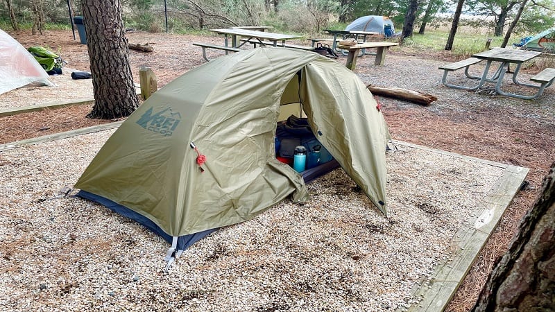
The primitive campground is located at Brewer’s Point on the west side of the park. It’s set on a peninsula that borders the Rappahannock River and Mulberry Creek.
It’s an easy 1.5-mile hike along the Neck Fields Trail from Equestrian Trailer Parking (backpackers can park here overnight) to the campground. It’s perfectly flat, too.
Brewer’s Point is a hike-in or boat-in campground. As in, you can only reach the primitive sites on foot or by human-powered watercraft, like a canoe or kayak.
The park website notes that there are four sites that each have room for up to six people, but that’s not quite right. There are two large platform sites and four small sites.
The large platform sites could probably fit two tents. Meanwhile, the four small sites can each only accommodate one tent, and even then, a fairly small tent.
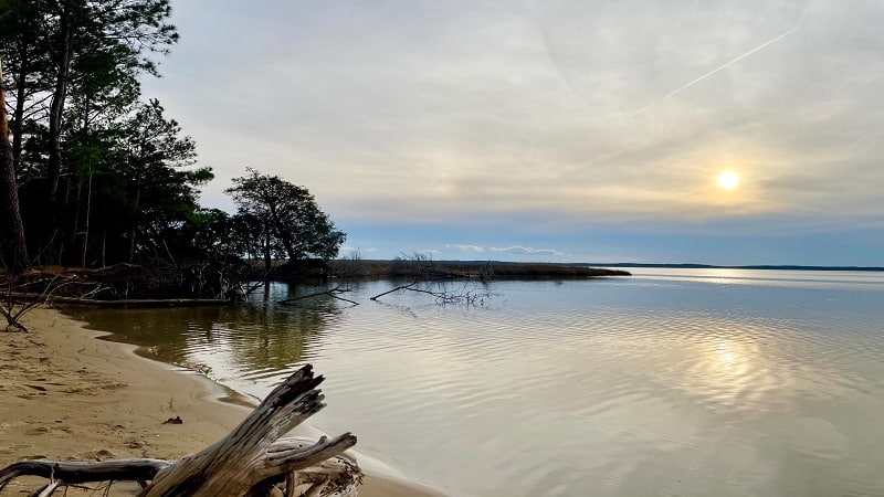
I have a one-person backpacking tent (REI’s Co-op Passage 1 Tent ). It fit perfectly on my pad site. It would have been a pretty tight squeeze if I had set up a larger tent.
There is also a good bit of wooded space between the large platform sites and the small pad sites if you want to hang a hammock either for day-use or for sleeping.
In the middle of the four small sites you’ll find several picnic tables, a couple of benches and a fire ring. I imagine there was probably at least one more fire ring.
Near the fire pit, I was excited to see a porta-potty. And a relatively clean one, at that. Honestly, I was not expecting to see one at all, so that was a huge score.
There is no electricity or potable water, but there is a porta-potty. There is also no wi-fi (obviously), but the AT&T cell signal is quite strong and reliable from Brewer’s Point.
Settling In
It was a short 30-45 minute walk from the parking area to the campground. On arrival, I chose my tent pad and got down to business setting up my space.
I had unboxed my new one-person tent a few days earlier and set it up in my family room. I wanted to make sure all the pieces were there (highly recommended).
I also didn’t want to look like a total newb, you know. I kind of wanted to look like I knew what I was doing. Thankfully, this tent was a cinch to set up. Phew.
With my first task complete, I began to take everything else out of my new backpack ( Osprey Renn 65 ), including my down sleeping bag and inflatable sleeping pad ( Big Agnes ).
Evening Falls
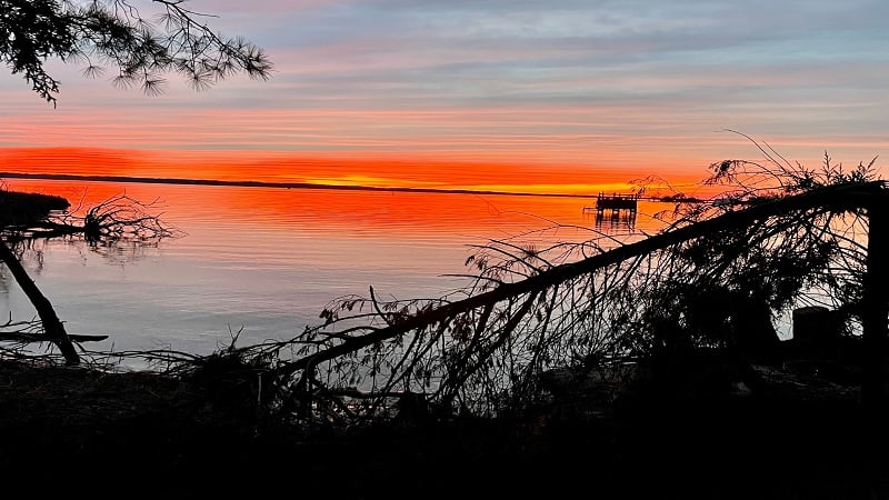
With my tent organized, I walked a few steps to the small driftwood-covered sandy beach. It was the perfect spot for a colorful sunset on an unseasonably warm January day.
I must have taken a dozen photos of the slowly fading sun. It was gorgeous. Then, it was time for dinner. I set up my new PocketRocket stove and got to work.
Honestly, it wasn’t a lot of work. You turn on the gas, light the burner, then set the one-liter pot filled with water on top of the stove. Easy-peasy.
I think the hardest part was having to wait 10 minutes for my dehydrated pasta primavera to “cook” after waiting five minutes for the water to boil.
Post-pasta primavera, everyone gathered around the fire to chat and chill. We even stayed up later than “hiker midnight” (aka 9 pm), but not that much later.
The temperature began to drop into the 40s. It got chilly, but still not as chilly as it would be on a typical January evening. It was time to snuggle up in my sleeping bag.
Sleepy Time
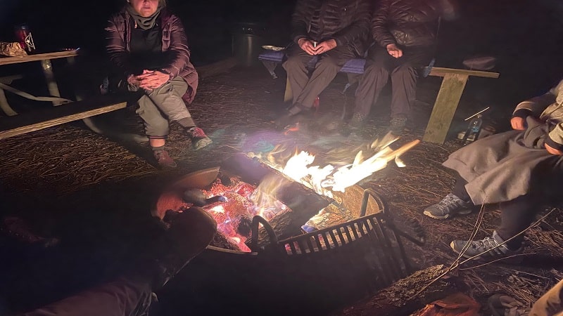
I was excited to get into my sleeping bag, but then I was cold. Worse, my toe warmers were outside my tent, hanging in a waterproof bag from a pole.
We had all taken anything with a scent out of our tents, as not to attract mice. Yikes. So, toothpaste, deodorant, lotion, lip balm. It all got set aside, away from the tents.
Sadly, my toe warmers were cuddled up with my toothpaste and lip balm. Worse, I did not want to exit my sleeping bag. Finally, I relented. I was glad I did.
With warm toes, I closed my eyes. I wanted to drift away to la-la land. Then, I had to pee. I held off as long as I could. After midnight, I finally went for the porta-potty.
Ugh, will I ever get to sleep? At some point, it began to rain. I don’t mind rain . I’ve camped in the rain before. I think it actually helped me fall asleep.
Still, I slept poorly. It was my first time sleeping on the ground (when we car camp, we usually bring cots). I was excited and uncomfortable all at the same time.
Headed Home
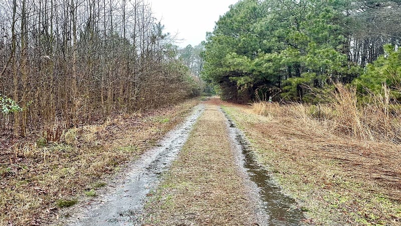
I waited as long as I could and by 7 am I finally unzipped my tent, hit the porta-potty one more time and began to pack it up. In the rain.
Thankfully, it wasn’t a driving rain. Mostly just a nuisance rain. More than a drizzle, less than a monsoon. I was the first one up and out of the campground.
I slogged 1.5-miles back to my car in Equestrian Trailer Parking. I was getting wet, but I felt good, accomplished. At last, I could say I was a backpacker. Even if still a newb.
I’m beyond excited to set out again soon. This next time, there will be no porta-potty. Another exciting milestone to reach in my quest for backpacking excellence.
Well, maybe not excellence. At the very least, I’d like to be able to go backpacking on my own and live to tell about the experience. This is definitely the year.
Wrap-Up Notes
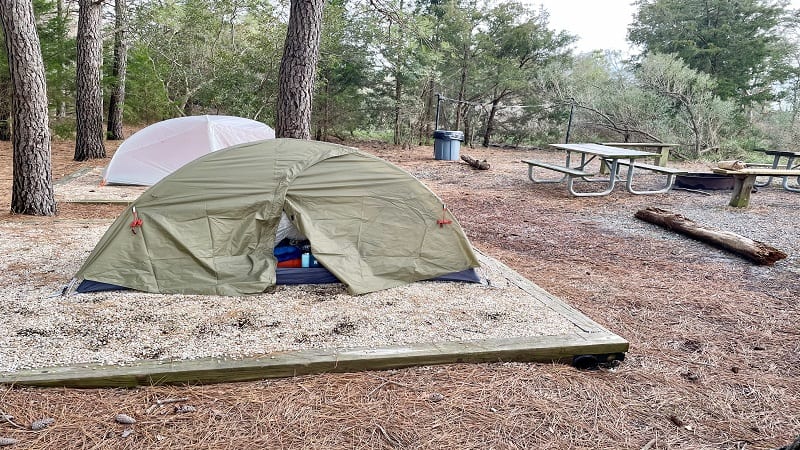
If you’re considering your very first backpacking adventure, I can’t recommend Belle Isle State Park more highly. It’s absolutely perfect for first-timers.
Since the trail is flat and short, it’s a snap to make it to the campground. Better, if you’re just not feeling it, it’s only a 1.5-mile walk back to your car to drive home.
I also can’t recommend Virginia Backpacking more highly. This outdoor-focused Meetup group organizes mostly beginner-level trips every couple of months.
If you decide to go out on your very first backpacking trip, maybe at Belle Isle State Park, I hope you’ll let me know. I can’t wait to hear about your experience.

Erin Gifford has completed more than 300 hikes in Virginia. She is also the author of three hiking guidebooks from Falcon Guides. Need help finding a hike? Check out the Trail Finder feature or send Erin an email at [email protected] .
- ← Conway Robinson State Forest: An Easy Wooded Loop Hike in Gainesville
- Pyrite Mine Loop: A Historic Hike at Prince William Forest Park →
You May Also Like

Mount Pleasant: A Spectacular Loop Hike in Amherst County, Virginia

Sky Meadows State Park: Camp at the Primitive Hike-In Campground in Delaplane, Virginia

Backpacking Shenandoah: Trayfoot Mountain-Paine Run Loop
Privacy overview.
- United States
- Shenandoah National Park
- Backpacking
Shenandoah National Park, Virginia
Looking for the best backpacking in Shenandoah National Park? We've got you covered with the top trails, trips, hiking, backpacking, camping and more around Shenandoah National Park. The detailed guides, photos, and reviews are all submitted by the Outbound community.
Top Backpacking Spots in and near Shenandoah National Park

Rocky Mount Trail Loop

Hike to Bear Church Rock via Bootens Gap

Backpack Rose River Loop

White Oak Canyon to Upper Falls

Backpack Three Ridges Loop

Backpack Reeds Gap to Rockfish Gap

Camp at Devil’s Backbone Basecamp

Backpack Jeremy's Run Trail, Shenandoah NP

Orkney Springs Trail

Hike to Overall Run Falls

Spy Rock via Cash Hollow

Tibbet Knob via Wolf Gap

Mount Pleasant Loop

White Rocks Loop, George Washington NF
Top activities.
- Mountain Biking
- Photography
- Rock Climbing
- Local Adventures
- Tours and trips
- Camping Nearby
- Outbound PRO Membership
- Add your property
Mobile Apps

© 2024 The Outbound Collective - Terms of Use - Privacy Policy
2-FOR-1 GA TICKETS WITH OUTSIDE+
Don’t miss Thundercat, Fleet Foxes, and more at the Outside Festival.
GET TICKETS
BEST WEEK EVER
Try out unlimited access with 7 days of Outside+ for free.
Start Your Free Trial
Powered by Outside
Virginia Trails
Located in the southeastern U.S., Virginia is mostly hilly and mountainous, home to ranges within the Appalachians like the Allegheny and Blue Ridge mountains.
Virginia is home to Shenandoah National Park . Across 500 miles of Shenandoah hiking trails, visitors will see the quiet beauty of the Blue Ridge Mountains, and make stops along its waterfalls and other attractions.
The 2,184-mile-long Appalachian National Scenic Trail , generally known as the Appalachian Trail or simply the AT, also runs through the state, extending between Springer Mountain in Georgia and Mount Katahdin in Maine .
>", "path": "https://www.backpacker.com/trips/3-trail-to-taproom-hikes-to-take-this-fall/", "listing_type": "category", "location": "hero", "title": "3 Trail to Taproom Hikes to Take This Fall"}}' > 3 Trail to Taproom Hikes to Take This Fall
These beer-and-trail pairings are refreshing from the first step to the last sip., latest in virginia trails, >", "path": "https://www.backpacker.com/trips/hiking-false-cape-state-park-vir/", "listing_type": "category", "location": "list", "title": "explore coastline, forest, and shipwrecks in false cape state park, virginia"}}'> explore coastline, forest, and shipwrecks in false cape state park, virginia.
A 22.6-mile lollipop loop showcases the best the Virginia coast has to offer.
>", "path": "https://www.backpacker.com/trips/trips-by-state/virginia-trails/experience-luxury-off-appalachian-trail-at-doyles-river-cabin/", "listing_type": "category", "location": "list", "title": "America’s Best Huts: Doyles River Cabin"}}'> America’s Best Huts: Doyles River Cabin
Shenandoah National Park, Virginia
>", "path": "https://www.backpacker.com/trips/mt-rogers-via-massie-gap/", "listing_type": "category", "location": "list", "title": "The Best Day Hikes in America: Mt. Rogers via Massie Gap"}}'> The Best Day Hikes in America: Mt. Rogers via Massie Gap
Grayson Highlands State Park, Virginia
>", "path": "https://www.backpacker.com/trips/wild-ponies-and-even-wilder-views-on-mt-rogers-virginia/", "listing_type": "category", "location": "list", "title": "Washington, D.C.: Mt. Rogers"}}'> Washington, D.C.: Mt. Rogers
By Matt Mills
>", "path": "https://www.backpacker.com/trips/asheville-nc-mount-rogers-via-massie-gap/", "listing_type": "category", "location": "list", "title": "Asheville, NC: Mount Rogers via Massie Gap"}}'> Asheville, NC: Mount Rogers via Massie Gap
Mount Rogers via Massie Gap: A state high point, the Appalachian Trail, and wild ponies all in one hike—jackpot!
>", "path": "https://www.backpacker.com/trips/charlottesville-three-ridges-loop/", "listing_type": "category", "location": "list", "title": "Charlottesville: Three Ridges Loop"}}'> Charlottesville: Three Ridges Loop
Enjoy a quiet weekend on this 12.3-mile loop to creekside campsites, a sea of mountains, and an excellent waterfall in the 4,608-acre Three Ridges Wilderness.
>", "path": "https://www.backpacker.com/trips/washington-dc-sky-meadows-state-park/", "listing_type": "category", "location": "list", "title": "Washington, DC: Sky Meadows State Park"}}'> Washington, DC: Sky Meadows State Park
Centuries-old settler ruins and fabulous forest overlooks make this quiet 4.7-mile loop one of the best dayhikes within an hour's drive of downtown D.C.
>", "path": "https://www.backpacker.com/trips/roanoke-new-river-trail-hiwassee-to-shot-tower/", "listing_type": "category", "location": "list", "title": "Roanoke: New River Trail (Hiwassee to Shot Tower)"}}'> Roanoke: New River Trail (Hiwassee to Shot Tower)
This 15.9-mile hike or bike trip follows an abandoned railroad along the banks of the New River, which local geologists claim is the second oldest river in the world.
>", "path": "https://www.backpacker.com/trips/assateague-national-seashore-park-loop/", "listing_type": "category", "location": "list", "title": "Assateague National Seashore: Park Loop"}}'> Assateague National Seashore: Park Loop
Watch wild ponies trot by the seashore on this 11.1-mile loop along a unique barrier island. Bring a bucket and hunt for clams on the isle's massive, undeveloped beaches.
>", "path": "https://www.backpacker.com/trips/washington-dc-first-manassas-trail/", "listing_type": "category", "location": "list", "title": "Washington, DC: First Manassas Trail"}}'> Washington, DC: First Manassas Trail
March 4.2 miles back in time to July 21, 1861, where General Stonewall Jackson led an epic battle on this ground at Manassas National Battlefield Park.
>", "path": "https://www.backpacker.com/trips/washington-dc-three-top-mountain-loop/", "listing_type": "category", "location": "list", "title": "Washington, DC: Three Top Mountain Loop"}}'> Washington, DC: Three Top Mountain Loop
In just a weekend, you can travel from wooded ridges to gentle peaks to quiet hollows on this 16.5-mile lasso in George Washington National Forest.
>", "path": "https://www.backpacker.com/trips/richmond-beaver-lake-trail/", "listing_type": "category", "location": "list", "title": "Richmond: Beaver Lake Trail"}}'> Richmond: Beaver Lake Trail
Flee summer's heat spells on this relaxing 2-mile loop around a breezy lake in Pocahontas State Park, which is just a few minutes by car from downtown.
>", "path": "https://www.backpacker.com/trips/washington-dc-wild-oak-loop/", "listing_type": "category", "location": "list", "title": "Washington, DC: Wild Oak Loop"}}'> Washington, DC: Wild Oak Loop
Find your inner hermit on this 26.3-mile loop in George Washington National Forest, complete with endless scenery, heaps of wildlife, and oh-so-quiet campsites.
>", "path": "https://www.backpacker.com/trips/roanoke-mount-rogers/", "listing_type": "category", "location": "list", "title": "Roanoke: Mount Rogers"}}'> Roanoke: Mount Rogers
Catch great views on your way up Virginia’s highest mountain on this 7.2-mile out-and-back through the open balds and ridges of the Appalachians.
>", "path": "https://www.backpacker.com/trips/washington-dc-south-fork-quantico-creek-loop/", "listing_type": "category", "location": "list", "title": "Washington, DC: South Fork Quantico Creek Loop"}}'> Washington, DC: South Fork Quantico Creek Loop
Go ahead: Bag work early and swing off the Beltway for a quick 4-mile hike or trail run through the rolling piedmont of Prince William Forest Park.
>", "path": "https://www.backpacker.com/trips/roanoke-pine-mountain-loop/", "listing_type": "category", "location": "list", "title": "Roanoke: Pine Mountain Loop"}}'> Roanoke: Pine Mountain Loop
Scattered along this 11.3-mile dayhike (or overnighter) is a bumper crop of mountain views, considered some of the best in southern Virginia.
>", "path": "https://www.backpacker.com/trips/roanoke-va-little-stony-creek/", "listing_type": "category", "location": "list", "title": "Roanoke, VA: Little Stony Creek"}}'> Roanoke, VA: Little Stony Creek
Twist through a sandstone gorge with a handful of waterfalls on this 7.8-miler topping out at a tabletop overlook above Jefferson National Forest.
>", "path": "https://www.backpacker.com/trips/washington-dc-manassas-bridle-trail-loop/", "listing_type": "category", "location": "list", "title": "Washington, DC: Manassas Bridle Trail Loop"}}'> Washington, DC: Manassas Bridle Trail Loop
Avoid the crowds on this 3-miler that explores less-traveled trails and an old Confederate headquarters in Manassas National Battlefield Park.
>", "path": "https://www.backpacker.com/trips/washington-dc-great-falls-loop/", "listing_type": "category", "location": "list", "title": "Washington, DC: Great Falls Loop"}}'> Washington, DC: Great Falls Loop
This 4.5-miler runs along steep cliffs to two photogenic overlooks above an impressive waterfall on the Potomac River.
>", "path": "https://www.backpacker.com/trips/lexington-va-roaring-runhoop-hole-loop/", "listing_type": "category", "location": "list", "title": "Lexington, VA: Roaring Run/Hoop Hole Loop"}}'> Lexington, VA: Roaring Run/Hoop Hole Loop
Reach waterfall nirvana in the Jefferson National Forest.
>", "path": "https://www.backpacker.com/trips/richmond-shenandoah-mountain-trail-to-jerrys-run/", "listing_type": "category", "location": "list", "title": "Richmond: Shenandoah Mountain Trail to Jerrys Run"}}'> Richmond: Shenandoah Mountain Trail to Jerrys Run
Camp two nights on this 15.7-mile loop through a remote and rugged corner of Ramseys Draft Wilderness in west-central Virginia.
>", "path": "https://www.backpacker.com/trips/washington-dc-bull-run-occoquan-trail/", "listing_type": "category", "location": "list", "title": "Washington, DC: Bull Run-Occoquan Trail"}}'> Washington, DC: Bull Run-Occoquan Trail
This 18-mile trek winds in and out of regional parks, wooded valleys, and open fields on a two-day trip that's a short drive from D.C.
>", "path": "https://www.backpacker.com/trips/virginia-beach-va-long-creek-overlook/", "listing_type": "category", "location": "list", "title": "Virginia Beach, VA: Long Creek Overlook"}}'> Virginia Beach, VA: Long Creek Overlook
A casual day hike along the dunes of the coastal forest where the Chesapeake Bay meets the Atlantic Ocean.
>", "path": "https://www.backpacker.com/trips/roanoke-va-rock-castle-gorge-loop/", "listing_type": "category", "location": "list", "title": "Roanoke, VA: Rock Castle Gorge Loop"}}'> Roanoke, VA: Rock Castle Gorge Loop
Explore the summits and history of a rare trail network along the Blue Ridge Parkway.
>", "path": "https://www.backpacker.com/trips/virginia-beach-va-first-landing-state-park/", "listing_type": "category", "location": "list", "title": "Virginia Beach, VA: First Landing State Park"}}'> Virginia Beach, VA: First Landing State Park
Brimming with beach and bay views, this Virginia Beach 9.9-miler tours cypress swamps, coastal forest (shrouded in Spanish moss), and idyllic marshlands.
>", "path": "https://www.backpacker.com/trips/virginia-beach-va-back-bay-national-wildlife-refuge/", "listing_type": "category", "location": "list", "title": "Virginia Beach, VA: Back Bay National Wildlife Refuge"}}'> Virginia Beach, VA: Back Bay National Wildlife Refuge
Sea turtles, white-tailed dear, and snow geese are just a few of the diverse wildlife species you might spot on this 7.6-mile coastal hike.
>", "path": "https://www.backpacker.com/trips/trips-by-state/virginia-trails/blue-ridge-parkway-va-sharp-top-mountain/", "listing_type": "category", "location": "list", "title": "Sharp Top Mountain Trail"}}'> Sharp Top Mountain Trail
Popular with Blue Ridge Parkway travelers for more than 150 years, this steep, 3.2-mile out-and-back climbs to the rocky summit of one of Virginia's highest peaks.
>", "path": "https://www.backpacker.com/trips/read-mountain-preserve-va-buzzards-rock/", "listing_type": "category", "location": "list", "title": "Read Mountain Preserve, VA: Buzzards Rock"}}'> Read Mountain Preserve, VA: Buzzards Rock
Roosting buzzards, a city skyline, and a 2,350-foot peak lure hikers to this 3.4-mile out-and-back inside Roanoke's new Read Mountain Preserve.
>", "path": "https://www.backpacker.com/trips/charlottesville-va-white-rock-falls/", "listing_type": "category", "location": "list", "title": "Charlottesville, VA: White Rock Falls"}}'> Charlottesville, VA: White Rock Falls
On this 4.6-mile loop, enjoy lunch beside a boulder-lined creek then burn off your meal with a steep climb beside the White Rock Falls cascades.
>", "path": "https://www.backpacker.com/trips/blue-ridge-parkway-va-flat-top-mountain/", "listing_type": "category", "location": "list", "title": "Blue Ridge Parkway, VA: Flat Top Mountain"}}'> Blue Ridge Parkway, VA: Flat Top Mountain
This 5.4-miler in the Blue Ridge Mountains climbs through poplars and oaks to the 4,001-foot summit of Flat Top Mountain, the tallest of the Peaks of Otter.
>", "path": "https://www.backpacker.com/trips/shenandoah-national-park-hawksbill-summit-loop-wp414-453/", "listing_type": "category", "location": "list", "title": "Shenandoah National Park: Hawksbill Summit Loop (WP414 – 453)"}}'> Shenandoah National Park: Hawksbill Summit Loop (WP414 – 453)
This *2.8-mile loop swings past talus fields, wildflowers, and a falcon nesting area, capping them off with a gob-smacking view from Shenandoah's highest peak.
>", "path": "https://www.backpacker.com/trips/roanoke-va-crabtree-falls-trail/", "listing_type": "category", "location": "list", "title": "Roanoke, VA: Crabtree Falls Trail"}}'> Roanoke, VA: Crabtree Falls Trail
Five cascading waterfalls are the draw on this popular 4.2-mile out-and-back that starts with a climb and ends with a leafy streamside ramble.
>", "path": "https://www.backpacker.com/trips/blue-ridge-parkway-harkening-hill/", "listing_type": "category", "location": "list", "title": "Blue Ridge Parkway: Harkening Hill"}}'> Blue Ridge Parkway: Harkening Hill
Highlights along this 3.5-mile loop include whitetail deer, a 3,364-foot summit, precariously perched boulders, and a 19th-century farmhouse.
>", "path": "https://www.backpacker.com/trips/lexington-va-lake-robertson-loop/", "listing_type": "category", "location": "list", "title": "Lexington, VA: Lake Robertson Loop"}}'> Lexington, VA: Lake Robertson Loop
Look for blackberries and bears on this 4.4-mile loop around an activity-filled lake complex in the southern Shenandoah Valley.
>", "path": "https://www.backpacker.com/trips/washington-dc-duncan-knob/", "listing_type": "category", "location": "list", "title": "Washington, DC: Duncan Knob"}}'> Washington, DC: Duncan Knob
This 8.7-mile round-trip has two tough, rocky ascents that lead to solitude atop the Massanutten Range.
>", "path": "https://www.backpacker.com/trips/richmond-va-belle-isle-loop/", "listing_type": "category", "location": "list", "title": "Richmond, VA: Belle Isle Loop"}}'> Richmond, VA: Belle Isle Loop
This seven-mile circuit traverses a mini wilderness right downtown, cruising the south banks of the James River before crossing onto the maple-shaded shores of Belle Isle. From there, head to the north shore hills and views of the river’s class IV whitewater.
>", "path": "https://www.backpacker.com/trips/roanoke-va-little-dry-run-wilderness/", "listing_type": "category", "location": "list", "title": "Roanoke, VA: Little Dry Run Wilderness"}}'> Roanoke, VA: Little Dry Run Wilderness
Score quiet views of the southern Virginia highlands on this lush loop.
>", "path": "https://www.backpacker.com/trips/rip-go-iron-mountains-little-dry-run-wilderness-va/", "listing_type": "category", "location": "list", "title": "Rip & Go: Iron Mountains – Little Dry Run Wilderness, VA"}}'> Rip & Go: Iron Mountains – Little Dry Run Wilderness, VA
>", "path": "https://www.backpacker.com/trips/rip-go-rockytop-loop-shenandoah-national-park-va/", "listing_type": "category", "location": "list", "title": "rip & go: rockytop loop – shenandoah national park, va"}}'> rip & go: rockytop loop – shenandoah national park, va.
Escape Skyline Drive to discover secret summits and hidden valleys.
>", "path": "https://www.backpacker.com/trips/best-hikes-ever-appalachian-trail-ga-me/", "listing_type": "category", "location": "list", "title": "Best Hikes Ever: Appalachian Trail, GA-ME"}}'> Best Hikes Ever: Appalachian Trail, GA-ME
Thru-hike America's most revered long trail: the Appalachian Trail.
>", "path": "https://www.backpacker.com/trips/rip-go-iron-mountain-loop-mount-rogers-national-recreation-area/", "listing_type": "category", "location": "list", "title": "Rip & Go: Iron Mountain Loop – Mount Rogers National Recreation Area"}}'> Rip & Go: Iron Mountain Loop – Mount Rogers National Recreation Area
Lose the leaf-peeping crowds on this quiet ramble above Virginia's loftiest canopies of color.
>", "path": "https://www.backpacker.com/trips/best-backpacking-in-virginia/", "listing_type": "category", "location": "list", "title": "Best Backpacking In Virginia"}}'> Best Backpacking In Virginia
Our comprehensive guide to the best backpacking you can find in Virginia.
>", "path": "https://www.backpacker.com/trips/muddy-love-in-shenandoah/", "listing_type": "category", "location": "list", "title": "Muddy Love In Shenandoah"}}'> Muddy Love In Shenandoah
All along the 23-mile Shenandoah Mountain trail and in the forested areas throughout the Appalachian Mountains, vernal pools are rich aquatic breeding grounds.
Adventure Travel for Women of All Ages
Toll Free: 1-877-439-4042
Phone: 970-833-3132
Slackpacking Virginia
Destination: damascus, virginia, | activities: hiking and slackpacking.
- Trip Overview
- Common Questions
- Join Waitlist
The Appalachian Trail truly has mythic status and for many of us, hiking it is a dream. But then we look at the reality of it and find the prospect of carrying a 30-40 pound pack on our back and sleeping on the ground rather daunting. Solution? Slackpacking! We offer many slackpacking trips along the trail and this beautiful section in Virginia is one of the best! We'll cover a little over fifty miles, returning at the end of the day to our lodging in the friendly little town of Damascus. We cover significant mileage on this trip so it still requires being in good shape. Maximum group size: 12
- Hiking one of the most beautiful sections of the Appalachian Trail
- Enjoying wild pony herds, amazing vistas, beautiful mountain streams and fall foliage
- Hiking thru Rhododendron Gap, Fat Man's Squeeze, Buzzard Rock, The Scales - all classic AT landmarks
- Returning to a comfortable bed and hot shower at the end of every day
- Earning your trail name and learning the lore of the Appalachian Trail
- Carrying only what you need for the day on your back
Departures and Prices
- 2-3 experienced AGC guides based on group size
- Six nights lodging
- All meals from dinner on Sunday through breakfast the following Saturday with the exception of one dinner
- Daily shuttles back and forth to the trailhead
What's not included : Airfare to/from Virginia (TRI), travel to Damascus, one dinner, alcoholic beverages, guide gratuities.
Trip Documents

This trip involves hiking from 7 to 13 miles a day (see the itinerary for daily mileage) with significant elevation changes and footing that is both rocky and uneven at times. It requires being in very good physical condition. While you can always choose to stay in town for the day, there are no options for shortening the daily hikes. This trip is rated 4. Prior to beginning the trip, participants should be engaged in aerobic conditioning for at least 40-50 minutes 4-5 times a week. Additional endurance exercise (e.g., going for a 2 hour hike once a week) and/or strength training is usually required. Rating: Rating: 1 2 3 [4] 5.

This is a hiking trip on the Virginia section of the legendary Appalachian Trail. You will be hiking in the mountains with constant elevation gain and loss on a trail that is rocky at times. We're staying in the legendary (but small) trail town of Damascus and there will be time to visit some of the shops there.

We will be spending 6 nights at our accommodation on Main Street (specific details will be sent with the Pre-departure Document). Our ‘home’ sleeps a maximum of 22 and has 4.5 baths. Plenty of room to move around, good gathering spaces, and a spacious kitchen. Wifi and linens are provided. Please note: Unless you are requesting a single supplement, rooms/roommates will be assigned as you register. Using VRBOs is a wonderful way to enjoy slackpacking trips but note that VRBOs are homes and rooms will not be uniform. Some rooms will be larger/smaller than others and beds will range from day beds to king beds. Having a single supplement guarantees a room to yourself – not all single supplements will have ensuite bathrooms.
Below is the proposed itinerary for the trip. As is true on any adventure travel trip, plans for any specific day may be modified due to weather considerations, unforeseen circumstances, new opportunities, and group interests.
Trip Orientation and Introductions. Welcome Dinner
Hike dicky gap to fox creek gap, hike fox creek gap to massie gap, hike massie gap to elk garden, hike elk garden to bear tree gap, bear tree gap to damascus, happy trails to you, *these are the unfiltered reviews of women who have been on this trip in answer to the question "what made this trip special for you". we take reviews very seriously and often tweak itineraries based on feedback. please feel free to contact us about any questions you have..
Guides and accomodations, great planning.
Great guides! Alicia and Emily were awesome and really helped make the trip enjoyable. Also all of the ladies in the group! Everyone was so friendly and fun to be with.
This was my first time on the AT and this section provided lots of variety from tree tunnels to ponies to sweeping vistas to an optional short detour up to the highest point in Virginia, Mt Rogers (a magical forest--highly recommend!). As always on AGC trips, the guides were amazing and the camaraderie of the group was wonderful.
This was a great section of the AT to hike with highlights including Fat Man's Squeeze, Buzzard Rock and of course seeing the ponies in Grayson Highlands State Park. It was fun even with rain part of 2 afternoons. Having options the last day for completing the route on either the AT or the Virginia Creeper Trail (part way) was really nice, especially with the rain. The accommodations were wonderful with lots of space to spread out and the food was delicious (especially the orange cardamom olive oil cake that we all wanted the recipe for). Alicia and Emily were great. I always feel safe on these trips and my husband especially likes knowing that I am with guides who are well trained and know what they are doing.
Great ladies, fantastic guides and amazing food!
Loved hiking the AT with my Mom and a great group of ladies. Will be my last hiking trip in a long time since I am pregnant, so this was a very special trip for me. The guides were fantastic! Tallie's knowledge of this second of the AT is beyond impressive.
Being able to hike and meet new people
Loved the hiking on the Appalachian Trail.
I am not sure how to rate this trip overall. I feel I was misled on the difficulty of the hikes. I had asked a number of times if what I had been doing fitness wise was appropriate for this trip and was told I was in great form for the trip I clearly was not. I run 2-3 miles 3 days a week, a spinning class 3 days a week, do the elliptical 4 days a week, lift weights/condition 3 days a week and average 8 miles a day walking outside or on a treadmill. I was blown away by the ruggedness of the AT. This particular group of women was made up of 3 of us with no experience on the AT and 9 who were super experienced with hundreds of miles completed and the goal of doing the entire trail over time. I wish I had been warned what a feat it would be for someone just starting out. And possibly steered to a different trip like the Shenandoah Lodge to Lodge trip that looks like a more suitable one for a newbie on the AT
I loved meeting women from across the country who are interested in hiking and exploring new places - and getting to check off a section in a many-years-long quest to hike the Appalachian Trail was great, too!
It was the right level of challenge, and the right level of luxury. I liked hiking and then coming home to a tasty meal and a hot shower!
Tali is a wonderful guide and very knowledgeable. Mel had never hiked the AT so she knew nothing about the trail which seemed unusual for a guide. I have never been on a trip where the guide wasn't an expert on the trail and the area. I loved the trail and the hiking
This in only a 4 because the first AGC trip I attended was so great I was expecting the same experience again. This experience was not bad at all (as I mentioned above), but just different, so now I know that the expectations will vary from trip to trip.
Accommodations were amazing as were the trip leaders.
I just love the AT and like to experience the different sections.
Was looking forward to seeing the ponies at Grayson Highlands, and they didn't disappoint. Going to the top of Mount Rogers exceeded my expectations. Wasn't expecting the different microclimate, and the cloudy/misty weather conditions that day further enhanced the experience. Finally, I was not expecting to be able to hike ahead at my own pace. That was such a treat!
It was the optimal amount of challenge for me. The right amount of risk and relaxation. Tali and Wendy were incredible, and their personalities and expertise added to the experience.
Beautiful lodging. Wonderful people!
Highlights- The commraderie, the terrain, food I wish there had been more sharing about the AT, its history, use of its resources, maps and systems etc; all may not have needed but more “formal” sharing on hiking tools and tricks of the trade-
The amazing vistas we encountered. The connections made with other women with whom we traveled. Having coffee and sometimes breakfast outside, too.
Hiking on the AT with a wonderful group of women
Wonderful scenery, good accommodation, great food, great guiding.
I really enjoyed beautiful countryside we hiked through. The views were spectacular. I also enjoyed meeting the other ladies participating.
I'd have to say first and foremost was the company. It was a fabulous group of ladies who all shared similar interests. Also, the views.
This trip pushed me to a new physical level. It was great. Guides so supportive, and our group coalesced perfectly.
Group dynamics, Claire, scenery, laughter, feeling of accomplishment, challenge
Very slow pace by lead guide and group was walking along like a freight train and we were so tight it was hard not to step on one another heels.
The best part was that the group of women was so easy to get along with and had zero drama, even when yellow-jackets tried to create lots of drama!
beautiful scenery, good food, wonderful guides and a great group of women
Briar Ridge past Mt Rogers--where you could see to North Carolina--after a close encounter with the wild ponies--equal to Angel's Landing as a peak experience. Also, perfect weather despite predictions, amazing.
Enjoyed spending a week with like minded individuals that were strong and willing to be active.
Wonderful group of women, good hiking. My only issue is with the accommodations (see below).
Wonderful group of participants. Hardworking, helpful guides.
- Where do we eat? The guides will be cooking breakfasts and some dinners at the lodging.Other dinners will be in restaurants where you can order off the menu. Before you leave in the morning the guides will put out lunch 'fixings' and you'll take a packed lunch. You'll go out for one dinner where you can order off the menu; other nights you'll relax in the lodging and have dinner there.
- What dietary preferences or restrictions can you accommodate on this trip? We can accommodate vegetarian, lactose-free, and gluten-intolerant although we can not guarantee a completely gluten-free diet, if we know well in advance. If you’re severely allergic or if you have other significant dietary restrictions, please call the office before you register. If you’re vegan, you may want to bring some additional protein bars.
- I will be coming by myself. Do I need to pay a single supplement? You only need to pay a single supplement if you want to guarantee you have your own room. Otherwise we'll randomly pair you up with someone else.
Email: [email protected]
Address: 409 Mason Ct., Suite 127, Fort Collins, CO 80524
Connect With Us
Check Out the AGC Blog
Quick Links
Privacy Policy
Media & Press
Cancellation/ Deposit Policies
Notice on Cancellation Policy
Booking confirmation, logged in notification.
You are logged in as . If you wish to book for someone else, please logout to be redirected back to the booking page.
Submission Confirmation
Notice on ach payments.
Sit tight, we're planting the seeds for your adventure.

- Alpha Guide
- Explore Like a Local
- Appalachian Trail
- Baxter & Katahdin
- White Mountains
- Adirondacks
- How to Choose
- The Rundown
- Campfire Stories
- Summit Views
A Guide to Backpacking the Virginia Triple Crown
From lush, dense forests to stunning overlooks and winding ridges, Southwestern Virginia offers plenty to keep any hiker busy. And, the three iconic destinations included in the Virginia Triple Crown give hikers an unparalleled set of challenges and rewards.
The Virginia Triple Crown combines three spots along the Appalachian Trail, all of which are located in close proximity to each other, and can be reached via day hikes or in one fell swoop through 30- to 40-mile backpacking routes. Whether you’re a day-hiker or backpacker, you’ll enjoy what the Triple Crown has to offer.
Things to Know Before You Go
If you’re considering day-hiking or backpacking the Triple Crown, plan to:
- Start your hike early. Parking lots fill quickly during the peak season.
- Be challenged and know your limits. Each day hike covers five to eight miles with a minimum elevation gain of 1,500 feet. Triple Crown backpacking routes may feature up to 16-mile days, depending on your route.
- Spend time doing careful, thorough route planning. Water sources and campsites may be few and far between.
- Practice Leave No Trace , observe group size restrictions , and camp only in designated areas to help protect the trail and landscape.

Day-Hiking to McAfee Knob
Start : McAfee Knob Parking Area Round-Trip Distance : 7-8 miles, steep Time: 4-5 hours View Route
McAfee Knob is one of the area’s most photographed hiking destinations. It has also seen an exponential increase in visitation recently, making observing rules and Leave No Trace principles paramount. You’ll share the trail with others, but the overhanging cliffs and panoramic views will be worth it.
Start at the McAfee Knob Parking Area, cross VA 311, and pick up the white-blazed Appalachian Trail, heading north. Pass an information kiosk, wind through dense forests, and pass the Johns Spring Shelter (0.8 miles) and the Catawba Mountain Shelter (1.5 miles). As you continue to gain elevation on the AT, you’ll see signs for an overlook, and as you hike through, you’ll arrive at McAfee Knob. To return, retrace your steps on the AT or take the McAfee Knob Trail back down to the parking lot.

Day-Hiking to Tinker Cliffs
Start : Andy Layne Trail Parking Lot Round-Trip Distance : 7.5 miles, steep Time: 4-5 hours View Route
Tinker Cliffs offers beautiful creek crossings, panoramic valley views, and a trail section named after a 1980s incident called Scorched Earth Gap. It’s a tough, steep hike but absolutely worth the journey.
From the parking lot, follow the yellow-blazed Andy Layne Trail. Cross two bridges over Catawba Creek, avoid stepping in cow patties, and move through a gate (1.2 miles), which indicates passage onto private land. The remaining part of the Andy Layne Trail is steep; you’ll gain 900-plus feet of elevation before arriving at the white-blazed AT and Scorched Earth Gap. Turn right onto the AT, and then, you’ll come to the first good viewpoint (0.5 miles). Over the next quarter mile, take in the views along Tinker Cliffs. To go back, retrace your steps to the parking lot.

Day-Hiking to Dragon’s Tooth
Start : Dragon’s Tooth Parking Lot Round-Trip Distance : 5.7 miles, steep and technical Time: 4 hours
Dragon’s Tooth is a giant, scraggly rock formation sticking out of Cove Mountain and the sand-covered land above the Catawba Valley. It’s the shortest of the three Triple Crown day hikes but by far the steepest, and it requires some hand-over-hand climbing and good balance.
From the parking lot, pick up the blue-blazed Dragon’s Tooth Trail, cross two small bridges, pass the yellow-blazed Boy Scout Connector Trail, and continue up. Here, climb steadily through dense tree cover, until you reach the intersection with the AT (1.4 miles). Then, turn right onto the AT. The next 0.7 miles cover extremely rocky terrain, including rock steps, two sets of iron rungs, and narrow sections just wide enough for two feet. As this portion eases, continue 0.3 miles to Dragon’s Tooth. To return, you have two options: Retrace your steps, or follow the AT north, turn left onto the Boy Scout Connector Trail, and catch the last bit of the Dragon’s Tooth Trail back to the parking lot.

Backpacking the Virginia Triple Crown
Start: McAfee Knob Parking Area Type: Loop Round-Trip Distance: 37 miles Time: 3 days, 2 nights
If you’re a seasoned backpacker looking for a challenge, you can visit all three Triple Crown destinations in one trip. The recommended route is a loop, but it’s also possible to complete it via a point-to-point route along the AT. For the recommended loop, refer to this trip report and the following itinerary :
Day 1: 10.6 miles. Starting at the McAfee Knob parking lot, follow the AT north. Then, pass McAfee Knob, three AT shelters (Johns Spring, Catawba Mountain, and Campbell), and Scorched Earth Gap, and stay overnight at Lamberts Meadow Shelter.
Day 2: 15.5 miles. Retrace your steps 0.7 miles south on the AT to Scorched Earth Gap, and take the Andy Layne Trail down the valley. Pass through the Andy Layne Trail parking lot, cross the road, and hike up to North Mountain Trail (yellow blazes) via the Catawba Valley Trail (blue blazes). Come down North Mountain, cross VA 311, head through Dragon’s Tooth parking lot, and camp at the campsites off the Boy Scout Connector Trail.
Day 3: 9.6 miles. Leave your packs at the Boy Scout camp, and then, tag Dragon’s Tooth via the Dragon’s Tooth Trail. After you retrace your steps back to camp, pick up your backpacks, and take the Boy Scout Connector Trail to the AT. Follow the AT back to VA 311 and the McAfee Knob parking lot.
Have you done any of the Triple Crown destinations as day hikes, or done all three via a backpacking trip? We’d love to hear from you!

Katie Levy is a self-proclaimed outdoor adventure addict and loves sharing her passion for playing outside with anyone willing to listen. Though currently based in Philadelphia, spending her formative years in upstate New York and two years in Alaska fostered a lifelong passion for the outdoors. She followed that passion on backpacking trips in the Adirondacks and Catskills, on sub-zero winter hikes in the Chugach Mountains, up Mount Rainier, and around some of our nation's most incredible public lands. If she's not out on the trail, you'll find working on her other passion, Adventure-Inspired , or practicing her Olympic weightlifting skills with her barbell club .
Related Posts

April 12, 2024
Explore Like a Local: The Outdoor Mecca of North Conway, NH
There's a lot to love about this New…
April 3, 2024
5 Things To Do in the Boston Area During Mud Season
Adventure opportunities are abundant…
March 25, 2024
I Can’t Believe I Did a Single Season Winter 48
Bagging 48 peaks in under 90 days.
Do you need a permit to do this trip??

Hi there! There were no permits necessary when I did this trip in July 2017, which is both good and bad. It means logistics are less challenging, but also means shelters and camping spots can fill up fast, as can parking lots!
Comments are closed.
IMAGES
VIDEO
COMMENTS
So, pack your tent and sleeping bag, strap on your pack and let's hit the AT for some rewarding 2-3 backpacking adventures in Virginia's highlands. Appalachian Trail, Virginia Creeper Loop. Nearest Town: Damascus. How Long: 13.8-mile loop. Elevation Highs and Lows: 2,190 low point, 3,410 high point.
Here are ten overnight trips we recommend to anyone looking to experience some of Virginia's best wilderness. White Rocks. Difficulty: Beginner. Distance: 5.0-8.5 mi. (Round-trip) Nights: 1. Relatively flexible, the length of this trip can depend on how far you need to go to find a suitable campsite for the group.
This trip can be done as an easy overnight hike with plenty of camping along the base of Duncan Knob or even down beside the Massanutten River. On the second day, you hit Strickler Knob, perhaps the highlight of the route, which offers a full 360-degree view from a funky rock outcropping. ... Three Ridges is a Virginia backpacking trip I have ...
Backpack Jeremy's Run Trail, Shenandoah NP. 3.3. 10 mi. This hike is best done as a two-day, one-night backpacking trip, however it can be done as a day hike if you don't wish to backpack.Jeremy's Run is a beautifully forested 10 mile roundtrip hike with numerous stream-crossing.
It was a 10.2-mile backpacking loop in the park's South District. This was a loop but also a triangle, if only because we touched three hiking trails, including the Appalachian Trail, Trayfoot Mountain Trail and Paine Run Trail. There is an elevation gain of 2,200+ feet, but spread out over 10 miles, it didn't feel so intense.
These hikes range from short and easy day trips to longer overnights, with a wide array of terrain, trails, and viewpoints to suit your interests. From Shenandoah National Park to High Knob Tower, Virginia offers a multitude of peaks with 360-degree views that can be enjoyed from atop these summits.
Hiking & Backpacking the Virginia Triple Crown Overnight Loop. Tuesday, November 26, 2019 5:00 PM by Casey L. Higgins. There are avid hikers among us who can claim Virginia's Triple Crown among their outdoor adventure conquests, and it's not the easiest task. Dragon's Tooth, McAfee Knob, and Tinker Cliffs are treasures of Virginia's ...
Virginia Triple Crown Loop. The Triple Crown is a combination of three amazing hiking destinations in Virginia. And they're all conveniently located right around Roanoke. This overnight backpacking trip begins and ends at the Route 311 Appalachian Trail head. This is a difficult hike totaling about 32 miles.
The wide skies and secluded camping in Sky Meadows State Park, near Front Royal, make for great stargazing, and easy trails access a little-traveled segment of the AT for long ridgeline hikes with sweeping horse-country views. Contact: Potomac Appalachian Trail Club, (703) 242-0693; www.patc.net. Mt. Rogers.
Day Hike the Virginia Triple Crown. Dragon's Tooth: Park at the Dragon's Tooth trailhead on VA 311 (37.378620, -80.156082). Follow the blue-blazed Dragon's Tooth Trail 1.5 miles to link up with the AT at Lost Spectacles Gap. Turn right and follow the white blazes up a steep, technical, 0.7-mile rock scramble to the top of Cove Mountain.
Join us for one of the best overnight backpacking loops in Virginia -- a lollipop loop in George Washington National Forest's Three Ridges Wilderness! Visit ...
This loop is a great option for an overnight backpacking trip on the Appalachian Trail. The hike totals approximately 32 miles and is suggested as a three night trip. The hike starts and finishes at the Rt. 311 Appalachian Trail trail head. ... Visit Virginia's Blue Ridge 101 Shenandoah Avenue NE Roanoke, VA 24016 (540) 342-6025 (800) 635-5535.
This 56-mile backpacking trip traverses some of Virginia's very best Appalachian Trail scenery! There are panoramic vistas, windswept balds, meadows full of wildflowers, pretty streams, and even wild ponies. ... This 10-mile loop could easily be a day hike, but we chose to do it as a short overnight backpacking trip. The route has some fairly ...
In January, I completed my very first overnight backpacking trip at Belle Isle State Park in Lancaster, Virginia. It was mostly perfect, too. I went with the Virginia Backpacking group that I found on Meetup. Thankfully, "all skill levels are welcome" with this group of backpackers. I was definitely a rookie.
Backpack Jeremy's Run Trail, Shenandoah NP. 3.3. 10 mi. This hike is best done as a two-day, one-night backpacking trip, however it can be done as a day hike if you don't wish to backpack.Jeremy's Run is a beautifully forested 10 mile roundtrip hike with numerous stream-crossing.
Virginia is home to Shenandoah National Park . Across 500 miles of Shenandoah hiking trails, visitors will see the quiet beauty of the Blue Ridge Mountains, and make stops along its waterfalls and other attractions. The 2,184-mile-long Appalachian National Scenic Trail, generally known as the Appalachian Trail or simply the AT, also runs ...
This is a hiking trip on the Virginia section of the legendary Appalachian Trail. You will be hiking in the mountains with constant elevation gain and loss on a trail that is rocky at times. ... Overnight: Damascus (B, L, D) Distance: 9.8 miles Elevation Gain: 2,694' Elevation Loss: 1,463' DAY 4. Hike Massie Gap to Elk Garden Although the ...
Type: Loop. Round-Trip Distance: 37 miles. Time: 3 days, 2 nights. If you're a seasoned backpacker looking for a challenge, you can visit all three Triple Crown destinations in one trip. The recommended route is a loop, but it's also possible to complete it via a point-to-point route along the AT.
Details. This is a beginner friendly overnight backpacking trip. ALL SKILL LEVELS WELCOME! This hike is about 9 miles total for 2 days. Elevation total for both days is 1,175. There is no shelter to sleep in BUT plenty of room for tents and hammocks. There is a water source at camp. Below are several links listed.