About the map
Featuring over 50 voyages, this interactive map illustrates a selection of well-known, or influential voyages that took place between the late-fifteenth and early twentieth centuries. These voyages focus on European maritime exploration and they follow a great number of different sea-routes, some travelling across vast oceans for a period of years; while others focus on exploring specific regions. The purposes for these voyages include empire-building and ‘discovery’, science, trade, and search and rescue attempts.
The voyages represented are by no means exhaustive but are intended to be used as a starting point for learning about some of the most well-known expeditions in the history of exploration.
To begin, press the Play all button and let the map play through all voyages plotted on the Global View, or drag the timeline to a start date that interests you and the map will play from there.
Alternatively, browse through the voyage list and select a specific voyage by clicking on the play button for that voyage; this will play that voyage in isolation.
Click on the voyage title, or on the coloured route while the map is playing to see background information on the voyage, as well as an interactive list of ports stopped at throughout the voyage and to link back to a relevant document from the collection.
You can return to the globe by clicking on the Global View button.
Colour-coded by nationality of the sponsor country, it is possible to makes comparisons between expeditions from different countries.
Use the filter search to find a specific nationality, or filter by Commander so you can more easily find specific people involved with each expedition.
The images in this site are © the source archives within this collection.
About the data
This data has been compiled using the primary source documents from Age of Exploration, as well as research carried out by our editorial team in collaboration with, and with feedback from, our academic editorial board.
Where dates are uncertain, we have highlighted these as ‘approximate’. It is possible to download the data as a csv file should you wish to further interrogate the data. Click ‘Download data’ to do so.

Mapping Globalization
Voyages of Exploration 1485-1600
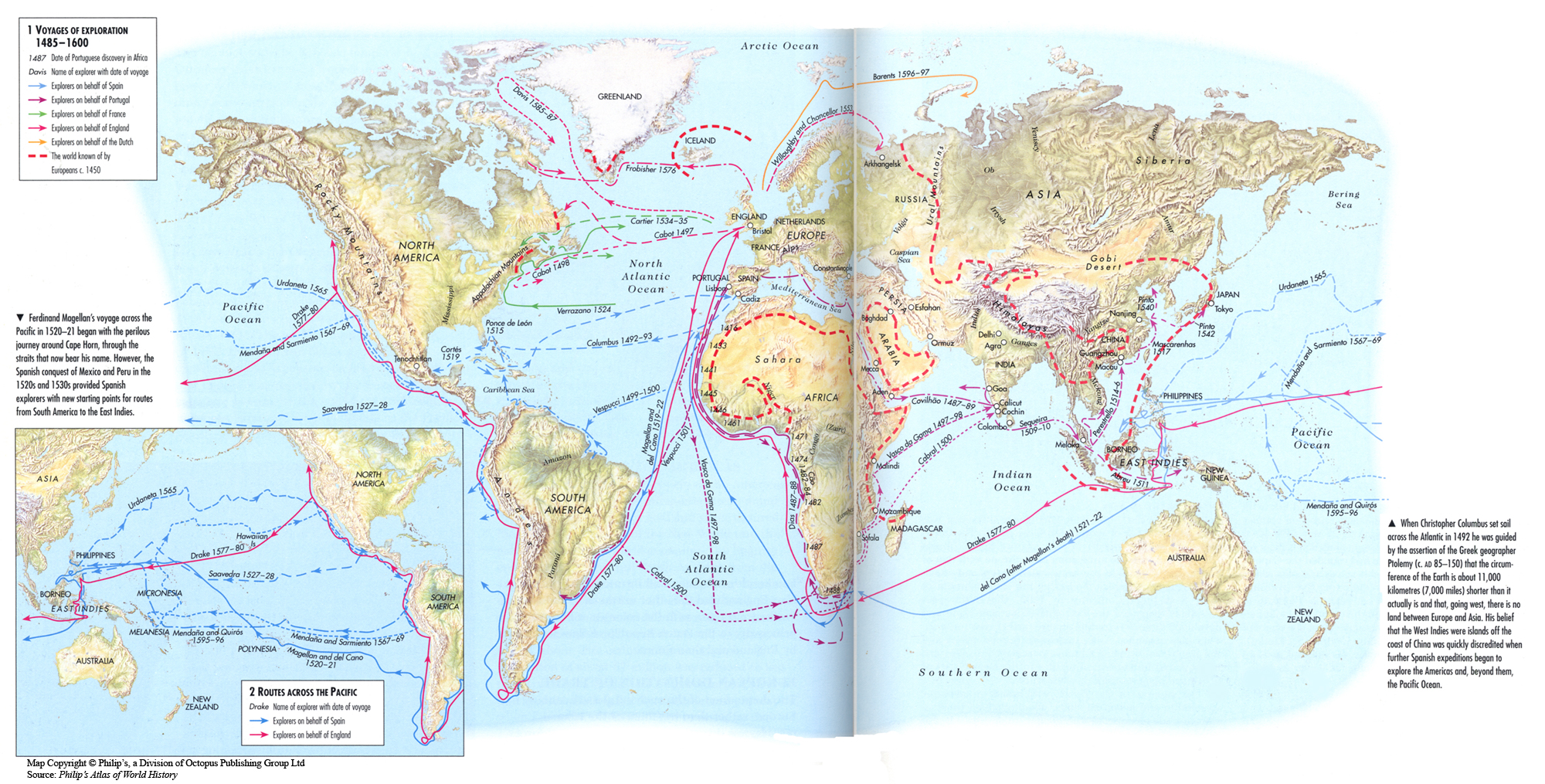
This map shows global exploration routes from 1485 to 1600. Routes are associated with the major powers: England, France, Portugal, Spain, and the Dutch. Explorers, like Columbus and da Gama, are named on the map.
Oxford Atlas of World History, Oxford University Press, 1999. General Editor Patrick K. O’Brien. (pp. 116-117).
Map copyright © Philip’s, a division of Octopus Publishing Group Ltd. Source: Philip’s Atlas of World History
Used under license from Octopus Publishing Group.
This map is one in a series of maps selected from the Oxford Atlas of World History .

Proudly powered by WordPress
COMMENTS
Age of Exploration. View the map. About the map. Featuring over 50 voyages, this interactive map illustrates a selection of well-known, or influential voyages that took place between the late-fifteenth and early twentieth centuries. These voyages focus on European maritime exploration and they follow a great number of different sea-routes, some ...
Voyages of Exploration 1485-1600 Summary. This map shows global exploration routes from 1485 to 1600. Routes are associated with the major powers: England, France, Portugal, Spain, and the Dutch. Explorers, like Columbus and da Gama, are named on the map. Source. Oxford Atlas of World History, Oxford University Press, 1999.