

Map of Ireland with places to visit
With our interactive Ireland map, all the must-see attractions in Ireland and Northern Ireland are just one click away. Here you’ll find a comprehensive overview of scenic highlights, cliffs, beaches, castles, antiquities, gardens and much more.
Meeting of the Waters & Old Weir Bridge

The National Monument

Nano Nagle Bridge

White Strand Beach

White Strand Bay

Vartry Reservoir

Vandeleur Walled Garden

Trinity College

Tourmakeady Waterfall

Torc Mountain Walk

Three Castle Head

St. Lua’s Oratory

St. Flannan’s Oratory

St. Brendan’s Well

Srahwee Wedge Tomb

Spinc and Glenealo Valley

Sketrick Castle

Cloghleagh Bridge & Shankill River

Seven Heads Bay

Sandycove Beach

Reefert Church

Ravensdale Dolmen

Rath Strand

Pulleen Loop Walk

Pulleen Harbour Bog

Powerscourt Waterfall

Port an Dorais

Pincher Bay

Old Bawn Beach

Nun’s Cove

Cathedral of St. Peter and Paul

Mullinhassig Wood & Poulanassig Waterfall

Muckross Lake

Muckross House & Gardens

Muckross Friary

Mornington Strand

Moone High Cross

Moloney’s Strand

Glendalough Miners Village

Mahon Falls

Loughane More Ring Fort

Lough Currane

Looscaunagh Lough

Long Woman’s Grave

Lissadell House & Gardens

Lettergesh Beach

Kockaunaniller Cliffs

Carlingford Castle

Kindred Spirits

Kilmacduagh Monastery & Round Tower

Killiney Beach

Kilcummin Bay Beach

Kilcooley Abbey

Kells Priory

Jameson Distillery Midleton

Enniscrone Castle

Hussey’s Folly

Huntington Castle and Gardens

Purteen Harbour

Grotto & Slate Quarry

Golden Castle

Glengarriff Nature Reserve

Glenarm Valley

Glenballyeamon

Gleensk Viaduct

Glebe Stone Circles

Glassilaun Beach

Glanleam Beach

Galley Cove

Split Rock / Fionn Mac Cumhal’s Stone

Eyrephort Beach

English Market in Cork

Dunworley Beach

Dunworley Bay

Dunbrody Castle

Dunany Beach

Dromineer Castle

Dingle Lighthouse

Dhurode Mine Powder House

Derryveagh Mountains

Cuas Pier Caves

Creagh Graveyard

Craigs Lower Passage Tomb

Courtown Beach

Shankill Beach

Coom Wedge Tomb

Cockle Row Cottages

Clonegal Bridge

Castlehaven Strand

Castledermot Friary

Castledermot Round Tower & High Crosses

Cashel Murphy

Carrowmore Lake

Carrowmore Beach

Carnivan Bay

Cahersiveen

Cahermore Pier

Burren Perfumery

Bunowen Castle

Brownshill Dolmen

Brigit’s Garden

Blarney Castle

Blackstairs Mountains

Bird Island

Bellacragher Bay

Barryscourt Castle

Barry’s Cove

Bishop’s Quarter Beach

Ballyvaughan

Ballymoney Beach

Ballymalis Castle

Ballydavid Cliff Walk

Ballinskelligs Pier

Tinnaberna Bay Beach

Dolmen of the Four Maols

Ardmore Point

Annascaul Lake

An Bhinn Dubh

Altagore Cashel

Ahakista Pier

High Mournes Scenic Loop

Coomhola Bridge

St Vincent’s Bridge

Shandon Bridge

Saint Fin Barre’s Cathedral

Shandon Bells and Tower – St. Anne’s Church

Toe Head Signal Tower

Benvoy Strand

Roaringwater Bay

Wynn’s Castle

Warren Beach

Grand Canal

Urris Hills

Twelve Bens

Tranabo Cove

Tralong Bay

Traloher Strand

Torc Waterfall

Addergoole Titanic Memorial Park

The Gearagh

Tetrapod Footprints

Templetown Church

Temple of Deen

Pigeon Hole Cave and Teach Aille Cave

Swiss Cottage

St. Saviour’s Priory

St. Patrick’s Cathedral

Sigginstown Castle

Shronebirrane Stone Circle

Sherkin Island

Sheen Falls

Rosscarbery

Rossbrin Castle

Ross Errilly Friary

Ross Castle

Rock Art at Letter West

Reenroe Beach / Inny Strand

Rattoo Round Tower

Rathlin Island

Rathfran Priory

Rabbit Island

Puffin Island

Puck’s Castle

Glengarriff

Poulnabrone Dolmen

Poulgorm Bridge

Owenahincha

The Old Barracks

Northburgh Castle

National Museum of Ireland

National Library of Ireland

Mount Gabriel

Mount Errigal

The Mottee Stone

Moll’s Gap

Memorial Garden in Kilmore Quay

Meeting of the Waters

Maynooth Castle

Mare’s Tail Waterfall

Magilligan Point

Macroom Castle

Loughareema

Lough Corrib

Lough Caragh

Lough Aughawoolia

Lough Abisdealy

Long Strand

Leacanabuaile Stone Fort

Lauragh Forest

Larrybane Quarry

Ladies’ View

Labbacallee Wedge Tomb

Kylemore Abbey

Knightstown

King John’s Castle

Kilmakilloge Church and Cemetery

Kilmainham Gaol

Kilcoe Castle

Kilcatherine Church and Cemetery

Kerry International Dark-Sky Reserve

Macgillycuddy’s Reeks

Kerry Highlands

Kenmare Stone Circle

Kenmare River

Keelbeg Pier

Kealkill Stone Circle

John D’Arcy Monument

Jerpoint Abbey

Holy Island

Hill of Tara

Guinness Storehouse

Grange Stone Circle

Gougane Barra

Goat Island

Glenveagh National Park

Glenmore Valley

Gleninagh Castle

Glencar Waterfall

Glenbeg Lough

Glen of Aherlow

Gleesk Pier

Glanworth Castle

Glanmore Lake

Garnish Beach

Gap of Dunloe

Foilhommerum Bay

Ferrycarrig Tower House

Ferns Cathedral

Ferns Castle

Glenariff Forest Park

Errew Abbey

Enniscorthy Castle

Dwyer-McAllister Cottage

Scotsman’s Bay – Dún Laoghaire

Merrion Square

Half Penny Bridge

Dublin Castle

Drumlohan Ogham Stones and Souterrain

Downhill Beach

Downeen Castle

Doonbeg Castle

Doonagore Castle

Dooks Beach

Desmond Castle Adare

Derrynane Beg Ogham Stone

Derrynane House

Derrymore Beach

Derryclare Lough

Derreen Garden

Cranny Falls

Craggaunowen

Courtmacsherry Woods

Coppinger’s Court

Coosacuslaun Bay

Coomasaharn Lake

Cloonsharragh Standing Stones

Cloonee Lough

Clontygora Court Tomb

Clonca Church and High Cross

Clogher Strand

Glenevin Waterfall

Causeway Coast Way

Causestown Castle

Castletownshend

Castlepoint

Castlehaven Bay

Castlefreke Woods

Cashelkeelty Stone Circles

Carton House

Carrowmore High Crosses

Carrigaphooca Castle

Carriganass Castle

Carrigadrohid Castle

Carlingford Lough

Cahir Castle

Caha Mountains

Old Bushmills Distillery

Burrishoole Abbey

Buncrana Bridge

Bunagee Old Pier

Bonane Heritage Park

Boheh Stone

Bocan Stone Circle

Blennerville Windmill

The Blasket Centre

Blackstones Bridge

Black Valley

Bishop’s Quarter

Beltany Stone Circle

Beaghmore Stone Circles

Barnancleeve Gap

Barloge Creek

Barley Lake

Bantry House and Gardens

Banagher Old Church

Dún na Séad Castle

Church Strand Bay

Ballyrisode Beach

Ballynahinch Castle

Ballylinchy Signal Tower

Ballylahan Castle

Ballydonegan Beach

Ballydehob Viaduct

Ballycrovane Harbour

Ballycorus Leadmines

Ballybrack Dolmen

Ballaghisheen Pass

Ballaghbeama Gap

Aughadown Church and Graveyard

Athgreany Piper’s Stones

Ardmore Beach

Ashford Castle

Ardclinis Church

Ardgroom Stone Circle

Annagh Killadangan Archaeological Complex

Garrykennedy

Dark Hedges

Downhill Demense and Hezlett House

Dalkey Island

Dalkey Castle

Trawnamoe Cove

Brown’s Bay

Hill of Uisneach

Titanic Belfast

Rogerstown Estuary

Bannow Church

Priest’s Leap

Glanteenassig Forest Park

Dysert O’Dea

Abbey Island

Christ Church Cathedral

Reginald’s Tower

Athassel Priory

Rock of Cashel

Clonmacnoise

Portumna Castle and Gardens

Rock of Dunamase

Kilkenny Castle

Mellifont Abbey

Trim Castle

Hill of Slane

Monasterboice

Powerscourt Gardens

Castle Roche

Glendalough

Bloody Foreland

Ballyhiernan Bay

Isle of Doagh

Kinnagoe Bay

Inishowen Head

Mussenden Temple

Londonderry

Whiterocks Beach

Whiterocks Bay

Dunluce Castle

Giant‘s Causeway

Dunseverick Castle

Dunseverick Falls

White Park Bay

Ballintoy Harbour

Carrick-a-Rede

Kinbane Castle

Ballycastle Beach

Bonamargy Friary

Murlough Bay

Torr Head Scenic Route

Layd Old Church

Red Bay Castle

Garron Point

Carnlough Harbour

Walled Garden at Glenarm Castle

Glenarm Harbour

Antrim Coast Road

Ballygalley

The Maidens

Blackhead Lighthouse

Gobbins Cliff Path

Carrickfergus Castle

Belfast Castle

Cave Hill and McArts Fort – Belfast

Donaghadee Lighthouse

Kearney Village

Mount Stewart House and Gardens

Scrabo Tower

Lightship L.V. Petrel

Strangford Lough

Nendrum Monastic Site

St. Patrick‘s Grave in Downpatrick

Down Cathedral in Downpatrick

Castle Ward

Killard National Nature Reserve

Ardtole Church in Ardglass

St John‘s Point Lighthouse

Rossglass Beach

Dundrum Castle

Murlough National Nature Reserve

Annalong Cornmill

Silent Valley in Mourne Mountains

Greencastle

Cloughmore Stone

Narrow Water Keep

Flagstaff Viewpoint

Cooley Mountains

Carlingford

Kilwirra Church

Proleek Dolmen

Carrig Cultra Wetlands near Blackrock

Dromiskin Monastery

Salterstown Pier

Port Beach or Lurganboy Beach

Termonfeckin Castle

Baltray Beach

Drogheda Port East Lighthouse

Laytown Beach

Balbriggan Harbour

Ardgillan Castle


Red Island Skerries

St. Patrick‘s Footprint in Skerries

Skerries Mills

Skerries Islands

Loughshinny

Lusk Round Tower

Tower Bay Beach

Donabate to Portrane Cliff Walk

Balcarrick Beach Donabate

Malahide Castle

Malahide Estuary

The Velvet Strand in Portmarnock

Howth Lighthouse

Howth Castle

St. Mary’s Abbey in Howth

Baily Lighthouse at Howth Head

Martello Tower in Sutton

North Bull Wall

Dollymount Strand and Bull Island

Wooden Bridge in Clontarf

Clontarf Pier

River Liffey

Samuel Beckett Bridge

Great South Wall

Seapoint Beach

Forty Foot in Sandycove

James Joyce Tower in Sandycove

Bullock Harbour

Coliemore Harbour

Sorrento Park

Killiney Hill

The Pyramid at Killiney Hill

The Obelisk at Killiney Hill

Bray Cliff Walk

Six Mile Point Newcastle

Wicklow Harbour

Black Castle Wicklow

Wicklow Head

Brittas Bay

Redcross River

Arklow Harbour

Clogga Strand

Kilmichael Point

Courtown Harbour

Norman Motte Glasscarrig

Cahore Beach

Curracloe Beach

Raven Nature Reserve

Wexford Wildfowl Reserve

Burrow Peninsula Rosslare

Rosslare Strand

Johnstown Castle

Our Lady‘s Island

Tacumshane Windmill

Ishartmon Church

Kilmore Quay

Shell Cottage

Bannow Island

Woods at Tintern Abbey

Tintern Abbey

Shipwrecks near Saltmills

Fethard Quay

Baginbun Head

Hook Lighthouse

St Dubhán‘s Church

Duncannon Fort

Ballyhack Castle

Dunbrody Abbey

Dunmore East

Metal Man Tramore

Garrus Strand

Kilfarrasy Strand

Dunhill Castle

Dunabrattin Bay

Tankardstown Copper Mines

Bunmahon Bay

Ballydowane Bay

Ballyvoony Cove

Stradbally Cove

Ballinacourty Lighthouse

Waterford Greenway

Dungarvan Castle

Davitt‘s Quay Dungarvan

Dungarvan Harbour

Helvick Head

Ballyquin Strand

Ardmore Cliff Walk

Ardmore Round Tower

Youghal Clock Gate Tower

Youghal Lighthouse

Garryvoe Beach

Ballymaloe Cookery School

Ballymaloe House

Ballycotton Lighthouse

Ballycotton Cliff Walk

Ballycroneen

Cloyne Round Tower

Roches Point

Little Island

Fota Island Castle

Fota Arboretum and Gardens

River Lee at Passage West

River Owenabue

Roberts‘ Cove

Myrtleville Beach

Tracton Woods

Rocky Bay Beach

Nohoval Cove

Charles Fort

James‘s Fort Kinsale

Lough Foyle

Dunmanus Bay
Barley Cove

Toormore Bay

Altar Wedge Tomb

Baltimore Beacon
Gurranes Stone Row

Raheen Tower House

Drombeg Stone Circle

Galley Head

Inchydoney Island

Timoleague Abbey

Harbour View

Courtmacsherry Bay

White Strand Garrylucas

Old Head of Kinsale

Ringrone Castle

Kinsale Harbour

Sheep‘s Head

Seefin Viewpoint

Garinish Island – Ilnacullin

Seal Harbour

Dunboy Castle

Pulleen Harbour

Firkeel Bay

Dursey Island

Dursey Sound

Ballydonegan Bay

Ballydonegan

Allihies Copper Mines

Ring of Beara

Hag of Beara

Kilmakilloge

Ardea Castle

Staigue Fort

White Strand

O’Carroll’s Cove

Lamb‘s Head

Derrynane Beach

Coomakesta Pass

Eightercua Stone Row

Ballinskelligs Bay

St. Finian‘s Bay

Coomanaspig Pass

Kerry Cliffs

Skellig Michael

Geokaun Mountain

Cromwell Point Lighthouse

Ballycarbery Castle

Cahergal Stone Fort

Mountain Stage

Rossbeigh Strand

Minard Castle

Kinard Beach

Dingle Town

Dunbeg Fort

Fahan Group

Slea Head Drive

Coumeenoole Bay

Great Blasket Island

Blasket Sound

Dunquin Pier

Clogher Head

Smerwick Harbour

Reask Monastic Site

Wine Strand

Gallarus Oratory

Dooneen Pier

Brandon Point

Fermoyle Strand

Castlegregory

Fenit Beach

Ballyheigue Beach

Ballybunion

Bromore Cliffs

Carrigafoyle Castle

Killimer – Tarbert Ferry

Scattery Island

Shannon Estuary

Carrigaholt Castle

Bridges of Ross

Kilkee Cliffs

White Strand Dunbeg

Doolin Pier

Fanore Beach

Limestone Coast of The Burren

Ballyvaughan Pier

Shanmuckinish Castle

Finavarra Point

Finavarra House

Flaggy Shore

Tawnagh Mill

Dunguaire Castle

Rinville Park

Silverstrand Beach

Spiddal Pier

Ballynahown Pier

Coral Beach

Lettermore Causeway

Illaunnaginga

Pearse‘s Cottage

Gorteen Bay

Aillebrack Beach

Derrigimlagh

Clifden Castle

Omey Island

Knockbrack Megalithic Tomb

Connemara National Park

Rinvyle Point

Rosroe Quay

Killary Harbour

Aasleagh Falls

Doolough Valley

Silver Strand

Carrownisky Strand

Old Head Beach

National Famine Memorial

Croagh Patrick

Carraigahowley Castle

Mulranny Beach

Corraun Peninsula

Kildavnet Castle

Atlantic Drive

Ashleam Bay

Minaun Heights

Trawmore Bay

Moyteogue Head

Achill Head

Deserted Village Achill Island

Doogort Beach

Doohoma Head

Claggan Island

Annagh Head

Doonamo Point

Ballyglass Lighthouse

Benwee Head

Céide Fields

Bunatrahir Bay

Downpatrick Head

Lackan Strand

Moyne Friary

Rosserk Friary

Ballina Quay

Easky Beach

Aughris Head

Dunmoran Strand

Culleenamore Strand

The Fairy Glen

Rosses Point

Raghly Harbour

Streedagh Point

Mullaghmore Head

Tullan Strand

Ballyshannon

Kilbarron Castle

Rossnowlagh Beach

Murvagh Beach

St. John‘s Point

Fintragh Bay

Muckross Head

Teelin Pier

Slieve League

Glengesh Pass

Maghera Beach

Loughros Beg Bay

Kilclooney Dolmen

Fall Island

Carrickfin Beach

Illannamarve

Dunmore Strand

Cara Na Mara Bunbeg

Tory Island

Marblehill Beach

Tranarossan Bay

Boyeeghter Bay

Donaghmore Strand

Kinny Lough

Great Pollet Arch

Ballymastocker Bay

Lough Swilly

Burt Castle

Grianán of Aileach

Inch Island

Lisfanon Beach

Dunree Head

Gap of Mamore

Tullagh Bay

Carrickabraghy Castle

Trawbreaga Bay

Culdaff Beach

Magilligan Point View

Five Fingers Strand

National Wax Museum

Uragh Stone Circle

Keem Strand

Cliffs of Moher

Interactive Ireland Map with sights and attractions
We’ve designed the Ireland map to help you plan your holiday. You can limit the selection of sights to specific topics or regions using filters. You can bookmark the sights you like best. We hope that the interactive tourist map of Ireland will be helpful to you when planning your trip to Ireland.
Recommended travel maps

Official Road Atlas Ireland

Road Map of Ireland

Wild Atlantic Way Pocket Map

Official Dublin City & District Street Guide
- B&Bs and Hotels in Ireland
The best B&Bs and hotels in Ireland – use our search to find perfect accommodations for your trip to Ireland.
- B&Bs and Hotels
- Ireland Tours
Discover self driving and guided multi-day tours and round trips through Ireland and Northern Ireland.
- Tour Packages
- Holiday Homes
Discover self-catering holiday homes and holiday apartments for an memorable holiday in an Irish cottage.
- Car Rental in Ireland
Find the best rental car deals from leading car hire companies in Ireland with our car rental search.
- Car Rentals
- Ferry to Ireland
Our ferry search engine finds the cheapest ferry crossings to Ireland and compares all relevant shipping companies.
- Flights to Ireland
Find the best flights to Ireland with our flight search widget, which includes all the major airlines.
Counties of Ireland Guide And Map
Categories Destinations , Travel Guides
The Irish counties have remained virtually unchanged for around 400 years since the English monarchy divided Ireland. In the olden times, the division was by provinces, each governed by a king. These provinces were full of beans, their borders changing all the time.
Today, these Irish provinces mean Leinster, Ulster, Munster, and Connaught. Historically, though, Ireland had more than 4 provinces. Others included Breifne between Ulster and Connaught, Oriel around county Armagh , and Meath which is the northern half of Leinster.
A partition of Ireland into two self-governing polities was made in 1921. The county became one of the basic land divisions used, along with its boroughs. The Republic of Ireland is divided into 26 counties while Northern Ireland comprises 6 counties.
Read on to learn more about these counties in Ireland and their top attractions.
Things you'll find in this article
Counties of Ireland Map
Irish counties list overview.
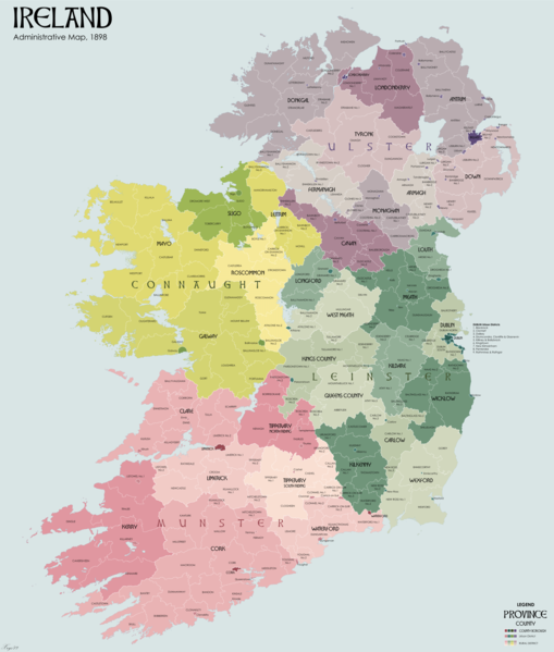
Here’s an overview of the counties of Ireland, their county town, native name, and province.
Counties in the Republic of Ireland
The 26-county Irish state officially describes the Republic of Ireland which is completely independent from England as well as Northern Ireland. These counties were established under English rule around four centuries ago, but the 1921 Anglo-Irish Treaty created the official list that we know today.
Here’s an overview of the Republic of Ireland’s 26 counties under their respective provinces.
Counties in Leinster Province
The County Carlow in the southeast of Ireland is rich in agriculture and industry, with cultural and recreational facilities for both young and old.
In the early 1800s, Carlow was such a stronghold for agriculture that it earned the nickname the “scallion eaters.” It is also where the first sugar beet factory in Ireland was located.
The name “Carlow” is thought to originate from the old Irish place called “Ceatharlach,” which means “city on the lakes” or “four lakes.” But depending on who you listen to, “Carlow” could also mean “a place of cattle.”
Carlow is known for the famous prehistoric site, Browneshill Dolmen, which is a megalithic portal tomb.
Points of Interest in County Carlow:
- Carlow Castle
- Huntington Castle
- Carlow Cathedral
- Duckett’s Groove
- Brownshill Dormen
The Vikings, arriving in Ireland in 800 AD, called the spot where the rivers Poddle and Liffey meet “Dubh Linn” or “black pool.” It is the origin of the name Dublin . It is also said to derive from “hurdled fort.”
County Dublin is known for the city of Dublin, the Irish capital which is a UNESCO City of Literature.
Points of Interest in County Dublin :
- Trinity College
- Malahide Castle
- Stephen’s Green
- Howth
- Guinness Storehouse
To the west of Dublin lies County Kildare, home of the powerful Fitzgerald family. In its early days, Kildare was known as the “church of the oak.”
Known as the equine county of Ireland, Kildare houses some of the world’s most renowned racecourses like the Curragh, Punchestown, and Naas.
Points of Interest in County Kildare:
- Castletown Estate
- Kildare Heritage Center
- Steam Museum
- The Grand Canal
- Irish National Stud and Gardens
County Kilkenny in southeastern Ireland is noted for its medieval monastic ruins such as Kells Priory, the 12th-century Augustinian complex surrounded by fortified walls.
Kilkenny was known as the “church of Cainnech,” in honor of St. Cainnech who converted the county to Christianity in the year 597.
People from Kilkenny are often called “Cats,” after the fabled pair of Kilkenny cats which, for the Kilkenny people, are a positive symbol of tenacity and fighting spirit.
Points of Interest in County Kilkenny:
- Kilkenny Castle
- Tholsel City Hall
- Ballybur Castle
- Shankill Castle
- Clomantagh Castle
Formerly known as Queen’s County in honor of Queen Mary (“Bloody Mary”), the modern County Laois takes its name from the medieval kingdom of Loígis. It has also been known as County Leix.
The Laois name is also said to come from the “people of Lugaid Laigne,” after a chieftain called Lugaid.
County Laois is in the south of the Midlands Region, 85km from Dublin. Laois is rich in historical sites and ancient ruins.
Points of Interest in County Laois:
- Rock of Dunamese
- Slieve Bloom
- Glenbarrow Waterfall
- Timahoe Round Tower
County Longford in Ireland’s East Coast and Midlands was originally known as “the port.” Previously considered part of Connacht, County Longford was added to Leinster by King James I in 1608.
Like many Irish counties, Longford has a number of castles and churches, of which St. Mel’s Cathedral is the most famous. St. Mel’s Cathedral is a Neoclassical building that dates as far back as 1840.
The smallest county in Ireland, County Louth is colloquially known as “the Wee County.” The name “ Louth ” was taken after the ancient Irish God Lugh.
County Louth is home to a number of historic sites, including religious sites at Monasterboice, Mellifont Abbey, and the St. Mary Magdalene Dominican Friary.
County Meath, just north of Dublin , is known for its archaeological sites, especially Brú na Bóinne in the Boyne Valley.
County Meath is nicknamed “The Royal County,” thanks to its history as the seat of the High King of Ireland. The name “Meath” is taken after the historic Kingdom of Meath, from “Midhe” which means “middle” or “center.”
County Offaly is part of the Midlands Region, formed after the Tudor plantations of Laois and Offaly in an expansion attempt of the English Crown in Ireland.
County Offaly derives its name from the Gaelic kingdom called Uí Failghe. It was formerly known as King’s County.
Offaly is known for its extensive bog and peatlands. Some of the famous ones are the Boora Bog, Clara Bog, Raheenmore Bog, and the Bog of Allen which extends into four other counties.
Similar to its neighbor, County Meath, Westmeath literally means “west middle.” Its name is also derived from An Lar Mhi , Gaelic for the west of Meath,
County Westmeath was originally part of the historic Kingdom of Meath,
Westmeath is sometimes called “The Lake County” because of its many lakes, streams, and other waterways. Its county town, Mullingar, is famous for its high-quality veal and beef.
A coastal county in southeastern Ireland, Wexford derives its name from the Norse meaning “fjord of the mud flats.”
County Wexford was among the first in Ireland to be Christianized, occurring in the early 5th century.
Wexford is famous for its golden beaches like the Blue Flag Beaches, Curracloe Beach with its rolling dunes, and Rosslare Beach which is a popular water sports hub.
County Wicklow in the south of Dublin is nicknamed the “Garden of Ireland.” Its name derives from Víkingaló , which is the Old Norse for “Vikings’ meadow.”
County Wicklow is noted for its mountains, Irish Sea coastline, country estates, and the Wicklow Way. Wicklow Mountains National Park is home to glacial lakes, rivers, and Glendalough, a forested valley where the remains of an early medieval monastic settlement are found.
Counties in Munster Province
County Clare in western Ireland has terrain that ranges from rolling countryside to craggy Atlantic coastline. It is known for the world-famous Cliffs of Moher and the Burren, one of the ancient single-chamber megalithic tombs called dolmen.
A literal translation of its name could mean “level piece of land,” but County Clare might also be named after the Norman lord of Thomond, Thomas de Clare.
County Cork, covering much of Ireland’s southwest, is dubbed the “rebel county.” King Henry VII of England gave it the name for its support of Perkin Warbeck in a futile attempt at a rebellion in 1491.
Cork is famed for the 15th-century Blarney Castle which houses the Blarney Stone, said to give the “gift of the gab” or eloquence to those who kiss it.
County Cork is Ireland’s largest county, deriving its name from the meaning for “swamp.” Its administrative capital, the city of Cork, is known as Ireland’s food capital.
Nicknamed “the Kingdom,” County Kerry in the peninsular southwest region of Ireland is known for its striking terrain, rugged coastline, and mountains. It houses the famous Ring of Kerry, as well as Torc Waterfall and Torc Mountain.
The county name is from the ancient Irish Ciarraighe or Ciarraí which means the “people of Ciar.” In Old Irish, the word “Ciar” meant dark brown or black, which is still used in modern Irish to describe a dark complexion. It was the name of the pre-Gaelic tribe who lived in part of the present county, which was founded by the legendary Ciar, son of Fergus mac Róich.
Limerick, in Ireland’s southwest, is a beautiful county although its name is derived from “bare spot” or “barren spot of land.” It is known for Irish Coffee, a brew infused with Irish whiskey, which was invented in the village of Foynes in 1943.
Limerick is home to Grange Stone Circle, Ireland’s largest stone circle, and Lough Gur, which is one of the country’s most important archaeological sites.
Known as the “well of the Arra,” Tipperary is sometimes referred to as The Premier County. It is known for its pastureland and horse breeding industry. Tipperary also houses the famous Rock of Cashel and Cahir Castle.
County Tipperary is in the south-central of Ireland. It was formed in 1328, making it the oldest of the Irish counties.
Waterford , originally called “Larag’s port,” is a maritime county located on the southeastern coast of Ireland.
County Waterford is colloquially known as “The Déise,” after the Déise tribe that conquered the Waterford region sometime between the 4th and 8th centuries.
County Waterford is known for Waterford Crystal, a legacy of the city of Waterford’s glass-making industry from 1783 until early 2009.
Counties in Connacht Province
County Galway, located on Ireland’s western seaboard, derives its name from the river “Gaillimh.” It became an official entity around 1569 AD.
County Galway’s capital, the city of Galway , is known as the festival capital of Ireland, thanks to its vibrant street theatre, film and fringe festivities, and fantastic food.
Situated in the north of Ireland, County Leitrim is one of the smaller counties in Ireland. The county is known simply as the “grey ridge,” from the Irish Liath Druim.
It is noted for its linen industry, as well as coal and iron ore mining.
On the west coast of Ireland lies County Mayo , whose name derives from the Irish Contae Mhaigh Eo , which means “plain of the yew trees.”
Formed in 1585, County Mayo is one of the most beautiful counties in Ireland. It is home to Achill, Ireland’s largest island off the county’s west coast.
Roscommon, literally meaning “St. Coman’s wood,” was named after St. Coman, founder of the Roscommon monastery in the year 550.
County Roscommon is roughly in the center of Ireland. It is known for sheep farming, which is celebrated annually with the Roscommon Lamb Festival. The county is home to a lot of castles and ruins, lakes, forests, and Ireland’s largest floating waterpark. However, it is most famous for being the birthplace of Halloween.
County Sligo in northwestern Ireland is most noted for the legacy of the renowned Irish poet, W.B. Yeats. It is also known for Benbulben Mountain, one of Ireland’s most distinctive natural landmarks.
County Sligo was officially formed in 1585, but coming into effect only after the end of the Nine Years’ War in 1603.
Its name derives from “shelly place,” thanks to the abundance of shellfish that can be found here.
Counties in Ulster Province
County Cavan, known simply as “the hollow,” is home to fabulous rolling hills and lakes shaped by the last Ice Age. With all its 365 lakes, there is no running out for fishing for the whole year!
Cavan, established in 1579, is based on the historic Gaelic territory of East Breffny (Bréifne).
Donegal is the second-largest county in Ireland, known for its castles, rugged coastline, and mountains such as the quartzite Mount Errigal.
The county name is derived from Dún na nGall , meaning “fort of the foreigners,” which were most likely the Vikings.
County Donegal lies on the coast of the Atlantic Ocean in northwestern Ireland. It was the home of the Patron St. Colmcille or St. Columba, one of Ireland’s three patron saints, the other two being St. Brigit and the famous St. Patrick.
Donegal is often referred to as “the forgotten county,” being the least commercialized part of Ireland.
County Monaghan has existed since 1585 when Airgíalla’ Mac Mathghamhna rulers agreed to join the Kingdom of Ireland. The county is noted for its ancient Irish craft of Carrickmacross Lace.
County Monaghan’ s name means “hilly or bushy land” or “place of little hills,” as the county is dotted with small mountains, lakes, and forests.
Points of Interest in County Monaghan:
- Monaghan County Museum
- Lough Muckno
- Castle Leslie
- Rossmore Forest Park
Counties in Northern Ireland

While the historic divisions are still used today as the groundwork of local government in the Republic of Ireland, it’s a different story in Northern Ireland. The counties no longer have any actual purpose—they only serve as mere curiosities, or part of their history—and districts are used instead.
Here are the 6 counties that comprise Northern Ireland, also under the province of Ulster.
Formed after Shane O’Neill’s rebellion, Antrim is perched right on the top of Ireland in the northeastern corner. So it’s no wonder the name “Antrim” is derived from the phrase “lone ridge” or “lone dwelling.”
County Antrim is famed for its glens which offer isolated rugged landscapes such as the Giant’s Causeway, which is a UNESCO World Heritage Site. Antrim is also known for the whiskey-producing village of Bushmills and Portrush which is a popular seaside resort and night-life area.
Belfast is part of the County Antrim, with the remainder being in Down.
Known as the “orchard county,” thanks to its many apple orchards, County Armagh is notable for being the seat of St. Patrick.
The name “Armagh” comes from the Irish Contae Ard Mhacha , which translates to “Macha’s Hill.” Macha was a pagan Celtic goddess.
County Armagh , as the heartland of St. Patrick, is home to St. Patrick’s Church of Ireland Cathedral and Saint Patrick’s Roman Catholic Cathedral. It also houses Gosford Castle and Slieve Gullion.
Founded in the early 16th century, County Down is home to Downpatrick and the burial place of Saint Patrick. The county takes its name from the Irish dún , meaning “fort.”
County Down is renowned for the granite Mourne Mountains, with Slieve Donard as the highest peak.
Based on the territory of the dominant Maguire clan, County Fermanagh is known for its lush Lakelands, hence its name which derives from the Irish for “men from the county of the lakes.” Lough Erne is the most famous of these lakes.
The famous playwright, Samuel Beckett, was born in Fermanagh in 1906.
Country Derry derives its name from the Gaelic Doire , which translates to “oak wood” or “oak grove.”
Bordered by the fast-flowing waters of the River Foyle, Derry is home to the Sperrin Mountains, which it shares with the County Tyrone.
The walled city of Londonderry is County Derry’s administrative capital, named the first UK City of Culture in 2013.
Country Tyrone is based on the Irish kingdom of Tír Eoghain, or the “Land of Eoghan,” in honor of Eogan mac Neill who founded this county.
Tyrone has spectacular landscapes and is home to a number of parks, such as Dungannon Park, Drum Manor Forest Park, and Gortin Glen Forest Park.
County Tyrone is no longer employed as an administrative division for local government. However, its strong identity remains in popular culture.
Hi, I’m Christine – a full-time traveler and career woman. Although I’m from the Philippines, my location independent career took me to over 40 countries for the past 8 years. I also lived in 3 continents – from the Caribbean, South East Asia to Africa. But despite living in several countries, my love for Ireland remains the same. A country that had been a part of my life since I was 14 because of my love for Irish music and bands. Ireland Travel Guides was born because of this passion and hopefully, in some little ways, this website will be able to help you on your next trip to Ireland.
Wild Atlantic Way Itinerary For 7 Days - Ireland Travel Guides
Saturday 24th of July 2021
[…] Way in just a few days seems like a daunting task. The entire stretch runs through at least six counties of Ireland, all of which have plenty of attractions one can’t simply […]
11 Best Things To Do In Donegal, Ireland - Ireland Travel Guides
Wednesday 30th of June 2021
[…] Donegal, nicknamed as Ireland’s Forgotten County, is one of the nine counties found in Ulster. Geographically and economically separated in the northwestern part of Emerald Isle, Donegal earns […]
Glamping in Galway - 8 Best Glamping Sites In Galway - Ireland Travel Guides
[…] one of the least densely populated counties in the Emerald Isle, there so much of its unique and varied landscapes to enjoy in Galway. From […]
Maps of Ireland

The Republic of Ireland, or simply Ireland, is a Western European country located on the island of Ireland. It shares its only land border with Northern Ireland , a constituent country of the United Kingdom , to the north. To the east, it borders the Irish Sea , which connects to the Atlantic Ocean . The Atlantic Ocean surrounds the western and southern coasts of Ireland, and the warm North Atlantic Drift , a major component of the Gulf Stream , is particularly influential on the climate of Ireland. The country's total area is approximately 70,273 km 2 (27,133 mi 2 ).
The Irish landscape generally consists of four geographical regions, several bodies of water and rivers, as well as islands.
The Central Lowlands encompass most of the interior of the country. Dominated by a series of flat plains and low-lying areas, the Central Lowlands feature numerous lakes and peat bogs, which give the region its distinct characteristics. The peatlands constitute roughly 20% of the country's landmass. Over the years, peat extraction and combustion have been ingrained in Irish traditions, but growing climate considerations are prompting a rethink on the stewardship of these peatlands.
The Western Coastal area lies to the west of the Central Lowlands. This coast is a region marked by rugged landscapes. It includes the western coastal counties and is characterized by steep cliffs, rocky outcrops, and isolated peninsulas that extend into the Atlantic Ocean. This area contains the Cliffs of Moher , a notable geological feature that stretches for about 14 kilometers along the coastline of County Clare. The west is also home to many of Ireland's Gaeltacht areas, where the Irish language is still spoken. Last, Carrauntoohil is the country's highest point in this region and it stands at 1041 m (3414 ft). The yellow upright triangle marks its position on the map.
The Eastern and Southern Coastal area sits to the east and south of the Central Lowlands, one encounters the Eastern and Southern Coastal area, a region marked by gentler landscapes compared to the west. Rolling hills, fertile valleys, and sandy beaches typify this region. The east coast, in particular, features the Wicklow Mountains, which provide a striking backdrop to Ireland's capital city, Dublin .
The Northern Uplands , which straddle the border with Northern Ireland, form another distinct region. This area is characterized by hills and mountains, including the Mourne Mountains and the Sperrin Mountains. Although less populated than other regions, the Northern Uplands hold significant environmental and cultural value.
Bodies of Water : The country hosts several large lakes, locally known as loughs. Lough Corrib and Lough Ree , both located in the Central Lowlands, are among the largest.
Numerous rivers crisscross Ireland. The River Shannon , the longest river in Ireland, flows south from the slopes of Cuilcagh Mountain in the Northern Uplands, through the Central Lowlands, and into the Atlantic Ocean. Other major rivers include the River Liffey, which flows through the heart of Dublin, and the River Boyne.
Islands : The Aran Islands , located off the west coast, are notable for their limestone landscapes. Other prominent islands include Achill Island , the largest island off the coast of Ireland, and the Skellig Islands, a UNESCO World Heritage Site.
County Councils of Ireland Map
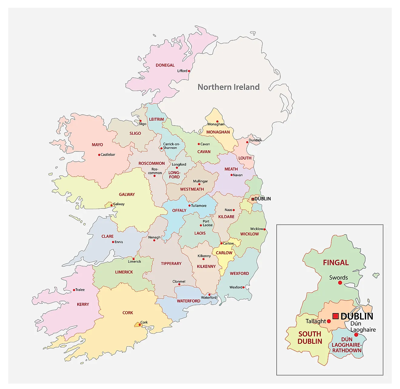
Ireland (officially, the Republic of Ireland) is divided into 26 county councils, 3 city councils, 2 city & county councils.
The county councils are: Carlow, Dun Laoghaire Rathdown, Fingal, South Dublin, Kildare, Kilkenny, Laois, Longford, Louth, Meath, Offaly, Westmeath, Wexford, Wicklow, Clare, Cork, Kerry, Tipperary, Galway, Leitrium, Mayo, Roscommon, Sligo, Cavan, Donegal and Monaghan.
The city councils are: Dublin city council, Cork city council and Galway city council.
The city and county councils are: Limerick city and county council, Waterford city and county council.
Located in the eastern part of the country is, Dublin – the capital, the largest and the most populous city in Ireland. It is also the major cultural, financial, commercial center and the chief maritime port of Ireland.
Where is Ireland?
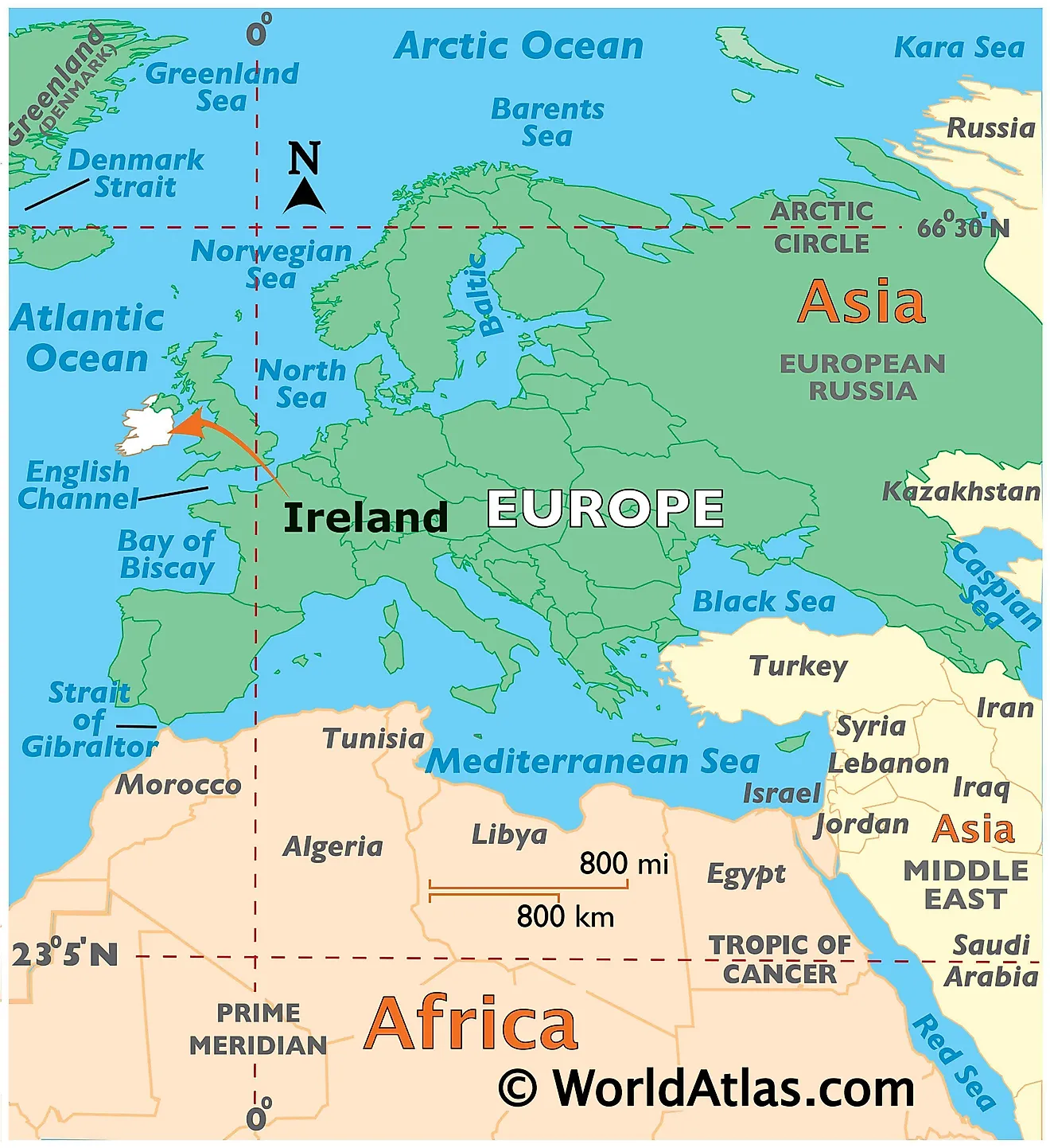
Ireland is located off the north western coastline of continental Europe. It is geographically positioned both in the Northern and Western hemispheres of the Earth. Ireland is the 2 nd largest island of the British Isles and lies in the west of Great Britain. It shares a land border with Northern Ireland (a recognised constitutionally distinct region of UK). Ireland is bounded by the Atlantic Ocean – by the Celtic Sea in the south; by the St. George’s Channel in the southeast and by the Irish Sea in the east.
Ireland Bordering Countries : The United Kingdom .
Regional Maps : Map of Europe
Outline Map of Ireland
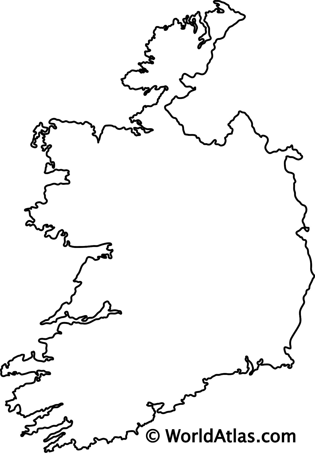
The above blank map represents the Republic of Ireland, a country located off the north western coastline of European continent. The above map can be downloaded, printed and used for educational purposes like coloring and map-pointing activities.
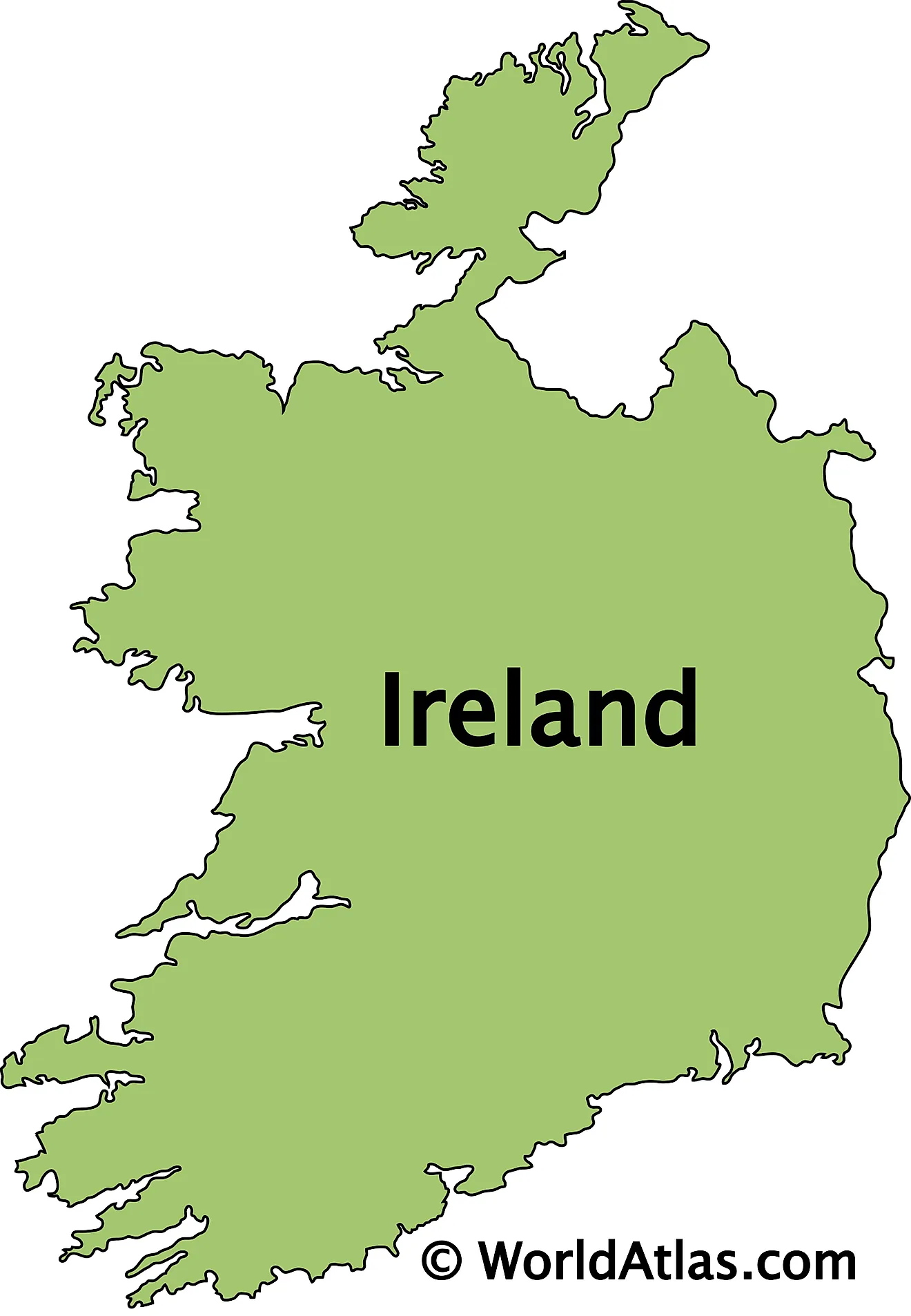
The above outline map represents the Republic of Ireland, a sovereign country on the island of Ireland. It is the second largest island of the British Isles and lies to the west of Great Britain.
This page was last updated on August 1, 2023
Latest by WorldAtlas
6 Coolest Towns in Kansas for a Summer Vacation in 2024
6 Towns Perfect for Retirement in North Carolina
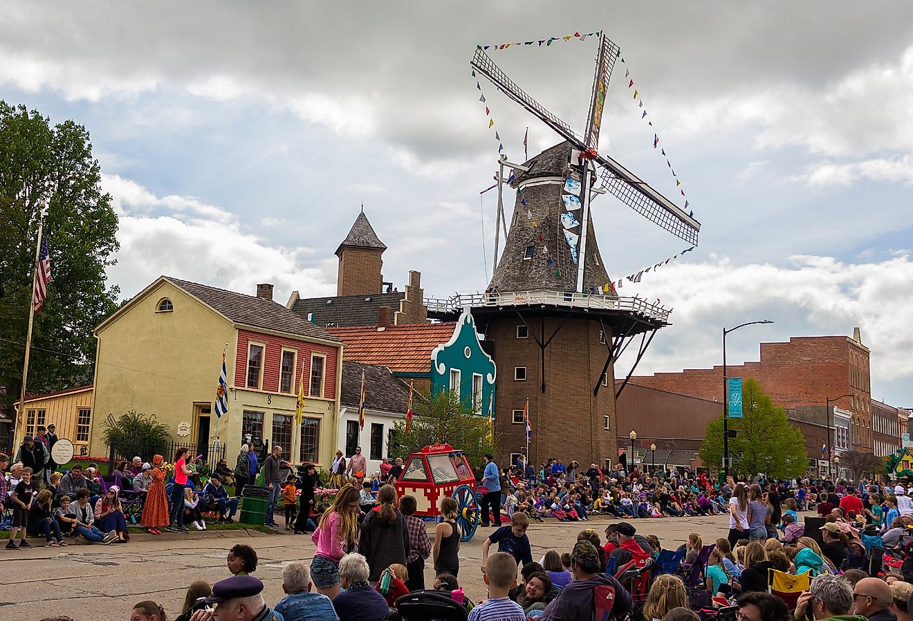
7 Most Idyllic Small Towns in Iowa
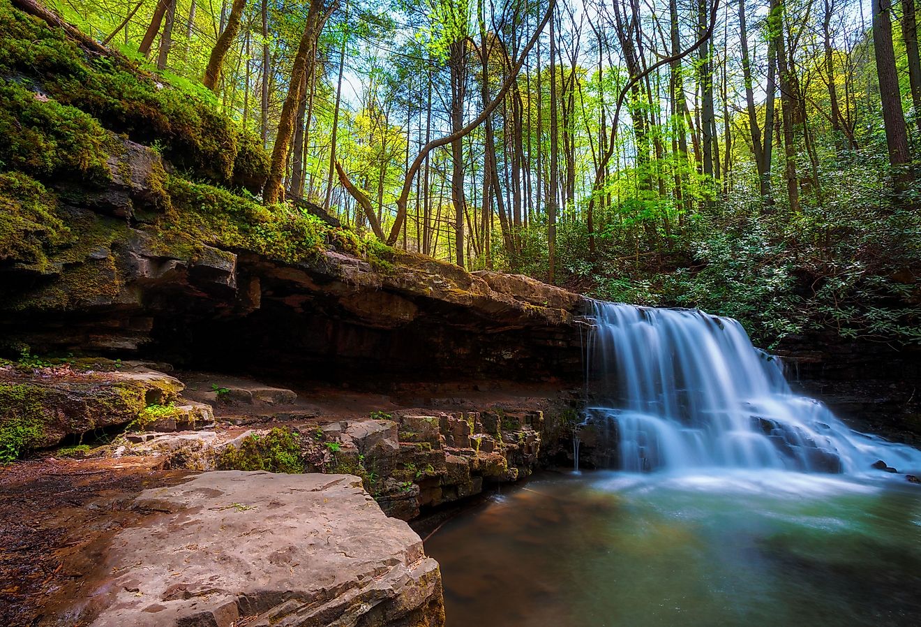
8 Senior-Friendly Towns in Tennessee
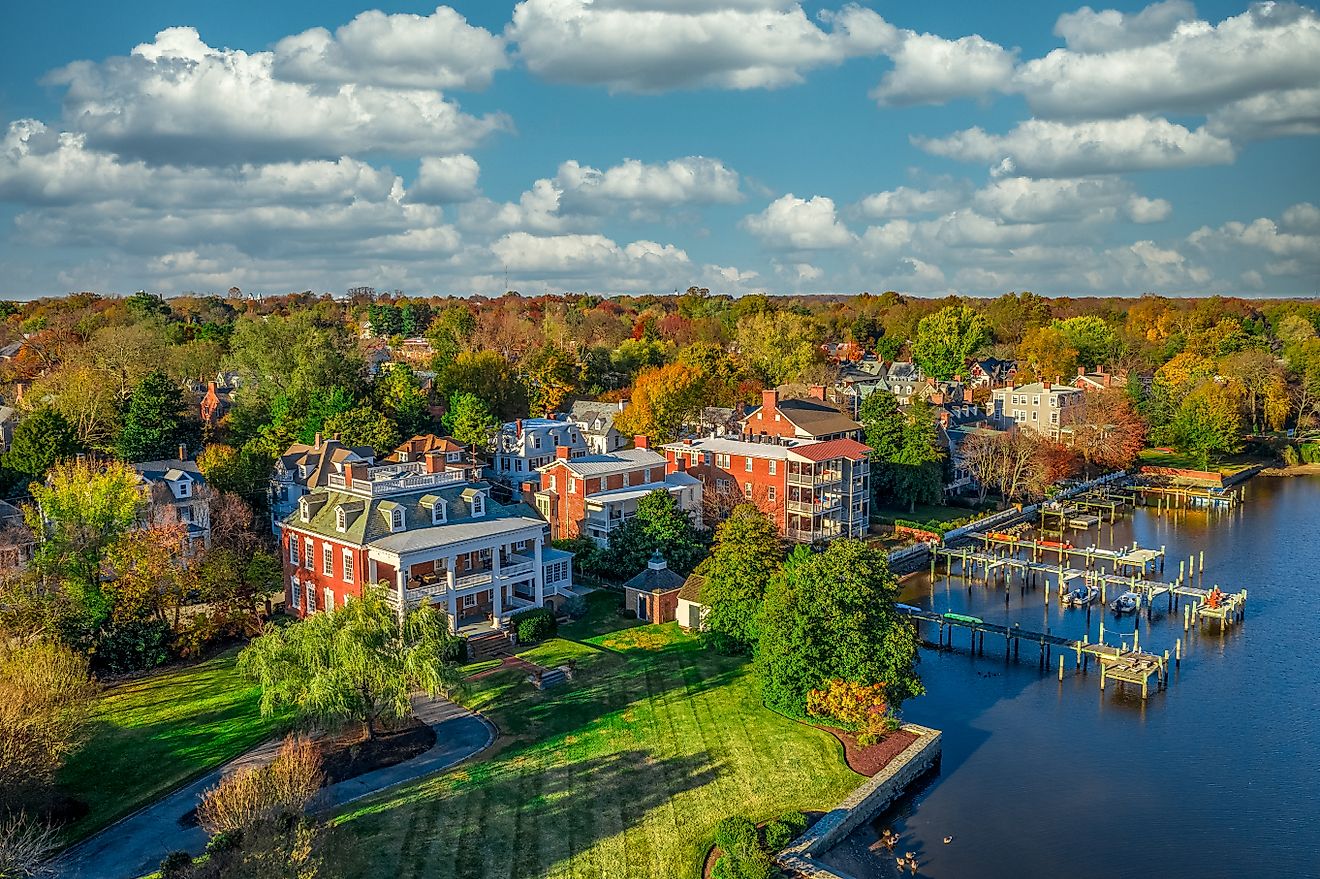
6 Breathtaking Towns to Visit in Maryland
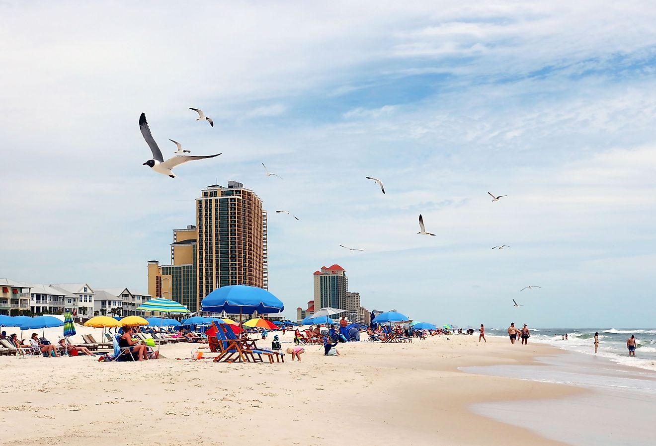
These Towns in Alabama Come Alive in Spring
9 Best Destinations For Wildlife Spotting in New York
Indiana Dunes State Park

601 Of The Best Things To Do In Ireland On 1 Map (This Makes Planning A Trip EASY)
By Author Keith O'Hara
Posted on Last updated: December 8, 2019

T he best things to do in Ireland… on an interactive driving map of Ireland… with f**k loads of attractions slapped onto it that people can use to plan an adventure.
The above two sentences were what I jotted down while I was planning out the list of resources that I wanted to have on this website.
It was a double edged sword – the map has proven to be one of the most popular features on the site, but it tooK about two inches off my fingers while I spent days bashing away on the keyboard, researching and plotting out attractions.
I’m possibly being a little over dramatic…
Created to battle FOMO (the fear of missing out)
Ever find yourself in a place that you’ve never been and thinking, “I wonder what there is to see around here?!”
There’s nothing more frustrating than arriving in a place with a limited amount of time to explore it and being unsure of what there is around you to see and do.
It happened me recently after I visited West Cork and realised about a week later that I was in a town that offered a shark watching tour ??? (see below…)
What you’ll get from this map
If you’re one of those hyper-organised people who plan out a trip in minute detail, then fair play to you – we’ve a tonne of hour-by-hour road trip guides that you’ll love here .
But if you’re like me and you tend to drift off the main roads whenever something catches your eye, then the map below, packed with the best things to do in Ireland, is for you.
- The best places to visit in Ireland across every single county
- Unique off-the-beaten-track sights that you won’t find in a lot of guidebooks
- Places that myself, family and/or friends have been to and loved – a lot of these are random places that you’ll only hear about when chatting to a local.
- Large tourist attractions that you’ll have heard of, but sure we’ve popped them on just in case
The Best Things to do in Ireland Nestled in your Pocket
Below, you’ll find an interactive Google map of Ireland packed with 600+ of the top things to do around our little island.
The best way to use it:
- While you’re planning your trip : bookmark this page and when you’re planning your Irish adventure, zoom in on where you’re heading to and hey presto, loads of deadly things to do all around you
- When you’re off exploring: bookmark this page and when you’re in a place and looking for stuff to do, whip our your phone and zoom in. You’ll quickly be surrounded by places to check out and things to do
How the map was created
Ahead of a recent Irish road trip, I asked the 220,000+ strong #IrishRoadTrip community for their recommendations of the best things to do in Ireland – thousands of people commented, emailed and DM’d.
I took these recommendations and combined them with personal experiences from my own travels along with recommendations from family and friends.
Yes, this detailed tourist map of Ireland has the main tourist attractions that you’ve heard of and plan on checking out, but its secret sauce is a tonne of off-the-beaten-track stop-off points that are less known, and harder to stumble across.
Looking for full road trip itineraries that save you having to research and plan?

Photo by Hillwalk Tours
Here’s some of our most popular road trip guides:
- An Unforgettable 18-Day Road Trip That’s Packed With The Best Places to Visit in Ireland ( our most popular guide )
- 21+ Adventurous And Fun Things To Do In Waterford This Weekend On A Looooovely 2-Day Road Trip ( see it here )
- 30+ Things To Do In West Cork Over A Mouth-Watering 4-Day Road Trip (Full Itinerary – check it out here )
- 3 Adventure, Food + Craic Packed Days in Galway ( get it here )
- 22 of the Best Things to do in Donegal on an Adventure-Packed 3-Day Road Trip ( grab it here )
- Our 2-Day Road Trip Along The Causeway Coastal Route For You To Steal ( Cliffs, Whiskey, Caves + Loads More )
Planning a trip to Ireland?
We’ve more handy interactive guides on the best places to stay, eat and drink (traditional pubs only) in every single county in Ireland.
Check them out below.
Is there somewhere that we missed? Let me know in the comments section below!
Keith O’Hara has lived in Ireland for 35 years and has spent most of the last 10 creating what is now The Irish Road Trip guide. Over the years, the website has published thousands of meticulously researched Ireland travel guides, welcoming 30 million+ visitors along the way. In 2022, the Irish Road Trip team published the world’s largest collection of Irish Road Trip itineraries . Keith lives in Dublin with his dog Toby and finds writing in the 3rd person minus craic altogether.
This site uses Akismet to reduce spam. Learn how your comment data is processed .
Saturday 30th of March 2019
Also silent valley reservoir in the mournes

- Extreme Spots
- Cities in 3D
- All countries

- Cultural sights
- Festivals in Ireland
- Unique sights
- Architecture and monuments
- Attractions and nightlife
- Extreme country spots
- Parks and lanscapes
- Cuisine and restaurants
- Traditions and lifestyle
- Festivals and celebrations
- Languages & religions
- High-resolution maps
- Interactive map
- Map of cities
- Map of regions
- Map of sights
- Best transportation means
- Nature of Ireland
- When to visit - climate
- Political life
- Economics and GDP
Maps of Ireland

Maps of cities and regions of Ireland
Fantastic City Tours and Excursions in Ireland
Unique places of interest in ireland.
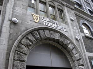
Guinness Storehouse
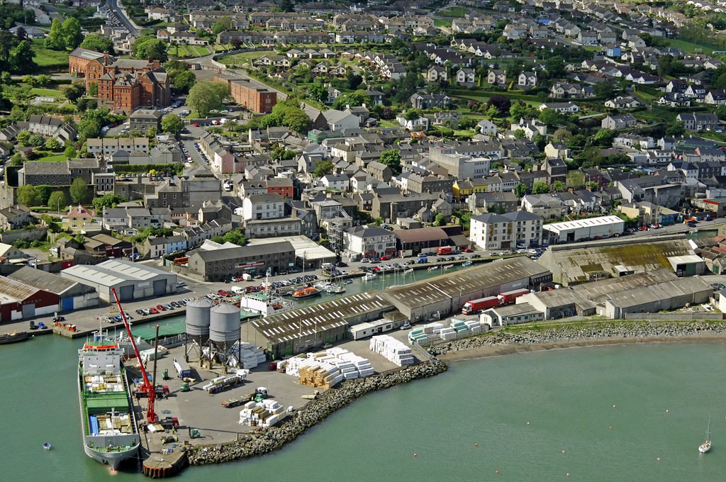
Aura of Ireland in photographs
Traditions in Ireland

Map of guides to cities of Ireland

World Map » Ireland » Ireland Counties Map
Ireland Counties Map

List of Counties of the Republic of Ireland
You may download, print or use the above map for educational, personal and non-commercial purposes. Attribution is required. For any website, blog, scientific research or e-book, you must place a hyperlink (to this page) with an attribution next to the image used.
Maps of Ireland
- Ireland maps
Cities of Ireland
- North America Map
- South America Map
- Oceania Map
Popular Maps
- Australia Map
- Germany Map
- Singapore Map
- United Arab Emirates Map
- United Kingdom Map
- United States Map
- New York City Map
- Los Angeles Map
U.S. States
- California Map
- Colorado Map
- Florida Map
- Georgia Map
- Illinois Map
- New York Map
- North Carolina Map
- Virginia Map
Ireland's most popular counties and their top attractions
From county antrim to county kerry, there is so much to see and do in ireland here's irishcentral's guide to the top attractions for visitors..
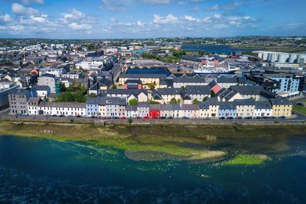
The following counties are among the most widely visited in Ireland . With their lively arts and culture attractions, it's not hard to see why.
Here are IrishCentral's guide and recommendations to Ireland's most popular counties!
Sign up to IrishCentral's newsletter to stay up-to-date with everything Irish!
County Antrim
Belfast City (in Irish, Béal Feirste) is the capital of Northern Ireland and is located in County Antrim , one of Ireland's most visited counties. History and politics have always played a major role in the fabric of Belfast, and perhaps for that reason, its citizens are among the most vivid and witty people you'll ever meet.
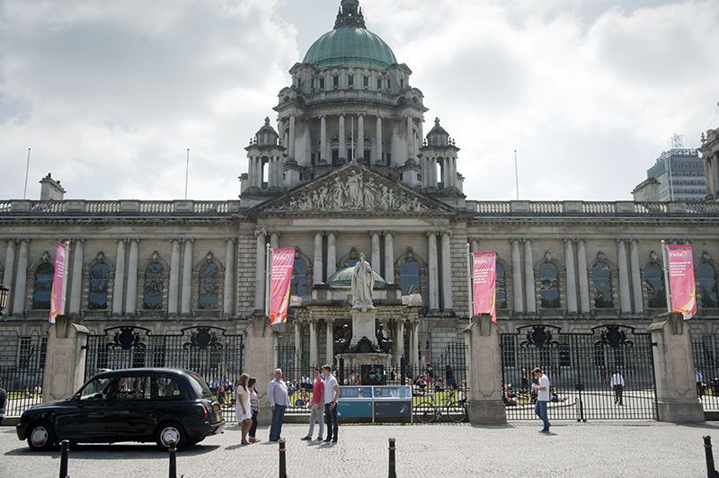
Belfast City Hall (Ireland's Content Pool)
Unsurprisingly, Belfast is rich in culture , art, music, dance, sports, shopping, attractions and historical sites. City Hall, one of the main seats of power, is located on Donegall Square and dominates the area with its magnificent classical Renaissance-style architecture and Italian marble interior. It was completed in 1903.
The Linen Hall Library, also located on Donegall Square, was established in 1788. It houses an Irish collection of over 20,000 volumes and a Robert Burns collection. Visit and you'll be keeping company with many noted Irish authors.
The Crown Liquor Saloon is the most famous pub in Belfast and, frankly, one of the most beautiful pubs in the world. Featuring Victorian architecture, with the outside covered in thousands of colorful tiles, the inside decor has stained and painted glass carved oak screens and mahogany furniture. Don't miss it.
The Botanic Gardens, the rose gardens, and herbaceous borders were established in 1920 and are unmissable. Two greenhouses dominate the gardens and the Palm House has a conservatory containing tropical plants like coffee, sugar, and banana plants. The Tropical Ravine has a high walkway that provides a great viewpoint.
Overlooking the city, Belfast Castle was built in 1870 and was the former home of the Donegall family, who gave the main square in the city center its name. The castle offers a spectacular view of the city. There is also a heritage center, antique shop, and children's play area on the premise.
County Clare
County Clare in the Republic of Ireland is steeped in history, and it offers beautiful seascapes, landscapes, lakes, cliffs, caves, and music. Highlights include The Burren (an ancient, perfectly preserved landscape), the Cliffs of Moher (700 foot high cliffs facing the wild Atlantic), and Bunratty Castle and Folk Park (an impressive castle dating from the early Middle Ages).
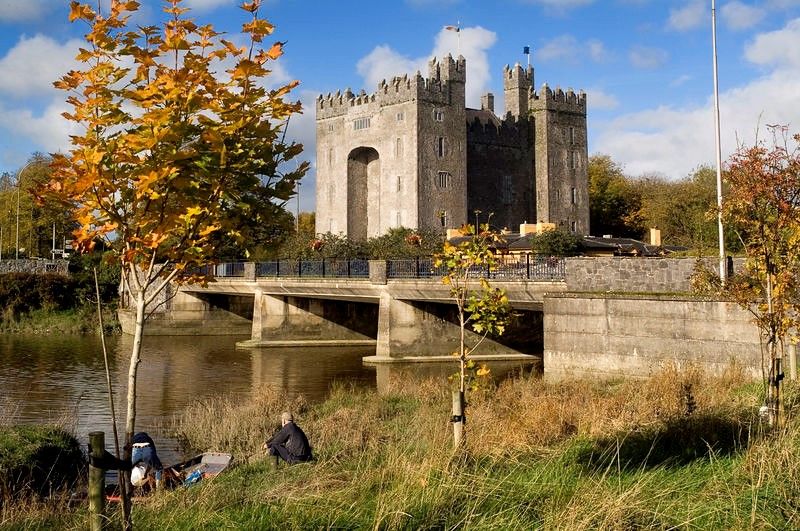
Bunratty Castle in Co Clare (Ireland's Content Pool)
The Burren is over 500 square miles of limestone located in the northwest corner of County Clare. The area is a haven for botanists and ecologists because of the unique flora and rock. The ground surface is a floor of gray rock with long parallel grooves, known as grykes. There is an amazing variety of flora with Arctic, Alpine, and Mediterranean plants growing in spring and summer. For that reason, there's also an amazing range of color in the flowers, ferns, and mosses.
Alwee Caves were discovered in the 1940s. There are caverns, underground waterfalls, stalagmite and stalactite formations and remains of brown bears, which have been extinct in Ireland for thousands of years. The caves are open for guided tours.
The Cliffs of Moher are one of the most spectacular sights of The Burren. These majestic cliffs rise more than 700 feet above the windswept Atlantic Ocean and stretch five miles along the west coast of Clare. Composed of shale and sandstone, the Cliffs' ledges make ideal roosting homes for birds. On a clear day, you can see as far as the Mountains of Kerry, Connemara and the Aran Islands.
Bunratty Castle and Folk Park is one of the most complete and authentic medieval castles in Ireland. This being Ireland it also has a long and bloody history.
The castle is a combination of earlier Norman castles and the later Gaelic Tower Houses furnished with a fine collection of medieval furniture, artwork, and ornate carvings. A four-course Medieval Banquet and entertainment with performers in traditional costume is offered in the evenings.

Are you planning a vacation in Ireland? Looking for advice or want to share some great memories? Join our Irish travel Facebook group.
County Cork
County Cork is the largest county in Ireland, and Cork City is the second-largest city in the Republic. A unique and lively second capital, the distinctive people are as much an attraction as the place itself.
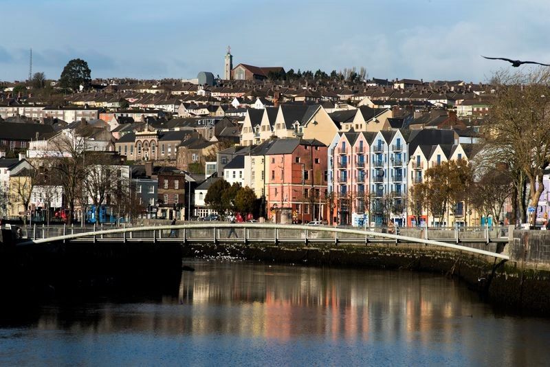
The Shandon Bridge over the River Lee in Cork City (Ireland's Content Pool)
Saint Finbarr first built a monastery on the site that would later become Cork City in the year 650. The city grew along the banks of the River Lee at the point where it splits into two channels.
Cork City is essentially an island with 16 bridges. The main commercial area is located along St. Patrick Street, Grand Parade, Washington Street, Oliver Plunkett Street, and Main Street. The charm and beauty of Cork City revolves around the contrasts the city offers. There are a multitude of theaters and a variety of arts. There is also a diverse range of excellent restaurants, cafes, and pubs with traditional Irish music.
The city also has many unique and quaint shops. Across the Southern Channel are some of the oldest streets in Cork, along with the campus of University College, Cork.
The nearby Blarney Castle was built by Dermot McCarthy, King of Munster in 1446 and should be at the top of your must-visit list. The castle is located on a thousand acres of beautiful woodland and is partially hidden by trees, some up to a thousand years old. The castle has been witness to the triumph and turmoil of Irish chiefs and enemy armies.
Cobh , (pronounced cove) is a picturesque town located on the Great Island, one of three large islands in Cork Harbour. It was the port of departure for many Irish during the Great Hunger from 1844 to 1848 and has the distinction of being central for two of the worst maritime disasters in history. Cobh was the last port of call for the Titanic and the nearest port to the Lusitania when it was torpedoed and sunk off the south coast of Ireland. The Titanic sank on its maiden voyage while crossing the Atlantic after leaving Cobh (then Queenstown).
Nearby Kinsale is a fishing and resort town with a picture-perfect harbor. The town's narrow streets are lined with colorfully painted buildings and it is widely renowned for its art galleries and gourmet restaurants. Kinsale is also considered the Gourmet Capital of Ireland. Many of the pubs offer traditional Irish music and upscale fare.
County Donegal
With its sandy beaches, unspoiled boglands and friendly communities, County Donegal is a leading destination for many travelers. One of the county treasures is Glenveagh National Park, the only official national park anywhere in the Province of Ulster. The park is a huge nature reserve with spectacular scenery of mountains, raised boglands, lakes, and woodlands. At its heart is Glenveagh Castle, a beautiful late Victorian "folly" that was originally built as a summer residence.
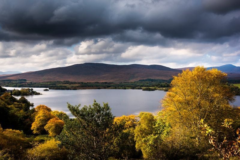
Glenveagh National Park in Co Donegal (Ireland's Content Pool)
Donegal's rugged landscape lends itself to active sports like climbing, hillwalking, scuba-diving, surfing, and kite-flying. Many people travel to Donegal for the superb golf links — long sandy beaches and extensive dune systems are a feature of the county, and many golf courses have been developed. Golf is a very popular sport within the county, including world class golf courses such as Ballyliffin (Glashedy), Ballyliffin (Old), both of which are located in the Inishowen peninsula. Other courses to note are Murvagh and Rosapenna.
The Donegal Gaeltacht (Irish-speaking district) also attracts young people to County Donegal each year during the school summer holidays. The three-week long summer Gaeltacht courses give young Irish people from other parts of the country a chance to learn the Irish language and traditional Irish cultural traditions that are still prevalent in parts of Donegal.
County Dublin
Dublin is the capital of the Republic of Ireland and is divided by the River Liffey. The Royal Canal and the Grand Canal provide connections between the port area and the northern and southern branches of the River Shannon.
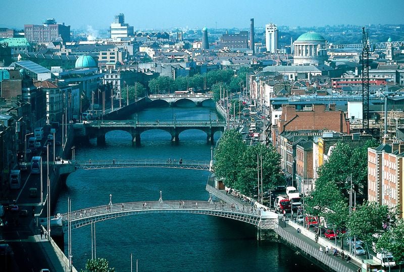
Dublin City (Ireland's Content Pool)
Dublin is a city steeped in history and boasts of having the oldest pub in Ireland, The Brazen Head, and the oldest university, Trinity College . It is a center of art and culture and the largest truly cosmopolitan city in Ireland.
O'Connell Street is the main thoroughfare and the widest street in Europe. At the south end, sits a huge monument of Daniel O'Connell, the Irish patriot . The General Post Office (GPO) is also located on O'Connell Street and was the headquarters of the Irish Republican Brotherhood, and the provisional government of Ireland in the 1916 Easter Rising .
The Dublin Writers Museum is a restored 18th-century mansion located at the north end of Parnell Square. The museum houses manuscripts and first editions of the works of some of Ireland's best writers, including Behan, Joyce, Shaw, Swift, Wilde, and Yeats. It is also home to an impressive collection of painting, photographs, and memorabilia of the various writers.
The Temple Bar Area is the cultural quarter of Dublin. This is a historical and eclectic area filled with art, theater, music, pubs, cafes, and the highest concentration of truly upscale restaurants. There's also the Market in Meeting House Square serving organic foods, unique shops, book, and music stores. It also plays host to many open-air events.
Trinity College is one of the oldest centers of learning, dating back to the 16th century. The library is home to the world-renowned Book of Kells , a Latin text of the four gospels, with meticulous artwork around the borders, created in the ninth century.
The National Museum of Archaeology and History is located on Kildare Street. This branch houses artifacts from 2000 B.C. through the 20th century and include the National Treasury with many archaeological treasures of Celtic and Medieval art, such as the Ardagh Chalice and Tara Brooch.
Christchurch Cathedral is Dublin's oldest place of Christian worship. The Christian Norse, King Sitric, founded it in 1038. Part of the structure goes back to the 12th century. It is presently an Anglican Church.
St. Patrick's Cathedral is the National Cathedral of the Anglican Church. Originally built in the 12th century, it is the burial site of Jonathan Swift, a former Dean, and author of Gulliver's Travels.
County Galway
Galway City is known as the City of Tribes after 14 merchant families who controlled and managed the city in medieval times and is situated along the River Corrib at the mouth of Galway Bay.
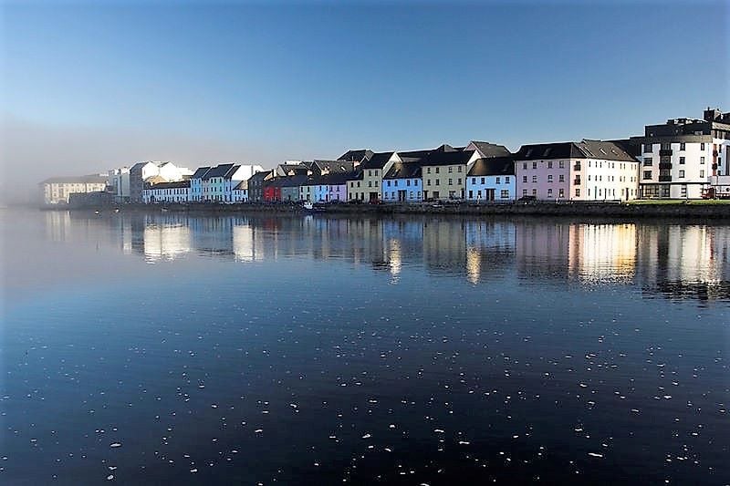
Galway Bay (Ireland's Content Pool)
Today, the city is a growing and thriving university city that offers the best theater in the country. There is also a vibrant nightlife and music can be found everywhere. During the summer, Galway offers many festivals.
Connemara , known for its wild beauty, is located north of Galway City, at the western tip of the county. It is one of the most unspoiled regions of Ireland and a vibrant Irish-speaking area.
The Aran Islands , also an Irish-speaking area, are located 30 miles off the Irish coast. The islands themselves consist of three islands, Inishmore, Inishmaan, and Inisheer.
Inis Móir, meaning Big Island, is eight miles long and two miles wide and has a population of 900. The fort of Dun Aengus is built on the edge of a sheer southern cliff with a defense forest of sharp stone spikes.
Inishmaan means Middle Island. It is three miles wide and two miles long, with fields bordered by high dry stonewalls, and marked by vast sheets of limestone rock. The island peaks at 300 feet and a series of giant terraces slope down to Galway Bay and the Atlantic Ocean. The island has a Gaelic speaking population .
Inisheer is known as the Little Island. It is 27 miles from Galway and covers 1,400 acres. It has a population of about 300. This island is an outcrop of the Burren landscape , consisting of bare limestone that is used for the many cottages, stone walls, roads, and pathways around the island. The Gaelic-speaking island is a haven for birdwatchers and those interested in flora and fauna.
County Kerry
The locals know County Kerry as The Kingdom, a reference to the contrasts you'll see in its astounding scenery, which suggest Ireland in miniature. The climate in Kerry is more unique than other places in Ireland, thanks to the warm waters of the Gulf Stream, and it's actually possible to swim here year round.
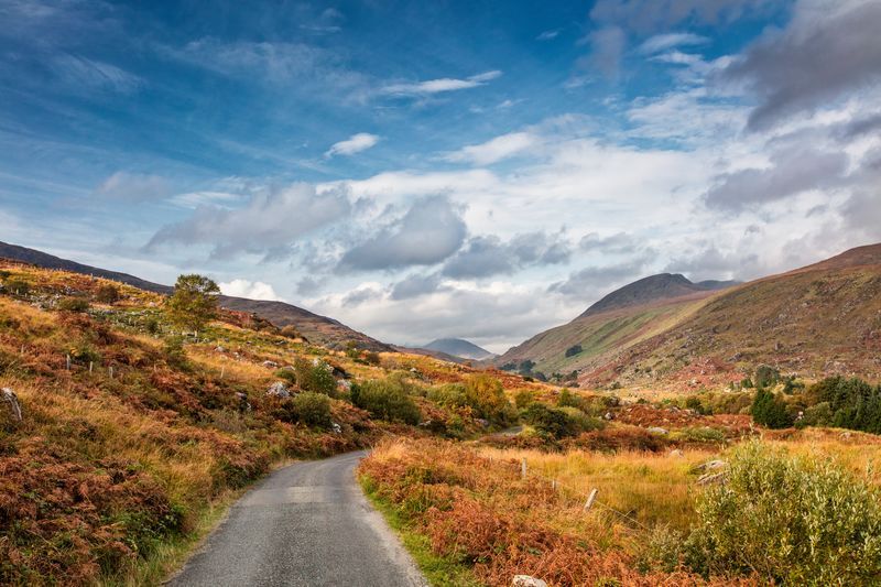
The Black Valley in Kenmare, Co Kerry (Ireland's Content Pool)
Kerry has preserved its heritage in many ways. The oak woods at Derrycunnihy and Tomies, for example, are the last of Ireland's primeval forests. There are many small villages that are still Gaelic-speaking too, adding to the character of the county. Dingle Town is a fishing village that offers a wonderful selection of shops, restaurants, and pubs with traditional music.
The Ring of Kerry is located on the Peninsula of Iveragh. It lies between Dingle Bay and The Kenmare River. It is 110 miles of gorgeous coastal and mountain scenery, enveloping the towns of Killorglin, Glenbeigh, Caherciveen, Waterville, Sneem, Kenmare, and Killarney. Each town has its own personality. The coastal drive is one of the most spectacular sites in all of Ireland.
County Kilkenny
Kilkenny is a county looked on enviously by other counties and not only because of the county's incredible track record in the ancient Irish game of hurling. Kilkenny is a county filled with enchantment and delight. From the spectacular scenery of the Nore and Barrow river valleys to the cultured beauty of Kilkenny City, the county provides the perfect setting for whatever holiday you desire.
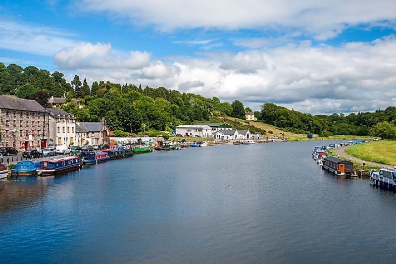
Graiguenamanagh, Co Kilkenny (Ireland's Content Pool)
Known through history as the Marble City because of its distinctive indigenous jet-black marble, Kilkenny City offers a curious, yet the undeniably attractive mix of perfectly preserved old buildings and the vibrancy of a modern city which has made festivals like the Kilkenny Cat Laughs comedy festival, an event with international recognition. St Canice's Cathedral and Kilkenny Castle are extremely important monuments and quality tours are available.
There are plenty of other things to see inside and outside the city and throughout Kilkenny's rural hinterland. Some of Ireland's finest craft studios are to be found in Kilkenny, from pottery to gold and silver-smithing. The experience of seeing a master craftsperson is not one to be missed.
For more physically active tourists, Kilkenny has no limit to the range of choices available. The Jack Nicklaus-designed golf course at Mount Juliet is one of the finest in the state. Arguably the best river wild trout fishing is to be found near Durrow on the River Nore.
The county has numerous ancient sites including Iron Age fortifications, inscribed stones and crosses, castles, and abbeys. The Dunmore Caves in Ballyfoyle are important both for historical and environmental reasons. The site of a massacre of the Irish by Viking raiders in 928, and according to legend, the place where The Lord of the Mice was slain Dunmore is best known these days for the wondrous sight of stalagmites of huge size dominating the chambers.
County Meath
County Meath has traditionally been known as the Royal County, being the seat of the ancient Kings of Ireland at Tara. In the Boyne Valley of County Meath are some of Ireland's most important archaeological monuments, including the Megalithic Passage Tombs of Newgrange, Knowth , Dowth, Fourknocks, Loughcrew, and Tara .
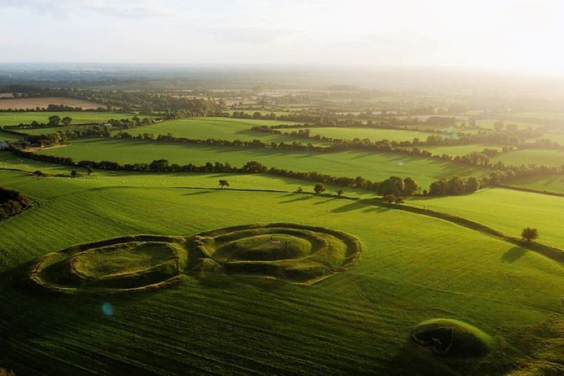
Hill of Tara (Ireland's Content Pool)
Newgrange is the most famous of these prehistoric monuments. It was originally built around 3,100 B.C. and was accidentally discovered in the 17th century.
County Offaly
The heart of the Midlands, County Offaly offers bogs, meadowlands, and undiscovered pastures. Clonmacnoise, located at Shannonbridge on the banks of the River Shannon, is one of the most famous monastic sites.
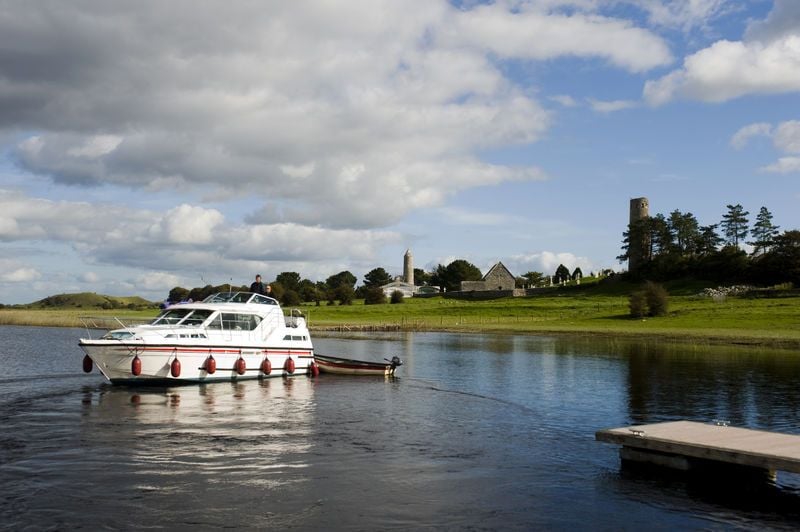
The River Shannon in Clonmacnoise, Co Offaly (Ireland's Content Pool)
Begun as an isolated monastery founded by St. Ciaran in 545 A.D. it is to this day an ecclesiastical site, with ruins of a cathedral, eight churches, and three high crosses.
Irish chieftains, Vikings , and Anglo-Normans plundered Clonmacnoise. Cromwell's forces devastated it beyond restoration. There are guided tours during the summer months; a video presentation at the Visitor Center, and an informative five-mile trail tour of the Blackwater.
County Tyrone
Located in the center of the historic province of Ulster, County Tyrone is blessed with an array of places to visit. The Ulster American Folk Park, for example, is located three miles north of Omagh.
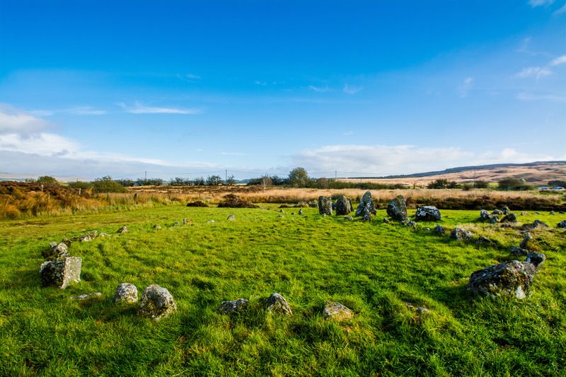
The Beaghmore Stones in Co Tyrone (Ireland's Content Pool)
The Folk Park is an open-air living history museum that explores Ulster's links to the many famous Americans who trace their ancestry to the North of Ireland. The park is comprised of an indoor gallery with information on the causes and patterns of immigration. Outside are a variety of reconstructed buildings of 18th and 19th century Ireland.
Throughout the park are costumed guides and craftsmen that add to the authenticity. Also on site is the Centre for Emigration Studies, an extensive research library. Plan at least half a day to explore the park.
County Wicklow
County Wicklow is often referred to as the Garden of Ireland, due to its breathtaking scenery and located just south of Dublin it makes for a wonderful day trip or overnight stay away from the 'big smoke.'
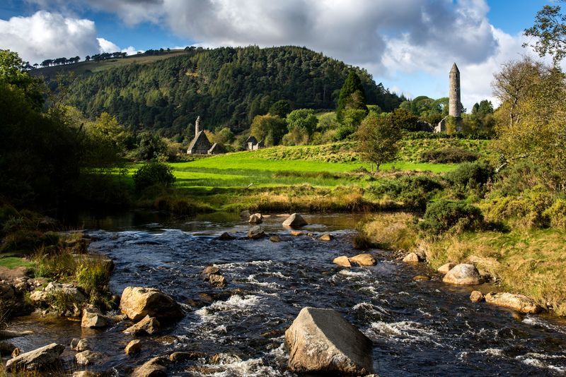
Glendalough in Co Wicklow (Ireland's Content Pool)
Glendalough is a 6th-century monastic site that was founded by St. Kevin.
Nestled in the heart of the Wicklow Mountains it offers a truly spectacular setting, featuring a stone tower that stands 110 feet tall. There is a visitor center and guided tours are available.
Wicklow National Park is an unspoiled natural wonder with nearly 50,000 acres of raw beauty. A drive through the Wicklow Gap from Glendalough to Hollywood is one of jaw-dropping beauty.
Powerscourt is a beautiful upscale estate with some of the finest gardens in Europe.
What's your favorite place to visit in Ireland? Let us know in the comments!
* Originally published in 2013, updated in March 2022.
Related: Antrim Coastline , Aran Islands , Belfast City , Blarney Castle , Cliffs of Moher , Cork City , Dingle , Dublin , Galway City , Ring of Kerry , The Burren , Wild Atlantic Way , Boyne Valley , Kenmare Village , Ireland's Travel Secrets
Reasons to love Ireland in spring: Bucket list travel destinations and fun-filled festivals
Co Clare area is an ‘iconic literary landmark,’ expert says
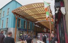
Wexford street becomes Ireland's 'first fully covered street'

What's your Irish County? County Antrim
Beyond the putting green – what to do in the lovely town of Portrush
Dublin attraction rated best in the world by Americans
After living in Ireland for almost one year, this is what I’ve learned
Homemade Irish soda farls recipe
Faces of the Titanic: John Horgan, lost at sea, remains a mystery man
Ireland's 20 "true" hidden gems revealed - from castles to parks to natural wonders!
WATCH: "The Thing" removed from Dublin after years of controversy
Maps Of Ireland
Printable irish county map.
Find the various lists of maps of Ireland, ranging from Administrative to travel friendly maps of Ireland.
Map of Ireland’s Tourism Regions
The map of Ireland’s tourism regions illustrates the various tourist counties in the country. The greyed area is Northern Ireland which is a part of the United kingdom.
The Irish tourism has grown tremendously in the past few years. This is attributed to many factors like the country’s history, culture, natural beauty, and people. Ireland has become a very popular tourist destination with over 20 million visitors coming each year. The number of tourists is increasing each year due to Ireland’s literary legacy and spectacular scenery.
Ireland’s tourist attractions are varied and are linked to its long history as a location of religious, political and educational importance. For example, tourists can visit historical sites such as Newgrange where people have been buried for 5,000 years ago or they can witness the Giant’s Causeway with its myths of giants building it.
Tourism is an industry that relies on sites of natural beauty. It is also one of the most heavily exploited industries in the world. Many people think that tourism should be eliminated entirely or at least regulated, but it’s impossible to do so when the industry has been around for so long.
Provinces and Counties of Ireland Map
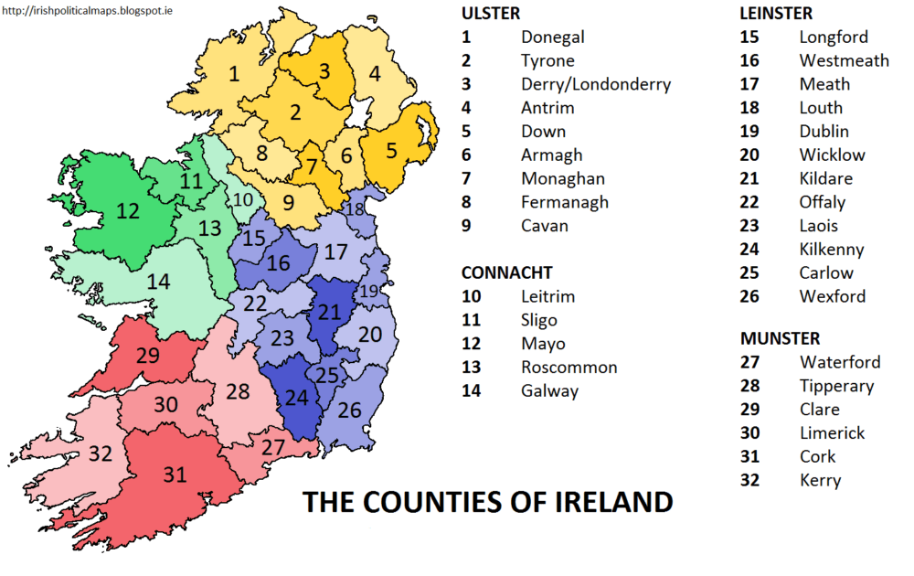
The Republic of Ireland is divided into four Irish provinces . These are Ulster, Leinster, Munster and Connacht. The provinces are further divided into counties which serve as the primary units of local government in the country.

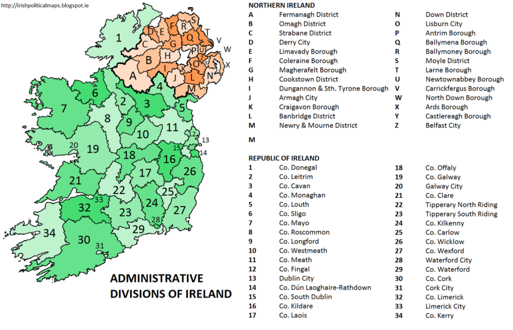
Administrative Map of Ireland
The administrative map of the Republic of Ireland is divided into two constituent parts – Northern Ireland and the Republic of Ireland. Northern Ireland is part of the United Kingdom while the Republic of Ireland is an independent country.
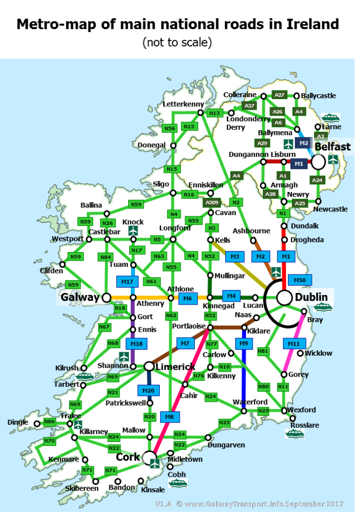
Road Maps Of Ireland
Ireland road map 1.
The road network in the Republic of Ireland is administered by the National Roads Authority. The authority is responsible for the national primary routes, national secondary routes, Regional roads and motorways in Northern Ireland.

Driving in Ireland and its country side
Ireland is a stunning country with many breathtaking attractions. The Irish countryside and the seacoast are also very scenic and beautifully preserved. However, driving in Ireland can be quite challenging as drivers must contend with narrow roads, bad weather and local drivers who may not follow the rules of the road.
Ireland Road Map 2
Ireland has a well developed road network with an extensive system of national primary roads. Motorways are largely confined to the outskirts of the country’s larger cities. Lesser roads are generally single-carriageway apart from some major regional roads which are dual carriageway with some sections being up to motorway standard.
The Irish road network is one of the most heavily trafficked in Europe, leading to significant congestion and delays. In recent years, the government has been lowering the speed limits on national secondary and tertiary routes in order to reduce accidents and improve safety.
Tourists are allowed to drive cars in Ireland with the right insurance, but they must be careful to obey the rules of the road.
Irish Rail Map
The Irish rail network, or Iarnrod Eireann, is made up of two separate networks, the Northern Ireland Railways (NIR) and the Republic of Ireland’s Iarnrod Eireann (IE). The NIR operates trains in Northern Ireland, while the IE operates trains on the island of Ireland.
Even though Ireland is known for its extensive road network, it is still heavily reliant on trains for public transportation between large cities.

Ireland by rail is a great way to explore the country by train. It may be the most scenic way to get around Ireland and enjoy the country’s magnificent countryside. The railway system in Ireland is very well developed. More than 18,000 miles of track crisscross the country and links towns, villages and cities together. The railway network in Ireland stretches for over 2,500 miles. This network connects virtually every town and village with at least one station to the other parts of the island.
The Irish railway network is operated by a single state company called Iarnród Éireann that provides passenger train services across the island of Ireland, from Belfast in Northern Ireland to Cork, Dublin and Galway in Southern Ireland.
The idea of travelling by train in Ireland is one which many people find appealing. Tours are available in every province, and because trains go to both Ireland’s beautiful seacoast and its mountainous interior, it is often possible to see the beautiful green countryside on the way to your next destination.
Airports Map Ireland
Ireland has 4 international airports: Belfast International Airport (BFS), Cork Airport (ORK), Dublin (DUB), and Shannon (SNN). There are also smaller regional airports like Galway Airport, Donegal Airport, Sligo Airport, Waterford Airport and Kerry Airport. Dublin airport is the largest airport in Ireland with an annual passenger capacity of over 22 million people per year with over 100 airlines flying into it annually. Dublin airport has the most passengers of any airport in Europe – about half of Ireland’s population travels through Dublin airport every year!
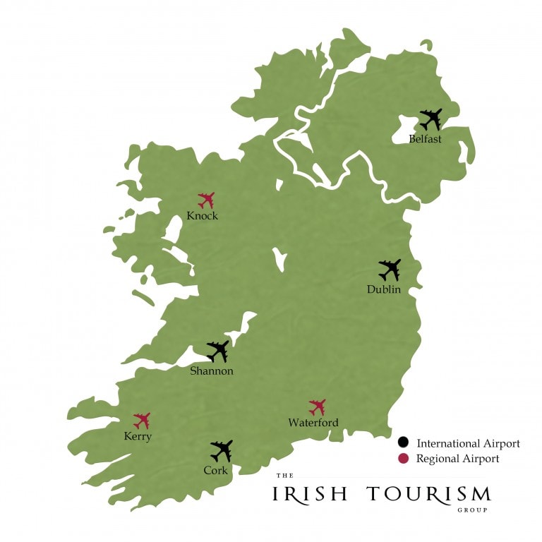
Knowledge check time. If you have been to Ireland then it should be easy for you to list all counties on this blank Ireland map. Go ahead print this blank Ireland map and test your knowledge. Its fun try it. The list of counties is given at the bottom for your assistance.
Google Map Of Ireland
Visit Aerfortel for more details about our airport hotel services .
Related Articles
The 4 Provinces Of Ireland
Consider These Top 12 Airport Hotel Benefits Before Your Next Travel and Holiday Plans.
The Best Airport Hotel Loyalty Programs in Ireland and the UK
Regions of Ireland
In this section.
- Special Offers
- Ireland Vacation Information
- Vacation Reviews
- Map of Ireland
- About Ireland
- Bed and Breakfast
- Flying to Ireland
- History of Ireland
- Practical Information
- Travel Tools
- Activities & Sports
Ireland Travel - Explore the best ways to travel around Ireland's regions
While traditionally Ireland is made up of four counties, Munster, Ulster, Connaught and Leinster, travelling through our website one may note that Ireland is divided into 7 separate tourist regions each defined by their location and the many different cultural and scenic delights they all offer the visitor on their Ireland vacation . The South West Region: Consists of two of Irelands most beloved and scenic counties Kerry and Cork. Fromthe Ring of Kerry, the Skelligs, Dingle and Carrauntoohill in Kerry to Cork counties Blarney Castle, its charming city and the delights of the remote and beautiful West Cork region, the southwest is one of Ireland most popular regions for visitors. The Shannon Region: Consists of counties Clare and Limerick. Clare has an abundance of visual riches with the Cliffs of Moher, Bunratty castle, the unique landscape of the Burren region and a fine tradition of Irish music. Limerick is a county of quiet beauty and rural charm with a city rich in history. The South East Region: The counties of Carlow, Kilkenny, Tipperary, Waterford and Wexford make up the sunny southeast. Highlights include Waterford, Irelands oldest city, home to the world famous Waterford Crystal, Wexford famous for its seaside resorts and Opera festival, the Celtic relics in Carlow, the medieval city of Kilkenny and the golden vale landscape of Tipperary site of the Rock of Cashel. The West Region: On the very edge of Europe lie the West counties of Galway, Mayo and Roscommon. Taking in wild romantic and rugged scenery and coastlines, great walks and the unique culture of Galway the west is a popular region. Highlights include the famous Connemara national park, Croagh Patrick, Galway city and the Aran Islands. The East Coast & Midlands Region: The area consists of 8 counties: Kildare, Laois, Longford, Louth, Offaly, Meath, Westmeath and Wicklow with areas of sunny coastlines and rich inland landscapes. From the home of Irish civilisation in Newgrange and the Hill of Tara the seat of the High Kings in Meath to the present day modern capital Dublin, the midlands come with a range of attractions from Kildares horse racing centre to Wicklow the garden of Ireland and everything in between. The North West Region: Comprising of the counties of Cavan, Donegal, Leitrim, Monaghan and Sligo, this is probably Ireland’s most romantic region with small villages and a green landscape. From wild scenic coastline of Donegal and Sligo the centre of surfing to the inland regions of Leitrim, Monaghan and Cavan with their canals, lakes, mountains and scenic walkways, the NorthWest is an understated region that provides the visitor with a welcome break from the city. Northern Ireland: Takes in the counties of Antrim, Armagh, Down, Fermanagh, Londonderry and Tyrone. Famous as much for its magnificent scenic landscape as it is for its culture and history rich cities of Derry and Belfast. Scenic highlights include the World Heritage site of the Giant's Causeway, the Mourne Mountains and the Glens of Antrim.
Get discounts and updates for Discovering Ireland Vacations
Sign up now for the official Discovering Ireland Vacations Update e-newsletter, designed to keep you up-to-date on what's new and exciting at Discovering Ireland and indeed in Ireland travel itself! You will also be among the first to know about our great special offers, vacation in Ireland deals and trip to Ireland cost!
Sign Up for News and Offers
Start planning your vacation... enquire now.
Interactive Map of Ireland
Clickable counties / cities.
- Add Unlimited Number of Clickable Pins
- Professional Looking and Clean Script
- Responsive and Mobile Friendly
- One-Time Purchase, No Annual Fees
- Free Life Time Updates
- Tech Support Experts
Try before you buy, [ Download Free Trial ]
Limited-time discount using coupon code LIMITEDCGT
DOWNLOAD NOW $ 17
Download Free Trial
Interactive Map of Ireland - Clickable Counties / Cities
The interactive template of the map of Ireland gives you an easy way to install and customize a professional looking interactive map of Ireland with 32 clickable counties, plus an option to add unlimited number of clickable pins anywhere on the map, then embed the map in your website and link each county/city to any webpage.
Main Features
- One-time purchase, no annual or subscription fees.
- SVG (Scalable Vector Graphics) based, responsive and fully resizable.
- Works perfectly on desktop and mobile devices (smartphones).
- Counties can be customized independently (colors, link, hover information, activate/deactivate, etc).
- Pins can be customized independently (shape: circle/square, size, position, colors, link, hover info., etc).
- You can link each county/pin to any webpage or open a modal window. Note : The modal window option works only with Bootstrap framework, if you are not sure or if you don't know how to use it, you need to ask your website template / WordPress theme provider.
- Easily customized through simple JavaScript files ( NO JavaScript knowledge required ).
- The map consists of HTML/CSS/JS files. Also include installable WordPress plugin zip file and customized by manual editing of simple JS files.
- You can embed as many maps as you want in the same website in different pages, (for WordPress you can install up to 3 instances of the map plugin but you can use the shortcode as many times as you want in different pages).
- Small file size > Fast loading speed > SEO friendly.
- Full documentation is included with an interactive X, Y coordinates guide.
- We encourage customers to read the description, use this coupon code TOREAD in the checkout page to get 10% discount.
List of the clickable counties in the map of Ireland
Each county can be customized independently (colors, link, hover information, etc).
- Londonderry
Frequently Asked Questions
Will be there any future fees, as a subscription or for hosting the map.
No, this is a one-time purchase and you immediately download a fully working map files and we don't keep any of your map files on our servers.
Can I merge/split areas?
That would require editing the map SVG and modify the script, and that's out of the specification of the map but we offer that as a customization service for extra cost, you can contact us for a quote.
How to get the X, Y coordinates of pins? can I use latitude and longitude?
The included documentation has an interactive X, Y coordinates map guide, you just need to click anywhere on that map to obtain the X, Y coordinate values and use them in your map. We manually draw all our maps for highest quality and best performance, so the final map is graphical map not a geographical map so latitude and longitude will not work with it.
Can I add an image in the hover popup?
Yes, you can write any text and add images and the popup will expand as needed. However we recommend that you keep the content of the hover popup basic for better user experience, if you want to have more detailed information about counties you can write them in sections below the map and give each section an ID, and use that id instead of the link in the map files, so when a user clicks a county the page will go to the corresponding section of the page.
Is this map responsive? Can I resize it?
Yes, it’s SVG based (No Flash) and it's responsive and fully resizable, the map size is automatically adjusted depending on the container/device size, however you can manually adjust the map size by editing the map CSS file.
Is this map for a Standard website or for a WordPress website?
The purchased files include both versions; one for a standard website with HTML/CSS/JS files and an installable WordPress plugin zip file for WordPress websites. Both versions customized by manual editing of simple JavaScript file(s) (JavaScript knowledge is not required). The documentation include detailed information about both versions.
Can I install the map in Wix, Weebly, Drupal, Joomla, etc?
Unfortunately, we don't have enough knowledge about those platforms. In general, you need to have full access to your website page code to embed the map HTML code and be able to upload the map supporting CSS/JS files and link them to the map code.
Do you offer special customization if needed?
Yes, we offer customization service for extra cost, please contact us for more details.
Home | Contact Us | License | Refund Policy | Site Map COPYRIGHT © All rights reserved to html5interactivemaps.com
Free Trial Download
The free trial version include almost identical map to the premium maps including full documentation but for a generic map (the back script file is also included but minified, however you will not need to edit that file even in the premium maps).
Download and install this map in your website and test it for free. And let us know if you need any help with installation or have any questions about customization.
Once ready, go ahead and purchase the premium map of the wanted continent, country, state, etc.
Open a Modal Window
You can choose to open a modal window like this one instead of opening a link, so you can add as much information as you want including text, images, links, etc
The modal window option works only with Bootstrap framework, if you are not sure or if you don't know how to use it, you need to ask your website template / WordPress theme provider.

- Tips & Info
- Inspiration
- Explore Cork App
- Conferences
Things To Do
Food & drink, plan your trip, what's on in cork.
Bounce in a club with Pure Cork pizzazz, revel in a festival or kick back to some jazz. Catch an intimate gig in a pub with a fire or watch a horse race with locals that comes down to the wire…
Things to do in Cork
Kayak around the city or head north for a hike, see Dursey by cable car and explore Beara by bike!
Stay in Cork
Find a charming old cottage or quiet hotel, in our old merchant city or near the sound of sea swell…
Food & Drink in Cork
Sink a cool pint of stout as the fireside roars, there’s a plate of fresh seafood and the name on it is yours…
From public transport to fish and chips. Read our list of handy Pure Cork tips.
- Getting to Cork
- Getting Around Cork
- Wild Atlantic Way
- Ireland's Ancient East
- View Itineraries
- Download a map of Cork
- Tourist Information Offices
- Helpful Information
- Destinations
- Ireland's Gateway
- Weather & Climate
Download a Map of Cork
Download a copy of the official tourist map for Cork which shows all the main attractions in the city and county.
Click or tap on the red buttons below to view the Pure Cork map in your preferred language. This is the official tourism map for Cork city and county. The maps are in PDF format.
Here we are!
Historic Town Maps
A series of beautiful, high quality heritage maps of some of Cork's towns.
Castletownbere
Charleville
Mitchelstown
- Cork Business Tourism
- Pure Cork Brand
- Add a Business
- Add an Event
- Art, Culture & Heritage
- Performance
- Cinema & Film
- Theatre & Comedy
- Sports & Outdoors
- Food & Drink Events
- On The Water
- Outdoor Activities
- Attractions
- Nature & Gardens
- Food Experiences
- Clubbing & Nightlife
- Sacred & Spiritual
- Learn English
- Guesthouses
- Self Catering
- Caravan & Camping Parks
- Restaurants
- Acceptable Use Policy
- Privacy Policy
- Terms of Use
- Accessibility
- Sustainability
- Copyright 2017.
- Website by Batucada Digital Ltd.
Cookies & Privacy
Pure Cork website use cookies. By continuing to browse the site you are agreeing to our use of cookies. For more details about cookies and how to manage them see our cookie policy
More information Accept

Printable Ireland Map – Map of Ireland with Counties [PDF]
- December 20, 2023
- Labeled Country Maps
Do you need a printable Ireland map ? Then check out our different versions of a map of Ireland with counties ! All of them are available for free as PDF files. You can download and print them as many times as you like.
A county map of Ireland is a great tool to learn about the administrative divisions of the Republic of Ireland. You can use all maps on this page for free for your teaching, learning, professional, and personal purposes.
And we also provide a blank map of Ireland as an additional resource for your collection!
Map of Ireland Counties
The Republic of Ireland is located in the northwestern part of Europe. It has four provinces (Leinster, Munster, Connacht, and Ulster) divided into counties. Our first map shows all of these counties but no cities or towns. The neighboring country of Northern Ireland is included as well.
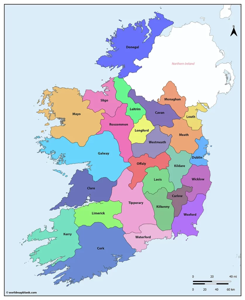
Download as PDF (A4) Download as PDF (A5)
Download the map in the desired format by clicking one of the links above. Please scroll down further if you need a more detailed map of Ireland. We also have maps with county seats and towns.
How Many Counties are in Ireland?
Ireland has 26 counties, 3 cities, and 2 cities and counties. These include Carlow, Cavan, Clare, Cork, Cork City, Donegal, Dublin City, Dún Laoghaire-Rathdown, Fingal, Galway, Galway City, Kerry, Kildare, Kilkenny, Laois, Leitrim, Limerick, Longford, Louth, Mayo, Meath, Monaghan, Offaly, Roscommon, Sligo, South Dublin, Tipperary, Waterford, Westmeath, Wexford and Wicklow.
The original Dublin County has been further divided into the local government areas of Dublin City, Dún Laoghaire-Rathdown, Fingal, and South Dublin. The latter three now have country status.
Ireland County Map with Capitals
The three most populated counties (as of 2022) are Dublin City (590,000), Cork (359,000) and Fingal (329,000). The smallest counties by population are Leitrim (35,000), Longford (47,000) and Carlow (62,000).
Our following map shows the original 26 counties and their capitals or county towns.
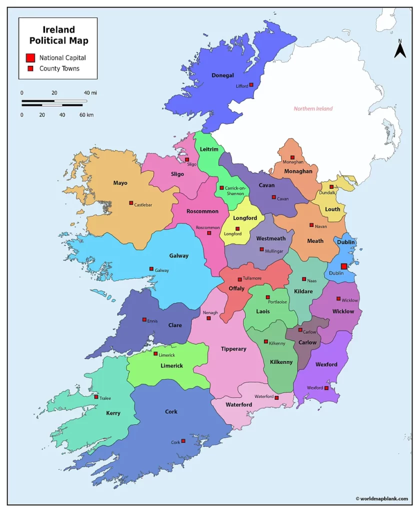
Here is a list of the current Irish counties with their administrative centers:
- Carlow – Carlow
- Cavan – Cavan
- Clare – Ennis
- Cork – Cork
- Cork City – Cork
- Donegal – Lifford
- Dublin City – Dublin
- Dún Laoghaire-Rathdown – Dún Laoghaire
- Fingal – Swords
- Galway – Galway
- Galway City – Galway
- Kerry – Tralee
- Kildare – Naas
- Kilkenny – Kilkenny
- Laois – Portlaoise
- Leitrim – Carrick-on-Shannon
- Limerick – Limerick
- Longford – Longford
- Louth – Dundalk
- Mayo – Castlebar
- Meath – Navan
- Monaghan – Monaghan
- Offaly – Tullamore
- Roscommon – Roscommon
- Sligo – Sligo
- South Dublin – Tallaght
- Tipperary – Clonmel and Nenagh
- Waterford – Waterford
- Westmeath – Mullingar
- Wexford – Wexford
- Wicklow – Wicklow
Ireland Map with Counties and Towns
Ireland is an island in western Europe surrounded by the North Atlantic Ocean. It consists of the Republic of Ireland and Northern Ireland, the latter belonging to the UK. The Irish Sea, the North Channel, the Celtic Sea, and St. George’s Channel separate the “Emerald Isle” from Great Britain.
The major cities in the Republic of Ireland are its capital, Dublin (1.2 million), Cork (221,000), Limerick (94,000), and Galway (84,000). In Northern Ireland, the largest cities are Belfast (639,000) and Londonderry (84,000).
The Republic of Ireland has been a member of the European Union since 1973 (as shown on our EU map labeled ) and uses the Euro.
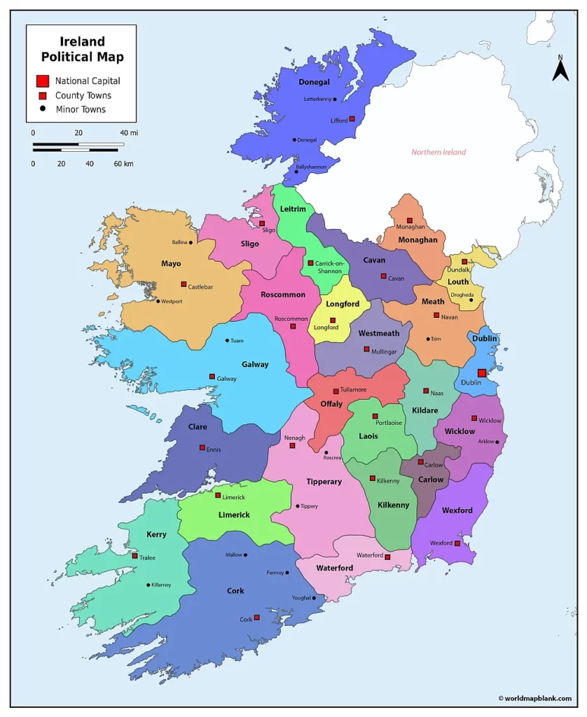
The map above shows the county boundaries, county towns, and additional smaller towns. It also includes the boundary of Northern Ireland.
Printable Ireland Map
The longest rivers in Ireland are the River Shannon (224 miles or 360 kilometers), the River Barrow (119 mi or 192 km), and the River Suir (114.5 mi or 184 km). The River Shannon is also the longest river in the British Isles.
Ireland has numerous large lakes, which are called loughs . The largest lake in the Republic of Ireland is Lough Corrib in Galway, with an area of 395 km² and a maximum depth of 25 m. The deepest lake is Muckross Lake in Kerry, with a maximum depth of 75 meters (246 ft).
Our following printable Ireland map does not include county borders but shows towns, main roads, railroads, and airports.
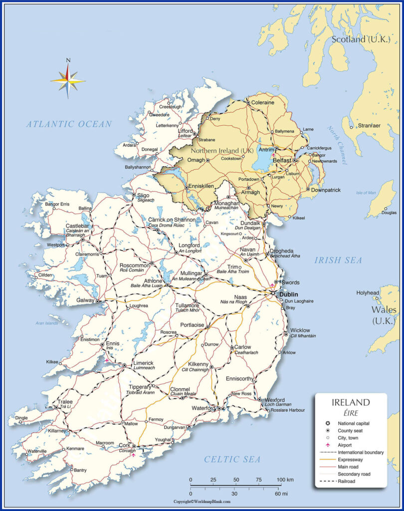
Download as PDF
Do you want to use our maps to learn or teach about the geography of Ireland? Then, download a free and printable blank map of Ireland from our site!
More Free and Printable Maps of the World
Below, we have compiled a collection of links to other exciting maps. If your desired map is not included, you can use the search feature at the top of this page. Please feel free to also send us a message via our contact form . Just tell us precisely what kind of map you need, and we will try to create it for you.
All of our maps can be downloaded free of charge as PDF files. Additionally, we offer a constantly increasing number of map worksheets with fun and interactive learning activities. Check them out!
- Country Maps
- Outline Map of Ireland
- UK Blank Map
- Map of Italy with Cities
- Blank Map of Italy
- Germany Map Outline
- Map of Germany with States
- France Map Outline
- Map of France with Regions
- Map of Australia with States
- Blank Map of Canada
- Provinces Map of Canada
- Italy Map with Regions
- Blank Map of Norway
- Continent Maps
- Blank Map of Asia
- Asia Mountains Map
- Blank Map of Africa
- Printable Map of Europe
- Blank Map of Europe
- Map of Australia with Capital Cities
- Blank Map of Australia
- South America Map Labeled
- Blank Map of South America
- Blank World Map
- World Map with Continents
- Map of the World with Countries
- Printable World Map for Kids
- United States Map with State Names
- Blank US Map
- US Interstate Highways Map
- California Map With Cities
- Blank Map of California
- Blank Map of Texas
With maps created by:

Edelweise Shane Angeles
Related posts.
World Map Blank and Edelweise Shane Angeles
- Labeled Maps
- Mountain Maps


Read our Blog!
Plan your route with the MyDiscoverIreland and explore the lesser-known hidden gems!
With normal route planners providing the most direct route, tourists have no idea of the attractions or hidden gems they may be driving by.
MyDiscoverIreland will give you the direct route AND show you what you can visit nearby. These tourist hotspots and lesser known destinations include cultural attractions, museums, outdoor activities, historic and scenic areas. Click on the icons to see if you want to visit and add it to route. MyDiscoverIreland will automatically generate new itinerary completed with directions, estimated fuel cost per trip, distances in KM/Miles and trip duration.
MyDiscoverIreland Guide My Discover Ireland website provides updated guide on visiting Ireland and travel tips on where to go! Visit website here
- Google Plus

IMAGES
VIDEO
COMMENTS
Ulster. North part of the island including counties Cavan , Donegal and Monaghan in the Republic of Ireland and counties Antrim, Armagh, Down , Derry, Fermanagh , Tyrone . You're part of the global Irish diaspora but still haven't managed to visit your home? Explore Ireland online today with the help of our interactive map.
Map of Ireland with places to visit. With our interactive Ireland map, all the must-see attractions in Ireland and Northern Ireland are just one click away. Here you'll find a comprehensive overview of scenic highlights, cliffs, beaches, castles, antiquities, gardens and much more. Filter: reset. Learn more.
Sligo, Mayo, Galway, Leitrim, Roscommon. If you need a detailed map of Ireland, we now recommend Google Maps. Our website has over 2000 pages of content to help you plan your dream vacation to Ireland, whether its more information about Ireland and its' history, our vacation packages, escorted coach tours of ireland or activity vacations, feel ...
Large detailed map of Ireland with cities and towns. 3049x3231px / 4.24 Mb Go to Map. Ireland physical map. 1769x2241px / 2.32 Mb Go to Map. Ireland tourist map. 1167x1629px / 1.6 Mb Go to Map. Road map of UK and Ireland. 4092x5751px / 5.45 Mb Go to Map. Ireland location on the europe map.
Interactive travel and tourist map of Ireland: click on icons and writings on the map to open web links. Guinness beer, stunning nature and friendly people will make you forget the inclement weather of the Emerald Isle. Republic of Ireland. Population: 5.011.500. Area: 70.273 sq.km.
Mayo. On the west coast of Ireland lies County Mayo, whose name derives from the Irish Contae Mhaigh Eo, which means "plain of the yew trees.". Formed in 1585, County Mayo is one of the most beautiful counties in Ireland. It is home to Achill, Ireland's largest island off the county's west coast.
Tourist map of Ireland Author: mytouristmaps.com Subject: Travel and tourist map of Ireland, pdf map with direct links to accommodation, official tourism websites, top sights and attractions. Keywords: travel tourist map ireland Created Date: 6/3/2021 5:58:57 PM
Ireland is the 2 nd largest island of the British Isles and lies in the west of Great Britain. It shares a land border with Northern Ireland (a recognised constitutionally distinct region of UK). Ireland is bounded by the Atlantic Ocean - by the Celtic Sea in the south; by the St. George's Channel in the southeast and by the Irish Sea in ...
Large detailed map of Ireland with cities and towns Click to see large Description: This map shows cities, towns, highways, main roads, secondary roads, tracks, railroads and airports in Ireland.
How the map was created. Ahead of a recent Irish road trip, I asked the 220,000+ strong #IrishRoadTrip community for their recommendations of the best things to do in Ireland - thousands of people commented, emailed and DM'd.. I took these recommendations and combined them with personal experiences from my own travels along with recommendations from family and friends.
Each county across Ireland has its own unique story and our bespoke Explore Ireland map will help you discover every corner of the island. IrishCentral Staff. @IrishCentral. Feb 17, 2024. Discover ...
Festivals in Ireland; Unique sights; Architecture and monuments; Leisure and attractions. Attractions and nightlife; Extreme country spots; Parks and lanscapes; Soul of Ireland. Cuisine and restaurants; Traditions and lifestyle; Festivals and celebrations; Languages & religions; Family trip with kids; Shopping; Tips for tourists; Maps of ...
Neighbors: Northern Ireland and United Kingdom. Wheelchair access: limited. Categories: sovereign state, island country, OECD country and locality. Location: Britain and Ireland, Europe. View on OpenStreetMap. Latitude of center. 53.1° or 53° 6' north. Longitude of center. -7.7° or 7° 42' west.
Tourist Map of Ireland. Tourist Map of Ireland showing the republic boundary, national capital, famous cities, and tourist places in Ireland. Description : Map showing the various tourist attractions, travel destinations and boundaries of Ireland. The travel map of Ireland is something every visitor to the country must carry.
Dublin. 46 sq mi (118 sq km) 590,000. Dún Laoghaire-Rathdown. Dún Laoghaire. 49 sq mi (127 sq km) 235,000. Fingal. Swords.
County Antrim. Belfast City (in Irish, Béal Feirste) is the capital of Northern Ireland and is located in County Antrim, one of Ireland's most visited counties.History and politics have always ...
The map of Ireland's tourism regions illustrates the various tourist counties in the country. The greyed area is Northern Ireland which is a part of the United kingdom. ... Provinces and Counties of Ireland Map. The Republic of Ireland is divided into four Irish provinces. These are Ulster, Leinster, Munster and Connacht. The provinces are ...
Find local businesses, view maps and get driving directions in Google Maps.
Ireland Travel - Explore the best ways to travel around Ireland's regions. While traditionally Ireland is made up of four counties, Munster, Ulster, Connaught and Leinster, travelling through our website one may note that Ireland is divided into 7 separate tourist regions each defined by their location and the many different cultural and scenic delights they all offer the visitor on their ...
Interactive Map of Ireland - Clickable Counties / Cities. The interactive template of the map of Ireland gives you an easy way to install and customize a professional looking interactive map of Ireland with 32 clickable counties, plus an option to add unlimited number of clickable pins anywhere on the map, then embed the map in your website and link each county/city to any webpage.
Download a Map of Cork. Download a copy of the official tourist map for Cork which shows all the main attractions in the city and county. Click or tap on the red buttons below to view the Pure Cork map in your preferred language. This is the official tourism map for Cork city and county. The maps are in PDF format. PURE CORK MAP (English).pdf.
The smallest counties by population are Leitrim (35,000), Longford (47,000) and Carlow (62,000). Our following map shows the original 26 counties and their capitals or county towns. Download as PDF (A4) Download as PDF (A5) Here is a list of the current Irish counties with their administrative centers: Carlow - Carlow. Cavan - Cavan.
MyDiscoverIreland will give you the direct route AND show you what you can visit nearby. These tourist hotspots and lesser known destinations include cultural attractions, museums, outdoor activities, historic and scenic areas. Click on the icons to see if you want to visit and add it to route. MyDiscoverIreland will automatically generate new ...