- Best Hikes In The World
- Appalachian Trail
- European Hikes
- Nepal Hikes
- Patagonia Hikes
- See All Hikes
- Mount Kenya
- Mount Kilimanjaro
- Mount Toubkal
- See All Mountains
- South Africa
- New Zealand
- Switzerland
- United Kingdom
- Packing Lists

Tour de Monte Rosa – A Classic Alps Hiking Route

Europe , Hikes , Italy , Switzerland

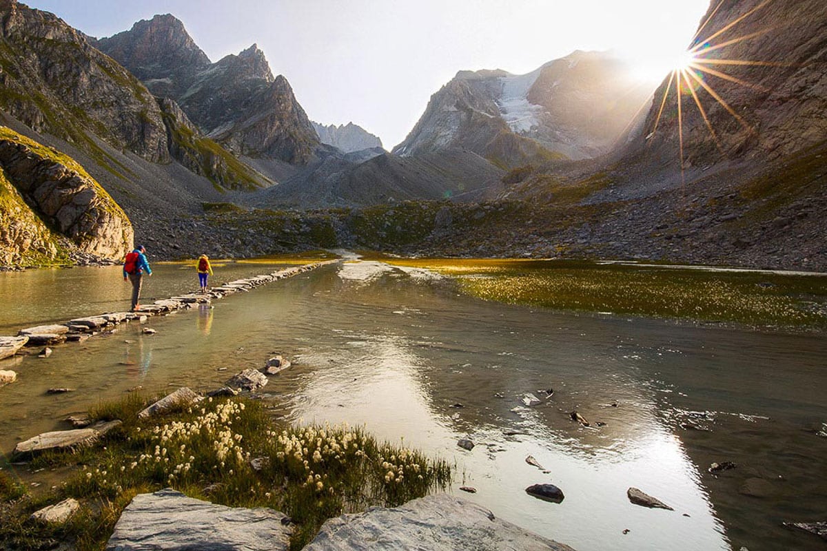
With ten peaks reaching higher than 4,000 meters, the Monte Rosa massif is one of the most impressive in the Alps . It is fair to say that the 9 day Tour de Monte Rosa trek, around the massif, is one of the best hiking routes in Europe .
The hike provides an epic mixture of awesome mountain-scapes across two great European states.
From hushed mountain passes to green valleys dotted with wooden Swiss Chalets during the first half of the hike, to the tranquility of remote Italian mountain villages during the latter stages of the trek, the Tour de Monte Rosa provides a great alternative to the Tour du Mont Blanc .
But do be aware, despite being one of the most scenic treks in the Alps, the route is strenuous , particularly the 3,295m high crossing of the Theodul Pass!
Join a Matterhorn Highlights Hike
Book with our recommended local guide
Tour de Monte Rosa Overview
The Tour de Monte Rosa is a long, multi-day hiking trail covering a total distance of 162 kilometers and gains more than 13,000 meters of altitude over 8 to 10 stages.
The highest point reached on the hike is 3,295 meters.
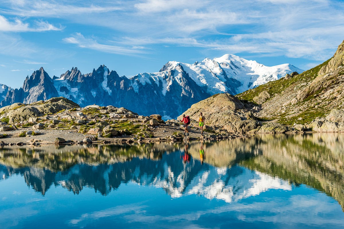
Most people start their hike in Täsh, Switzerland going in an anti-clockwise direction. Resting just to the east of the Matterhorn, the stunningly beautiful Monte Rosa is situated at the border between Switzerland and Italy .
The Tour de Monte Rosa provides a perfect opportunity to experience the different valleys in both countries.
On the circular hike you will pass some heavily glaciated areas, be afforded many scenic views of the highest peaks in Switzerland and take on some of the highest mountain passes in the Alps. The route will bring you to famous towns such as Zermatt, Aosta and Saas Fee, while crossing the notorious Europaweg.
You may also like : hiking in Switzerland
Tour de Monte Rosa Pros & Cons
Here's what we like and dislike about the Monte Rosa hike.
- Incredible views of the Monte Rosa massif and the Matterhorn
- Hike in two countries - Switzerland and Italy!
- Walk the amazing Europaweg between Grächen and Zermatt - this route is considered by many to be the most beautiful 2-day hike in the Alps
- Spend the night in some of the most famous European mountain huts
- More expensive than standard camping hikes due to the use of mountain huts
- Physically challenging, not for the faint-hearted
Monte Rosa Hike Route Map
This map illustrates the Tour de Monte Rosa.
Most people start their hike in Täsh or the Saas Fee.
The route is normally done in an anti-clockwise pattern but if you want to make the route a little easier then a clockwise plan is better as the ascents are more gradual.
You will need to cross Theodul Pass (3,295m), which is one of the highest passes in the Alps.
For an excellent guidebook and map we recommend Hilary Sharp's The Tour of Monte Rosa: A Trekker's Guide .
Monte Rosa Trail Altitude Profile
In the chart below you can see the altitude profile of the full hike. It is quite clear there is a lot of altitude to be gained over the stages. The heighest point is 3,295 meters. You can see that there are a few strenuous stages reaching high mountain passes that will require great effort.

This profile was produced by Trace de Trail and shows the altitude profile for the hike as well as the ultra marathon!
Tour de Monte Rosa Itinerary
Below we have laid out the most popular version of the Tour de Monte Rosa route – 9 days, starting and finishing in Saas Grund. The itinerary includes approx. distances, hiking times and elevation changes.
Day 1: Saas Grund – Macugnaga
Ascent: 650m Descent: 1500m Hiking time: 6-8hrs
The Monto Moro pass sitting at 2,853m is your first major col of the journey. Soon after you will reach the Italian part of the trip. Cameras will be much used since you will have great views of the Monte Rosa massif and an impressive look onto the Macugnaga wall.
Day 2: Macugnaga to the Rifugio Pastore
Ascent: 1450m Descent: 1300m Hiking time: 7-8hrs
A great route over the Colle del Turlo while you reach the valley of Alagna. The Monte Rosa will be out of view, but not for long.
Day 3: Alagna to Col d’Olen
Ascent: 1750m Descent: 560m Hiking time: 7-8hrs
A lot of altitude gain today, since you will need to reach Bocetta delle Pisse before descending to Alpe Pianlunga. You can spend the night at a rifugio close to lake Gabiet.
Day 4: Col d’Olen to Resy
Ascent: 1050m Descent: 1300m Hiking time: 6-8hrs
When you reach the Gressoney valley you will truly feel yourself in the Italian Alps. Enjoy an Italian coffee while admiring the impressive Monte Rosa. But don’t depart too late, since there still is an ascent to complete before reaching the refuge at Resy, which is a stunning location.
Day 5: Resy to the Matterhorn!
This is one of the highlights of the trek as you begin with a wonderful traverse towards the meadows of Alpe Varda and Alpe Mase. Soon you will gain views of the Breithorn while you’re climbing towards the Colle Superieur delle Cimes Blanches 2982m. From the top of the pass you gain first views of the Matterhorn, 4478m. After a short descent, your ascent continues to Theodul Pass at 3295m, where you spend the night.
Day 6: Theodul Pass – Zermatt
Descent: 1700m Hiking time: 5hrs
An easy day since all you need to do is descend. Your day starts with the crossing of the glacier before passing Gandegg and on towards the Mattertal.
Day 7: Zermatt to the Europahutte
Ascent: 850m Descent: 300m Hiking time: 6hrs
A pleasant start to the day since you head down the Mattertal before climbing steadily alongside the Europweg, a high mountain route. Be careful of rockfall, since this is unstable terrain. Spend the night in the Europa hut.
Day 8: Europahutte to Grachen
Ascent: 500m Descent: 850m Hiking time: 6-7hrs
Your hike along the Europaweg continues by crossing boulder fields with stunning views.
Day 9: Grachen to Saas Grund
Ascent: 1300m Descent: 1200m Hiking time: 6-7hrs
Even though it’s the last day of the Tour de Monte Rosa, you will finish in style, since this is one of the most stunning paths in the Alps.
Monte Rosa Hiking Video
A beautiful video overview of the Tour de Monte Rosa by valsesiaincoming1 .
Tour de Monte Rosa FAQ
When is the best time to trek the tour de monte rosa.
The best time to tackle this high-level trek around the Monte Rosa massif depends on the amount and timing of the previous winter’s snowfall and the onset of cold weather in the autumn.
Since the route crosses high passes (Theodul at 3295m), snow can create dangerous conditions. Therefore in a normal year it is not advisable to set out before early July .
In the summer months, July and August, the trail is busiest, temperatures can rise to 25 degrees, but thunderstorms or a dump of snow is possible as well.
By the end of September huts will close and it might get a lot harder to complete the trek.
How much does the Tour de Monte Rosa trek cost?
Guided trekking tours of the Tour de Monte Rosa will cost in the region of $1,500-$2,000.
This will include mountain hut accommodation, food throughout the trek and luggage transfers between each stage, which will allow you to enjoy the hike with just a small backpack. You will also be accompanied by an experienced guide.
The trek can however be done unsupported. The cost would be in the region of $1,000. A DIY trek would mean carrying more weight in your backpack and some planning of logistics in the weeks / months before.
How difficult is the Tour de Monte Rosa trek?
Hiking the Tour de Monte Rosa is strenuous and demanding. Make sure your are physically and mentally fit for the trek. There are many steep, uphill sections to conquer, with over 13,000m of altitiude gained throughout the circuit. You need to ensure you are in shape for the physical demands of this route. Mental fitness is as important and often go hand in hand.
The Tour de Monte Rosa is doable for any fit mountain walkers who are able to hike between 5h and 8 hrs per day for several days in a row.
Please note : there are a few sections where you can use public transport to shorten your hike if you are struggling.
Are permits needed for the Monte Rosa trek?
No permits are required to the Monte Rosa circuit trek.
Is altitude sickness a risk on the Monte Rosa trek?
No, you will not cross passes any higher than 3,300 meter, and since you’re hiking slowly to this altitude, you have more than sufficient time to acclimatize.
Most people don’t feel any symptoms of altitude sickness before reaching 3000-3500 meter. But this is when they haven’t spent enough time acclimatizing.
What gear do I need for the Monte Rosa?
To do a serious hike like the Tour de Monte Rosa you will need appropriate layered clothing, including a warm insulated jacket and a hard shell waterproof layer .
Some comfortable lightweight trekking boots are a must to enjoy this trek, while good waterproofs are essential, not only to protect you against rain or snowfall but to double as windproofs. Since you’ll be crossing passes of more than 3000 meters, gloves and several base / second layers may prove useful. Trekking poles are a good way to not overload your knees and ankles.
If you are hiking unsupported you will need to carry a 50-60L backpack , however, if you plan to join an organised tour then many organisations will often include luggage transfer to your next accommodation in the valley, so you only need to carry a small backpack with some lunch, snacks and clothes.
A good three season, preferably four season sleeping bag is a must!
To help you plan and prepare for your trek we recommend reading our gear section .
Browse more hikes in Europe
See our top European hikes picks, or check out these popular hikes.
- Tour du Mont Blanc
- Walkers Haute Route
- Camino de Santiago Routes
- Cinque Terre Hiking
- West Highland Way Hike
- El Caminito del Rey
- Laugavegur Trail
- Kungsleden Trail
- Rota Vicentina
- Slovenian Mountain Trail
About the author
Mark Whitman
Mark has trekked extensively in Asia, Europe, South America and Africa. He founded Mountain IQ in 2014 with the sole aim to be the best online information portal to some of the most popular mountain destinations around the world. When not writing for Mountain IQ, Mark is out exploring the outdoors with his wife!
Leave a Reply
Your email address will not be published. Required fields are marked
I am wondering if there is a possibility of shortening the trip and what your recommendation would be to do such.
I remember I ended the trek at Staffal (Gressoney-La-Trinité) and traveled with public transport to Milan. I liked the part crossing Theodulpass so my advice would be to follow the route clock-wise towards Zermatt. This would take 3-4 days, so you could hike further along the Europaweg towards Sint Niklaus as well, adding two extra days.
If you have mountaineering aspirations or just want some bragging rights 😉 you can climb Breithorn along the way from Klein Matterhorn. This is an easy 4000 meter peak, which requires crampons and ice axe though, but only takes 3 hours. It gives you awesome views on Matterhorn and Monte Rosa massif.
Hi. Great site. Thanks for offering help. If I fly in to Milan and have 6 hiking days, what are suggested routes? [Beginning August. Dad & Grad (son graduating high school). Fitness – I run marathons, he runs half marathons. We had a great 4 day hut to hut experience in Switz/ Bernese Oberland a few yrs ago.] I assume we can’t do full circuit. Is that right? Thank you!
HI Tagrey, see our answer to Michael Wirth below. Cheers!
Hello! Thanks for the info above. I’m planning on self guided walk in July. I’ve done a lot of hiking but new to the alps. Is saas-fee – Macugnaga a fairly manageable 30km first day? Seems too short to stop at Britannia Hutte after only 10km.
Thanks! Bella
Hi Bella, thanks for getting in touch. I’m not 100% sure as the person who wrote this guide has left Mountain IQ. I recommend checking out this website for self-guided help: https://www.thehiking.club/
We work with local guides to offer great value adventures at unbeatable prices
A Legendary Hike through the Swiss and Italian Alps
Tour de monte rosa.
Italy, Switzerland
From $7,695
Call 1-800-368-2794 or contact us for any questions
Arrive: Zermatt, Switzerland
Depart: Zermatt, Switzerland
- Cross high passes and glacial terrain, explore mountain hamlets of character, stay in alpine hotels
- Savor breathtaking, less-traveled trails away from the crowds, crossing through the Aosta and Saas Fee valleys
- Enjoy mid-hike lunch stops in historic alpine huts perched in incredible spots
- Hike the legendary TMR trail encircling Monte Rosa on a spectacular route through the Italian and Swiss Alps
- Begin and end in Zermatt, the delightful village right below the Matterhorn
Dates & Pricing
Pricing below is per person and based on double occupancy. The earlier you book, the more choice you’ll have. WT also has the most generous cancellation and transfer policies in the industry, we make it easy if you change your mind. Have a small group of your own? Take over an existing date or choose your own. You’ll have your own private guide–and the adventure–all to yourselves!
Payment & Cancel Schedule
$600 due at time of reservation 90 days prior to departure: Balance
Cancellation & Transfer Schedule
Up to 91 days prior to departure: No Charge! 61-90 days prior to departure: 25% of trip cost 46-60 days prior to departure: 50% of trip cost 45 days or less: 100% of trip cost
- Expert leadership of at least two Wilderness Travel Trip Leaders
- Accommodations in hotels and mountain inns
- All meals included except 2 dinners as indicated in Detailed Itinerary
- A glass of wine or beer with dinner
- All ground transportation and baggage handling from meeting until departure
- All activities as indicated in Detailed Itinerary
- Cable cars, funiculars, and cog rails to and from trailheads for scheduled hikes
Not Included
- Travel to and from the arrival and departure location as indicated in Detailed Itinerary
- Additional hotel nights outside the trip's scheduled dates
- Optional gratuities to Trip Leaders or staff
- Optional travel insurance
- Other expenses of a personal nature (some alcoholic beverages, laundry, etc.)
Accommodations
Scroll through our signature accommodations for this trip below. Although it is highly unlikely, we may make substitutions when necessary.
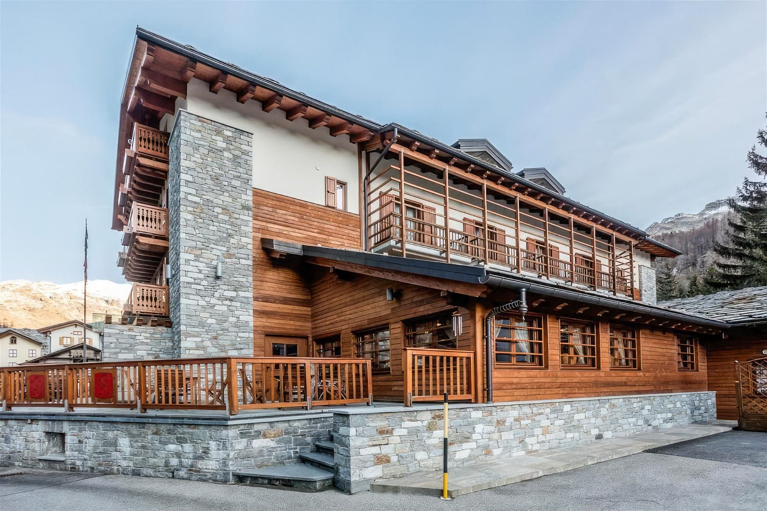
BEAUSiTE Zermatt
Zermatt, Switzerland
Days 1-2 (2 nights)
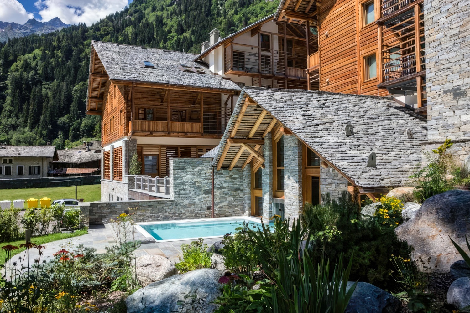
Hotel Castor
Champoluc, Italy
Day 3 (1 night)
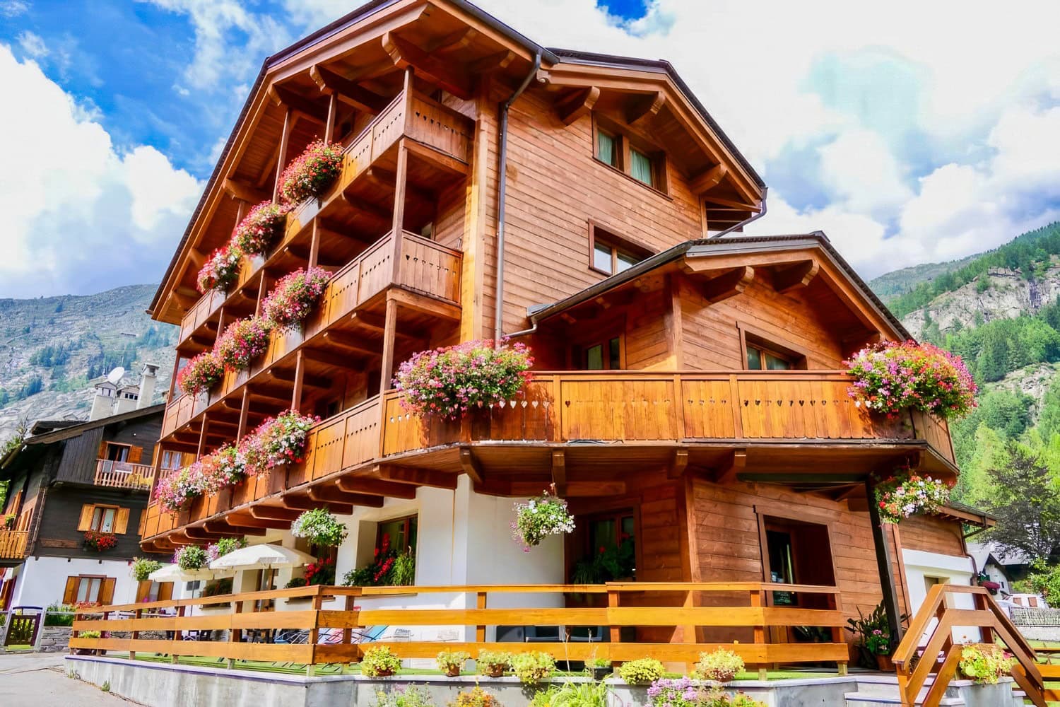
Hotel Lo Scoiattolo: Gressoney-la-Trinité
Gressoney-la-Trinite, Italy
Days 4-5 (2 nights)
Alagna Resort
Alagna Valsesia, Italy
Day 6 (1 night)
Dream Hotel
Macugnaga, Italy
Day 7 (1 night)
Walliserhof Grand-Hotel & Spa
Saas-Fee, Switzerland
Days 8-9 (2 nights)
Day 10 (1 night)
What the Trip is Like
- 3,000 feet gain/loss
- Altitudes range 7,000 to 10,000 feet
- Day 7 & 8: both roughly 12 miles, 8 hours, 4,000 feet gain, and 4,500 loss
Other Trips You Might Like
Small Group Adventure
Mont Blanc to the Mediterranean
From $7,395
Tour du Mont Blanc
Switzerland, Italy, France
From $5,795
Ultimate Dolomites
From $6,995
Ultimate Haute Route
Switzerland, France
Book your trip today
Our Area Specialists know every detail about our tours. They will be happy to answer any questions and help you choose the journey that’s right for you. Contact us to learn more or book your trip today!
Submit the form below to download itinerary
Trip Download Itin
Trip Levels
With more than 200 different adventures to choose from, we want to help you find the trip that’s right for you. Our Trip Level system ranks each trip in two ways: a number rating from 1 to 6 according to the activity, and general travel rigors. 1 is the easiest and 6+ the most difficult—see descriptions below for explanations of each number. A plus (+) sign means the trip is a bit more strenuous than other trips of that level. The detailed explanation of each trip—below the bar with the number rating—is perhaps more important, specifying activities, altitudes, hiking, and travel conditions. The Detailed Itinerary, available by download or mail, gives further information. Our Area Managers can also answer questions and guide you to the trip that best suits your interests.
Level 1 – Easiest
Non-camping journeys, optional walks, little elevation gain or loss.
- Royal Rajasthan and Villages of India
- Small ship cruises
Level 2 – Easy to Moderate
Hotel nights and/or safari-style camping, hikes of two to four hours on some days. Other physical activities are sometimes included, such as optional sea kayaking.
- Our African safaris
- Costa Rica Wildlife
Level 3 – Moderate
Half- to full-day hikes (3-6 hours) over rolling countryside on most days, occasional steep trails. Many of our hotel-based walking tours are in this category, as are our snorkeling adventures.
- Tuscany & the Cinque Terre
- Argentina: Hikes and Estancias of Patagonia
- Palau Snorkeling & Sea Kayaking
- Some trips with minimal hiking but rugged travel conditions or long drives, such as Tribal Ghana, Togo & Benin, are Trip Level 3.
Level 4 – Moderate to Strenuous
Full-day hikes (4-6 hours), mountainous terrain, significant elevation gains and losses (hiking up or down as much as 3,000 feet) on many days. Altitudes no greater than about 10,000 feet.
- Ultimate Patagonia
- Hiking the Spanish Pyrenees
Level 5 – Strenuous
Full-day hikes (4-8 hours), mountainous, steep terrain (hiking up or down as much as 3,500 feet) on many days. Trips with hiking at average altitudes of 10,000 to 12,000 feet are in this category.
- Inca Trail to Machu Picchu
- Everest Lodge to Lodge
Level 6 – Very Strenuous
Full-day hikes (5-8 hours), mountainous, steep terrain (hiking up or down as much as 3,500 feet) on many days. Most hikes take place at altitudes above 10,000 feet, with some days ascending as high as 18,000 feet.
- Everest Base Camp
- Climb Kilimanjaro!
Live & Book
Weather forecast
day after tomorrow
Lift tickets
Live panorama map, timetables & prices, mountain excursions, accommodation.
- Booking in only 3 minutes
- Maximum protection & excellent assistance
- Real guest reviews
- 97% customer satisfaction

Holiday flats

Tickets & Shop
Ski tickets, train tickets, accomodation, sunday, 28. april 2024.
- Planning hikes & tours
Tour Monte Rosa - Matterhorn
- print version
- Share the current page on Twitter
- Share the current page on Facebook
- Share the current page on Google+
This tour around the Monte Rosa massif is one of the finest long-distance hikes in the Alps. Requirements: fitness and stamina.

- Type Multi-day hike
- Difficulty hard
- Duration 58,00 h
- Distance 164,1 km
- Ascent 10654 m
- Descent 10660 m
- Lowest point 1148 m
- Highest point 3316 m
Description
The view into the different valleys in Switzerland and Italy is unforgettable. Hikers see not only the highest and most beautiful mountains in the Alps, but also mountain villages with different cultures and of incomparable character. The stage destinations are well-known: Zermatt, over the Theodul Pass to Cervinia, Alagna, Macugnaga, and back into Switzerland via the Monte Moro Pass, to Saas-Fee and Grächen. The route leads anticlockwise around the Monte Rosa massif, an endlessly fascinating world of rock and ice. Hikers also make a complete circuit of the Mischabel peaks and the 4,000-metre summits of the Nadelgrat ridge. A thrilling adventure that is simply unforgettable!
- Tour card with certificate and annual competition
- High above the Matter valley: glorious views of the Matterhorn
1. Zermatt – Theodul Pass (5h 25) 2. Theodul Pass - St-Jacques (5h 30) 3. St-Jacques - Gressoney (4h 15) 4. Gressoney - Gabiet - Alagna (6h 20) 5. Alagna - Macugnaga (8h) 6. Macugnaga / Staffa - Saas-Fee (8h 55) 7. Saas-Fee - Grächen (6h 25) 8. Grächen – Europa Hut (7h 20) 9. Europa Hut - Zermatt (6h 10)
Note: A new ski slope is being built at the Theodul Pass this summer and a lot of construction activity is to be expected.
We recommend:
- Good, sturdy footwear
- Hiking poles (optional)
- Clothing suitable for the weather (always carry a waterproof)
- Food and water
Additional equipment for glacier crossings: crampons, climbing harness, 1 rope per group of 4, suitable clothing
Reserve mountain huts and accommodation in mountain villages in advance.
The mountain landscape along the Tour Matterhorn is known for its breathtaking panoramas, attractive mountain villages and wealth of fauna and flora.
- Plan every mountain tour carefully and adapt to participants’ fitness level as well as the weather and season.
- Weather conditions can change quickly in the mountains. Appropriate clothing is therefore essential, along with adequate supplies of food and water. In uncertain weather, turn back in good time.
- Inform others of planned route, and whenever possible avoid going alone.
- Do not leave the marked routes; do not venture onto glaciers without a mountain guide.
- Please be considerate to other walkers and to plants and animals.
- Take note of the warning signs drawing attention to the constant danger in river beds and along watercourses below dams and reservoirs.
Important! This is a demanding alpine trek; stages may include glacier traverses. We therefore recommend the services of a mountain guide with local knowledge. Tip: “Be searchable”. Equip yourself with an additional RECCO rescue reflector*. Whether summer or winter. Available in our Online-Shop or our information desk. *The additional reflector does not replace an avalanche beacon.
Map and arrival

Experiences & activites

Gift Vouchers

AGM Zermatt Tourism: A magical financial year

Zermatt Tourism takes part in the biggest night in Hollywood

Grow beyond yourself with the Mammut Mountain School

Tips of the day

Room / Appartment 1
Room / Appartment 2
Room / Appartment 3
Room / Appartment 4

- Email Keep me logged in
- Password Forgot my password
1743 trails = 308897 miles
Rate your trails, learn more ..., tour monte rosa, description.

- Name Tour Monte Rosa (TMR)
- Length in days 8 days
- Start of trail Zermatt
- End of trail Zermatt
- Traildino grading DW, Difficult walk, bushwalk
- Hut tour grading T3, Demanding mountain walk
8 days. Circular tour around the Monte Rosa on the Swiss-Italian border, from Zermatt.
Guides and maps
Organisations, tour operators.

- Wandelgids Hüttentrekking Schweiz - Zwitserland Band 2 | Rother Bergverlag
- Absolute aanrader als het gaat om meerdaagse tochten van hut naar hut in Zwitserland. Gedegen Duitstalig boek! Die Schweiz gilt als Inbegriff einer schönen Landschaft. Nicht zufällig werden weltweit die unterschiedlichsten Regionen mit dem Beinamen der kleinen Alpenrepublik versehen und stets ist ein besonders reizvolles Fleckchen unserer Erde... Read more

- Tour of Monte Rosa
- The 134km Tour of Monte Rosa is a challenging and very varied trek that takes a high route around the massif, in a circuit that begins and ends in Zermatt. The trek is described in eight stages, but these are not necessarily one-day stages, and some will be more comfortably achieved over two days or more. Realistically you should allow 9-10... Read more
- Also available from:
- Bol.com, Belgium

- Trekking in the Alps
- An inspirational guidebook to 20 classic treks in the Alps. As well as introducing new hiking areas in the Alps, classics such as the Tour of Mont Blanc, and Chamonix to Zermatt are included. Trekking in the Alps is immensely satisfying, and this book celebrates the rich and scenic diversity for which this great mountain range is renowned. Read more
- Stanfords, United Kingdom
- Bol.com, Netherlands
- De Zwerver, Netherlands

- Alps Trekking
- An inspirational walking guide to 20 summer treks in the European Alps in Italy, Austria, Switzerland, France and Slovenia, by 8 Alpine trekking experts, including the classics such as the Tour of Mont Blanc and lesser-known routes like the Traverse of the Slovenian Alps. All the rich scenic diversity for which the Alps are renowned is... Read more

- An inspirational guide to the delights of Alpine multi-day hikes. With 20 hikes described, including classics such as the Tour of Mont Blanc and the Tour of the Vanoise as well as new multi-day routes like the Traverse of the Slovenian Alps, this guide celebrates the rich scenic diversity for which the Alps are renowned.The eight talented... Read more

- Wandelgids Trekking in the Alps | Cicerone

- Walliser Alpen. Die gro en Trekking-Runden
- Uitstekende wandelgids met een groot aantal dagtochten in dal en hooggebergte. Met praktische informatie en beperkt kaartmateriaal! Wandelingen in verschillende zwaarte weergegeven in rood/blauw/zwart. Nirgends ballen sich solch großartige hochalpine Impressionen, so viele Viertausender auf engem Raum wie in den Walliser Alpen. Drei große... Read more

- Wandelgids Walliser Alpen | Rother Bergverlag

- Val Brembana - Valsassina - Le Grigne: Lecco - Bergamo 50K IGC Map No. 22
- Val Brembana - Valsassina - Le Grigne area including Lecco and Bergamo in a series contoured hiking maps at 1:50,000 with local trails, long-distance footpaths, mountain accommodation, etc. from the Turin based Istituto Geografico Centrale.Maps in this series have contours at 50m intervals, enhanced by shading and graphic relief. An overprint... Read more

- Cinque Terre - Golfo del Tigullio: La Spezia - Sestri Levante - Rapallo - Genoa 50K IGC Map No. 23
- Cinque Terre - Golfo del Tigullio area of the Italian Riviera from genoa to la Spezia including Sestri Levante and Rapallo in a series contoured hiking maps at 1:50,000 with local trails, long-distance footpaths, mountain accommodation, etc. from the Turin based Istituto Geografico Centrale.Maps in this series have contours at 50m intervals,... Read more

- Lanzo - Viù - Chialamberto - Locana 25K IGC Map No. 110
- Lanzo - Viù - Chialamberto - Locana – Cirié – Basse Valli di Lanzo area at 1:25,000 in a series of contoured, GPS compatible walking maps from the Turin based Istituto Geografico Centrale, highlighting hiking trails including long-distance routes, ski routes and alpine accommodation. Maps in this series have contours at 25m intervals, enhanced... Read more

- Cervino - Monte Rosa - Valtourenche - Valle di Champorcher L`Escursionista Editore
- Cervino/Matterhorn - Monte Rosa - Valtourenche - Gressoney - Valle di Champorcher area of the Italian Alps on a contoured and GPS compatible map at 1:50,000 from L’Escursionista Editore, with an accompanying booklet providing English language descriptions of five hiking tours.The map has contours at 25m intervals with relief shading and spot... Read more

- Il Canavese: Ivrea to Chiavasso 50K IGC Map No. 21
- Il Canavesea area including Ivrea and Chiavasso in a series contoured hiking maps at 1:50,000 with local trails, long-distance footpaths, mountain accommodation, etc. from the Turin based Istituto Geografico Centrale. This title also shows cycle routes.Maps in this series have contours at 50m intervals, enhanced by shading and graphic relief.... Read more

- Wandelkaart 21 Il Canavese da Ivrea a Chivasso | IGC - Istituto Geografico Centrale
- Il Canavese: Ivrea to Chiavasso, map no. 21, in a series contoured hiking maps at 1:50,000 with local trails, long-distance footpaths, mountain accommodation, etc. from the Turin based Istituto Geografico Centrale covering the Italian Alps and Piedmont, the lakes and northern Lombardy, and the Italian Riviera.The maps have contours at 50m... Read more

- Limone Piemonte - Vallée des Merveilles 25K IGC Map No. 114
- Limone Piemonte - Vallée des Merveilles area at 1:25,000 in a series of contoured, GPS compatible walking maps from the Turin based Istituto Geografico Centrale, highlighting hiking trails including long-distance routes, ski routes and alpine accommodation. Maps in this series have contours at 25m intervals, enhanced by shading and graphic... Read more

- Wandelkaart 114 Limone Piemonte, Valle Delle Meraviglie, St. Dalmas De Tende | IGC - Istituto Geografico Centrale
- IGC Italien Wanderkarten 1 : 25 000. Neuauflage. Read more

- Finale Ligure - Alassio - Savona IGC 15
- The coast of the Italian Riviera around Albenga, Alassio and Savona in a series contoured hiking maps at 1:50,000 with local trails, long-distance footpaths, mountain accommodation, etc. from the Turin based Istituto Geografico Centrale.Maps in this series have contours at 50m intervals, enhanced by shading and graphic relief. An overprint... Read more

- Wandelkaart 15 Finale Ligure Alassio Savona | IGC - Istituto Geografico Centrale

- Maritime Alps Natural Park - Entracque - Valdieri - Mercantour - Gelas IGC 113
- Argentera Regional Park - Entracque - Valdieri area at 1:25,000 in a series of contoured, GPS compatible walking maps from the Turin based Istituto Geografico Centrale, highlighting hiking trails including long-distance routes, ski routes and alpine accommodation. Maps in this series have contours at 25m intervals, enhanced by shading and... Read more

- Wandelkaart 113 Parco Naturale Alpi Marittime - Maritieme Alpen / Mercantour | IGC - Istituto Geografico Centrale

- Matterhorn / M. Cervino - Monte Rosa IGC 5
- The Italian side of the Matterhorn and Monte Rosa, with coverage extending from Zermatt to Aosta, in a series contoured hiking maps at 1:50,000 with local trails, long-distance footpaths, mountain accommodation, etc. from the Turin based Istituto Geografico Centrale. Maps in this series have contours at 50m intervals, enhanced by shading and... Read more

- Wandelkaart 05 Cervino Matterhorn e Monte Rosa | IGC - Istituto Geografico Centrale
- Matterhorn/M.Cervino and Monte Rosa, map no. 5, in a series contoured hiking maps at 1:50,000 with local trails, long-distance footpaths, mountain accommodation, etc. from the Turin based Istituto Geografico Centrale covering the Italian Alps and Piedmont, the lakes and northern Lombardy, and the Italian Riviera.The maps have contours at 50m... Read more

- Maira, Grana and Stura Valleys IGC 7
- Maira, Grana and Stura Valleys in a series contoured hiking maps at 1:50,000 with local trails, long-distance footpaths, mountain accommodation, etc. from the Turin based Istituto Geografico Centrale.Maps in this series have contours at 50m intervals, enhanced by shading and graphic relief. An overprint highlights local footpaths and... Read more

- Wandelkaart 07 Valli Maira, grana e stura | IGC - Istituto Geografico Centrale
- Maira, Grana and Stura Valleys, map no. 7, in a series contoured hiking maps at 1:50,000 with local trails, long-distance footpaths, mountain accommodation, etc. from the Turin based Istituto Geografico Centrale covering the Italian Alps and Piedmont, the lakes and northern Lombardy, and the Italian Riviera.The maps have contours at 50m... Read more

- Susa, Chisone & Germanasca Valleys: Sestiere - Sauze d`Oulx - Bardonecia 50K IGC Map No. 1
- Susa, Chisone and Germanasca Valleys, with coverage including Sestiere, Sauze d`Oulx and Bardonecia, in a series of contoured hiking maps at 1:50,000 with local trails, long-distance footpaths, mountain accommodation, etc. from the Turin based Istituto Geografico Centrale.Maps in this series have contours at 50m intervals, enhanced by shading... Read more

- Wandelkaart 01 Valli di Susa, chisone e germanasca | IGC - Istituto Geografico Centrale
- IGC heeft een serie gedetailleerde wandelkaarten voor het Italiaanse gedeelte van de Alpen (Piemonte). Voldoende gedetailleerd voor het volgen van het lokale wandelnetwerk. Voorzien van schaduwreliëf; hoogtelijnen en referentiehoogtes. Onderscheid in soort wandelpad ( bergpad, bergpad met hindernissen,gletsjerovergang). Ook zijn de... Read more

- Monviso IGC 6
- Monviso / Monte Viso cross-border area with coverage from Châteaux Queyras to Sampeyre and from the Grand Queyron to the Aiguille de Chambeyron in a series contoured hiking maps at 1:50,000 with local trails, long-distance footpaths, mountain accommodation, etc. from the Turin based Istituto Geografico Centrale.Maps in this series have contours... Read more

- Wandelkaart 06 Monviso | IGC - Istituto Geografico Centrale

- Matterhorn / Cervino - Breuil Cervinia - Champoluc IGC 108
- Matterhorn/M. Cervino - Breuil-Cervinia - Champoluc area at 1:25,000 in a series of contoured, GPS compatible walking maps from the Turin based Istituto Geografico Centrale, highlighting hiking trails including long-distance routes, ski routes and alpine accommodation. Maps in this series have contours at 25m intervals, enhanced by shading and... Read more

- Wandelkaart 108 Cervino-Matterhorn, Breuil-Cervinia, Champoluc | IGC - Istituto Geografico Centrale

- Ivrea - Biela - Lower Aosta Valley 50K IGC Map No. 9
- Ivrea - Biela - Lower Aosta Valley area in a series contoured hiking maps at 1:50,000 with local trails, long-distance footpaths, mountain accommodation, etc. from the Turin based Istituto Geografico Centrale. Maps in this series have contours at 50m intervals, enhanced by shading and graphic relief. An overprint highlights local footpaths and... Read more

- Wandelkaart 09 Ivrea, Biella e Bassa Valle d'Aosta | IGC - Istituto Geografico Centrale
- Ivrea - Biela - Lower Aosta Valley, map no. 9, in a series contoured hiking maps at 1:50,000 with local trails, long-distance footpaths, mountain accommodation, etc. from the Turin based Istituto Geografico Centrale covering the Italian Alps and Piedmont, the lakes and northern Lombardy, and the Italian Riviera.The maps have contours at 50m... Read more

- Sestriere - Claviere Sansiciaro - Prali 25K IGC Map No. 105
- Sestriere - Claviere - Prali area at 1:25,000 in a series of contoured, GPS compatible walking maps from the Turin based Istituto Geografico Centrale, highlighting hiking trails including long-distance routes, ski routes and alpine accommodation. Maps in this series have contours at 25m intervals, enhanced by shading and graphic relief for very... Read more

- Wandelkaart 105 Sestriere, Claviere, Sansicario, Prali | IGC - Istituto Geografico Centrale
- Sestriere - Claviere - Prali area at 1:25,000 in a series of contoured, GPS compatible walking maps from the Turin based Istituto Geografico Centrale, highlighting hiking trails including long-distance routes, ski routes and alpine accommodation. The maps have contours at 25m intervals, enhanced by shading and graphic relief for very clear... Read more
- Submit Cancel
- Zermatt - Theodulpass Closed
- Theodulpass - St. Jaques Closed
- St. Jaques - Gressoney Closed
- Gressoney - Alagna Closed
- Alagna - Macugnaga Closed
- Macugnaga - Saas Fee Closed
- Saas Fee - Grächen Closed
- Grächen - Europahütte Closed
- Europahütte - Zermatt Closed
- cartina globale
- punti di interesse (POI)
- Zermatt - Theodulpass
- Theodulpass - St. Jaques
- St. Jaques - Gressoney/Gabiet
- Gressoney/Gabiet - Alagna
- Alagna - Macugnaga
- Macugnaga/Staffa - Saas Fee
- Saas Fee - Grächen
- Grächen - Europahütte
- Europahütte - Zermatt
- letteratura
- vostra pubblicita
ultime notizie
Il tour del Monte Rosa è chiusa.
A causa dei continui cambiamenti di condizioni sul Passo del Teodulo, si prega di prenotare una guida alpina: Tipp: - Guide del Cervino (guide alpine di Cervinia) - Zermatters (guide alpine di Zermatt)
Gressoney - Alagna: deviazione in zona Moso via 7b fino a fine agosto.
Il tour del Monte Rosa è aperto.
Il Passo del Monte Moro e il percorso da Saas Fee a Grächen sono chiusi.
Il tour del Monte Rosa è aperto. Sul Passo di Monte Moro e sul Passo del Teodulo potrebbe esserci ancora un po' di neve, per il resto il tour è percorribile in ogni sua parte.
Europaweg e il ponte sospeso sono chiusi. Da giovedi 04.11.2021, il ponte sospeso di Randa è chiuso. In inverno, NON è possibile transitare sul ponte, che sarà riaperto in primavera. Eventuali tentativi di attraversarlo saranno respinti.
L'Europaweg è chiuso. Il percorso circolare verso il ponte sospeso di Randa rimane aperto fino a nuovo avviso.
Il tour è aperto.
Nonostante il maltempo di questa settimana, il lavoro sull'Europaweg ha potuto essere completato. L'inaugurazione avrà luogo domani, 17/07/2021.
Tutte le informazioni sul nuovo percorso possono essere trovate su www.europaweg.ch .
La neve sui seguenti passi: Col de Nannaz, Passo Foric!
Si prega di notare: La deviazione non è segnalata.
L'itinerario circolare fino al ponte sospeso di Randa è superfluo. L'Europaweg (Percorso dell'Europa) è chiuso.
I lavori di costruzione del sentiero previsto tra Grächen e l'Europahütte inizieranno nella primavera del 2021. Il nuovo percorso dovrebbe essere aperto agli escursionisti nell'agosto 2021. Fino al completamento dei lavori di costruzione del nuovo Europaweg, il percorso provvisorio esistente rimarrà attivo.
L'Europaweg (Sentiero d'Europa) è chiuso. Il percorso circolare per il ponte sospeso di Randa rimane aperto fino a nuovo avviso.
Il sentiero Grächner Höhenweg è attualmente chiuso. Il motivo è una colata detritica vicino all'Eistbach. Il percorso probabilmente non si aprirà quest'anno. Il passo del Monte-Moro è innevato.
07.08. 2020
Il tratto del sentiero europeo "Flüewald - Taflüe - Herbriggen" rimarrà chiuso a causa delle cadute di massi. Si prega di notare la deviazione via Mattsand e la segnaletica.
A causa di una frana, l'Europaweg si interrompe sul tratto Grächen - Europahütte. Vi preghiamo di informarvi sulla situazione attuale in loco. L'Europahütte e il sentiero circolare che porta al ponte sospeso sono ancora accessibili da Herbriggen.
Tutti i sentieri del Tour Monte Rosa sono ufficialmente percorribili. Potrebbe esserci ancora neve sui passi.
La tappa da Grächen all'Europahütte sarà di nuovo aperta sabato 08 giugno 2020. Gli escursionisti devono prestare attenzione al nuovo percorso (vedi pdf sotto).
Benvenuto agli escursionisti!
Sending email...
Email sent!
You are using an out of date browser and this website will not function properly.
Please upgrade to Edge or Chrome browsers.

+33 (0)781586903
montblanctreks
- Dates & Prices
Celebrate Earth Day this April. MBT will be donating a portion of each booking, to our conservation partner, EOCA. Book now for 2025!
Hiking the Tour of the Monte Rosa
Through the swiss & italian pennine alps.

When it comes to alpine adventures, the Monte Rosa range is undoubtedly a name that comes to mind. This magnificent mountain range, located in the Pennine Alps, straddles the border between Switzerland and Italy. While the region is famous for its renowned peaks like Dufourspitze and Signalkuppe, there are also lesser-known areas within Monte Rosa that offer a unique and rewarding hiking experience. For those seeking an off the beaten path adventure, exploring Monte Rosa is an absolute treat.

One such area is the Sesia Valley, nestled on the Italian side of Monte Rosa. This hidden gem boasts breathtaking landscapes, charming alpine villages, and a network of hiking trails that will captivate outdoor enthusiasts. The Sesia Valley remains relatively untouched by mass tourism, allowing hikers to immerse themselves in pristine nature and experience a sense of serenity that is often hard to find in more popular destinations.
One of the highlights of hiking in the Sesia Valley is the opportunity to explore the Walser villages. These small, traditional hamlets are steeped in history and offer a glimpse into the region's rich cultural heritage. Walking through these picturesque villages, with their wooden chalets and flower-filled balconies, feels like stepping back in time. The Walser people have preserved their unique language, architecture, and way of life, creating an authentic and enchanting atmosphere.
As you venture deeper into the Sesia Valley, you'll be rewarded with stunning alpine scenery. Towering peaks, glacier-fed streams, and lush meadows dotted with colorful wildflowers create a visual feast for the eyes. Hiking trails meander through this natural wonderland, catering to a range of difficulty levels and allowing hikers to choose their own adventure. From leisurely strolls along gentle paths to challenging ascents to mountain passes, there is something for everyone.

One trail that shouldn't be missed is the Alta Via della Valle d'Otro. This multi-day trek takes you through remote valleys, high mountain passes, and breathtaking vistas. Along the way, you'll encounter crystal-clear lakes, cascading waterfalls, and dramatic rock formations. Camping or staying in mountain huts along the route adds an element of adventure and allows you to fully immerse yourself in the alpine environment.

Another hidden gem in the Monte Rosa range is the Gressoney Valley. Located on the Italian side, this valley is renowned for its charming villages, such as Gressoney-Saint-Jean and Gressoney-La-Trinité. The valley is also home to the famous Lyskamm ridge, which offers spectacular panoramic views of the surrounding peaks. Hiking trails in the Gressoney Valley cater to a variety of skill levels, making it an accessible destination for hikers of all abilities.
While exploring the lesser-known alpine regions of Monte Rosa, it's important to be prepared and well-equipped. The weather in the mountains can be unpredictable, so packing appropriate clothing, navigation tools, and sufficient supplies is essential. Additionally, it's advisable to check trail conditions and consult local guides or tourist information centers for up-to-date information before setting out on your adventure.
Off the beaten path and away from the crowds, hiking in the lesser-known alpine regions of the Monte Rosa offers a truly authentic and unforgettable experience. The untouched natural beauty, the rich cultural heritage, and the sense of tranquility make it a paradise for outdoor enthusiasts. Whether you're a seasoned hiker seeking a new challenge or a nature lover looking to escape the hustle and bustle, Monte Rosa's hidden alpine regions will leave you with lasting memories of a truly remarkable journey.

Interested in exploring the Tour de Monte Rosa ?
If you would like to experience our new UIMLA Monte Rosa guided trek for 2024 through 170k of stunning vistas crossing Switzerland and Italy, bookings are now open for 2024.
For those who would like some flexibility, we offer a self-guided full circuit Monte Rosa trek through 140k of pristine trails.

By Sara Wild
Uimla trekking guide & owner/ director.
Sara has lived and worked in the Chamonix Valley since 2007 after moving her from the UK with her family. Prior to living in the Alps Sara was a teacher of design and also outdoor education, all her free time was spent here in the Alps. In 2007 Sara moved with her then young family to pursue her dream of living and working in the mountains. Mont Blanc Treks was formed in 2010 offering personalised guided and self-guided trekking holidays enabling her to share her passion for this beautiful part of the world.
Get in touch with Sara for any route or itinerary advice: [email protected]
Sign up to Our Newsletter
Marketing permissions.
Mont Blanc Treks will use the information you provide on this form to be in touch with you and to provide updates and marketing. Please let us know if you are happy to receive emails from us by checking the box below.
You can change your mind at any time by clicking the unsubscribe link in the footer of any email you receive from us, or by contacting us at [email protected]. We will treat your information with respect. For more information about our privacy practices please visit our website. By clicking below, you agree that we may process your information in accordance with these terms.
We use Mailchimp as our marketing platform. By clicking below to subscribe, you acknowledge that your information will be transferred to Mailchimp for processing. Learn more about Mailchimp's privacy practices here.
- Sci Fuoripista
- Sci alpinismo
- Sci di fondo
- Pattinaggio
- Passeggiate invernali
- Trekking e Passeggiate
Tour del Monte Rosa (TMR)
- Bici e Mountain Bike
- I Rifugi del Monte Rosa
- Alpinismo Monte Rosa
- Freeclimbing
- Capanna Margherita
- Sport sul fiume
- Pesca in Valsesia
- Gite fuoriporta
- Natura e Benessere
- Circuiti Walser
- Aree Pic Nic
- Alagna video
- Walser Green Paradise
- Monte Rosa Paradise
- Freeride Paradise
- Il Monte Rosa
- L'Alta Valesia
- Esplorando Agrosistemi delle Terre Alte
- Il Parco Naturale
- Corpo Guide Alagna
- Artigianato
- Prodotti Tipici
- Ricette tipiche
- I vini del territorio
- Ski pass online
- Prezzi Risalita
- Funivie di Alagna
- Orari e apertura
- STATUTO DEL CONSORZIO
- Come Arrivare
- Dove mangiare
- Dove dormire
- Navette comunali
- Negozi e noleggi
- Sanità ed emergenze
- Programmazione Sante Messe
- App Valsesia Monterosa
- LIVE WEBCAM
- Tutti gli eventi
- FIERE E MERCATINI
Acquista biglietto funivie
- Alpinismo in Giornata
- Tour di più giorni
- Le classiche del Monte Rosa
- Monte Rosa e dintorni
- Salite di Gruppo
- Scialpinismo
- Pesca Sportiva
- Prenota Capanna Margherita
- Prenota una giornata di Freeride
- Prenota un taxi
- Prenota una guida alpina
- Prenota un hotel
- Gite collettive
Home / Trekking e passeggiate / Tour del Monte Rosa (TMR)
Il TMR (Tour del Monte Rosa) è il bellissimo itinerario che attraversa i paesi attorno al Monte Rosa, tra Svizzera e Italia, con un percorso circolare.
Il TMR è idealmente suddiviso in 9 tappe con partenza ed arrivo a Zermatt, ma può essere percorso con partenza ed arrivo in qualsiasi delle località coinvolte nel tour, per il numero di tappe e per il senso di marcia desiderato.
Le tappe: Zermatt - Colle del Teodulo; Colle del Teodulo - St Jacques; St Jacques - Gressoney; Gressoney - Alagna; Alagna - Macugnaga; Macugnaga - Saas Fee; Saas Fee - Grächen; Grächen - Europahütte; Europahütte - Zermatt
Partenza: Zermatt 1616m Arrivo: Colle del Teodulo 3317m Tempo: 5,30 h Percorso inverso: 4 h
Partenza: Colle del Teodulo 3317m Arrivo: St. Jacques 1689m Tempo: 6h Percorso inverso: 7,30h
Partenza: St. Jacques 1689m Arrivo: Gressoney 1637m Tempo: 4,30h Percorso inverso: 4,30h
Partenza: Gressoney 1637m Arrivo: Alagna 1191m Tempo: 7h Percorso inverso: 8h
Partenza: Alagna 1191m Arrivo: Macugnaga 1327m Tempo: 8h Percorso inverso: 8h
Partenza: Macugnaga 1.327m Arrivo: Saas Fee 1772m Tempo: 7h Percorso inverso: 6,30h
Partenza: Saas Fee 1772m Arrivo: Grächen 1619m Tempo: 6,30h Percorso inverso: 7h
Partenza: Grächen 1619m Arrivo: Europahütte 2220m Tempo: 6,30h Percorso inverso: 5,30h
Partenza: Europahütte 2220m Arrivo: Zermatt 1616m Tempo: 6h Percorso inverso: 6,30h
APPROFONDISCI le tappe di Alagna
Gressoney/Gabiet - Alagna
Una delle tappe più lunghe, ma che può essere accorciata utilizzando gli impianti del Monterosa-ski.
Lo stambecco di bronzo che guarda la valle di Gressoney dal colle del Camoscio, che segna il confine tra Valle d’Aosta e Valsesia, è senza dubbio l’obiettivo della salita da Gressoney, dove la vastità della valle è punteggiata da numerosi alpeggi walser che fanno da corona agli spazi aperti e ariosi dell’area del Gabiet. Passato il colle si scende in direzione di Alagna, percorrendo un sentiero ben segnato in un’ampia area morenica. Dopo circa 30 minuti di discesa, si raggiunge l’istituto Mosso, centro specializzato nella ricerca in alta quota dell’università di Torino e un po’ più a valle il rifugio Vigevano, oggi chiuso. La discesa nel vallone dell’Olen costeggia il Sasso del Diavolo, enorme pietrone spaccato in due che la leggenda racconta, sarebbe servito al Diavolo per impedire la costruzione di una cappelletta a Gressoney. Ma l’amore di Dio impedì il misfatto e il diavolo per la rabbia scaglio il masso verso Alagna che rotolando e rimbalzando imprigionò il Diavolo al suo interno, dove pare, ancora oggi, sia. Poco oltre il Sasso del Diavolo si incontra la deviazione per il passo Foric che sceglieranno i camminatori che vogliono raggiungere Alagna attraverso la bellissima val d’Otro. Per i viaggiatori che passano da Otro punto tappa sono il rifugio Zar Senni a Follu oppure Alagna con circa un’ora di cammino in più. Per i viaggiatori che decidono di scendere verso Alagna lungo la valle dell’Olen, in 40 minuti di cammino dalla deviazione, si raggiunge l’alpe Pianalunga dove c’è una stazione della funivia che porta in centro ad Alagna e 15 minuti più a valle si trova il rifugio Grande Halte, possibile punto tappa. Con un’altra ora e mezza di cammino si raggiunge Alagna (vedi elenco hotel e B&B nella sezione alloggi) oppure si può proseguire fino al rifugio Pastore che è la base della tappa successiva. A piedi è circa un’ora e mezza, ma in estate c’è un servizio navetta continuato fino alle 17 (info al + 39 0163 922988). Il tragitto si può fare anche in taxi con un costo di circa 20 € e poi 10 minuti a piedi per raggiungere il rifugio che ha la più bella vista sulla parete sud del Monte Rosa.
Alagna - Macugnaga
La tappa Alagna Macugnaga è percorsa dal bellissimo sentiero lastricato costruito dal battaglione Intra negli anni ’20 che raggiunge i 2.738 metri del colle del Turlo -ds T ü rli- la piccola porta, da cui passarono le popolazioni Walser di Macugnaga per dare vita alla nuova colonia di Alagna attorno al 1200. Il panorama è davvero suggestivo e la salita regolare e continua: prima boschi di latifoglie e conifere e altre il limite della vegetazione gli alpi Faller e Fum Blatte, in primavera tempestati di genzianelle.
Dal colle si scende nella valle Anzasca e il sentiero corre attraverso boschi suggestivi e cascatelle d’acqua; di tanto in tanto si incontrano precipizi e suggestivi ponti in legno ma anche i tratti più esposti, sembrano innocui e facili in virtù del sentiero ben tenuto e largo. Prima di giungere a Quarazza si incontra il lago delle Fate, piccolo lago artificiale che merita una sosta.
Da qui in 30 minuti si raggiunge Macugnaga, borgo Walser curato e ben organizzato con molti alberghi dove soggiornare dopo questa lunga tappa
TEMPO DI PERCORRENZA
Con bambini, in bicicletta.

Giro di Zermatt in 4 giorni
Punta dufour - dufourspitze, il cristo delle vette 4161 m e la piramide vincent 4215 m, corso di sci alpinismo, scarica la mappa dei sentieri.
- Il tuo nome *
- La tua email *
- Settimanale
- Acconsento all' informativa sul trattamento dei dati personali * Privacy policy
0163 922 988
[email protected], alagna social media, 0163 1900925, +39 379 29 844 59.

Guida al tour del Monte Rosa
- Gennaio 23, 2019
Con dieci cime che superano i 4000 metri di altezza, il massiccio del Monte Rosa è uno dei più impressionanti delle Alpi. E’ giusto dire che il Tour de Monte Rosa di 9 giorni, intorno al massiccio, è uno dei migliori itinerari escursionistici delle Alpi.
L’escursione offre un mix epico di paesaggi montani impressionanti attraverso due grandi stati europei.
Dai passi montani silenziosi alle verdi vallate punteggiate di chalet svizzeri in legno durante la prima metà dell’escursione, alla tranquillità dei remoti villaggi di montagna italiani durante le ultime tappe del trekking, il Tour de Monte Rosa rappresenta un’ottima alternativa al Tour du Mont Blanc.
Ma sappiate che, nonostante sia una delle escursioni più panoramiche delle Alpi, il percorso è faticoso, in particolare l’attraversamento del Passo del Theodul, alto 3.295 metri!
Questa pagina fornisce una panoramica dettagliata del percorso del Tour de Monte Rosa. Vi consigliamo di utilizzare i link rapidi qui sotto per navigare verso le sezioni che vi interessano di più. In alternativa, segnalibri questa pagina per riferimenti futuri.
Panoramica del percorso
Il Tour de Monte Rosa è un lungo sentiero escursionistico di più giorni che copre una distanza totale di 162 chilometri e supera i 13.000 metri di dislivello in 8-10 tappe.
Il punto più alto raggiunto durante l’escursione è di 3.295 metri.
La maggior parte delle persone iniziano l’escursione a Täsh, in Svizzera, in senso antiorario. Ad est del Cervino, il bellissimo Monte Rosa si trova al confine tra la Svizzera e l’Italia.
Il Tour de Monte Rosa è l’occasione perfetta per vivere le diverse valli di entrambi i paesi.
Durante l’escursione circolare si attraversano zone fortemente ghiacciate, si gode di una vista panoramica sulle cime più alte della Svizzera e si incontrano alcuni dei passi montani più alti delle Alpi. Il percorso vi porterà a città famose come Zermatt, Aosta e Saas Fee, attraversando il famoso Europaweg.
La maggior parte delle persone iniziano la loro escursione a Täsh o al Saas Fee.
Il percorso è normalmente fatto in senso antiorario, ma se si vuole rendere il percorso un po’ più facile, è meglio un piano in senso orario, poiché le salite sono più graduali.
È necessario attraversare il Passo del Theodul (3.295 m), uno dei passi più alti delle Alpi.
Per un’ottima guida turistica e mappa vi consigliamo The Tour of Monte Rosa di Hilary Sharp: Una guida escursionistica.
Profilo altimetrico
Nella tabella sottostante è possibile vedere il profilo altimetrico dell’intera escursione. E’ abbastanza chiaro che c’è molta altitudine da guadagnare durante le tappe. Il punto più alto è di 3.295 metri. Si può vedere che ci sono alcune tappe impegnative che raggiungono i passi di alta montagna che richiedono un grande sforzo.

Di seguito abbiamo presentato la versione più popolare del percorso del Tour de Monte Rosa – 9 giorni, con partenza e arrivo a Saas Grund. L’itinerario comprende circa distanze, tempi di percorrenza e dislivelli.
1° giorno: Saas Grund – Macugnaga
Salita: 650m Discesa: 1500m Tempo di marcia: 6-8 ore
Il passo del Monto Moro a 2.853 m è il primo grande passo del viaggio. Poco dopo si raggiunge la parte italiana del viaggio. Le macchine fotografiche saranno molto utilizzate perché si avrà una splendida vista sul massiccio del Monte Rosa e uno sguardo impressionante sulle mura di Macugnaga.
2° giorno: Macugnaga al Rifugio Pastore
Salita: 1450m Discesa: 1300m Tempo di marcia: 7-8 ore
Un ottimo percorso sul Colle del Turlo mentre si raggiunge la valle di Alagna. Il Monte Rosa sarà fuori dalla vista, ma non per molto tempo.
3° giorno: Alagna al Col d’Olen
Salita: 1750m Discesa: 560m Tempo di marcia: 7-8 ore
Oggi è necessario raggiungere la Bocetta delle Pisse prima di scendere sull’Alpe Pianlunga. Si può pernottare in un rifugio vicino al lago di Gabiet.
4° giorno: Col d’Olen a Resy
Salita: 1050m Discesa: 1300m Tempo di marcia: 6-8 ore
Quando si raggiunge la valle di Gressoney ci si sente veramente nelle Alpi italiane. Godetevi un caffè italiano ammirando l’imponente Monte Rosa. Ma non partire troppo tardi, perché c’è ancora una salita da completare prima di raggiungere il rifugio di Resy, che è una posizione mozzafiato.
5° giorno: Resy to the Matterhorn!
Questo è uno dei punti salienti del trekking che inizia con una splendida traversata verso i prati dell’Alpe Varda e dell’Alpe Mase. Presto si può ammirare il Breithorn mentre si sale verso il Colle Superieur delle Cimes Blanches 2982m. Dalla cima del passo si gode una prima vista sul Cervino, 4478m. Dopo una breve discesa, la salita prosegue fino al passo del Theodul a 3295 m, dove si pernotta.
6° giorno: Passo del Theodul – Zermatt
Discesa: 1700m Tempo di marcia: 5 ore
Una giornata facile, visto che tutto cio’ che devi fare e’ scendere. La giornata inizia con l’attraversamento del ghiacciaio prima di superare Gandegg e proseguire in direzione della Mattertal.
7° giorno: da Zermatt all’Europahutte
Salita: 850m Discesa: 300m Tempo di marcia: 6 ore
Un piacevole inizio di giornata, perché si scende lungo la Mattertal e si sale costantemente lungo l’Europweg, una via di alta montagna. Fate attenzione alla caduta massi, dato che il terreno è instabile. Trascorrete la notte nel rifugio Europa.
8° giorno: da Europahutte a Grachen
Salita: 500m Discesa: 850m Tempo di marcia: 6-7 ore
L’escursione lungo l’Europaweg prosegue attraversando campi di masso con vista mozzafiato.
9° giorno: da Grachen a Saas Grund
Salita: 1300m Discesa: 1200m Tempo di marcia: 6-7 ore
Anche se è l’ultimo giorno del Tour de Monte Rosa, il vostro arrivo sarà in grande stile, poiché si tratta di uno dei sentieri più belli delle Alpi.
Condividi :
Cerca il tuo cammino o trekking selezionando anche la regione
- Seleziona la regione Abruzzo Basilicata Calabria Campania Emilia Romagna Friuli Venezia Giulia Italia Lazio Liguria Lombardia Marche Molise Piemonte Puglia Sardegna Sicilia Toscana Trentino Alto Adige Umbria Valle d’Aosta Veneto
- Classifiche
- Destinazioni
- Equipaggiamento e accessori
- Idee viaggio
- In evidenza
- Trekking e cammini
- Uncategorized
- Atlante dei Cammini d'Italia del Ministero della Cultura
- Catalogo dei Cammini religiosi in Italia del Ministero della Cultura
- Associazione Compagnia dei Cammini
Seguici sui social
Sito web realizzato da jacoporomani.it

Tour del Monte Rosa
Desde: 1.130 € /persona IVA incluido
El Tour del Monte Rosa es una ruta de montaña de varios días que recorre los grandes valles de las montañas de los Alpes de Suiza e Italia. Uno de los mejores trekking del mundo que nos permitirá vivir una formidable experiencia acompañados de un guía de montaña de Trekkinea.
- Duración: 8 días
- Continente: Europa
- País: Suiza

- 4 - 5 PAX: 1.290€
- 6 - 9 PAX: 1.130€
Tu nombre *
Tu teléfono *
Tu correo electrónico *
Tu mensaje (opcional) *
Descripción
- Fechas y Reservas
- Equipamiento
- Propón tu fecha
El Tour del Monte Rosa es una preciosa travesía de montaña por los Alpes que recorre algunos de los valles más bonitos de Suiza e Italia. Con una exigencia física un poco mayor que el Tour del Mont Blanc, debemos superar varios collados a más de 2.700 metros de altitud y uno, el más alto, a más de 3.000 metros, el paso Theodul. Acompañados por un guía de montaña, las rutas de montaña nos permitirán conocer el encanto de los pueblos alpinos, descubrir naturales e históricos rincones y por supuesto disfrutar de inmejorables vistas rodeados de alguna de las montañas más bellas del mundo como el Cervino, el Dom o el Dent Blanche. La exigencia física de este trekking es notable, teniendo que estar acostumbrados a realizar largas jornadas de montaña cargando con nuestra propia mochila.
Imprescindible estar en posesión de la licencia federativa con cobertura europea o contratar un seguro de accidentes que te cubra la actividad.
Día 1: Punto de encuentro en Grächen, Suiza.
Si tomamos un vuelo a Ginebra es importante hacerlo a primera hora de la mañana para, posteriormente, poder viajar a Grachen. Alojamiento y cena en Grächen.
Día 2: Grächen – Saas Fee.
Comenzamos el Tour del Monte Rosa ascendiendo por el bosque hasta Hannigalp. A continuación, el camino comienza a girar siguiendo el impresionante sendero Balfrin Höhenweg que une el valle de Saastal y el Mattertal. La senda va colgada de la ladera, teniendo algunos tramos un poco estrechos o aéreos donde debemos tomar precauciones al pasar. Al otro lado del valle contemplamos las cumbres del Weissmies, el Lagginhorn y sus brillantes glaciares. Por encima de nosotros se encuentran los glaciares de Balfrin y Bider. A través de un bosque de pinos la senda nos lleva hasta el alpino pueblo de Saas Fee donde nos alojaremos rodeados de montañas que superan los cuatro mil metros de altitud.
- Desnivel de ascenso: 1.250 metros.
- Desnivel de descenso: 1.050 metros.
- Distancia: 21 kilómetros.
- Duración: 8-9 horas.
*Posibilidad de ascender a Hannigalp en teleférico. (Nos resta unos 530 metros de ascenso).
Día 3: Saas Fee – Macugnaga.
Nos trasladaremos en autobús desde Saas Fee hasta la presa de Mattmark, donde comenzamos el ascenso. A nuestra derecha quedarán los glaciares Schwarzberg y Seewjinen mientras seguimos el elaborado camino hasta el collado del monte Moro a 2.850 metros. Por este histórico paso accedemos a Italia. Apenas un poco de descenso por escalones artificiales y una cadena como pasamanos, nos encontramos el Refugio Oberto. Tras contemplar las espléndidas vistas de nuestro alrededor, descendemos al valle por un largo sendero. A medida que perdemos altura, la impresionante mole de roca y hielo del Monte Rosa nos mostrará su gran dimensión. A 1.305 metros de altitud llegaremos al coqueto pueblo de Macugnaga, lugar acogedor con excelentes vistas donde tenemos nuestro alojamiento.
* Para descender a Macugnaga existe la opción de coger un teleférico. (Nos resta unos 1.500 metros de descenso).
- Desnivel de ascenso: 810 metros.
- Desnivel de descenso: 1.700 metros.
- Distancia: 16 kilómetros.
- Duración: 6-7 horas.
Día 4: Macugnaga – Collado del Turlo – Refugio Pastore.
Quizás la etapa más bonita del Tour del Monte Rosa. Iniciamos el día adentrándonos en el precioso valle de Quarazza. Ascendiendo de manera suave y progresiva pasamos junto a las bordas de La Piana, donde comienza un largo camino empedrado. Más arriba pasamos junto a la cuidada cabaña Lanti y con un poco más de esfuerzo alcanzamos el collado Turlo a 2.740 metros. Una vez alcanzado este punto, el más alto del día, podremos contemplar el enorme valle que hemos ascendido. Aún tenemos por delante un largo descenso hasta llegar al encantador refugio Pastore, ubicado a 1.575 metros de altitud en un enclave privilegiado, con vistas hacia la cabaña Margarita del Monte Rosa. El trekking por Alpes nos ha traído hasta uno de los mejores parques naturales, el Parque Natural de Alta Valsesia.
*Jornada SIN POSIBILIDAD de coger teleférico.
- Desnivel de ascenso: 1.610 metros.
- Desnivel de descenso: 1.350 metros.
- Distancia: 22 kilómetros.
Día 5: Refugio Pastore – Collado Olen – Refugio Gabiet.
Descendemos por el bosque hasta el pueblo de Alagna Valesia. Como tenemos por delante una jornada de notable exigencia física no podremos detenernos mucho. Comenzamos con la fuerte subida por el bosque de pinos y alerces para dar paso a las verdes praderas alpinas, del valle de Otro. Dejando este fantástico enclave nos dirigimos a Pianmisura para hacer frente a la fuerte subida hasta el collado Foric. Perdemos un poco de altura por unos pasos estrechos para finalizar con la última subida en el Col d’Olen a 2.881 metros. Con nuevas vistas descendemos hacia el valle de Gressoney para llegar al lago y refugio Gabiet a 2.350 metros de altitud.
- Desnivel de ascenso: 1.840 metros.
- Distancia: 19 kilómetros.
- Duración: 7-8 horas.
*En esta jornada se pueden hacer dos tramos en teleférico.
Día 6: Refugio Gabiet – Collado Bettaforca – Refugio Ferraro.
Etapa tranquila y sencilla que se inicia con la bajada hasta Staffal Tschaval (Gressoney) situado a 1.850 metros. A continuación, subimos por buen camino hasta Sitten, buen lugar para descansar y disfrutar del momento que estamos viviendo. La subida restante, hasta coronar el colle Della Bettaforca a 2.672 metros la realizamos por el camino de las pistas de esquí. Pasado el collado, un nuevo y cómodo descenso nos lleva al fin de jornada en el refugio Ferraro ubicado a 2.066 metros, en Resy, por encima del pueblo de Champoluc y el valle de Ayas.
- Desnivel de ascenso: 980 metros.
- Desnivel de descenso: 1.250 metros.
Día 7: Refugio Ferraro – Refugio Teodulo (3.317 metros).
El Tour del Monte Rosa aún nos aguarda con una exigente jornada. Por el bosque, un breve descenso hasta Piain di Verra, cruzamos el rio y subimos por el valle de Courtoud. Verdes praderas y algunos lagos como el lago Bleu acompañan nuestros pasos hacia el collado superior de la Cime Blanche a 2.981 metros. La naturaleza que nos rodea es formidable, las vistas son sublimes, pero aún lo son más cuando el Cervino se muestra ante nuestras miradas. Bajaremos por la zona de pistas de esquí hasta la estación del teleférico para seguir subiendo hasta el collado y el refugio de Teodulo, a 3.317 metros de altitud. Desde este enclave privilegiado tendremos la oportunidad de cenar con vistas al cercano Cervino, el Monte Rosa, el Dent Blanch, Weisshorn y un largo etcétera. Será un día especial que todos deseamos vivir.
- Desnivel de ascenso: 1.390 metros.
- Desnivel de descenso: 460 metros.
- Distancia: 17 kilómetros.
Día 8: Refugio Teodulo – Zermatt.
Finalizamos el trekking por los Alpes entrando de nuevo en Suiza. Aunque la jornada no suele hacerse larga, hay mucho desnivel que descender para llegar a uno de los pueblos más bonitos del mundo, Zermatt. Un pueblo de ensueño con sus casas de madera rodeado de montañas que superan los 4.000 metros. Bajamos por las pistas de esquí hasta Trockener Steg, punto desde donde vemos el enorme glaciar Gorner que se desliza bajo el Monte Rosa. La bajada nos conduce por un camino hasta llegar a Zermatt, donde finalizamos esta inolvidable ruta por los Alpes.
- Desnivel de ascenso: 130 metros.
- Desnivel de descenso: 1.820 metros.
- Duración: 5-6 horas.
*Para descender a Zermatt, desde Trockener Steg, se puede bajar en teleférico.
Hora prevista de finalización entre las 13:00 – 14:00. Debemos tener en cuenta que al finalizar el tour no se incluye alojamiento.
- Servicio de guía de montaña.
- Gestión y reserva de los alojamientos.
- Media pensión en Grächen, Saas Fee, Macugnaga, refugio Pastore, refugio Gabiet, refugio Ferraro, refugio Teodulo.
- Material colectivo de seguridad.
NO INCLUYE:
- Alimentación no especificada en el apartado “incluye”.
- Gastos ocasionados por el abandono de la ruta por cualquier motivo.
- Gastos por cambio de alojamiento si durante la ruta nos vemos obligados a cambiar el itinerario.
- Equipación personal de trekking.
- Extras personales: bebidas, lavandería, picnic…etc.
- Cualquier otro concepto no mencionado como incluido.
En todos los alojamientos hay mantas, para dormir, es suficiente un saco fino o un saco sábana. En los alojamientos existe la posibilidad de comprar un picnic, se debe pedir a nuestra llegada al alojamiento.
Haz ahora tu reserva del viaje
Para formalizar la reserva, tan sólo tienes que pagar el coste de la reserva, el resto se abonará días antes del comienzo de la actividad. Si la actividad tiene varios precios, el precio final del viaje variará en función del número de participantes inscritos.
ESTA ACTIVIDAD AÚN NO TIENE FECHA, PROPÓN TU FECHA Y TRATAREMOS DE FORMAR GRUPO.
- Mochila de 30-40L y su cubre mochila impermeable. Una vez cargada la mochila con todo el material necesario, debería pesar entre 6-8 Kg.
Ropa técnica de montaña :
- Pantalón largo de trekking. Opcional pantalón corto de trekking.
- Primera capa: Camisetas técnicas de manga corta y/o larga (evitar las de algodón). No hace falta llevar una para cada día, de este modo ahorramos peso en la mochila.
- Segunda capa: Prenda de abrigo como forro polar, chaqueta fina de plumas, primaloft o similar.
- Tercera capa: Chaqueta impermeable tipo Gore Tex o similar.
- Botas de montaña (recomendable usadas previamente).
- Calcetines de repuesto (varios, pero no hace falta llevar un par para cada día).
- Mallas o pantalón fino de repuesto.
- Pantalón de agua (si se prevén lluvias).
- Crema solar y gorra para el sol.
- Gafas de sol: Filtro protección de 3 o 4.
- Saco fino de dormir. Normalmente, en todos los refugios hay mantas y suele ser suficiente con llevar un saco sábana.
- Linterna frontal (revisar antes de viajar que las pilas están cargadas).
- Guantes y gorro (finos).
- (Ajustar al número de días). Se puede comprar en los alojamientos.
- Botella o cantimplora de agua (de 1,5 litros como mínimo).
- Documentación personal. Licencia federativa si se posee.
*Recomendable llevar toda la ropa y material dentro de la mochila metido en bolsas de plástico o estancas para evitar que se moje en caso de lluvia.
Recomendable:
- Bastones telescópicos de trekking.
- Pequeños crampones (tipo trail) para pasar el glaciar Teodulo.
- Tapones para los oídos (en los refugios suele haber ronquidos).
- Crema protectora de labios.
- Sales minerales para el agua.
- Neceser de aseo personal (toalla de microfibra, cepillo de dientes…)
- Ropa de recambio para cambiarnos el último día al finalizar la actividad (Esta ropa se puede dejar en el coche o punto final del viaje).
1. ¿Quieres unirte a un grupo y nuestras fechas no se ajustan a las tuyas? Propón fechas, las publicaremos en la web para tratar de formar grupo. 2. ¿Quieres viajar con tus amigos o familiares de forma privada? 3. ¿Deseas organizar un viaje con tu Grupo o Club de Montaña? Especiales descuentos para el organizador del viaje, excluyendo los vuelos. Si quieres que un guía de nuestra agencia de viajes de montaña acompañe a su grupo, tenga en cuenta que deben ser al menos 8-10 personas.
Nombre completo *
Ya tengo un grupo Proponer fechas para grupo
Fecha del grupo *
Tu mensaje (opcional)
¿Tienes alguna duda sobre este viaje? Consúltanos.
Rutas sugeridas

Trekking Travesera Picos de Europa

Trekking y ascenso a Peña Ubiña

Ruta de Trekking Porta del Cel

Carros de Foc con Cumbres
Resumen de privacidad.
Explore the world with tourHQ
- Destinations
- I am a Guide
- I am a Traveller
- Online Experiences
- Currency (USD)
The epicenter of modern Russia, Moscow booms with shiny new skyscrapers, the bulbous onion domes of the tsars and politically-rich Red Square. Explore the metropolis with a tourHQ guide.
Search Cities in Russia
Moscow Tour Guides

Jorge De Reval
I am a happy, enthusiastic, amusing Spanish guy. Lively and hyperactive. Recently became qualified ...

Tanya Neyman
I became a local tour guide 6 years ago in Moscow and now we are a team of passionate guides ...

Ekaterina Smirnova
Please note: I'm away from Moscow June 11-26, 2021. I am a native Muscovite but traveled ...

Vasil Valiev
Occupation: Senior guide-translator. Guiding since 2012 in Altai mountains, North of Russia ...

Marina Spasskaya
Hi there! My name is Marina and I'm a licensed Moscow city guide.Moscow is like ...

Greetings from Saint Petersburg. This is your private tour guide Ali in Saint Petersburg. I was ...

Maria Deulina
Dear friends,My name is Maria, I am a licensed guide about Moscow. Being a native Muscovite I have ...

Ashraf Rabei
My name is Ashraf ...I'm graduated from faculty of tourism and hotel guidance department, in Egypt ...

Hengameh Ghanavati
My name is Hengameh Ghanavati. Im a licenced international tour guide since 2014 and I have ...

Todd Passey
We are a cooperative of highly experienced, certified, professional guides. Each guide takes ...

Tim Brinley
Young at heart, adventurous, organized, good people skills, a good speaker, entertaining, ...

Nikolay Borkovoy
Hace 32 años nací en la ciudad de Moscú. Tengo experiencia trabajando como guía turístico en ...

Anika Socotra-International
Our mission is to provide you with the kind of holiday you want: where you can relax in wonderful ...

Al'bina Andreeva
Moscow guide&photo! Feel Putin vibes and explore the enigmatic Russian soul through history ...
The sprawling, mind-boggling metropolis of Russian Moscow has long been one of the theatrical stages on which the great dramas of Europe and Asia have been played out in grand style. Burned by Napoleon in 1812, immortalised by Tolstoy, utilised by the Bolsheviks and championed as a bastion of heroic defiance by the post-war communists, it’s almost hard to believe just how defining the historical events that found their home on Moscow’s streets have been. Moscow tour guides will easily be able to mark the major must-see landmarks on the map, from the onion-domed orthodox Saint Basil's Cathedral, to the political powerhouse of Red Square just next door, while others will be quick to recommend a ride on Moscow’s famous subterranean metro system, or a visit to the UNESCO-attested Novodevichy Convent on the city’s southern side. But Moscow is a city also in the throes of a cultural wrangling between the old and the new. Creative energies abound here: Boho bars and pumping super clubs now occupy the iconic mega structures of the old USSR; high-fashion outlets, trendy shopping malls and luxurious residential districts stand as testimony to a city that’s now the undisputed playground of the world’s super-rich, while sprawling modern art museums dominate the cultural offering of the downtown districts north of the Moskva River.
Tell us your destination, date, and group size.
Our team of travel experts and guides will design a tailored itinerary just for you., enjoy your trip with peace of mind knowing everything is taken care of..
Say Goodbye to Travel Stress

Choose Currency Close modal
- USD US, dollar
- GBP British Pounds
Cookie icon We use cookies!
We, and third parties, use cookies for technical and analytical purposes, for marketing purposes and for integration with social media. For more information, refer to our Privacy Policy and Terms of Consent.
By clicking on 'I agree', you consent to the use of these cookies.
- Tour Planner
Tra Italia e Svizzera – il Tour del Monte Rosa
Spazi selvaggi, montagne che si ergono per oltre 4.000 metri in ogni direzione e sentieri tranquilli: ecco cosa rende il Tour del Monte Rosa, spesso abbreviato in TMR, perfetto per il trail running. I suoi circa 165 chilometri sono stati concepiti per essere camminati in otto o dieci tappe. Tuttavia, ho suddiviso l'intero percorso in cinque tappe, in modo da poter godere del meglio di entrambi i mondi: una vera sfida di corsa in montagna, mantenendo l'atmosfera rilassante di un'escursione e passando le notti in rifugi o nelle piccole città di montagna. Il percorso, che inizia e termina a Macugnaga, in Piemonte, segue il senso antiorario attorno al massiccio del Monte Rosa, un mondo infinitamente affascinante di roccia e ghiaccio. Vedrai non solo le montagne più alte e belle delle Alpi, le 40 cime che superano i 4.000 metri d'altitudine, ma anche i pittoreschi villaggi di montagna della comunità Walser, un popolo di discendenza tedesca stanziata nelle regioni montuose dell'Italia settentrionale, in particolare nelle Alpi. Il Monte Rosa sarà il protagonista di questa avventura, ma non mancheranno scenari mozzafiato con vista anche sul Cervino. Una delle scene più iconiche di questa avventura è il Cervino che si erge all'orizzonte di Zermatt. Il TMR non è un itinerario recente; il primo a percorrerlo fu Horace Bénédict de Saussure, un facoltoso scienziato svizzero e alpinista. Il 15 luglio 1789 partì da Ginevra, attraversò il passo del Sempione e si addentrò in questa terra sconosciuta. Immagina una montagna selvaggia, dove i suoni sono solo il fragore dei ghiacci che si staccano e lo scricchiolio della neve sotto gli scarponi chiodati. De Saussure non andò tra i monti per una semplice vacanza come facciamo noi oggi, ma per studiare l'orografia, le popolazioni indigene e tutti i fenomeni di questi luoghi. Per affrontare questo percorso, avrai bisogno di una buona condizione fisica poiché le tappe sono impegnative. Lo consiglio solo a chi ha esperienza di corsa in montagna. È un percorso faticoso, con passaggi ad alta quota e alcuni tratti tecnici, ma la corsa è possibile nella maggior parte del terreno, a patto che i tuoi muscoli siano pronti ad affrontare le salite. Questo cammino è transfrontaliero, attraversando due nazioni, Italia e Svizzera, quindi ricordati che cambierà la moneta. Il periodo migliore per intraprenderlo va da giugno a settembre, quando i rifugi alpini sono aperti. È fondamentale prenotare i pernottamenti con largo anticipo. Naturalmente, un buon paio di scarpe da trail è essenziale. Consiglio vivamente di indossare strati caldi e impermeabili per affrontare le frequenti variazioni meteorologiche in alta montagna. Inoltre, puoi gestire la traversata del ghiacciaio con ramponcini, ma puoi anche portare attrezzature più robuste per una maggiore sicurezza. A Macugnaga puoi arrivare in autobus dalla stazione di Domodossola. Quest'ultima località è collegata a Milano da treni diretti. Se hai l'obiettivo di partecipare all'Ultra Trail du Mont Blanc (UTMB), il TMR è il terreno di allenamento perfetto, poiché presenta molte somiglianze, sebbene sia leggermente più impegnativo. Ti do il benvenuto nel mondo della montagna. Buon cammino! Se vuoi esplorare il TMR camminando, scopri di più qui: komoot.com/collection/1577214
Vedi sulla mappa
Pianifica a modo tuo.
Cosa aspetti a partire? Dai forma alla tua avventura e pianifica il percorso a tuo piacere basandoti sul Tour qui sotto.
Tour del Monte Rosa (TMR)
Ultimo aggiornamento: 18 aprile 2024
Tappa 1: Da Macugnaga a Saas-Fee – Tour del Monte Rosa
Eccoti all’inizio della tua avventura! La prima tappa del Tour del Monte Rosa è la più agevole, lunga 25 chilometri e con meno di 2.000 metri di dislivello positivo.
Tappa 2: Da Saas-Fee all'Europahütte – Tour del Monte Rosa
La seconda tappa del tuo Tour è la più impegnativa, ma offre una grande varietà in termini di tecnica, dislivello complessivo e atmosfera.
Partendo dalla suggestiva Saas-Fee, ti addentri nel bosco di Ussere Wald. Il sentiero passa per un alpeggio e prosegue salendo tra larici e pini cembri. Lungo il percorso … leggi altro
by Bryan Da Silva
Registrati e scopri luoghi come questo
Ricevi consigli su singletrack, vette e tante altre avventure imperdibili!
Tappa 3: Dall'Europahütte al Gandegghütte – Tour del Monte Rosa
Questa è la tappa intermedia del TMR, e il suo punto forte è il panoramico ponte sospeso Charles Kuonen, il più lungo della Svizzera.
Dopo aver salutato l’Europahütte, scendi verso il ponte sospeso, lungo 494 metri, inaugurato nel 2017 per sostituire il vecchio sentiero spesso danneggiato da frane e cedimenti … leggi altro
Tappa 4: Dal Gandegghütte al rifugio Gabiet – Tour del Monte Rosa
La quarta tappa del TMR include un'esperienza alpina che non si vive tutti i giorni: l’attraversamento di un ghiacciaio.
La giornata inizia sul ghiaccio. In questa sezione potrebbe essere necessaria attrezzatura come corde e imbraghi. Tuttavia, se le condizioni meteorologiche lo consentono e ti fidi della … leggi altro
Tappa 5: Dal rifugio Gabiet a Macugnaga – Tour del Monte Rosa
Eccoti all'ultima tappa di questo impegnativo Tour del Monte Rosa. Oggi attraverserai passi alpini famosi per le loro straordinarie viste.
Lascia il rifugio Gabiet e dirigiti verso il primo passo notevole, il Col d'Olen. Poco sotto il colle trovi le vecchie miniere d'oro di proprietà della facoltosa famiglia … leggi altro
Ti piace questa Raccolta?
La raccolta in numeri.
- Distanza 167 km
- Durata 31:59 h
- Dislivello 10.280 m
Potrebbe anche interessarti
Corsa – Raccolta by deuter
Moscow Tours & Travel Packages 2024/2025
Our 60 most popular moscow trips. compare tour itineraries from 45 tour companies. 308 reviews. 4.7/5 avg rating., popular moscow tours.

St Petersburg & Moscow in Style - Winter
- Explore the majestic St Petersburg & Moscow on private city tours
- Admire the rich Russian history, art and architecture
- Travel to Moscow on a highspeed train
- Enjoy the local cuisine in stylish restaurants

Lower Volga Voyage
- Visit magnificent Red Square and Kremlin and examine the collection at theKremlin’s State Armory.
- Experience Russia’s diverse musical traditions at lively folk music performances
- Explore Volgograd, the site of the decisive battle of World War II’s eastern front

Volga Dream Russian River Cruise

St Petersburg & Moscow in Style - Summer

White Russian - 7 days
- Discover Moscow's UNESCO-listed Red Square, home to spectacular St Basil’s Cathedral, Lenin's Mausoleum and the historic GUM Department store
- Explore the grounds of Moscow's mighty Kremlin, with its numerous governmentbuildings, gold-domed cathedrals and the giant tsar bell
- Celebrate New Year's Eve in Moscow!
- Take in the highlights of St Petersburg including a guided tour of the exquisite Church on Spilled Blood, Peter & Paul Fortress and Cathedral
- Take a guided tour of the remarkable Hermitage Museum at the Winter Palace

Vodka Shot - 6 days
- Explore the beautiful city of St Petersburg, including the exquisite Church on Spilled Blood, Peter & Paul Fortress and Nevsky Prospekt
- Marvel at the dazzling array of art and exhibits in the world-famous Hermitage Museum, at the Winter Palace in St Petersburg
- Discover a lavish residence of the tsars on a day trip to Catherine Palace at Tsarkoe Selo (winter: mid-October to April) or Peterhof Palace and gardens (summer: May to mid-October)
- Take in the highlights of the capital on a walking tour, visiting Moscow's famous Red Square, home to the historic GUM Department Store, Lenin’s Mausoleum and spectacular St Basil’s Cathedral
- Take a guided tour of the Moscow Kremlin, Russia’s political power house. Stroll around the grounds of this fortified complex, visit the Kremlin's cathedrals and see the mighty Tsar Bell

Route of the Romanovs - 10 days
- Learn about the last days of the Romanovs in Yekaterinburg, visiting the sites where Tsar Nicolas II and his family were assassinated and buried
- Straddle two continents at the famous obelisk Europe/Asia border marker in Yekaterinburg
- Experience the Trans-Siberian railway on an overnight train journey from Moscow to Yekaterinburg

New Year's in Moscow - 9 days
- Visit Catherine Palace at Tsarkoe Selo on Christmas Day and marvel at the incredible Amber Room
- Spend a night in Novgorod, an ancient city by the Volkhov River - explore the kremlin, cathedral and other sights and enjoy a traditional Russian banya (sauna)
All Moscow , expedition cruises, self guided adventures and vacation packages. Find the best guided and expert planned vacation and holiday packages. Read more about Moscow

Small Group Moscow Tours
Back in the USSR - 7 days

Russian Revolution - 9 days
- Visit historic Novgorod, an ancient city which straddles the Volkhov River. Explore the attractive riverside kremlin and experience a traditional Russian banya (sauna)

The Snowball - 6 days
- Visit Catherine Palace at Tsarkoe Selo and marvel at the incredible Amber Room

Mood for Moscow - 4 days
- Head underground to visit a Stalinist-era Soviet Bunker on an optional excursion
- Stroll to the vibrant Izmailovo Market, which lies behind the walls of an ancient Kremlin, and shop for an array of souvenirs
Best Moscow Tours by Duration
Tours, Cruises & Private Trips
Best Moscow Tours by Price
Top Moscow Attractions & Experiences
Moscow Tours & Travel Guide
Moscow Attractions & Landmarks Guide
Moscow reviews & ratings, capitals of the north.
some hotels could have been better
It was jam packed with every place I wanted to go and see. I especially love my photo of us setting out on the night time river cruise in St Petersburg and the Peter...
I really did not buy much and what I did buy was small gifts for others .
Johanna-Marie
Good hotels, some better than others. Interesting itinerary
Too rushed. Optional tour rather too short
See all Moscow reviews
Moscow Tours FAQ
1. Does Travelstride have all the tour operators?
2. How does the Member Savings program save me money?
3. Can I trust the tour operator and trip reviews on Travelstride?
4. What does ‘Stride Preferred’ mean?
IMAGES
VIDEO
COMMENTS
The Tour of Monte Rosa is an 104-mile (167km) long-distance hiking route which circles the huge mountain plateau of Monte Rosa. It's a remarkable route which passes through perfect pastoral valleys and farmlands, but which is defined by the rock and ice of high mountains and glaciers, taking in some of the most beautiful mountains in western Europe (if not the world), and passing through ...
The Tour de Monte Rosa is a long, multi-day hiking trail covering a total distance of 162 kilometers and gains more than 13,000 meters of altitude over 8 to 10 stages. The highest point reached on the hike is 3,295 meters. Most people start their hike in Täsh, Switzerland going in an anti-clockwise direction.
The Tour of Monte Rosa is a hike through high alpine terrain. The standard trail stays mostly above 2,000m / 6,650ft, with 6 mountain passes between 2,600m / 8,530ft and 3,295m / 10,810ft which tests even the fittest hiker. Some sections are well maintained, undulating and an absolute delight.
The TMR (Tour Monte Rosa) is the beautiful route through the villages around Monte Rosa, between Switzerland and Italy, with a circular path.. DOWNLOAD THE MAP. ITINERARY. The (TMR ) Tour Monte Rosa is ideally divided into 9 stages starting and finishing in Zermatt. But it can be covered with start and end in any of the villages involved in the tour, choosing the number of stages and direction ...
One of Europe's epic mountain adventures is the multi-day hike circling the massif of Monte Rosa (15,203'), a towering realm of rock and ice and the second highest peak in the Alps, topped only by Mont Blanc. The Tour de Monte Rosa (long known as the "TMR") is a very challenging trekking route full of steep ascents and descents, but the rewards are many as we cross the heart of the European ...
The stage destinations are well-known: Zermatt, over the Theodul Pass to Cervinia, Alagna, Macugnaga, and back into Switzerland via the Monte Moro Pass, to Saas-Fee and Grächen. The route leads anticlockwise around the Monte Rosa massif, an endlessly fascinating world of rock and ice. Hikers also make a complete circuit of the Mischabel peaks ...
Tour of Monte Rosa; The 134km Tour of Monte Rosa is a challenging and very varied trek that takes a high route around the massif, in a circuit that begins and ends in Zermatt. The trek is described in eight stages, but these are not necessarily one-day stages, and some will be more comfortably achieved over two days or more.
Il tour del Monte Rosa è aperto. Sul Passo di Monte Moro e sul Passo del Teodulo potrebbe esserci ancora un po' di neve, per il resto il tour è percorribile in ogni sua parte. 4.11.2021. Europaweg e il ponte sospeso sono chiusi. Da giovedi 04.11.2021, il ponte sospeso di Randa è chiuso. In inverno, NON è possibile transitare sul ponte, che ...
Interested in exploring the Tour de Monte Rosa? If you would like to experience our new UIMLA Monte Rosa guided trek for 2024 through 170k of stunning vistas crossing Switzerland and Italy, bookings are now open for 2024. For those who would like some flexibility, we offer a self-guided full circuit Monte Rosa trek through 140k of pristine trails.
Il Tour del Monte Rosa (TMR) è un trekking di dieci tappe che in poco più di 160 chilometri ti porterà a passeggiare tra le vette più alte d'Europa; là dove l'aria si fa più sottile, le rocce affiorano dal ghiaccio e il silenzio è prezioso. Questo percorso è un mix tra alta montagna e momenti di ritorno alla civiltà: alcune tappe si concluderanno presso rifugi alpini, altre in ...
Il TMR (Tour del Monte Rosa) è il bellissimo itinerario che attraversa i paesi attorno al Monte Rosa, tra Svizzera e Italia, con un percorso circolare.. SCARICA LA MAPPA. ITINERARIO. Il TMR è idealmente suddiviso in 9 tappe con partenza ed arrivo a Zermatt, ma può essere percorso con partenza ed arrivo in qualsiasi delle località coinvolte nel tour, per il numero di tappe e per il senso di ...
The Swiss Tour Monte Rosa is identical to the «King's Stage» of the classical Tour Monte Rosa (TMR), an eight-day trekking tour around the Monte Rosa massif. Content provider. An enjoyable tour includes the careful planning of the same. Please inform yourself in advance at the local information center about the route and weather conditions.
El Tour del Monte Rosa (TMR) es un recorrido de diez etapas que en poco más de 160 kilómetros te llevará por entre los picos más altos de Europa; donde el aire es más fino, las rocas emergen del hielo y el silencio es precioso. Esta Ruta es una mezcla de alta montaña y momentos de vuelta a la civilización: algunas etapas terminarán en refugios alpinos, otras en pueblos característicos ...
Tour del Monte Rosa (TMR) è un Tour percorso escursionistico per esperti: 163 km e 70:26 h. Visualizza questo percorso o pianifica il tuo! ... Mappa. Ingrandisci. Dati del Tour. Altitudine massima 3.320 m. Altitudine minima: 1.180 m. Tipi di strada. Sentiero escursionistico alpino: 23,3 km.
Panoramica del percorso. Il Tour de Monte Rosa è un lungo sentiero escursionistico di più giorni che copre una distanza totale di 162 chilometri e supera i 13.000 metri di dislivello in 8-10 tappe. Il punto più alto raggiunto durante l'escursione è di 3.295 metri. La maggior parte delle persone iniziano l'escursione a Täsh, in Svizzera ...
Tour del Monte Rosa. Desde: 1.130 €/persona IVA incluido. El Tour del Monte Rosa es una ruta de montaña de varios días que recorre los grandes valles de las montañas de los Alpes de Suiza e Italia. Uno de los mejores trekking del mundo que nos permitirá vivir una formidable experiencia acompañados de un guía de montaña de Trekkinea ...
Create your perfect combo. Take exploring to a whole new level and move your adventure to the water with our City Sightseeing Moscow River Cruise. You'll get a great view of the whole city as we travel down the Vodootvodny canal. You have the option of combining your Hop-On Hop-Off Bus Tour with the Boat Tour or you can just purchase your River ...
Tell us your destination, date, and group size. Our team of travel experts and guides will design a tailored itinerary just for you. Enjoy your trip with peace of mind knowing everything is taken care of. The epicenter of modern Russia, Moscow booms with shiny new skyscrapers, the bulbous onion domes of the tsars and politically-rich Red Square.
Spazi selvaggi, montagne che si ergono per oltre 4.000 metri in ogni direzione e sentieri tranquilli: ecco cosa rende il Tour del Monte Rosa, spesso abbreviato in TMR, perfetto per il trail running. I suoi circa 165 chilometri sono stati concepiti per essere camminati in otto o dieci tappe. Tuttavia, ho suddiviso l'intero percorso in cinque tappe, in modo da poter godere del meglio di entrambi ...
Moscow is the biggest city of Russia, with more than 12 million citizens, 400 museums, 11 000 restaurants, and around 500 parks. Our individual tours are here to help you not to get lost in the Russian capital's vibrant rhythm and explore the most exciting spots of Moscow with our professional guides.
Moscow Tours & Travel Packages 2024/2025. Our 60 most popular Moscow trips. Compare tour itineraries from 45 tour companies. 308 reviews. 4.7/5 avg rating. Choose your trip style: