

Your Guide to the Best Materials for Outdoor Signs
Aug 7, 2021 | Building Signs , Custom Signs

If you are planning to purchase outdoor signage, getting the right materials is one of the most important concerns you may have. Materials for exterior signs should:
- Allow you to customize the sign to fit your business perfectly.
- Stand out the right way to best promote your business.
- Be durable and weather-resistant.
- Be easy to attach in a safe, permanent way.
Below are some of the best material options, along with our recommendations for the types of exterior signage they are most suitable for.
When it comes to outdoor signage, aluminum is an excellent option—probably the one we would recommend first. It is a very affordable option, which contributes to making it a best-seller for all kinds of outdoor signage.
Aluminum is lightweight, durable, rigid, and strong . It is an extremely versatile material that can be used for a wide range of outdoor signage. It is easy to customize, as it comes in strong panels of various thicknesses and can be used to build anything from temporary yard signs (.040 gauge thickness) to sturdier post-and-panel signs (.080 gauge thickness), and even heavy-duty permanent signs (.125 gauge thickness).
Aluminum can be combined with other materials to create the perfect sign for your business. As a substrate, it can be covered with vinyl or printed panels.
Aluminum outdoor signs are weather-resistant: aluminum is waterproof and UV resistant, which makes it durable in high temperatures and dry weather. It is a material that won’t rust, split, warp, bleach out, or shatter due to weather elements. Aluminum is also eco-friendly, as it is recyclable once you decide to replace it.
We recommend aluminum for:
- Temporary outdoor signs, such as yard signs and political signs.
- Permanent exterior signage , where aluminum can serve as a substrate for panel signs or as a basic structure for light cabinet signs.
- Channel letters.
- Custom shapes.

CTDI-Building sign with aluminum channel letters
Made from plastic, PVC is an affordable, extremely durable material , widely used for outdoor signage. It is a lightweight but very sturdy material that never fades or loses its shape, providing you with lasting value signage.
PVC can be cut into whatever form you need for your signs and can be printed in vibrant, high-resolution colors for a highly professional, matte (and glare-free) look. Because it is lightweight, it is great for larger signs that you can attach to an external wall. It is also a great option for A-frames, as it is easy to move around or transport.
We recommend PVC for:
- A-frames, outdoor tradeshow signs you move often.
- Large signs that need to be lightweight.
- Signs with custom shapes.
ACM is a composite material made with a solid polyethylene core and an attractive aluminum surface . Its multiple layers offer ACM exceptional strength and resilience to the elements. There are several ACM types, some with solid sheets of polyethylene as a middle layer and others with a ribbed/corrugated plastic core.
ACM comes at a higher cost than aluminum or PVC, but is stronger than either material. It does not peel or flake and offers a professional finish that makes for high-quality signs.
ACM is highly customizable , as it can be cut to any size and shape. This makes it a great option if you have a sign of unusual shape or dimensions. Because of its plastic core, it offers thickness and depth without any extra weight.
We recommend ACM for:
- Exterior signs of unusual dimensions or shape.
- Decorative yard letters or shapes for special occasions, such as yard Christmas decorations.
- High-quality wall-mounted signs.
MDO is plywood that has a resin-impregnated fiber overlay fused to the surface of the plywood panel . This makes for a glossy, highly professional, durable surface that is water-resistant.
Compared to wood, MDO is more resistant to weather conditions. Also, unlike wood, it needs no special treatment or varnish. It can be painted in any color.
We recommend MDO for:
- Post-and-panel signs of any kind.

Cafe Diem-Channel letter and logo cabinet with an acrylic face
Acrylic sheets (also known as Plexiglas) are used mainly as the front part of exterior light cabinet signs , because of their translucent nature that lets light through. Acrylic is perfect when you want a glossy finish and illumination. It is a sturdy material that can survive most weather conditions while also being resistant to color fading.
We recommend acrylic for:
- Light cabinet signs.
Vinyl is a great material for outdoor banners and temporary outdoor signs . It is a durable material that withstands most kinds of weather, from exceptionally cold to extremely hot conditions. Therefore, signs can last for several seasons and be reused repetitively.
Vinyl prints offer high definition and vivid colors, which is exactly what you need to attract attention and make your brand highly visible.
Businesses may need temporary banners for various reasons, from a one-off occasion to repetitive events such as festivals, bazaars, seasonal events, etc. If you need temporary outdoor banners , vinyl is your ideal choice, as it is both inexpensive and highly portable.
Vinyl is also a good option if you cannot afford a more expensive permanent sign yet. It will cover your needs until your budget allows for an aluminum or other type of outdoor sign. Finally, vinyl is also great for A-frames, since you can change the message as often as you wish at a minimal cost.
We recommend vinyl for:
- Outdoor banners.
- Election campaign signs.
- Aluminum panel signs.

St Mary’s Academy-Vinyl pole banner
Wood is a traditional material for outdoor signs, especially when you go for a rustic, traditional feel . Sturdy and rigid, wood has a classic beauty that looks great as long as you maintain it regularly to withstand water and moisture.
Wood is a very versatile material, as it can be carved, painted, and shaped in any form. The price of a wooden sign depends on the wood you choose to use and the craftsmanship involved in creating the sign.
We recommend wood for:
- Wooden monuments.
- Post-and panel signs.
- Outdoor directional signs.
- Rustic-looking brand signs.

Saint Mary’s Glacier – Wooden Post and Panel
If you want the look-and-feel of wood without the fuss, Dura-wood can be a good option. Classy-looking like wood, Dura-wood is in fact made from vinyl and is, therefore, less expensive than real wood. It is also far more weather-resistant and requires very little signage maintenance .
Dura-wood is great for signs of any size and shape, whether one-sided or double-sided.
We recommend Dura-wood for:
- Signs with a classy “wooden” look.
- Double-sided hanging signs.
Magnify Signs for Any Materials
Depending on your needs, budget, and the design of your exterior signs, there are many great materials to choose from to create high-quality, professional-looking signage.
From temporary to permanent, from inexpensive to long-term investment, from small to large, and from simple to custom-shaped, we can help you find the best materials for signs that offer value for your investment and will help build the best possible image for your business.
Whichever option you choose, let us help! Call now 303-647-9005 or contact Magnify Signs online for your free quote.
Submit a Comment
You must be logged in to post a comment.

Recent Posts
- Customizing Acrylic Signs for Colorado’s Unique Environment
- Church Signs: Exploring Options for Every Budget and Need
- Customization Options for Your Lobby Signs Design
- Shine Bright: Mastering Placement for Lit Exterior Signs
- ADA Signage Innovations: Exploring Modern Designs & Trends
- Banner Stands
- Blade Signs
- Building Signs
- Business Signage
- Channel Letters
- Church Signs
- Custom ADA Signs
- Custom Architectural Signs
- Custom Signs
- Digital Signs
- Disabled and ADA Signs
- Entertainment
- Event Signage
- Healthy Lifestyle
- Illuminated
- Interior Directional Signs
- Light Cabinet
- Monument Signs
- Office Signs
- Post and Panel
- Real Estate
- Retractable banner
- Sign Foam Letters
- Trade Show Displays
- Vehicle Lettering
- Vinyl Wraps
- Wall Murals
- Window Graphics
- Route Finder
- Route Planner
- Travel Guide
- Places to visit
- Eat & drink
- Accommodation
- Ski resorts
- Current Conditions
- Avalanche Report
- Collections
- Travel Stories
- Publications

What do the symbols on Outdooractive mean?
Have you always wondered what functions are hidden behind the symbols on Outdooractive? This is an overview of the symbols we use and their meanings. Some icons are only found in the app, but many are available both in the app and on the web.
The symbols

This picture shows an overview of the symbols used. You can find more information about each function further down the page.
- Three-bar menu (only in the app)
- Compass (only in the app)
- Download (only in the app)
- Three-point menu (behind this menu you can find functions 14 to 18 and 22)
- Map Layer Panel
- Tracking (only in the app)
- BuddyBeacon
- Map Content Panel
- Navigation (only in the app)
- Skyline (only in the app)
What the symbols mean
1. three-bar menu.
Click on the three-dash menu to access the main menu including settings, information and more.
You can only find this icon in the app.
2. Route Finder
There are two ways you are able to search for routes:
- In the search window you are able to search for a specific location, region or coordinates.
- Click on "Show content" to display routes on the map section you are viewing.
You can use the filters to sort the search results.

The Route Finder on the website can be used to filter for keywords that are relevant to your trip.
You can rotate the map using 2 fingers, in the app. The compass always shows you the current direction. If you tap on the compass, the map is re-aligned to North. You can also view a full-screen compass in the app by tapping the compass.
4. Download
This function allows you to save map sections offline so you can use them without the need for an internet connection.
Access all route details and map sections at any time, anywhere, without the need for an internet connection.
5. Route Planner
Use the Route Planner to create routes for your next outdoor adventure. You have several options:
- Tap and hold to place individual waypoints directly on the map.
- Create waypoints by entering coordinates.
- Access the many other functions available in the Route Planner.
Plan your perfect route with just a few clicks. Choose your activity and set the individual waypoints directly on the ...
6. Location
- How can I save battery power when using the App?
- How do I determine my current position and align my view on the map?
8. Discover
10. 3-dot menu, 11. map layer panel.
The Map Layer Panel, located at the bottom right of the map, lets you select your favorite map view.
12. Tracking
This is the function used to record a route. Afterward, you can view various data such as total duration and distance, as well as details on speed and altitude recorded while tracking.
Recording a track generates a set of specific data for the activity using GPS, which includes the route taken, and a ...
13. My Page
This is where you find an overview of your routes, tracks, and plans. You can also access your lists and media here. In the app, you can also access your downloaded routes and map sections.
In the app, you can find this function within the lower, dark taskbar. On the web, you can find this function by clicking on your name in the upper right corner.
"My Page" is your personal home on our platform. You can find an overview of your self-created content and manage your ...
Combine your favorite routes and destinations on one map and keep track of your content.
15. BuddyBeacon
- How to share your location using BuddyBeacon
- How to watch the BuddyBeacons of your Friends or Family
16. Map Content Panel
The Map Content Panel gives you the possibility to display different content on the map.
This function is only available on the web.
Mark your favorite places on the map with points and give them a suitable name. You can sort them by category and add ...
A GPX file is a format that enables the storage and processing of GPS data (geodata). You can use our app to record ...
19. Clipboard
If you've discovered a route, destination, or offer you'd like to save for looking at again later you can do so with ...
20. Sharing
There are several ways to share both published and unpublished routes and other content with friends. You can share ...
21. Navigation
With the navigation function, you can navigate from A to B and display the remaining time and distance of the route, as well as your current speed and altitude. With voice navigation, you can also leave your smartphone in your pocket - the navigation will continue. You also have the option to navigate via your Apple or Android smartwatch.
You will only find this icon in the app.
- Navigation made simple
- Watch Navigation for Android and iOS
22. Skyline
This feature will show you the names of peaks, cities, lakes, cliffs, ridgelines, mountain passes, and even glaciers using your phone or tablet's camera.
Use your camera to see what's around you and to discover peaks and places. Take unique photos and share them with your ...

Outdoor Smarts: Tracking and Stalking
By Karen Berger Illustrations by Martha Mitchell and courtesy of Lynn Levine From the March-April 2008 issue of Scouting magazine Camping , Outdoors , Understanding Nature
A field guide and magnifying glass can help you identify animal tracks in the wild or the critters running through your campsite.
Observing wildlife is a memorable part of any outdoors excursion, and spring is a good time to do it. As winter melts away, animals become more active, looking for mates and food. The ground, still covered with snow in northern areas, or wet from snowmelt and spring rains in warmer climes, is perfect for discovering animal tracks.
Tracking 101

To identify these tracks, you should recognize both fore prints and hind prints. Tracks that look similar on first glance might be differentiated by their size. Other identity clues are claw length and shape, track width and the straddle (the distance at the shoulder, indicated on the ground as the distance between the right and left tracks).
Expert trackers categorize animals by how they move. In her guide, Mammal Tracks and Scat: Life-size Tracking Guide , forester Lynn Levine explains that a rabbit is a hopper, a cat or a dog is a walker or a trotter, a bear is a waddler and a weasel is a bounder. Each leaves different types of tracks. For example, as a rabbit hops, its long back legs pass its front legs so the hind-foot tracks are actually in front of the forefoot tracks. Understanding gaits helps identify tracks when the track itself is incomplete or hard to see.

On another occasion, she followed bobcat tracks that were 10 feet apart, indicating that the animal was moving fast and hunting. “I followed the tracks from deer bed to deer bed,” she recalls.
Similarly, the gait can help you decide if the tracks belong to a pet dog or a wild coyote.
“The tracks are similar,” Levine says, “But well-fed pets meander, so their tracks are close together and circular. Wild animals are more often hunting. Their tracks are in a straight line and farther apart; you can see the intent.”

In addition to footprints, look for these telltale signs:
- Bent grass, broken twigs, and damaged vegetation suggest a big animal — or a group of animals — crashing through vegetation. Bent vegetation shows the direction of travel.
- Smashed grass can indicate an animal’s resting place.
Scat, or droppings, identifies herbivores, carnivores and omnivores. Take a stick and poke at the contents to see what they’ve been eating: seed husks, berry skins or grasses (herbivore); bones, fur and feathers (carnivore); or a mixture (omnivore).

Getting close enough to watch animals in their natural habitat is a real thrill. But your first priority should be safety:
- Don’t stalk alone. Always follow Scouting’s buddy system and have at least one other person accompany you when you are involved in any outdoor activity. Solo stalkers make less noise, but be sure you have at least one partner a few steps behind.

- Be sensible. Don’t stalk something that might be interested in stalking you — such as a mountain lion or a bear.
- Never get between a mother and her cub. Mother bears are especially volatile.
- Never feed wild animals or lure them with food.
- Don’t become so obsessed with the chase that you forget where you are. Notice landmarks or use a GPS that can lead you back from where you came.

- Ask park and wildlife rangers. Animals often follow established routes. Water sources, game trails and pasture areas are good places to sit quietly with your eyes open and your camera at hand.
- Animals easily disappear into the background. Sweep your eyes over a large area looking for movement.
- Track in morning or evening, when the slanted light makes tracks easier to see. Many animals are more active at these times.

- The condition of the tracks will tell you how fresh the trail is. Are they in dried mud or damp earth? How precise and sharp are the edges?
- Practice stalking techniques. Avoid stepping on leaves or twigs. Expert trackers walk in slow motion, placing their feet down one part at a time and transferring the weight slowly so as not to make a sound.
- Stay downwind. If you are upwind when you find the animal, circle around in a wide arc. Don’t approach the animal until you feel the wind in your face.
Tools for learning
Binoculars are rated by two numbers: magnification and lens size. For wildlife viewing, 7 x 35 to 8 x 42 is a good choice. Bigger lenses are more difficult to keep steady. For outdoor use, compact binoculars are easier to carry; waterproof ones are a must.

Cameras: A zoom lens can turn a so-so picture into a great one. You can also use a macro lens to photograph tracks up close.
“Make sure that you have something to indicate the track’s exact size, including a ruler, a coin or even a finger in the picture to add scale,” says Levine. “Track size is an important part of identification.”
Using plaster molds of tracks is a good way to study and learn to recognize tracks. But Levine cautions that “making casts in the wild is difficult because conditions are rarely perfect.” She recommends using molds available from Acorn Naturalists to create casts of animal feet, which can then be used to make sample tracks.
Journaling and drawing: We remember what we concentrate on. Writing up your experiences and sketching them will help lock them in your memory.
That’s the way Sir Robert Baden-Powell did it. The founder of Scouting was a premier tracker who spent countless hours sketching his wilderness impressions.
Inspire Leadership, Foster Values: Donate to Scouting
When you give to Scouting, you are making it possible for young people to have extraordinary opportunities that will allow them to embrace their true potential and become the remarkable individuals they are destined to be.
Share this:
- Click to share on Facebook (Opens in new window)
- Click to share on Twitter (Opens in new window)
- Click to share on Pinterest (Opens in new window)
- Click to share on Tumblr (Opens in new window)
- Click to print (Opens in new window)
- Click to email a link to a friend (Opens in new window)
Great reading..!
Leave a Reply Cancel reply
Your email address will not be published.
Save my name, email, and website in this browser for the next time I comment.
© 2024, Boy Scouts of America. All rights reserved.
Hiking trail signs: what they mean and how to use them
We offer a quick guide to some common hiking trail signs – and a few other types of markers – so you can use them to your advantage on your walks and hikes
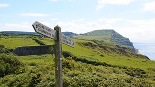
Hiking is a great way to get off the beaten path and away from civilization, but the trails we walk on are lovingly constructed and maintained by teams of rangers, forestry workers and volunteers who work tirelessly to keep the trails free of obstacles and often, to post handy hiking trail signs that help us on our way. Though not all trails have clear signs marking the way, and hiking trail signs different from state to state and country to country, there are some basic categories of trail signs that it’s useful to understand before you hike, much in the same way you want to understand traffic signs before driving a car.
In this article, we offer a quick guide to some common hiking trail signs – and a few other types of markers – so you can use them to your advantage when it comes to remaining safe, sharing the trail, and staying on track when you’re out in your hiking boots .
Trailhead signs
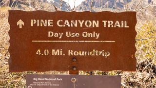
Designated trails should have a trailhead sign announcing the beginning of the path. This may be as simple as a wooden sign with the name of the trail and hopefully the walk distance, however it may also come with other informative details such as a route and area map, which is helpful to study in case you come upon an unmarked crossroads. If it’s a long or complicated hike, a good hack is to photograph the map on your phone in case you want to refer to it later.
The trailhead may also have information regarding camping permits, wildlife safety and overnight parking if you’re backpacking. Pause here to take stock of where you are and where you’re going.
If you’re hiking into a National Wilderness area, there may be a sign-in book here – be sure to sign your name so that if you get into trouble, search and rescue has some clues about who you are, where you went and when you set off.
Permitted use signs
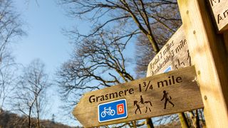
Before you set off, look out for any signs indicating whether the trail is mixed use. These might be wooden or metal, but will typically have diagrams indicating whether the trail is open to hikers, bikers, horseback riders and motorized vehicles like dirt bikes and four wheelers. Any that are depicted are permitted, unless they have an X through them.
If bikers, horses or motorized vehicles are permitted on the trail you are using, you will want to make sure you aren’t wearing your best running headphones so that you can hear other users coming and move out of the way as needed.
Advnture Newsletter
All the latest inspiration, tips and guides to help you plan your next Advnture!
The signage may also indicate who has the right of way. Generally speaking, bikers should yield to hikers, however mountain bikers will be moving fast if they’re coming downhill so it’s best not to play chicken. Meanwhile, as a hiker, you should yield to horses. Read more in our article on what to do if you encounter a horse on the trail. Motorized vehicles should yield to hikers and should slow way down as you pass.
If you encounter users on hiking trails that aren’t permitted to be there, alert park rangers or the forest service when you return to the trailhead.
Warning signs
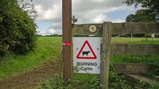
There are various warning signs that you might encounter either at the trailhead or on the trail. These might include the following:
- Wildlife warnings may tell you about bear prevalence in the area and what to do if you meet a bear , recent mountain lion sightings and may advise what type of protective equipment you need, such as bear spray .
- Hazard warnings alert you to obstacles such as flooding on the trail, construction or trail closures – these should be heeded.
- Stay on the trail signs along the way are placed there to keep hikers from cutting switchbacks , which can increase erosion or offset revegetation and conservation efforts.
- Private property signs along the trail will alert you to any time you are crossing private land – be respectful in these areas by staying on the trail, not going to the bathroom and being friendly to any land owners you meet.
- Livestock warning signs will alert you to the presence of cows where you are at risk of being trampled and will want to keep your dog on a leash.
Navigational signs
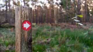
You can’t rely on navigational signs along every hiking trail unless you’re hiking in a National Park , but they sure are helpful when they're there. If you’re lucky, these will be arrow-shaped wooden posts with the name of the trail or destination and indicating the direction and distance left to go.
However, they may appear in a different format, for example:
- Colored signs: a simple method is just to nail small colored metal signs with arrows to trees or wooden posts.
- Numbers: forest service trails may be marked only by number on a wooden or metal sign, instead of a name, so make sure you identify your trail number at the trailhead.
- Long trail symbols : long distance trails like the Appalachian Trail and the Pacific Crest Trail will be marked by small signs displaying the trail’s unique logo that will be nailed to trees or lamp posts along the way. These are useful when the trail crosses a road or briefly disappears in a more developed area.
- Paint blazes: some trails are marked by small dabs of paint on the trees. These vary from state to state and are sometimes color coded or use systems such as different shapes or formats to denote different directions and details, while at their simplest they simply mark the way through the forest.
- Flagging tape: instead of blazes, you might see pieces of tape, usually yellow, tied around tree trunks to mark the way. These can also be a way of marking diseased trees for removal so you’ll want to be sure that they are for navigation before using them for that purpose.
- Rock cairns: perhaps the original waymarker, rock cairns are piles of stones used for navigational purposes and are particularly helpful above treeline where there are no trees. Please do not disturb rock cairns – despite appearances, they aren’t art.
Don't want to rely on the unpredictable and inconsistent world of hiking trail signs to navigate the trails? The best approach is to arrive armed with your own navigational tools. Start with our articles on how to read a map and how to use a compass and you shouldn't be lost for long.

Julia Clarke is a staff writer for Advnture.com and the author of the book Restorative Yoga for Beginners . She loves to explore mountains on foot, bike, skis and belay and then recover on the the yoga mat. Julia graduated with a degree in journalism in 2004 and spent eight years working as a radio presenter in Kansas City, Vermont, Boston and New York City before discovering the joys of the Rocky Mountains. She then detoured west to Colorado and enjoyed 11 years teaching yoga in Vail before returning to her hometown of Glasgow, Scotland in 2020 to focus on family and writing.
Coros Vertix 2S vs Coros Vertix 2: choose the right adventure watch for you
Fjällräven/Specialized Top Tube Bag review: a bijou bikepacking bag with a lot to offer
Your Garmin watch is getting a huge update, with 35 new features and bug fixes
Most Popular
- 2 Coros Vertix 2S vs Coros Vertix 2: choose the right adventure watch for you
- 3 Fjällräven/Specialized Top Tube Bag review: a bijou bikepacking bag with a lot to offer
- 4 18 crazy things climbers and ultra runners do to save weight
- 5 Careless tourists caught mobbing giant elk for photos at Canadian National Park
Learning to read signs on a trail
I am thrilled to introduce fellow Ordnance Survey #GetOutside Champion Glyn Dodwell who has kindly agreed to contribute a guest post to our blog on Tracking Signs. Creating and following track signs is a brilliant outdoors family activity, and a great way to entice kids outside – I can’t think of one child who doesn’t love following clues, and since it’s a visual activity that works with symbols, even the youngest members of your family will be able to join in!

Tracking Signs – The art of leaving and/or following the tracks that are left behind to show a route by Glyn Dodwell
It can be important to be able to leave an explicit track that others can follow, and it is an enjoyable skill both to leave and to follow tracking signs. If you are forced to set out on your own, for instance, it might save your life. If something were to happen to you and you weren’t able to make it to your destination, someone could follow your trail, and eventually find you.
Below are some of the more frequent signs used in tracking. The first four are the most commonly used ones, and can be made out of anything available including piles of pebbles, sticks, or even by tying the tops of long grass together and pointing the end in the required direction. The X sign is useful as it is a simple sign which can quickly show the path that wasn’t taken at a fork in the road, for instance. The final one, Gone Home, marks the end of the trail.
The second row are some of the fancier signs, showing that you have left a message for your trackers, that your party had to split up, that you might have to cross a fallen tree, for instance, or go over water (or just that water is nearby in particularly arid places such as deserts).
There are lots of other signs, but these are the common ones:
Why not try linking your new found skills into some form of fun survival activity. This could include finding a casualty, rescuing someone being held captive or simply following a trail to the perfect spot to build a camp. Although this activity could be carried out anywhere, a local woods would make an ideal spot. If you would like to save the tracking signs to take out with you, it can be found in a printable version here.
Having just turned 60 himself, Glyn was surprised to see how little encouragement there is to get the ‘older generation’ out into the hills. And despite suffering from arthritis, severe pain and a stroke 2 years ago, he is a determined Champion for the greater involvement of over 60’s in hill-walking on his blog Hill Walking For The Over 60’s – It’s better to be on the hill, Than over the hill!
How to Make Beautiful Sgraffito Decorated Eggs
How to get kids to do their chores, leave a comment, 20 comments.
[…] Learning to Read Signs on the Trail […]
This is really cool, I must try it with my little one!
And congratulations, someone loved this post so much they added it to the #BlogCrush linky! feel free to collect your ‘I’ve been featured’ blog badge :)
Thank you so much Alice, I’m delighted you enjoyed our post and to be featured!
[…] of sticks I can get him whittling something fantastic – I keep saying it in the hope it happens. Craft Invaders have some fabulous bushcraft activities on their website, so I plan to have a go at making and […]
I love outdoors and I am familiar with the most of the signs he showcased in this blog but there are a few I never saw before and they are good to know!
But I think that while leaving these signs it is good to make sure that the wind or no animal can rip them apart and make them unreadable.. Maybe getting thick wood branches and placing them in the ground for the half of their thickness. That way they are still visible and can not be easily moved. Naturally the same can be done with the thick stones.
Great tips George, thanks :)
Hiking is a favorite of my family! If I ever make it to the UK, I’m hiking with you. I don’t think I ever knew these tricks.
It’s a date Kellie – that’d be so much fun :) The signs are great aren’t they – fab way to turn a walk into an adventure :)
Ok, it’s added to my wish list. And on all of our hikes this year, it will be fun to make some signs.
I look forward to seeing some photos when you get out hiking :)
What fun Sarah. It would be such a lovely way to get the kids outside on a treasure hunt and leaving natures clues. Thanks for getting Glyn to share these, I really enjoyed it.
Thanks Michelle, it is such a great way to get kids to open their eyes up to their surroundings :)
This is fab. I didn’t know any of these.
It’s great isn’t it Kerry, there’s so many ways kids could use these both in and outside!
As my daughter has got older (teens) she’s started to suggest more long walks. You could have knocked me over with a feather – I didn’t expect this from her! She would love to use this printable and make walks more fun. Super idea.
Thanks Janet, it’s great when kids start to recognise for themselves the joy that can be found in being outdoors :)
Glyn sounds like such an inspiration person and I love the idea of trail signs to get more people outside. I think these day it is too easy to stay in, so anything to get people outside is a winner with me!
He’s lovely Emma, and an absolute mine of knowledge. It’s a great way to make a walk sound exciting to kids, rather than just saying ‘lets go on a really long walk’ which isn’t always the best way to create enthusiasm in my experience!
Oh I wouldn’t have had a clue about any of these!
It’s great fun isn’t Lyndsey, my kids love any sort of treasure hunts and secret codes so they love this!

Outdoor Action
Leadership Starts Here
Search form
Guide to animal tracking, tracking.pdf.
trackcard.pdf
Outdoor action guide to animal tracking, by rick curtis.
The information in this workshop is taken from my notes from a course at Tom Brown's Tracking School in New Jersey, in a course taught by John Stokes of The Tracking Project, and from my personal tracking experience. The information provided here is designed for educational use and is not a substitute for specific training or experience. Princeton University and the author assume no liability for any individual's use of or reliance upon any material contained or referenced herein. This material may be freely distributed for nonprofit educational use. However, if included in publications, written or electronic, attributions must be made to the author. Commercial use of this material is prohibited without express written permission from the author. Copyright © 1999 Outdoor Action Program, Princeton University.
- Large Scale Sign
- Medium Scale Sign
- Small Scale Sign
- Ghost Scale Sign
- Parts of a Track
- Measuring a Track
- Classification of Tracks
- Pattern Classification
- Diagonal Walkers
- Reading Tracks
- Aging Tracks
- Learning Techniques
- Tracking Safety
- Bibliography
- Tracking Cards
"The earth is a manuscript, being written and unwritten every day. The Pine Barrens are a geological track, the Mississippi River is a track, and so are the Rocky Mountains. The track/print/geology is made and then slowly worn down or built upon by the forces of natural erosion and gravity. Gravity ultimately wants everything to be at the same level. A track is the earth's reaction to your passing over it. From each passing there are a series of concentric rings than ripple out. The track itself is one such ring, so is the call of the blue jay that scolds you as you walk beneath his tree." from John Stokes '74 "Tracking is like learning to read. First you start with the ABC's then you work up to simple sentences, then to paragraphs and finally to books. Ultimately, with practice, you can read very difficult books with a great deal of hidden meaning." "A track is a window to the past of an animal. Look at the ground as if it were a manuscript of the animal's life." "Every pock, hill, dome, etc. is the track of something. A dent in the forest floor may be the track of a fallen branch." from Tom Brown
Learning to track is a sacred responsibility. It gives you the ability to come into the center of the lives and homes of animals. You must treasure this gift and respect the animals by being non-intrusive. Getting too close to animals can cause serious disturbances including: abandoning young, disturbing nesting grounds, damaging foraging areas, and may even cause the animal's death. For example, in winter, many animals are severely stressed to gather enough energy to stay alive. Escaping from a human prescence could rob them of enough energy that they can no longer sustain themselves. Always remember that you are only a visitor into their habitat.
SIGN TRACKING
The first thing to learn about tracking is knowing where to look for animals. Much of this is done by what is called "sign tracking". Signs are anything besides a track proper that is an indication of an animal (e.g. trails, scat etc.). About 1/2 of tracking is sign tracking the other 1/2 is working with actual tracks.
LARGE SCALE SIGN
I. Landscape Tracking - this is reading the landscape to locate animals. In most landscapes there are "islands" where many species will be found. One way to look is to find the best "islands" for herbivores. Wherever there are herbivores, carnivores will follow. The areas between the islands will tend to be scarce of animals except as an area for animals to pass through.
- *Cover - thick tangles of vegetation, brush, rocks, to hide in and escape to
- *Wide variety of vegetation - a single type of vegetation is cleaned out. A good supply is necessary to be able to stay in the habitat/home. Going outside of the habitat is dangerous. Therefore, having various types of vegetation that come in at different times helps to maintain an ongoing food supply.
- Water - this is not essential since many herbivores don't need it. They get water from dew and from the plants they eat.
- Vole - most prolific rodent, and a major food source for all predators
- Deep Forest - very poor as an animal habitat. There is little undergrowth and poor cover. The vegetation is not very varied. Generally there are some raccoons, birds, rabbits, but very few others.
- Fields - also very poor. There is little or no cover except at the side of the fields. The middle of the field is open territory for hawks and owls.
- TRANSITION AREAS - these are excellent locations to find animals. A transition area is zone of intersection between two habitats. Ex. Forest and field, field and stream, forest and stream. These offer wide varieties of vegetation and cover.
II. Travel Routes - Animals will tend to take the easiest route of travel across a landscape (just like you and I - around boulders etc.) unless they are being pursued. This results in the creation of a number of "roadway systems" within the habitat. Sticking to a roadway system when being chased is poor. The prey is usually smaller than the predator and therefore tries to push through tiny openings in deep brush where the larger predator can't follow.
- Trails - are species nonspecific. Any number, size, and shape of animal will use them. These are the superhighways of the woods. They are frequently used and rarely changed. Animals know them intimately. There may be troughs, no vegetation or battered vegetation.
- Runs - these are less frequently used and are very subject to change. There is some definite wearing into the landscape but varies. These are very specific to a particular animal and what it is used for (e.g. runs may connect watering areas, bedding areas, feeding areas back to a trail). Survival Note: Runs are good areas to trap. You know what animal you are going for.
- Pushdown - Generally only used once, crashing through the brush from a trail or run to escape. Brush is broken down.
- Established Escape Route - a pushdown used repetitively. It often leads to a hide.
III. Animal Sleeping Areas
- Bed - any consistent sleeping place. It is well chosen to be in the thickest area of brush to be able to hear a predator coming.
- Transit Bed - an established bed used every so often.
- Lay - usually used only once or twice. Used for rest, chewing cud, etc. Can be recognized by broken and crushed vegetation.
- Den - only used to bear and raise young.
Ex. Fox is an open ground sleeper, it curls up in the brush. For birthing it excavates a hole or uses an old groundhog hole for a den. Ex. The groundhog hole is a place for the groundhog to live. While it is raising young it is a groundhog den.
IV. Feeding Areas
- Varied Run Feeding area - where animals go through and eat off of the trail or run further and further. (80%)
- Single plant feeding area - characterized by a run terminating at a single plant or group of plants of one kind.
- Eat-through - where an animal or animals has literally eaten through a patch of vegetation and come out the other side.
- Patched - marked by irregular nibblings along the edges of established trails or runs
MEDIUM SCALE SIGN
This makes up the largest assortment and most definitive sign. It is found all over especially on trails and runs.
I. 8 Most Important:
- Unintentional - animal rubbing up against an object that protrudes onto the trail (e.g. a branch).
- Intentional - specific area where an animal is rubbing itself. E.g. deer scraping velvet off antlers, wallowing in dirt to rid itself of mites etc.
- Hair and Feathers - especially at a rub or a projection where the hair or feather gets snagged. Clumps of hair may either be purposely pulled out by the animals or clumps of hair or feathers may indicate a kill site.
- Gnawing - like a beaver, on nuts, trees bones (rodents get their calcium from gnawing bones). You can tell the animal by the size of the teeth marks.
- 45 degree Clean Cut - caused by an animal with incisors - rodent
- Little serrated edge - deer - pull grass up against upper palette and sickle it off by pulling neck up
- Masticated - teeth marks all over possibly with saliva - a predator chew, used to get minerals
- Break - not a chew, this is caused by animal movement.
- Intentional - for example a skunk or raccoon scratching in the ground for grubs, cat or bear sharpening claws on a tree.
- Unintentional - from the animal's passing
- Ground Debris - any debris on the ground that is scratched, pinched, dented, abraded unnaturally, holes, stone rolls, broken twigs etc. (stone roll = a stone out of its bed, rolled over, skidded etc.)
- Upper Vegetation - vegetation breaks (see above), plants abraded and broken by animal passage. The location of the break (how high up) indicates type of animal. You can age a break by clearly noting how the vegetation has aged at the break and doing a sample break to observe and time. This is not as accurate as track aging.
- Scat - tells an incredible amount. Scat tells you the type of animal by its size, shape, and consistency. It tells you what the animal has been eating. Animals leave scat in areas which they feel safe. This means that it is a good area to look for animals. Scat is often found near lays.
Scat Analysis: First determine the family shape. Then lay the scat on a piece of paper, cut it down the center carefully, then quarter it. Take a pair if tweezers or a toothpick and pick away at the edge carefully. Separate the contents into piles of bone, feathers, hair, misc. in order to see what the animal's been eating (this is for carnivores). If you find a skull, check Peterson's Field Guide to Mammals for skull or teeth identification. Herbivores tend to show loose, mushy scat in the summer because they are browsing on soft succulent vegetation. As summer turns to fall you will find more evidence of nuts, seeds, and fruits. In winter the scat becomes quiet hard and compact consisting mainly of the more woody buds, twigs, and bark. Avoid using your fingers to work with scat (wear gloves). If the scat is dry and dusty, don't inhale the dust (can lead to lung infections).
Aging Scat: can be aged but to be at all accurate you need to see it come out of the animal. Leave a popsicle stick marker and check it every so often. Scat dries from the inside out. Find some fresh, pick it apart and examine the contents. Come back later, pick another apart and see how it has changed over time.
Pellets: Raptors (hawks, eagles, and owls) regurgitate pellets of what isn't digested. These pellets consist of bones, hair and/or feathers.
SMALL SCALE SIGN
- Compressions - this is both a track and a sign. On any surface there are dust particles and grit which collect. When anything walks over this surface it either presses the grit into the surface or removes it. You can see this using the sideheading technique.
- Sideheading: Keep the track between you and the light source. Get you head down along the ground. Scan the ground with your bottom eye (bottom eye reads to 1 ft. top eye reads to 3 ft.). The compressions will appear as a shiny spot or a dull spot on the surface (depending on whether the grit is shiny or dull). When more dust settles it will add a layer to everything but the pock still is visible.
GHOST SCALE SIGN
This is an interface between tracks proper and disturbances not on the ground which disappear (or seem to).
- Dullings - in the morning with dew on the ground everything is shiny from the dew. If something crosses the grass it either presses or wipes away the moisture which appears as a dull area. This disappears as the dew evaporates.
- Shinings - during the day everything begins to dull down. Anything walking on the grass presses it down and the shinny side of the grass catches the sunlight giving it a shining. The shininess disappears in about 2 hours. The bent grass recovers completely in about 24 hours.
- Leaf Depression - leaves are compressed as an animal walks leaving a compression outline beneath the leaves in the soil (a true track). The leaves spring back up but not all the way leaving a depression. By sideheading you can see the depression.
PARTS OF A TRACK
When a track is made, the heel slides into the ground, registers and pulls out. No track will register straight down. There is always some angled component (looking at the track cross-section) either from the foot entering or the foot leaving.
The softer the soil, the greater the slope of the wall creating a larger distortion between the overall track and the true track. Most people don't read the true track. They read the horizon cuts (overall track) which does not give the true track measurement. The true track is the only real measurement for tracking. If you read the overall track you could not tell the difference between a dog track and a coyote track. E.g. on a dog the inner toes are larger than the outer toes; on a coyote the outer toes are larger. But this distinction will not show on the overall track.
MEASURING A TRACK
You need to measure the length and width of all four tracks (2 in humans). When measuring animal tracks the length readings between tracks are measured from toe to toe because animals hit first with their toes. In humans it is measured from heel to heel because we land heel first.
- Establish the Line of Travel - This can be done by eye if the tracks are clear or by placing popsicle sticks at the heel of the tracks and connecting a string to the sticks.
- Length of Track - measure the length of the true track.
- Width - measure the widest part of the track.
- Stride - is measured from the heel of one foot to the heel of the other foot (i.e. right heel line to left heel line).
- Straddle - if you draw a line of travel between the left heels and a line of travel between the right heels the distance between these two lines is the straddle. There is zero straddle and positive straddle.
Overall Pitch - 1/2 track width = True Pitch
Ex. 4" wide track, 3" overall pitch 3 - (1/2 * 4) = 1" = true pitch
This is because if there is no pitch there would still be 2" from the line through the track to the heel line. So this measurement must be subtracted.
Ex. 2" - (1/2 * 4") = 0
- Overall Stride - is measured from the heel on one side to the next heel on that side. Thus there is a left overall track and a right overall track. Comparison of these two can determine the orientation of the trackee.
- Determining Orientation - The dominant side gives a short (punch) step while the nondominant side gives a long (feeler) step. Thus if a person is walking blindfolded they will circle to the dominant side. E.g. a right-sided person has a right overall stride of 20" and a left overall stride of 20 1/2". Thus the person will veer to the right. This is why a lost person often picks a path dictated by veering to their dominant side. Note: If you add 1 pound of weight for every 50 pounds of the person's body weight and carry this weight on the nondominant side it will straighten out the person's walk (no circling).
CLASSIFICATION OF TRACKS
5% 1) Clear Print - when you can see the track clearly in soft soil, all toes visible. 95% 2) Pattern Classification - no clear print, you must tell track by general shape and size of track
CLEAR PRINT CLASSIFICATION
The front and rear tracks on one side will be near each other. You need to note the number of toes in the front track and the rear track. Looking at the track you will also note the type of preferred gait used by the animal (in order to differentiate between front and rear tracks).
- Track Shape - the track shape is the overall shape of the track pattern.
- Direct Register - as the front foot is lifted up the rear foot on that side drops directly into the front track (cats and foxes). Also called perfect walking.
- Indirect Register - as the front foot is picked up the rear foot on that side drops slightly behind and to the right or left of the front track (depending on the sex of the animal).
See Track Cards.
- Ground Bird - spend most of their time on the ground and show a "walking" gait
- Perching Bird - spends most time in the trees - shows a "hopping" gait
- Mixed - if the track shows both walking and hopping it is probably a bird that splits its time between trees and the ground e.g. Crow
PATTERN CLASSIFICATION
There are a number of different types of locomotion patterns. 90 - 95% of the time an animal will use this method of locomotion. In each case below the gait described is the normal walking pattern for that animal. As the animals speed changes this pattern will change (ex. moving slowly, in pursuit, being chased).
RF = right front LR = left rear, etc.
1) Continuum of Speed:
Stalk ------->Slow Walk -------->Walk ------->Trot ------->Bound ------->Lope ------->Gallop
2) Diagonal Walkers - the animal moves the opposite sides of the body at the same time (e.g. RF & LR move simultaneously) Deer Dog Cat - cat and fox direct register by being completely off the ground at one point
3) Bound Walkers - the front feet land together, then the rear feet behind 99.9% of the time these animals use this pattern even when moving slow or fast. Stride measured from rear toes to rear toes. Weasel Family - All Members Except Skunks & Badgers
4) Gallop Walkers - the front feet land first, then the rear feet come on the outside of the front feet and land ahead. 99.9% of the time these animals use this pattern even when moving slow or fast. Stride measured from rear toes to rear toes. The pattern doesn't change with speed. The distance between sets of tracks increases. Rabbits Hares Rodents - Except Porcupine & Ground Hog
If the front feet hit at a diagonal = ground dwelling rodent e.g. Rabbit, and the front foot that is further back is the one that hit first - sidedness (punch step). If the front feet hit side by side, it is a tree dweller e.g. Squirrel (just like tree dwelling birds - "hoppers")
5) Pacers - move the same side of the body at the same time (e.g. RF & RR) - these animals have wide, rotund bodies. These are the exceptions from the other groups. 95% of the time these animals use this pattern. As speed increases, they change their pattern. Badgers Skunk Porcupine Oppossum Raccoon Bear
6) Variations on Pattern Classifications - 5% of the time. All animals can change their gait. In particular, Diagonal Walkers and Pacers will change their pattern as their speed increases.
In between these major patterns there is a continuum of discernable pattern variations.
- From Pacer to Diagonal = 16 patterns
- From Diagonal to Bounder = 32 patterns
- From to Galloper = 16 patterns
- For speed, a slow walk for a Pacer is faster than a slow walk for a Diagonal Walker.
- A stalk is generally the slowest pattern and is slower for both a Pacer and a Diagonal Walker.
- Slow Walk - animal pushes body weight forward.
RR --> RF --> LR --> LF
SUMMARY OF CLASSIFICATIONS & VARIATIONS
Tracking by patterns allows you to track over hard ground over a long distance.
1. Diagonal Walkers
- Pace when bored, annoyed, aggravated
- Rarely hold a bound except in soft or rocky terrain - prefer to gallop; on clear terrain hold a bound on for a few patterns before going into a gallop - prefer to trot or lope - can go straight from a walk to a gallop (e.g. if suddenly frightened)
Species Note: Deer prefer to gallop for high speed except for the Black Tail Deer and the Mule Deer that prefer to bound because they live in rocky areas.
2. Bound Walkers
- For a shear burst of speed will gallop - seen just before a kill
- Will diagonal walk when approaching hunting territory e.g. slowing down to be more quiet
- Will stalk when hunting game
- Will pace when aggravated, bored or agitated, threatening, seen just before going out on hunt
Note: This is an example of how you can tell the "emotional state" of an animal by looking at its tracks.
3. Gallop Walkers
- Prefer to gallop but will bound in soft terrain i.e. snow, mud or rocky terrain
- Will diagonal walk if it needs to cover a shorter distance than a hop would cover, e.g. rabbit moves 2" over to feed
- Will stalk when moving away from danger
- Will pace when aggravated, threatening or bored
- Can go from a stalk to a gallop
READING TRACKS
1) Sidedness - if one front foot is behind the other over 4 - 5 tracks that foot is on the dominant side. The animal will have a tendency to circle in that direction.
2) Sex - (this works for diagonal walkers only). Deer for example, just because a track is deep or splayed wide does not mean that animal is male. There are variations in the size of animals of the same species from location (different amounts of feed). Male deer (bucks) and female deer (does) have different bone structure. Doe - pelvic girdle > shoulder girdle (for birthing). Buck - shoulder girdle > pelvic girdle (to support antlers). In order to tell the sex of the animal you must compare the animal to itself. Find the front track on one side. The look for the rear track on that side. If the rear track is to the inside of the front track = male, a rear track to the outside = female. This system works only for adult animals. Immature animals have not finished bone development and may have rear track falling exactly behind front track. Cats are another example because they direct register. Then how do you tell whether the rear foot is inside or outside the front? In cats (and foxes) the front foot is larger (by 1/3) that the rear foot. Thus the rear track will fall in the front track and be to the inside or the outside. Inside = male Outside = female.

AGING TRACKS
1) The single most important factor in track degradation (and thereby aging) is weather and weather fluctuations.
2) Gravity is the second major factor in track degradation.
3) The third factor is the type of soil. The only way to learn to age tracks is to observe a track degrade over time with given soil conditions and weather conditions. Soils are classified from 1 to 10 with 1 being sand and 10 being clay (soft to hard). You must estimate the soil classification first. Then keep an accurate record of weather changes and by observing a track you will develop a sense of how a track degrades in that type of soil with those weather conditions. Weather conditions to be aware of are temperature, humidity, wind, precipitation, and hours of direct sunlight on the tracks.
4) Wisdom of the Marks - Do this once a month for three months and you will cover all seasons for the type of soil in your area (if possible do it with various types of soil). Clean out rectangular area of soil. Remove all rocks, transplant plants etc. Dig down 2 inches, break up soil into smooth texture, pat it down smooth and leave it to settle for 24 hours. Using a stick or object approximately 1/2 inch diameter make 5 marks in a row in the soil with varying pressure from a touch to enough to go 1/2 inch deep. Look at the marks carefully for 10 minutes to ingrain into your subconscious what they look like. Write down weather conditions. Come back 6 hours later and repeat the entire process making the new marks with the same implement and the same pressures in a row next to the first marks. You will now have fresh marks and 6 hour old marks to compare. Study both for 10 minutes. Come back in 6 hours and again 6 hours after that and again in 6 hours. This will give you a comparison of track degradation at 6 hours, 12 hours, 18 hours and 24 hours. Then go back every 24 hours for 6 days and you will see the track age and degrade over a week. After doing this summer, fall, winter, and spring you will begin to learn how to age tracks to within 2 hours of their being made. It is also advisable to do this whenever you move into a new area for tracking.
LEARNING TECHNIQUES
1) File card learning Method - Read about an animal in the Peterson's field guide an prepare a scan card on a 3 x 5 index card. By scanning these cards during "blow off time," you will quickly learn to recognize tracks.
2) Tracking Stick - This can be either primitive ( a stick with notches cut into it) or advanced a dowel with rubber bands ("O" ring washers work great). The stick should be about 3' x 1/4" and very straight. The tip should be sharpened to give a point. The stick is used to measure a track and give you a standard for comparing and looking for the next track.
- Tip to 1st mark = length
- 1st to 2nd = width
- Tip to 3rd = stride
- 3rd to 4th = straddle
- 4th to 5th = true pitch
Since animals walk 95% of the time the tracking stick is a useful way to find the next track. If you lay the 3rd mark over the center of the last track the stick will point to the center of the area where the next track will be. To find the track add the straddle. If you don't find the track, ask yourself what does the landscape tell you? Uphill, downhill will shorten the stride; debris - does the animal understep or overstep it? Soft earth will have an effect on stride length.
3) Track Pack - Carrying these items with you will help in learning to track.
- Magnifying glass - large 2-4 x, jewelers loop 10x
- Tape measurer - thin, metal 8'- to measure stride, straddle etc.
- 6" plastic ruler - to measure track
- Small notebook
- Ziplock bags - for scat, bones etc.
- Peterson's Field Guides
- Popsicle sticks and string
- Price tags - for labeling.
All the information you need to find the next track is within the one you have. Never skip a track (cross-tracking); it doesn't teach you anything. If you hit "the wall" and can't find the next track, work at it, analyze it. This is how you learn to be a good tracker. If you spend 2 hours to find the next track, your skill will grow to a higher level.
TRACKING ENVIRONMENTAL HAZARDS
In any tracking situation you need to be aware of what the local environmental hazards are in order to avoid accidents. This is a general list for a typical mid-Atlantic forest region.
Sample Environmental Hazards:
- Scat - avoid handling it with your hands. When picking apart scat or pellets use a stick or disposable gloves. Dry scat contains numerous microorganisms and spores which if inhaled can lead to serious lung infections.
- Poison Ivy, Oak, Sumac - The basic rule of "leaves of three, let it be" serves as basic identification of poison ivy. Know how to recognize it both in the plant stage and the vine stage. Typically found in moist soil areas.
- Ticks - Tick bites can lead to a number of serious diseases including Rocky Mountain Spotted Fever (RMSF) and Lyme Disease. RMSF is primarily carried by dog ticks. Lyme Disease is carried by deer ticks which can be very difficult to locate. See the enclosed articles on Lyme Disease. Often found in the thick brush at the edge of transition areas.
- Bees & Wasps - nests often found in rotting logs where you may be looking for sign.
- Rattlesnakes - often sun themselves on rocks in cool weather or hide in shadowed areas in hot weather.
- Rabies - Rabies is on the increase in animals. Do not approach animals too closely. Rabid animals may appear anxious and aggressive or very docile. In either case they can attack very suddenly.
- Hanta Virus - Hanta Virus is carried by rodents.
BIBLIOGRAPHY
- Animal Tracks , Olaus Murie, Houghton-Mifflin, New York, NY 1974.
- A Guide to Animal Tracking and Behavior , Donald and Lillian Stokes, Little Brown, Boston, MA 1986.
- A Field Guide to Mammal Tracking in North America , James Halfpenny, Johnson Books, Boulder, CO 1986.
- A Field Guide to Tracking Animals in Snow , Louise Forrest, Stackpole Books, Harrisburg, PA 1988.
- Tom Brown's Field Guide to Nature Observation and Tracking , Tom Brown and Brandt Morgan, Berkeley Publishing, New York, NY 1983.
Graphics adapted from the following:
- The Tracking Project, Corrales, NM 1991.
Volunteering at Scouts is changing to help us reach more young people
Volunteering is changing to help us reach more young people
Volunteering is changing at Scouts. Read more

Try making tracking signs
Back to Activities
You’ll need
- Natural materials (for example, leaves, twigs, feathers)
- Tracking symbol sheets
Before you begin
- Use the safety checklist to help you plan and risk assess your activity. Additional help to carry out your risk assessment , including examples.
- Make sure all young people and adults involved in the activity know how to take part safely.
- Make sure you’ll have enough adult helpers. You may need some parents and carers to help if you’re short on helpers.
Setting up this activity
- having an InTouch system
- checking the weather forecast and sunset
- clothing and footwear
- telling people where to meet and drop off/pick up area
- roads and traffic
- appropriate boundaries and no-go zones
- accessibility of the venue and terrain
- toilet access
- drinks and snacks, including allergies and dietary requirements
- having activity consent forms
- having appropriate supervision
- Print out or create different tracking signs and symbols and put them on the ground.
- Gather together some sticks and stones, as well as other natural materials, for people to use during the session.
Introducing the space
- Everyone should head out to the outdoor space or meet at the chosen venue.
- Explain the boundaries of the playing area and where the no-go zones are. You should set rules for where players can go and where they can’t, making sure that the terrain and spaces are accessible for everyone to use.
- Remind people how they can use the space respectfully to nature and other users. They should be calm and quiet, try not to disturb wildlife, take litter home, replace things from where they were found, and not pick any flowers or plants.
- If playing in a public space, young people should be paired up so no young person is left alone and they should run or move together.
- Tell everyone where adults will be around the site and what people should do if anyone in their team needs help. This should include setting memorable spot where an adult will stay at all times.
- Explain the signal to stop play and how long the activity will go on for. A long blast on a whistle works well as a signal to stop.
Running this activity
- Gather everyone together and tell them that you’re going to be learning about tracking. Ask if anyone knows what tracking is. It means using of signs and symbols to leave a trail for other people to follow.
- Explain that good tracking means you have to be observant and pay attention to your surroundings. People to look around them and observe, as some of the symbols or signs might not be obvious.
- Ask everyone to get into pairs or small groups. Each group needs a sheet to help them identify different tracking signs and symbols.
- Using the sheet, each group should work to identify what all the signs and symbols on the floor mean.
- Once everyone has finished, people should get into groups of four. One pair should plan and create a simple trail for the other pair to follow. You could give pair something to put at the end of the trail, so people know when it’s been completed, such as a cone or beanbag.
- Everyone should think about what they could use to make the signs, such as chalk or sticks.
- Each pair has ten minutes to lay out their simple trail, before testing it to see if they can follow the route.
- Ask each pair to swap over, so they each are stood in front of the other pair’s trail. They should be ready to follow it.
- When everyone’s ready, ask the pairs to start following the trail. the pair laying the trail now get the chance to follow a trail.
- At the end, gather everyone back together. Ask everyone what natural track signs could be, which might help show us where something unexpected has happened or where someone’s been before we got there. For example, this could be something out of place, flattened grass where an animal has disturbed something looking for food, or where a plant has been crushed by a foot. Everyone should look for a natural track or sign, then try to work out what caused it.
- You could also set up a longer tracking trail for the whole group to try and follow - you could even put a prize or reward at the end.
This activity gave everyone a chance to enjoy being outdoors. What did you enjoy about making and following the tracks? Did you find it easy to spot and follow the tracks once you knew what you were looking for? Did you feel comfortable being outside to lay and follow the track?
This activity needed everyone to communicate. When might you use a tracking sign or symbol to send a message to someone else? You might want to think about alerting someone to a hazard up ahead, or letting someone know where the camp or base is. When might laying a track be more useful than having a mobile phone? It might be useful when you don’t have signal, or you wanted to communicate with people you don’t know – or it might just be that laying a track is fun!
All activities must be safely managed. You must complete a thorough risk assessment and take appropriate steps to reduce risk. Use the safety checklist to help you plan and risk assess your activity. Always get approval for the activity , and have suitable supervision and an InTouch process.
You must have permission to use the location. Always check the weather forecast, and inform parents and carers of any change in venue.
The game area should be free of hazards. Explain the rules of the game clearly and have a clear way to communicate that the game must stop when needed. Take a look at our guidance on running active games safely .
Complete a thorough risk assessment and include hazards, such as roads, woodland, plants, animals, and bodies of water (for example, rivers, ponds, lakes, and seas). Y ou’ll probably need more adult helpers than usual. Your risk assessment should include how many adults you need. The young people to adult ratios are a minimum requirement. When you do your risk assessment, you might decide that you need more adults than the ratio specifies. Think about extra equipment that you may need to take with you, such as high visibility clothing, a first aid kit, water, and waterproofs. Throughout the activity, watch out for changes in the weather and do regular headcounts.
Change the level of challenge
Start with just a few tracking signs and add more as the group becomes more confident. Put tracking signs at different levels – try on logs or chairs as well as on the floor. You could also print out the different tracking symbols, if that makes them clearer to see.
Make it accessible
Make sure the trails are placed in areas accessible for everyone in the group.
All Scout activities should be inclusive and accessible.
20 Best Outdoor Adventure Apps
Check out these outdoor apps for camping, hiking and trekking. Here you'll find help with navigation, first aid, survival guides and more.

Take on the Great Outdoors
When you're prepping for vacations, holidays, and hiking and camping trips, remember to take your trusty smartphone with you. It's an essential piece of survival gear, if you know what apps to preload. Without these key apps, you could get lost or hurt and be unable to call for help. Check out our top picks for awesome outdoor navigation, first aid and survival guide apps. ( Credit: Wavebreakmedia/Shutterstock )
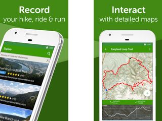
AllTrails - Hiking & Biking (Android, iOS: Free)
Out for a hike? The AllTrails app (Android, iOS ) has got you covered with more than 50,000 trail guides for hiking, biking and more. Browse through the trail list or search for trails near you, look up trail reviews and write your own. AllTrails allows you to view topographic maps, photos and reviews. From within the trail, you can upload pictures taken on the trail, and even create and upload your own tracks using your phone's GPS tracker. An AllTrails Pro subscription allows you to download offline maps, print maps from AllTrails.com, create custom maps, and access additional map layers.
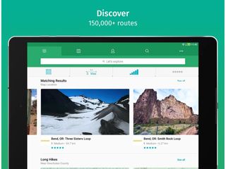
ViewRanger (Android, iOS: Free)
ViewRanger ( Android , iOS ) is another versatile GPS trail navigation app that offers both free and premium content. Users can download free maps and trails for offline navigation, while buying premium map data including USA and USGS Topo maps. There's also a premium "Skyline" augmented reality viewer that flags peaks, hills, and points of interest when you use your camera view. The app includes more than 180,000 trails, and users can print maps, import GPX files, track routes, plot points of interest, and view other important trip navigation stats.
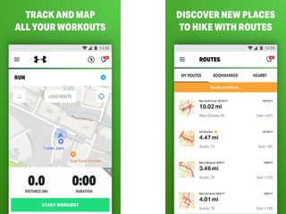
MapMyHike (Android, iOS: Monthly or annual subscription)
MapMyFitness has an app for every outdoor activity under the sun, including hiking. MapMyHike (Android, iOS ) uses your phone's sensors to track and log your hiking route, complete with information on pace, distance, calorie counting and route navigation. In addition to logging your own hikes, you can also search and download other nearby routes. A premium subscription, starting at $5.99 per month, unlocks other features such as customized audio training cues, and real-time location sharing to friends and family with Live Track.
BackCountry Navigator (Android: $11.99)
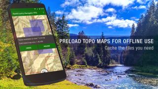
Another excellent resource for offroad back country maps is BackCountry Navigator , an Android app that can take map data from a variety of free and paid sources for offline use. Users can add or import GPS waypoints, record a track, and display a variety of map layers and sources. The app can take maps from a variety of sources, such as from free maps like OpenStreetMap and Open Cycle Map, various official mapping agencies for selected regions worldwide, as well as premium sources.

Spyglass (Android, Free; iOS, $5.99)
Spyglass ( Android , iOS ) is a multipurpose GPS navigation and augmented reality viewfinding app that serves as a heads-up display with navigation details, a smart compass, and map display all rolled up into one mobile package. Users can download offline maps, navigate toward waypoints, get coordinates and find their way to locations. You can track your GPS location data, with altitude, course, and speed, track the sun and stars, use a rangefinder feature, and take measurements with the sextant, angular calculator and inclinometer tools. The app is premium on iOS, while a free version exists on Android. (In-app purchases unlock app features.)
Maps 3D Pro (iOS: $4.99)
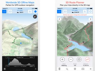
Not everyone has the skill or training to properly read a topographic map, so Maps 3D Pro is a helpful navigation tool for those planning an outdoor hike in rugged terrain. As its name suggests, Maps 3D Pro projects maps on a 3D view, allowing users to much more easily interpret terrain features such as hills, ridges, trails, paths, and more. Users can plan, save, and share routes, pre-load maps for offline viewing and navigation, and record their trip complete with coordinates and elevation data. If you are planning to use your iPhone as a navigation tool though, make sure you're well supplied with power (and a battery pack) and/or have a good backup guide.
Komoot (Android, iOS: Free)
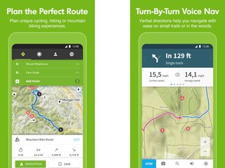
Komoot ( Android , iOS ) is another excellent option for hikers, cyclists and mountain bikers. The app is able to help you plan routes that are perfect for you. Users can lay down routes, view surface conditions, difficulty, distance and elevation, and the app also provides turn-by-turn navigation, even on winding outdoor trails. Komoot comes with offline map support, and free users can download one detailed map region for free forever, with in-app purchases unlocking more maps and features.
MSW Surf Forecast (Android, iOS: Free)
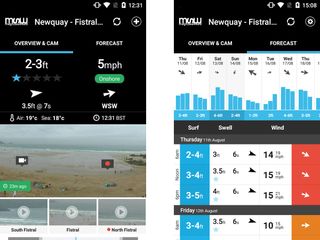
If you're looking to get some waves rather than hit the trails, then you might want to check out Magicseaweed.com's Surf Forecast app ( Android , iOS ), which delivers long range surf forecasts for thousands of beaches globally. Forecasts include a quick star rating summary of conditions, surf size, swell size, period, wind conditions and temperature. Users have access to 7-day forecasts, wind and tide station data, and live webcams for select beaches, as well as related media. Premium subscribers get extended forecasts and reduced ads.
Ramblr (Android, iOS: Free)
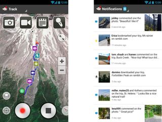
Outdoors types who like to document and journal everything about their trip should check out Ramblr ( Android , iOS ), a mobile journaling app designed for hikes and mountaineering trips. Ramblr allows users to record everything from their route, statistics such as average speed, distance traveled, and highest point, as well as record geotagged audio, video, pictures or text, allowing you to easily create a blow-by-blow account or relive the trip in the future. Additional features include built-in mapping, the ability to upload and share your trips, or check out where other Ramblr users have gone to.
Yonder (Android, iOS: Free)
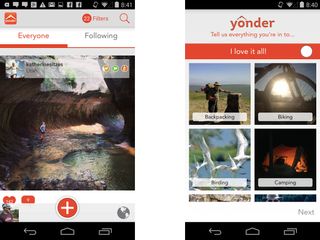
Yonder ( Android , iOS ) allows users to easily share their hiking, biking and camping experiences with a global network of other lovers of the outdoors. Users can search or browse through a database of more than 200,000 destinations, follow other hikers to view their activity streams, or explore nearby locations through the map. It's great for finding out about nearby trails and routes, as well as an opportunity to network with fellow outdoor enthusiasts.

Strava (Android, iOS: Free)
Fancy an early morning run, or a mountain bike excursion? Strava Running and Cycling ( Android , iOS ) is a top-notch fitness tracker with running and cycling in mind, and the app adds some pretty neat competitive and gamified features to the usual run-tracking recipe. Strava records your running speed, distance traveled, time and course taken for both useful metrics and tracking, but combines all that with leaderboards, achievements and challenges as you race against your friends. Strava supports a variety of running trackers in addition to Android Wear and Apple Watch.
UVLens (Android, iOS: Free)
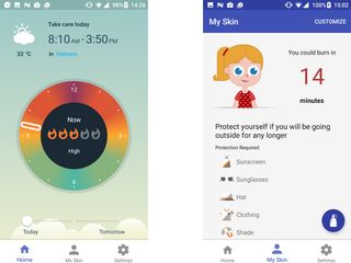
The Sun's ultraviolet rays can be a cause of skin diseases and cancer, so it's important to protect your skin with sunscreen to prevent stinging sunburns and reduce the risks of overexposure to the sun. UVLens ( Android , iOS ) is a feature-packed UV index forecast app and sunscreen calculater that lets you create a personalized skin profile for more accurate estimates of their sunburn risk, including estimated time before getting a sunburn on a given day, as well as recommended precautions. A UV index forecast can help suggest the best times of the day to be out, and a sunscreen reminder notifies you when it's time to reapply your sunscreen.
Cairn (iOS: Free)
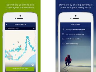
Cairn is a outdoors safety app that does two things. First, it crowdsources information about where you can receive mobile signal on a map (and also logs your location). Second, it allows you to leave a trip plan with your friends. If you are ever overdue, your contacts are alerted, and are given a map of location data where you were tracked to. It allows you to plan ahead for areas on the trail with mobile coverage.
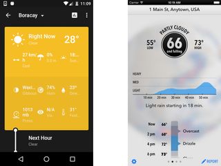
Weather Timeline (Android: $1.49) / Dark Sky (iOS: $3.99)
The weather can make or break a hike, so having a reliable weather forecast (preferably with hyperlocal weather alerts) can be a lifesaver. Dark Sky ( iOS ) and Weather Timeline ( Android ) are both excellent premium weather forecast apps for their respective platforms, providing extended forecasts, as well as hyperlocal, almost down-to-the-minute warnings of rainfall thanks to data taken from Forecast.io. With clean, no-nonsense, ad-free interfaces, both apps are great tools for travel planning and all-around weather forecast use.
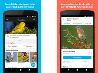
Audubon Birds Pro (Android: $3.99; iOS: $9.99)
The Audubon Field Guides are a storied name in wildlife field guides, and they've also been adapted into mobile apps. The Audubon Birds Pro app (Android, iOS ) provides an incredibly detailed illustrated field guide that identifies 821 different bird species complete with recorded bird calls. Seasonal and migratory maps give you an idea of where to find particular species, while personalized accounts let you log bird sightings, keep a checklist, and share sightings over social media. A new Bird ID feature even helps you identify sightings, allowing users to enter information like color and size of a bird to help narrow down possible species.
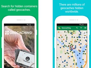
Geocaching (Android, iOS: Free)
A modern day version of the Letterboxing game, Geocaching is a modern day treasure hunt where players hide caches of small items and tokens and then post the cache's GPS coordinates for other players to find, with more than 2 million active geocaches ongoing worldwide. The Geocaching.com app (Android, iOS) takes advantage of your phone's GPS features and map apps to provide a searchable database of geocaches, with recommendations for beginners, listings of nearby caches and numerous other features.
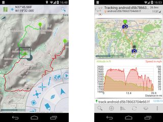
GPS Essentials (Android: Free)
GPS Essentials is a free Android GPS app that is filled to the brim with options, features, and widgets. A ridiculously configurable dashboard can be set to display a wealth of navigational and route data, while route and track functions let you set and manage waypoints on a map and import or export them into a variety of formats. An augmented reality HUD feature is even available, allowing for easier orienteering with the use of your smartphone camera as a viewfinder.

Star Walk (Android, iOS: $2.99)
Vito Technologies' Star Walk 2 ( Android , iOS ) is an augmented reality star chart that displays the stars and planets in the heavens above you. In addition, the app includes detailed information on the history and mythology of the various constellations, stars and planets, as well as a coordinates viewer for easy reference. A Time Machine slider lets you view the skies of the past or the future, and you can tap on individual objects for more details. A night mode allows you to stargaze without burning out your night vision, and an augmented reality view overlays the star chart over your camera view. It's a great app to have along on a clear night or when out camping.

First Aid - American Red Cross (Android, iOS: Free)
The American Red Cross' First Aid app (Android, iOS ) is a free (and ad-free) app that provides a wealth of basic first aid information for burns, injuries, and other medical emergencies that might arise. A "Learn" mode lets you read up on a type of injury, basic first aid treatment, and a Q&A section, while an Emergency mode dispenses with the extra information while providing concise first aid instructions in a single page, sometimes accompanied by videos and diagrams, as well as a one-button shortcut to call 911. Additional links allow you to sign up for first aid courses, buy first aid kits , donate or volunteer for the American Red Cross.

SAS Survival Guide (Android, iOS: $5.99)
Based on the bestselling book by John "Lofty" Wiseman, the paid SAS Suvival Guide app (Android, iOS ) contains the full text of the book optimized for mobile formats and covers a host of basic and advanced survival topics. It also includes extensive first aid information, as well as photo galleries of edible, medicinal, and poisonous plants. In addition, the app also allows you to download 16 instructional videos by the author. A survival quiz tests your knowledge, and helpful checklists assist in preparation. Additionally, the app includes a Morse code signalling function.
More Apps for Outdoor Fun
Need more apps for outdoor fun? Check out our best hiking apps for heading up the mountain. Or there's best fishing apps when you're content just sitting by the dock of the bay. The best space watching apps can help you make the most of a clear evening. Or if sandy shores are in your future the best beach apps may be what you're looking for.

Google Maps is getting a makeover — here's everything you need to know
9 essential Google Maps tips for your Summer road trip
One of the year's best-selling games just got pulled from Steam in over 170 regions
Most Popular
- 2 New Android security flaw lets hackers seize control of apps — uninstall these immediately
- 3 7 pro tips for vacuuming a mattress to get rid of bed bugs, dust mites and smells
- 4 Google Maps is getting a makeover — here's everything you need to know
- 5 What killer feature would make you buy the next iPad? Tom’s Guide weighs in ahead of Apple’s ‘Let Loose’ event

Your monthly outdoor activity tracker | printable journal page
Jouranaling is one of the best things you can do for overall well being. And, many would agree that getting outside into nature is one of the best things you can also do for your health… so, what if you combined the two? What if you could do a quick daily reflection on your outdoor time? What if you were prompted to plan out some outdoor adventures every month? Would keeping a monthly outdoor activity log help better any attitudes or behaviors you and your family have?
Well, now’s as good a time as ever to try it out, right?
Below you’ll find a free printable journal page for tracking monthly outdoor activities . It’s a simple page to add to your planner or family binder. Use it to help motivate and track your time in nature. See the patterns and gaps in outdoor time and make plans to adjust and increase where you see needed.
How should you use the outdoor activity journal page?
You can choose to use this log sheet any way you like!
You could print it out and add it into your bullet journal or planner. You could also tape it up on the wall beside your family calendar.
At the beginning of the month write down any planned outdoor excursions or broad goals you or your family might have. For example, you might want to do 4 family hikes that month, have a water balloon fight, or achieve 30 hours of outdoor time.
This is a good opportunity to talk with your family and get excited about that month’s outdoor adventures. And don’t forget to take some time to reflect on last month’s highlights and areas of improvement.
If you’re a family that’s into family meetings , you could throw this in your meeting book and pull it out weekly to see how your outdoor goals are progressing and have the kids color the chart at the meeting.
You might decide to use this log as a personal record of your own outdoor time, or you might want to track outdoor family time. It will work for both.
How does the monthly outdoor activity tracker work?
The main feature of this printable journal page is a circular time tracker. The circle is divided into 31 slots. When the month you’re tracking has less than 31 days just ignore those or cross them out.
You’ll find a color key to the right of the daily tracker circle. Choose which colors you’ll use for each time category at the beginning of the month to customize your own time key.
Color each day to match your hours outdoors. At the end of the month you’ll have a completely colored circle and a quick visual graph of how often you go outside. Collecting a few month’s worth of activity circles might even help identify patterns to your outdoor activity.
Get your own copy of the monthly activity log
- Click here to sign up and grab your printable journal page!
After you join the Take Them Outside Newsletter you’ll receive access to our private outdoor family resource library. Every week you’ll receive tips, activity ideas, nature news, and inspiration to get you and your family enjoying nature more often!
What’s in the resource library, you ask? Well, that resource library is full of games, scavenger hunts, packing lists, activity calendars, and more sweet stuff to get you and your kids connecting with nature!
What should you do now?
- Go grab that printable journal page and start tracking your outdoor activity this month!
- Check out the Wild Week Challenge – a full week’s worth of encouragement and support so you can disconnect from distractions and reconnect with nature and your family!
Other posts you might want to read:
- How to rock family table talk with nature themed conversation starters
- Easy Family Picnics are Simpler thank you think!

Leave a Comment Cancel Reply
Your email address will not be published. Required fields are marked *

- Field Courses
- Online Courses
- Expeditions
- Manage Booking
Tracking: The 6 Key Characteristics of Sign
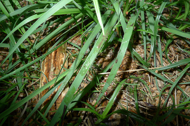
A tracker doesn’t follow footprints. She follows sign.
In its broadest definition, sign is any change from an environment’s natural state inflicted upon it by the passage of animal, man or machinery.
Sign can be obvious or it can be the most subtle change to the environment.
There are six key characteristics of sign that we look for. Particular sign can display one or more of these characteristics, in any combination.
There is a certain order and distribution to the natural world. Much material in nature is distributed in such a way as to create an even-ness; for example the distribution of leaves after they have fallen from a tree. This is an order that someone familiar with their environment will consider “normal”.
When there is a disturbance to that normality it can be noticed by the observant. An animal walking or running has a certain tempo and this creates a pattern on the ground over which it moves. This pattern is easy to spot on ground such as sand but harder to spot in less uniform materials. Nevertheless, regularity is a key attribute to look out for.
Regularity also appears within the impressions left by the passing of an animal, person or machine. For example, a boot will leave an imprint of its tread containing a pattern of geometric shapes that is not normal.
The human brain is very adept at detecting patterns (sometimes where there are none). This allows us to pick out regularity imposed on the environment by the passing of an animal or person.
Edges as straight as a ruler don’t tend to present themselves very often in nature; you will certainly spot them when they have been imposed where they don’t normally occur. For example, creases in leaves or blades of grass are something easy to pick up on to the attuned.
Downward pressure from the foot placement of people or animals will flatten or even depress material on the ground.
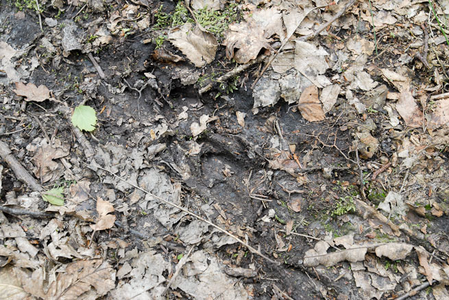
Other behaviour such as lying or sitting will also flatten vegetation in a way that is detectable by the tracker. Flattening is easily detected by comparison with the surrounding area.
An easily understood example of transfer is the school child running off the football or rugby pitch into changing rooms and depositing clods of mud from between the boot studs onto the floor. This is transfer of material from the pitch to the changing room floor tiles.
More generally, transfer is any deposit of material carried forward from one medium to another. For example, sand onto rock; mud onto grass; water onto dry ground; vegetation onto a road; and so on.
Descriptive examples of transfer are generally quite bold. It is a bold concept. Yet, in practice, transfer can be incredibly subtle. A tiny amount of material can have been carried forward yet still be detected.
Colour Change
When natural materials are disturbed there can be a colour change. Colour change can be at the micro level, for example where a leaf has been bruised by a hoof or the edge of a boot.
Colour change can also occur at a more macro level; for example, where someone has walked through leaf litter that had previously been rained upon yet dried on the surface. The passing of a person will have turned over, or up, certain areas of leaves which will show up as dark (damp) patches amongst the generally dry top surface of leaves.
Similarly, someone walking or driving over grass will depress certain areas. Hence, the angle at which the grass lays to incident sunlight will be different to the surrounding foliage. This presents itself as a change in colour/shine.
Also, some leaves are darker on their top side than their underside. If the light underside of leaves are showing, then something has disturbed them.
Discards are any materials that have been left behind. This can be intentional or unintentional. A deer that is shedding its winter coat will be discarding hairs.
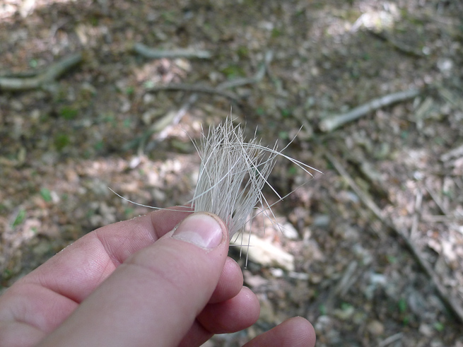
A cigarette butt is a discard. A chewed apple core or banana skin is a discard. A chewed hazelnut left by a squirrel is a discard. An antler shed by a deer is a discard. Fur or threads from clothing on a fence are discards. A shotgun cartridge is a discard. Faeces are discarded naturally.
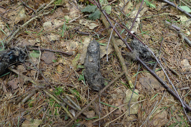
Disturbance
Disturbance is any other change to the environment that you recognise as abnormal but doesn’t directly fit into the categories above. Leaves or grass or bracken, for example, have been moved around in an area so they lay in an unnatural way. A puddle is full of suspended sediment. Insects have been agitated. Roots have been bruised. These are all disturbances to the natural order of things.
A Tracker Must Tune In
It is important to remember that trackers do not follow footprints. They follow sign. This sign can be obvious or very faint. A tracker must be able to recognise sign in the environment in which they are tracking . To track well, she must be able to perceive the most subtle indications.
An ability to tune in this way and to recognise sign by the 6 key characteristics of sign is fundamental to being able to track in any environment.
- Latest Posts
Paul Kirtley
Latest posts by paul kirtley ( see all ).
- The Swedish Firesteel - January 5, 2023
- Kevin Callan and Paul Kirtley in Conversation - April 25, 2020
- Kevin Callan and Ray Goodwin in Conversation - April 18, 2020
If you liked this article, you’ll probably like the following:
Animal Tracks and Sign: Nature Awareness in The British Countryside
The Joy of Tracks
Animal Tracks and Sign: Vole or Mouse?
A Pair of Perennial Edibles
Quiet Wanderings Reveal Wildlife At Dusk
10 Responses
Hi Paul, Another great article with a very nice selection of photos. There is something very satisfying about following sign. It’s the hope of seeing an animal up close in it’s natural environment. You start moving in silence, concentrating on the sounds around you, holding your breath, looking ahead yet searching near by. Very calming and the “tuning in” part is essential! Many Thanks, Dave.
Good to hear from you. Thanks for you comment – I agree there is something very special about tuning in to your environment in this way and the secrets it can uncover 🙂
All the best,
Adored your article Paul,
Last year, I spent a few months with my brother at his rural house in Ontario. During that time I would occasionally track a red fox that lived nearby. I endearingly named him seven-eights because his scat was always (and I mean always) seven eights of an inch wide. When I tracked this fox in June, his scat was mostly composed of mammal fur, feather quills and the odd beetle case (elytra). I could imagine the fox at that time being quite wide ranging in its foraging – more predatory, less omnivorous. Later in August, when his scat was almost entirely composed of a matrix of saskatoon berries and grasshopper legs and heads, I could imagine the fox pouncing (with a certain amount of glee) on grasshoppers, which were abundant in the meadows at the time. I could also see the fox scavenging the broken messy remains of black bears that had fed upon the delicious berries of the saskatoon trees, whereby the fractured, grounded branches – still laden with berries, allowed the fox to access an otherwise difficult-to-reach resource. A simplistic imaginary association? – maybe, but when I was out on my own in the immense, daunting wilds of Canada I felt a reassuring connection with the feeding habits of an animal species that I was somewhat familiar with from home – an unspoken connection, in my perception at least, with a friend of sorts. A deeply gratifying experience.
P.s. Black bears were a different story altogether! If anybody sees a black bear roaming the Ontarian woods wearing a dark green bandanna – its mine! I want it back! I guess it was my fault for leaving my bandanna at an unattended camp for a few days! I know it was a black bear that took the bandanna because there was bloody big bear sign all over the camp including a large, undignified deposit of bear scat!
Welcome back and thanks for such a great comment. I really enjoyed reading your tale of fox tracking. Fox scat I’ve seen recently in Sussex has contained both a lot of rabbit fur as well as beetle wing cases.
It definitely pays to imagine the behaviour of an animal as you look at its tracks. I’d recommend to anyone interested in furthering their tracking to spend time watching animals (remember to take your binoculars). This builds a reference against which you can interpret sign you see on the ground.
Thanks again for a great comment 🙂
Superb article Paul..
Very original perspective on tracking ; giving us all an even better insight in to this amazing subject.
It is a subject that everyone who participates in any countryside activity should look at in greater detail.. ‘a true eye opening experience’. Many people refer to ‘Bow drill’as being corner stone to Bushcraft..I however beg to differ. Surely Tracking and Natural Awareness open up and allow us to afford all the bounties that nature has to offer. Many instructors , especially you , enjoy teaching this subject above others in the Bushcraft Spectrum because when taught well it is…. so enlightening. It draws all of the skills together and makes being outdoors very complete.
The blog goes from strength to strength..more videos please and a book ?
Go well Mark
Hi Paul, very interesting article and yet another area I am interested to learn more about. I have done basic tracking in terms of seeing signs of wildlife by discards, disturbance etc and have also used it when running a farm to find missing sheep and lambs! However, I have more to learn for sure so will look forward to zoning in next time I’m out. Thanks Paul
Glad you found it interesting Vee. Hope this framework serves you well.
Warm regards,
christophe manea
I really liked your article. I enjoy nature photography and you have given me some different ideas on what to look for when I’m out an about. Thank you
Thanks for the article. Helps to have photos to put together with what people try to describe with words. It would be cool to see one about puddles with pictures 🙂
Marcel Lafond
You should really consider writing a book my friend You qualify.
cheers, Marcel
Leave a Reply Cancel reply
Your email address will not be published. Required fields are marked *
Notify me of followup comments via e-mail.
This site uses Akismet to reduce spam. Learn how your comment data is processed .
- Tracking signs for outdoor activity
Access restricted
Access to study materials is restricted. You are not logged in to Opiq.
A valid license for package „Opiq Private User Package” , „Opiq Pupil Package” or „Opiq Teacher Package” is required to use the kit. Click the link with the package name to learn more about the package and order a license.
If you have a valid license, log in to view the chapter.
Chapter topics:
- Activity 1. Discovery Time
- Activity 2. Digital Time
- Practice Time
- Activity 7. Story Time
If you have a valid license, log in to view the chapter .

- Service provided by Star Cloud Ltd
- P.O. Box 1219‑00606, Regus, Ushuru Pensions Plaza, Muthangari Drive, Nairobi
- +254 205 148 194 (Mon–Fri 9–17)
- [email protected]
- About the service
- User guides
- Privacy notice
- Use of cookies
- Terms and conditions of ordering
0 ? heading : 'Confirm'">
Opiq uses cookies.
Opiq uses essential cookies to make our website work, to help keep you safe, to analyse user interaction and to improve user experience.
Cookie is a small file which is sent from users computer to the website server. It includes necessary information for the website to operate and includes information about the user and their preferences.
Most of the cookies are necessary for the operation of Opiq. It is possible to deny analytical cookies and in that case your usage data is not used to develop and improve Opiq services. Read more
- Popular Professionals
- Design & Planning
- Construction & Renovation
- Finishes & Fixtures
- Landscaping & Outdoor
- Systems & Appliances
- Interior Designers & Decorators
- Architects & Building Designers
- Design-Build Firms
- Kitchen & Bathroom Designers
- General Contractors
- Kitchen & Bathroom Remodelers
- Home Builders
- Roofing & Gutters
- Cabinets & Cabinetry
- Tile & Stone
- Hardwood Flooring Dealers
- Landscape Contractors
- Landscape Architects & Landscape Designers
- Home Stagers
- Swimming Pool Builders
- Lighting Designers and Suppliers
- 3D Rendering
- Sustainable Design
- Basement Design
- Architectural Design
- Universal Design
- Energy-Efficient Homes
- Multigenerational Homes
- House Plans
- Home Remodeling
- Home Additions
- Green Building
- Garage Building
- New Home Construction
- Basement Remodeling
- Stair & Railing Contractors
- Cabinetry & Cabinet Makers
- Roofing & Gutter Contractors
- Window Contractors
- Exterior & Siding Contractors
- Carpet Contractors
- Carpet Installation
- Flooring Contractors
- Wood Floor Refinishing
- Tile Installation
- Custom Countertops
- Quartz Countertops
- Cabinet Refinishing
- Custom Bathroom Vanities
- Finish Carpentry
- Cabinet Repair
- Custom Windows
- Window Treatment Services
- Window Repair
- Fireplace Contractors
- Paint & Wall Covering Dealers
- Door Contractors
- Glass & Shower Door Contractors
- Landscape Construction
- Land Clearing
- Garden & Landscape Supplies
- Deck & Patio Builders
- Deck Repair
- Patio Design
- Stone, Pavers, & Concrete
- Paver Installation
- Driveway & Paving Contractors
- Driveway Repair
- Asphalt Paving
- Garage Door Repair
- Fence Contractors
- Fence Installation
- Gate Repair
- Pergola Construction
- Spa & Pool Maintenance
- Swimming Pool Contractors
- Hot Tub Installation
- HVAC Contractors
- Electricians
- Appliance Services
- Solar Energy Contractors
- Outdoor Lighting Installation
- Landscape Lighting Installation
- Outdoor Lighting & Audio/Visual Specialists
- Home Theater & Home Automation Services
- Handyman Services
- Closet Designers
- Professional Organizers
- Furniture & Accessories Retailers
- Furniture Repair & Upholstery Services
- Specialty Contractors
- Color Consulting
- Wine Cellar Designers & Builders
- Home Inspection
- Custom Artists
- Columbus, OH Painters
- New York City, NY Landscapers
- San Diego, CA Bathroom Remodelers
- Minneapolis, MN Architects
- Portland, OR Tile Installers
- Kansas City, MO Flooring Contractors
- Denver, CO Countertop Installers
- San Francisco, CA New Home Builders
- Rugs & Decor
- Home Improvement
- Kitchen & Tabletop
- Bathroom Vanities
- Bathroom Vanity Lighting
- Bathroom Mirrors
- Bathroom Fixtures
- Nightstands & Bedside Tables
- Kitchen & Dining
- Bar Stools & Counter Stools
- Dining Chairs
- Dining Tables
- Buffets and Sideboards
- Kitchen Fixtures
- Wall Mirrors
- Living Room
- Armchairs & Accent Chairs
- Coffee & Accent Tables
- Sofas & Sectionals
- Media Storage
- Patio & Outdoor Furniture
- Outdoor Lighting
- Ceiling Lighting
- Chandeliers
- Pendant Lighting
- Wall Sconces
- Desks & Hutches
- Office Chairs
- View All Products
- Designer Picks
- Side & End Tables
- Console Tables
- Living Room Sets
- Chaise Lounges
- Ottomans & Poufs
- Bedroom Furniture
- Nightstands
- Bedroom Sets
- Dining Room Sets
- Sideboards & Buffets
- File Cabinets
- Room Dividers
- Furniture Sale
- Trending in Furniture
- View All Furniture
- Bath Vanities
- Single Vanities
- Double Vanities
- Small Vanities
- Transitional Vanities
- Modern Vanities
- Houzz Curated Vanities
- Best Selling Vanities
- Bathroom Vanity Mirrors
- Medicine Cabinets
- Bathroom Faucets
- Bathroom Sinks
- Shower Doors
- Showerheads & Body Sprays
- Bathroom Accessories
- Bathroom Storage
- Trending in Bath
- View All Bath
- Houzz x Jennifer Kizzee
- Houzz x Motivo Home
- How to Choose a Bathroom Vanity

- Patio Furniture
- Outdoor Dining Furniture
- Outdoor Lounge Furniture
- Outdoor Chairs
- Adirondack Chairs
- Outdoor Bar Furniture
- Outdoor Benches
- Wall Lights & Sconces
- Outdoor Flush-Mounts
- Landscape Lighting
- Outdoor Flood & Spot Lights
- Outdoor Decor
- Outdoor Rugs
- Outdoor Cushions & Pillows
- Patio Umbrellas
- Lawn & Garden
- Garden Statues & Yard Art
- Planters & Pots
- Outdoor Sale
- Trending in Outdoor
- View All Outdoor
- 8 x 10 Rugs
- 9 x 12 Rugs
- Hall & Stair Runners
- Home Decor & Accents
- Pillows & Throws
- Decorative Storage
- Faux Florals
- Wall Panels
- Window Treatments
- Curtain Rods
- Blackout Curtains
- Blinds & Shades
- Rugs & Decor Sale
- Trending in Rugs & Decor
- View All Rugs & Decor
- Pendant Lights
- Flush-Mounts
- Ceiling Fans
- Track Lighting
- Wall Lighting
- Swing Arm Wall Lights
- Display Lighting
- Table Lamps
- Floor Lamps
- Lamp Shades
- Lighting Sale
- Trending in Lighting
- View All Lighting
- Bathroom Remodel
- Kitchen Remodel
- Kitchen Faucets
- Kitchen Sinks
- Major Kitchen Appliances
- Cabinet Hardware
- Backsplash Tile
- Mosaic Tile
- Wall & Floor Tile
- Accent, Trim & Border Tile
- Whole House Remodel
- Heating & Cooling
- Building Materials
- Front Doors
- Interior Doors
- Home Improvement Sale
- Trending in Home Improvement
- View All Home Improvement
- Cups & Glassware
- Kitchen & Table Linens
- Kitchen Storage and Org
- Kitchen Islands & Carts
- Food Containers & Canisters
- Pantry & Cabinet Organizers
- Kitchen Appliances
- Gas & Electric Ranges
- Range Hoods & Vents
- Beer & Wine Refrigerators
- Small Kitchen Appliances
- Cookware & Bakeware
- Tools & Gadgets
- Kitchen & Tabletop Sale
- Trending in Kitchen & Tabletop
- View All Kitchen & Tabletop
- Storage & Organization
- Baby & Kids
- Housekeeping & Laundry
- Pet Supplies

- View all photos
- Dining Room
- Breakfast Nook
- Family Room
- Bed & Bath
- Powder Room
- Storage & Closet
- Outdoor Kitchen
- Bar & Wine
- Wine Cellar
- Home Office
- Popular Design Ideas
- Kitchen Backsplash
- Deck Railing
- Privacy Fence
- Small Closet
- Stories and Guides
- Popular Stories
- Renovation Cost Guides
- Fence Installation Cost Guide
- Window Installation Cost Guide
- Discussions
- Design Dilemmas
- Before & After
- Houzz Research
- View all pros
- View all services
- View all products
- View all sales
- Living Room Chairs
- Dining Room Furniture
- Coffee Tables
- Home Office Furniture
- Join as a Pro
- Interior Design Software
- Project Management
- Custom Website
- Lead Generation
- Invoicing & Billing
- Landscape Contractor Software
- General Contractor Software
- Remodeler Software
- Builder Software
- Roofer Software
- Architect Software
- Takeoff Software
- Lumber & Framing Takeoffs
- Steel Takeoffs
- Concrete Takeoffs
- Drywall Takeoffs
- Insulation Takeoffs
- Stories & Guides
- LATEST FROM HOUZZ
- HOUZZ DISCUSSIONS
- SHOP KITCHEN & DINING
- Kitchen & Dining Furniture
- Sinks & Faucets
- Kitchen Cabinets & Storage
- Knobs & Pulls
- Kitchen Knives
- KITCHEN PHOTOS
- FIND KITCHEN PROS
- Bath Accessories
- Bath Linens
- BATH PHOTOS
- FIND BATH PROS
- SHOP BEDROOM
- Beds & Headboards
- Bedroom Decor
- Closet Storage
- Bedroom Vanities
- BEDROOM PHOTOS
- Kids' Room
- FIND DESIGN PROS
- SHOP LIVING
- Fireplaces & Accessories
- LIVING PHOTOS
- SHOP OUTDOOR
- Pool & Spa
- Backyard Play
- OUTDOOR PHOTOS
- FIND LANDSCAPING PROS
- SHOP LIGHTING
- Bathroom & Vanity
- Flush Mounts
- Kitchen & Cabinet
- Outdoor Wall Lights
- Outdoor Hanging Lights
- Kids' Lighting
- Decorative Accents
- Artificial Flowers & Plants
- Decorative Objects
- Screens & Room Dividers
- Wall Shelves
- About Houzz
- Houzz Credit Cards
- Privacy & Notice
- Cookie Policy
- Your Privacy Choices
- Mobile Apps
- Copyright & Trademark
- For Professionals
- Houzz vs. Houzz Pro
- Houzz Pro vs. Ivy
- Houzz Pro Advertising Reviews
- Houzz Pro 3D Floor Planner Reviews
- Trade Program
- Buttons & Badges
- Your Orders
- Shipping & Delivery
- Return Policy
- Houzz Canada
- Review Professionals
- Suggested Professionals
- Accessibility
- Houzz Support
- COUNTRY COUNTRY
Home & House Stagers in Elektrostal'
Location (1).
- Use My Current Location
Popular Locations
- Albuquerque
- Cedar Rapids
- Grand Rapids
- Indianapolis
- Jacksonville
- Kansas City
- Little Rock
- Los Angeles
- Minneapolis
- New Orleans
- Oklahoma City
- Orange County
- Philadelphia
- Portland Maine
- Salt Lake City
- San Francisco
- San Luis Obispo
- Santa Barbara
- Washington D.C.
- Elektrostal', Moscow Oblast, Russia
Professional Category (1)
- Accessory Dwelling Units (ADU)
Featured Reviews for Home & House Stagers in Elektrostal'
- Reach out to the pro(s) you want, then share your vision to get the ball rolling.
- Request and compare quotes, then hire the Home Stager that perfectly fits your project and budget limits.
A home stager is a professional who prepares a house for sale, aiming to attract more buyers and potentially secure a higher selling price. They achieve this through the following techniques:
- Rearranging furniture to optimize space and functionality.
- Decluttering to create a clean and spacious look.
- Making repairs to address visible issues.
- Enhancing aesthetics with artwork, accessories, and lighting.
- Introducing new furnishings to update the style.
Their goal is to present the house in the best light. Home stagers in Elektrostal' help buyers envision themselves living there, increasing the chances of a successful sale.
- Decluttering
- Furniture Selection
- Space Planning
- Art Selection
- Accessory Selection
Benefits of the home staging in Elektrostal':
- Attractive and inviting: Staging creates a welcoming atmosphere for potential buyers.
- Faster sale: Homes sell more quickly, reducing time on the market.
- Higher sale price: Staging can lead to higher offers and appeal to a wider range of buyers.
- Showcasing best features: Strategic arrangement highlights positives and minimizes flaws.
- Stand out online: Staged homes capture attention in online listings.
- Emotional connection: Staging creates a positive impression that resonates with buyers.
- Easy visualization: Buyers can easily picture themselves living in a staged home.
- Competitive advantage: Staging sets your home apart from others on the market.
- Affordable investment: Cost-effective way to maximize selling potential and ROI.
- Professional expertise: Experienced stagers ensure optimal presentation for attracting buyers.
What does an Elektrostal' home stager do?
What should i consider before hiring an interior staging company, questions to ask potential real estate staging companies in elektrostal', moscow oblast, russia:, business services, connect with us.

COMMENTS
Aluminum is lightweight, durable, rigid, and strong. It is an extremely versatile material that can be used for a wide range of outdoor signage. It is easy to customize, as it comes in strong panels of various thicknesses and can be used to build anything from temporary yard signs (.040 gauge thickness) to sturdier post-and-panel signs (.080 ...
This symbol can be found on the map in both the app and the web. Functions 14 to 18 and 22 can be hidden behind it - depending on whether you are on the web or in the app, or whether you are currently using the Route Planner or the Route Finder. 11. Map Layer Panel. Use this icon to switch between different map views.
Observing wildlife is a memorable part of any outdoors excursion, and spring is a good time to do it. As winter melts away, animals become more active, looking for mates and food. The ground, still covered with snow in northern areas, or wet from snowmelt and spring rains in warmer climes, is perfect for discovering animal tracks. Tracking 101
Tracking signs Tracking involves leaving signs or symbols made from natural materials, such as sticks and stones, on a trail or course for others to follow. Turn (left or right) Party split up This way Message this way Not this way Water this way This way (over obstacle)
Colored signs: a simple method is just to nail small colored metal signs with arrows to trees or wooden posts. Numbers: forest service trails may be marked only by number on a wooden or metal sign, instead of a name, so make sure you identify your trail number at the trailhead. Long trail symbols: long distance trails like the Appalachian Trail ...
The X sign is useful as it is a simple sign which can quickly show the path that wasn't taken at a fork in the road, for instance. The final one, Gone Home, marks the end of the trail. The second row are some of the fancier signs, showing that you have left a message for your trackers, that your party had to split up, that you might have to ...
Much of this is done by what is called "sign tracking". Signs are anything besides a track proper that is an indication of an animal (e.g. trails, scat etc.). About 1/2 of tracking is sign tracking the other 1/2 is working with actual tracks. LARGE SCALE SIGN. I. Landscape Tracking - this is reading the landscape to locate animals. In most ...
5. Dangle a carrot - draw them in. Entice visitors from one area of the trail to another by creating 'visual magnets'. For example, begin a story on one panel and conclude it on another panel farther down the trail. 6. Use lots of eye-catching shapes and use readable fonts.
Design Guided Tours Signs using our Sign Tools or Upload Print Ready Files | Quality Printing on All our Banners Shipped Fast. 800-494-5850. Login. ... Covid-19 Social Distancing Signs Outdoor Signs ...
It means using of signs and symbols to leave a trail for other people to follow. Explain that good tracking means you have to be observant and pay attention to your surroundings. People to look around them and observe, as some of the symbols or signs might not be obvious. Ask everyone to get into pairs or small groups.
We are proud to offer the PULSE DESIGN NATURE SERIES which is a beautiful, "Ready-to-Order" and "Customizable" series of interpretive trail signs that cover many common nature subjects. This product is perfect for projects with a modest budget and short deadlines. With over 300 signs to choose from, and a 10 year manufacturers warranty, we are sure to have something that will suit your needs.
In the heart of wildlife tracking lies the fascinating study of individual animal tracks and the distinctive signs they leave behind. This section serves as a visual guide, introducing beginners to the common imprints of mammals, birds, and other creatures found in diverse ecosystems. Paw prints, hoof marks, and feather imprints each carry ...
Check out these outdoor apps for camping, hiking and trekking. ... The app includes more than 180,000 trails, and users can print maps, import GPX files, track routes, plot points of interest, and ...
Exterior Signage Design. Printing and delivery. Installation. Storage. FASTSIGNS is a sign company that has over 35 years of industry experience and is trusted by our customers to always deliver cutting-edge solutions that fully meet their visual communication needs. We look forward to helping you elevate your brand through large outdoor signs ...
Learn, for example, the very distinctive track left by sidewinders and the tracks left by various non-poisonous snakes. Since you might not see the animal that passed by the night before, field identification of tracks and sign can add a whole new dimension to your next outdoor excursion. #FG-24277
The main feature of this printable journal page is a circular time tracker. The circle is divided into 31 slots. When the month you're tracking has less than 31 days just ignore those or cross them out. You'll find a color key to the right of the daily tracker circle. Choose which colors you'll use for each time category at the beginning ...
A tracker must be able to recognise sign in the environment in which they are tracking. To track well, she must be able to perceive the most subtle indications. An ability to tune in this way and to recognise sign by the 6 key characteristics of sign is fundamental to being able to track in any environment. Bio.
Service provided by Star Cloud Ltd; P.O. Box 1219‑00606, Regus, Ushuru Pensions Plaza, Muthangari Drive, Nairobi +254 205 148 194 (Mon-Fri 9-17)
These signs suggests instructions for different fitness levels including beginner, intermediate, and advanced. Signs available for the following equipment: Stretching Station, Parallel Bars, Vertical Ladder, Pull and Chip Up Bars, Beam Run, Jump Touch Beam, Sit-Up Bench, Balance Beams, Horizontal Overhead Ladder and Spring Up Bars.
Search 31 Elektrostal' outdoor lighting installers to find the best outdoor lighting company for your project. See the top reviewed local outdoor lighting companies in Elektrostal', Moscow Oblast, Russia on Houzz.
Search 151 Elektrostal' custom fireplace contractors & installers to find the best fireplace contractor for your project. See the top reviewed local fireplace services and installers in Elektrostal', Moscow Oblast, Russia on Houzz.
Search 17 Elektrostal' playset installers to find the best outdoor play equipment supplier for your project. See the top reviewed local outdoor play equipment suppliers in Elektrostal', Moscow Oblast, Russia on Houzz.
Search 23 Elektrostal' home & house stagers to find the best home stager for your project. See the top reviewed local home stagers in Elektrostal', Moscow Oblast, Russia on Houzz.